4493 risultati
Small folio (190 x 268 mm). Eight issues and eight supplements (1 October 1957 to 1 August 1959), bound in one. Vol. 5 (nos. 1-4 & supplements 18-21): 234 pp.; vol. 6 (nos. 1-4 & supplements 22-25): 256 pp. Contemporary sand buckram; red and black labels with gilt lettering to spine, 'Foreign Office' stamped in black to upper cover. Two early volumes from the highly important "Persian Gulf Gazette", which ran from 1953 to 1972. Published in the final decades before the independence of the Gulf States, it is a fascinating record of the waning of direct British involvement in the governments of Kuwait, Bahrain, Qatar and the Trucial States (now the United Arab Emirates). - The Gazette was a quarterly publication containing notices of anything relevant to Britain's jurisdiction in the aforementioned States, from political appointments to new Orders and Regulations. It was sold at H.M. Political Agencies in Bahrain, Kuwait, Qatar and Dubai, as well as at H.M. Consulate, Muscat. Supplements were published with each issue, printing the Orders and Regulations in full. These include all manner of regulations - often created in response to rapidly developing infrastructure - covering, inter alia, employment, shipping, patents and the penal system. - Provenance: withdrawn from the Foreign and Commonwealth Office Library with stamps to endpapers. Some very minor dampstaining to the top edge of textblock, handwritten ink reference numbers to some title-pages, rest of interior clean and fresh. Very well preserved. Though fairly well-held institutionally, original issues (not to mention volumes and runs) are rare in commerce.
4to. 70 pp. Contemporary Italian boards with papered spine. Only issue of this Persian grammar for the use of the Padua seminary, ascribed to Lodewijk de Dieu (1590-1642) by the State and University Library of Göttingen. Without a title page as issued. - Old monastic library stamp at bottom of final page; 19th c. note of donation (a gift of Cardinal Barberini) on front flyleaf. OCLC 461040960.
Folio (230 x 368 mm). Title, (6) pp., single column, lithographed throughout, with large Persian coat of arms on the title page (by Abu’l-Hasan Gaffari). Early issue of Persia's official government newspaper. Traces of folds; some edge chipping and tears to folds. Removed from the City Library Association, Springfield, MA, with their stamp to the title an handwritten note "The 'Persian Gazette", one of the only two in Persia - printed at Teheran - The Persian Coat of Arms".
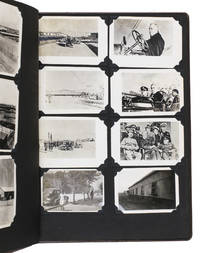
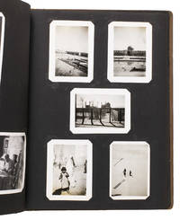
1943rif. ABC_484281943. Contemporary embossed brown cloth with the title embossed in silver on the front board and the green shoulder sleeve insignia of the Persian Gulf Command embedded in the front board. Ca. 32.5 x 26 cm. With 150 gelatin silver photographs various sizes. Unusual military photo album with 150 photographs of the activities of the Persian Gulf Command PGC at the base in Andimeshk Iran. The PGC was a branch of the United States Army established to facilitate the supply of material from the U.S. Lend-Lease programme through the Persian Corridor. This material was sent to the Soviet Union to strengthen it so it could help defeat Nazi Germany. The photographs in this album which cannot be found anywhere else offer a visual documentation of this time. However they show the simple soldiers; the men tasked with driving trucks maintaining oil supply lines or working alongside Iranians at the two factories producing trucks for the war effort. The work therefore offers a fascinating insight into daily life of PCG members in Persia in the Second World War.This album was compiled by John Stefano dates unknown a technician fourth grade in the PGC. It includes photographs of the Tehran conference in 1943 the first World War II conference between the Soviet Union the United States and the United Kingdom where it was decided to open a second front against Germany. Other than this there are photographs of the barracks the men lived in the military vehicles they used the marches and excercises they partook in but also the surrounding landscape and the local people.Inserted in the album is a booklet with images and information about Persia with a letter by PCG commander Donald Prentice Booth 1902-1993 which was sent to PCG members after the war to congratulate them on a job well done. He hoped the booklet would serve as a memento. Together with the album it continues to do so until this day.With the shoulder sleeve insignia of the Persian Gulf command mounted on the inside of the frfont board some of the photographs are captioned on the back. The eyelets for the string on the front board have come loose. The corners of the leaves are slightly creased. Overall in very good condition. hardcover
1943rif. ABC_484291943. Contemporary embossed brown cloth with the title embossed in silver on the front board the name of the owner painted in silver and the green shoulder sleeve insignia of the Persian Gulf Command embedded in the front board. Ca. 32.5 x 26 cm. With 76 gelatin silver photographs various sizes. Remarkable military photo album with 76 photographs of the activities of the Persian Gulf Command PGC at various locations in Iran. The PGC was a branch of the United States Army established in 1941 to assure the supply of U.S. Lend-Lease war material to the Soviet Union through the Persian Corridor. After the war members of the PCG received an empty album to fill with personal memories of their time in Iran. These albums are now relatively rare. The present one was compiled by Colonel S. Morgan Thomas dates unknown a PGC member who carried out inspections of the railroads. It includes various photographs of him at work.This album also contains photographs of PCG commander Donald Prentice Booth 1902-1993 a visit by Soviet soldiers and a young child military activity in Teheran locals and soldiers sending telegrams. Loosely inserted in the album are maps of Iran the lands surrounding Hamadan and the Trans Iranian Railroad which would have been important to carry for someone who inspected the railroads. The work offers a rare insight into life of a PGC member stationed in Iran.The corners of the boards are somewhat scuffed. One of the inserted maps is somewhat foxed and another has a tear that has been repaired with tape in the lower margin not affecting the image some leaves are missing one of the corner mounts the photographs are mounted on possibly missing a photograph on the verso of leaf 4. Otherwise in very good condition. hardcover
25 stamps (42 x 50 to 52 x 65 mm) mounted on 6 printed album sheets (250 x 170 mm). Loosely inserted within an envelope in a full cloth album with the name and insignia of the Persian Gulf Command. Jubilee stamps issued on the occasion of the celebration of the Persian Empire's 2,500-year anniversary, from a collector's album. Including portraits of Mohammad Reza Pahlavi and his father, Shah Reza Pahlavi, they also feature architectural landmarks and artefacts such as the Pahlavi crown, the Cyrus Cylinder, and a section of the Bishapur mosaic, as well as the coronation of Shahinshah Aria Mehr of the Kingdom of Yemen. The festivities were to celebrate Iran's ancient civilization and history and to showcase the country's contemporary progress under Mohammad Reza Pahlavi. - Album slightly rubbed at extremities. Vertical tear to 4 sheets, not touching stamps. A few stamps with traces of postmarks; one stamp loose. An appealing set.
Ca. 66 x 54 cms. Printed outline colour. Constant ratio linear horizontal scale 1:4,200,000 (1 inch = 66 miles). Folded and bound in original yellow cloth boards. 8vo. Includes Afghanistan and the Balochistan province of Pakistan, as well as the Arabian Gulf with the coastline of the Gulf Emirates to Oman. - Ownership stamps of the German botanist Prof. Dr. Arnold Scheibe (1901-89; cf. NDB XXII, 619f.). OCLC 37732501.
Hand-coloured engraved map (531 x 480 mm).
Hand-coloured engraved map, 440 x 315 mm. Constant ratio linear horizontal scale, ca 1:8,122,000. Includes the entire Gulf coast of the Arabian Peninsula, showing Kuwait, El Katif, Bahrain, Qatar, and the Musandam Peninsula, including the territory of today's United Arab Emirates (here still labeled the "Pirate Coast"). "Debai", Sharja", "Ras-el-Khaimah", "Khorfakan" and "Fejerah" are identified. - Well preserved. Issued as plate XXXVIII in Sidney Hall's General Atlas of the World. OCLC 781690561.
8vo. (2), 17 pp., final blank page. With 2 half-tone photographs in the text and a folding map of the area between Baghdad and Beirut. Staple-bound. In original printed wrappers. Exceedingly rare pocket-booklet of leave instructions issued to members of the Persia and Iraq Force during the Second World War, "in the hope that it will help [them] to understand the type of country and the places [they] will see on [their] journey" (first page). Subdivided into three sections, the first part of the booklet describes the route taken by the leave convoy from Baghdad via Fallujah, Habbaniyah, Ar-Rutba, Mafraq and Damascus to Beirut, deeming the last portion from Damascus "by far the most picturesque part of the route" (p. 4), and finishing off with a photograph of people relaxing on the beach. The second section comprises a history of Damascus and the Syrian desert by Seton Lloyd (1902-96), who had been appointed archaeology adviser to the Directorate of Antiquities, Baghdad, in 1939, and during the war "was able to conduct some notable research, principally the excavation of the painted temple at Uqair and later of Tell Hassuna, where he identified a new culture - and the earliest known - in Iraq" (obituary, Independent, 13 Jan. 1996). The third and last section discusses the construction of the Baghdad to Haifa road by the British between 1938 and 1943. - General Edward Quinan's Iraq Command (originally Iraq Force) was renamed Persia and Iraq Force (Paiforce) shortly after the successful Anglo-Soviet invasion of Persia in August 1941. The main responsibilities of Paiforce were to protect the Iraqi and South Persian oil fields and to maintain the lines of communication from British-controlled ports on the Persian Gulf to the Soviet ports on the Caspian. A dedicated Persia and Iraq Command was established under Sir Maitland Wilson in August 1942, though victory in the Western Desert Campaign combined with series of Soviet victories in southern Russia meant that Paiforce activities began to be wound down from mid-1943. The folding map to the rear of this booklet provides a detailed overview of the vital infrastructure roads and oil pipelines which they were tasked with defending. - Mended tear to upper cover; traces of folds and a little soiled. Handwritten numbers in orange crayon to lower cover. The interior with traces of a vertical fold throughout, resulting from the pages resting on the rim of the folding map; margins slightly creased. Map somewhat foxed. An uncommon survival, with only the Imperial War Museum copy traceable in institutions. Not in OCLC.
12mo. 46, (2) pp. (ads). With full-page maps of Iraq and Baghdad and map of Baghdad amenities area on back cover. Original illustrated wrappers, stapled. First edition. An extremely rare guide to Iraq, produced for members of Paiforce (Persia and Iraq Force). It covers the expected subjects of health, hostels, clubs, sports and tours but also aims to instill a degree of cultural and historical awareness, principally with Seton Lloyd's short history of the country. Lloyd was the curator of the Baghdad Museum at the time, an institution mentioned in the guide as home to "astonishingly beautiful specimens of early Sumerian art, and the whole of Iraq's history ... within well laid out rooms" (p. 23). - Less routine sections highlight Trunk Call (the Paiforce paper) and list Christian churches in Iraq and Bahrain. The advertisements, acting as front and rear endpapers, give a sense of the establishments catering to the troops, including an advert for a shopping centre belonging to the Hasso Brothers, who issued many fascinating photographic postcards of Iraq. - A few small stains to wrappers, a little dusty, otherwise very good. Rare, with no copies in Copac/Jisc or OCLC. We have only been able to trace one example, located at the Imperial War Museum.
11 pp. Re-stapled paper. A detailed war-time newsletter from the Middle East, relaying through the soldier's wives at home the regiment's movements at the front for family members back in the UK. Covering August 1942 to March 1943, it focuses on general updates of the regiment's position and provides lists of soldiers, facts which would give some comfort to their families. Whilst there are humorous bits on the trivialities of warfare, the confidential nature and redacted passages remind the reader that this was an internal communication with the bare minimum of information allowed. - The letter starts with addresses which a reader would need to write to for inquiries as to whether family members had been wounded or captured as prisoners. It then proceeds into "regimental letter number 1", which describes the regiment boarding a steamer and at sea; the typical routine is portrayed as a "wild rush to get the mess deck clean, hammocks and mattress stacked, blankets rolled and so on before breakfast" (p. 3). - The 2nd letter commences with 8 Dec. 1942, making reference to landing in Egypt and preparations for fighting Germany. In the same format as the first letter, it is followed by a battery notes section, listing ill or other soldiers who had to remain at HQ, promotions, soldiers injured and casualties sustained from the fighting. - A humorous note concerns an incident involving poisonous creatures of the desert, where "Battery Commander was dragged from his bed to take L/Bdr. Tait to the M.O. for treatment for scorpion sting. The scorpion, later in the night, was captured alive [...] and severely dealt with. Bdr. Hood G's scorpion sting turned out to be a piece of sardine tin, and it's thought that the piece of hand grenade alleged to have fallen on Gnr. Elliot's truck may have been the remainder of the tin" (p. 10). As discussed at the end of the letter, the paper rationing introduced in the UK meant that "it will be impossible to make the future circulation of these letters as wide as it has been" and that in the future a lady in each area of the UK would pass a single letter around for the families eager to find out about the loved ones on distant shores. - Some spotting and staining with a 3 cm tear along the central hold line to some pages. In good condition for a fragile letter.
8vo. 54 pp. - Bound with (II): Neueste ausführliche historische und geographische Beschreibung des Caspischen Meeres, Daria-Stroms, und der übrigen da herum liegenden Länder, Städte und Völcker [...]. Danzig, no printer or publisher, 1723. (10), 112 pp. With an engraved double-page frontispiece of Derbent. Contemporary full vellum with handwritten spine title. I: First German edition: a rare account of the Afghan invasion of Safavid Persia that began in 1722. Anonymously translated from the French "Relation historique du détrônement du roi de Perse, et des révolutions arrivées pendant les années 1722, 1723, 1724 et 1725", it describes the reign of Shah Mahmud Hotak, who overthrew the Safavid dynasty to briefly become King of Persia from 1722 until his death in 1725. Includes observations on the 1722 siege of Isfahan. - II: A similarly rare description of the Caspian Sea, including an account of the 1722/23 Persian campaign of Peter the Great, involving the creation of the Caspian Flotilla at Astrakhan. The war ended with the 1723 Treaty of St Petersburg, which recognized the Russian annexation of the west and south coasts of the Caspian Sea. - Inner hinges weakened; some browning and foxing. Still a good copy. - Provenance: handwritten initials "J.H." to recto of final text leaf. Contemporary bookplate of the consistorial councillor Benedikt Hugo Math (d. 1752) to pastedown; 20th c. bookplate of Eckhard Günther to flyleaf. I: VD 18, 10893008. OCLC 837836269. Cf. Wilson 187. - II: VD 18, 1143094X. Miansarof, Bibliographia Caucasia et Transcaucasia I, 1042. OCLC 470145584.
Small 4to. Altogether 3 pp. 1. Birth certificate of the foal Tulip, born of a thoroughbred mare "d'espèce de Selle" and a royal stud of the same stud farm, Pompadour (document partly printed, signed by the domain administrator de Pompadour). 2. Certificate of Affiliation. 3. Document concerning the mare's sale.
8vo. 133, (1) pp. With frontispiece and 30 photo illustrations by Godfrey Argent on plates. Publisher's original giltstamped blue cloth with printed dustjacket. Lavishly illustrated account of the author's sojourn in Jordan, where she studied the royal horses and their training. - Well preserved. OCLC 2164501.
Image dimensions ca. 35 x 24 cm (sheet size cs. 43 x 29 cm). Matted. Rare lithograph of the ruins of the Domitian Gate in the Greco-Roman city of Hierapolis, situated immediately above the famous travertine terraces of Pamukkale. From Laborde's "Asia Minor". - Some wrinkling; small tear at upper edge (not touching image).
Large 4to. (4), 175, (1) pp. With a folding engraved plate. Contemporary half calf with giltstamped spine title over red marbled boards. First edition of one of the earliest studies of the Rosetta Stone, published some 18 years before Champollion deciphered the text. N. G. Palin (1765-1842) was a leading Swedish diplomat whose postings included Madrid, Vienna, Dresden, and Constantinople. He made several journeys to Asia Minor, Greece, and Egypt, twice reaching the Cataracts of the Nile. On leave from 1824, he devoted all his time to his Egyptological studies. - Binding only very slightly rubbed; spine professionally rebacked preserving gilt title label and old library label. Paper a little browned; bookplate of the Portuguese historian Francisco Soares de Lacerda Machado (1870-1955) to flyleaf. Rare. Gay 1792. Ibrahim-Hilmy II, 194. Brunet VI, 29107. Kayser I, 57. OCLC 40974048.
8vo. 94, (1) pp., final blank page. With a folding plan of the Church of the Holy Sepulchre and a folding map of Palestine and southern Syria. Original printed wrappers. Very rare pocket guide to the Holy Land, prepared for British soldiers serving in Mandatory Palestine, encouraging them to explore sites of religious and historical interest in "a land of diversity" that can be "bewildering at times to the newcomers" (p. 5). - The book describes the most prominent landmarks of Jerusalem and its surroundings, including the Church of the Holy Sepulchre, the Dome of the Rock, the Via Dolorosa, the Muristan, the Zion quarter, Gethsemane, and Jericho, as well as Bethlehem and Hebron, and gives directions to and accounts of other places including Jaffa, Tel Aviv, Haifa, Beirut, Nazareth, Damascus, and Baalbek. In addition, it contains a short history of Palestine and a chronological list of events from 2,600 BC to the Lebanon's declaration of independence in 1941. - Wrappers slightly soiled. Plan lightly waterstained; pp. 77-80 torn at lower margin without loss to text; paper evenly browned throughout. A good copy. Only two library copies traceable internationally (National Library of Israel and Stanford University Library). OCLC 234128765.
Large 4to (240 x 273 mm). 48 albumen photographs (ca. 240 x 180 mm) mounted on card recto and verso. Bound in contemporary black half calf and cloth, ruled in gilt. An elegant example of the early photography souvenirs which were becoming increasingly popular in the 1890s, especially in tourism of the Holy Land. Many of the photographs are by the studio of Félix Bonfils (1831-85), a French-born photographer who came to the Levant with General d'Hautpoul in 1860 and remained to begin a prolific photography career. Based in Beirut, Bonfils produced thousands of photographs depicting Palestine, Egypt, Syria, Greece and other parts of the Ottoman Empire. In the early days of Western tourism to the Middle East, his works soon became popular as souvenirs, and other photographers soon followed. Other examples are by Francis Frith or unsigned. They show memorable scenes of Jerusalem and surroundings, especially tombs, monuments, churches, mosques, landscapes, and cityscapes. - Gentle wear and fading, some foxing to cards, but generally appealing and well preserved.
Small folio (310 x 235 mm). 46 window-mounted albumen photograph cartes-de-visite (84 x 52 mm), Contemporary pebbled green cloth, all edges gilt, remains of metal clasp. Moirée endpapers. An elegant example of the early photography souvenirs which were becoming increasingly popular in the 1890s, especially in tourism of the Holy Land. The cartes-de-visite distinctively illustrate the moment visual souvenirs began to evolve from etchings and prints to photographs: all are, in fact, photographs of paintings depicting church scenes and architecture. There are 48 cartes-de-visite, though only 46 are photographs, the final two being handwritten and hand illuminated well-wishes in French. - Gentle wear and fading, but well preserved.
C. 258 x 325 mm (cardboard); image dimensions c. 222 x 284 mm. Albumen prints (vintage) on cardboard. By Bonfils, from Bethlehem: "Tombeau de Rachel" (no. 336); "Puits des Mages" (889); "Entrée des pèlerins à Bethléem, le jour de Noël" (892, illustrated in Wieczorek/Sui, "Ins Heilige Land", p. 106); "Vue générale de Bethléem, du puits de David" (1225) and interior of the Church of the Nativity (uncaptioned); from Jaffa: "Place du marché vue générale" (238, ill. with alternative caption in W./S., p. 67); from Jerusalem: "Porte de Jaffa" (244, ill. with alternative caption in W./S., p. 73); "Mur des Juifs en vendredi" (245); "Façade du St-Sépulcre" (246); "Prison de St. Pierre" (250); "Arc de l'Ecce Homo" (252); "Ruelle allant au palais d'Hérode" (259); "Coupoles du St.-Sépulcre" (274); "Vue générale de la mosquée d'Omar" (278); interior of the Dome of the Rock ([279], illustrated with caption but trimmed in W./S., p. 85); "Porte donnant accès au-dessous du rocher" (280); "Vue générale de l'emplacement du temple de Salomon" (285); "Porte de Damas" (287); "Jardin de Gethsemané, vue générale" (303, ill. trimmed in W./S., p. 76); "Vallée de Josaphat" (310); "Intérieur du St-Sépulcre avec ornements" (850); "Grotte de Sainte-Hélène, intérieur" (855 bis); "Entrée de Jérusalem près de la porte de Jaffa" (1037) and "Rue de la Porte de Jaffa" (1038). - By Lorent: "Tombeau de David sur le Mont Sion" (288). This is apparently a print of the 1864 image illustrated in Wieczorek/Sui (p. 88), made by Bonfils and supplied with a caption. Curiously, that image is trimmed by several centimeters on the left, as compared to our print. - By the Zangakis: "Jerusalem", "Eglise du Pater couloir" (1018). - Anonymous: "Juive, costume riche" (1). - 4 photographs show slight edge defects. Occasional staining to cardboard edges, but mainly clean and well-preserved, with German ms. pencil captions.
Chromolithograph map, 852 x 520 mm. Scale 1:500,000. A map depicting the Jewish settlements related to Keren Hayesod agricultural work from 1921-1946. Keren Hayesod was, during the pre-state period, a single-issue Zionist funding body and played a large role in the settlement of Palestine by Jewish colonists prior to 1948; many of these settlements were agricultural in nature. The map lists over one hundred settlements and distinguishes those established by from those aided by Keren Hayesod. Also identified are settlement types: communal, smallholders, village, urban, town, training farms, and ex-servicemen villages. A colourful and thorough overview of Keren Hayesod's work in the region. - A hint of wear along creases, otherwise well preserved. OCLC 827860593.
Colour-printed map, 889 x 632 mm. Scale 1:250,000. First edition. A rare, large full-colour geological map of Palestine, sheet 3, partly revised from aerial photographs by the Geological Section. The key lists era and type of rock, from Precambrian grey and red granites to Neogene sandstones and recent dune deposits, and illustrates both known and predicted fault lines across the earthquake-prone region. However, geology was evidently not the sole concern: international and district boundaries are noted along with railways, various roads, wadis, Arab and Jewish villages individually marked, monasteries and convents, khirba ruins and tell mounds, and sheikhs' tombs. This provides a holistic and detailed map showing Palestinian human settlements, water cycles, geological deposits, and transport corridors during the Mandate period. - Fully and professionally backed in cloth.
4to (165 x 205 mm). (18), (11 blank) ff. Decorated with hand-drawn maps in ink and crayon, labelled in handwritten Hebrew. Original black wrappers. All edges red. Unique private copybook of folk art hand-coloured maps from an unknown Jewish girl named Sarah Klein. Klein was likely a schoolgirl; most of the maps she has drawn and labelled in neat Hebrew are of European countries, including Spain, Italy, Greece, Yugoslavia, Bulgaria, Turkey, Great Britain and Ireland, Iceland, France, Portugal, and Scandinavia, as well as one map of the entirety of Africa. The northern coast of France is shown twice and in greater detail than many others. Most of the maps are carefully hand-coloured in crayon or perhaps oil pastels, often indicating rivers and mountain ranges. - A unique preservation of a Jewish schoolgirl's vision of her world. - Light wear, one leaf detached but present, altogether well-preserved.
8vo. 14 pp. With a folding map. Original printed wrappers. Only edition of this rare pamphlet. "The only chance of peace, and of immediate advance towards self-governing institutions, appears to lie in so framing the constitution of the country as to give to each the greatest practicable measure of power to manage its own affairs". - An uncommon and important publication, detailing the Morrison-Grady Plan for the division of Palestine into four areas. The plan was based upon the work of British and American "expert delegations", who believed the political aspirations of the Arab and Jewish communities were irreconcilable and the best course of action was to give them their own territories and autonomy, albeit under a central government. - A little light water-staining to top of front wrapper, otherwise very good. The folding map, titled the "Provincial Autonomy Plan", shows the four areas: an Arab Province, a Jewish Province, a District of Jerusalem, and a District of the Negeb.