1997347 pages including index and notes. Author's signature upon title page. The first book about Gulf War Syndrome. An intensely personal account of the struggle of two dedicated public servants to expose one of the largest government cover-ups of modern history. A former CIA analyst exposes the officially sanctioned deceptions that have made Gulf War veterans the walking wounded of Desert Storm. "Demolishes the Pentagon's contention that Iraqi chemical weapons were not present during the Gulf War and the U.S servicemen and women were not exposed to chemical agents." - Raymond L. McGovern, retired after 27 years at CIA and recipient of the Intelligence Commendation Medal. Includes several black and white photographic plates. Spine leaning otherwise book in excellent clean, unmarked condition with minimal wear. Dust jacket excellent with very light wear. Very nice copy. Book
rif. 506G M & O. n.d. 18 1/4 x 13 inches. Very good condition. See pic. Center map with the GM&O trackage laid out in the Central U.S. On both side are towns and cities listed with connections to other railroads. The GM&O was well connected! G M & O. unknown
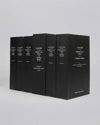
rif. 122010London Archive Editions 2003. . 6 vols 8vo 25.5 x 16.5 cm; includes maps & genealogical tables; publisher's original black cloth white lettering to upper board and spine a fine set. Lorimer's Gazetteer of the Persian Gulf was compiled by officials of the British Government in India during the decade after Lord Curzon's Vice-Regal tour of the Gulf in 1903. When first issued in 1915 it was classified as Secret and for Official Use Only and just a few dozen copies were printed for circulation to British Government departments and agencies. The work was planned in two parts; the first comprising a history of the Gulf region the second being a geographical dictionary but grew to encompass all aspects of Gulf life culture cities towns tribes and topography. Lorimer was an official of the India Civil Service who had spent most of his career on the North West Frontier. He was placed on 'special duty' to compile the Gulf handbook which was intended to be completed in six months but due to Lorimer's dedication and extensive field trips the work took some ten years to complete. The present edition printed from the India Office Records makes available one of the most important primary sources for the study of the Gulf region from the seventeenth to the early twentieth century. London, Archive Editions, 2003. hardcover
Folio. 3 parts in one volume. (4), 144 (last blank) ff. with 32 woodcut illustrations; 94, (2), 45 (3) (last blank) ff. First title-page printed in red and black; 3 (repeated) printer's devices. Contemporary blindstamped leather over wooden boards with one metal clasp (out of 2). A collection of three works published by Feyerabend, issued jointly with separate title-pages each. The first work contains a translation of the famous travel account of Francisco Alvarez (ca. 1470-1540), who accompanied as a chaplain the 1520-26 Portuguese expedition to Ethiopia under Rodrigo de Lima. The embassy was occasioned by a letter by Helen, Empress of Ethiopia, the grandmother of Lebna Dengel (David II). The journey began in Massaua in 1520, leading the party to Shewa and Dabra Libanos before they reached Lebna Dengel's camp near Taguelat. Alvarez made at least four journeys to Shewa before leaving Ethiopia in 1526, bound for India. According to Ramusio, this was the earliest account of Etiopia, and for at least a century it would remain the principal published source on the country. The first edition appeared in Portuguese in 1540, comprising merely a part of Alvarez's lost five books. Alvarez describes the country's churches, including the rock-hewn churches, and also the towns and the agriculture. Historical geography owes to him the story of the invasion of the Somal and Galla. Alvarez also gives accounts of the countries surrounding the rule of Prester John, such as Danakil and Godjam. It is unfortunate that Alvarez was unable to perform cartographical and topographical localisations, and yet his influence on cartography remained evident until the days of d'Anville and J. Bruce (cf. Henze I, 62ff.). The account is prefixed by two letters by Andrea Corsal, previously published in 1516. The Florentine traveller Corsal describes, on 24 ff., mainly the area of the Red Sea, Southern Arabia (with descriptions of Aden, Hormuz, Bahrein, Socotra, Muscat, and Oman), India, Ethiopia, Persia (the city of Balsera and King Sophi), as well as Malacca. - Binding somewhat rubbed; wants one clasp. Title-page clipped and remargined; old ownerships to title and flyleaf; a small worm-hole to 35 ff. (touching a single line); evenly browned throughout. A very good copy. Kainbacher 15f; Lockot 711, 732; Gay 186; Sabin 974. Cox I, 3 & 22. Gay 3321 (French ed.). The second work is a translation of Orosius's world history; the third work is a translation of the text from Ortelius's 1580 world atlas. - Schweiger 622 (Orosius). Not in Adams.
1864rif. 94849New Orleans 1864. Paperback. Very Good. 8 unnumbered pages. 21 cm. Modest foxing and some light staining on outer leaves. Small stitchmarks indicates that this was previously sewed. "Invalid Battalion Corps d'Afrique" printed in small type in upper left corner of first page. Authorized establishment of an Invalid battalion for the Corps d'Afrique to be composed of "colored" tropps who by reason of wounds or sickness contracted in the line of duty are unfit for further field service. Most of this rare general order reprints the War Department's General Orders Nos 105 dated 4.28/63 and 139 dated 5/15/63. Most of General Order 139 consisted of lists of physical infirmities that did or didn't disqualify soldiers from serving in the Invalid Corps. The final provision in General Order No. 139 states that no officer or enlisted man would be entitled to any pension premium or bounty for enlistment or service in the Invalid Corps although such soldiers would receive other pay and allowances authorized for the U.S Infantry. paperback
1864rif. 94849New Orleans 1864. Paperback. Very Good. 8 unnumbered pages. 21 cm. Modest foxing and some light staining on outer leaves. Small stitchmarks indicates that this was previously sewed. "Invalid Battalion Corps d'Afrique" printed in small type in upper left corner of first page. Authorized establishment of an Invalid battalion for the Corps d'Afrique to be composed of "colored" tropps who by reason of wounds or sickness contracted in the line of duty are unfit for further field service. Most of this rare general order reprints the War Department's General Orders Nos 105 dated 4.28/63 and 139 dated 5/15/63. Most of General Order 139 consisted of lists of physical infirmities that did or didn't disqualify soldiers from serving in the Invalid Corps. The final provision in General Order No. 139 states that no officer or enlisted man would be entitled to any pension premium or bounty for enlistment or service in the Invalid Corps although such soldiers would receive other pay and allowances authorized for the U.S Infantry. paperback books
Large folding chromolithographed map (map size 65.5 × 88 cm). Original publisher's printed paper wrappers. Large folding map of the world, completely in colour, showing the areas containing oil and where oil/gas wells are located. Inserted around the margins of the map are several more detailed inset maps of Europe, Poland, California, Kansas, Oklahoma, Texas, Mexico, Venezuela, Trinidad, Apsheron (Azerbeidzjan), Sumatra, Japan, Egypt and Borneo. Also included is a large diagram illustrating the world's oil production, from 1860 to 1924. - Only very slightly worn along a few folds. Paper wrappers slightly damaged, otherwise in very good condition.
A total of 382 topographic maps, colour-printed, ca. 58 x 45 cm. Constant ratio linear horizontal scale. In Russian (Cyrillic). Most of the Soviet Union's 1:200,000 General Staff map quadrangles showing the Arabian Peninsula: from the Russian series of maps produced during the Cold War, based on high-quality satellite imagery, but usually also ground reconnaissance. While there are a few lacunae in the eastern and central part of the Peninsula, mainly concerning Oman and the UAE, and a few Saudi Arabian quadrangles are lacking, most of the area is well-covered. Assembled continuously, the quadrangles would form an enormous map spanning ca. 13 x 11 metres!. - Products of a massive, clandestine cartographic project begun under Stalin and ultimately encompassing the entire globe, the Soviet General Staff maps are today noted for their extreme precision. Indeed, even in post-Soviet times they provide the most reliable mapping for many remoter parts of the world: "Soviet-era military maps were so good that when the United States first invaded Afghanistan in late 2001, American pilots relied on old Russian maps of Afghanistan. For almost a month after the United States began a bombing campaign to help oust the Taliban government, American pilots were guided by Russian maps dating back to the Soviet occupation of Afghanistan in the 1980s" (Davies/Kent, p. xi). - Although the details of the cartographic programme evolved over the decades, its overall system and plan remained remarkably constant. "The basic quadrangle is the 1:1,000,000 sheet spanning 4° latitude by 6° longitude [...] Each 1:1,000,000 sheet is [...] subdivided into 36 1:200,000 sheets in a six-by-six grid [... They] normally contain on the reverse side a detailed written description of the districts (towns, communications, topography, geology, hydrology, vegetation, and climate) together with a geological sketch map" (ibid., p. 19-21). "Printing such large-format plans in so many colors with near-perfect print registration itself testifies to the skill of the printers in the military map printing factories across the former Soviet Union. The quality of printing reflects the level of training and the reliability of humidity-control equipment and the electricity supply at the time" (ibid., p. 6f.). - The 1:200,000-scale maps are specifically labelled "For Offical Use". Indeed, all General Staff maps de facto constituted closely guarded military material, none of which became available in the West before the end of the Cold War in the early 1990s. - Light traces of folds, occasional wrinkles and a few odd edge flaws, but altogether in excellent condition. Cf. J. Davies / A. J. Kent, The Red Atlas (Chicago/London, 2017).
A total of 350 topographic maps, colour-printed, ca. 52 x 47 cm. Constant ratio linear horizontal scale. In Russian (Cyrillic). The Soviet Union's 1:200,000 General Staff map quadrangles showing Iran, Iraq and the countries of the Levant: Palestine and Israel, southern Lebanon, parts of Syria and Jordan. From the Russian series of maps produced during the Cold War, based on high-quality satellite imagery, but usually also ground reconnaissance. Nearly complete, only a few quadrangles missing along the south-western border regions and two lacunae on the very north-eastern fringe. Assembled continuously, the quadrangles would form an enormous map spanning nearly 14 x 9 metres!. - Products of a massive, clandestine cartographic project begun under Stalin and ultimately encompassing the entire globe, the Soviet General Staff maps are today noted for their extreme precision. Indeed, even in post-Soviet times they provide the most reliable mapping for many remoter parts of the world: "Soviet-era military maps were so good that when the United States first invaded Afghanistan in late 2001, American pilots relied on old Russian maps of Afghanistan. For almost a month after the United States began a bombing campaign to help oust the Taliban government, American pilots were guided by Russian maps dating back to the Soviet occupation of Afghanistan in the 1980s" (Davies/Kent, p. xi). - Although the details of the cartographic programme evolved over the decades, its overall system and plan remained remarkably constant. "The basic quadrangle is the 1:1,000,000 sheet spanning 4° latitude by 6° longitude. The quadrangles are identified by lettered bands north from the equator and by numbered zones east from longitude 180° [...] Each 1:1,000,000 sheet is subdivided into four 1:500,000 sheets (from northwest to southeast), labeled [by] the first four letters of the Russian alphabet" (ibid., p. 19-21). "Printing such large-format plans in so many colors with near-perfect print registration itself testifies to the skill of the printers in the military map printing factories across the former Soviet Union. The quality of printing reflects the level of training and the reliability of humidity-control equipment and the electricity supply at the time" (ibid., p. 6f.). - The 1:200,000-scale maps are specifically labelled "Secret" or "For Offical Use". Indeed, all General Staff maps de facto constituted closely guarded military material, none of which became available in the West before the end of the Cold War in the early 1990s. - Light traces of folds and occasional wrinkles and small edge flaws, but altogether in excellent condition. Cf. J. Davies / A. J. Kent, The Red Atlas (Chicago/London, 2017).
A total of 49 topographic maps, colour-printed, ca. 70 x 60 cm. Constant ratio linear horizontal scale. In Russian (Cyrillic). The Soviet Union's 1:500,000 General Staff map quadrangles showing Iran, Iraq and the countries of the Levant: Palestine and Israel, southern Lebanon, parts of Syria and Jordan. From the Russian series of maps produced during the Cold War, based on high-quality satellite imagery, but usually also ground reconnaissance. Nearly complete, with only a few lacunae at Iran's easternmost fringes and at Bandar Abbas. Assembled continuously, the quadrangles would form an enormous map spanning roughly 6 x 3.5 metres!. - Products of a massive, clandestine cartographic project begun under Stalin and ultimately encompassing the entire globe, the Soviet General Staff maps are today noted for their extreme precision. Indeed, even in post-Soviet times they provide the most reliable mapping for many remoter parts of the world: "Soviet-era military maps were so good that when the United States first invaded Afghanistan in late 2001, American pilots relied on old Russian maps of Afghanistan. For almost a month after the United States began a bombing campaign to help oust the Taliban government, American pilots were guided by Russian maps dating back to the Soviet occupation of Afghanistan in the 1980s" (Davies/Kent, p. xi). - Although the details of the cartographic programme evolved over the decades, its overall system and plan remained remarkably constant. "The basic quadrangle is the 1:1,000,000 sheet spanning 4° latitude by 6° longitude. The quadrangles are identified by lettered bands north from the equator and by numbered zones east from longitude 180° [...] Each 1:1,000,000 sheet is subdivided into four 1:500,000 sheets (from northwest to southeast), labeled [by] the first four letters of the Russian alphabet" (ibid., p. 19-21). "Printing such large-format plans in so many colors with near-perfect print registration itself testifies to the skill of the printers in the military map printing factories across the former Soviet Union. The quality of printing reflects the level of training and the reliability of humidity-control equipment and the electricity supply at the time" (ibid., p. 6f.). - Two of the maps carry the Russian air defense grid ("setka PVO") printed in pink. Although the general terrain evaluation maps and operational maps produced at the smaller scales of 1:1,000,000 and 1:500,000 were not usually marked as classified (larger-scale maps were routinely labelled "Secret" or "For Offical Use"), all General Staff maps de facto constituted closely guarded military material, none of which became available in the West before the end of the Cold War in the early 1990s. - Light traces of folds and occasional wrinkles and small edge flaws, but altogether in excellent condition. Cf. J. Davies / A. J. Kent, The Red Atlas (Chicago/London, 2017).
A total of 86 topographic maps, colour-printed, ca. 58 x 45 cm. Constant ratio linear horizontal scale. In Russian (Cyrillic). Nearly all of the Soviet Union's 1:200,000 General Staff map quadrangles showing the Red Sea coast of the Arabian Peninsula: from the Russian series of maps produced during the Cold War, based on high-quality satellite imagery, but usually also ground reconnaissance. While there are a few lacunae in Yemen near the south-western tip of the Peninsula, most of the area is well-covered. Assembled continuously, the quadrangles would form an enormous map spanning ca. 8 x 4 metres. - Products of a massive, clandestine cartographic project begun under Stalin and ultimately encompassing the entire globe, the Soviet General Staff maps are today noted for their extreme precision. Indeed, even in post-Soviet times they provide the most reliable mapping for many remoter parts of the world: "Soviet-era military maps were so good that when the United States first invaded Afghanistan in late 2001, American pilots relied on old Russian maps of Afghanistan. For almost a month after the United States began a bombing campaign to help oust the Taliban government, American pilots were guided by Russian maps dating back to the Soviet occupation of Afghanistan in the 1980s" (Davies/Kent, p. xi). - Although the details of the cartographic programme evolved over the decades, its overall system and plan remained remarkably constant. "The basic quadrangle is the 1:1,000,000 sheet spanning 4° latitude by 6° longitude [...] Each 1:1,000,000 sheet is [...] subdivided into 36 1:200,000 sheets in a six-by-six grid [... They] normally contain on the reverse side a detailed written description of the districts (towns, communications, topography, geology, hydrology, vegetation, and climate) together with a geological sketch map" (ibid., p. 19-21). "Printing such large-format plans in so many colors with near-perfect print registration itself testifies to the skill of the printers in the military map printing factories across the former Soviet Union. The quality of printing reflects the level of training and the reliability of humidity-control equipment and the electricity supply at the time" (ibid., p. 6f.). - The 1:200,000-scale maps are specifically labelled "For Offical Use". Indeed, all General Staff maps de facto constituted closely guarded military material, none of which became available in the West before the end of the Cold War in the early 1990s. - Light traces of folds, occasional wrinkles and a few odd edge flaws, but altogether in excellent condition. Cf. J. Davies / A. J. Kent, The Red Atlas (Chicago/London, 2017).
2 topographic maps, colour-printed. Lambert conformal conic projection, scale 1:1,000,000. In Russian (Cyrillic). Ca. 86 x 107 cm each. Extremely rare: the two massively-sized synoptic 1:1,000,000 maps covering the Arabian Gulf in its entirety, as published by the Soviet Union's General Staff of the army. Not to be confused with the Soviet Union's vastly smaller General Staff map quadrangles of the same scale which are aligned along the graticules, spanning 4° latitude by 6° longitude and covering only roughly half the area shown by each of the present sheets. - Edited from information sourced during the years 1972-1983 by D. D. Trushin and I. A. Medvedev. Although not specifically marked as classified, all General Staff maps de facto constituted closely guarded military material, none of which became available in the West before the end of the Cold War in the early 1990s. - A few insignificant edge flaws, but generally in perfect condition.
4 topographic maps, colour-printed. 70 x 58 cm (1:1,000,000), 66 x 55.5 cm (1:500,000), ca. 54 x 45 cm (1:200,000). Constant ratio linear horizontal scale. In Russian (Cyrillic). The Soviet Union's 1:1,000,000, 1:500,000, and 1:200,000 General Staff map quadrangles showing Al-`Ula: from the Russian series of military maps produced during the Cold War, based on high-quality satellite imagery, but usually also ground reconnaissance. The information was compiled during the years 1982, 1967-70, and 1972-75; the editors were V. R. Iost, Ju. V. Chekusov, and N. D. Yarema, respectively. The smaller-scale maps cover the northwestern coastal portion of the Arabian Peninsula, the large-scale maps provides an astonishing degree of detail. The oasis town Al-`Ula, on the historical Incense Road, is depicted in the Wadi Al-'Ula; nearby landmarks include the Jabal al Mijdar, Khuraybah, and Bi'r 'Udhayb. - Products of a massive, clandestine cartographic project begun under Stalin and ultimately encompassing the entire globe, the Soviet General Staff maps are today noted for their extreme precision. Indeed, even in post-Soviet times they provide the most reliable mapping for many remoter parts of the world: "Soviet-era military maps were so good that when the United States first invaded Afghanistan in late 2001, American pilots relied on old Russian maps of Afghanistan. For almost a month after the United States began a bombing campaign to help oust the Taliban government, American pilots were guided by Russian maps dating back to the Soviet occupation of Afghanistan in the 1980s" (Davies/Kent, p. xi). - Although the details of the cartographic programme evolved over the decades, its overall system and plan remained remarkably constant. "The basic quadrangle is the 1:1,000,000 sheet spanning 4° latitude by 6° longitude. The quadrangles are identified by lettered bands north from the equator and by numbered zones east from longitude 180° [...] Each 1:1,000,000 sheet is subdivided into four 1:500,000 sheets (from northwest to southeast), labeled [by] the first four letters of the Russian alphabet [...] Each 1:1,000,000 sheet is [also] subdivided into 36 1:200,000 sheets in a six-by-six grid [... They] normally contain on the reverse side a detailed written description of the districts (towns, communications, topography, geology, hydrology, vegetation, and climate) together with a geological sketch map" (ibid., p. 19-21). "Printing such large-format plans in so many colors with near-perfect print registration itself testifies to the skill of the printers in the military map printing factories across the former Soviet Union. The quality of printing reflects the level of training and the reliability of humidity-control equipment and the electricity supply at the time" (ibid., p. 6f.). The 1:200,000-scale maps are specifically labelled "For Offical Use". Although the general terrain evaluation maps and operational maps produced at the smaller scales of 1:1,000,000 and 1:500,000 were not separately marked as classified, all General Staff maps de facto constituted closely guarded military material, none of which became available in the West before the end of the Cold War in the early 1990s. - Light traces of folds; some very insignificant wrinkling in places, but altogether in excellent condition. Cf. J. Davies / A. J. Kent, The Red Atlas (Chicago/London, 2017).
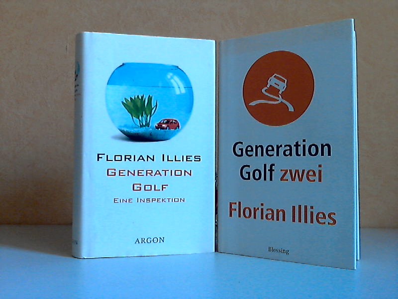
2003rif. 40159Berlin, Argon Verlag GmbH + München, Karl Blessing Verlag GmbH, 2000, 2003. 217, 256 Seiten , 19 cm, Hardcover/Pappeinband
8vo. (4), 304 pp. With a frontispiece showing the author in Arab garb, 88 illustrations in text, most of them reproductions of drawings and photographs by the author, and a folding map loosely inserted in a pocket at the end. Publisher's green cloth. First and only edition, in the original Danish, of an account of a journey through the Arabian Peninsula. Sponsored by the Royal Danish Geographical Society, Barclay Raunkiaer (1889-1915) set out to penetrate the hitherto unexplored deserts of south-east Arabia. Although the traveler came equipped with a modest amount of scientific instruments and a camera, the use of these became almost impossible. The foreigner was looked on with suspicion by the Arabs and Raunkiaer could only use his camera, with great risk, at certain unwatched moments (p. 12). At the beginning of 1912, the traveler reached Kuwait, where he stayed at the palace of Sheikh Mubarak. Since it was Mubarak's policy to keep Kuwait free of foreign interference, it took some active lobbying of the British envoy to convince the Kuwaitis that Runkiaer was a harmless traveller. After that, it seems that the Dane enjoyed a certain amount of freedom, as numerous photographs, including one of pearl-fishers and a portrait of Sheikh Mohammed, testify. Raunkiaer was very impressed by the volume of trade in Kuwait, which he considered to be the most important trading town on the east coast of Arabia. - In Kuwait, Raunkiaer became seriously ill, but his tuberculosis was undiagnosed. After a period of rest, he travelled further to Riyadh. As the first western traveller in the city in half a century, Raunkiaer was graciously received by Ibn Saud. After a short stay in Riyadh, Raunkiaer followed a caravan which mostly consisted of 150 pearl-fishers bound for Bahrain. During a stay in Hofuf, where the book ends, Raunkiaer's health became worse and he sailed to Bahrain to recuperate. From there he travelled back to Copenhagen via Bombay. After a few years working for the East Asiatic Company, Raunkiaer died from tuberculosis. - Shortly after the appearance of the Danish edition, the book was translated into German. T. E. Lawrence, who considered it to be one of the "readable Arabian books", helped facilitate an English translation in 1916, which was privately printed by the Arab bureau in Cairo. - Inscribed by the author to the Danish historian of religion Ditlef Nielsen (1874-1949), with and a few annotations in pencil in the final chapter. Binding slightly worn along the edges, with a small stain on the title. Endpapers foxed with the text browned; some small random pen marks at the lower margin of p. 47. The map with a few tears along the folds, most of them expertly repaired; a very good copy. Facey, Kuwait by the first photographers, pp. 50-51; "Mr. Raunkiaer's expedition in east-central Arabia", The geographical journal XL (1912), pp. 331-332; "Danish expedition to Arabia", The geographical journal XLIV (1914), pp. 85-86; not in Howgego.
Folio (490 x 375 mm). (2), 70 pp. With lithographed title-page and 48 lithogr. plates. Contemporary giltstamped half calf. Rare, elaborately produced publication about Maximilian's journey to Egypt, Nubia, Palestine, Syria, and Malta, on which he was accompanied by the artist Heinrich Mayr. The harem and market scenes are obviously indebted to the French orientalist tradition; several plates show details of architecture, costumes, camel and horse care, etc. They are not identical with the better known plates in Mayr's earlier "Malerische Ansichten aus dem Orient" (Leipzig 1839). - Spine professionally rebacked. Foxing throughout, mainly confined to the plates' margins. Blackmer 1101 (French ed.). Ibrahim-Hilmy II, 26. Tobler 161. Rohricht 1871. Lipperheide Ma 28 (French ed.). Thieme/B. 477 (citing 36 plates only). Kainbacher 299, 2 ("RR").
4to. 2 volumes bound as 1. With lithographed frontispiece and with a small woodcut Portuguese royal coat of arms on title-page of both parts. Contemporary half sheepskin, gold-tooled spine. Rare first and only edition of a monograph on Portugal's political and economical decline, consisting of the two parts, by Antonio Maximino Dulac (1768-1850). The author examines the historical, political, agricultural and economic background of Portugal, comparing it to other European countries and trying to find "remedies" to "cure" the Portuguese state. In the first part Dulac deals at great length with France, whereas the second part deals, among other aspects, with ancient Egypt and the Arabs in the Iberian Peninsula. He examines the Umayyad dynasty, especially the reign of Abdullah (855-912) and Abd-ar-Rahman III (889-961). - Some marginal (water)stains and some pages somewhat thumbed. Binding worn along the extremities, especially at the bottom of the spine. Overall in good condition. Porbase (5 copies). WorldCat (4 copies).
2 sheets (A, combined map of geography and geology; and B, geography only) in full colour, both covering the same section the Arabian Peninsula. Ca. 103 x 103 and 83 x 100 cm, folded. In original printed envelope. English and Arabic. Scale 1:500,000; relief shown by hachures and spot heights. The only two sheets of the groundbreaking series covering today's UAE - the remaining parts of the Emirates were skipped in the survey prepared by the U.S. Geological Survey and Aramco and were therefore never published. The first to produce a full series of geological and geographical maps of the Kingdom of Saudi Arabia, the venture was instrumental in establishing the country as a major global force in the production of natural resources and must count as "a unique experiment in geological cooperation among several governments, petroleum companies, and individuals" (Seager/Johnston). - The area here covered is the eastern portion of Qatar and the westernmost area of Abu Dhabi, including the island of Sir Bani Yas and the adjoining border territory of Saudi Arabia. Indeed, this is the only map in the series to show any portion of today's United Arab Emirates: the land to the eastward was still beyond the focus of oil exploration in the mid-1950s and was omitted from the mapping project. - The importance of the present map within the series is underscored by the fact that its joint authors, R. A. Bramkamp and L. F. Ramirez, were Aramco's foremost geologists. Together with Glen F. Brown, a veteran of the industry who also had been in the region since the 1940s and who would oversee the venture, Bramkamp had in February 1955 planned the entire programme, laying down everything from the scales of maps, the areas of responsibility, and types of terrain representation to the bilingual names. As Aramco's chief geologist, Bramkamp was responsible for the compilation of the areas within Arabia where the sediments crop out. This responsibility fell to Ramirez following Bramkamp's early death in September 1958. - The surveyors divided the Peninsula into 21 quadrangular sections (numbered I-200 through I-220), each to cover an area 3 degrees of longitude and 4 degrees of latitude. All maps were produced on a 1:500,000 scale and issued in two series: a combined map of geography and geology (marked by the appendix 'A') and a map of geography only ('B'). "High altitude photography [...] was [...] completed in 1959 [...] This controlled photography resulted in highly accurate geographic maps at the publication scale which then served as a base for the geologic overlay. The topography of the sedimentary areas was depicted by hachuring and that of the shield region by shaded relief utilizing the airbrush technique. The first geographic quadrangle was published in July 1956 and the last in September 1962 [...] The first of the geologic map series was published in July 1956 and the final sheet in early 1964" (Seager/J.). - Although it was the search for oil, gas and minerals that "was ultimately to drive geological survey work across the region [...], in its early years it was the need for water that was the catalyst for Saudi Arabia's resource exploration. In 1944 King 'Abd al-'Aziz approached the United States for a technical expert who could assist with the identification and plotting of the kingdom's natural resources, particularly its groundwater reserves [...] By 1954 the Saudi Ministry of Finance, USGS and Aramco were working together to produce the first full series of geographic and geologic maps of the country. The first of their type in the Peninsula, these were published [...] in both Arabic and English versions, and the information they contained formed the basis of subsequent Saudi national development plans" (Parry). The project was considered highly important by Ibn Saud, and its aims encompassed all aspects of cartography. It was to enable not only the search for natural resources but also aid in advances for agriculture, civil and military engineering and general infrastructure projects. The results were seminal for the mapping of the region: "To this day, all modern maps of the kingdom trace their roots back to these first publications" (ibid.). - Lower left corner of 'B' map chipped (no loss to text or image); printed sleeve somewhat rubbed with a 1960s few pencil annotations, otherwise a very clean set in excellent state of preservation. A single map of the quadrangle to the immediate west of this, I-208 (the 1958 'A' sheet only), showing Dhahran and Ras Tanura, is currently being offered on the market at £25,000. James V. Parry, "Mapping Arabia", in: Saudi Aramco World 2004/1, p. 20ff. O. A. Seager/W. D. Johnston, Foreword to the Geology of the Arabian Peninsula series (U.S. Geological Survey Professional Paper 560-A-D, 1966).
4to. (2), 362 pp. (but: 360 pp.; p. 176f. omitted); 100 pp. (complete). With engraved frontispiece (margins trimmed) and 16 engraved plates. Contemporary full vellum with ms. spine title. Leaves Bb2-4 and Cc1-2 supplied from another copy. The first German edition of Vairasse's "Histoire des Sevarambes" ("History of the Sevarambians"), translated from the French 1677-79 edition. This is an account of an imaginary journey to Australia, a utopian history in the style of Thomas Moore. Presented in the manner of the then-current geographical and anthropological works, the book provides a direct criticism of revealed and imposed religions, in particular of 17th century Catholicism. Remarkably, this edition also includes the first German publication of Thomas Skinner's slavery narrative entitled "The adventures of an English merchant, taken prisoner by the Turks of Algiers, and carried into the inland countries of Africa" ("Die Selsamen Begebenheiten Herrn T. S. Eines Englischen Kauff-Herrens, Welcher von den Algierischen See-Räubern zum Sclaven gemacht, und in das inwendige Land von Africa geführet worden"). - Lower margin of title torn with some loss, final two leaves torn and frayed without loss of text. Minor foxing to the plates; binding worn, edges somewhat defective. From the library of Swedish antiquarian bookdealer Björn Löwendahl (1941-2013). VD 17, 39:131551R. Holzmann/Bohatta II, 12150.
Colour-printed map, 889 x 632 mm. Scale 1:250,000. First edition. A rare, large full-colour geological map of Palestine, sheet 3, partly revised from aerial photographs by the Geological Section. The key lists era and type of rock, from Precambrian grey and red granites to Neogene sandstones and recent dune deposits, and illustrates both known and predicted fault lines across the earthquake-prone region. However, geology was evidently not the sole concern: international and district boundaries are noted along with railways, various roads, wadis, Arab and Jewish villages individually marked, monasteries and convents, khirba ruins and tell mounds, and sheikhs' tombs. This provides a holistic and detailed map showing Palestinian human settlements, water cycles, geological deposits, and transport corridors during the Mandate period. - Fully and professionally backed in cloth.
Large 4to. VI, 147, (1) pp. With 10 folding maps and plates stored loosely in envelope. Original printed wrappers. Front cover with owner's stamp "W. R. Farrand". - Binding slightly rubbed, larger tears to spine.
Large 4to (20.6 x 28.5 cm). (3), 14, (3). With one map in the text, 3 folding diagrams and 4 numbered plates (plate II and IV comprising 3 pages each), as well as 4 corresponding pages of captions. Original printed wrappers. Stapled and perforated. Rare conference paper for the Seventh Arab Petroleum Congress organized by the Secretariat General of the League of Arab States, held in Kuwait from March 16 to 22, 1970. Authored by the geologist Galal Loutfi and the paleontologist Ali Salama Jaber, it discusses the stratigraphiy of three oil fields in the Kuwait-Saudi Arabian Neutral Zone offshore area, namely Khafji, Hout, and Dorra. The illustrations show the geologic profile of the area with its various rock formations, as well as microfacies of four different kinds of limestone in a total of 33 figures. - Front cover slightly brownstained along edges; a larger trace of glue on inside of lower cover; interior otherwise crisp and clean. A single copy located in libraries worldwide (Muséum d'histoire naturelle, Genève). OCLC 716527649.
rif. 55018Marl: Skulpturenmuseum Glaskasten and Adolf-Grimme-Institut 1981. Square octavo 20.5 × 21.4 cm. Original pictorial wrappers; 60 pp. with reproductions of video stills. Wrappers fox-stained at lower edge and with larger scuff mark; leaves with very faint crease at the upper corner; one leaf detached from the binding; else good. Catalog for an exhibition of German video art which was shown in April and May at the Sculpture Museum of the city of Marl. The internationally little-known city on the western edge of Germany is significant for the country's media landscape as it is home to the most important media award in the FRG. The Grimme Prize Institute organized the exhibition in the hope that video art could make a contribution to the quality of television - not only directly by becoming a component of it but also because it is understood both as a critical accompaniment to the medium and as a field of experimentation. The exhibition was opened with a discussion about experimental and commercial television which is printed in the catalog. Works by the most renowned German video artists were exhibited. The catalog documents video works by: Joseph Beuys Klaus vom Bruch Peter Campus Wendelin Glatzel Klemens Golf Bernd Kracke Ulrich Rückriem Lukas Rahm Klaus Rinke Ulrike Rosenbach Werner Schmiedel Richard Serra and Herbert Wentscher. As of September 2025 KVK OCLC find only one copy in North America. unknown
8vo. XVI, 167, (17) pp. Contemporary half calf with handwritten spine label. First edition. Selections from Arabic works on medicine and natural science in the original language appended with separate title page (in Arabic): extracts from the "Kitab tahdib al-asma", by Abu Zakariya Yahya al-Nawawi, "Kitab 'uyun alanba' fi tabaqat al-atibba'", by Ibn Abi Usaybi'a, and "Tabaqat as-safiiyya", by Ibn Suhba. - The German orientalist H. F. Wüstenfeld (1808-99), considered one of the greatest literary historians of Arabic, studied theology and oriental languages at Göttingen and Berlin. He taught at Göttingen, becoming a professor there (1842-90), and published many important Arabic texts and valuable works on Arabic history. - Binding somewhat rubbed; some foxing. Old handwritten pencil notes to flyleaf; handwritten ownership to title. A good copy. Macro 2345. Ibrahim-Hilmy II, 342.
8vo. 2 parts in 1 volume. XII, 303, (1) pp. VIII, 262 pp., final blank. Contemporary hald cloth with handwritten spine label. First edition of this history of the Ottoman Empire between 1826 and 1856, by the Prussian orientalist and diplomat Rosen (1821-91). - From the library of the German diplomat Friedrich Werner von der Schulenburg (1875-1944), one of the conspirators against Hitler. From 1922 to 1931 Schulenburg served as German envoy to Iran. His handwritten ownership is dated "Tehran, 1928"; his bookplate is on the front pastedown. For his involvement in the tragically failed plot of 20 July 1944, Schulenburg was executed on November 10. - Well preserved copy.