[Broadsheet].MareMagnum

4 114 résultats
Folio (271 x 493 mm). Broadsheet with 5 engravings and two columns of letterpress. Extremely rare, uncommon print describing the legendary Biblical city of Enoch, the "first city of the world", founded by Cain and named after his first son (cf. Gen. 4:17). The centre of the sheet shows a large (264 x 152 mm) view of the city (workmen erecting the walls in the background; Cain's family farming in the foreground), with numerous animals including elephants and lions. The smaller engravings to the left and right (130 x 85 mm each) show pumpkins ("Pepones"), a white falcon, a crane, and several marine animals (including a seal, dolphin, and sand flea). To the left and right of these are columns of letterpress text describing the city in eight twelve-line verses. - The style of the view is obviously closely related to the illustrations familiar from the Prague engraver Jan Hiller (active 1716-46, cf. Dlabacz, Allgemeines Künstlerlexikon für Böhmen I, 628-631), who also provided the plates for Myller's "Peregrinus in Jerusalem", a work that not only contains several topographical views, but also botanical and zoological illustrations. The Myller plate "La Ragna, die Meer-Spinne" shows several of the marine creatures depicted here in exactly the same fashion: clearly, Hiller re-used his work for the present broadsheet. This conclusion is further supported by the fact that the five plates evidence varying degrees of wear: while the large, central illustration shows good, strong contrast, the other four are markedly fainter. - Mounted on sturdy paper, probably by a near-contemporary collector; trimmed close to the plate edges. Slight brownstaining.
1957Features: The friendly voice of Canada - the forest of shortwave transmitter masts near Sackville, N.B. which send the signal of the CBC International Service to distant lands; They're Tenting Tonight - tenting in Canada's parks; Miracle in the Mountains - Lake Louise is rated as one of the seven most nearly perfect landscapes on earth; The Great Trans-Canada Trail / The Carlton Trail from Winnipeg to Edmonton; British Columbia's Gulf Islands - nice photos. Unmarked. Average wear. A sound copy. Book
8vo. 46, (2) pp. Arabic text. Original printed wrappers, stapled. First edition. The second of two rare pamphlets published by the Iraqi government, opposing the independence of Kuwait. The first pamphlet, published in English and Arabic, outlined Kuwait's historical connection to Iraq and analysed its "imperialist relations" with Britain. This second one, in Arabic throughout, prints the minutes of the Political Affairs Committee of the Arab League, which met in Cairo on 20 July 1961 to consider Kuwait's request to join the League. - Kuwait emerged as an independent state in June 1961, after sixty-two years as a British protectorate. With a new constitution, it held its first parliamentary elections in 1963, thereby becoming the first Arab state in the Gulf to establish a parliament. Such political developments, married with growing wealth and modernisations in health, culture and finance, helped to make Kuwait the most prosperous state in the Arabian Peninsula. - The Iraqi government argued that the move toward independence was a continuation of Kuwait's relationship with Britain, albeit under a new guise. Furthermore, they felt that the historical links between Iraq and Kuwait entitled the former to control over the latter and, one suspects, a share of its growing wealth. This position, partly detailed in the pamphlet, led to a point of crisis, with Iraq threatening invasion. To the relief of Kuwait, the Iraqis were eventually deterred by the Arab League's promise of military opposition. - Wrappers a little dusty, two thick black lines to upper wrapper, seemingly erasing stamp, another stamp partially visible to lower wrapper (most likely a bookseller's name and address, "Baghdad" is legible). Interior clean and bright. - Rare: LibraryHub locates one copy in the UK at the British Library; OCLC locates copies in Harvard, the University of Toronto, and the NYU Abu Dhabi. OCLC 219629380.
Standard issue 516 x 688 mm. Scales 1:7,230 to 1:29,040. Nautical chart of ten of the principal harbours and anchorages of the Red Sea, prepared by the British Admiralty: Sherm Sheikh, Sherm el Moiyah, Mersa Diba, Sherm Habban, Omeider Island, Dahab, Sherm en Noman, Wasit anchorage, Akaba Bay, and Khor el Wahla. The chart of Akaba Bay shows Akaba City and the ruined fort as well as Victoria Pier and an observation spot. Several charts show dangerous coral reefs, including Harrier reef on the Khor el Wahla chart. - The British Admiralty has produced nautical charts since 1795 under the auspices of the United Kingdom Hydrographic Office (HO). Its main task was to provide the Royal Navy with navigational products and service, but since 1821 it has also sold charts to the public. The present chart was composed after surveys by the Austrian Imperial ship "Pola" in 1895-96, as well as an admiralty survey of 1918; it was first published in 1899 and saw several corrections up to 1921. - With a stamp "Increase 50%" near upper margin. Captioned in former collectors' hands on verso. Blueish smudge near upper margin; several small marginal tears, only one of which touching text.
Standard issue, 514 x 690 mm. Scales 1:8,250 and 1:94,700. Nautical chart of Perim Harbour, Beilul Bay and the Rakhmat Island anchorage in the Red Sea, prepared by the British Admiralty. The island of Perim divides the Strait of Mandeb into two channels. The island, as a dependency of Aden, was part of the British Empire between 1857 and 1967. - Perim encloses a deep and comparatively large natural harbour on the southwestern coast. The chart labels the pilot's and coal agent's houses, piers, coal stacks, the hospital, the Lloyd's signal station, and leisure facilities like a tennis court and a cricket ground. Other prominent places on the island include the fishing village of Meyun, Murray Point, William Bay, the old fort, and a parade ground. The two smaller maps of Beilul Bay and Rakhmat Island detail lava formations, mangroves, and swamps. - The British Admiralty has produced nautical charts since 1795 under the auspices of the United Kingdom Hydrographic Office (HO). Its main task was to provide the Royal Navy with navigational products and service, but since 1821 it has also sold charts to the public. The present chart was composed after Admiralty surveys of 1885; it was first published in 1886 and saw several corrections up to 1919. Captioned in former collectors' hands on verso.
460 x 670 mm. Farbige Lithographie auf Papier.
1992175 p. Hardcover Very good condition
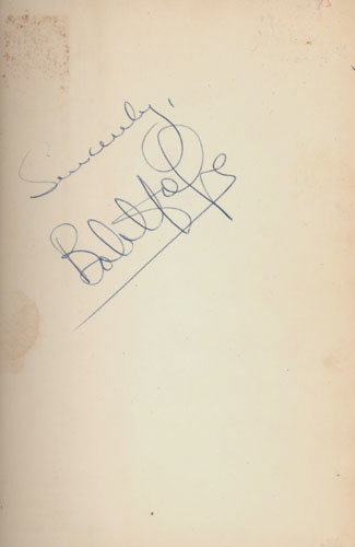
1954réf. 5923BB(New York), Simon and Schuster, (1954). 8°. 308 S. OLn. Illustr. OUmschl., 1Hope, Have Tux, Will Travel. Signiert
2010réf. B3A210320016Hazeltine National Golf Club. 50th Anniversary Committee 2012-01-01. Hardcover. Very Good. A nice copy. Text in mint/unmarked condition. Cover has minor wear. Binding is tight. Your Satisfaction Guaranteed. We ship daily. Hazeltine National Golf Club. 50th Anniversary Committee, hardcover
667 x 580 mm. Scale 1:7,500,000. A large folding map of the Middle East, with the states of the Arab League indicated in red and the Hashemite states shown in green. - Rare; a single copy known in the National Library of Israel as part of the Eran Laor Cartographic Collection.
Watercolour, signed "Haywood" at bottom right. 220 x 203 mm.
4to. 4 parts in 1 volume. (8), 47, (1) pp. (38) pp. 63, (1) pp. 18 pp. With 2 title pages, the first and dedication on its verso printed in red and black, 1 botanical woodcut in text, woodcut headpiece, tailpiece and decorated initials, woodcut Chinese characters, decorations built up from cast fleurons. With diamond-head music notes, long passages in Syriac and Arabic type. - (Bound with) II: Müller, Andreas. Monumenti Sinici [...]. Berlin, Christoph Runge, 1672. Including: [drop-title:] De monumento Sinico commentarius novensilis. [drop-title:] Caput Primum. Historia lapidis. [Berlin, Georg Schultz?, 1674?]. Marbled boards (ca. 1800?). A series of works apparently printed and published together (even though the second title-page gives a different publisher and date) on various aspects of China and its culture, by the gifted orientalist Andreas Müller (1630-94). The title-page of part 1 lists seven numbered subjects for its brief observations: history, missionaries in China from the time of the Old Testament to the time of publication, Chinese emperors and other rulers, ginseng and its medicinal uses, astronomy and the calendar, geography and the relation between the names of the planets and the days of the week. Part 2 is devoted primarily to the transliteration in italic type of an extensive Chinese inscription, using special diacritical marks to indicate the tones and representing them also with Western musical notation above the text. It was a 781 "Nestorian" (East Christian) inscription that had been discovered in the 1620s and first published by Athanasius Kircher in 1667. Müller took issue with Kircher's publications on the inscription. It is followed by several shorter texts, including two pages with parallel columns giving an Aramaic text (the language of the Nestorians) in Syriac script with a Latin translation, and a phonetic rendering of the Chinese Lord's Prayer. Parts 3 and 4 contain additional commentaries on the same Nestorian inscription. - Although the title-page to part 2 is dated "1672" and names the "officina Rungiana" as publisher, all four parts appear to be printed on the same paper stock and they share at least some typographic materials. At least the supplements (which have no date or imprint) seem likely to have been printed by Schultz with part 1, and part 2 may have been as well. - The extensive use of Syriac and Arabic type gives the publication special typographic interest, and it also provides a fine example of Reinier Voskens's two largest italic types (the largest in the 6-page dedication), only about a decade after he cut them. Copies with all four parts complete are extremely rare, VD17 recording at most one. - Somewhat browned, but otherwise in good condition, with only some tiny marginal worm holes (affecting 1 letter in the imprint of the second title-page). Parts 2 and 4 each lacks a final blank leaf. A remarkable example of early oriental studies. BLC German (17th cent.) M-1471. Cordier (Sinica) 773f. (parts 2-4 only). Löwendahl 155, 161-163. Walravens, China illustrata 88 (part 1 only).
8vo. (40), 312, 53, (19) pp. With one folding plate. - (Bound with) II: Tarnow, Hermann / Weidner, Johann Joachim. Grammatica Hebraeo-Biblica, comprehendens etymologiam, syntaxin, eloquentiam [...]. Rostock, Nikolaus Schwiegerau, 1722. (8), 248, (16) pp. 19th century half calf over marbled boards with giltstamped spine and spine-label. First edition of the Hebrew grammar prepared by the most celebrated orientalist of his day. The Göttingen scholar Johann David Michaelis (1717-1791) was the leading expert on Hebrew philology and Biblical exegesis. The present work advocates a new approach to emancipating Hebrew philology from the Greek and Roman tradition of linguistics, discussing verbs before nouns, as opposed to traditional Latin grammars. Fürst dates the first edition to 1744, in apparent error for 1745. - II: First edition of this grammar of biblical Hebrew by the German Lutheran theologians J. J. Weidner (1672-1732) and H. Tarnow (1674-1741). - Extremities slightly rubbed; tiny portion of upper hinge chipped away. Paper evenly browned troughout; occasional light spotting. ADB XXI, 685-690. OCLC 258323863. Cf. Fürst II, 375 (1744 ed.). Goedeke IV, 221. Not in Smitskamp. - II: Fürst III, 410. VD 18, 13308904. OCLC 248815662. Not in Smitskamp.
1971réf. 029735New York: Simon and Schuster 1971. Near Fine condition in a bright and shiny Very Good dust jacket. NOT price clipped $7.50. NOT a library discard. Sharp corners. Square and tight. Previous owner's name on the front free endpaper. Pages are otherwise crisp clean and unmarked. Foreword by Bing Crosby. Bound in the original gilt-stamped green cloth. Complete with dust jacket. Hardcover. Near Fine condition/Very Good dust jacket. Illus. by NOT a library discard. 8vo. 317pp. Great Packaging Fast Shipping. Simon and Schuster Hardcover
1956Previous owner's name to front end paper and list of golf irons to rear end paper. No other marks or inscriptions. A very clean very tight copy with bright unmarked yellow cloth boards and no bumping to corners. Dust jacket not price clipped with dusty faintly cup-ringed rear and rubbing to edges. 128pp. Short cuts to lower scores - an illustrated guide for beginners and experts.
1998Features: Saving old town Lunenberg; Preserving a garden of Plaster Delights - Ottawa's Beattie House; The Future of the Past - Ken Osborne; B.C.'s Gulf of Georgia Cannery on Endangered List; Fredericton's Preservation area expands; Fisheries Fiasco - Steveston's Pacific Coast Cannery demolished. Clean, bright and unmarked with negligible wear. An excellent copy. Book
2 parts in one volume. Engraved title page, letterpress title in red and black, 2 armorial engraved plates, 2 ff. of dedication, 208 pp. 258, (10) pp. With 111 engravings in the text, 1 folding engraved map, and 35 double-page-sited engraved plates. Full calf, spine and covers stamped in blind, spine label. Folio. Second Dutch edition (previously published in 1665) of this description of the 1655-57 embassy of Peter de Goyer and Jacob de Keyzer, with a general account on China in part 2. The plates show views (including Batavia, Canton, Macao, Nanjing, and Beijing), plans, costumes, flora and fauna etc. - "The Dutch, being at the height of their power, having supplanted the Portuguese, desired to gain access to China and a portion of the Chinese trade. After much opposition the Government succeeded in sending merchants to try the pulse of the Chinese at Canton. Upon their report it was determined to despatch ambassadors from Batavia to the Court of Peking to solicit liberty to trade. This is the embassy written up by Nieuhoff, who was steward to the ambassadors" (Cox). - The selection of plates varies from copy to copy. The present one contains two engraved armorial plates not called for in the list of plates, but not the portrait (not mentioned there either) and also lacks the plate "Paolinxi". - Hardly browned of soiled; insignificant edge flaws at beginning and end. Map wrinkled, waterstained and with repaired edge tears. Cat. Nederl. Hist. Scheepvart Mus. 499. Cordier, BS 2345. Graesse IV, 675. Tiele 800. Cf. Boucher de la Richarderie V, 297; Cox I, 325; Henze III, 612.
Black and white photograph (gelatin silver print, 80 x 70 mm) mounted on brown cardboard (90 x 85 mm). Captioned in white ink. HH Sheikh Hamad ibn Isa Al Khalifa, KCIE, CSI (1872-1942) was the King (Hakim) of Bahrain from 1923 until his death. Throughout the 1920s and 1930s, his palace in Al-Sakhir was a centre where both Gulf Sheikhs and British nobility and political figureheads were regularly invited to dine and discuss foreign policy of the region. The photograph shows the monarch in a deck chair on a ship in the company of noble retainers. The caption reads "Sheikh Hamad. Ruler of group of Islands Persian Gulf". - A well-preserved, glossy print in good contrast.
Small 8vo (126 x 177 mm). 63, (1) pp. With several black and white illustrations; 2 large folding maps (63 x 42 cm / 43 x 51 cm) inserted in a paper pocket on the inner side of the rear wrapper. Original printed wrappers. Rare "Hicaz Rehberi" (Hijaz guide): a detailed Turkish-language guide to the Hajj and the Hejaz region, including maps of Mecca and Medina as well as instructions for the routes, for prayers and tariffs, and other various useful tips for pilgrims. The two folding maps are "Ravza-I Mutahhara'nin Plani" (The Map of the Al-Masjid an-Nabawi) and "Kâbe-i Muazzamanin Haritasi ve Hac ile Umrenin Menâsiki" (The Map of the Kaaba and the Place of Worship of Hajj and Umrah). - Original seller's label pasted to back cover. Old ink ownership, dated 1958, to title-page. Slightly age-toned and stained. Extremely rare: no institutional copies recorded in OCLC or KVK.
8vo. 126 pp., final blank f. With printer's device on t. p. Half vellum (c. 1900) with marbled boards and giltstamped spine title. Edges sprinkled in red. Third edition of the famous "Hieracosophion", the second to contain the third book. - "Celebrated poem on falconry" (Schwerdt), written in Latin hexameters by Jacques-Auguste de Thou (1553-1617), a distinguished and highly erudite French nobleman. "His poem was reprinted by N. Rigault in 'Rei Accipitrariae Scriptores' in 1612 and also translated into Italian [...] De Thou succeeded his father, Christophe, as president of parliament; he was privy councillor to Henry III, and also to Henry IV of France, and keeper of his library. He was not thirty when he composed the elegant verses on hawking, which were probably inspired by the experience he gained of this noble sport during his sojourns at foreign courts" (ibid.). On p. 7, we find "an important note on the various kinds of hawks used for Falconry, with the Latin and French names for them" (Harting). - Very minor brownstaining; traces of an old bookseller's label on endpapers. A good copy. Adams T 658. BM-STC French 225. Barbier IV, 1270. Harting 306. Souhart 461. Schwerdt II, 261. Thiébaud 897. Graesse VI/2, 147. OCLC 69042873. Cf. Brunet V, 840 (first ed. 1584). Not in Renouard or Schreiber.
1995Book is in excellent condition. Binding is solid and square, covers have sharp corners, exterior shows no blemishes, text/interior is clean and free of marking of any kind. 218 pages with maps, b&w photos.
12mo. With a woodcut of the main character on the title-page. Contemporary plain wrappers. Very rare first edition of a Croatian translation of the popular comic novel "Le sottilissime astuzie di Bertoldo" by Giulio Cesare Croce, first published in 1606. Based on oral traditions, this highly popular novel told the story of the farmer Bertoldo, who is sometimes cunning and at other times stupid. In this Croatian version the translator "localized" the name of the main character to Nasreddin, thereby establishing a link with the famous 13th-century Turkish satirist Nasreddin Hodja, whose stories were well known in the Balkan region. The translator, Nikola Palikuca from Prokljan (near Šibenik) was probably the pseudonym of a friar or nun. A second edition of the book was published in 1799 in Venice. - With owner's inscriptions on the final blank and interior of the wrapper and some pencil crossing on the back of the title-page. Browned and with waterstains throughout, nevertheless a structurally good edition of a very rare book. Deželjin, "Bertoldi di Giulio Cesare Croce e il riflesso di quest'opera nell'altra sponda dell'Adriatico" in: Capasso, L'Italia altrove, atti del III convegno internazionale di studi dell'AIBA, pp. 135-144. Not in WorldCat; ICCU.
1998réf. 64935Clarendon Hills:: Hinsdale Golf Club. Fine in Fine dust jacket. 1998. Hardcover. Color and black and white photographs throughout. First edition. Fine in a fine dust jacket. . Hinsdale Golf Club, hardcover books
8vo. With 11 full-page black and white plates and 42 numbered black and white illustrations in text. VII, 268 pp. Including errata-slip tipped-in at end. Original pictorial cloth, gilt. The second, best edition of Harting's manual on the management of hawks and a historical and descriptive explanation on practical falconry. For this edition, the author has not merely revised the original text, but has made considerable additions to it, as well as to the illustrations. With plates and illustrations showing a hooded falcon on block, heron hawking, kite hawking with jerfalcons, the falconer's knot, a falcon in flight, etc. The first edition of this work appeared in 1884 with the same publisher. "Not recommended for the beginner [...] Much interesting material collected from various sources, particularly the instructions for hawk catching" (Barber). - Binding rubbed. Barber 7. OCLC 23929448. Cf. Harting 80 (first edition). Schwerdt I, 233 (first edition).
8vo. VII, 268 pp. With 11 full-page black and white plates and 42 numbered black and white illustrations in text. Including errata-slip tipped-in at end. Original gilt green cloth. The second and best edition of Harting's manual on the management of hawks and a historical and descriptive explanation on practical falconry. For this edition, the author not merely revised the original text, but made considerable additions to it, as well as to the illustrations. Plates and illustrations include a hooded falcon on block, heron hawking, kite hawking with jerfalcons, the falconer's knot, a falcon in flight, etc. The first edition of this work appeared in 1884 with the same publisher. "Not recommended for the beginner [...] Much interesting material collected from various sources, particularly the instructions for hawk catching" (Barber). - Binding rubbed, spine-ends chipped; first and last leaves slightly foxed and the usual browning, pasted bookplate and manuscript entry on blank recto of the frontispiece. Good copy of this manual on practical falconry and the management of hawks. Barber 7. OCLC 23929448. Cf. Harting 80 (first edition). Schwerdt I, 233 (first edition).