4 114 résultats
Engraved map. 1245 x 690 mm (if joined). Fine large-format map of the southern portion of the Arabian Peninsula. Includes a large inset plan of Aden and smaller inset maps of the island of Socotra and a smaller map of the routes to Mecca. Illustrates the indigenous peoples, towns, topography and trade routes in the region. - 2 sheets, unjoined.
Large folio. 12 leaves (22 x 16 inches), each containing a large mounted albumen photograph (ca. 12 x 10 inches) with descriptive letterpress beneath. Original leather-backed marbled boards with gilt-lettered roan label on front cover and leaf of printed introductory text mounted to inside front board. Skilfully rebacked and recornered. Small, unobtrusive 19th century embossed library stamp at lower right blank corner of each mount, minor wear at board extremities and chipping at edge of front endpaper, else an unusually clean and nice copy, with the photographic plates in perfect condition. An extremely rare photographic work, unrecorded in the major scholarly studies of early photography in the Holy Land. - According to the introductory text, "In the winter of 1859 the King of Prussia sent an artist to the Holy Land to procure views for his portfolio. Having reached Jerusalem, whilst the Royal commission was being executed, I was so fortunate as to secure (through the courtesy of Right Reverend Samuel Gobat, of the Anglican and Prussian mission) fine impressions from the most valuable of these negatives [...] they are now published, at the request of many persons [...]". Eccleston was an Anglican minister in Newark, New Jersey. - A gilt frame surrounds each photograph, beneath which is the title of the plate and two columns of letterpress text within a decorative type-ornament border. The titles of the plates are: Garden of Gethsemane; Damascus Gate; Jew's Waling Place; Church of Holy Sepulchre; Mosk El-Aksa / Solomon's Bridge; Valley of the Son of Hinnom; St. Stephen's Gate; Golden Gate; Top View of Jerusalem; Bethany; Via Dolorosa and Ecce Homo Arch; Mount Moriah and the Mosque of Omar. - We have been unable to identify the photographer, as the work is unrecorded by the leading authorities on early photography in the Holy Land, and the photographs themselves do not appear in any of the other known photographic albums of the period. Both Eyal Onne, "Photographic Heritage of the Holy Land 1839-1914" (Manchester 1980), and Yeshayahu Nir, "The Bible and the Image" (Philadelphia 1985), record in considerable detail the early missions to the Holy Land and the photographers who either accompanied these missions or who were living in the Holy Land and were retained by the missions. In neither work is the king of Prussia's mission recorded, nor is "Jerusalem Photographic Album" recorded in either bibliography of early photographic works on the Holy Land. Similarly, the recent book, "Revealing the Holy Land: The Photographic Exploration of Palestine" by Kathleen Stewart Howe (1997) records neither Eccleston's book nor these photographs. - Though seemingly unknown to scholars working in the field, two copies of Eccleston's book are indeed known: the NUC and RLIN both record one copy, at Yale, and OCLC locates a second copy at the University of Texas. Our copy was given by Eccleston, probably soon after publication, to his local library company; in the 1880s the library company was absorbed by a newly-created public library, from which it was purchased.
Oblong album (445 x 315 mm) with 71 large albumen photographic prints, mostly ca. 22 x 28 cm, signed and captioned in the negative (in French and English), mounted on both sides of the album's leaves. Includes a three-part folding panorama of Jerusalem from Mount Olivet, measuring 82 x 21 cms. Ornamental endpapers printed in gilt. Original auburn morocco with gilt upper cover. All edges gilt. A rare and unusually massive Palestine souvenir album containing 71 photographs by the renowned studio of Félix Bonfils (1831-85), the French-born photographer who had come to the Levant with General d'Hautpoul in 1860 and remained active in the East. Based in Beirut, Bonfils produced thousands of photographs depicting Palestine, Egypt, Syria, Greece and other parts of the Ottoman Empire. In the early days of western tourism to the Middle East, his works soon became popular as souvenirs. The photographs were available both separately and as individually arranged albums, but sets of this scope were uncommon, very few exceeding fifty images. The sumptuous binding which the owner chose underlines that this was a luxury souvenir for a more than ordinarily wealthy traveller. It features landscapes and city views, famous sights such as Jaffa Gate (Bab el-Khalil), sites sacred to the three religions (Church of the Holy Sepulchre, Church of the Flagellation, Al-Aqsa Mosque, Mosque of Omar, Wailing Wall), but also sights outside Jerusalem, including Hebron, Bethlehem, the Dead Sea, the River Jordan, Jericho, Wadi el-Kelt, Khan-el-Ahmar, Bethany, Nazareth, and Emmaus. - The photographs occasionally show some insignificant loss of contrast, but are altogether in good condition. A few edge flaws to the cardboard leaves, including a chafe mark across the lower edge where the paper has buckled. Binding in good condition, with occasional scuffing (more obvious on lower cover). A fine album of photographs of Palestine.
2004216 pages. Colour photography throughout. Text in English. Features: The Mundanthurai sanctuaryis Tamil Nadu's haven for wildlife enthusiasts; The Unknown Lucknow; Bharatpur's Keoladeo Ghana Bird Sanctuary; Devil Rays off the coast of the Maldives; Nagpur and Indian aviation achievements; Suits that make the man; Jijoy Chowdhury's evocative images of a winter morning in Kolkata; Kurukshetra is steeped in mythological grandeur; Sakinalu packs a punch for the Telegus; Sri Lanka's capital; Bentota Beach; Sigiriya Rock; Buddhist art; Sri Lankan cuisine; Tea and golf in Nuwara Eliya's green hills; Baila; Sri Lankan writers; Tamilian tales; Geoffrey Bawa's architectural style; and more. Clean and unmarked with moderate wear. A quality copy. Magazine
Engraved map. 1230 x 690 mm. Detailed British Admiralty chart of the approaches to Jeddah, present-day Saudi Arabia, with an inset chart of Jeddah Harbour and the city itself. - This is undoubtedly one of the better antiquarian maps of the gateway city to Mecca and Medina. Jeddah was an important diplomatic city when the map was made; illustrated are the consulates of Britain, Russia, Austria, the Netherlands, Egypt, and France. Numerous minarets of the old city are shown. The old city walls and the gates of Mecca, Cherif, and Medina are labeled. The Ummina Howwa (Eve's Tomb) is shown. - At the beginning of the 20th century, Jeddah was an important Red Sea port, but with many islands and much shoaling in the approaches, it was a dangerous one. The British Admiralty has produced nautical charts since 1795 under the auspices of the United Kingdom Hydrographic Office (HO). Its main task was to provide the Royal Navy with navigational products and service, but since 1821 it has also sold charts to the public. In 1795, King George III appointed Alexander Dalrymple, a pedantic geographer, to consolidate, catalogue, and improve the Royal Navy’s charts. He produced the first chart as the Hydrographer to the Admiralty in 1802. Dalrymple, known for his sticky personality, served until his death in 1808, when he was succeeded by Captain Thomas Hurd. The HO has been run by naval officers ever since. Hurd professionalized the office and increased its efficiency. He was succeeded by the Arctic explorer Captain William Parry in 1823. By 1825, the HO was offering over 700 charts and views for sale. Under Parry, the HO also began to participate in exploratory expeditions. The first was a joint French-Spanish-British trip to the South Atlantic, a voyage organized in part by the Royal Society of London. In 1829, Rear-Admiral Sir Francis Beaufort was appointed Hydrographer Royal. Under his management, the HO introduced the wind force scale named for him, as well as began issuing official tide tables (1833). It was under Beaufort that HMS Beagle completed several surveying missions, including its most famous voyage commanded by Captain FitzRoy with Charles Darwin onboard. When Beaufort retired in 1855, the HO had nearly two thousand charts in its catalogue. Later in the 19th century, the HO supported the Challenger expedition, which is credited with helping to found the discipline of oceanography. The HO participated in the International Meridian Conference which decided on the Greenwich Meridian as the Prime Meridian. Regulation and standardization of oceanic and navigational measures continued into the 20th century, with the HO participating at the first International Hydrographic Organization meeting in 1921. During World War II, the HO chart making facility moved to Taunton, the first purpose-built building it ever inhabited. In 1953, the first purpose-built survey ship went to sea, the HMS Vidal. Today, there is an entire class of survey vessels that make up the Royal Navy’s Hydrographic Squadron. The HO began to computerize their charts in the late 1960s and early 1970s. In 1968, the compilation staff also came to Taunton, and the HO continues to work from there today.
2017réf. 029687OnePutt Press 2017. INSCRIBED / SIGNED by the AUTHOR directly on the dedication page. NEW and unread in PERFECT condition. Flat spine. NO chips tears creases rubbing or fading. Bright and shiny. Sharp corners. Pages are fresh crisp clean and unmarked - obviously never read. Laid in are two full color photos of The Westin Mission Hills Gary Player Signature Course in Ranch Mirage California where the author is a golf writer and Head Teaching Professional. Bound in the original pictorial wraps. From the rear cover: " A young man determined to launch a career as a gold professional must first overcome self-doubt heartbreak and limited resources. His propects improve when he meets Jitterbug Bell a local golf legend with a unique gist for teaching. Jitterbug's Gift is a treasure trove of golf knowledge.". INSCRIBED / SIGNED by the AUTHOR. 1st ed No additional printings listed. Softcover. New. xi 148pp. Great Packaging Fast Shipping. OnePutt Press Paperback
4to. (8), 200 pp. With 8 engraved plates (some with touches of colour, two folded). - (Bound with) II: Wenner, Adam. Türckisches Reisebuch von Prag aus biß gen Constantinopel [...]. Nuremberg, Johann Andreas Endter & Wolfgang Endter's heirs, 1665. (8), 135, (5) pp. Title printed in red and black. Contemporary full vellum with handwritten title to spine. Exceedingly rare Mediterranean travelogue: one of two German editions published in the same year (the other, an entirely different translation, by Cunradus in Amsterdam; the Nuremberg edition cited by several bibliographies is fictitious). Dutch editions had previously appeared in 1649 (the first) and in 1661. Although the Amsterdam-published German edition dates the journey to 1640-42, the Dutch first edition as well as the present translation make it clear that it had taken place as early as 1590-92! Somer's voyage began inauspiciously - he was captured by a Turkish galley in the harbour of Famagusta and briefly enslaved, but was soon set free after the French consul at Alexandria intervened for him. In spite of this episode, he travelled the Ottoman Empire at a time of relative peace (the Long Turkish War with the Habsburgs would not break out until 1593), spending several months in Egypt, Constantinople and Palestine. His colourful account includes a description of desert sandstorms and the trade in Egyptian mummies (not all of them ancient) as well as extensive chapters on Constantinople, the Ottoman court, the ubiquitous baths, Turkish customs and manners, the Muslim faith, curses and magic, etc. Somer returned via then-Ottoman Greece and Hungary, which he also describes. An appendix (pp. 170ff.) contains A. Stockram's topical account of the voyage of the Dutch ship Arnheim, which foundered off Mauritius on the return from Batavia. The translation is credited to "Philemerus Irenicus Elisius" (i.e., Martin Meyer). Rare; the last copy in auction records sold in 1983 (Erasmushaus, an incomplete reissue with only 5 views). - Bound after this is the second edition of A. Wenner's narrative of the Imperial embassy to the Porte in 1616-18, to ratify the Treaty of Zsitvatorok. Wenner served as secretary to the embassy; his "book is a day-to-day account of the journey to Constantinople from Prague, and includes a list of all the entourage from nobles to the apothecary, goldsmith, musicians, tailors, cooks, and so on. A list of presents for the sultan, with their values, is also given" (Atabey). The Treaty of Zsitvatorok "was a landmark in Turkish-European diplomatic relations, when the Turks first began to observe the general principles and courtesies of international law, and to exchange special ambassadors on an equal footing with European nations" (Blackmer). - Some browning throughout due to paper, more pronounced in Somer's work, the title-page of which shows an unobtrusive tear in the upper edge. Contemporary handwritten ownership "Bocken" to recto of flyleaf; verso has stamp and 1978 ownership of the Viennese collector Werner Habel (1939-2015). I: VD 17, 23:231760C. Tobler 86. Röhricht p. 217, no. 820. Paulitschke 532; Ternaux-Compans, Bibliothèque asiatique et africaine, 1977 (both have "Nuremberg" in error for Frankfurt). Cf. Weber II, 216 (Amsterdam German ed.); Kat d. Scheepvart Mus. I, 254f. (Dutch eds.). Not in Atabey, Blackmer, Aboussouan, Howgego, Henze, Cox, or Chauvin. - II: VD 17, 23:234557B. Cf. Atabey 1326; Blackmer 1783; Brunet VI.2, 435 (all for the 1622 first edition). Not in Röhricht, Tobler, Aboussouan or Brunet.
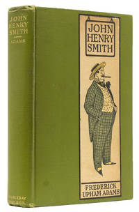
1905réf. 245773New York: Doubleday Page 1905. First edition. With 42 illustrations by A.B. Frost. 346 pp. 1 vols. 8vo. Cloth with inset paper label of Golfer on upper cover. Gift inscription on front flyleaf. Owner blindstamp on rear flyleaf. Very good. Frost A.B. First edition. With 42 illustrations by A.B. Frost. 346 pp. 1 vols. 8vo. Donovan & Murdoch 4850 Doubleday, Page unknown
1905réf. 245773New York: Doubleday Page 1905. First edition. With 42 illustrations by A.B. Frost. 346 pp. 1 vols. 8vo. Cloth with inset paper label of Golfer on upper cover. Gift inscription on front flyleaf. Owner blindstamp on rear flyleaf. Very good. Frost A.B. First edition. With 42 illustrations by A.B. Frost. 346 pp. 1 vols. 8vo. Donovan & Murdoch 4850 Doubleday, Page unknown books
Pastel on paper, laid onto canvas stretched over (original?) wooden board (305 x 410 mm). This pastel was drawn by the prolific itinerant portraitist John Saunders (1682-c. 1758) at Peterborough in September 1739. Saunders is recorded as active in East Anglia, the Midlands and elsewhere in the mid-18th century (cf. Neil Jeffares, "John Saunders", Dictionary of Pastellists Before 1800 [London, 2006]). The sitter, John Sturges in Turkish costume, wearing a white turban with blue feather and golden embroidered coat, was probably drawn from a mezzotint after John Vanderbank (1694-1739) by Francis Kyte (d. 1744), published in 1733. The pastel is of interest as an example of mid-18th century depiction of Turkish costume. Saunders, perhaps in an attempt to add extra exoticism to Mr. Sturges, has included a curling moustache that is not present in the mezzotint. Sturges, an architect based in the East Midlands, is known to have collaborated with William Talman (1650-1719) at Chatsworth and Milton House in Northamptonshire. The fact that this pastel was produced in Peterborough may indicate some connection with descendants of Sturges, assuming that he himself was dead by 1739. The Fitzwilliam Museum holds a drawing of John Sturges by John Vanderbank (wash on paper, PD.1-1992). - Verso with label bearing 19th century manuscript note concerning the autograph pencil inscription by Saunders top right: “Saunders pinxit after Mr. J[oh]n Vanderbank Peterborough Sept. anno d. 1739”. Two negligible scratches to surface, otherwise good, offered without frame.
Hand-coloured engraved map (456 x 345 mm). Decorative map of Turkey, Persia, Arabia, Afghanistan, Beloochistan and contiguous regins., with large inset views of Smyrna, Trebisond and Muscat. Shows excellent detail, including towns, rivers, mountains, deserts, roads, etc. Al-Qasimi 270.
Folio (212 x 298 mm). 25 ff. Contemporary brown leatherette binding with giltstamped cover-title. The original Joint Venture Agreement between the state-owned Iraqi Drilling Company (IDC) and the Mesopotamia Petroleum Company (MPC), with the autograph signatures of Idriss Muhsen Al-Yassiri, General Director of IDC, Stephen Remp, Director of MPC and its associate Ramco Energy, and Peter Redman, Director of Midmar Energy and Firstdrill, other associate companies of MPC. - This joint venture, known as the Iraqi Oil Services Company LLC (IOSCO), was created with the objective of drilling 60 new wells each year in the Republic of Iraq, thus significantly increasing oil and gas production. This groundbreaking deal was the first joint venture of its kind between the Iraqi Ministry of Oil and a foreign oil company since the fall of the regime of Saddam Hussein in 2003. On 7 July 2009, IDC terminated the agreement after MPC failed to fulfil financial obligations. MPC was unable to confirm funding of $44.1 million to meet the initial capital commitments to preserve its 49 percent stake in the venture. - Handwritten addition by Stephen Remp on fol. 4 specifying the territory of the joint venture: "(i.e. Missan Province or any other Provinces to be mutually agreed by The Parties.) [...]". - In mint condition.
8vo. 4 vols. 36 pp. (Jordan). 192 pp. (Iraq). 88 pp. (Iran). 52 pp. (Afghanistan). Original illustrated stiff wrappers, each volume with a map on the inside front cover. Collection of four curious foreign trade monographs issued by the Austrian Chamber of Commerce, directed at Austrian concerns aiming to do business with the Near and Middle East. With the exception of Iraq, where the revolution of 1958 had just heralded a republic, all countries here discussed were still monarchies. Contains general geographical data and statistics, details on units of measurements, economic structure, and customs of trade.
Toned lithograph. 375:540 mm. From a series of illustrations depicting the Old Testament story of Joseph within oriental scenery of bedouins, palms, and camels. Joseph (Yusuf) is regarded by Muslims as a prophet (Qur'an, suras vi, 84; xl, 34), and a whole chapter Yusuf (sura xii) is devoted to him, the only instance in the Qur'an in which an entire chapter is devoted to a complete story of a prophet. - A few edge flaws, some repaired, with some browning and staining.
8vo. English ms. in blue ink on paper. 69 pp., interleaved with pink blotting paper. With several coloured ink sketches. Bound in red morocco with inscribed cover "Journal of the proceedings on board the ship Oriental from London to Bombay". Marbled endpapers, inscribed "W. Collingwood. Journal Book". A passage journal kept aboard the ship "Oriental" from London around Africa to Bombay between 6 January and 30 May 1846, written in a neat and clear hand with occasional coloured ink sketches. The varied content includes weather observations, poetry, and day-to-day commentary: "March 31st 1846 Tuesday: A large shoal of porpoises playing about the bows the mate went out on the dolphin striker to harpoon one but was unsuccessful [...]", "May 11th 1846 Monday: This morning we sighted Coëtivy, it is a low rocky shore sprinkled with Cocoa nut trees etc., before 12 it was out of sight [...]" (includes a panoramic sketch of the coastline). - Lieutenant William Collingwood, a distant cousin of the Admiral, was an R.I.N. surveyor who did much valuable work in Iraq, including the large-scale, though surreptitious, mapping of Baghdad in 1855. During this same expedition, Collingwood also surveyed the Shatt-ul-Arab, the city of Bussorah (also by stealth) and much of the country between the Tigris and Euphrates Rivers, and he was undoubtedly one of the most gifted and productive R.I.N. surveyors of his day. - Binding slightly rubbed at extremeties; in good condition altogether.
4to. VI, 50 pp. With a portrait frontispiece of the author, from a photograph, 34 other photographic illustrations on plates, and a double-page sketch map of the Kittar Mountains. Publisher's purple cloth, blocked in black and gilt with ibex and palm tree. All edges gilt. First edition. Extremely rare example of this journal which covers Pretyman's 1891 hunting expedition to the Kittar mountains, the Eastern Desert of Egypt between Qena on the Nile and Quseer on the Red Sea, using the only known map of the area produced by Floyer four years earlier. H. E. Pretyman, a lieutenant in the Grenadier Guards, travelled back from Ismalia to London in 1891 but died the same year, whilst Camp Adjutant at Bisley, and it is believed he had not fully recovered from a severe attack of typhoid and jaundice in 1889. His father, the Rev. Frederic Pretyman, arranged to have the journal published as a memorial volume. - Extremeties insignificantly rubbed, light brownstaining or foxing to a few places in the first and last few leaves. An excellent copy. Meckly, Alpine Journal. Bibliography of Privately Printed Mountaineering Books 204. Lloyd, Cat. of the Graham Brown and Lloyd Collections in the NLS, 813. Not in Czech, Asian Big Game Hunting Books.
1982réf. ABE-2678142178216 PAGES-SYLVIE VARTAN EN COUVERTURE/"LES NOUVELLES CONFIDENCES DE SYLVIE"-RENE MONORY PAR CATHERINE NAY-LES NOUVELLES CONFIDENCES DE SYLVIE/6P-MALOUINES: L'ESCALADE-VILLENEUVE: LE DERNIER VIRAGE/4P-SAINT NOM: DEUX MAITRES SOUS LA PLUIE//4P-VARSOVIE LA COLERE/4P-AZNAVOUR: "MON GRAND RETOUR"/4P-A 12 ANS ILS RECOIVENT LE BAPTEME DE LA TELE-LES SURPRISES DU LIMOUSIN/POULIDOR/CHIRAC/MITTERRAND-DAVE: CET ETE AU FIL DE L'EAU-LES MALOUINES POUR LES BEAUX YEUX DE LA POMPADOUR PAR CHRISTIAN BRETAGNE/4P
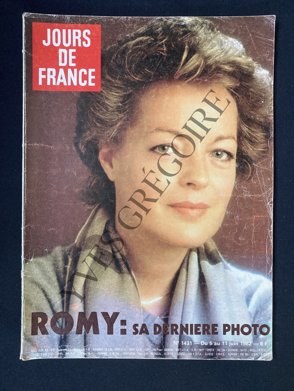
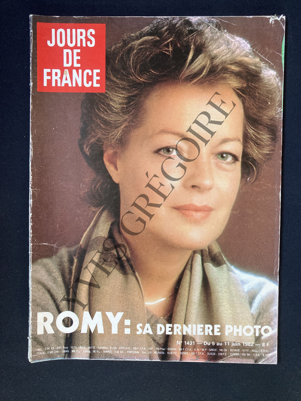
1982réf. ABE-1551260319540EN COUVERTURE "ROMY: SA DERNIERE PHOTO", GROS PLAN-KIRAZ COLOR, PARTIE DE TENNIS-INTERVIEW DE CATHERINE NAY: MAURICE FAURE, 4P-ROMY N'EST PLUS, 6 PAGES-ROLAND-GARROS: DEUX NOUVEAUX VISAGES, 4 PAGES, CATHERINE TANVIER, LOIC COURTEAU, 3 PHOTOS-ET PENDANT CE TEMPS-LA BORG ET MARIANA, 2P, PHOTO-HOSSEIN: LE MARIAGE DE COSETTE, 4P, 4 PHOTOS-AIRE SUR L'ADOUR: L'ENFER DES INNOCENTS, 6P-LES LAURIERS DE CANNES, 8P-REVILLON: LE NOUVEL ELAN DE LA HAUTE FOURRURE, 2P-LES "22" SUR LEUR 31, COUPE DU MONDE DE FOOTBALL, 2P, 5 PHOTOS-LA MODE "JOURS DE FRANCE" SPORTS, 10P, TENNIS, GOLF-COUVERTURE LEGEREMENT FROTTEE
1982réf. ABE-1552585782247EN COUVERTURE "ROMY: SA DERNIERE PHOTO", GROS PLAN COULEURS-KIRAZ COLOR, PAGE COULEURS-MAURICE FAURE, 4P PAR CATHERINE NAY-ROMY N'EST PLUS, 6P-ROLAND GARROS: DEUX NOUVEAUX VISAGES, 4P, CATHERINE TANVIER, LOIC COURTEAU-DANS LA VOITURE D'ANNA: LA BOMBE, ANNA COSMEDIS, 6P-HOSSEIN: LE MARIAGE DE COSETTE, 4P-AIRE SUR L'ADOUR: L'ENFER DES INNOCENTS, 6P-CANNES-LES "22" SUR LEUR 31, 2P, 5 PHOTOS, COUPE DU MONDE DE FOOTBALL-LA MODE "JOURS DE FRANCE" SPORTS, 10P, TENNIS, GOLF
82 x 96 cm. Original colour-printed map. Scale 1:5,000,000. Rare political map of Southwest Asia from the Cold War era, centred on the Arabian Peninsula and the Gulf region but including Turkey and the Levant, Iraq and Iran. With Cyrillic titles and captions. - Small marginal flaws.
8vo. XIX, (1), 196 pp. Contemporary calf with giltstamped cover borders, gilt spine, gilt cover dedication; leading edges gilt; all edges gilt. First edition, second impression with corrected title page. Hammer's German translation of verses by a 16th-century dervish residing in Constantinople. - From the library of the Swedish diplomat Ulf Torsten Undén (1877-1962) with his ownership "U. T. Undén" signed twice to endpapers. Goedeke VII, 763, 60. Wurzbach VII, 276, 42. WG² 28. Hayn/Gotendorf III, 498. OCLC 41405611.
Folio (335 x 432 mm). 3 ff. of letterpress matter (half-title, title and list of plates). With 40 mounted calotypes. Contemporary marbled half morocco on five raised bands with giltstamped spine title; marbled endpapers. Second, "better known" (Parr/Badger) edition of this pioneering work, first published in 1854: only the plate volume with the 40 magnificent calotypes, wanting the separately published 90 pages of text. - Wishing to support L. F. J. Caignant de Saulcy in the controversy concerning the dating of the wall of Jerusalem that followed his journey to the Dead Sea, Auguste Salzmann set out for the Holy Land on 12 December 1853. With the help of his assistant Durheim, he prepared some two hundred waxed-paper negatives of the Jerusalem monuments during his four-month stay. While his findings were first published in a monumental volume in 1854 (the copy of the Duke de Luynes commanded 463,500 Euros at Sotheby's Paris in 2013), the present reduced edition, with prints by Blanquart-Evrard, is better known. "It was an expensive book, a livraison, or fasicle of three prints costing 24 gold francs. A single print was 10 francs [...] Salzmann was acutely attentive to both patina and pattern in attempting to define the architectural strata of a city in which building was built upon building, thus leaving a vertical record of the various cultures that had occupied the city and left their remains on the foundations built by earlier conquerors [...] Salzmann himself described his pictures as having 'a conclusive brutality', but to modern eyes their poetic aspect seems paramount. It would appear that Salzmann was at one and the same time both expert and layman, dispassionate observer and enthusiast. His pictures have this dual quality, flickering rapidly between documentary and poetry. This, one might suggest, is the ideal goal for any photographer". - Binding slightly rubbed and chafed in places. Marginal foxing throughout, affecting only a few photographs; insignificant waterstain to edge; old ownerships erased from title, leaving slight traces. Parr/Badger, The Photobook I, 25. Tobler 181f. Röhricht 440f. Baier, Geschichte der Fotografie 452f. Gernsheim, History of Photography 186. Witkin/London, Photograph Collector's Guide 86f.
4to. 48 ff., printed in red and black throughout. Contemporary yellow boards with restored calf spine. First edition. "Editio princeps of this popular short syntax of the Arabic language, written in the 13th century. Two centuries later an Oriental printed edition was published in Istanbul (1786), but in the meantime this edition, printed in Arabic (30 point) throughout, could well have passed for a manuscript [...] To some copies a Latin title page was added bearing the legend: 'Grammatica Arabica dicta Caphia auctore filio Alhagiabi'" (Smitskamp). - Composed by the Arabian grammarian Uthman Ibn Umar, known as Ibn al-Hajib (1175-1249), and printed at the Medicean Press, founded in 1584 by Cardinal Ferdinando I de’ Medici and directed by Giambattista Raimondi (1536-1614), an able scholar of Arabic. - Some edge faults (professionally repaired), old repairs to title page, with slight loss to letterpress. A wide-margined copy, generously printed in 13 lines per page. An exceptionally appealing typographical achievement. Edit 16, CNCE 44392. Adams U 102 (both s. v. Uthman). BM-STC Italian 706. GAL I, p. 303. Smitskamp 30. Schnurrer 42.
Standard issue, 685 x 1025 mm. Scale 1:29,420. Nautical chart of Kamaran Island and Kamaran passage in the Red Sea, prepared by the British Admiralty. With an inset map of Kamaran harbour. - During the second part of the 19th century, Kamaran Island was occupied by the Ottomans, who built a quarantine station for pilgrims from East Africa, the Gulf, India and the East conducting the Hajj by sea to the Ottoman-controlled holy city of Mecca. The chart details the quarantine area on the island, labelling quarantine buildings and the quarantine anchorage. Among the most prominent labelled places are Ras Rasha, Ras el Yemmen, Ras el Bayádh, and Saliff. Other details include Risha Island with a coral-free spot marked "good landing", as well as a warning of buoys adrift in the Kamaran passage. - The British Admiralty has produced nautical charts since 1795 under the auspices of the United Kingdom Hydrographic Office (HO). Its main task was to provide the Royal Navy with navigational products and service, but since 1821 it has also sold charts to the public. The present chart was composed after Admiralty surveys in 1899; it was first published in 1900 and saw several corrections up to 1919. - With a single fold. Captioned in a former collector's hand on verso. Two small marginal tears.
Large 4to (176 x 262 mm). Arabic ms. on oriental paper. 325 ff., expertly written naskh script, possibly in more than one hand, black ink with rubrics, usually 6-8 lines to the page, considerable interlinear and marginal glossing. Full-leather Islamic binding with fore-edge flap; original blind tooled ornamentation (medallion). Manual on Islamic Law by Abu al-Barakat `Abdallah b. Ahmad b. Mahmud al-Nasafi (d. 710/1310), an important Hanafi legist and theologian. Born in Nasaf in Sogdian, he taught in the Madrasa al-Kutbiya al-Sultaniya in Kirman, came to Baghdad in 710 and died in Rabi` I 710 (August 1310), apparently on his return journey to Idjadj (in Khuzistan), where he was buried. The Kanz al-Daqa'iq is an important text on Hanafite law and formed the basis for a great number of commentaries, especially in the 9th/14th and 10th/15th centuries (EI² VII, p. 96; GAL II, pp. 250-53). Contains both the `Ibadat and the Mu`amalat. - Final 12 leaves (f. 313ff.) show edge damage with some loss of text. Copied by Khidr b. Shaykh `Ali (colophon in a chancery hand on f. 325v). Cf. GAL S II, 265.