4 409 résultats
Folio. 268 ff. Contemporary vellum with ms. title to spine. Fine incunabular edition of Pliny's famous encylopedic work, covering the entire field of ancient knowledge. With his "Natural History", Pliny gives a mathematical and physical description of the world, discusses geography, ethnography, anthropology, human physiology, zoology, botany, mineralogy, sculpture and painting. As "a purveyor of information both scientific and nonscientific, Pliny holds a place of exceptional importance in the tradition and diffusion of culture" (DSB). Through the present work Pliny "gives us by far the most detailed account of the coast of the United Arab Emirates that has come down to us. Chapter 32 of Book 6 (§ 149-152), beginning near the Qatar peninsula, proceeds to describe the Emirates islands, tribes, and coast right up to the Musandam peninsula, before continuing on south along the coast of Oman. As such, it is a mine of invaluable information on the UAE in the late pre-Islamic era" (UAE History, online). Pliny "completed his 'Natural History' in 77 AD and, to judge from his account of the peoples and places of south-eastern Arabia [...], the area of the UAE was full of settlements, tribes, and physical features, the names of which he recorded for posterity" (Ghareeb/Al Abed 54). - "This appears to be the first edition of Barbarus' recension, the note of a 1496 edition by the same printer being probably due to a confusion (Hain 13099)" (BMC). Dated 1497 in the colophon, but the dedication is dated the Ides of February in the twelfth year of the Doge Augustinus Barbadicus (30 Aug. 1497 to 29 Aug. 1498). - Numerous contemporary marginalia. Slight worming to gutter and some waterstaining near end; spine restored. Late 19th-c. bookplate of Dr. J. Klauber on front pastedown. HC 13101*. Goff P-799. GW M34321. Klebs 786.14. Proctor 4893A. BMC V 377. ISTC ip00799000.
1998réf. Q-0966352408Natural Golf Corp 1998-03-01. paperback. New. In shrink wrap. Looks like an interesting title! Natural Golf Corp paperback
19881st edition. Folio, 219 pages, illustrated. Nr fine condition hardback in very good condition dust jacket, jacket has been price clipped. Dedcation to previous owner from family on free front endpaper. 40796. eng
Folio. (16), 311, (60) ff. Title-page and sub-title to index with ornamental woodcut border. Woodcut initials, head and tail pieces. Calf, gold-tooled ribbed spine with title-label. Sprinkled edges. First edition of the "Natural history" edited by Johannes Caesarius (1468-1550), a humanist and close friend of Erasmus. The original text was by Gaius Plinius Secundus (AD 23 - August 25, AD 79), better known as Pliny the Elder. He was a Roman author, naturalist, and natural philosopher, as well as naval and army commander of the early Roman Empire, and personal friend of the emperor Vespasian. The text in the present edition is decorated with woodcut borders and many woodcut initials. - The "Naturalis Historia" is one of the largest single works to have survived from the Roman empire to the modern day and purports to cover the entire field of ancient knowledge, based on the best authorities available to Pliny. He claims to be the only Roman ever to have undertaken such a work. It comprised 37 books in 10 volumes and covered over 20,000 facts on topics including the fields of botany, zoology, astronomy , geology and mineralogy as well as the exploitation of those resources. It remains a standard work for the Roman period and the advances in technology and understanding of natural phenomena at the time. Some technical advances he discusses are the only sources for those inventions, such as hushing in mining technology or the use of water mills for crushing or grinding corn. Much of what he wrote about has been confirmed by archaeology. ''We know from Pliny that there were important pearl fisheries in the Gulf [...] Pliny identifies Tylos (Bahrain) as a place famous for its pearls [... He] attests that pearls were the most highly rated valuable in Roman society, and that those from the Gulf were specially praised [...] The pearl related finds at the site of El-Dur indicate the site was integrated into the maritime trade routes linking the Roman Empire, the Persian Empire, India and South Arabia'' (Carter). Book 6 holds a chapter that gives the first detailed account of the regions around the Gulf, including what are now Qatar, the Emirates and Oman. - Not only is it virtually the only work which describes the work of artists of the time, and has it become an important reference work for the history of art, due to the wide range of topics, the referencing system and index it became a model for later encyclopaedias. - With manuscript notes of multiple owners on pastedown (including written ex-libris by Antonii Mauritii Seguin 1713 and Mathon de la cour 1744). Some underling in text, and notes in the margins (partly lost due to trimmed edges). A very good copy with bookplate of De Ponsainpierre on pastedown. VD 16, P 3531. Adams P 1556. BM-STC German 704. Durling 3689 (imperfect copy). Hunt 23. USTC (11 copies).
2 parts in 1 volume. Folio. (8), 357, (3), 324, (4) pp. With engraved frontispiece, title-page printed in red and black, 16 engraved views and maps (2 folding, 14 double-page; 4 drawn by Charles Vasteau), and 22 engraved illustrations in the text (3 signed by Johannes Kip), further with 5 woodcut decorated initials (3 series) plus repeats and a woodcut headpiece and tailpiece. Contemporary blind-tooled vellum, manuscript spine title, red sprinkled edges. First edition of Olfert Dapper's important description of the Middle East. The first part is devoted to Mesopotamia or Algizira, Babylonia, Assyria and Anatolia, while the second is entirely devoted to Arabia. The work is especially important for the original and new information on Islam, Arabic science, astronomy, philosophy and historiography. Besides a map of Arabia, the fine plates include views of Mount Sinai, Bagdad, Basra, Nineveh, Abydos, Smyrna, Aden, Muscat, Mocha the Tower of Babel. The second part includes a description of coffee: "In Arabia Felix alone, and in no other place of the whole world, there grows a seed or corn or bean shrub which the Arabs call 'Bon' or 'Ban', of which they prepare a drink by cooking it in water over the fire ..." (part 2, pp. 61f.). The present copy includes a plate showing the plants "Abelmosch", "Semsen" and "Sambak", not called for in the binder's instructions, but included in some copies. - A German translation of Dapper's account appeared in 1681. - Front hinge cracked, otherwise in very good condition. Atabey 322; Hage Chahine 1206; Hünersdorff, Coffee, p. 386; Tiele, Bibl. 300; cf. Blackmer 450 (German ed.); Slot, The Arabs of the Gulf, p. 412.
réf. 61097, picture Publishing, 2023 hardcover, formaat 340mm x 260 mm, gebonden, 420 pagina's full colour, rijk ge llustreerd. ISBN 9789492576637.
560 x 827 mm. Chromolithographic map of the Arabian Peninsula, from Turkey in the north to the Indian Ocean in the south, and covering Saudi Arabia, Egypt, Israel, Palestine, Jordan, Syria, Lebanon, Iraq, Iran, Kuwait, Bahrain, Qatar, United Arab Emirates, Oman, North and South Yemen. Scale 1:5,000,000. Folded. Extremely rare Israeli strategic map of the Arabian Peninsula showing oilfields and associated infrastructure. Printed in black, red and blue, the map demarks the political boundaries of the time along with the areas covered by oil companies' concessions. Pipelines form a web across the northern part of the Arabian Peninsula (shown in uncommon vertical orientation), while oilfields and refineries, large and small, are also marked. The map was most probably created by the IDF in reaction to the Suez Crisis and its associated geopolitical shifts. With the Egyptians operating the Suez Canal, and Britain and France being forced by the USA to abandon their post-imperial plans, Israel now counted in both U.S. and Soviet plans for their control of Middle Eastern politics. Britain was forced to anchor its Middle Eastern influence in Cyprus, Aden and Iraq, while the increased American influence can be seen in the huge swathe of territory assigned to Aramco. We have only been able to trace a single institutional copy of this map in the National library of Israel. - Scale and key in Hebrew inset to top-right, inset explanatory panels in Hebrew and English, compass rose in Saudi Arabia. A couple of small light stains, some uneven creasing and edge tears along creasefolds with a couple of tiny holes at fold joins. Traces of pins from former wall mounting.
réf. ria9780801891564_inpHardback. New. New Book; Fast Shipping from UK; Not signed; Not First Edition; " In doing so Wimberley defines a new environmental philosophy and a new ecological ethic. hardcover
Folio (214 x 342 mm). 3 vols. bound in one. (4), 120 (instead of 124) pp. (2), 142 pp. 172, (4) pp. Two title pages printed in red and black. With a total of 97 (instead of 98) half-page woodcuts in the text. Period style dark brown calf, elaborately gilt decorated spine and boards, red morocco spine label, raised bands, marbled endpapers. First editions of three separately issued parts of the very scarce "newly-opened amphitheatre", comprising the America, Asia, and Turkey volumes. The exceptional large woodcuts show the native inhabitants of the various parts of the world. Of special interest is the rare volume dedicated only to Ottoman society, as well as that on Asia: together, they cover the Islamic countries of the early modern period, including details on the Arabian Peninsula. Among the illustrations are various Muslim clerics, Northern Arabians and desert Arabians in Bedouin costume, coffee salesmen, sweetmeats salesmen, and a Turkish gentleman carrying the Qur'an on his head, as well as Persians, the Sultan, Janissaries, archers, dancers, etc. The Asia volume, produced later, repeats a single illustration but contains much new matter on Arabia, including a discussion of the Muslim religion, the Qur'an, ablutions performed with sand, and the trade in incense, coffee, and spices, as well as pearl fishing in Bahrain (p. 54). The America volume covers the discovery and exploration of America, with woodcut illustrations including portraits of Columbus, Vespucci, Magellan, and 30 depictions of Native Americans from throughout the New World, including Virginia, California, Pennsylvania, Maryland, etc. - This present set omits the parts on Europe and Africa, which were published first, and thus contains parts 3 (America) and 4 (Asia) of the four-part "Neu-eröffnetes Amphitheatrum" (the final part of which was produced only after a five-year hiatus), along with the "Neu-eröffnetes Amphitheatrum Turcicum", separately issued in 1723, from which the 1728 volume on Asia drew freely. Severely browned throughout due to paper. Title page of "America" vol. remargined; edge-wear to first and last few leaves only; wants quire G (pp. 25-28, including one illustration). Quire K in "Turkey" vol. (pp. 37-40) with expert paper repairs. In a highly appealing modern binding. Lipperheide Ac 5. Colas 2187. Hiler 652. Sabin 52360. Palmer 364. Not in Atabey or Blackmer. Not in Hünersdorff (Coffee).
(4), 207, (1) SS. Mit lithogr., goldgehöhtem Frontispiz. Originalleinenband mit goldgepr. Vorderdeckel und Rückentitel. 8vo. Erstausgabe, vom Verfasser gewidmet. - Schöner, "überaus prunkvoll" (Rabenlechner) gestalteter Band türkischer, persischer und arabischer Poesie. "Der Rand jeder Seite [...] ist goldgespritzt - es finden sich weiter schöne orientalisch-ornamentierte Kopfleisten in Gold - meist auch farbige - nur steht leider die Einfassung des Textes durch Verwendung des griechischen Mäanders mit dem orientalischen Stil etwas in Widerspruch" (ders.) Mit eigenhändiger Widmung und Unterschrift am Vorsatz: "Zeichen herzlicher Ergebenheit und Anhänglichkeit. Wien, 30. Mai 1881. OSchlechta". Besitzstempel "A. v. Kendler" am Titelblatt. Rabenlechner I, 124f.
8vo. 2 volumes bound as one. (10), 125, (3) pp. (2), 154 pp. With an engraved folding frontispiece view (of Yedikule fortress in Istanbul) and 3 engraved maps (2 large folding), the view coloured, 1 map with the Ottoman-Persian border coloured in blue and red, and all three maps with the route coloured in red. Further with decorated rules on the title-pages. Set in fraktur types with incidental roman. Mid 19th-century boards covered with chemical-marbled paper, sewn on 3 recessed cords, with the arms of Friedrich Wilhelm IV, King of Prussia (crowned eagle, with the Order of the Golden Fleece) in gold on the front board, printed spine-label in sans-serif type. First and only German edition of Griffith's account of his journey (leaving England in 1785) from Smyrna (Izmir) through the Dardanelles to Constantinople (Istanbul) and back by ship, then from Smyrna overland through Turkey and (after crossing the corner of the Mediterranean) from Antioch via Aleppo and by caravan across the desert in what is now Syria and Iraq to Basra. On his return trip by ship he visited Muscat, which he also describes. For most of the journey he travelled disguised as a "poor Greek", allowing him to see people, especially in the poorer layers of society, with an intimacy not possible for most European visitors. Griffiths, a British (Edinburgh?) medical doctor, first published his account in English in 1805 as Travels in Europe, Asia Minor and Arabia. The author notes that he limits himself to "faithfully describing such things as he saw, the scenes in which he participated, and offering ... reflections which resulted from the impressions", avoiding second-hand accounts, speculations or borrowings from other publications. Although he in fact sometimes borrowed accounts of parts of Turkey published by his friend William Eton in 1798, much is reported first-hand, including his extensive travels in Anatolia and beyond. He is unabashedly critical of the Turks and the French (the English edition was published one year after Napoleon declared himself Emperor and while England and France were at war) but shows admiration for the Bedouins, noting their honesty, "liberality, kindness, and strict regard for their engagements". He describes the use of opium and tobacco, coffee houses, bazars, puppet shows, clothing of the men and women, cookery and the daily life of common people. At Muscat he saw beautiful Indian girls performing a nautch dance, which initially disgusted him, though he notes that more intimate acquaintance with the music and dance turned him into a nautch admirer. Part of the journey was made in the company of David Hays, English merchant and consul at Aleppo, his seven-year-old daughter Marianne (who spoke Arabic, Greek, French, Italian and English fluently) and an Armenian servant. Hays died during the journey around 1786 and Griffiths continued with Marianne to Basra where he arranged for her return to her mother in Aleppo, where she later married the British consul. The three maps show a detail of the Dardanelles, Asia minor, and the regions between the Mediterranean and the Gulf, each with Griffiths' route coloured in red and the last indicating with the boundary between the realms controlled by the Ottoman and Persian Empires (at this date running from the Gulf through Kurdistan) coloured blue on the Ottoman side and red on the Persian side. - With a contemporary black ink owner's stamp (oval with script "Beyer") at the head of the first text page and foot of last text page; arms on the binding of Friedrich Wilhelm IV (1795-1861), King of Prussia from 1840 to 1861; later 19th-century red ink stamp (round) of the Royal Library in Berlin on the back of each title-page; and a blue ink stamp (rectangular, in Russian) of the All-Union State Library of Foreign Literature in Moscow, established in 1921, on the back of the first title-page. With a small gap at the foot of the folding view running 2.5 cm into the image (1.5 mm wide at the edge of the image: fold shaved by the binder), a chip in the gutter margin of the second title-page and occasional minor stains, but otherwise in good condition. Binding somewhat rubbed, and spine damaged at the head and foot. Account of a 1780s journey through Turkey and the Middle East to the Gulf and back via Muscat. Cf. Atabey 530-531 (English & French eds.). Blackmer 755 (English ed.). Gay 3573 (English & French eds.). For Griffiths see also: R. Schiffer, Oriental Panorama: British Travellers in 19th Century Turkey (1999), pp. 376-377.
1986réf. V10458Hamburg 1986 (= Erste Ausgabe). Gr.-8°, illustrierter Originalkarton, 106 S., zahlrreiche Abbildungen und Bildtafeln
1986"Simply watch and dramatically improve your gold with this powerful new training technology." - from front cover. Includes 4 audio cassette tapes, 1 sixty-minute VHS video tape, and 28 page book in clamshell case. Moderate wear. Unmarked. A sound copy. Book
19688vo., First Edition, neat contemporary inscription on front free endpaper; green cloth, gilt back, a very good, clean copy in unclipped dustwrapper.
18 instalments, plus 1 duplicate. 8vo. Original wrappers. A selection of instalments of the magazine: New Outlook, an Tel Aviv-based monthly devoted to Israeli and Middle Eastern affairs and the promotion of Israeli-Palestinian dialogue and peace. It includes articles on politics, poetry, agriculture, meteorology, the Cold War, education, music, education, economy, etc. covering all countries in the Middle East and from both Jewish and Arab perspectives. - A very good set. - The collection includes the followings numbers: Volume I. No. 2. August 1957. Volume I. No. 3. September 1957. Volume I. No. 4. October 1957. Volume I. No. 5. November/December 1957. Volume I. No. 7. February 1958. Volume I. No. 8. March 1958. Volume I. No. 9. April 1958. Volume II. No. 2. October 1958. Volume II. No. 3/4. November 1958. Volume II. No. 5. January 1959. Volume II. No. 6. February 1959. Volume III. No. 9. September 1960 (2 copies). Volume IV. No. 1. October 1960. Volume IV. No. 3. January 1961. Volume IV. No. 4. February 1961. Volume XI. No. 8. October 1968. Volume XII. No. 1. January 1969. Volume XVIII. No. 3. March/April 1975.
8vo (23.5 × 15 cm). VIII, [1], 227 pp. With a small map of the Arabian Gulf. Original printed paper wrappers. Document printed by the government of the United States of America, concerning several hearings of witnesses of events in the Middle East and South Asia, especially concerning "arms sales or pending arms deals with some of the oil-rich countries of the Persian Gulf, especially Iran, Saudi Arabia, and Kuwait" (p. 1). Included are a list of witnesses, their statements, tables listing military transactions and import/export numbers, and relating documents, including memorandums, biographies of the witnesses, letters and articles. Inserted is a letter from Eric Barnes to the Congressman Kazen, requesting a copy of the present book. A very good copy.
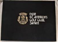
réf. 008750Japan: New St Andrews Golf Club Japan Very informative book on the New St Andrews Golf Club Japan Looks to be published around 1972 as an information pack for all aspects of the club. This is made up of 3 oblong format card cover booklets 14¼ x 10¼ Inches contained in an attractive cloth covered silver and gold embossed hard cover. Contains 44 pages in total plus three loose colour inserts all in overall bright clean condition a few small foxing spots to covers and a few pages. Many B/w photographs colour illustrations and plans of buildings and courses all present as called for plus very informative text NO dustwrapper outer boards are bright and clean just a small mark to bottom of spine. HEAVY BOOK 1.6 Kg with sound packing EXTRA POSTAGE REQUIRED FOR OVERSEAS.A pleasing example of an interesting and unusual golf book. SEE IMAGES. DETAILED IMAGES AVAILABLE ON REQUEST . DecorativeCloth Covered Boards. Good Plus/No Jacket. 14 ½ x 11Inches. Hardcover. New St Andrews Golf Club Japan Hardcover
8vo. XI, (1), 211, (1) pp. With a hand-coloured wood-engraved frontispiece and 4 large folding lithographed pedigree tables. Original burnt red cloth binding with giltstamped title to spine and upper cover. First edition. - Upton was one of the early experts on the bloodlines of British thoroughbreds. His book describes both the influence of the Arabian horse on the development of the English thoroughbred as well as many interesting aspects of the Arabian horse. Shortly after the publication of this work - intended to "point out errors that have been committed in the breeding of our horse" (p. iii) - he travelled in Arabia to obtain purebred horses and so improve the quality of British cavalry remounts. Upton served with the 9th Lancers. - Binding somewhat bumped and rubbed with traces of moisture to covers. Lightly browned throughout, paper brittle with occasional edge or corner flaws, frontispiece and title-page rather foxed. Rare. Boyd/P. 130. Huth 273. OCLC 12795478.
4to. (40) pp. With numerous black-and-white photographic illustrations. Original printed wrappers. Stapled. Illustrated report of BP activities in 1956. It showcases the company's international agenda, including their involvment with the trans-Antarctic expedition of Vivian Ernest Fuchs, drilling tests at Fahud, Oman, the search for oil in Gambia, East Africa and France, the fight against the caterpillar plague in Germany, aviation service, and refinery visits, as well as operations in Iran, Kuwait, Denmark and Austria. - Punched holes. Margins slightly worn.
193960 pages. Features: Great ad for Dodge Trucks features delivery van, a pickup and a stake truck; Wonderful one-page International Trucks ad features tractor trailer hauling mature tree as part of construction of Treasure Island at the Golden Gate in San Francisco; Bewildered Congress groping for sound neutrality policy - article with three photos including Bernard Baruch; Defense Fever - America prepares for war; Photos of high income earners Louis B. Mayer and Greta Garbo; Italy's Seizure of Albania spreads fear from the Adriatic to the Dardanelles - major article with eight photos; Levantine Ferment; Hitler Yardstick; Refugee dilemmas in Europe; Hitler conscripts children 10 through 18 years-old for the Hitler Youth; Handsomme one-page color Packard auto ad features a 120 touring sedan; Nice two-color centerfold ad for Schlitz beer; Nice one-page two-color ad for Pontiac cars; Chevrolet car ad; Baby tumor cured with X-ray therapy; Western Union's photos by cable - with received image of Yankee Clipper aircraft; Early vintage ad for Titleist / Acushnet Golf Balls; Diary kept by Byrd's ancestor, William Byrd of Westover VA, is a gold mine of colonial data; Obituary for Joseph A. Lyons, Prime Minister of Australia; Nice 2/3-page ad for the Hotel Del Monte; New Oil Boom - four-state boom is centered near Forest City, Missouri; Full page introduction to Ernest K. Lindley of Newsweek's Washington Bureau - with photo; Photo of carload of dignitaries at New York's World's Fair includes Alfred E. Smith, Henry Ford, Mayor La Guardia, Grover Whalen (fair boss), and Edsel Ford at the wheel; Zeus cigarette holder ad; Color ad for Mount Vernon Whiskey on back cover features scene in George Washington's dining room. Average wear. Unmarked. A sound vintage copy Book
194056 pages. Features: Nice color Bermuda tourism ad inside front cover features golf scene with young black caddy; Nice one-page photo ad for Plymouth cars; 1/3-page ad for United Air Lines with photos; Mercury 8 one-page illustrated car ad; Lawrence Olivier and Jill Esmond divorce; Orson Welles and Virginia Nicolson divorce; Novelist Adela Rogers St. Johns is jailed; Brief obituary for Dr. George De Bothezat, builder of the first successful helicopter; Nice one-page photo ad for Dodge cars; The work of Martin Dies; Rev. Charles Coughlin under attack by the Jewish People's Committee; Census Revolt; Photo of tent city build for Californai Okies; Punxsutawney, PA groundhog predicts weather; The Convoy System - Britain depends on it; A look at the Finnish situation; Poultney Bigelow reveals ex-Kaiser Wilhelm wants the Nazis to turn on the Bolsheviks; Swedish volunteers help Finns resist Russia; Bombers supplanting U-Boats and Mines in Blockade Duel; Eddie Arcaro Rides Winners; Photo of basketball being played on skaes!; "Grapes of Wrath" hits movie screen as powerful social drama - with photo of Henry Fonda and his movie parents; Nice one-page color ad for the Good Year Double Eagle Air Wheel (tire); James Jefferson Davis Hall is the Bishop of Wall St.; Photo and write-up on the Air Corps' new 400 mph Airacobra; Nice 2/3-page two-color ad for Beech-Nut Gum features young lady reading mystery book; Neutrality Dodge - photo of big Lockheed bomber, destined for Allied war service, crossing the North Dakota/Canada border behind a team of horses; Big Pepsi-Cola skywriting contract; Nice color-photo ad for Four Roses Whiskey on back cover; and much more. Middle page holding by one staple. Average wear. Unmarked. A sound vintage copy. Book
réf. 11500Album publicitaire année 1928. In folio broché couverture illustrée en couleurs, sur fond doré e Jean LUCHESI. 8 pages de publicités (hôtels principalement) titre illustré en couleurs de Jean LUCHESI. 42 pages, 8 pages de publicités. Texte bilingue français et anglais (en regard) Nombreuses illustrations photos dans le texte ; Photos hors texte dont une double page de GILETTA. Album édité par le Syndicat d’initiative de NICE- le soleil -la mer- les fleurs 1928. Bon exemplaire. Peu courant 60€ (L74 Miche) photos 2013 02 26 5293 94 95 96 97 98 99 5300 301 302 5303 Nice, côte d’Azur Riviera, tourisme, casino, hôtel, luxe, soleil, paysages, golf, tennis,
Hand-coloured engraved map (355 x 290 mm). Matted. Striking full color example of Tirion's detailed map. The map is highly detailed, including a number of the major roads and caravan routes, including those leading to Mekka and Medina. Two monument-style cartouches contain the title at upper right and three distance scales opposite. "This map shows a great advance on the others by showing the true extent of Turkish power. It has a curious mountain system, dividing the Peninsula into smaller regions" (Tibbets). Although it is mainly based on Delisle's map through de Fer, the map contains much original data. - Very well preserved. Tibbetts 250. Al Ankary p. 330. Al-Qasimi 160.
Hand-coloured engraved map (355 x 290 mm). Striking full-colour example of Tirion's detailed map. The map is highly detailed, including a number of the major roads and caravan routes, including those leading to Mekka and Medina. Two monument-style cartouches contain the title at upper right and three distance scales opposite. "This map shows a great advance on the others by showing the true extent of Turkish power. It has a curious mountain system, dividing the Peninsula into smaller regions" (Tibbets). Although it is mainly based on Delisle's map through de Fer, the map contains much original data. - Very well preserved. Tibbetts 250. Al Ankary p. 330. Al-Qasimi 160.
Hand-coloured engraved map (355 x 290 mm). Striking full color example of Tirion's detailed map. The map is highly detailed, including a number of the major roads and caravan routes, including those leading to Mekka and Medina. Two monument-style cartouches contain the title at upper right and three distance scales opposite. "This map shows a great advance on the others by showing the true extent of Turkish power. It has a curious mountain system, dividing the Peninsula into smaller regions" (Tibbets). Although it is mainly based on Delisle's map through de Fer, the map contains much original data. - Very well preserved. Tibbetts 250. Al Ankary p. 330. Al-Qasimi 160.