4 497 résultats
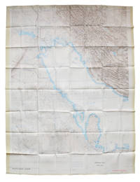
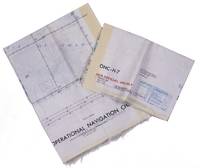
Two copies of two folding maps colour printed on both sides of a sheet of silk (103 x 78.5 cm) on a scale of ca. 1:1,000,000. The two maps (ONC-H-6 & ONC-H-7) show one continuous area. Rayon pilot's map of the Arabian Gulf region focusing on the Trucial States (modern United Arab Emirates), Qatar, Bahrain, Oman, Iran and Saudi Arabia, including the main oil installations. Items of specific interest to aircraft, such as airfields and even seaplane bases, are particularly listed. Warnings to stay within the specific flying routes while in Iran are placed on multiple locations. While the map depicts a continuous area on both sides of one sheet, it actually consists of two maps, originally published separately. We here include two copies so the whole area can be displayed at once. The maps are reproduced after the third and fourth edition. - In very good condition.
Map (67 x 98 cm). Lights and beacons highlighted in purple. Wartime reprint, “reproduced by the U.S. Hydrographic Office from British Admiralty Chart”. First issued in 1921, with changes in 1923, 1928, 1931, 1936, 1940, and 1943. Not in Al Ankary; Al-Qasimi.
1040 x 710 mm. Scale 1:350,000. Nautical chart of the Arabian Gulf off the coast of Ras Tanura on the north-eastern coast of the Arabian Peninsula, with parts of the southern coastline of Persia. Including tidal information, compass roses, soundings, seabed notations, currents, sandbanks, shoals, inland elevations (including a "conspicuous tree" on the island of Shaikh Shu'aib). This edition first published in 1955, with large corrections in 1958 and smaller ones in the subsequent years to 1964 (overstamped or handwritten). - Folded; some pencil annotations but very well preserved. Provenance: from the archives of Lilley & Reynolds Ltd., suppliers of Navigation Equipment.
Engraved map, hand coloured in outline. 535 x 371 mm. An English version of D'Anville's famous nautical chart of the Gulf from 1776. Although Bahrain is depicted, the large peninsula of Qatar is notably absent, and the coast between Bahrain and Abu Dhabi is marked "This Coast is not known". Al-Qasimi (2nd ed.), p. 236.
1040 x 710 mm. Scale 1:150,000. Nautical chart of the Arabian Gulf off the coast of Ras Tanura on the north-eastern coast of the Arabian Peninsula. Including tidal information, compass roses, soundings, seabed notations, currents, sandbanks, shoals, inland elevations. This edition first published in 1951, re-engraved in 1958, with revisions in 1962, 1963 and (overstamped or handwritten) 1964. - Folded; very well preserved. Provenance: from the archives of Lilley & Reynolds Ltd., suppliers of Navigation Equipment.
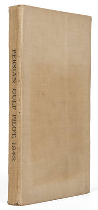
8vo. (2), L, 312, (2) pp. With several maps and plates. Original cloth. "The Persian Gulf Pilot contains sailing directions for the Persian gulf and the approaches thereto, from Ras al Hadd, in the south-west, to Cape Monze, in the East". - Also includes copious information on politics, population, languages, trade, currencies, pearl fishery, meteorological information (climate, winds, weather, temperature, humidity), as well as currents, tides, communications and other miscellaneous information. - Binding rubbed and faded. Only two copies in auction records of the past decades (Peter Hopkirk's copy fetching £1,300 at Sotheby's, Oct 14, 1998, lot 1043). Hydrographic Office Publication 158. OCLC 709448977. Cf. Wilson 171.
8vo. (2), L, 312, (2) pp. With several maps and plates. Original cloth. "The Persian Gulf Pilot contains sailing directions for the Persian gulf and the approaches thereto, from Ras al Hadd, in the south-west, to Cape Monze, in the East". - Also includes copious information on politics, population, languages, trade, currencies, pearl fishery, meteorological information (climate, winds, weather, temperature, humidity), as well as currents, tides, communications and other miscellaneous information. - Binding slightly rubbed. Only two copies in auction records of the past decades (Peter Hopkirk's copy fetching £1,300 at Sotheby's, Oct 14, 1998, lot 1043). Hydrographic Office Publication 158. OCLC 709448977. Cf. Wilson 171.
1747réf. 143611747. Bellin Jacques Nicolas. Ile d'Ormus ou de Jerun 1747 depicts Hormuz and the surrounding Persian Gulf maritime landscape more than a century after an Anglo-Persian force ended Portuguese control of the island in 1622. Published in Histoire générale des voyages the engraving identifies the Persian coast islands anchorages fortifications and channels while distinguishing Arab vessels from large-masted European sailing ships. Its concentration on ships coastal defenses and approaches to Hormuz records the strategic geography of a passage that connected Persian Gulf ports with Indian Ocean trading routes. Bellin Jacques Nicolas. Ile d'Ormus ou de Jerun. From Histoire générale des voyages 1747. Overall sheet size 13.5 x 9.5 inches; image size 7.5 x 9.75 inches. The upper portion identifies the "Cote de Perse" while inscriptions throughout the engraving include "Fortresse" "Ile de Kishom ou Quixema" "Entre des Vaisseaux" "Porte de derriere" "Parade Alkoran" "St. Lucia" and "Lardimira." Five Arab vessels occupy the foreground while additional Arab shipping appears at left and European ships with tall masts and multiple sails appear at right. The fortified settlement on Hormuz includes the fortress associated with Portuguese occupation of the island. Hormuz had been seized in 1507 by the Portuguese commander Afonso de Albuquerque and Portuguese control made the island a fortified base for regulating maritime commerce at the entrance to the Persian Gulf. The Portuguese constructed the Fort of Our Lady of the Conception there; in 1622 forces of Shah Abbas I assisted by ships of the English East India Company captured Hormuz and ended Portuguese rule on the island. Bellin's 1747 engraving therefore records a landscape shaped by earlier Portuguese fortification but returned to Persian control while its juxtaposition of Arab and European vessels documents the continuing international maritime character of the strait. Paper folded three times consistent with its original publication format. Overall very good condition. unknown books
Coloured map (72 x 57 cm). Scale 1:4,055,040. Map of the Arabian Gulf. “It must have been drawn to show the zones of influence of Russia and Great Britain in Persia, as defined by the Anglo-Russian convention on 31st of august 1907” (Alai). Alai, General maps E.354. OCLC 221059917. Not in Al Ankary; Al-Qasimi.
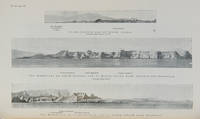
réf. 119766London Hydrographic Department Admiralty 1942. . Ninth edition with the fourth supplement dated 1948; 8vo 24.5 x 16 cm; supplement tipped to front pastedown 2 maps acting as an index for admiralty charts folding meteorological chart 21 plates showing numerous coastal views with additional view of Abu Dhabi fort tipped in from supplement further in-text weather diagrams notice of supplement tipped in to face title numerous annotations making good the corrections from the supplement; publisher's tan cloth lettered in black touch of rubbing to spine very good copy; xxvi 286 pp. A scarce pilot guide of the Persian gulf describing Bahrain Kuwait Qatar Dubai and Abu Dhabi and numerous other villages and towns along the Arabian coast. Includes coastal views of Ras Al Hadd Sur Qalhat As Suwaiq Sohar Fujairah Khasab the Tunb Islands Abu Musa the Doha Fort Bahrain Harbour and Tarut Island amongst others. The guide was published to give accurate sailing directions to the ports towns and safe anchorages along the Arabian coast from Ras al Hadd on the eastern peninsular of Oman to Shatt al Arab in the North and back along the coast of Iran to Bandar Abbas and beyond. With much early information on the principal settlements of the United Arab Emirates Qatar Bahrain Kuwait and Oman and an interesting glossary of Arabic-English key terms. Dubai is described as well as Daira: 'Daira is a large suburb consisting of mat huts amongst which stand a number of well-built houses.' 'Dibai Dubai contains the residence of the Shaikh. There are several tall towers in Dibai; the fort is a conspicuous square building with a round tower. from which the Shaikh's flag is displayed.' Abu Dhabi is similarly described: 'This town consists for the most part of huts and extends along the coast for nearly two miles. In the town there is a small fort partially surrounded by trees with five towers close together. The coast in the vicinity of Abu Dhabi is very low and the beach is of white sand'. There are two views of Qasr Al Hosn one of which appears here with the 1948 supplement for the first time. The great pearl bank is also given attention: 'this extensive bank. fills the great bight in the southern part of the Persian Gulf.' 'Many islands both close to the coast and far offshore lie on the bank. With the exception of Dalma none has permanent inhabitants though they are frequented by the pearl boats during the summer and by fisherman from Abu Dhabi in the winter.' 'The best pilots for the coast are to be obtained at Abu Dhabi.' Much of the information of Qatar and Doha is amended by the supplement and appropriately altered by the annotations showing its quickly changing nature. Bahrain is also described and there is also note of the health of the region: 'Manama. is more liable to epidemics than the smaller ports; since 1920 however there have been no more epidemics in Bahrain than in any other of the larger Gulf ports.' Kuwait is described 'The Shaikh's palace. has a small roof which is the highest point of any building in the town.' 'The principal export is pearls; the chief imports are rice sugar tea flour piece goods matches hardware wheat and barley.' London, Hydrographic Department, Admiralty, 1942. hardcover
réf. 112658London Hydrographic Department Admiralty 1955. . Tenth edition with the second supplement dated 1959; 8vo 24.5 x 16 cm; supplement loosely inserted at rear 4 coloured plates of diagrams two maps acting as an index for admiralty charts 16 double-sided plates showing numerous coastal views further in-text weather diagrams notice of supplement tipped in to face title; publisher's blue cloth lettered in yellow spine a little sunned joints professionally restored very good copy; l 312 1 pp. A scarce pilot guide of the Persian gulf describing Bahrain Kuwait Qatar Dubai and Abu Dhabi and numerous other villages and towns along the Arabian coast. Includes coastal views of Ras Al Hadd Sur Qalhat As Suwaiq Sohar Fujairah Khasab the Tunb Islands Abu Musa Sirri Island Al Jazirah Al Hamra Al Shebeakah Rams Ajman Qasr Al Hosn in Abu Dhabi Sir Bani Yas the Doha Fort Bahrain Harbour and Tarut Island amongst others. The guide was published to give accurate sailing directions to the ports towns and safe anchorages along the Arabian coast from Ras al Hadd on the eastern peninsular of Oman to Shatt al Arab in the North and back along the coast of Iran to Bandar Abbas and beyond. With much early information on the principal settlements of the United Arab Emirates Qatar Bahrain Kuwait and Oman and an interesting glossary of Arabic-English key terms. By 1955 it was clear how the oil boom had changed the economy of the region. The first chapter gives an overview and includes the character of the sea and ports description of major towns and cities and their respective populations for example 18000 in Qatar the main economic imports and exports of each locale and considerable weather information. Dubai is described as well as Daira: 'Daira is a large suburb consisting of mat huts amongst which stand a number of well-built houses.' 'Dibai Dubai contains the residence of the Shaikh. There are several tall towers in Dibai; the fort is a conspicuous square building with a round tower. from which the Shaikh's flag is displayed. There is a hospital.' Abu Dhabi is similarly described: 'This town consists for the most part of huts and extends along the coast for nearly two miles. In the town there is a small fort partially surrounded by trees with five towers close together. The coast in the vicinity of Abu Dhabi is very low and the beach is of white sand'. The fort is given it's own view on one of the plates. The great pearl bank is also given attention: 'this extensive bank. fills the great bight in the southern part of the Persian Gulf.' 'Many islands both close to the coast and far offshore lie on the bank. With the exception of Dalma none has permanent inhabitants though they are frequented by the pearl boats during the summer and by fisherman from Abu Dhabi in the winter.' 'The best pilots for the coast are to be obtained at Abu Dhabi.' Much detail is also given to Qatar and Doha: 'This town situated on the southern side of the harbour is the capital of Al Qatar peninsula and had a population in 1947 of about 12000.' ' The Shaik's palace. is a large building with many colonnades and an open balustrade round its roof.' ' The chief exports are gutch fish and pearls; imports are food timber and manufactured goods.' Bahrain is also described with Manama being called the 'principal town and port' and as well as the trade being described there is also note of the health of the region: 'Manama is more liable to epidemics than the smaller ports; since 1920 however there have been no more epidemics in Bahrain than in any other of the larger Gulf ports.' It is interesting also that one of the major changes of the supplement is changing the name 'Bahrein' to 'Bahrain'. Kuwait is described as greatly altered by the oil wealth: ' Wealth derived from oil revenues is being spent on completely replanning and rebuilding the town. Government offices schools hospitals electric generating and water distillation stations private houses and blocks of flats are all being built in the most modern style'. 'Pearl fishing is now practically extinct. There are to all intents and purposes no exports. The chief imports are food of all kinds machinery motor vehicles and building materials.' London, Hydrographic Department, Admiralty, 1955. hardcover
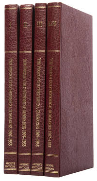
réf. 113476London Archive Editions 1987. . First edition; 4 vols 8vo includes a volume of maps and genealogical tables original brown cloth gilt a fine set. An historical summary of events in the Arabian Gulf concerning British interests from 1907. also includes oil agreements and concessions in the region particularly Muscat and Oman. London, Archive Editions, 1987. hardcover
1967réf. L6CEZZVCL8UFSt Louis: Aeronautical chart and information center United States Air Force 1967. Two maps colour printed on both sides of a sheet of silk 103 x 78.5 cm on a scale of ca. 1:1000000. The two maps ONC-H-6 & ONC-H-7 show one continuous area. Rayon pilot's map of the Arabian Gulf region focusing on the Trucial States modern UAE Qatar Bahrain Oman Iran and Saudi Arabia including main oil installations. Items of specific interest to aircraft such as airfields and even seaplane bases are particularly listed. Warnings to stay within the specific flying routes while in Iran are placed on multiple locations. While the map depicts a continuous area on both side on of one sheets it actually consist of two maps originally published separately. Slightly frayed at the edges. In very good condition. Aeronautical chart and information center, United States Air Force, unknown
1969réf. L95DV18L9VQZSt Louis: Aeronautical chart and information center United States Air Force 1969. Two copies of two folding maps colour printed on both sides of a sheet of silk 103 x 78.5 cm on a scale of ca. 1:1000000. The two maps ONC-H-6 & ONC-H-7 show one continuous area. Rayon pilot's map of the Arabian Gulf region focusing on the Trucial States modern UAE Qatar Bahrain Oman Iran and Saudi Arabia including main oil installations. Items of specific interest to aircraft such as airfields and even seaplane bases are particularly listed. Warnings to stay within the specific flying routes while in Iran are placed on multiple locations. While the map depicts a continuous area on both side on of one sheets it actually consist of two maps originally published separately. We here include two copies so the whole area can be displayed. The maps are reproduced after the third and fourth edition.In very good condition. Aeronautical chart and information center, United States Air Force, unknown
1747réf. 143611747. Bellin Jacques Nicolas. Ile d'Ormus ou de Jerun 1747 depicts Hormuz and the surrounding Persian Gulf maritime landscape more than a century after an Anglo-Persian force ended Portuguese control of the island in 1622. Published in Histoire générale des voyages the engraving identifies the Persian coast islands anchorages fortifications and channels while distinguishing Arab vessels from large-masted European sailing ships. Its concentration on ships coastal defenses and approaches to Hormuz records the strategic geography of a passage that connected Persian Gulf ports with Indian Ocean trading routes. Bellin Jacques Nicolas. Ile d'Ormus ou de Jerun. From Histoire générale des voyages 1747. Overall sheet size 13.5 x 9.5 inches; image size 7.5 x 9.75 inches. The upper portion identifies the "Cote de Perse" while inscriptions throughout the engraving include "Fortresse" "Ile de Kishom ou Quixema" "Entre des Vaisseaux" "Porte de derriere" "Parade Alkoran" "St. Lucia" and "Lardimira." Five Arab vessels occupy the foreground while additional Arab shipping appears at left and European ships with tall masts and multiple sails appear at right. The fortified settlement on Hormuz includes the fortress associated with Portuguese occupation of the island. Hormuz had been seized in 1507 by the Portuguese commander Afonso de Albuquerque and Portuguese control made the island a fortified base for regulating maritime commerce at the entrance to the Persian Gulf. The Portuguese constructed the Fort of Our Lady of the Conception there; in 1622 forces of Shah Abbas I assisted by ships of the English East India Company captured Hormuz and ended Portuguese rule on the island. Bellin's 1747 engraving therefore records a landscape shaped by earlier Portuguese fortification but returned to Persian control while its juxtaposition of Arab and European vessels documents the continuing international maritime character of the strait. Paper folded three times consistent with its original publication format. Overall very good condition. unknown
8vo. XI, (1), 323, (1) pp. With coloured frontispiece and 5 photo plates; title within colored ornamental border. Original boards with illustrated spine. An account of travel through the "Land of the Lion and Sun" in an age redolent of the Tales from the Arabian Nights and the Rubaiyat. First published in 1909 (by Smith Elder & Co., London), under the title "Through Persia, from the Gulf to the Caspian". The frontispiece shows a group of Persian shepherds. - Spine tanned, otherwise well preserved. OCLC 2226672. Cf. Wilson 29.
Hand-coloured engraved map (531 x 480 mm).
Hand-coloured engraved map (272 x 370 mm). Attractive full color example of this decorative map of Persia. Includes decorative vignettes of the Ispahan, Kurds, a Bactian Camel and a Persian on Horseback. Engraved for R. Montgomery Martin's Illustrated Atlas. Tallis was one of the last great decorative map makers. His maps are prized for the wonderful vignettes of indigenous scenes, people, etc. Al-Qasimi 260. Not in Tibbets and Al Ankary.
Ca. 66 x 54 cms. Printed outline colour. Constant ratio linear horizontal scale 1:4,200,000 (1 inch = 66 miles). Folded and bound in original yellow cloth boards. 8vo. Includes Afghanistan and the Balochistan province of Pakistan, as well as the Arabian Gulf with the coastline of the Gulf Emirates to Oman. - Ownership stamps of the German botanist Prof. Dr. Arnold Scheibe (1901-89; cf. NDB XXII, 619f.). OCLC 37732501.
Engraved map (38 x 49,5 cm), contemporarily hand-coloured. Scale 1:9,000,000. 17th century map of Persia stretching from the Caucasus to Afghanistan and from the Arabian Desert to the Indus River, published in the monumental Blaeu Atlas. Koeman Bl 18a.
Hand-coloured engraved map (435 x 375 mm). Striking map of Saudi Arabia, Iran, Iraq, and Afghanistan, showing fine detail. Colton was one of the pre-eminent American map publishing firms in the mid-19th Century. Not in Tibbets, Al Ankary or Al-Qasimi.
Engraved map (41 x 33 cm), hand-coloured in outline. Al-Qasimi 243.
Hand-coloured engraved map, 440 x 315 mm. Constant ratio linear horizontal scale, ca 1:8,122,000. Includes the entire Gulf coast of the Arabian Peninsula, showing Kuwait, El Katif, Bahrain, Qatar, and the Musandam Peninsula, including the territory of today's United Arab Emirates (here still labeled the "Pirate Coast"). "Debai", Sharja", "Ras-el-Khaimah", "Khorfakan" and "Fejerah" are identified. - Well preserved. Issued as plate XXXVIII in Sidney Hall's General Atlas of the World. OCLC 781690561.
1920réf. r9801London: Perrier. G : in Good condition. Case rubbed. Previous owner inscription to case. 1920. First Edition. Grey hardback cloth case. 260mm x 210mm 10" x 8". 36 linen-backed panels. 2 full colour maps - North and South Sections. 8 miles to 1 inch. . Perrier hardcover
195 x 137 mm. Lithographed document in Arabic with an image of a donkey. Validated with two official blue ink stamps. Very rare Egyptian issued permit for a donkey to enter the holy sites of Mecca and Medina. - With ms. notes in Arabic.