4 101 résultats
8vo. (40), 312, 53, (19) pp. With one folding plate. - (Bound with) II: Tarnow, Hermann / Weidner, Johann Joachim. Grammatica Hebraeo-Biblica, comprehendens etymologiam, syntaxin, eloquentiam [...]. Rostock, Nikolaus Schwiegerau, 1722. (8), 248, (16) pp. 19th century half calf over marbled boards with giltstamped spine and spine-label. First edition of the Hebrew grammar prepared by the most celebrated orientalist of his day. The Göttingen scholar Johann David Michaelis (1717-1791) was the leading expert on Hebrew philology and Biblical exegesis. The present work advocates a new approach to emancipating Hebrew philology from the Greek and Roman tradition of linguistics, discussing verbs before nouns, as opposed to traditional Latin grammars. Fürst dates the first edition to 1744, in apparent error for 1745. - II: First edition of this grammar of biblical Hebrew by the German Lutheran theologians J. J. Weidner (1672-1732) and H. Tarnow (1674-1741). - Extremities slightly rubbed; tiny portion of upper hinge chipped away. Paper evenly browned troughout; occasional light spotting. ADB XXI, 685-690. OCLC 258323863. Cf. Fürst II, 375 (1744 ed.). Goedeke IV, 221. Not in Smitskamp. - II: Fürst III, 410. VD 18, 13308904. OCLC 248815662. Not in Smitskamp.
4to. 4 parts in 1 volume. (8), 47, (1) pp. (38) pp. 63, (1) pp. 18 pp. With 2 title pages, the first and dedication on its verso printed in red and black, 1 botanical woodcut in text, woodcut headpiece, tailpiece and decorated initials, woodcut Chinese characters, decorations built up from cast fleurons. With diamond-head music notes, long passages in Syriac and Arabic type. - (Bound with) II: Müller, Andreas. Monumenti Sinici [...]. Berlin, Christoph Runge, 1672. Including: [drop-title:] De monumento Sinico commentarius novensilis. [drop-title:] Caput Primum. Historia lapidis. [Berlin, Georg Schultz?, 1674?]. Marbled boards (ca. 1800?). A series of works apparently printed and published together (even though the second title-page gives a different publisher and date) on various aspects of China and its culture, by the gifted orientalist Andreas Müller (1630-94). The title-page of part 1 lists seven numbered subjects for its brief observations: history, missionaries in China from the time of the Old Testament to the time of publication, Chinese emperors and other rulers, ginseng and its medicinal uses, astronomy and the calendar, geography and the relation between the names of the planets and the days of the week. Part 2 is devoted primarily to the transliteration in italic type of an extensive Chinese inscription, using special diacritical marks to indicate the tones and representing them also with Western musical notation above the text. It was a 781 "Nestorian" (East Christian) inscription that had been discovered in the 1620s and first published by Athanasius Kircher in 1667. Müller took issue with Kircher's publications on the inscription. It is followed by several shorter texts, including two pages with parallel columns giving an Aramaic text (the language of the Nestorians) in Syriac script with a Latin translation, and a phonetic rendering of the Chinese Lord's Prayer. Parts 3 and 4 contain additional commentaries on the same Nestorian inscription. - Although the title-page to part 2 is dated "1672" and names the "officina Rungiana" as publisher, all four parts appear to be printed on the same paper stock and they share at least some typographic materials. At least the supplements (which have no date or imprint) seem likely to have been printed by Schultz with part 1, and part 2 may have been as well. - The extensive use of Syriac and Arabic type gives the publication special typographic interest, and it also provides a fine example of Reinier Voskens's two largest italic types (the largest in the 6-page dedication), only about a decade after he cut them. Copies with all four parts complete are extremely rare, VD17 recording at most one. - Somewhat browned, but otherwise in good condition, with only some tiny marginal worm holes (affecting 1 letter in the imprint of the second title-page). Parts 2 and 4 each lacks a final blank leaf. A remarkable example of early oriental studies. BLC German (17th cent.) M-1471. Cordier (Sinica) 773f. (parts 2-4 only). Löwendahl 155, 161-163. Walravens, China illustrata 88 (part 1 only).
Watercolour, signed "Haywood" at bottom right. 220 x 203 mm.
667 x 580 mm. Scale 1:7,500,000. A large folding map of the Middle East, with the states of the Arab League indicated in red and the Hashemite states shown in green. - Rare; a single copy known in the National Library of Israel as part of the Eran Laor Cartographic Collection.
2010réf. B3A210320016Hazeltine National Golf Club. 50th Anniversary Committee 2012-01-01. Hardcover. Very Good. A nice copy. Text in mint/unmarked condition. Cover has minor wear. Binding is tight. Your Satisfaction Guaranteed. We ship daily. Hazeltine National Golf Club. 50th Anniversary Committee, hardcover
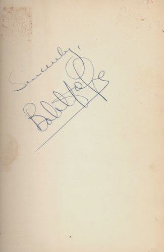
1954réf. 5923BB(New York), Simon and Schuster, (1954). 8°. 308 S. OLn. Illustr. OUmschl., 1Hope, Have Tux, Will Travel. Signiert
1992175 p. Hardcover Very good condition
460 x 670 mm. Farbige Lithographie auf Papier.
Standard issue, 514 x 690 mm. Scales 1:8,250 and 1:94,700. Nautical chart of Perim Harbour, Beilul Bay and the Rakhmat Island anchorage in the Red Sea, prepared by the British Admiralty. The island of Perim divides the Strait of Mandeb into two channels. The island, as a dependency of Aden, was part of the British Empire between 1857 and 1967. - Perim encloses a deep and comparatively large natural harbour on the southwestern coast. The chart labels the pilot's and coal agent's houses, piers, coal stacks, the hospital, the Lloyd's signal station, and leisure facilities like a tennis court and a cricket ground. Other prominent places on the island include the fishing village of Meyun, Murray Point, William Bay, the old fort, and a parade ground. The two smaller maps of Beilul Bay and Rakhmat Island detail lava formations, mangroves, and swamps. - The British Admiralty has produced nautical charts since 1795 under the auspices of the United Kingdom Hydrographic Office (HO). Its main task was to provide the Royal Navy with navigational products and service, but since 1821 it has also sold charts to the public. The present chart was composed after Admiralty surveys of 1885; it was first published in 1886 and saw several corrections up to 1919. Captioned in former collectors' hands on verso.
Standard issue 516 x 688 mm. Scales 1:7,230 to 1:29,040. Nautical chart of ten of the principal harbours and anchorages of the Red Sea, prepared by the British Admiralty: Sherm Sheikh, Sherm el Moiyah, Mersa Diba, Sherm Habban, Omeider Island, Dahab, Sherm en Noman, Wasit anchorage, Akaba Bay, and Khor el Wahla. The chart of Akaba Bay shows Akaba City and the ruined fort as well as Victoria Pier and an observation spot. Several charts show dangerous coral reefs, including Harrier reef on the Khor el Wahla chart. - The British Admiralty has produced nautical charts since 1795 under the auspices of the United Kingdom Hydrographic Office (HO). Its main task was to provide the Royal Navy with navigational products and service, but since 1821 it has also sold charts to the public. The present chart was composed after surveys by the Austrian Imperial ship "Pola" in 1895-96, as well as an admiralty survey of 1918; it was first published in 1899 and saw several corrections up to 1921. - With a stamp "Increase 50%" near upper margin. Captioned in former collectors' hands on verso. Blueish smudge near upper margin; several small marginal tears, only one of which touching text.
8vo. 46, (2) pp. Arabic text. Original printed wrappers, stapled. First edition. The second of two rare pamphlets published by the Iraqi government, opposing the independence of Kuwait. The first pamphlet, published in English and Arabic, outlined Kuwait's historical connection to Iraq and analysed its "imperialist relations" with Britain. This second one, in Arabic throughout, prints the minutes of the Political Affairs Committee of the Arab League, which met in Cairo on 20 July 1961 to consider Kuwait's request to join the League. - Kuwait emerged as an independent state in June 1961, after sixty-two years as a British protectorate. With a new constitution, it held its first parliamentary elections in 1963, thereby becoming the first Arab state in the Gulf to establish a parliament. Such political developments, married with growing wealth and modernisations in health, culture and finance, helped to make Kuwait the most prosperous state in the Arabian Peninsula. - The Iraqi government argued that the move toward independence was a continuation of Kuwait's relationship with Britain, albeit under a new guise. Furthermore, they felt that the historical links between Iraq and Kuwait entitled the former to control over the latter and, one suspects, a share of its growing wealth. This position, partly detailed in the pamphlet, led to a point of crisis, with Iraq threatening invasion. To the relief of Kuwait, the Iraqis were eventually deterred by the Arab League's promise of military opposition. - Wrappers a little dusty, two thick black lines to upper wrapper, seemingly erasing stamp, another stamp partially visible to lower wrapper (most likely a bookseller's name and address, "Baghdad" is legible). Interior clean and bright. - Rare: LibraryHub locates one copy in the UK at the British Library; OCLC locates copies in Harvard, the University of Toronto, and the NYU Abu Dhabi. OCLC 219629380.
1957Features: The friendly voice of Canada - the forest of shortwave transmitter masts near Sackville, N.B. which send the signal of the CBC International Service to distant lands; They're Tenting Tonight - tenting in Canada's parks; Miracle in the Mountains - Lake Louise is rated as one of the seven most nearly perfect landscapes on earth; The Great Trans-Canada Trail / The Carlton Trail from Winnipeg to Edmonton; British Columbia's Gulf Islands - nice photos. Unmarked. Average wear. A sound copy. Book
Folio (271 x 493 mm). Broadsheet with 5 engravings and two columns of letterpress. Extremely rare, uncommon print describing the legendary Biblical city of Enoch, the "first city of the world", founded by Cain and named after his first son (cf. Gen. 4:17). The centre of the sheet shows a large (264 x 152 mm) view of the city (workmen erecting the walls in the background; Cain's family farming in the foreground), with numerous animals including elephants and lions. The smaller engravings to the left and right (130 x 85 mm each) show pumpkins ("Pepones"), a white falcon, a crane, and several marine animals (including a seal, dolphin, and sand flea). To the left and right of these are columns of letterpress text describing the city in eight twelve-line verses. - The style of the view is obviously closely related to the illustrations familiar from the Prague engraver Jan Hiller (active 1716-46, cf. Dlabacz, Allgemeines Künstlerlexikon für Böhmen I, 628-631), who also provided the plates for Myller's "Peregrinus in Jerusalem", a work that not only contains several topographical views, but also botanical and zoological illustrations. The Myller plate "La Ragna, die Meer-Spinne" shows several of the marine creatures depicted here in exactly the same fashion: clearly, Hiller re-used his work for the present broadsheet. This conclusion is further supported by the fact that the five plates evidence varying degrees of wear: while the large, central illustration shows good, strong contrast, the other four are markedly fainter. - Mounted on sturdy paper, probably by a near-contemporary collector; trimmed close to the plate edges. Slight brownstaining.
8vo. 276 pp. With a folding table printed on both sides. Early 20th c. half cloth over marbled boards with giltstamped spine title. First edition. - Contains the text of the Trade Agreement of 24 March 1784 as well as earlier similar treaties: trade and shipping accords closed as part of the Treaty of Passarowitz in 1718, articles concerning trade as part of the Peace of Carlowitz in 1739, and the 1783 trade engagement between Russia and the Ottoman Empire. The extensive final section (pp. 165ff.) contains tables of the prices for various products manufactured in Austrian factories "to facilitate and make more transparent the trade with Turkey", giving prices for a vast array of wares, such as mirrors, crockery, silverware, boxes and cases, toys, cloth and socks, etc.). - Title-page stained and wrinkled with and old Hungarian stamp and paper flaws (rebacked with insignificant loss), some further staining to fol. G1, otherwise a very good copy. Kress p. 5073. Wernigg 5849.
575 x 420 mm. Colour lithograph, signed "Ibrahim K.". Mounted on styrofoam board. Bilingual safety poster in Arabic and English. - Traces of folds.
4to. 2 vols.: VIII (but: X), 112 pp., final blank leaf; I-(XIV), 179 pp., final blank page. With numerous black and white photographic illustrations as well as several colour-printed illustrations, maps and charts in the text. Contemporary printed wrappers. Spiral binding. Second edition. The well-known handbook series prepared by the Arabian American Oil Company for the benefit of their staff as operations began to expand after WWII. First published as a set of five booklets in 1950. Although intended for the instruction of Aramco's own employees, the series "attracted widespread interest outside the company and the demand of copies was so great that two years later, in January 1952, a revised hardbound edition was published" (Nawwab). The present spiral-bound second edition was apparently produced simultaneously. Subsequent editions in a single volume appeared in 1960 and 1968. - Part I discusses the history of oil production and the role of the United States, in particular the evolution of Aramco oil exploration in Saudi Arabia, emphasizing the company's pioneering role in the country. Part II describes the work and life of Aramco employees in Saudi Arabia. Parts III-V provide some background on Arabia and the Middle East, including information on the Saudi government, as well as on Arabian culture and customs. - Apart from refineries, tanks, drilling operations, oil wells, the city of Jeddah, the Dammam oil field, Dhahran Camp, the Ras Tanura refinery, and the construction of pipelines in the desert, the photographs include pictures of royal visits to Aramco operations, showing King Ibn Saud and Crown Prince Saud in Dhahran in 1947, as well as the Sheikh of Bahrein in 1939, mosques and scenes of the Hajj, life at the Dhahran expats' camp, local farmers and fishers, as well as Arabian hospitality and wildlife. Further, the illustrations comprise charts showing the changes in U.S. consumer demand between 1908 and 1948 and U.S. production increase from 1859, as well as maps of the American interest in the Middle East and a world map displaying oil reserves and the inter-regional movements of petroleum in 1948. - Extremities slightly worn; some tears to first volume. Interior crisp and clean. OCLC 83399405.
4to. 2 vols.: VIII (recte: X), 112 pp., final blank leaf; I-(XIV), 179 pp., final blank page. With numerous black-and-white photographic illustrations as well as several colour-printed illustrations, maps and charts in the text. Contemporary printed wrappers. Spiral binding. Second edition. The well-known handbook series prepared by the Arabian American Oil Company for the benefit of their staff as operations began to expand after WWII. First published as a set of five booklets in 1950. Although intended for the instruction of Aramco's own employees, the series "attracted widespread interest outside the company and the demand of copies was so great that two years later, in January 1952, a revised hardbound edition was published" (Nawwab). The present spiral bound second edition was apparently produced simultaneously. Subsequent editions in a single volume appeared in 1960 and 1968. - Part I discusses the history of oil production and the role of the United States, in particular the evolution of Aramco oil exploration in Saudi Arabia, emphasizing the company's pioneering role in the country. Part II describes the work and life of Aramco employees in Saudi Arabia. Parts III-V provide some background on Arabia and the Middle East, including information on the Saudi government, as well as the Arabian culture and customs. - Apart from refineries, tanks, drilling operations, oil wells, the city of Jeddah, the Dammam oil field, Dhahran Camp, the Ras Tanura refinery, and the construction of pipelines in the desert, the photographs include pictures of royal visits to Aramco operations, showing King Ibn Saud and Crown Prince Saud in Dhahran in 1947, as well as the Sheikh of Bahrein in 1939, mosques and scenes of the Hajj, life at the Dhahran expats' camp, local farmers and fishers, as well as Arabian hospitality and wildlife. Further, the illustrations comprise charts showing the changes in U.S. consumer demand between 1908 and 1948 and U.S. production increase from 1859, as well as maps of the American interest in the Middle East and a world map displaying oil reserves and the inter-regional movements of petroleum in 1948. - Extremities slightly worn. Interior crisp and clean. OCLC 83399405.
1943réf. 56-682BRandolph Field 1943. 1943. 66p. Small Blue wraps. Fine Copy. Paperback. Fine. Randolph Field, 1943. Paperback
4to (150 x 208 mm). 70 ff. (numbered 3-71 and 74) of hand-drawn costumes. India ink and gouache heightened in silver and gilt on laid, watermarked paper, polished in the oriental style. Bound in full modern fawn calf signed by J. E. Baudrillart, covers ruled in blind, spine sparsely gilt with title. Top edge gilt. Marbled endpapers. A beautifully crafted album comprising seventy portraits painted by a Turkish artist in colours, gold and silver, illustrating the various offices at the Ottoman court, people of various occupations, different ethnic groups, and their traditional costumes. Most of the portraits are accompanied by captions inscribed in Osmanli at the bottom of the page. One of them, representing Sultan Mehmet IV (1642-93, ruled 1648-87) on his throne, has in the lower part an inscription in French, "Mehemet Grand Seigneur / 1660" (no. 67). Among the further subjects depicted are Janissaries, a porter (hamal), a davul player, messengers of the court, the bearer of the Sultan's sword, women adorned in various costumes, and foreigners. - Albums of this kind were known as muraqqa': compiled from various sources, they were often created to order, by or for Europeans, as gifts to members of Western embassies or as travel souvenirs. European courts appreciated them as valuable sources of diplomatic information. Several similar examples from the second half of the 17th century have survived, among which one of the most famous is the so-called Rålamb Dräktboken (Raland Book of Costumes), acquired in 1657/58 by Claes Ralamb, the Swedish ambassador to the Sublime Porte, and now kept at the Royal Library of Sweden. - A magnificent survival, handsomely bound by Jean-Eudes Baudrillart of Paris. F. Hitzel (ed.), Turkophilia révélée. L'art ottoman dans les collections privées. Catalogue d’exposition publié à l’occasion du 14e congrès international d’art Turc, Collège de France (Galerie Charpentier), 19-23 Sept. 2011, pp. 72f.
A single hand-carved woodblock (ca. 170 by 110/92 by 220 mm) for use as printing block, together with a print on 18th century paper (165 x 105 mm). Woodblock in Ottoman Turkish for a Hebrew publication of the Song of Solomon, probably produced in the Ottoman regions of the Levant for a rural printing press. A rare survival of a printing tool, and also an important witness to cross-cultural printing for minority audiences in the Ottoman world. - Includes a print of the text reading "Safr Nishd al-Nishad li-Suleyman wa'ighal ba-l'Abraniyat Sir Hashirim", printed on a piece of 18th-century paper pasted to a cutting from a Croatian printed book ("Pasha Duhovna", on Spirituality and the Passover). - Some small wormholes in the wood, post-dating the print; carved side stained black from ink used for printing. Printing devices such as this are often discarded or recycled and rarely survive in such condition as the present example.
19881st edition. VG pbk. ISBN 060055712X.22107. eng
8vo. 115-124 pp. Contemporary blue cloth with giltstamped title to upper cover: "Philby - Yaman". First edition. A brief investigation of Joseph Halévy's journey through the Jawf region of Yemen, comparing the account given by Hayyim Habshush, recently published, with Halévy's own. - St John Philby (1885-1960), also known by his Arabian name "Sheikh Abdullah", was an Arabist, explorer, writer, and British colonial office intelligence officer. Educated at Trinity College, Cambridge, he studied oriental languages and was a friend and classmate of Jawaharlal Nehru, later prime Minister of India. Philby settled in Jeddah and became famous as an international writer and explorer. He personally mapped on camelback what is now the Saudi-Yemeni border on the Rub' al Khali; in 1932, while searching for the lost city of Ubar, he was the first Westerner to visit and describe the Wabar craters. At this time, Philby also became Ibn Saud's chief adviser in dealing with the British Empire and Western powers. He converted to Islam in 1930. The personal contacts between the United States and Saudi Arabia were largely channeled through the person of Philby. - Very slight browning, a few minor stains to the first page. Macro 1782. Smith, The Yemens, 84.
1844Steel engraving (Henit del. / Lechard sculp.). Image size 134 x 91 mm, plate size 228 x 170 mm, leaf size 262 x 176 mm. From Gabriel de Lurcy's "Voyages autour du Monde et Naufrages célèbres". - Clean and well-preserveed.
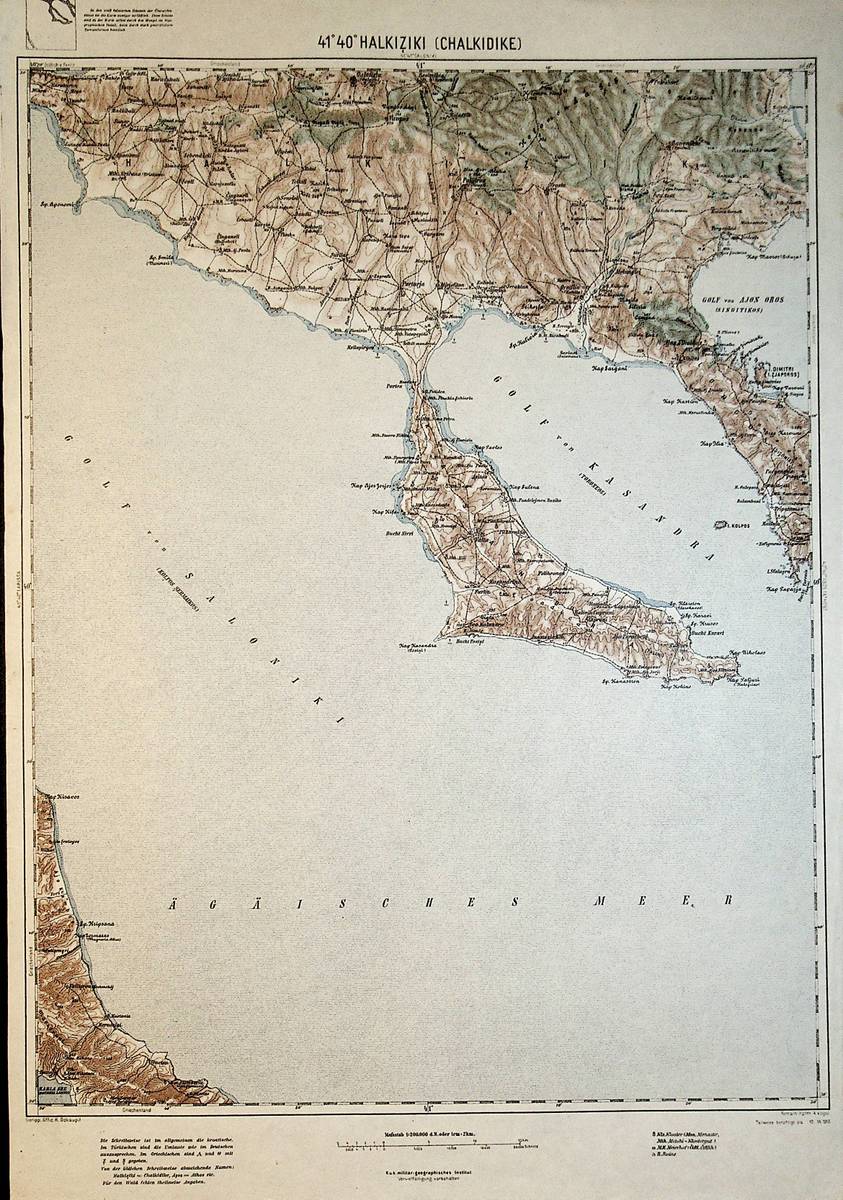
1913réf. A111-124Wien, Kaiserlich-K?nigliches Milit?r-Geographisches Institut, 1913. Hochformat, ca. 42 x 55 cm, Ausgabe: mehrf?rbig; Zustand: gut +
1895réf. c0549London: George Bell & Sons. Worn condition. Cover rubbed and faded with some loss. Fep soiled but content in overall good condition. 1895. First Edition. Green card cover. 180mm x 120mm 7" x 5". 184pp. 4 chromolithograpg plates 35 b/w illustrations. . George Bell & Sons unknown