4to. 72, (14), VIII pp.; (2) ff. with engravings. Text set in roman, Hebrew, Greek and Arabic type. With a small Portuguese woodcut coat of arms on the title-page and 4 engraved plates on 2 leaves bound at the end of the book. Later blue paper wrappers. First and only edition of an instruction manual for the compositors of the Portuguese Impressão Regia on the proper setting of Greek, Hebrew and Arabic type. It was written by Custodio José de Oliveira (d. 1812), professor of Greek at the Colégio Real dos Nobres in Lisbon and one of the Directores Litterarios of the Impressão Regia, serving until 1807, for which he wrote the present work. The present work is identified as "very useful" by Innocencio and according to him, it was the only Portuguese manual on typesetting he knew so far ("Trabalho mui aproveitavel, para o tempo em que sahiu, e o unico que sobre o assumpto temos até agora escripto orginalmente em portuguez"). Oliveira shows in both the tables and inserts within the text the alphabets and numbers in Greek, Hebrew and Arabic with their roman equivalents. The last four plates (printed on both sides of two leaves) show common ligatures and abbreviations in Greek. The present copy of this very rare work is complete with all plates, the "Prefação aos compositores typograficos" (numbered I-VIII) and the seven-leaf dedication, all bound at the end of the book. An important work on the subject of typesetting and the only work on this topic known in Portuguese. - With the bookplate of Américo Cortez Pinto (1896-1979) on the front wrapper, a Portuguese physician, writer, poet and historian who also wrote some works on the art of printing. Front wrapper half loose and back wrapper loose, spine partly gone, wrappers a little frayed, discoloured and slightly stained. Paper edges slightly frayed as it is an untrimmed copy, sometimes with the bolts unopened. Some marginal staining, very minor foxing, but overall a very rare work on printing and typography which is still in fine condition. Bigmore/Wyman II, 90. Innocencio II, 461. The literature of printing: a catalogue of the library illustrative of the history and art of typography, calcography and lithography of Richard M. Hoe, p. 85. Not in Porbase.
Arabic manuscript on paper with somewhat wavy laid lines only (335 x 239 mm; text area 263 x 176 mm), 544 ff., written in a tidy nasta'liq, 35 lines to the page, text frame of red and blue rules, important words and phrases in red or in larger naskhi; chapter headings repeated in margins in a bold calligraphic script, several marginal annotations in various contemporary and later hands. Early 20th century brown roan preserving covers of contemporary morocco binding blind-stamped with a single tool to form a central motif of three interlocking lozenges, smaller lozenges above and below, blind-stamped corner-pieces. Very rare Arabic translation of Al-Jurjani's important medical compendium, the first major medical text written in the Persian language. - Al-Jurjani (d. 1136) "went to live in Khwarizm in 504/1110 and became attached to the Khwarizmshahs Kutb al-Din Muhammad, to whom he dedicated his 'Dhakirah', and Atsiz b. Muhammad [...] His 'Dhakirah Khwarizmshahi', probably the first medical Encyclopaedia written in Persian and containing about 450,000 words, is one of the most important works of its kind; it also exists in an Arabic version, and was translated into Turkish and (in an abbreviated form) into Hebrew" (Encyclopaedia of Islam). - Modelled on the Qanun of Ibn Sina (Avicenna), the "Dhakirah" is divided into ten books, covering: definition and utility of medicine, and the structure and powers of the human body; health and disease, in general, including causes and symptoms of disease, and accidents of the body; the preservation of health; diagnosis, crisis and prognosis; fevers and their treatment; local diseases and their treatment; tumours, ulcers and so forth; the care of the external parts of the body (hair, skin, nails, and so on); poisons and antidotes; and simple and compound drugs. - Binding stained and rubbed. Various seal impressions (some erased) on first and second leaves and at end of text. Paper shows some splashes, soiling and staining, first leaf re-attached and with loss of one or two words on verso (sense recoverable), margins of last few leaves strengthened, but generally in good, sound condition. Provenance: Abdul-Malik bin Mahmud al-Mausuli al-tabib ("the physician"), with his ownership inscription dated 5 Rajab 913 AH (10 Nov. 1507) at the Mu'ayiddi hospital in Mosul; the distinguished German ophthalmologist and Arabist Max Meyerhof (1874-1945), with his bookplate on the front pastedown. GAL I, 487 & S I, 889. Cf. Keshavarz, A descriptive and analytical catalogue of Persian manuscripts in the library of the Wellcome Institute for the History of Medicine, pp. 52-54 & p. 149. Fihrist records no copies of the Arabic translation.
985 x 645 mm. Scale 1:500,000. Key in English. Printed on cloth. Blueprint map of the Gulf, showing Saudi Arabia, Bahrain, and parts of Qatar. The map pays particular interest to oil and gas exploration, detailing the Trans-Arabian Pipeline, the old tapline survey route, and the offshore terminal and refinery at Ras Tanura, as well as the Jafurah basin, the largest natural gas field in the Kingdom stretching 170 by 100 kilometers. - Among the most notable places are Hofuf, Dhahran, and Abqaiq in Saudi Arabia, as well as Manama, Awali, and al-Muharraq in Bahrain. Labelled locations in the displayed portion of Qatar's coast include Hawar Island, Dukhan and Salwa. The map illustrates trails, roads, and airstrips, as well as topographical features such as dunes, sand and gravel patches, and sabkhas. - The sheet was prepared as a working document by Aramco and the U.S. Geological Survey to help them in the early stages of comprehensive nationwide mapping and exploration work for the Saudi Government. First published in May 1953, the present map was revised in February 1954. - Two minor brown spots; upper left edge a little toned and frayed.
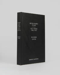
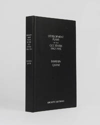
rif. 121997Minneapolis East View 2026. . 8vo 25.5 x 17 cm; includes many maps tables graphs and charts text in English and Arabic; publisher's black cloth lettered white to board and spine a fine copy. The complete development plan of Bahrain in 1982-85 including the report of the same and the development plan of Qatar of 1977 as well as planning studies and long term plans. Minneapolis, East View, 2026. hardcover
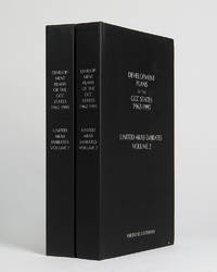
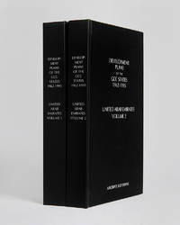
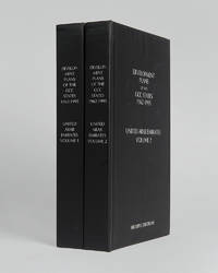
rif. 122001Minneapolis East View 2026. . 2 vols 8vo 25.5 x 16.5 cm; includes maps charts and tables; publisher's black cloth lettered white to boards and spines a fine copy. The complete collection of planning documents for Abu Dhabi from 1962 to 1979 the development plan review for Dubai of 1971 and the Federal Economic and Social Development Plan 1975 to 1980. Minneapolis, East View, 2026. hardcover
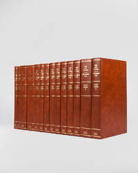
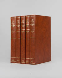
rif. 121946London Archive Editions 1994. . 14 vols 8vo 25.5 x 16.5 cm; includes maps charts & diagrams; publisher's original orange-brown cloth gilt lettering to spines top edges gilt a fine set. The complete development plans of Saudi Arabia from 1970 to 1995 with supplementary documents and reports including the master plans for Jeddah. London, Archive Editions, 1994. hardcover
rif. 121998Minneapolis East View 2026. . 8vo 25.5 x 17 cm; includes many maps tables graphs and charts text in English and Arabic; publisher's black cloth lettered white to board and spine a fine copy. The complete development plan of Bahrain in 1982-85 including the report of the same and the development plan of Qatar of 1977 as well as planning studies and long term plans. Minneapolis, East View, 2026. hardcover
rif. 121996London Archive Editions 1994. . 5 vols 8vo 25.5 x 16.5 cm; numerous charts maps plans graphs and tables; publisher's original orange-brown cloth gilt lettering to spines top edges gilt a fine set. The full development plan for Kuwait of 196/7-1971/2 as well as master plan for the city studies for the National Physical Plan and of urban development the statistics and figures for the years 1963-1988 and the statistical abstract for 1990-91. With numerous maps graphs and charts illustrating the reports as well as the full first five year plan reproduced in Arabic. London, Archive Editions, 1994. hardcover
rif. 122000Minneapolis East View 2026. . 2 vols 8vo 25.5 x 16.5 cm; includes maps charts and tables; publisher's black cloth lettered white to boards and spines a fine copy. The complete collection of planning documents for Abu Dhabi from 1962 to 1979 the development plan review for Dubai of 1971 and the Federal Economic and Social Development Plan 1975 to 1980. Minneapolis, East View, 2026. hardcover
rif. 121999Minneapolis East View 2026. . 2 vols 8vo 25.5 x 16.5 cm; includes maps charts & tables; publisher's black cloth lettered white to boards and spines a fine copy. The complete collection of planning documents for Abu Dhabi from 1962 to 1979 the development plan review for Dubai of 1971 and the Federal Economic and Social Development Plan 1975 to 1980. Minneapolis, East View, 2026. hardcover
Albumen print, 279 x 218 mm.
Oblong large folio (570 x 419 mm). Lithographed illustrated title, 2 ff. of text, 16 mostly coloured lithogr. plates showing horses (c. 33 x 45 cm, paper dimensions c. 40 x 55 cm; some with borders), 5 (instead of 6) ff. of descriptive letterpress text (the missing page supplied in ink). Contemporary half calf with giltstamped spine label. Extremely rare and early series of lithographs. The large and appealingly coloured plates depict important stallions and mares from the famous Danish Royal Stud at Frederiksborg (Pegasus, Flink, Zephir, Palnatoke, and Velskat, among others). All horses are branded with a monogram and often also with the crown. The publication was originally planned to comprise 12 issues of 4 plates each but no more than the first four were produced. - Two plates are trimmed and mounted on different backing paper (one with a repaired tear). Text shows foxing, but plates are generally clean. Binding somewhat rubbed and bumped at extremeties, with damage to spine. Nissen 1499. Not in Schwerdt or Mennessier de la Lance.
2007rif. 37483ABMünchen, blv, 2007. 29 x 29 cm, 400 Seiten, mit zahlreichen farbigen Abbildungen, DVD fehlt, weißer illustrierter Pappband. 1. Auflage wenig gebraucht, gut erhalten.
2011As New English Paperback. Pbo. Mint. Cr. 8vo. (21 x 11 cm). In English. Color ills. 167, [1] p. Destination Cappadocia: Cappadocia outdoor sports guide.
Folio. 54 pp. Sewn. Military reports from the Mesopotamian theatre, issued by Generals W. S. Delamain, A. A. Barrett, and J. E. Nixon between 1914 and 1915, in the early months of the British Empire's Mesopotamian campaign against the Ottoman Empire. Includes the despatches regarding the Battle of Shaiba (12-14 April 1915), in which the British infantry successfully defended Basra from the Ottoman forces. Significantly, this was the last time the Ottomans would threaten Basra, and after the battle it would be the British who generally held the initiative in Mesopotamia. It also changed attitudes among the Arabs, who subsequently began to distance themselves from the Ottomans. - Perfectly preserved. OCLC 44868586.
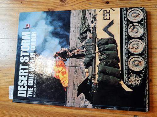
1991rif. 490468London: Greenhill. 1991. Ca. 60. 33x24,5cm. Zustand: Sehr Gut, eher ungelesen (Innen); Einband (Außen) hat geringe Gebrauchsspuren; Untere Außenecken sind etwas bestoßen; Ppbd.
1999rif. 8355Connecticut/London: Greenwood Press. Near Fine. 1999. First Edition. Hard Cover. 0313310246 . xxii 329pp; previous owner's inscription to front endpaper otherwise fine. Contributions in Military Science Number 175 ; 240 x 160mm . Greenwood Press hardcover
8vo. pp. 137-171 (entire volume: x, 137-262, (6) pp., with 28 photographic illustrations, numerous sketch maps in the text, and two folding maps, one in colour, loosely inserted). Original printed blue wrappers. The famous British explorer's extensive account of his expedition in the interior of Oman; much of the territory crossed now is part of the United Arab Emirates. Thesiger (1910-2003) set out from Abu Dhabi in 1948; the large and detailed colour map shows his journeys from 1945 to 1950. - Thesiger later expanded on the subject to produce his classic travelogue, "Arabian Sands" (1959). Thesiger's highly regarded photographs depict the desert of the Empty Quarter, a settlement at Liwa, sand vegetation after heavy rain, a falconer mounted on a camel, a peregrine falcon with a caught hare, peregrine falcons on the blocks, Sheikh Wahiba of Yahahif and a young Wahiba girl, a thoroughbred Batina camel, the Farai well in Wahib country, portraits of Musallim bin al-Kamam and Salim bin Kabina, and a view of Jabal Kaur from the wadi Saifam. The paper was read in the presence of the Second Secretary at the Saudi Arabian Embassy, H.E. Abdul Rahman Halassie. Not in Macro.
4to (193 x 258 mm). (4), 171, (5) pp. With 30 hand-coloured aquatint plates, 1 folding engraved map coloured in outline, 1 hand-coloured engraved plan, 1 uncoloured plate. Modern blue cloth with metal corner-pieces. Top-edge gilt. First edition of this fine topography of the Holy Land. "The signing artists include G. Bramati, Citterio, D. Landini, Bonatti, A. Angeli" (cf. Lipperheide). The splendidly coloured aquatints mostly show views (including Jerusalem, Bethlehem, Bethany), costumes, churches, sepulchres, temples, etc. - Some foxing to edges and margins as common; very minor clean tear to outer margin of map. A a wide-margined copy complete of the map and the hand-coloured plates. Tobler 217. Lipperheide Lc 10. Roehricht 1757.
Engraved map on two sheets, joined. 440 x 600 mm. Framed (84:67,5 cm). Rare. Based on the large mural map of Giacomo Gastaldi in the Palazzo Ducale in Venice, in 1550, considered the culmination of his work on the cartography of Africa through the 1540s. (The mural was subsequently lost to overpainting.) Shows the continent with southern Europe and Arabia; large strapwork dedication cartouche to Thomaso Ravenna at lower left; compass rose centre right. Trimmed to the outer neat lines; some wear and repairs to old folds, with loss of a few letters of the dedication. Two small areas of sea supplied in pen facsimile. Faint spotting, a pale uneven wash. Tibbetts p. 47, 31. Not in Sultan bin M. Al-Qasimi, The Gulf in Historic Maps (1st or 2nd ed.).
8vo. 2 vols. (4), XV, (1), 400 pp. (4), 488 pp. With 10 engr. plates (2 folding). Contemporary quarter calf over mottled boards on four raised bands. Gilt lettering and decoration to spines. Marbled endpapers and edges. First edition of J. T. Reinaud's (1795-1867) rare catalogue of the famous collection of Islamic Art amassed by the French statesman Blacas. Most copies have title changed to "Monumens arabes, persans et turcs". This copy is inscribed by Reinaud to the Duc de Luynes, another famous French antiquarian. - The French antiquarian and diplomat Pierre Louis Jean Casimir, prince de Blacas d'Aulps (1770-1839) acted as prime minister to Louis XVIII when he succeeded Napoleon in 1814 and later served as French ambassador to the Holy See. Remaining in Rome for many years, he provided Ingres with a commission and became a patron to the German classicist Theodor Panofka. He worked closely with Italian archaeologist Carlo Fea in the excavation of the Roman Forum, supported the orientalist Jean-François Champollion and created the "Musée Egyptien" within the Louvre. In 1866, his descendants sold most of his collection to the British Museum, where it remains to this day. - The plates show beautiful specimens of Arabic calligraphical art (including many seals). Some browning and staining throughout. From the library of the Ducs de Luynes from the Château of Dampierre with bookplate to pastedowns. Ibrahim-Hilmy II, 159. Gay 3592 bis (variant title). Brunet IV, 1198. Graesse VI, 72. Quérard VII, 513. OCLC 39974885. Not in Arntzen/Rainwater.
Elephant folio (685 x 510 mm). 2 plate volumes. [Antiquities volume]: Half-title, title for Histoire Naturelle [!], list of artists (mounted). 92 large engraved plates, maps, and plans, including 2 colour, 9 double page, and a few folding, numbered 1-97 (lacking plates 15, 18, 49, 79, 87). - [Etat Moderne]: Half-title, title, list of artists (all trimmed and mounted). 57 engraved plates and maps, including 2 double page. 19th century green half morocco, spines gilt. All edges gilt. From the first comprehensive description of ancient and modern Egypt. Two plate volumes from the 23-volume series produced by the commission of scholars and artists that accompanied Napoleon's expedition to Egypt in 1798-1801. The complete set comprises 10 text and 13 plate volumes, divided into "Antiquités", "Mémoires", "Histoire naturelle", "Etat moderne", and "Carte topographique", published between 1809 and 1828. The present volumes are something of an amalgam: the spine and title page of one indicate the first volume of plates for "Histoire Naturelle", but the 92 large plates within are from the first volume of "Antiquités", depicting architecture and ruins, monuments, tombs, artifacts, views, elevations, and maps from Philae, Eswan, Edfou, Esne, Koum Omobu, and elsewhere. The volume labeled "Etat Moderne" (with a corresponding title page) features a selection of plates from volumes 1 and 2 of "Etat Moderne", in addition to 21 plates from the first volume of "Histoire Naturelle", including 17 ichthyological plates as well as plates mineralogical and botanical. - Condition report for "Antiquités": all plates backed with new sheets, scattered foxing (significant to 2 or 3 plates) and a few pale dampstains, a few repaired tears and marginal restorations, lower third of plate 10 lacking, some restoration to spine. - "Etat Moderne": Plates trimmed at plate marks and mounted to elephant folio sheets, dampstaining throughout at upper right quarter, restoration to margins outside image of several plates, title page trimmed close at upper margin and worn at lower margin, plate 14 scuffed with loss of text, foxing throughout, staining to natural history plates, repairs to margins mostly outside of image of several plates. Blackmer 476. Ibrahim-Hilmy I, 239. Gay 1999. Cf. Tobler p. 236 (citing the Carte Topographique only). Heritage Library, Islamic Treasures, s. v. "Art" (illlustration). Graesse II, 365.
A total of 36 vols.: 26 text vols. (4to) and 10 atlas vols. (elephant folio). With coloured frontispiece and 899 engraved plates and maps, many double-page-sized and folded. Slightly later English half calf, professionally repaired in places. Second edition of this monumental work (the first was published from 1809 onwards), the first comprehensive description of ancient and modern Egypt. Commissioned by Napoleon during his Egyptian campaign between 1798 and 1801, this encompassing historical, archaeological, art-historical, and natural-historical account of the country was realised through the efforts of the Institut d'Egypte in Cairo. Its influence was enormous, establishing Egyptology as an intellectual discipline and nurturing a passion for Egyptian art throughout the Western world. Edited by some of the leading intellectual figures in France, the Description also includes contributions from celebrated artists such as Jacques Barraband, Pierre-Joseph Redouté, Geoffrey Saint-Hilaire, Jules-César Savigny and others. More than 150 scholars and scientists and some 2000 artists, designers and engravers were involved in its preparation. The success of the publication was such that work on the second edition (known as the "Pancoucke edition") began before the first was completed. The text was expanded into a greater number of volumes, now printed in a smaller format; new pulls were taken from the plates, and these were bound with many of the large-format plates folded into the new, reduced dimensions. - A splendid, clean copy, complete with all the plates. An incomplete copy of the second edition of the Description de l'Egypte sold at Sotheby's for £68,750 in 2016. Blackmer 526. Gay 1999. Brunet II, 617. Graesse II, 366. Cf. Monglond VIII, 268-343 (for the first edition). Nissen, BBI 2234. Nissen, ZBI 4608. Heritage Library, Islamic Treasures, s. v. "Art" (illustration).
4to (214 x 250 mm). 2 parts in one volume. XXI, (3), 328, 242, (10) pp. Title-page printed in red and black. With engraved portrait frontispiece, 7 engraved plates (2 of which folding), and 1 engraved folding map of Egypt. Contemporary full calf with traces of gilt spine (oxydized) and remnants of a spine-label. Marbled endpapers. Edges sprinkled red. First edition. - Prominent compendium of all that was known about Egypt at the time, taking the form of a series of letters written by the French consul and inspector of the French institutions in the Levante, Benoît de Maillet (1656-1738), stationed in Cairo from 1692 to 1708, edited and compiled for publication by the cleric Jean-Baptiste le Mascrier (1697-1760). During his time in Egypt, Maillet developed a great interest in Arabic and Egyptian life, as well as in Egyptian antiquities and Arabic architecture. With his work he greatly expanded European knowledge about the country, its antiquities and the manners and costums of its inhabitants. The frontispiece shows a portrait of the author, while the plates depict tombs, sarcophagi, obelisks, and animals. The two folding plates exhibit the Mikias, or Nilometer, in Cairo, and a cross section of the Great Pyramid of Giza. The final chapter discusses the annual Hajj to Mecca and describes the cities of Mecca and Medina, as well as Mahomet's tomb. - Title-page a little duststained, with traces of a removed stamp of ownership. Somewhat foxed and brownstained throughout, more pronounced among first and last leaves. Upper margins slightly waterstained near the end. The map of Egypt shows small marginal flaws. Upper joints and extremities professionally restored. A near-contemporary note on the estimated price of the volume by a former owner on front flyleaf. A good copy. Atabey 748. Blackmer 1061. Gay 2105. Ibrahim-Hilmy I, 170. Paulitschke 717. Not in Weber.
4to. XLII, 372 pp. With engraved title (in counted prelims.), 25 engraved plates (8 folding, including large engraved map of the Yemen, in partial colour) and a folding table. Contemporary half calf with giltstamped red morocco label over marbled green boards. Marbled endpapers. Second French edition, translated from the German ("Beschreibung von Arabien") by F. L. Mourier. Includes Niebuhr's famous map of the Yemen and Arabic specimens from the Qur'an, with added hand colouring to indicate vowel sounds. "L'on voit [...] sur la IV et V planche, une feuille copiée d'un Korân, qui est écrit sur du parchemin et conservé comme un grand thresor dans la collection de livres faites par l'Académie Dsjamea el ashar à Kahira, parce qu'on croit, que le Calife Omar l'a écrit de sa propre main. Mais quand Omar ne l'auroit pas écrit, cette feuille est toujours très ancienne et par là-même remarquable" (Chauvin). - This is the famous account of the Royal Danish Expedition (1761-67) to the Middle East, Egypt, Persia and India, the first scientific expedition to this area. Niebuhr's "work on Arabia was the first European attempt at a complete account of Arabia, its people and their way of life. He amassed a vast quantity of factual information which he relates in a simple unrhetorical fashion, distinguishing clearly between things observed personally and things learned from others. The expedition, which lasted six years, was sponsored by the Danish king, and included the brilliant Swedish scientist, Peter Forsskal, who died while in Yemen" (Cat. Sotheby‘s, 13 Oct 98, lot 1010). Of the five scientists, Carsten Niebuhr (1733-1815) was the sole survivor, and his work represents an important contribution to the study of the Middle East. His map of the Yemen, the first exact map of the area ever, remained the standard for the next 200 years. "Niebuhr's comprehensive description [...] was the best and most authentic of the day. Many subsequent travellers have acknowledged their debt to him, and only on a few minor points have they shown him to be in error. He was scientifically and philosophically minded, cautious and steady, and hardly the man to masquerade in Mekkah or wander with the Bedouins, but few contributed more solidly to the study of Arabia" (Atabey). - Binding a little rubbed, spine professionally repaired. A good, wide-margined copy in a contemporary binding from the library of the French historian, archaeologist, numismatist, and orientalist Victor Langlois (1829-69) with his cancelled ownership handwritten to the flyleaf. Chauvin X, p. 57, no. 128; XII, p. 288, no. 1206. Howgego I, N24 (p. 752). Weber II, 548. Gay 3589. Nyon 21017. Grenoble 25621. Cf. Macro, Bibliography of the Arabian Peninsula, 1699. Carter, Robert A. Sea of Pearls, p. 116. Carter, Robert A. Sea of Pearls, p. 116.