4.409 resultados
ref. rja651916UKslim 8vo HBdw/djillustrated1st edn. NFINE/NFINE. Owner's neat ink namedate to ffe and no price-clip to dw/dj. Brightcrispcleanglossy laminatedaction shot colour photographic illustrated front panel of dw/djwith yellow and white lettering; with negligible shelf-wear or creasing to edges and corners - no major nicks or tears present.A few snicks to head of spine/backstrip and rear top cornerlower edges much less affected.Top edges lightly dust-soiledfore-edges clean; contents brighttightcleansolid and sound - near pristine - no dog-ear reading creases to any pages' cornersappears unread apart from my own collation.Publisher's brightcrispclean sharp-corneredoriginal speckled sage green cloth boards with brightcrispwhite ink blocked letters to spine/backstrip and clean plain white endpapers.UKslim 8vo HBdw/djillustrated 1st edn1-146pp paginated includesa Preface by Oscar Fraley11 chapterscontemporary b/w action sequence photographs by Charles Yerkowand an Index; plus unpaginated 2pp blankshalf-title with author's b/w portrait photograph to it's versotitle pagea Contents list/tableanother title separator pageand 4p blanks at the rear. Sam Snead is known as the golfer with the greatest swing in the history of the game.Here his famous swing is captured in a series of action photographs that give you a close-up look at each important stage of the motion. "If you are having trouble breaking 100it is mostly in your headnot in your aim" is Snead's introduction to psychological side of golf.The "week-end golfer's" difficulties - erratic puttingpoor chip shots topped shotsslicing and all the rest - are analysed by Snead and the main points of his analysis are then set down in chart form.He shows the importance of blue-printing and planning your round and how to gain complete confidence in yourself and your ability to play a bettermore leisurely game.You get expert guidance on the three most vital phases of the game - the gripthe stance and the swing - as well as a description of each type of clubits purposeadvantages and disadvantages swing weightsshaft lengths and gripsalways written with the average golfer well in mind.All through this friendly and helpful book the emphasis is upon developing a natural easy-going style. Sam Snead is perhaps the greatest winner in the annals of golf competitionfor he has scored over 100 tournament victories since he began his career in 1937and has taken the Vardon Trophywhich goes annually to the golfer with the lowest scoring average over the entire yearno less than four times.He has been in many Ryder Cup teams.Yetfor all thisthere is never a hint of strain in the way he plays golf and his object in writing this book is to show you how to play the game in the same relaxed way. Please contact seller @ rpaxtonden@blueyonder.co.uk because of the weight/value of this item for correct shipping/Pp quotes - particularly ALL overseas buyers - BEFORE ordering through the order page! N.B. ALL buyers please notestocks' shipping quotes are adjusted for any refunds AFTER receipt of order and BEFORE the despatch of the orderespecially if the item is offered either Pp included/FREE. N.B. US/Canada customers please be aware: Standard US AIRMAIL to these destinations can nowin some casescost more than the price of the book! If speed is not of the essence then Economy rate is recommended - at approx. anything from a 1/3rd to 1/2 of the standard US AIR quote/rate - sometimes arriving sooner than the 42 days - but not always. LONDON.NICHOLAS KAYE LIMITED,1962. hardcover
1953159p. Numerous illustrations. 16mo. Dell paperback. Very nice copy. GAMES BOX 1
1953159p. Illus. Original paperback. Pages browned, but still in very good condition. Valuable information. Great gift for the golfer on your list.
20038vo., First Edition, with coloured plates; black cloth, gilt back, a fine copy in unclipped dustwrapper. A PRESENTATION COPY FROM THE AUTHOR WITH HIS SIGNED HOLOGRAPH INSCRIPTION ON TITLE.
8vo. (24), 455, (23) pp. With 4 engr. plates. Contemporary half calf with gilt title label on gilt spine. Edges sprinkled red. Extremely rare sole edition of this account of the Niebuhr expedition to Arabia in the 1760s. Produced as a cheaper alternative to the hefty 3-volume sets which appeared in German, Danish, French, and other languages, the present work was printed by the Royal press and gives a summary of the journey intended for a popular audience. Swedish interest in the expedition was elicited by the presence of the Swedish botanist and explorer Peter Forsskål in Niebuhr's caravan. After studying Arabic dialects, Forsskål was the first to scientifically describe many plants of the Arabian Peninsula, before dying in Yemen of malaria in 1763. - The plates, modeled after those of the German edition of 1772, depict a Turkish Pilgrim to Mecca; an Arab woman in a hijab, with an inset detail of a burkha; an Arab farm-girl from the 'Coffee Mountains' of southern Arabia; and an Arab nobleman of Yemen. - Binding rather rubbed; blank margin of first few leaves a little toned, otherwise a very good copy, clean and fresh. OCLC shows just 3 copies worldwide: the University of Texas, the Swedish National Library, and the Danish National Library. No copy seen at Anglo-American auction since 1999. OCLC 156793368. James Ford Bell 340.
8vo. (24), 455, (23) pp. With 4 engr. plates. Contemporary half calf with gilt title label on spine. Extremely rare sole edition of this account of the Niebuhr expedition to Arabia in the 1760s. Produced as a cheaper alternative to the hefty 3-volume sets which appeared in German, Danish, French, and other languages, the present work was printed by the Royal press and gives a summary of the journey intended for a popular audience. Swedish interest in the expedition was elicited by the presence of the Swedish botanist and explorer Peter Forsskål in Niebuhr's caravan. After studying Arabic dialects, Forsskål was the first to scientifically describe many plants of the Arabian Peninsula, before dying in Yemen of malaria in 1763. - The plates, modeled after those of the German edition of 1772, depict a Turkish Pilgrim to Mecca; an Arab woman in a hijab, with an inset detail of a burkha; an Arab farm-girl from the 'Coffee Mountains' of southern Arabia; and an Arab nobleman of Yemen. - Binding rather rubbed; some chipping to spine; blank margin of first few leaves a little toned, otherwise a very good copy, clean and fresh. OCLC shows just 3 copies worldwide: the University of Texas, the Swedish National Library, and the Danish National Library. No copy seen at Anglo-American auction since 1999. OCLC 156793368. James Ford Bell 340.
8vo. 2 parts in 1 vol. XXXIV, 111, (1) pp. (2), 136 pp. Publisher's giltstamped red cloth. First edition, re-issue by Georg Reimer, Berlin (their 1902 publisher's stamp on title page). Collection of Arabic texts from Oman and Zanzibar, edited in the original language with a glossary by Bernhard Moritz. - An immaculate copy. Fück 316. OCLC 59217290.
Imperial folio (520 x 415 mm). 17, (1) pp. With additional coloured title in Persian and 44 coloured plates. Original blue cloth portfolio with gilt-embossed floral and oriental decoration. Marbled endpapers. Very rare monograph about Henri Moser's collection of oriental arms and armour. The present copy in German is no. 103 of a small press run of 125 German copies (total number of copies: 300). The outstanding plates, printed in colour by the Vienna Court Printing Office, show extraordinary pieces of Moser's precious collection containing over 1,300 weapons. The Swiss merchant and art patron Henri Moser (1844-1923) left Schaffhausen at the age of 23 and began travelling through Asia. During his expeditions he collected many pieces of art, weapons, armour, and hunting trophies. His remarkable collection was displayed at various museums throughout Europe. - Cloth portfolio splitting at hinges. A few insignificant edge flaws; some staining, mainly confined to the text fascicule, otherwise in excellent condition.
Large folio (approx. 33 x 49 cm). (4), 41, (3) pp. With 58 plates (all with tissue guards; all edges gilt). Contemporary cloth portfolio. A fine set of plates, with extensive scholarly commentaries by three specialists, showing not only a wealth of Chinese and and Japanese, but also Arabic ceramics from Austrian princely and noble collection. The Middle-Eastern works are mainly in the Hispano-Mauric tradition of mediaeval Spain. Includes an illustrated essay by Josef Karabacek on Muslim ceramics. - Occasional slight foxing to wide margins of plates, otherwise well-preserved.
50 plates with 5 ff. of letterpress text. In original half cloth portfolio. Folio (340 x 465 mm). A fine collection of Arabic, Persian, and Ottoman as well as Indian and Asian decorated metal objects, including bowls, basins, water pitchers, and tea pots. Several separate plates show details of the elaborate ornamentation. - Some foxing; slight defects to portfolio flaps. Removed from the Vienna University of International Trade with their cancelled stamps on the portfolio. OCLC 3124615.
8vo. (16), 191, (1) pp. Contemporary black marbled wrappers. Rare first German edition of Galland's "Recueil des rits et cérémonies du pelerinage de la Mecque" (1754). Galland's account of the rituals surrounding the pilgrimage to Mekkah includes enlightening description of many of the important shrines and sites within the city. Extensive footnotes describe the history and physical appearance of such features as the Kaaba, the Black Stone, and Mount Ararat, as well as explaining relevant Arabic terms and the importance of certain religious figures in the Islamic tradition. The work also contains an extensive essay on the island of Chios, as well as a discussion of Ottoman science. "This very interesting work contains five separate essays. The first three are translations from Arabic and Turkish authorities; the last two are eye-witness accounts - one a long description of Chios and the other a description of the marriage of Sultana Esma with Yakub Pasha, governor of Silistria" (Navari). - Some occasional browning and foxing. Extremeties rubbed and bumped; untrimmed and uncut as issued. Not in Chauvin. Cf. Atabey 470. Blackmer 643.
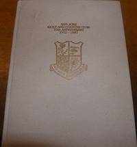
ref. 68-5054San Jose CA: San Jose Golf And Country Club 1987. 4to. White Gilt Cloth 109 pp. Very Good. Color and B&W plates. Provenance: Everett Mathews attorney from Millbrae CA. San Jose, CA: San Jose Golf And Country Club, 1987. hardcover
ref. 88638Paris, Editions Karthala, 2001. 13 x 21, 202 pp., 4 cartes, quelques illustrations en couleurs, broché, très bon état.
Folio. 163, (19) pp., final blank f. With woodcut printer's device to title-page. - (Bound with) II: Hoffmeister, Johann. In XII priora capita actuum apostolicorum commentaria [...]. Cologne, Arnold Birckmanns heirs, 1567. (6) pp., 1 blank f., 225, (1) pp. With woodcut printer's device to title-page. Contemporary limp vellum with ms. spine title. Traces of ties. First edition of the history of the Saracens and Turks, dedicated to Emperor Maximilian II. The humanist C. A. Curio (1538-1567) thinks it likely that the Turks are descended from the Huns and shows skepticism toward theories that they might be descended from the Twelve Tribes of Israel, or, as Pliny had surmised, from the Tartars. Curio describes the Saracens as a people wrought by internal strife, often defeated and fragmented by the Arabs. - Bound within the same volume is a rare commentary on the first 12 chapters of the Acts of the Apostles by the Augustinian and theologian J. Hoffmeister (c. 1509-47). - Binding slightly loosened; some reinforcements to gutters; second word rather browned in places with occasional waterstains. A good copy of an important, early work on the Turkish people. I: VD 16 C, 6410 (D 2655). Göllner 1211. Adams C 3078. BM-STC German 232. Schottenloher 51906. Kutter A14, 1. - II: VD 16. H 4266. Not in Adams or BM-STC German.
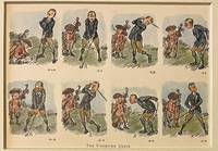
ref. 120757-092Original 1920 lithography bookillustration of golfers on a golf course. A golfer and a caddy with golfclubs. Lithography 145 x 195 in a bigger cardboard passepartout total size 235 x 295 mm. Nice gift for a lover of Golf. The illustration depicts a golfers failed attempts at making a proper shot. The cartoons charming style and expressive sequence capture the lighthearted frustration of early golfing culture.NL Originele lithografie met een golfer en zijn caddy met de titel The Undriven Drive. Engelse bookillustratie. Stripvorm. Satirisch humoristisch. Leuk cadeau voor een liefhebber van golf. Vintage sportcartoon. unknown
6 maps, colour printed. Scales: 1:100,000; 1:250,000; 1:2,500,000. All in their original printed orange and green envelopes, all but one with accompanying booklets. Six maps from the USGS's premier Geologic and Geoscience series (English and Arabic text), focusing on the west of the Arabian Peninsula. Originally compiled from field mapping carried out at the 1:100,000 scale, though scales here vary. Maps include keys and cross-sections, and sometimes an accompanying booklet of detailed explanatory notes. Comprises individually: - 1) GM-22 (IR 182; Vranas p. 17): Geology of the Jabal Ibrahim Quadrangle, Sheet 20 / 41C, by W. R. Greenwood, with a Section on Economic Geology, by R. G. Worl and W. R. Greenwood, 82 x 74 cm, 1:100,000, 1975 (1976). Based on mapping done Dec. 1970-Jan. 1971. With 18 pp. staple-bound illustrated notes as called for. - 2) GM-28: Geology of the Nuqrah Quadrangle, sheet 25E, by J. Delfour, 106 x 62 cm, 1:250,000, 1977. Includes 18 pp. staple-bound illustrated notes by J. Delfour. This area lies a little to the north of Medina. Original mapping is credited to the Bureau de Recherches Geologiques et des Minieres. - 3) GM-66 - Plate 2: Mineral locality maps of Saudi Arabia, by Hans van Daalhoff, 71 x 96 cm, 1:2,500,000, 1982. This map is a reduction of the Anglo-American / USGS Map I-270-B2 (1963) and includes a large stretch of the Red Sea coast including the Holy Sites, part of Qatar, and the major oil producing locations on the Arabian Gulf. - 4) GM-78A (IR 383; Vranas p. 33): Geologic map of the Najran quadrangle, Sheet 17G (with Landsat base), by Edward G. Sable, 109 x 64 cm, 1:250,000, 1985. Includes 18 pp. staple-bound illustrated "Explanatory Notes" by Sable as called for (though Vranas confusingly indicates this should also include an additional geographic map, and the booklet be 35 pp.). - 5) GM-122: Industrial mineral resources map of Jiddah, by C. H. Spencer, Alain Cartier, and Pierre Louis Vincent, in two sheets, 1988. 1:100,000. 2 sheets (Jiddah East; Jiddah West), each 102 x 76 cm. Includes 15 pp. staple-bound illustrated notes by Spencer, Cartier and Vincent. - 6) GM-132: Geologic map of the Cenozoic Lava field of Harrat Kishb, by M. John Roobol and Victor E. Camp, 86 x 76 cm, 1:250,000, 1991. Includes 34 pp. staple-bound illustrated notes by Roobol and Camp. - Very well preserved in general. G. J. Vranas, List of Interagency Reports submitted by the US Geological Survey Saudi Arabian Mission to the Saudi Arabian Directorate General of Mineral Resources from 1965 to the beginning of 1992 (Open File Report USGS-OF-92-2. Interagency Report 844 (Jiddah: Ministry of Petroleum and Mineral Resources Directorate General of Mineral Resources, 1412 AH/1992 AD), pp. 17, 33.
6 maps, 70 x 61 cm to ca. 75 x 65 cm. Printed in black and white. Constant ratio linear horizontal scale 1:4,000,000 scale. All in their original printed orange envelopes. Of the eight index maps produced during 1980-81, six are included here (wanting 100 [IR 400] and 107 [IR 407]). They feature the Arabian Peninsula, with labels for Mecca, Medina, Jeddah, Riyadh, Dammam, Sharjah, Masqat, Kuwayt etc. Comprises individually: - 101 (IR 401): Index Map of 1:250,000 scale quadrangle maps; 102 (IR 402): Index map of Landsat imagery of the Arabian Peninsula: Path 169 through 189, Row 38 through 51; 103 (IR 403): Index map of 1:50,000 scale mosaics, SAG and GSMO photography 1950-53; 104 (IR 404): Index map of 1:100,000 scale mosaics and photo maps, SAG and GSMO photography 1950-53; 105 (IR 405): Index map of 1:100,000 scale mosaics, WSA photography 1955-57; 106 (IR 406): Index map of 1:50,000 scale mosaics, WSA photography 1955-57. - In excellent condition throughout. G. J. Vranas, List of Interagency Reports submitted by the US Geological Survey Saudi Arabian Mission to the Saudi Arabian Directorate General of Mineral Resources from 1965 to the beginning of 1992 (Open File Report USGS-OF-92-2. Interagency Report 844 (Jiddah: Ministry of Petroleum and Mineral Resources Directorate General of Mineral Resources, 1412 AH/1992 AD), pp. 71, 35f.
20 maps, 84 x 53 cm or larger. Printed in brown tones. Transverse Mercator projection, constant ratio linear horizontal scale 1:250,000 scale. All but two in their original printed orange envelopes. The joint NASA/USGS Landsat Programme started in the early 1970s, providing the longest continuous space-based record of the Earth’s surface. Of the 25 maps in 1:250,000 scale produced during 1979-81, 20 are included here (wanting 2, 3, 4 [IR 301, 302, 303], 13 [IR 312], 16 [IR 315]). They cover the stretch of the Red Sea coast from just below the Gulf of Aqaba to just below Jeddah, and inland from Jeddah towards Dammam via Riyadh. Comprises individually: - 1 (IR 300): Jabal Al Hasir Quadrangle, Sheet 19F, 1979; 5 (IR 304): Jibal Hayil Quadrangle, Sheet 17E, 1980; 6 (IR 305): Al Qunfudhah Quadrangle, Sheet 19E, 1980; 7 (IR 306): Wadi Hali Quadrangle, Sheet 18E, 1980; 8 (IR 307): Jizan Quadrangle, Sheet 16F, 1980; 9 (IR 308): Jibal Al Qahr Quadrangle, Sheet 19G, 1981; 10 (IR 309): Bi’r Idimah Quadrangle, Sheet 18G, 1981; 11 (IR 310): Jaza’ir Farasan Quadrangle, Sheet 16E, 1980; 12 (IR 311): Wadi Bishah Quadrangle, Sheet 20F, 1981; 14 (IR 313): Al Lith Quadrangle, Sheet 20D, 1981; 15 (IR 314): Wadi Tathlith Quadrangle, Sheet 20G, 1981; 17 (IR 316): Turabah Quadrangle, Sheet 21E, 1981; 18 (IR 317): Ar Rawdah Quadrangle, Sheet 21F, 1981; 19 (IR 318): Jabal Tarban Quadrangle, Sheet 21G, 1981; 20 (IR 319): Rabigh Quadrangle, Sheet 22D, 1981; 21 (IR 320): Al Muwayh Quadrangle, Sheet 22E, 1981; 22 (IR 321): Zalim Quadrangle, Sheet 22F, 1981; 23 (IR 322): Wadi Ar Rika’ Quadrangle, Sheet 22G, 1981; 24 (IR 323): Al Mulayh Quadrangle, Sheet 22H, 1981; 25 (IR 324): Al Ji’lan Quadrangle, Sheet 21H, 1981. - Envelope and map of no. 10 stamped with initials and date (TRU May 1981) and a couple of nicks to map edge, otherwise excellent throughout. G. J. Vranas, List of Interagency Reports submitted by the US Geological Survey Saudi Arabian Mission to the Saudi Arabian Directorate General of Mineral Resources from 1965 to the beginning of 1992 (Open File Report USGS-OF-92-2. Interagency Report 844 (Jiddah: Ministry of Petroleum and Mineral Resources Directorate General of Mineral Resources, 1412 AH/1992 AD), pp. 71, 26-29.
4 maps, 86 x 98 cm to 104 x 102 cm. Printed in brown tones. Transverse Mercator projection, constant ratio linear horizontal scale 1:500,000 scale. All maps but one (32) in their original printed orange envelopes. The joint NASA/USGS Landsat Programme started in the early 1970s, providing the longest continuous space-based record of the Earth’s surface. Of the five produced in 1:500,000 scale, all but one (no. 34 [IR 333]) are included here. (As Vranas notes, numbers 26-31 and 35-37 were never produced.) They focus on the southwestern portion of the Peninsula; map 32 shows Mecca and Jeddah, though they are not marked. Comprises individually: - 32 (IR 331): Southern Hijaz Quadrangle; 33 (IR 332): Southern Najd Quadrangle; 38 (IR 337): Tihamat Ash Sham Quadrangle; 39 (IR 338): ‘Asir Quadrangle. - In excellent condition throughout. G. J. Vranas, List of Interagency Reports submitted by the US Geological Survey Saudi Arabian Mission to the Saudi Arabian Directorate General of Mineral Resources from 1965 to the beginning of 1992 (Open File Report USGS-OF-92-2. Interagency Report 844 (Jiddah: Ministry of Petroleum and Mineral Resources Directorate General of Mineral Resources, 1412 AH/1992 AD), pp. 71, 26-29.
27 maps, ca. 54 x 84 cm to 104 x 98 cm. Printed in brown tones. Transverse Mercator projection, constant ratio linear horizontal scale 1:250,000 scale (except for OF-02-32 through 02-35, which are on a scale of 1:500,000). All in their original printed orange envelopes. The joint NASA/USGS Landsat Programme started in the early 1970s, providing the longest continuous space-based record of the Earth’s surface. Its "OF" (Open File reports) series was designed to publish urgent interim or preliminary information edited with only a single peer review. As of 1992, 11 sets had been produced, which included a mixture of maps and other documents, prefixed OF-01 through OF-10 and OF-92. The present set comprises 27 maps from the 91 documents that made up the OF-02 set. Comprises individually: - OF-02-12 (IR 325): Halaban Quadrangle, Sheet 23G; OF-02-14 (IR 327): Al Hawtah Quadrangle, Sheet 23I; OF-02-15 (IR 328): Yabrin Quadrangle, Sheet 23J; OF-02-16 (IR 329): Ad Dawadimi Quadrangle, Sheet 24G; OF-02-17 (IR 330): Durma Quadrangle, Sheet 24H; OF-02-19 (IR 335): Harad Quadrangle, Sheet 24J; OF-02-20 (IR 336): Aban Al Ahmar Quadrangle, Sheet 25F; OF-02-21 (IR 339): Al Faydah Quadrangle, Sheet 25G; OF-02-22 (IR 340): Shaqra Quadrangle, Sheet 25H; OF-02-23 (IR 341): Rumah Quadrangle, Sheet 25I; OF-02-24 (IR 419): Jabal Habashi quadrangle, Sheet 26F; OF-02-25 (IR 420): Buraydah Quadrangle, Sheet 26G; OF-02-26 (IR 421): Qiba Quadrangle, Sheet 27G; OF-02-27 (IR 422): Mahd Adh Dhahab Quadrangle, Sheet 23E; OF-02-28 (IR 423): 'Afif Quadrangle, Sheet 23F; OF-02-29 (IR 424): Al Hissu Quadrangle, Sheet 24E; OF-02-31 (IR 426): Baq'A' Quadrangle, Sheet 27F; OF-02-32 (IR 427): Wadi As Sirhan Quadrangle; OF-02-33 (IR 428): Northwestern Hijaz Quadrangle, 104 x 98 cm; OF-02-34 (IR 429): Northeastern Hijaz Quadrangle, 80 x 100cm, OF-02-35 (IR 430): Wadi Ar Rimah Quadrangle, 83 x 100 cm; OF-02-72 (IR 476): Sahl Al Matran Quadrangle, Sheet 26C; OF-02-73 (IR 477): Harrat Ithnayn Quadrangle, Sheet 26D; OF-02-74 (IR 478): Wadi Ash Sha'bah Quadrangle, Sheet 26E; OF-02-75 (IR 479): Al Muwaylih Quadrangle, Sheet 27A; OF-02-76 (IR 480): Shaghab Quadrangle, Sheet 27B; OF-02-79 (IR 483): Ha'il Quadrangle, Sheet 27E. - In excellent condition throughout. G. J. Vranas, List of Interagency Reports submitted by the US Geological Survey Saudi Arabian Mission to the Saudi Arabian Directorate General of Mineral Resources from 1965 to the beginning of 1992 (Open File Report USGS-OF-92-2. Interagency Report 844 (Jiddah: Ministry of Petroleum and Mineral Resources Directorate General of Mineral Resources, 1412 AH/1992 AD), pp. 75f., 28-42.
Large folding map (60 × 90.5 cm), printed in light orange with darker purple, depicting the Kingdom of Saudi Arabia and its main roads. With on the right the title in both Arabic and English and a table with the distances from one city to another. Large folding map, published by the Arabian American Oil Company, depicting the Kingdom of Saudi Arabia. It depicts the country’s roads, trails, railroads, roads that are still under construction and proposed roads, as well as cities, villages, airports and deserts. The table on the right shows the distance in kilometres from several towns and cities to some of the major cities: Buraidah, Dhahran, Dammam, Hofuf, Jeddah, Mecca, Medina, Riyadh and Ta’if. - Slightly discoloured along the folds, with only some very minor tears along the folds. Otherwise in very good condition
Large folding map (60 x 90.5 cm), printed in colour, depicting the Kingdom of Saudi Arabia and its main roads. With the title in both Arabic and English and a table with the distances from one city to another. Printed on two sides, one side with the map in English and the other in Arabic. Bilingual road map of the Arabian Peninsula for Aramco employees. Focusing on Saudi Arabia, the map shows the main roads as well as surfaced roads, trails, roads under construction and even proposed roads. A list titled "hints for survival" mentions straightforward traffic rules such as "come to a complete stop at stop signs and observe stop-and-go signals" and "observe speed laws in the community where you live as well as on the highway". The headline makes readers fear the worst for Saudi Arabian traffic of this period. The Arabic side of the map contains the same "hints" as well as a list of road signs in Arabic and English. A table lists the distance in kilometres from several towns and cities to some of the major cities: Buraidah, Dhahran, Dammam, Hofuf, Jeddah, Mecca, Medina, Riyadh and Ta'if. - In very good condition.
Colour-printed map, 590 x 855 mm. Bilingual road map of the Arabian Peninsula for Aramco employees. Focused on Saudi Arabia, the map shows the main roads, as well as surfaced roads, trails, roads under constructions and even proposed roads. A list titled "hints for survival" mentions extremely logical traffic rules such as "come to a complete stop at stop signs and observe stop-and-go signals" and "observe speed laws in the community where you live as well as on the highway". Placing common traffic rules under the header "hints for survival" makes one fear the worst for Saudi Arabian traffic in this period. The Arabic side of the map contains the same "hints" as well as a list of road signs in Arabic and English. - In very good condition.
Large folding map (60 x 90.5 cm), printed in colour, depicting the Kingdom of Saudi Arabia and its main roads. With on the right the title in both Arabic and English and a table with the distances from one city to another. Printed on two sides, one side with the map in English and the other in Arabic. Bilingual road map of the Arabian Peninsula for Aramco employees. Focused on Saudi Arabia, the map shows the main roads, as well as surfaced roads, trails, roads under constructions and even proposed roads. A list titled "hints for survival" mentions extremely logical traffic rules such as "come to a complete stop at stop signs and observe stop-and-go signals" and "observe speed laws in the community where you live as well as on the highway". Placing common traffic rules under the header "hints for survival" makes one fear the worst for Saudi Arabian traffic in this period. The Arabic side of the map contains the same "hints" as well as a list of road signs in Arabic and English. A table lists the distance in kilometres from several towns and cities to some of the major cities: Buraidah, Dhahran, Dammam, Hofuf, Jeddah, Mecca, Medina, Riyadh and Ta'if. - In very good condition.