Hawaii Photography; Tourism and LeisureBiblio.com

6.436 resultados
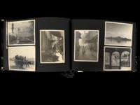
1925ref. 227841925. SS Resolute photo archive approximately 86 photographs dating to 1925 documenting a passenger voyage through the Hawaiian Islands and broader Pacific region during a period of expanding U.S. tourism and colonial presence. The material captures volcanic landscapes urban development agricultural activity and Native Hawaiian individuals providing visual evidence of both environmental features and social life. These images record the intersection of natural geography and emerging tourist infrastructure in Hawaii during the interwar period when the islands were increasingly integrated into trans-Pacific travel networks. Approximately 86 black-and-white and color photographs each measuring about 3.5 x 5 inches mounted on black album leaves with white ink captions identifying locations such as Honolulu Hilo Waimea Bay Kilauea Crater and the Royal Hawaiian Hotel. The archive includes multiple views of volcanic activity including lava flows associated with eruptions from 1868 1901 and 1924 as well as craters at Halemaumau and Kilauea steam vents and descending lava formations. Coastal landscapes and inland terrain of Oahu and the Big Island are represented alongside urban scenes in Honolulu including hotels streetscapes and institutional buildings such as the Moana Hotel and the Mormon Temple at Laie. Agricultural images show sugarcane cultivation and rural labor environments while market scenes and portraits depict local residents in daily settings. A group of photographs includes Duke Kahanamoku posed with a surfboard marked "DUKE" alongside additional images referencing Pacific locations such as Tutuila and Upolu indicating the voyage extended beyond Hawaii. Produced during the 1920s expansion of Pacific tourism these photographs document how Hawaii and surrounding islands were visually framed for travelers within a colonial and commercial context. The combination of landscape infrastructure and human subjects reflects both the promotion of the islands as a destination and the presence of established local communities and industries. The archive supports research into tourism history Pacific colonial networks environmental documentation and Native Hawaiian cultural representation. Mild toning and occasional rippling to prints with minimal edge wear; captions remain clear; overall very good condition. A comprehensive visual record of a trans-Pacific यातà¥à¤°à¤¾ and its documentation of Hawaii and neighboring islands in the early twentieth century. unknown
1925ref. 227841925. SS Resolute photo archive approximately 86 photographs dating to 1925 documenting a passenger voyage through the Hawaiian Islands and broader Pacific region during a period of expanding U.S. tourism and colonial presence. The material captures volcanic landscapes urban development agricultural activity and Native Hawaiian individuals providing visual evidence of both environmental features and social life. These images record the intersection of natural geography and emerging tourist infrastructure in Hawaii during the interwar period when the islands were increasingly integrated into trans-Pacific travel networks. Approximately 86 black-and-white and color photographs each measuring about 3.5 x 5 inches mounted on black album leaves with white ink captions identifying locations such as Honolulu Hilo Waimea Bay Kilauea Crater and the Royal Hawaiian Hotel. The archive includes multiple views of volcanic activity including lava flows associated with eruptions from 1868 1901 and 1924 as well as craters at Halemaumau and Kilauea steam vents and descending lava formations. Coastal landscapes and inland terrain of Oahu and the Big Island are represented alongside urban scenes in Honolulu including hotels streetscapes and institutional buildings such as the Moana Hotel and the Mormon Temple at Laie. Agricultural images show sugarcane cultivation and rural labor environments while market scenes and portraits depict local residents in daily settings. A group of photographs includes Duke Kahanamoku posed with a surfboard marked "DUKE" alongside additional images referencing Pacific locations such as Tutuila and Upolu indicating the voyage extended beyond Hawaii. Produced during the 1920s expansion of Pacific tourism these photographs document how Hawaii and surrounding islands were visually framed for travelers within a colonial and commercial context. The combination of landscape infrastructure and human subjects reflects both the promotion of the islands as a destination and the presence of established local communities and industries. The archive supports research into tourism history Pacific colonial networks environmental documentation and Native Hawaiian cultural representation. Mild toning and occasional rippling to prints with minimal edge wear; captions remain clear; overall very good condition. A comprehensive visual record of a trans-Pacific यातà¥à¤°à¤¾ and its documentation of Hawaii and neighboring islands in the early twentieth century. unknown books
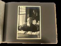
1930ref. 223021930. Japan travel photograph album. 1930s. This album documents Western travel through Japan during a period of expanding imperial influence and managed international tourism recording temple architecture theatrical performance and curated cultural sites alongside limited family portraiture. The photographs provide primary visual evidence of how foreign visitors encountered Japan through established travel circuits that emphasized religious monuments scenic landscapes and staged cultural forms while also including a labeled image from Korea that situates the journey within the geography of Japanese colonial rule. Photo Album containing 22 silver gelatin photographs each mounted one per page with white ink captions identifying locations including "Nikko" "Kyoto" "Shochiku-za" "Koya San" "Akashi" "Takao" and "Korea." Three photographs depict members of a Western family posed in studio and outdoor settings including portraits in front of temple gates and residential entrances. The remaining images focus on architectural and cultural sites including temple facades with detailed ornamentation mountain and waterfall landscapes and a staged theatrical performance at the Shochiku-za theatre in Osaka showing performers in elaborate costume and makeup. One photograph labeled "Korea" depicts seated women wearing hanbok indicating travel beyond the Japanese home islands. The photographs are consistently sized at approximately 5 x 7 inches and mounted in an album measuring approximately 8.5 x 12 inches bound in cloth boards with decorative striping and cord binding. The album was produced during a decade when Japan promoted domestic and imperial sites as destinations for foreign travelers integrating religious landmarks urban infrastructure and colonial territories into a coherent tourist experience. Sites such as Nikko and Koya San were presented as emblematic of national heritage while theatrical venues and scenic locations formed part of structured itineraries. The inclusion of Korea reflects the extension of these travel routes into occupied regions where colonial subjects and landscapes were incorporated into representations of the empire. Photographs remain clear with strong contrast; minor wear to album consistent with handling; overall very good. A focused visual record of Western travel in 1930s Japan documenting how cultural sites and imperial geography were presented to foreign visitors. unknown
1930ref. 223021930. Japan travel photograph album. 1930s. This album documents Western travel through Japan during a period of expanding imperial influence and managed international tourism recording temple architecture theatrical performance and curated cultural sites alongside limited family portraiture. The photographs provide primary visual evidence of how foreign visitors encountered Japan through established travel circuits that emphasized religious monuments scenic landscapes and staged cultural forms while also including a labeled image from Korea that situates the journey within the geography of Japanese colonial rule. Photo Album containing 22 silver gelatin photographs each mounted one per page with white ink captions identifying locations including "Nikko" "Kyoto" "Shochiku-za" "Koya San" "Akashi" "Takao" and "Korea." Three photographs depict members of a Western family posed in studio and outdoor settings including portraits in front of temple gates and residential entrances. The remaining images focus on architectural and cultural sites including temple facades with detailed ornamentation mountain and waterfall landscapes and a staged theatrical performance at the Shochiku-za theatre in Osaka showing performers in elaborate costume and makeup. One photograph labeled "Korea" depicts seated women wearing hanbok indicating travel beyond the Japanese home islands. The photographs are consistently sized at approximately 5 x 7 inches and mounted in an album measuring approximately 8.5 x 12 inches bound in cloth boards with decorative striping and cord binding. The album was produced during a decade when Japan promoted domestic and imperial sites as destinations for foreign travelers integrating religious landmarks urban infrastructure and colonial territories into a coherent tourist experience. Sites such as Nikko and Koya San were presented as emblematic of national heritage while theatrical venues and scenic locations formed part of structured itineraries. The inclusion of Korea reflects the extension of these travel routes into occupied regions where colonial subjects and landscapes were incorporated into representations of the empire. Photographs remain clear with strong contrast; minor wear to album consistent with handling; overall very good. A focused visual record of Western travel in 1930s Japan documenting how cultural sites and imperial geography were presented to foreign visitors. unknown books
1994ref. 210521994. Laermer Richard; Collins Andrew; Link Matthew; Damron Guides; Fodor's Editors; Guaracino Jeff. Gay and lesbian travel guide collection 1994-2007 documenting the development of LGBTQ travel culture and the identification of queer social spaces in the late twentieth and early twenty-first centuries. These guides situate travel as a structured means of accessing community particularly in the aftermath of the AIDS crisis when information about safe spaces health resources and social networks was critical. The collection provides evidence of how printed directories functioned as both navigational tools and cultural records of LGBTQ presence across cities regions and international destinations. Collection comprises 7 travel guides ranging in size from approximately 4" x 7" to 5" x 8.5". 1 Richard Laermer's Gay and Lesbian Handbook to New York City 1994. This book contains 244 pages of hundreds of listings in New York City broken up by subjects including gay neighborhoods entertainment the arts politics spirituality and most importantly health services and support groups for those suffering from AIDS in the midst of the crisis. 2 Betty & Pansy's Severe Queer Review of San Francisco 1995. A queer travel guide of San Francisco that contains many illustrations and sketches representing the underground of queer culture. 130 pages that includes listings of bars performance spaces night clubs hotels restaurants and more. This copy also includes an original postcard which features a picture of both authors and has an inscription signed by Betty. 3 Fodor's Gay Guide to San Francisco and the Bay Area by Andrew Collins. First Edition 1997. Includes 166 pages on Gay Life Culture Establishments and more in the bay area. 4 Matthew Link's Rainbow Handbook: Hawaii the Island's Ultimate Travel Guide 1999. Contains 225 pages dedicated to gay travel in Hawai'i written by gay travel writer Matthew Link. Includes a breakdown of locations on each individual island. 5 Fodor's Gay Guide to the USA Second Edition 1998. 600 Pages. Measures 5" x 9". Includes a city by city breakdown with 67 road maps. 6 Damron Men's Travel Guide 1999. 900 pages. Measures 3.5" x 6.5". Includes USA Mexico Canada Caribbean and European Cities along with a 1999 party calendar. About 800 pages on USA locations 7 Guaracino Jeff. Gay and Lesbian Tourism: the Essential Guide to Marketing. 183 pages. This is a 2007 book focusing on marketing towards the LGBT community. The author focuses on various aspects of LGBT tourism such as the case for its economic value finding the right stakeholders and the best practices in marketing towards that audience. Produced during a period of expanding LGBTQ visibility and mobility these guides illustrate how travel infrastructure supported the formation and maintenance of queer social networks. The inclusion of health resources nightlife and community organizations reflects the practical needs of travelers as well as the broader cultural landscape of LGBTQ life. Many listed establishments no longer operate making these guides a record of spaces that have since disappeared. Light wear consistent with use; bindings intact and pages clean; overall very good condition. This collection offers a substantial printed record of LGBTQ spatial and cultural networks at the turn of the twenty-first century. unknown
1994ref. 210521994. Laermer Richard; Collins Andrew; Link Matthew; Damron Guides; Fodor's Editors; Guaracino Jeff. Gay and lesbian travel guide collection 1994-2007 documenting the development of LGBTQ travel culture and the identification of queer social spaces in the late twentieth and early twenty-first centuries. These guides situate travel as a structured means of accessing community particularly in the aftermath of the AIDS crisis when information about safe spaces health resources and social networks was critical. The collection provides evidence of how printed directories functioned as both navigational tools and cultural records of LGBTQ presence across cities regions and international destinations. Collection comprises 7 travel guides ranging in size from approximately 4" x 7" to 5" x 8.5". 1 Richard Laermer's Gay and Lesbian Handbook to New York City 1994. This book contains 244 pages of hundreds of listings in New York City broken up by subjects including gay neighborhoods entertainment the arts politics spirituality and most importantly health services and support groups for those suffering from AIDS in the midst of the crisis. 2 Betty & Pansy's Severe Queer Review of San Francisco 1995. A queer travel guide of San Francisco that contains many illustrations and sketches representing the underground of queer culture. 130 pages that includes listings of bars performance spaces night clubs hotels restaurants and more. This copy also includes an original postcard which features a picture of both authors and has an inscription signed by Betty. 3 Fodor's Gay Guide to San Francisco and the Bay Area by Andrew Collins. First Edition 1997. Includes 166 pages on Gay Life Culture Establishments and more in the bay area. 4 Matthew Link's Rainbow Handbook: Hawaii the Island's Ultimate Travel Guide 1999. Contains 225 pages dedicated to gay travel in Hawai'i written by gay travel writer Matthew Link. Includes a breakdown of locations on each individual island. 5 Fodor's Gay Guide to the USA Second Edition 1998. 600 Pages. Measures 5" x 9". Includes a city by city breakdown with 67 road maps. 6 Damron Men's Travel Guide 1999. 900 pages. Measures 3.5" x 6.5". Includes USA Mexico Canada Caribbean and European Cities along with a 1999 party calendar. About 800 pages on USA locations 7 Guaracino Jeff. Gay and Lesbian Tourism: the Essential Guide to Marketing. 183 pages. This is a 2007 book focusing on marketing towards the LGBT community. The author focuses on various aspects of LGBT tourism such as the case for its economic value finding the right stakeholders and the best practices in marketing towards that audience. Produced during a period of expanding LGBTQ visibility and mobility these guides illustrate how travel infrastructure supported the formation and maintenance of queer social networks. The inclusion of health resources nightlife and community organizations reflects the practical needs of travelers as well as the broader cultural landscape of LGBTQ life. Many listed establishments no longer operate making these guides a record of spaces that have since disappeared. Light wear consistent with use; bindings intact and pages clean; overall very good condition. This collection offers a substantial printed record of LGBTQ spatial and cultural networks at the turn of the twenty-first century. unknown books
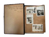
1960ref. 232021960. Pakistan travel album recordingstreet life mountain excursions landscapes military ceremony and local custom in the 1960s with particular strength in its photographs depicting everyday culture and public life of Pakistany rural people. Photographer identified in an inscription as "Pech." The album focuses on a Life in Pakistan showing men in regional dress military regiments animal handling agricultural labor roadside and market activity mountain travel and formal as well as informal gathering. References to Rawalakot Many scenes of upland terrain and military units place part of the album in northern Pakistan. Photo album of over 120 corner mounted and loose silver gelatin photographs arranged across black paper leaves with many loose prints inscribed in French. Photos measure primarily between 2.5" x 3.5" to 3.5" x 5". Album measures 7.5" x 11". Visible scenes include men in celebratory flower garlands gathered in mountain settings groups posed in rugged terrain and photographs of men standing beside lakes rivers and highland roads suggesting travel or climbing excursions that were socially marked as memorable events rather than casual tourism. One photo of a man's portrait is inscribed to "Pech" en verso and mentions Rawalakot and their participation in climbing "6000 feet" he signs off as "M. MacDonald / Rockhampton Queensland." Other photographs turn to daily life and custom showing men in turbans and traditional dress rural figures with cattle agricultural work village architecture street scenes and portraits of children and families. Several images show snake charmers one seated with cobras raised before him others posed with baskets and spectators nearby preserving a form of public performance long circulated in South Asian spectacle. Urban views include crowded market lanes mixed traffic and building fronts while architectural photographs show mosques domed structures gardens and formal compounds placing devotional civic and residential space within the traveler's route. A handful of photos show military images of uniformed men in camp and review settings one caption identifying a brigade parade ground and another a general showing the compiler's access to official environments alongside civilian ones. Multiple photos depict dinner settings with the compiler seated with friends family and his "amour" also seen throughout the album. Most images from Pakistan with a small handful in Egypt and Lebanon circa 1960s. One dinner scene shows him and three other individuals with the en verso inscribed "Beruit - 1962." In the 1960s Pakistan was a young post-Partition state shaped by military visibility frontier administration and conflict especially in Kashmir where UN observers operated. Foreign travelers and officials moved through the country alongside local communities recording mountain travel public ceremony village life and everyday custom with Rawalakot being part of a borderland where military oversight diplomacy and travel intersected. Chipping to album covers photos exhibit some corner and edge wear overall very good condition. A mid-century photo album of a traveler's view of Pakistan through a distinctly outsider lens shaped by transnational movement official access and cultural encounter. unknown
1960ref. 232021960. Pakistan travel album recordingstreet life mountain excursions landscapes military ceremony and local custom in the 1960s with particular strength in its photographs depicting everyday culture and public life of Pakistany rural people. Photographer identified in an inscription as "Pech." The album focuses on a Life in Pakistan showing men in regional dress military regiments animal handling agricultural labor roadside and market activity mountain travel and formal as well as informal gathering. References to Rawalakot Many scenes of upland terrain and military units place part of the album in northern Pakistan. Photo album of over 120 corner mounted and loose silver gelatin photographs arranged across black paper leaves with many loose prints inscribed in French. Photos measure primarily between 2.5" x 3.5" to 3.5" x 5". Album measures 7.5" x 11". Visible scenes include men in celebratory flower garlands gathered in mountain settings groups posed in rugged terrain and photographs of men standing beside lakes rivers and highland roads suggesting travel or climbing excursions that were socially marked as memorable events rather than casual tourism. One photo of a man's portrait is inscribed to "Pech" en verso and mentions Rawalakot and their participation in climbing "6000 feet" he signs off as "M. MacDonald / Rockhampton Queensland." Other photographs turn to daily life and custom showing men in turbans and traditional dress rural figures with cattle agricultural work village architecture street scenes and portraits of children and families. Several images show snake charmers one seated with cobras raised before him others posed with baskets and spectators nearby preserving a form of public performance long circulated in South Asian spectacle. Urban views include crowded market lanes mixed traffic and building fronts while architectural photographs show mosques domed structures gardens and formal compounds placing devotional civic and residential space within the traveler's route. A handful of photos show military images of uniformed men in camp and review settings one caption identifying a brigade parade ground and another a general showing the compiler's access to official environments alongside civilian ones. Multiple photos depict dinner settings with the compiler seated with friends family and his "amour" also seen throughout the album. Most images from Pakistan with a small handful in Egypt and Lebanon circa 1960s. One dinner scene shows him and three other individuals with the en verso inscribed "Beruit - 1962." In the 1960s Pakistan was a young post-Partition state shaped by military visibility frontier administration and conflict especially in Kashmir where UN observers operated. Foreign travelers and officials moved through the country alongside local communities recording mountain travel public ceremony village life and everyday custom with Rawalakot being part of a borderland where military oversight diplomacy and travel intersected. Chipping to album covers photos exhibit some corner and edge wear overall very good condition. A mid-century photo album of a traveler's view of Pakistan through a distinctly outsider lens shaped by transnational movement official access and cultural encounter. unknown books
1939ref. 236791939. Mexico travel album documenting archaeology bullfighting urban leisure regional performance religious architecture and roadside travel from 1931 to 1939 during the first major expansion of tourism under the postrevolutionary government. The photographs follow visitors through Mexico City and its surrounding attractions presenting Teotihuacan Xochimilco public markets tropical landscapes and the bullring as components of a modern national itinerary. Mexican authorities during the 1930s institutionalized tourism within government policy and used historic centers architecture cultural traditions and natural scenery to shape an internationally recognizable image of the country. Photo album containing 96 items including 71 silver gelatin photographs 21 postcards and 4 pieces of printed Mexican ephemera including tickets and menus most photographs approximately 2.5" x 3.5" mounted in an album measuring approximately 8.5" x 11" Mexico 1931 to 1939. The photographs show bullfights before crowded stands at El Toreo; visitors standing among the monumental architecture of Teotihuacan; canal boats and waterside excursions at Xochimilco; church entrances plazas street markets gardens rural roads thatched buildings tropical vegetation animal displays and a roadside sign reading "Tropic of Cancer." Other scenes record costumed performers vendors working beside public buildings groups traveling by automobile social outings and companions posed at archaeological and scenic destinations. Printed material includes tickets for the 1939 season at "Plaza de Toros El Toreo" a color "Aguas de Lourdes" restaurant menu advertising "Un 'Seltzer' alcalino natural" newspaper clippings and postcards extending the private snapshots through commercially produced views of Mexican landscapes and monuments. An inscription on the front pastedown dated "Xmas 1931" establishes the beginning of the chronology while the El Toreo tickets extend the record through 1939. Tourism became an instrument of economic policy and national image making after the Mexican Revolution translating archaeological sites colonial architecture regional customs food and public spectacle into destinations for domestic and foreign visitors. Government tourism promotion of the period used bullfighting as a recognizable emblem of Mexico including official travel posters issued between 1930 and 1950 while preservation programs increasingly linked historic buildings and urban centers to the visitor economy. Pages and photos exhibit rippling but no apparent staining some minor wear consistent with age; several photographs remain securely mounted while others show lifting or losses. Overall in good condition. A sustained record of how postrevolutionary Mexico presented archaeology spectacle landscape and regional culture as the foundations of a modern tourist nation. unknown
1939ref. 236791939. Mexico travel album documenting archaeology bullfighting urban leisure regional performance religious architecture and roadside travel from 1931 to 1939 during the first major expansion of tourism under the postrevolutionary government. The photographs follow visitors through Mexico City and its surrounding attractions presenting Teotihuacan Xochimilco public markets tropical landscapes and the bullring as components of a modern national itinerary. Mexican authorities during the 1930s institutionalized tourism within government policy and used historic centers architecture cultural traditions and natural scenery to shape an internationally recognizable image of the country. Photo album containing 96 items including 71 silver gelatin photographs 21 postcards and 4 pieces of printed Mexican ephemera including tickets and menus most photographs approximately 2.5" x 3.5" mounted in an album measuring approximately 8.5" x 11" Mexico 1931 to 1939. The photographs show bullfights before crowded stands at El Toreo; visitors standing among the monumental architecture of Teotihuacan; canal boats and waterside excursions at Xochimilco; church entrances plazas street markets gardens rural roads thatched buildings tropical vegetation animal displays and a roadside sign reading "Tropic of Cancer." Other scenes record costumed performers vendors working beside public buildings groups traveling by automobile social outings and companions posed at archaeological and scenic destinations. Printed material includes tickets for the 1939 season at "Plaza de Toros El Toreo" a color "Aguas de Lourdes" restaurant menu advertising "Un 'Seltzer' alcalino natural" newspaper clippings and postcards extending the private snapshots through commercially produced views of Mexican landscapes and monuments. An inscription on the front pastedown dated "Xmas 1931" establishes the beginning of the chronology while the El Toreo tickets extend the record through 1939. Tourism became an instrument of economic policy and national image making after the Mexican Revolution translating archaeological sites colonial architecture regional customs food and public spectacle into destinations for domestic and foreign visitors. Government tourism promotion of the period used bullfighting as a recognizable emblem of Mexico including official travel posters issued between 1930 and 1950 while preservation programs increasingly linked historic buildings and urban centers to the visitor economy. Pages and photos exhibit rippling but no apparent staining some minor wear consistent with age; several photographs remain securely mounted while others show lifting or losses. Overall in good condition. A sustained record of how postrevolutionary Mexico presented archaeology spectacle landscape and regional culture as the foundations of a modern tourist nation. unknown books
1950ref. 3215Les flots bleus 1950 1950, Les flots bleus, album animé n° 107, imaginé par l'illusioniste Georgeo, illustré par Germaine Bouret, animé par Robert de Longchamp, album in-8 cartonné d'éditeur, couverture illustrée en couleurs, dos refait très proprement avec du scotch rouge, intérieur détaché mais complet de ses 6 illusions, systèmes complets, en très bon état, fonctionnent tous. | Etat : Très bon état intérieur, J2229 (Ref.: J2229)
ref. D'ALL1903Librairie Hachette -Boulevard Saint Germain - Paris - 1903 -Edition originale -382 pages - Tables in finé - Illustrations dans le texte noir et blanc et nombreux hors texte couleurs sous serpentes - Des premier jeux en passant par le cerf volant ,le criquet ,la toupie ,le billard ,l'escrime ,les échasses,jeux de ballon ,le cerceau ,etc -Fort volume in folio ,cartonnage souple broché éditeur couverture à rabats ,excellent état pour cet ouvrage rarissime .
ref. 17711Vérone, Officine Bodoni, 1957. In-8, 9 pp. 1 pl., cartonnage vert, étui de carton.
1769ref. GITk136A Paris chez Gueffier 1769-1770. 4 volumes in-8 *Tomes I: 2 feuillets non chiffrés (faux-titre titre) II-IV (épître) II-XXIII (discours explication des planches, errata) 2-243pp 3 feuillets non chiffrés (table, prix du matériel) *Tome II: 2 feuillets non chiffrés (faux-titre, titre) II-X (discours, explication des planches) 1 feuillet non chiffré (approbation, privilège) 2-322pp dont table 1 feuillet non chiffré prix du matériel *Tome III: 2 feuillets non chiffrés (faux-titre, titre) VI-XVI (discours, explication des planches) 2-204pp 1 feuillet prix du matériel *Tome IV: 2 feuillets non chiffrés (faux-titre, titre) II-XVI (avant-propos, explication des planches) 2-232pp 4 feuillets non chiffrés table. Demi basane rouge, dos lisse orné de filets dorés, frise dorée en queue, relié vers 1860. Orné de 5 "tables" (1 dans le texte, 1 à pleine page et 3 réunies sur 2 planches; 1 tableau dépliant et 73 planches dépliantes dont 1 numérotée bis ( 4 en noir, 69 finement colorées à l'époque). Manque en bordure de la coiffe supérieure du Tome I; restauration angulaire en tête du faux-titre du Tome II; planche n°11 non numérotée; feuillet 29-30 (Tome II) numéroté 21-22; cachets de bibliothèque sur les 4 pages de titre. Intérieur en bon état, collationné complet du texte, des "tables", du tableau et des planches. Reliure du XIXe siècle. TEXTE INTERESSANTS qui contribua à la création de l'illusion et de la prestidigitation modernes.
1950ref. 2748Couverture rigide Signé par l'illustrateur Collins 1950 London 28,5x22 cm
ref. 8252"P., Chez Denys Thierry, 1682. Petit in 8, feuillet dépliant, frontispice, titre, 9 pp. (68) pp. paginées de 1 à 17, (25) pp.; reliure veau de l’époque, dos muet orné à nerfs, tranches dorées. Première édition."
ref. 16929Paris, Galerie Jean Giraudoux, 1964. In-folio, 123 pp., cartonnage éditeur de toile grise estampée en rouge sur le premier plat, chemise et étui de l'éditeur de papier gris chiné, dos de toile rouge (dos de la chemise et étui insolés).
1920ref. 2354Paris, L. Saussine éditeur, sans date (circa 1910-1920). Planche chromolithographiée de très grand format (65 x 80 cm), destinée à illustrer un plateau de jeu évoquant les débuts de l’aviation, probablement issu du stock inutilisé de la prolifique maison Saussine (1860-1960) et jamais édité. Il s’agit d’un jeu de parcours de type jeu de l’oie, mais comptant 90 cases : au départ, dans un décor de meeting aérien qui attire une foule enthousiaste, un biplan décolle, puis effectue un trajet sinueux, dans le ciel, croisant dirigeable ou divers aéroplanes, sur fond de paysages tout aussi variés (montagnes enneigées, lacs et cascades, mers et océans, champs et pâtures, oasis avec ses pyramides évoquant l’Egypte, voûte céleste étoilée surplombant une architecture orientale…). A l’issue de ce voyage riche en péripéties (vents plus ou moins favorables, accidents techniques, collisions, chutes…), le vainqueur atterrit, comme il se doit, à Paris, au pied de la Tour Eiffel. Très belle image, fidèle à la qualité des productions de Léon Saussine et de ses successeurs, l'une des principales fabriques de jeux de Paris. Elle s'inspire très nettement du « Jeu de la Conquête de l’Air » édité en Allemagne par J.W. Spear & Söhne vers 1910, qui comptait, lui, 85 stations, et scénographiait l’ensemble en bord de mer. Pour des raisons de sécurité, l'affiche sera expédiée enroulée.
1894ref. 51988P., Librairie Quantin 1894 In-8, reliure plein maroquin vert, dos à nerfs, caissons ornés, fleurons mosaïqués, filets d’encadrement des plats, fleurons d’angles, filets en coupes, large dentelle en contreplats, tranches dorées, étui bordé, couvertures cristal conservées, rel. signée J. Polera, IV- 593 pp. Infimes frottements.
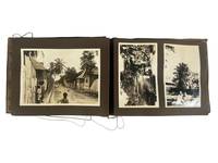
1930ref. 224461930. Caribbean and Panama travel photograph album. circa early 1930s. This album documents interwar travel through the Panama Canal Zone and Jamaica recording maritime transit canal infrastructure and rural Caribbean life as observed by Western travelers. The photographs provide primary visual evidence of the Panama Canal as a site of industrial activity and international movement alongside scenes of Jamaican village life and landscape establishing a contrast between engineered environments and colonial rural settings. The material is particularly strong in its depiction of canal operations and the presence of local populations within these spaces. Album containing 29 silver gelatin photographs mounted on black leaves with individual prints measuring approximately 3.5 x 4.5 to 5 x 7 inches housed in a string-bound album measuring approximately 7 x 9.5 inches. The opening sequence shows passengers aboard a steamship with men and women posed along deck rails and views of ships navigating canal locks and docking areas. Additional images depict cranes drawbridges canal cuts and small boats in the water along with dock workers and uniformed personnel visible among travelers. Architectural and infrastructural views include colonial-style buildings and mechanical equipment associated with canal operation concluding with a monument identified as that of Vasco Núñez de Balboa in Panama City. The Jamaica sequence includes landscape views of hillsides and gardens along with images of Black Jamaican residents posed in village settings. One photograph bears the caption "Kingston Jamaica 10 -- S.S. 'Reliance' West Indies Cruise" showing children and adults gathered along a dirt road lined with wooden and metal-roofed structures. Other images show groups assembled beneath trees and within rural surroundings. Produced during a period when the Panama Canal served as a major conduit for global shipping under U.S. administration and Caribbean travel formed part of organized cruise itineraries the album reflects established routes of interwar tourism. The juxtaposition of canal engineering and Jamaican village scenes situates the photographs within broader patterns of travel that linked industrial infrastructure with colonial landscapes. Minor water rippling to pages and photographs; images remain clear; overall very good. A coherent travel album documenting canal operations and Caribbean life in the early twentieth century. unknown
1930ref. 224461930. Caribbean and Panama travel photograph album. circa early 1930s. This album documents interwar travel through the Panama Canal Zone and Jamaica recording maritime transit canal infrastructure and rural Caribbean life as observed by Western travelers. The photographs provide primary visual evidence of the Panama Canal as a site of industrial activity and international movement alongside scenes of Jamaican village life and landscape establishing a contrast between engineered environments and colonial rural settings. The material is particularly strong in its depiction of canal operations and the presence of local populations within these spaces. Album containing 29 silver gelatin photographs mounted on black leaves with individual prints measuring approximately 3.5 x 4.5 to 5 x 7 inches housed in a string-bound album measuring approximately 7 x 9.5 inches. The opening sequence shows passengers aboard a steamship with men and women posed along deck rails and views of ships navigating canal locks and docking areas. Additional images depict cranes drawbridges canal cuts and small boats in the water along with dock workers and uniformed personnel visible among travelers. Architectural and infrastructural views include colonial-style buildings and mechanical equipment associated with canal operation concluding with a monument identified as that of Vasco Núñez de Balboa in Panama City. The Jamaica sequence includes landscape views of hillsides and gardens along with images of Black Jamaican residents posed in village settings. One photograph bears the caption "Kingston Jamaica 10 -- S.S. 'Reliance' West Indies Cruise" showing children and adults gathered along a dirt road lined with wooden and metal-roofed structures. Other images show groups assembled beneath trees and within rural surroundings. Produced during a period when the Panama Canal served as a major conduit for global shipping under U.S. administration and Caribbean travel formed part of organized cruise itineraries the album reflects established routes of interwar tourism. The juxtaposition of canal engineering and Jamaican village scenes situates the photographs within broader patterns of travel that linked industrial infrastructure with colonial landscapes. Minor water rippling to pages and photographs; images remain clear; overall very good. A coherent travel album documenting canal operations and Caribbean life in the early twentieth century. unknown books
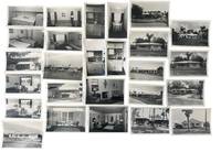
1951ref. 233771951. 1950s Clearwater Florida photographed by George L. Fulmer documenting real estate expansion and early housing and rental marketing showing how ranch houses apartment courts furnished efficiencies and street addressed properties were presented during the postwar Sunbelt expansion of Pinellas County. After World War II Florida's housing market was pushed by returning veterans retirees northern migrants automobile commuting and seasonal tourism while federal mortgage programs and private development made small houses garden apartments and furnished rentals central to the state's growth. Fulmer's commercial assignments connect that boom to named local properties: each job envelope ties the house or rental unit to a studio number client or property name address and in several cases a 1951 date. The archive reveals how Clearwater real estate moved through a practical commercial process with repeated exterior records interior room studies duplicate proofs and labeled job packets created for owners brokers and rental promotion. Photo archive of 47 items including 25 silver gelatin photographs and 22 large scale negatives. Many photographs have correlating negatives while some negatives contain unique images. Contained in 6 original photo studio envelopes. Photographs measure approximately 3 x 5 inches and negatives 4 x 5 inches Clearwater Florida circa 1951. Exteriors include one story ranch houses with low hip and gable roofs picture windows shutters carports mowed lawns curbside plantings palm trees shell or gravel yards television antennas and street frontage arranged for automobile approach. Apartment material includes a roadside sign reading "Bright Water Apts" with "Vacancy" a two story rental building set behind trees and a long low apartment row with a fenced yard and children's play equipment. Interiors include living rooms staged with patterned sofas lounge chairs framed floral and figural prints table lamps venetian blinds wall rugs and coffee tables; bedrooms with paired beds dressers and striped coverlets; small dining alcoves set with tables and chairs; and compact kitchens built around metal cabinets white sinks refrigerators cooktops wall ovens and built in storage. Fulmer photographs the houses apartments furnishings appliances and rental readiness as the product. Studio envelopes preserve job numbers and partly legible entries including Bright Water Apts Nokomis 1021 235 Bayshore Dr. 315 Venetian St. 420 Brightwater Mary Ann Apts Beach and dated jobs from July August September and October 1951. These photographs were taken in the decade when Clearwater shifted from a compact Gulf Coast resort city toward a year round Sunbelt housing market shaped by suburban lots furnished rentals small apartment complexes and real estate photography meant to make properties legible to buyers and tenants before arrival. The interior shots record what was being sold inside the walls from tropical curtains tile floors small dining rooms compact kitchenettes wall ovens living rooms sized for seasonal use and domestic decoration calibrated for a middle class Florida market. The address level job records support comparison with city directories tax records property files architectural surveys and later redevelopment histories making the archive usable for reconstructing specific Clearwater buildings rather than only identifying broad mid century style. Negatives show handling wear and envelopes show toning and some small tears. Overall in very good condition. unknown
1951ref. 233771951. 1950s Clearwater Florida photographed by George L. Fulmer documenting real estate expansion and early housing and rental marketing showing how ranch houses apartment courts furnished efficiencies and street addressed properties were presented during the postwar Sunbelt expansion of Pinellas County. After World War II Florida's housing market was pushed by returning veterans retirees northern migrants automobile commuting and seasonal tourism while federal mortgage programs and private development made small houses garden apartments and furnished rentals central to the state's growth. Fulmer's commercial assignments connect that boom to named local properties: each job envelope ties the house or rental unit to a studio number client or property name address and in several cases a 1951 date. The archive reveals how Clearwater real estate moved through a practical commercial process with repeated exterior records interior room studies duplicate proofs and labeled job packets created for owners brokers and rental promotion. Photo archive of 47 items including 25 silver gelatin photographs and 22 large scale negatives. Many photographs have correlating negatives while some negatives contain unique images. Contained in 6 original photo studio envelopes. Photographs measure approximately 3 x 5 inches and negatives 4 x 5 inches Clearwater Florida circa 1951. Exteriors include one story ranch houses with low hip and gable roofs picture windows shutters carports mowed lawns curbside plantings palm trees shell or gravel yards television antennas and street frontage arranged for automobile approach. Apartment material includes a roadside sign reading "Bright Water Apts" with "Vacancy" a two story rental building set behind trees and a long low apartment row with a fenced yard and children's play equipment. Interiors include living rooms staged with patterned sofas lounge chairs framed floral and figural prints table lamps venetian blinds wall rugs and coffee tables; bedrooms with paired beds dressers and striped coverlets; small dining alcoves set with tables and chairs; and compact kitchens built around metal cabinets white sinks refrigerators cooktops wall ovens and built in storage. Fulmer photographs the houses apartments furnishings appliances and rental readiness as the product. Studio envelopes preserve job numbers and partly legible entries including Bright Water Apts Nokomis 1021 235 Bayshore Dr. 315 Venetian St. 420 Brightwater Mary Ann Apts Beach and dated jobs from July August September and October 1951. These photographs were taken in the decade when Clearwater shifted from a compact Gulf Coast resort city toward a year round Sunbelt housing market shaped by suburban lots furnished rentals small apartment complexes and real estate photography meant to make properties legible to buyers and tenants before arrival. The interior shots record what was being sold inside the walls from tropical curtains tile floors small dining rooms compact kitchenettes wall ovens living rooms sized for seasonal use and domestic decoration calibrated for a middle class Florida market. The address level job records support comparison with city directories tax records property files architectural surveys and later redevelopment histories making the archive usable for reconstructing specific Clearwater buildings rather than only identifying broad mid century style. Negatives show handling wear and envelopes show toning and some small tears. Overall in very good condition. unknown books
1898ref. 14831Illustrations par Marius Roy.14 planches, la reproduction d'une gravure de Bonnart et une gravure sur la couverture. Vignette dans le texte.Édition limitée à 60 exemplaires. Il a été tiré, de cet ouvrage, 10 exemplaires sur papier de Chine et cinquante exemplaires sur papier du Japon tous numérotés et parafés par l'éditeur. Celui-ci (N°8) sur Japon.Édition nouvelle revue et augmentée. Paris, Ernest Flammarion, non daté, vers 1898 - 312 pages.Superbe reliure demi-maroquin chocolat à coins. Dos à 4 gros nerfs, filets dorés. Tête dorée sur témoins. Non rogné. Couverture illustrée et dos conservés. Très bon état pour ce bel exemplaire. Format in-8°(20x15).
ref. 5851"P., Veuve Bouchard-Huzard, 1848. Deuxième édition, deux volumes grand in 8 reliés, demi-chagrin de l'époque, dos lisse orné, XVI-720-596 pp. ; planches hors texte ; dos très légèrement frottés, bel exemplaire."