42.291 Ergebnisse
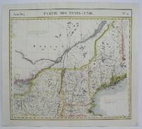
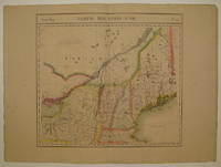
1827Best.-Nr. 225532Brussels: Phillippe Marie Vandermaelen 1827. unbound. very good. Map. Large format lithograph with original hand color wash. Image measures 18.25" x 20". Beautiful double page map of New England showing Maine New Hampshire Vermont and parts of New York Massachusetts and Canada. Features counties towns waterways topographical and geographical features population size indicated in pink circles mineral deposits and the area of each state yellow circles. Minor wear to edges light scattered staining and offsetting. Expert repair to chip to bottom centerfold. From Vandermaelen's 6 volume "Atlas universel de geographie physique politique statistique et mineralogique sur l'echelle de 1/16411836" in which each map can be combined as gores to form an immense globe. The atlas was the first to map the world on a uniform scale as well as the first lithographed atlas. Phillippe Marie Vandermaelen unknown books
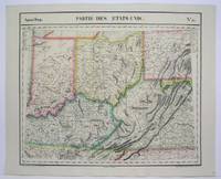
1825Best.-Nr. M4522Brussels 1825. Excellent. Notes: The first atlas of the world on a uniform scale. If assembled as a globe gores forms a very large globe. Size : 470x560 mm 18.5x22 Inches Coloring: Original Outline Coloring Category: Maps United States Midwest States; unknown
1825Best.-Nr. M4528Brussels 1825. Very Good. Notes: Detailed mid-19th century map of New England and New York region. The first atlas of the world on a uniform scale. If assembled as a globe gores forms a very large globe. Size : 460x505 mm 18.125x19.875 Inches Coloring: Original Outline Coloring Category: Maps Canada East Quebec;; Maps United States New England unknown
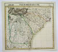
1825Best.-Nr. M4504Brussels 1825. Very Good minor worming on upper and lower portion of the map along the central fold proficiently repaired. Notes: The first atlas of the world on a uniform scale. If assembled as a globe gores forms a very large globe. Size : 460x495 mm 18.125x19.5 Inches Coloring: Original Outline Coloring Category: Maps United States East Carolinas; Maps United States South States; unknown
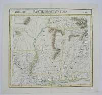
1825Best.-Nr. M4500Brussels 1825. Very Good minor worming on the upper and lower portion of the map along the central fold proficiently repaired. Notes: The first atlas of the world on a uniform scale. If assembled as a globe gores forms a very large globe. Size : 460x495 mm 18.125x19.5 Inches Coloring: Original Outline Coloring Category: Maps United States South Louisiana; Maps United States South States; unknown
1827Best.-Nr. 225532Brussels: Phillippe Marie Vandermaelen 1827. unbound. very good. Map. Large format lithograph with original hand color wash. Image measures 18.25" x 20". Beautiful double page map of New England showing Maine New Hampshire Vermont and parts of New York Massachusetts and Canada. Features counties towns waterways topographical and geographical features population size indicated in pink circles mineral deposits and the area of each state yellow circles. Minor wear to edges light scattered staining and offsetting. Expert repair to chip to bottom centerfold. From Vandermaelen's 6 volume "Atlas universel de geographie physique politique statistique et mineralogique sur l'echelle de 1/16411836" in which each map can be combined as gores to form an immense globe. The atlas was the first to map the world on a uniform scale as well as the first lithographed atlas. Phillippe Marie Vandermaelen unknown
1827Best.-Nr. 278526Brussels: Phillippe Marie Vandermaelen 1827. unbound. Map. Lithograph with original hand outline. Image measures 18.5" x 22.25". Minimal yet beautiful map of east-central portion of the Argentine coast just south of Buenos Aires. Includes notes in French on the capital city. Double page with centerfold. From Vandermaelen's 6 volume "Atlas universel de geographie physique politique statistique et mineralogique sur l'echelle de 1/16411836". Phillippe Marie Vandermaelen 1795-1869 was a Belgian cartographer and publisher. His Atlas universal was both the first lithograph atlas and the first atlas to map the world on a uniform scale. The maps were meant to join together to form a huge globe. This map is a fine example of his work. Phillippe Marie Vandermaelen unknown books
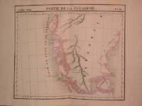
1827Best.-Nr. 204810Brussels: Phillippe Marie Vandermaelen 1827. unbound. very good. Map. Lithograph with original hand outline. Image measures 19" x 22.5". Exquisite map of the southern portion of the continent including the Strait of Magellan and the Andes of Patagonia. Double page with centerfold. From Vandermaelen's 6 volume "Atlas universel de geographie physique politique statistique et mineralogique sur l'echelle de 1/16411836". Can be combined as gores to form an immense globe. The atlas was the first to map the world on a uniform scale. Phillippe Marie Vandermaelen unknown books
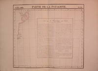
1827Best.-Nr. 204796Brussels: Phillippe Marie Vandermaelen 1827. unbound. very good. Map. Lithograph with original hand outline. Image measures 18.5" x 20.75". Map of St. Joseph's Peninsula known today as the Valdes Peninsula south to Camarones. Includes notes in French on Chile perhaps in reference to an adjacent map. Double page with centerfold. From Vandermaelen's 6 volume "Atlas universel de geographie physique politque statistique et mineralogique sur l'echelle de 1/16411836". Can be combined as gores to form an immense globe. The atlas was the first to map the world on a uniform scale. Phillippe Marie Vandermaelen unknown books
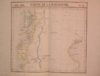
1827Best.-Nr. 204795Brussels: Phillippe Marie Vandermaelen 1827. unbound. very good. Map. Lithograph with original hand outline. Image measures 18.75" x 20.5". Map of southern portion of Argentina and Chile from the Chonos Archipelago and the Golf of Corcouado in the west to the Golfe of St. George in the east. Double page with centerfold. From Vandermaelen's 6 volume "Atlas universel de geographie physique politique statistique et mineralogique sur l'echelle de 1/16411836". Can be combined as gores to form an immense globe. The atlas was the first to map the world on a uniform scale. Phillippe Marie Vandermaelen unknown books
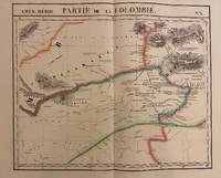
1827Best.-Nr. 302381Brussels: Phillippe Marie Vandermaelen 1827. unbound. Map. Lithograph with original hand outline. Image measures 19" x 22.5". Exquisite map of the Amazon region at the borders of Colombia Venezuela and Brazil. Shows important rivers - Orinoco Guaviare Inirida and Rio Negro. Many native indigenous groups are labeled. Notations on the map describe the terrain the native peoples and colonial activities in the region. Double page with centerfold. From Vandermaelen's 6 volume "Atlas universel de geographie physique politique statistique et mineralogique". Can be combined as gores to form an immense globe. The atlas was the first to map the world on a uniform scale. Phillippe Marie Vandermaelen unknown books
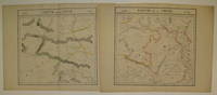
1827Best.-Nr. 220293Brussels: Phillippe Marie Vandermaelen 1827. unbound. very good. Map diptych. Large format lithograph with original hand outline color. Each image measures 18 3/8" x 19 1/8". Beautifully detailed set of two maps of eastern central China including part of Hubei Henan Anhui Jiangsu Shanxi Shandong Gansu Sichuan and Shaanxi provinces. Mountains are delicately treated with hachure marks and major rivers and waterways are also shown. Minor overall toning and a few tears to edges. From Vandermaelen's 6 volume "Atlas universel de geographie physique politique statistique et mineralogique sur l'echelle de 1/16411836". Can be combined as gores to form an immense globe. The atlas was the first to map the world on a uniform scale. Phillippe Marie Vandermaelen unknown books
1827Best.-Nr. 220303Brussels: Phillippe Marie Vandermaelen 1827. unbound. very good. Map set of 4. Large format lithograph with original hand outline color. Each image measures 18.75" x 20 5/8" 18 5/8" x 20 5/8" 18.5" x 20 3/8" Beautifully detailed set of four regional maps of northern China and southern Mongolia. Mountains are delicately treated with hachure marks and major rivers waterways and cities are also shown. Notable inclusions from the west to the east: Plate 44 shows the very northwestern tip of China Xinjiang province and part of south central Mongolia with Lac Nor and Hami. Plate 45 shows the eastern portion of Xinjiang province and western Mongolia with Karakorum called here Karakum the medieval capital of Ghengis Khan and the Mongol Empire. Plate 46 demarcates the tribal regions of Khalkha and Tzakhares Mongolians. Plate 47 shows the western portion of the Wall of China delineating the border between Tartary and China. Some minor offsetting several tears and chips to edges. From Vandermaelen's 6 volume "Atlas universel de geographie physique politique statistique et mineralogique sur l'echelle de 1/16411836". Can be combined as gores to form an immense globe. The atlas was the first to map the world on a uniform scale. Phillippe Marie Vandermaelen unknown books
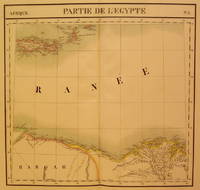
1827Best.-Nr. 202376Brussels: Phillippe Marie Vandermaelen 1827. unbound. very good. Map. Large format lithograph with original hand coloring. Image measures 18.5" x 22.25". North Eastern coast of Africa and the Mediterranean Sea including the northern coast of Egypt the Nile delta and Crete. Double page with centerfold. From Vandermaelen's 6 volume "Atlas universel de geographie physique politique statistique et mineralogique sur l'echelle de 1/16411836". Can be combined as gores to form an immense globe. The atlas was the first to map the world on a uniform scale. Phillippe Marie Vandermaelen unknown books
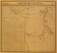
1827Best.-Nr. 202377Brussels: Phillippe Marie Vandermaelen 1827. unbound. very good. Map. Large format lithograph with original hand coloring. Image measures 18.5" x 22.25". Includes northern Egypt and the northern section of the Nile as well as an inset with information on the area. Double page with centerfold. From Vandermaelen's 6 volume "Atlas universel de geographie physique politique statistique et mineralogique sur l'echelle de 1/16411836". Can be combined as gores to form an immense globe. The atlas was the first to map the world on a uniform scale. Phillippe Marie Vandermaelen unknown books
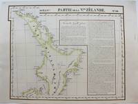
1827Best.-Nr. M9228Brussels: Philippe Vandermaelen c. 1827. Very Good. Notes: A scarce set of maps one showing the north island and the other the south island of New Zealand from the early 19th century. This is considered to be one of the first maps to show New Zealand as the core focus. They do an excellent job of showing detail by having the names of various places showing geographical features and by keeping that same detail in their portrayal of the numerous smaller islands around New Zealand. To further add to the detailed nature of the map there are extensive notes. Measurement for No. 60 is 495x545mm Size : 483x595 mm 19.02x23.43 Inches Coloring: Original Hand Coloring Reference: Phillips 749; Koeman Vdm 1; National Maritime Museum 179; Wellens-De Donder L. Philippe Vandermaelen 1795-1869 4-5. Category: Maps Pacific; Philippe Vandermaelen unknown
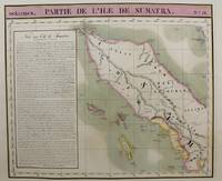
1815Best.-Nr. M9661Brussels c.1815. Very Good. Notes: Map of the northern half of Sumatra from the early 19th century. The map shows topographical features and has a short history of the island . Philippe Vandermaelen 1795-1869 was an eminent Belgian geographer and cartographer famous for having founded the geographical establishment of Brussels. Size : 480x570 mm 18.90x22.44 Inches Coloring: Hand Colored Category: Maps Asia South East Indonesia & Papua New Guinea; unknown
Best.-Nr. 5522Brussels: 1822. No binding. Good. 470 x 550 mm. early outline colour with no folds one or two minor tears in the lower margin repaired otherwise in good condition. It is from Vander Maelen's 'Atlas Universel de Geographie Physique Statistique et Mineralogique'. The atlas was the first published in lithograph and formed a Sanson-Flamsteed projected globe of 7.75 metres in diameter. This was constructed in the 'Etablissement Geographique' in Brussels. A total of 400 maps were produced covering the world on the same scale throughout. Koeman 1967-70 III Vdm 1. 1822 unknown
1827Best.-Nr. 802Brussels: Vandermaelen Phillipe 1827. 20 1/2 x 18 1/2 inches. Very good condition. This map shows the West Coast inward into the Tonto Apache territories. Also shown is the land of the Papagos which also includes western Arizona and southern Arizona. Located on the east side of the map is Tumacacori site of a cluster of mission buildings indicating the long arm of religious colonialism. On the west coast is Cape Loma and San Diego. Above this is San Juan Capistrano located in present day Orange County California. This antique map rare map is an original artifact of a period oof little direct knowledge of the area. Vandermaelen, Phillipe unknown
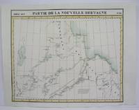
Best.-Nr. M4476Brussels 1825. Excellent. Notes: The first atlas of the world on a uniform scale. If assembled as a globe gores forms a very large globe. Size : 485x579 mm 19.125x22.75 Inches Coloring: Original Outline Coloring Category: Maps Canada North; unknown
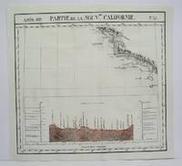
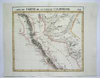
1825Best.-Nr. M4512Brussels 1825. Very Good minor worming on upper and lower portion of the map along the central fold proficiently repaired. Notes: The first atlas of the world on a uniform scale. If assembled as a globe gores forms a very large globe. Size : 460x500 mm 18.125x19.625 Inches Coloring: Original Outline Coloring Category: ; Maps United States West California unknown
1825Best.-Nr. M4513Brussels 1825. Very Good minor worming on upper and lower portion of the map along the central fold proficiently repaired. Notes: The first atlas of the world on a uniform scale. If assembled as a globe gores forms a very large globe. Size : 464x515 mm 18.25x20.25 Inches Coloring: Original Outline Coloring Category: ; Maps United States West California unknown
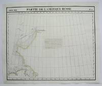
1825Best.-Nr. M4493Brussels 1825. Excellent. Notes: The first atlas of the world on a uniform scale. If assembled as a globe gores forms a very large globe. Size : 483x579 mm 19x22.75 Inches Coloring: Original Outline Coloring Category: Maps Polar Arctic Regions Alaska Greenland Iceland; unknown
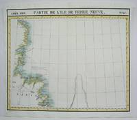
1825Best.-Nr. M4479Brussels 1825. Excellent. Notes: The first atlas of the world on a uniform scale. If assembled as a globe gores forms a very large globe. Size : 475x570 mm 18.75x22.375 Inches Coloring: Original Outline Coloring Category: Maps Canada East Newfoundland unknown
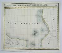
1825Best.-Nr. M4524Brusseld 1825. Very Good minor worming on upper portion of the map along the central fold proficiently repaired. Notes: The first atlas of the world on a uniform scale. If assembled as a globe gores forms a very large globe. This map shows the western shore of Hudson Bay. Nothern Ontario Size : Coloring: Original Outline Coloring Category: Maps Canada Ontario North unknown