ANONYMOUSBiblio.com
263,121 results
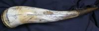
ref. 11029Chicago: c.1830. No binding. Very Good. AN ORIGINAL POWDER HORN WITH THE SECOND EARLIEST KNOWN VIEW OF FORT DEARBORN CHICAGO. An engraved or scrimshawed cow horn using a burin 26 centimetres 10.5 inches long with a maximum circumference of 15 cms. with a cork plug at the base secured by four brass pins one is missing the spout is capped with a later brass sprung cap with a ring for a strap and was worn on the right-hand side. A remarkable evocative powder horn. The horn is engraved with 'A prospect of Fort Deerborne' above which is a map of the Detroit River between Lake Erie and Lake St. Clair. Displaying Fort Detroit 'Sandwych' on the opposing shore and Fort Maldon. It is adorned with a two masted ship the coat of arms for the US Marine Corp and a portrait above. It is highly polished and is quite thin which enabled a finer surface for engraving and indicates that it was used more for ornamental purposes. This reflects its later period when decorated horns are more usually ornamental than functional. It was produced just after the period depicted. POWDER HORNS Powder horns are made from cow or ox horns and were found to be ideal for carrying gunpowder. They were lightweight waterproof plentiful and cheap. To ensure that he received his own horn back went sent for refilling a soldier would often mark his horn in some way to identify it. This could take the form of a mark a name or a more decorated form. The zenith of engraved horns is American from the 1750s through the American Revolution. Whilst some were clearly engraved in Britain the majority were worked on in America. Stephen V. Grancsay curator at the Metropolitan Museum of Art in New York once estimated based on a study of nearly 1200 horns that only about 10-15% could be considered to have been engraved with maps. Most of the horns with maps surviving depict the much travelled and hostile routes between New York and Canada; these being generally the Hudson-Lake Champlain and Hudson-Mohawk River routes. To quote Grancsay 'Horns with maps of New England and of Pennsylvania are much rarer than those with maps of New York'. Here we have one of even further afield. In the eighteenth-century horns were carved using one of two methods. Either the use of a knife like a jackknife which most soldiers would have or a burin graver which is used to push through and gouge out metal or soft material. A knife would displace material to the sides leaving some raised displayed material a graver leaves a trench in the material. The more polished work was often undertaken by gunsmiths or silversmiths. Du Mont stated that 'the finest horns which we term 'professionally' engraved were probably done by army topographical engineers. Soot or a plant dye was often rubbed over the engraved area to enable the carving to stand out more as here. Over time the engraved powder horn became more of an item of ornamentation. This is emphasised by its more highly polished finish. Powder horns were used as long flintlock systems were used for firearms; that is until cap locks widely replaced them in the second quarter of the 19th century. Grancsay's reference work listing 1152 horns identifies a very few depicting Detroit all within a much broader map often extending to the Atlantic coast. None refer to Fort Dearborn. No. 100 – No map a gift from W. Harffy to Tayadenega Captain Joseph Brant Mohawk Chief dated 1789 No. 330 – A map with plans of Forts Pitt and Detroit n.d. No. 1105 – A general map with plan of Fort Detroit No. 1106 – A general map with 4 views including Detroit HISTORICAL CONTEXT Fort Detroit was built by the French in 1701 as a fur trading post. The Treaty of Paris in 1763 formally transferred possession to the British and by the time of the American Revolution it had a population above 2000. Although possession passed to the United States of America following the War of Independence the British remained in control. The Jay Treaty of 1795 settled c.1830 unknown
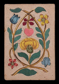
1680ref. 21834Germany c1680. 93 by 65mm. 3.75 by 2.5 inches. A luxury silk and brocade deck 36 playing cards coloured silk and brocade laid between paper. The Maker There is no information on the present deck of cards about its maker but the nature of the materials used demonstrate that he or she must have been working for some extremely wealthy clients. The Cards The present cards are uniquely luxurious each one being comprised of layers of coloured silk and brocade laid between two sheets of paper. The different layers of fabric give the images added depth which reinforces the sense of meticulous craftsmanship. The janiform eagle which had been a symbol of the German emperors since the fifteenth century points towards a German origin for these cards. Indeed Hargrave records another deck of silk trappola cards from the seventeenth century which appear to have been made in Germany. It has been tentatively suggested that hearts represent France with Louis XIV as King; spades Russia with Peter the Great as Tsar - the jack bears the double headed-eagle of the Russian Empire; clubs the Holy Roman Empire with Leopold I as Emperor - he holds a shield bearing the imperial eagle; and diamonds the Ottoman Empire with - possibly - Mehmed IV as Sultan; the jack holds a falcon: falconry was one of the most popular pastimes in the Ottoman court. unknown
ref. TM 466ELEGANT MANUSCRIPT CONTAINING TWO WORKS OF SPIRITUAL AND MORAL EDIFICATION IN FRENCH TRANSLATION. Illuminated manuscript on parchment in French France after 1482 c. 1490. Dimensions 274 x 175 mm. 70 folios written in a Gothic bâtarde bookhand 18 large initials parti-colored in red and/or blue inserted leaf in first quire with FULL-PAGE HERALDIC COMPOSITION IN GOLD SILVER RED BLUE AND BLACK. BINDING: Bound in modern nineteenth-century blue velvet over wooden boards pink paper pastedowns and endleaves edges gilt. TEXT: Manuscript contains two works that reflect the spirituality of fifteenth-century Carthusians and their quest for the contemplative life. The first text Sept fruits de la tribulation is known in only five extant manuscript and is still unedited. A free French version probably dating from the fifteenth century of either the longer Latin Tractatus de tribulacione or an abridged adaptation of the French Livre de tribulacion. The second text Miroir d'or de l'ame pecheresse is a work of spiritual edification which consists of seven sections: on human misery sin especially lechery penance rejection of the world the vanity of human wishes death and hell and heaven. There is neither a modern critical edition of the second text nor a complete census of the existing manuscripts; the copy here was apparently made from an incunable edition of c. 1490. This manuscript begins with a remarkable added full-page illuminated frontispiece with the coat of arms and motto of Louis de Grolée fl. late fifteenth-early sixteenth century the abbot of Bonnevaux and Saint-Pierre de Vienne. PROVENANCE: Copied in France perhaps northeastern based on script and linguistic characteristics as well as internal evidence. It belonged to Louis de Grolée fl. late fifteenth-early sixteenth century. It then belonged Charles Chardin bibliophile. It was later a part of the collection of Sir Thomas Phillipps 1792-1872 who has been described as the greatest private manuscript collector of all time. CONDITION: Gold slightly rubbed some off-setting from heraldic painted composition to opening text page slight staining in upper margin and into three lines of text ff. 68-69. Overall good condition. Full description and pictures available. TM 466
ref. TM 466ELEGANT MANUSCRIPT CONTAINING TWO WORKS OF SPIRITUAL AND MORAL EDIFICATION IN FRENCH TRANSLATION. Illuminated manuscript on parchment in French France after 1482 c. 1490. Dimensions 274 x 175 mm. 70 folios written in a Gothic bâtarde bookhand 18 large initials parti-colored in red and/or blue inserted leaf in first quire with FULL-PAGE HERALDIC COMPOSITION IN GOLD SILVER RED BLUE AND BLACK. BINDING: Bound in modern nineteenth-century blue velvet over wooden boards pink paper pastedowns and endleaves edges gilt. TEXT: Manuscript contains two works that reflect the spirituality of fifteenth-century Carthusians and their quest for the contemplative life. The first text Sept fruits de la tribulation is known in only five extant manuscript and is still unedited. A free French version probably dating from the fifteenth century of either the longer Latin Tractatus de tribulacione or an abridged adaptation of the French Livre de tribulacion. The second text Miroir d'or de l'ame pecheresse is a work of spiritual edification which consists of seven sections: on human misery sin especially lechery penance rejection of the world the vanity of human wishes death and hell and heaven. There is neither a modern critical edition of the second text nor a complete census of the existing manuscripts; the copy here was apparently made from an incunable edition of c. 1490. This manuscript begins with a remarkable added full-page illuminated frontispiece with the coat of arms and motto of Louis de Grolée fl. late fifteenth-early sixteenth century the abbot of Bonnevaux and Saint-Pierre de Vienne. PROVENANCE: Copied in France perhaps northeastern based on script and linguistic characteristics as well as internal evidence. It belonged to Louis de Grolée fl. late fifteenth-early sixteenth century. It then belonged Charles Chardin bibliophile. It was later a part of the collection of Sir Thomas Phillipps 1792-1872 who has been described as the greatest private manuscript collector of all time. CONDITION: Gold slightly rubbed some off-setting from heraldic painted composition to opening text page slight staining in upper margin and into three lines of text ff. 68-69. Overall good condition. Full description and pictures available. TM 466 books
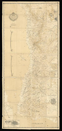
1886ref. 15648Arabia 1886. 2435 by 1085mm. 95.75 by 42.75 inches. Lithograph dissected and mounted on linen in black and brown sea in sepia wash minor spotting or staining occasional wear to edges. A rare Arabic map of the Red Sea and Hejaz region. Despite the key role that the Arabian Peninsula and waters had played in Mediterranean trade for centuries European cartographers historically paid surprisingly little attention to the area. The lack of rivers and waterways made Arabia particularly difficult to chart but the exploration of the sixteenth and seventeenth centuries did see a number of new maps being produced. These however were generally littered with errors which were then compounded as later mapmakers drew on the inaccurate work of their predecessors. The eighteenth and nineteenth centuries however saw the rapid expansion of European empires giving rise to a renewed interest in foreign cultures and religions a trend that came to be known as 'Orientalism'. As a result explorers and cartographers began to venture further into the Arabian Peninsula undertaking expeditions to trace the deep-rooted incense trails and pilgrimage routes to the holy cities of Mecca and Medina. Maps began to appear showing the Hajj routes across the peninsula. After annexing Arabia during the sixteenth century the Ottoman Empire exerted various levels of influence; the emergence of Al Saud in the eighteenth century however introduced a rival power. In 1744 the founder of the dynasty Muhammad bin Saud had joined forces with the Wahhabi religious movement and their alliance soon lead to the rapid expansion of their territories and power. Although the first Saudi state was overcome by Mohammed Ali Pasha the Ottoman viceroy of Egypt in 1818 a second state continued to exist in the eastern region of Nejd. Al Saud rule over the Emirate of Nejd was contested throughout the nineteenth century by the Al Rashid dynasty. This map shows the southern portion of the Red Sea bordered on the east by the Arabian peninsula. The majority of the map is taken up by Hejaz the western region of Arabia where the two Holy Cities of Medina and Mecca are located. From 1845 Hejaz was under the direct control of the Ottomans governed by an appointed official known as the Sharif of Mecca. Ottoman influence persisted in the region until the early twentieth century when a popular revolt ousted them from power. In 1825 it was conquered by Ibn Saud who combined the kingdoms of Hejaz and Nejd in 1932 to form Saudi Arabia. Al Saud now controlled almost the entire Arabian peninsula with the exception of Yemen; Ibn Saud's attempts to claim Yemeni land sparked the war of 1934. Interestingly on the present map there is no national boundary drawn between Hejaz and Yemen probably because they were both subsumed under Ottoman control as part of the Egyptian Eyalet. The inset maps offer more detailed views of important cities and ports with two of the urban views depicting specific buildings and walls. Further inland where there were fewer significant settlements general areas are identified while towards the coast numerous towns rivers islands and harbours are labelled. At the bottom of the map the Horn of Africa is partially visible separated from Yemen by the Bab-el-Mandeb strait. We have been unable to trace any other examples of this map in institutions or at auction. unknown
1834ref. 000044First volume of two 710 p. in later hard cover binding. the most rare and complete edition edited by Abdurrahman al Safti al Sharqawi. vol.1 contains 536 stories. 26.5 x 18 cm. printed in Bulak 1251 1834-1835. Bulak hardcover
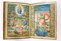
1569ref. 57498s. l. Grenade Granada: S. n. 1569. Fine. S. n. s. l. Grenade Granada 1569 21.50 x 30.50 cm relié ILLUMINATED MANUSCRIPT ANONYMOUS Regla y Constitutiones de la Cofradia del Sanctissimo Sacramento de la Yglesia de San Christoval de Granada Autograph manuscript with three miniatures no publisher Granada 1569 folio 21.5 x 30.5 cm upper margin: 35 mm bottom margin: 50 mm interior margin: 30 mm exterior margin: 40 mm 31 ff. 16th-century full calf gilt Manuscript on vellum comprising 31 leaves: 50 pages of text ruled and lined and 3 full-page miniatures in colours heightened in gold. The four final leaves were numbered and partly ruled but left empty. Contemporary manuscript ex-libris on front endpaper. In Spanish throughout written in Caroline minuscule on 24 lines the text is very readable and very regular. The manuscript begins with a three-page summary covering the 24 chapters that comprise the Regla y constitutiones de la cofradia del Sanctissimo sacramento de la yglesia de San Christoval de Granada. One illuminated capital in red and blue indents and pagination in red small sketch in black ink to the inner margin. The verso of the final page of the summary has been ruled and lined in red but left blank. There follow the three full-page miniatures. The first shows a Communion scene on the recto of one leaf the second the Tree of Jesse verso of the same leaf and the third Saint Christopher bearing the baby Jesus recto of the following leaf. The verso of the miniature bears a short manuscript text explaining that these rules are those of the confraternity and brotherhood of the Holy Sacrament established in the Church of Saint Christopher of Granada on the 1st of May 1568. This is followed by the prohemio a prologue of two and a half pages in which the confraternity takes an oath; this starts with an imposing illuminated capital in red and blue. The chapters then follow on directly each with a tidy initial. The important terms are heightened in red allowing for quick navigation in the text. A long manuscript annotation to the outer margin of leaf 24. The aforementioned rules take up 23 ruled leaves ruled and lined in red. Leaf 27 bears two manuscript privileges. We have not been able to read the signature on the first dated May 1569 though quite elaborate. The second later one May 1596 is signed by Justino Antolinez de Burgos 1557-1637 at the time the Chaplain Royal charged with the inspection of ecclesiastical lodges. Long contemporary manuscript note to reverse of leaf 24. Contemporary light-brown calf spine in five compartments with gilt fillets and fleurons gilt fillet frame to boards small gilt fleurons to corner and a larger gilt fleuron to centre of covers. One clasp preserved. A few very skilful repairs and regilding practically invisible. This manuscript has three spectacular full-page miniatures in gouache heightened in gold. The first shows the Holy Communion with Christ himself establishing the Eucharist with the words This is my body this is my blood. The Apostles and Jesus with a halo blessing them are seated around a table set with bread and fish. This motif became a major theme of Christian art in the Renaissance as this miniature also shows. The second miniature shows the Tree of Jesse which symbolises the genealogy of Christ traced from Jesse Xese shown as an old man reclining. In keeping with the iconographic tradition a tree protrudes from his side the main branches of which bear some of Jesus's ancestors. Here they are: Zachary Jeremiah David an unidentified king and at the pinnacle Mary holding the Christ child within a mandorla. The third miniature presents a scene with Saint Christopher the patron of the Church in Granada to which the Confraternity of the Holy Sacrament was attached with a child on his shoulders as he was commonly represented. The iconography derives from a passage in the Golden Legend in which St Christopher helps a small b S. n. hardcover
1569ref. 57498S. n. | s. l. [Grenade] 1569 | 21.50 x 30.50 cm | relié
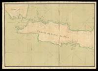
1733ref. 17524Probably Paris: Dépôt des cartes et plans de la Marine c1733-1739. 530 by 1500mm. 20.75 by 59 inches overall. Manuscript chart pen and black ink and colour wash on two separate sheets of paper watermarked with Strasburg Lily within a shield initials "VDL" beneath and countermark "IV" closest to Churchill 405 dated to 1733 from the mill of Pieter van der Ley son of Gerrit Pieters van der Ley who worked De Wever - the Weaver - and De Bonsem - the Polecat - mills at Koog aan de Zaan Holland from 1674 onwards. The conquest of Jakarta by the Dutch who immediately renamed the port Batavia in 1619 gave the VOC its Asian headquarters from which it commanded a vast trading empire eventually extending from southern Africa to Japan that lasted for nearly two hundred years. By the end of the 1730s the British and French had begun to flex their seafaring muscles in the area and were publishing their own maps. This large-scale and detailed French chart of Java is clear evidence of a hostile interest that is directed at the very the heart of the Dutch empire. It is very similar to Francois Valentyn's large chart 'Nieuwe en zeer naaukeurige kaart van t Eyland Java Major of Groot Java' published in his 'Oud en Nieuw Oost-Indien vervattende een Naaukeurige en Uitvoerige Verhandelinge van Nederlands Mogentheyd in die Gewesten' 1724-1726 based on his own research correspondence and from previously unpublished material secured from the VOC officials. Some of this information must also have been available to the Chatelain family who published their 'Carte de l'Ile de Java: Partie Occidentale Partie Orientale.' 1719 which included details of inland topography not found on this manuscript chart nor on Valentyn's. The Chatelain map is avowedly based on Hadriaan Reland's work which was not published by the Dutch until Johannes van Keulen issued it as 'Insulae Iavae pars Occidentalis edente Hadriano Relando' in 1728. Interestingly this manuscript chart includes soundings that are not expressed on the Chatelains' chart implying some more recent knowledge of the coastline. However it does not reflect VOC knowledge of the southern coastline of Java dating from 1739 when Paulus Paulsz. in the sloop de Valk went on a surveying expedition there. His report and much more detailed chart which "remained the best sea chart of this area until the end of the VOC rule" Schilder page 173 survive. In 1513 Francisco Rodrigues sailed with the "Portuguese expedition from Malacca to find the unknown source of the rich trade in nutmeg mace and other spices. They sailed along the north coast of Java a trip from which Rodrigues prepared the first European map of Java's basic outline only of the north coast from direct observation. The Dutch who followed the Portuguese also ignored the interior in their mapping. In 1619 when the VOC established Batavia present-day Jakarta as a trading entrepot the south coast remained relatively unknown: it did not lie on the route to the valuable Molucca Spice Islands. The interior lands away from Batavia were ignored as long as the Javanese kingdoms remained quiescent; the VOC was intent only on ensuring a profitable return for its investors. Pursuit of these immediate economic goals restricted the exploration and associated topographic cartography of Java for nearly a century. A trivial cartographic misunderstanding reveals much about the stagnant state of mapping in Java at that time. The VOC sent Cornelius Coops by ship in 1698 to update the charts of the south coast; until this time charting was largely restricted to the northern coast where the Dutch ports and trading centres were located. Several schematic manuscript maps of the whole island appeared in Isaak de Graaf's 'Atlas Amsterdam' compiled by the VOC at the end of the seventeenth century but not published until the 1980s chiefly showing unnamed rivers and several VOC strongholds in the island's interior. At the beginning of the eighteenth century further mapping of the interior was conducted in a spasmodic and uncoordinated manner. The maps mostly by anonymous cartographers are in manuscript form and are held by the Netherlands National Archives The Hague. They were prepared internally by the VOC as administrative planning and strategic documents for circulation and use by VOC officials. VOC maps were closely guarded trade secrets; however commercial maps of the whole of Java and the neighbouring island of Madura were becoming readily available in Europe by the second decade of the eighteenth century" Simpson. This anonymous manuscript chart was probably prepared by the Dépôt de la Marine known more formally as the Dépôt des cartes et plans de la Marine the central charting institution of France. The centralization of hydrography in France began in earnest when Jean-Baptiste Colbert became First Minister of France in 1661. Under his watch the first Royal School of Hydrography began operating as did the first survey of France's coasts 1670-1689. The Dépôt itself began as the central deposit of charts for the French Navy. In 1720 the Navy consolidated its collection with those government materials covering the colonies creating a single large repository of navigation. By 1737 the Dépôt was creating its own original charts and from 1750 they participated in scientific expeditions to determine the accurate calculation of longitude. In 1773 the Dépôt received a monopoly over the composition production and distribution of navigational materials solidifying their place as the main producer of geographic knowledge in France. Dépôt-approved charts were distributed to official warehouses in port cities and sold by authorized merchants. The charts were of the highest quality as many of France's premier mapmakers worked at the Dépôt in the eighteenth century including Philippe Bauche Jacques-Nicolas Bellin Rigobert Bonne Jean Nicolas Buache and Charles-François Beautemps-Beaupré. The Dépôt continued to operate until 1886 when it became the Naval Hydrographic Service. In 1971 it changed names again this time to the Naval and Oceanographic Service SHOM. Although its name has changed its purpose is largely the same to provide high quality cartographic and scientific information to the France's Navy and merchant marine. Simpson 'Java Emerging Unfolding Cartographic Views' The National Library Magazine December 2010. Dépôt des cartes et plans de la Marine,
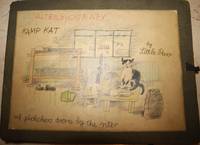
1943ref. 0072801943. Hardcover. Cloth Box. Very Good. Inimitable and disarming tales that represent the pinnacle of outsider art and folk art with the naive drawings richly full of life as they speak of the daily routine at a British army camp during the Second World War from the point-of-view of a camp mascot cat who excels at mangling English in its creative attempts at phonetic spelling. Folios are oblong 41 by 30 cm each. The first folio contains "The Alterbyografy" a 56 pages long unpaginated with 54 illustrations including the folio cover 28 of which are full page 24 of which are half page. The second folio is entitled "Kamp Karacters" . This is 51 leaves with 92 illustrations including the cover 51 of which are full page 40 a third page generally with the area above entirely blank. Illustrations are rendered with colored pencil and crayon. The first manuscript is a continuous narrative of army life its humdrum rhythms and routines its various inanities its social life sports and other activities etc. while the second part is more character sketches. The second folio is even more visually driven than the autobiography. Another distinction between the two is that the autobiography is done with the leaves oblong while the character studies are applied with the leaves vertical. While one part isn't exactly a sequel to the other the two parts are truly complementary. The two folios are of a rough burlap material with a large title sheet mounted on their front cover. The folios have three flap folds to hold the loose sheets in plus ribbon ties on their right sides. hardcover
1943ref. 0072801943. Hardcover. Cloth Box. Very Good. Inimitable and disarming tales that represent the pinnacle of outsider art and folk art with the naive drawings richly full of life as they speak of the daily routine at a British army camp during the Second World War from the point-of-view of a camp mascot cat who excels at mangling English in its creative attempts at phonetic spelling. Folios are oblong 41 by 30 cm each. The first folio contains "The Alterbyografy" a 56 pages long unpaginated with 54 illustrations including the folio cover 28 of which are full page 24 of which are half page. The second folio is entitled "Kamp Karacters" . This is 51 leaves with 92 illustrations including the cover 51 of which are full page 40 a third page generally with the area above entirely blank. Illustrations are rendered with colored pencil and crayon. The first manuscript is a continuous narrative of army life its humdrum rhythms and routines its various inanities its social life sports and other activities etc. while the second part is more character sketches. The second folio is even more visually driven than the autobiography. Another distinction between the two is that the autobiography is done with the leaves oblong while the character studies are applied with the leaves vertical. While one part isn't exactly a sequel to the other the two parts are truly complementary. The two folios are of a rough burlap material with a large title sheet mounted on their front cover. The folios have three flap folds to hold the loose sheets in plus ribbon ties on their right sides. hardcover books
ref. 8510Monumental manuscrit remontant probablement au XVIIIe siècle et représentant la célèbre Danse macabre de Bâle. Lensemble est constitué de 40 vignettes aquarellées en couleurs encadrées sous verre en cinq panneaux en bois, à raison de huit dessins par panneau. Ils ont été composés sur des feuillets en papier gris clair de 150 x 190 mm, collés sur un support en papier bleu turquoise de 220 x 250 mm. Les panneaux, réalisés par Werner R. Knöll, mesurent quant à eux 93,5 x 57 x 15 cm. L'ensemble est généralement en bon état, mais plusieurs feuillets présentent des déchirures ou portent des traces de restauration ancienne. Conformément aux gravures de Merian, les dessins sont distribués de la manière suivante:Panneau 1: LAvertissement du Prédicateur (Der Prediger), La Mort (Der Tod), La Mort au Pape (Der Tod zum Papst), La Mort à lEmpereur (Der Tod zum Kaiser), La Mort à LImpératrice (Der Tod zur Kaiserin), La Mort au Roi (Der Tod zum König), La Mort à la Reine (Der Tod zur Königin), La Mort au Cardinal (Der Tod zum Cardinal)Panneau 2: La Mort à lEvêque (Der Tod zum Bischoff), La Mort au Duc (Der Tod zum Herzog), La Mort à la Duchesse (Der Tod zur Herzogin), La Mort au Comte (Der Tod zum Grafen), La Mort à l'Abbé (Der Tod zum Abt), La Mort au Chevalier (Der Tod zum Ritter), La Mort au Juriste (Der Tod zum Juristen), La Mort au Conseiller (Der Tod zum Rathsherrn)Panneau 3: La Mort au Chanoine (Der Tod zum Chorheern), La Mort au Médecin (Der Tod zum Doctor), La Mort au Gentilhomme (Der Tod zum Edelmann), La Mort à la Dame (Der Tod zur Edelfrauen), La Mort au Marchand (Der Tod zum Kauffmann), La Mort à lAbbesse (Der Tod zur Äbtissin), La Mort au boiteux (Der Tod zum Krüppel), La Mort à lErmite (Der Tod zum Waldbrüder)Panneau 4: La Mort au Jeune Homme (Der Tod zum Jüngling), La Mort à l'Usurier (Der Tod zum Wucherer), La Mort à la Jeune Fille (Der Tod zur Jungfrauen), La Mort au Musicien (Der Tod zum Rirbepfeiffer), La Mort au Héraut (Der Tod zum Herold), La Mort à l'avoyer (Der Tod zum Schultheiss), La Mort au Bourreau (Der Tod zum Blutvogt), La Mort au Bouffon (Der Tod zum Narren)Panneau 5 : La Mort au Mercier (Der Tod zum Krämer), La Mort à lAveugle (Der Tod zum Blinden), La Mort au Juif (Der Tod zum Juden), La Mort au Païen (Der Tod zum Heyden), La Mort à la Païenne (Der Tod zur Heydin), La Mort au cuisinier (Der Tod zum Koch), La Mort au Paysan (Der Tod zum Bauern), Adam et Eve.
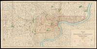
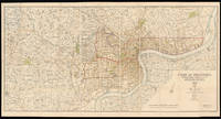
1932ref. 15013Shanghai: Shanghai Municipal Council 27th October 1932. 860 by 1744mm. 33.75 by 68.75 inches. Coloured lithograph map dissected and laid on linen early ownership stamp of "John Pook & Co." in blank area folding into original cloth portfolio lettered in gilt 'General Map of Shanghai 1933' on spine. Acknowledgement is made of information obtained from the French Municipal Council the Shanghai City Government and the Whangpoo Conservancy Board. The map depicts Shanghai city in 1933 however the date printed on the bottom right corner is 27th October 1932. The round shape of the Old city is still clearly visible as in the Plan of Shanghai printed in 1928 it is labelled the "Chinese City" Similarly immediately to the north east and west is the French Concession and further to the north is the International Settlement. It is printed with a legend which includes: villages and developed property; creek; motor road; path and roads; and important buildings. Compared with the Plan of Shanghai printed in 1928 this map has much more information added most notably is that more villages and developed property are marked and identified using the relevant legend. We are only able to trace one other example of this map that in the British Library Map Collection. BL: Cartographic Items Maps X.3743. Shanghai Municipal Council, hardcover
2024ref. Gyan-9788121258883Gyan Publishing House 2024. In 384 Bindings. Hardcover. New. 28.94 x 22.59 x 1524.27 cm. English Gyan Publishing House hardcover
2024ref. Gyan-9788121258883Gyan Publishing House 2024. In 384 Bindings. Hardcover. New. 28.94 x 22.59 x 1524.27 cm. English Gyan Publishing House hardcover
1800ref. 18412c1800. 470mm in diameter. Instruments""Planispherum Lunare A unique manuscript lunar astrolabe Ink and polychromy on paper over pine. The instrument comprises a circular base plate and three rotatable cardboard volvelles and a brass radius pointer attached to each other in the centre. A brass ring is attached to the base plate for suspending. All four paper covered discs are finely inscribed in manuscript with various scales and symbols. Content 1. The smallest volvelle bears a scale covering 12 hours on its outer ring. It also shows the ecliptical motion of the Sun the Moon's orbit the line of nodes and the arguments of latitude in other words the distances from the nodes. 2. On the second volvelle a scale covers the years from 1801 to 1825. each year is subdivided in twelve months with the abbreviated name written for each month. 3. The following volvelle carries a series of scales showing a monthly calendar a zodiac calendar with skilfully drawn pictures and the symbols of the signs. Below the zodiac is a scale for the declination of the sun throughout the year set in four sequences of three. 4. On the outside rim of the volvelle is another calendar scale in which the months are unevenly distributed. This scale presumably was to be used in conjunction with the outer scale on the circular base plate. In addition the volvelle holds two brass studs that most probably helped the user turn the disc to the desired position. This latter scale gives the days subdivided in hours. The days are numbered I to XXXI with the number I coinciding with XXVII and 8 hours the sidereal period of the Moon which results in a double numbering from XXVIII to XXXI. Below this scale for days there is a series of dates all confined to the period 1801 to 1825 presumably for solar eclipses. The brass rule or pointer holds a horizontal scale from 5 to 0 LA-southern declination and from 0 to 5 LB-northern declination indicating the latitude of the moon with respect to the ecliptic. The closer to 0 at new moon or full moon the likelier an eclipse is to occur. The rule is engraved with """"Locus Lunae"""". The circular scales serve to set the moon's position and node relative to the sun from which the user can then infer the lunar phase and whether an eclipse will occur at new moon or full moon. Manuscript instruments of this type are rare especially in such good condition as no other exact copy is recorded to date. Similar instruments were produced at the end of the sixteenth century mostly in brass. Sir Robert Dudley 1573-1649 see item 17 had a lunar calculator made by Charles Whitwell c. 1568-1611 a brass disc of 72 cm diameter overall which was the most complex instrument made during the sixteenth century. Inscribed 'Sir Robert Dudley was the inventor of this instrument' its purpose was to calculate the place of the moon over a period of thirty years. It is now in the Museo di Storia della Scienza in Florence Italy. Another similar paper device was printed with detailed instructions in 1786 in Vlissingen Flushing in the Netherlands advertised as a """"Starkundige Maan-Wyzer en Almanach"""" Astronomical Moon Pointer and Almanac by Henricus Schortinghuis. Oxford Dictionary of National Biography; Webster Roderick and Marjorie 'Western Astrolabes' Adler Planetarium & Astronomy Museum 1998; Museo di Storia della Scienza Florence Italy unknown
1913ref. 15014Shanghai: North-China Daily News & Herald Limited 1st June 1913. 735 by 1510mm. 29 by 59.5 inches. A large English map of Shanghai dissected in 40 4 by 10 sections and mounted on linen folding map. Oriented with north towards the upper right. Top left includes an inset of "plan shewing the rubicon road system". Signed by Engineer and Surveyor. The North-China Daily News was an English-language newspaper in Shanghai China the most influential foreign newspaper of its time. The paper was founded as the weekly North-China Herald and was first published on 3 August 1850. Its founder British auctioneer Henry Shearman died in 1856. North-China Daily News & Herald Limited, unknown
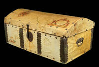
1690ref. 2196Spain c1690. 320 by 740mm. 12.5 by 29.25 inches. Wooden chest clad in vellum manuscript maps with wrought iron handles rivets lock and clasp. A very unusual piece of cartographic history. It was common for seafarers to have sturdy wooden chests for storage whilst on a voyage but the owner of this chest chose to have it covered it with manuscript maps drawn on vellum possibly by their own hand with the decorative ironwork fitted on top. The lid is covered with a map of North and Central America with the Darien Isthmus labelled to the south and decorated with an elaborate compass rose and title cartouche supported by figures of Native Americans. The map on the front is decorated with a title cartouche showing a sea god. The sides are covered with maps of the East and West Indies decorated with ships. It is remarkable that the maps have survived given the treatment they would have encountered at sea. hardcover
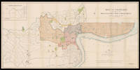
1928ref. 15011London: Standford's Geog.l Establishment London 21st April 1928. 880 by 1660mm. 34.75 by 65.25 inches. A large coloured lithographed map showing the plan of Shanghai made in 1928. Signed by Commissioner of public works 44 4 by 11 sheets mounted on linen. The map depicts Shanghai city in 1928 with the French Settlements and Shanghai International Settlements hand-coloured in outline in brown and pink. Two lines noted below the title: 1. The Pootung shore is taken from surveys by the Whangpoo Conservancy Board. 2. The French settlement is taken from surveys by the French Municipal Council. The famous Whangpoo Huangpu river in Shanghai is prominently shown from the midpoint of the bottom edge sinuating upwards to the top right corner which divides the settlements to the left and Pootung Pudong to the right. Between the bank of the river and the French settlement are the 'Chinese city' and a district labeled 'Nan Tao' Nan Dao. The "Chinese city" is now called the "Old City" the traditional urban core of Shanghai. Its boundary was formerly defined by a defensive wall. The Old City was the county seat for the old county of Shanghai with the advent of foreign concessions in Shanghai it became just one part of Shanghai's urban core but continued for decades to be the seat of the Chinese authority in Shanghai. It was essentially coterminous with the old Nanshi District - Nan Dao which is now part of Huangpu District. In 1927 in a bid to establish a tangible Chinese authority in Shanghai the Republic of China government established the Special Municipality of Shanghai. The municipal government was moved out of the Old City to near Xujiahui. In 1928 Shanghai City the Old City was reduced to district status under the Special Municipality. In 1930 Shanghai County became a separate parallel administrative unit to the Special Municipality and the county government was moved out to Minhang. This was the end of the Old City's role as the seat of government of Shanghai. From 1928 the Old City was Hunan District; 'Hunan' literally meant 'southern Shanghai'. An exact copy of the map dated to the same day 21st April 1928 was published in Shanghai North-China Daily News and Herald Limited. by permission of the Municipal. It is signed by the same commissioner of public works. We are only aware of a single surviving example that in the Library of Congress Geography and Map Division Washington D.C. Publisher Edward Stanford 1827-1904 rose to prominence during the height of the Victorian age a period defined by technological innovation social upheaval literary excellence and world exploration. In 1853 Stanford became sole proprietor and expanded his shop to 7 and 8 Charing Cross whilst acquiring premises on Trinity Place for a printing works. This solidified Stanford's as the largest and only map maker and seller in London at a time when British colonialism the rise of the railways and the continuing popularity of the Grand Tour. Edward Stanford II took over in 1882 when Stanford's had become the sole agents for Ordnance Survey Maps in England and Wales and in 1887 published Stanford's London Atlas Of Universal Geography dedicated to Queen Victoria on the occasion of her Royal Jubilee and he received his royal warrant as Cartographer to the Queen in 1893. Edward Stanford II died in 1917 and his son Edward Fraser Stanford assumed control of the business in 1917. This map was made in the succeeding period between the wars which saw the company continue to innovate and encourage exploration. Standford's Geog.l Establishment, London, unknown
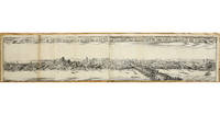
ref. 10469London: 1666. No binding. Good. A TOTALLY UNRECORDED PANORAMA OF THE AFTERMATH OF THE GREAT FIRE OF LONDON. 140 x 665 mm. two sheets joined trimmed from a lower panorama small paper hole on right side otherwise in good condition. A TOTALLY UNRECORDED PANORAMA OF THE AFTERMATH OF THE GREAT FIRE OF LONDON. This engraving is undoubtedly drawn from that of Wenceslaus Hollar 1607-77 published late in 1666. That work records London before and after the Great Fire of 1666. It takes in London from Temple Church just below Fleet Street to the Tower of London and is taken from the perspective of the steeple of Southwark Cathedral which at the time was known as the church of St. Mary Overy. Within just a couple of months of the fire the print was available. Samuel Pepys 1633-1703 records in his diary for 22 November 1666: 'Up and to the office where we sat all the morning and my Lord Bruncker did show me Hollar's new print of the City with a pretty representation of that part which is burnt very fine indeed; and tells me that he was yesterday sworn the King's servant and that the King hath commanded him to go on with his great map of the City which he was upon before the City was burned'. It was sold by John Overton 1640-1713 who had only been made free in 1663 and acquired Peter Stent's stock in 1665. The Hollar print is extremely rare only one example has been seen at auction in twenty-three years at Christie's New York 29 January 2019 where it fetched $32500. We had an example in 2022. This engraving is entirely unknown. The engraver and publisher are unidentified. Closer examination reveals that a second panorama like the Hollar was below this one. The images are here reversed with that of the aftermath being depicted on top. It is reasonable to presume that this engraving was issued shortly after that of Hollar to meet the demand. The most likely candidates are Thomas Jenner fl.1621-72 or Robert Walton 1618-88 both active printsellers. The lack of an imprint might be explained by its possible presence on the lower half let us hope one is discovered some day. Further evidence might come to light by a study of the keyed numbers on the plate. They do not match any plan of London of the period or pagination to any book we can think of. Closer examination of the view reveals the level of devastation caused. The fire lasted 4 days and consumed 436 acres 13200 houses and 87 churches including St. Paul's Cathedral. Contemporary accounts relate that only church spires and chimney stacks seem to have survived. John Evelyn 1620-1706 wrote in his diary on the 3 September describing London the day after it started as: 'a resemblance of Sodome or the last day. It call'd to mind that of 4 Heb: non enim hic habemus stabilem Civitatem; the ruines resembling the picture of Troy. London was but is no more' On 7 September 1666 the day after the fire ended he walked through the city and reported his hair almost singed: 'I went this morning on foote from White hall as far as London bridge … with extraordinary difficulty clambring over mountaines of yet smoking rubbish & frequently mistaking where I was the ground under my feete so hott as made me not onely Sweate but even burnt the soles of my shoes'. As in interesting aside utilising the current average price of a London house the fire destroyed £7.5 billion worth of housing. Working on the idea that it destroyed a quarter of the housing stock in London at the time the economic impact of that today would be a loss of £500 billion worth 'Actuarial Post' accessed 2022. Provenance: Burden collection since the 1970s. Evelyn's diary https://www.pepysdiary.com/indepth/2009/09/02/evelyns-fire/; Griffiths & Kesnerová 1983 p. 64 no. 113 Hollar ill.; not in Hind 1922; ODNB; Pennington 1982 1015.3 Hollar; Pepys diary https://www.pepysdiary.com/diary; not in Scouloudi 1953 refer pp. 81-2; Worms & Baynton-Williams 2011. 1666
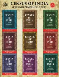
2024ref. BIBHB0334000512024. Hardcover. New. Due to the very old age and scarcity of this book some pages are missing and may be hard to read due to the blurring of the original text. The Title 'Census of India 1871-1951 written/authored/edited by Anonymous' published in the year 2024. The ISBN 9788121258883 is assigned to the Hardcover version of this title. This book has total of pp. 152427 Pages. The publisher of this title is Gyan Publishing House. This Book is in English. The subject of this book is History Census India. Size of the book is 22.59 x 28.94 cms Vol: Volume In 384 Bindings hardcover
2024ref. Gyan-9788121258876Gyan Publishing House 2024. In 384 Bindings. Paperback. New. x x 1066.989 cm. English Gyan Publishing House paperback
2024ref. Gyan-9788121258876Gyan Publishing House 2024. In 384 Bindings. Paperback. New. x x 1066.989 cm. English Gyan Publishing House paperback
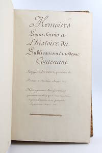
1750ref. 78168s. l. 1750. Fine. s. l. 1750 23 x 38 cm 2 manuscrits reliés en un volume Manuscript entitled Mémoires pour servir à l'histoire du publicanisme moderne contenant l'origine les noms qualités le portrait et l'histoire abrégée de nosseigneurs les fermiers généraux du Roy qui se sont succédés depuis l'année 1720 jusqu'à la présente année 1750 with Mémoires pour servir à l'histoire du publicanisme ou l'Origine des receveurs généraux des finances du royaume 1750 folio 23 x 38 cm 330 pp 4 p. bl. 8 p. 4 p. bl. 83 pp. contemporary full calf Important and long manuscript composed of two parts written by two different hands retracing in total 160 biographies of the Fermiers Généraux active between 1720 and 1750 lavish and unpopular collectors of indirect taxes in the Ancien Régime. Each of the parts also contains a very useful index. The entries with the exception of 19 of them are all decorated with a coat of arms drawn in pencil painted by hand in colour and sometimes enhanced with gold or silver. Some modern notes some juicy in pencil in the margin of certain leaves. These memoirs have never been the object of a publication and we know of only a few handwritten copies with varying texts. The other examples that we have been able to find including the one digitised by the French National Library contain fewer biographies that ours and are not illustrated. Contemporary binding in full blond marbled calf title pieces in black and red morocco. Joints top of the first board and spine head repaired joints of the first board split but solid scratches on the boards corners damaged. A very beautiful manuscript richly painted retracing the history of the most despised institution of the Ancien Régime. Provenance: library of Count Chandon de Briailles descendent of the founders of the famous house of Champagne then of the Michel de Bry library with its motto Pro captu lectoris with their ex-libris glued to the first endpapers. hardcover
ref. 21691Grenoble Chez Philippes Charvys 1671 in 16 (14,5x8) 1 volume reliure pleine basane fauve granitée de l'époque, dos à nerfs orné, caissons dorés avec fleurons central, titre, 5 faux-feuillets non chiffrés et 135 pages et 3 faux-feuillets non chiffrés. Garrison-Morton, 6491.9; Krivatsy, 10856. Très rare première édition (First edition). Bel exemplaire (Good copy) ( Photographies sur demande / We can send pictures of this book on simple request )