M Hurst, A Heywood (publishers).Biblio.com
6217 resultados
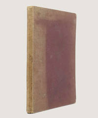
1877ref. 15283Sheffield & London M. Hurst; A. Heywood 1877-78. 1877. A COMPLETE RUN of 29 issues in 3 volumes bound as one. Quarto pp. 2 96; 2 96; 40 plus photograph portrait of football and cricket players mounted to title-page of each issue photographic frontispiece to volume 1 and 2 so 31 photographs in total. Contemporary morocco-grain maroon cloth; edges sprinkled red; white end-papers. Cloth faded to spine and upper board; corners bumped and rubbed; a few nicks to head of upper board. Very occasional spotting the Lilywhite portrait underdeveloped but otherwise internally rather clean. A very good copy. The complete run of a very early and exceedingly rare cricket and football magazine which includes match reports articles wood-engraved comics advertisements for sporting paraphernalia and portraits of famous sportsmen. The woodburytypes mounted to the title-page of each issue were also advertised for sale mounted as cards and are examples of some of the earliest football and sporting cards. The portraits include A. N. 'Monkey' Hornby who joined Blackburn Rovers in 1878; George Ulyett who played in goal for Sheffield Wednesday in 1883-84; Alfred Shaw who was both a cricketer and rugby footballer; the champion cyclist John Keen then fastest man in the world and cricketers such as W. G. Grace and James Lillywhite. The team portrait of the Sheffield Wednesday Football Club Cup Team shows the team just nine years after the club was founded in 1867 and includes James Lang the Scottish player who was arguably the first professional footballer in England. Complete runs of this short-lived periodical with every woodburytype are exceptionally difficult to find advertisements within the later volumes even acknowledge the scarcity of the publication. Jisc the union catalogue of over 100 major libraries across the UK and Ireland locates three copies of individual issues of the magazine only and in 1906 A. D. Taylor wrote that "Vols. I and 2 can frequently be met with at bookstalls but the odd five numbers in the final vol. are difficult to obtain making the complete set somewhat valuable". Taylor The Catalogue Of Cricket Literature p. 4. Sheffield & London, M. Hurst; A. Heywood, 1877-78. hardcover
1982ref. ZB393193Applied Science Publishers 1982-1988. Volumes 2-9 11-15; mostly in original paper wrappers price is for the lot. - If you are reading this this item is actually physically in our stock and ready for shipment once ordered. We are not bookjackers. Buyer is responsible for any additional duties taxes or fees required by recipient's country. Photos available upon request. Applied Science Publishers unknown
1970ref. ZB393567Applied Science Publishers 1970-93. volumes 1-63 complete volumes lacking vol. 38 partly bound ex library; PRICE IS FOR THE LOT. - If you are reading this this item is actually physically in our stock and ready for shipment once ordered. We are not bookjackers. Buyer is responsible for any additional duties taxes or fees required by recipient's country. Photos available upon request. Applied Science Publishers unknown
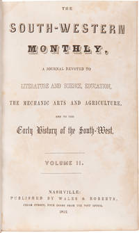
1852ref. WRCAM16070Nashville 1852. Two volumes. viii374 i.e. 376; vii376pp. plus thirty-one plates. Later three-quarter black morocco and cloth spines gilt. Corners lightly worn. Ownership inscription on verso of each frontispiece bookplate on rear pastedowns. First volume with ink stamp on pastedown and titlepage. Lightly foxed. Some light wear and soiling. Very good. A very rare complete set of this interesting and important Tennessee periodical containing all twelve articles entitled "Early History of the Southwest" which constitute the main interest of the magazine for modern readers. After the magazine ceased publication with the December 1852 issue the editors followed their intention stated in their last editorial and gathered all of the narratives into a book issued in January 1853 entitled INDIAN BATTLES MURDERS SEIGES sic AND FORAYS IN THE SOUTH- WEST. ".This was a collection of narratives by various authors. These had appeared separately as articles in the SOUTH WESTERN MONTHLY MAGAZINE printed in Nashville during the years 1851-52. The magazines are considered frontier periodicals of extreme rarity - the 1853 book.is all but unobtainable. Apparently few copies of the book were printed judging from the very few times one finds records of its sale." - Allen. The actual first appearances in print of all of the items in the book are the periodical versions. Articles include "Sketch of the Captivity of Col. Joseph Brown" "The Indian Massacres in the Vicinity of Bosley's Spring." "Indian Murders around Nashville - Narrative of John Davis Esq." "Scalping of Thomas Everett and his two sisters near Buchanan's Fort." "Indian Battles and Murders - Narrative of General Hall" "Perils attending emigration from Virginia to the West.burning of Sigler's Fort. Narrative of John Carr" "The levy of men sent out from North Carolina.narrative of Mr. Samuel Blair" "Narrative of John Rains" "Massacre at Cavet's Station." Virtually all of the narratives describe Indian fights in Tennessee between the 1780s and the War of 1812. An important rarity of Indian warfare on the Old Southwest frontier. This set has a remarkably large number of plates; other sets we know of have far fewer. All seem to be remainders from New York publications used as illustrations without regard to text. HOWES W30 ref. ALLEN RARITIES 47. ALLEN IMPRINTS 3160. hardcover books
1852ref. 16070Nashville. 1852. Extremely Rare: A Remarkable Collection of Narratives A very rare complete set of this interesting and important Tennessee periodical containing all twelve articles entitled "Early History of the Southwest" which constitute the main interest of the magazine for modern readers. After the magazine ceased publication with the December 1852 issue the editors followed their intention stated in their last editorial and gathered all of the narratives into a book issued in January 1853 entitled INDIAN BATTLES MURDERS SEIGES sic AND FORAYS IN THE SOUTH-WEST. ".This was a collection of narratives by various authors. These had appeared separately as articles in the SOUTH WESTERN MONTHLY MAGAZINE printed in Nashville during the years 1851-52. The magazines are considered frontier periodicals of extreme rarity - the 1853 book.is all but unobtainable. Apparently few copies of the book were printed judging from the very few times one finds records of its sale." - Allen. The actual first appearances in print of all of the items in the book are the periodical versions. Articles include "Sketch of the Captivity of Col. Joseph Brown" "The Indian Massacres in the Vicinity of Bosley's Spring." "Indian Murders around Nashville - Narrative of John Davis Esq." "Scalping of Thomas Everett and his two sisters near Buchanan's Fort." "Indian Battles and Murders - Narrative of General Hall" "Perils attending emigration from Virginia to the West.burning of Sigler's Fort. Narrative of John Carr" "The levy of men sent out from North Carolina.narrative of Mr. Samuel Blair" "Narrative of John Rains" "Massacre at Cavet's Station." Virtually all of the narratives describe Indian fights in Tennessee between the 1780s and the War of 1812. An important rarity of warfare on the Old Southwest frontier. This set has a remarkably large number of plates; other sets we know of have far fewer. All seem to be remainders from New York publications used as illustrations without regard to text. Later three-quarter black morocco and cloth spines gilt with raised bands. Light rubbing and wear especially to edges and corners head of spine on second volume chipping slightly. Ownership inscription on verso of each frontispiece bookplate on rear pastedowns. First volume with ink stamp on pastedown and titlepage. Lightly foxed. Some light wear and soiling. Very good. HOWES W30 ref. ALLEN RARITIES 47. ALLEN IMPRINTS 3160. hardcover
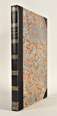
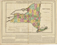
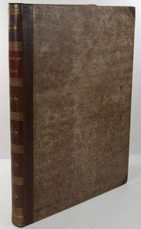
1827ref. 29764Philadelphia: H.C. Carey & I. Lea 1827. Folio. Mounted on guards throughout. Letterpress title copyright notice on verso 1p. "Advertisement" to Third Edition dated "January 1827" verso blank 1p. "Contents" and "Index" verso blank plus forty-six double-page handcolored copper engraved maps most with descriptive letterpress in margins and many with supplementary text pages following; one double-page engraved plate of mountains uncolored; and one double-page colored plate of river lengths. Titlepage remargined minor foxing some faint staining along bottom edge. Later 19th-century three-quarter calf and original plain paper boards later gilt morocco label. Boards slightly rubbed. One of the most important early atlases printed in the United States: a handsome atlas of the Americas with individual colour maps of each state in the Union including a seminal map of the West by Stephen H. Long. At the time of publication this was the best and most detailed atlas to be produced in the United States. Fielding Lucas the major Baltimore printer was the principal engraver and substantial historical background text accompanies each map. Among the most noted maps in the atlas is Major Stephen H. Long's "Map of Arkansa and other Territories of the United States." That map which depicts the Missouri basin between Nashville in the east the Mandan villages in the north and the Rocky Mountains in the west was based on the surveys conducted by Long on his expeditions of 1819 and 1820. On this famous map is the printed legend which would perpetuate a myth for many years to come identifying the high plains as the "Great American Desert." The 1827 edition "Third edition Corrected and Improved" of Carey & Lea's historic atlas first published in 1822 includes much new material with all the maps and text updated except for the Washington D.C. and Michigan maps. This was the first American atlas that was modeled on Le Sage's plan of having explanatory text surrounding the maps. The maps for the most part by Fielding Lucas are beautifully drawn and colored. Howes C133 "aa"; Phillips 1373a; Sabin 15055; Wheat Transmississippi West 348 and 352. H.C. Carey & I. Lea unknown books
1823ref. WRCAM43415APhiladelphia: H.C. Carey & I. Lea 1823. Letterpress title copyright notice on verso 1p. advertisement verso blank 1p. table of contents verso blank. Forty-six double-page handcolored engraved maps of the United States all but one with borders of letterpress descriptive text; uncolored double-page engraved view showing the comparative heights of mountains throughout the world; handcolored double-page engraved table showing the comparative lengths of the principal rivers worldwide; five letterpress tables four double-page three of these handcolored; 18pp. of letterpress text. Mounted on guards throughout. Modern half calf and marbled boards spine gilt leather label. Dampstaining along lower edge causing chipping to initial leaves. Closed tear in bottom margin of first map repaired with tissue. Very light offsetting from maps. Some dust soiling light tanning and foxing. Good plus. A handsome atlas of the Americas with individual color maps of each state in the Union including a seminal map of the West by Stephen H. Long. At the time of publication this was the best and most detailed atlas to be produced in the United States with substantial historical background text accompanying each map. Fielding Lucas the major Baltimore printer was the principal engraver. Among the most noted maps in the atlas is Major Stephen H. Long's "Map of Arkansa and other Territories of the United States." That map which depicts the Missouri basin between Nashville in the east the Mandan villages in the north and the Rocky Mountains in the west was based on the surveys conducted by Long on his expeditions of 1819 and 1820. The map published in Carey & Lea's atlas preceded the official account of that expedition by expedition botanist Edwin James which includes a smaller map with similar detail titled "Country drained by the Mississippi Western Section." Carey & Lea's 1823 publication of James' ACCOUNT perhaps explains the prior inclusion of this map with Long expedition information in their atlas. On this famous map is the printed legend which would perpetuate a myth for many years to come identifying the high plains as the "Great American Desert." Carey & Lea's atlas was first issued in 1822; this is the second issue with revised states of three maps Maine North Carolina and Louisiana with the same printing of the remaining maps and a cancel title. HOWES C133 "aa." PHILLIPS ATLASES 1373a. SABIN 15055. WHEAT TRANSMISSISSIPPI 348 352. H.C. Carey & I. Lea hardcover books
1823ref. 58505Philadelphia: H.C. Carey & I. Lea 1823. One of the Most Important Early Atlases Printed in the United States A handsome atlas of the Americas with individual color maps of each state in the Union including a seminal map of the West by Stephen H. Long. At the time of publication this was the best and most detailed atlas to be produced in the United States with substantial historical background text accompanying each map. Fielding Lucas the major Baltimore printer was the principal engraver. Among the most noted maps in the atlas is Major Stephen H. Long's "Map of Arkansa and other Territories of the United States." That map which depicts the Missouri basin between Nashville in the east the Mandan villages in the north and the Rocky Mountains in the west was based on the surveys conducted by Long on his expeditions of 1819 and 1820. The map published in Carey & Lea's atlas preceded the official account of that expedition by expedition botanist Edwin James which includes a smaller map with similar detail titled "Country drained by the Mississippi Western Section." Carey & Lea's 1823 publication of James' Account perhaps explains the prior inclusion of this map with Long expedition information in their atlas. On this famous map is the printed legend which would perpetuate a myth for many years to come identifying the high plains as the "Great American Desert." Carey & Lea's atlas was first issued in 1822; this is the second issue with revised states of three maps Maine North Carolina and Louisiana with the same printing of the remaining maps and a cancel title. Letterpress title copyright notice on verso 1p. advertisement verso blank 1p. table of contents verso blank. Forty-six double-page handcolored engraved maps of the United States all but one with borders of letterpress descriptive text; uncolored double-page engraved view showing the comparative heights of mountains throughout the world; handcolored double-page engraved table showing the comparative lengths of the principal rivers worldwide; five letterpress tables four double-page three of these handcolored; 18pp. of letterpress text. Mounted on guards throughout. Modern half calf and marbled boards spine gilt leather label. Dampstaining along lower edge causing chipping to initial leaves. Closed tear in bottom margin of first map repaired with tissue. Very light offsetting from maps. Some dust soiling light tanning and foxing. Good plus. HOWES C133 "aa." PHILLIPS ATLASES 1373a. SABIN 15055. WHEAT TRANSMISSISSIPPI 348 352. hardcover
1823ref. 25085Philadelphia: H.C. Carey & I. Lea 1823. Folio. 17 1/2 x 11 7/8 inches. Mounted on guards throughout letterpress title copyright notice on verso 1p. Advertisement verso blank 1p. Contents verso blank 46 double-page hand-coloured engraved maps of the United States all but one with borders of letterpress descriptive text 1 uncoloured double-page engraved view showing the comparative heights of mountains throughout the world 1 hand-coloured double-page engraved table showing the comparative lengths of the principal rivers worldwide 5 letterpress tables 4 double-page 3 of these hand-coloured 18pp. of letterpress text. Expertly bound to style in half calf over contemporary marbled paper covered boards flat spine in six compartments divided by gilt roll tools red morocco label in the second compartment the others with a repeat decoration in gilt. One of the most important early atlases printed in the United States: a handsome atlas of the Americas with individual colour maps of each state in the Union including a seminal map of the West by Stephen H. Long. At the time of publication this was the best and most detailed atlas to be produced in the United States. Fielding Lucas the major Baltimore printer was the principal engraver and substantial historical background text accompanies each map. Among the most noted maps in the atlas is Major Stephen H. Long's "Map of Arkansa and other Territories of the United States." That map which depicts the Missouri basin between Nashville in the east the Mandan villages in the north and the Rocky Mountains in the west was based on the surveys conducted by Long on his expeditions of 1819 and 1820. The map published in Carey & Lea's atlas preceded the official account of that expedition by expedition botanist Edwin James which included a smaller map with similar detail titled "Country drained by the Mississippi Western Section". Carey and Lea's 1823 publication of James Account perhaps explains the prior inclusion of this map with Long expedition information in their atlas. On this famous map is the printed legend which would perpetuate a myth for many years to come identifying the high plains as the "Great American Desert." Carey and Lea's atlas was first issued in 1822; this is the 1823 second issue substantially the same as the first but with a new title and revised states of several maps and text leaves generally minor revisions including additional shading to maps and improved resetting of several text leaves though this copy with first state settings of the Maryland and Virginia text leaves. Howes C133 "aa"; Phillips 1373a; Sabin 15055; Wheat Transmississippi West 348 and 352. H.C. Carey & I. Lea unknown books
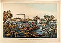
1868ref. 20565New York: Currier & Ives 1868. Hand-coloured lithograph by James Merrit Ives after Fanny Palmer. A poignant image demonstrating the triumph of the human spirit and depicting the twin stack steam paddle wheel and riverboat "Stonewall Jackson." In the foreground uprooted trees bob in the current using a roof as a raft two men pole themselves and nine others to safety one of their companions holds tight to reins of a mule swimming beside the roof whilst two others rescue furniture and a barrel. In the mid-ground: a large white-painted house with second-floor balconies front and back and a smaller cook-house off to the right side. Two men in a row boat approach the back of the house a lady stands on the balcony speaking to the men; on the widow's walk on the roof a man and a woman stand: the man waves a handkerchief to the twin-stack riverboat. The riverboat "Stonewall Jackson" is travelling at speed: the near-side paddle creates a substantial wake the flags fly in the stiff breeze and the smoke from the stacks steams backwards: passengers line the rails attracted by the human drama they are passing. The overall impression is of a crisis that is being survived and dealt with by man's ingenuity whilst life continues. Conningham 2819; Gale 3057. Currier & Ives unknown books
1776ref. 23542London: Printed for R. Sayer and J. Bennet 1776. Octavo. 10 5/8 x 8 1/4 inches. Letterpress text: title verso blank 2pp. dedication to 'Gov. Pownall' 2pp. 'Advertisement' 1p. 'List of maps' verso blank. 6 folding engraved maps all hand-coloured in outline all cut into sections hinged with linen and folded. Large triangle from upper outer corner of dedication leaf torn away without affecting the text. Expertly bound to style in 18th-century half russia over contemporary marbled paper-covered boards spine ruled in gilt in compartments lettered direct in the second compartment the others with a repeat decoration in gilt The Holster Atlas: one of the most important atlases of the American Revolution designed for use in the field. The Holster Atlas was issued at the suggestion of Governor George Pownall and included the "maps that the British high command regarded as providing essential topographical information in the most convenient form" Schwartz & Ehrenberg. This collection of maps was published by Sayer and Bennet at the beginning of the Revolution for the use of British officers. "Surveys and Topographical Charts being fit only for a Library such maps as an Officer may take with him into the Field have been much wanted. The following Collection forms a Portable Atlas of North America calculated in its Bulk and Price to suit the Pockets of Officers of all Ranks" Advertisement. Although the publishers claimed the atlas would fit into an officer's pocket it was more usually carried in a holster and thus gained its nick-name. The six maps are as follows: 1. DUNN Samuel. 'North America as divided amongst the European Powers. By Samuel Dunn Mathematician London: printed for Robt. Sayer 10 Jany. 1774.' Engraved map hand-coloured in outline in six unequal sections sheet size: 13 3/4 x 19 inches. Engraved for Dunn's 'A New Atlas' London: 1774. 2. DUNN Samuel. 'A compleat map of the West Indies containing the coasts of Florida Louisiana New Spain and Terra Firma: with all the islands.' London: Robt. Sayer 10 January 1774. Engraved map hand-coloured in outline in six unequal sections sheet size: 13 1/8 x 19 inches. Engraved for Dunn's 'A New Atlas' London: 1774. The 'Advertisement' describes these first two maps as 'a general map of the part of the globe called North America and a second general map of those islands shores gulfs and bays which form what is commonly called the West Indies; these we consider as introductory and as giving a general idea and we trust a just one.' 3. 'A general map of the Northern British Colonies in America. which comprehends the Province of Quebec the Government of Newfoundland Nova-Scotia New-England and New-York. from the maps published by the Admiralty and Board of Trade Regulated by the astronomic and trigonometric observations of Major Holland and corrected from Governor Pownall's late Map 1776. London: Robt. Sayer & Jno. Bennet 14 August 1776.' Engraved map hand-coloured in outline in eight unequal sections sheet size: 20 1/2 x 27 1/2 inches. First state also issued as a separate map. This map was re-issued in 1788 with the title changed to reflect the new political realities. McCorkle New England 776.11; Sellers & Van Ee 143; Stevens & Tree 65 4. EVANS Lewis. 'A general map of the Middle British Colonies in America. containing Virginia Maryland the Delaware Counties Pennsylvania and New Jersey. With the addition of New York and the greatest part of New England as also of the bordering parts of the Province of Quebec improved from several surveys made after the late war and corrected from Governor Pownall's late Map 1776. London: R. Sayer & J. Bennet 15 October 1776.' Engraved map hand-coloured in outline in eight unequal sections sheet size: 20 1/4 x 27 3/4 inches. Based on Lewis Evans' map of 1755 with additions and corrections. Cf. Stephenson & McKee Virginia p.82 an image of the Evans map 5. ROMANS Bernard. 'A general map of the Southern British Colonies in America. comprehending North and South Carolina Georgia East and West Florida with the neighbouring Indian countries. From the modern surveys of Engineer de Brahm Capt. Collet Mouzon & others; and from the large hydrographical survey of the coasts of East and West Florida. By B. Romans. London: R.Sayer & J. Bennett sic. 15 Octr. 1776.' Engraved map hand-coloured in outline eight unequal sections sheet size: 20 3/4 x 27 inches. Based on charts and maps by Roman and others. 6. BRASSIER William Furness 1745-1772. 'A Survey of Lake Champlain including Lake George Crown Point and St. John Surveyed by order of . Sr. Jeffery Amherst . by William Brassier draughtsman. 1762. London: Robt. Sayer & Jno. Bennet 5 Aug. 1776.' Engraved map hand-coloured in outline on eight unequal panels 27 3/4 x 20 3/8 inches. Also issued as the first separately published map of Lake Champlain this excellent detailed chart was based on a survey made during the French and Indian War but not published until the Revolution. Included is an inset illustrating America's first naval battle in which General Benedict Arnold though forced back down the lake was able to delay the British attempt to descend to the Hudson for that year. No mention of course is made of Ethan Allen's taking of Fort Ticonderoga in 1775. Fite & Freeman A Book of Old Maps pp.212-216; Howes A208; Nebenzahl Atlas of the American Revolution pp.61-63; Phillips Atlases 1206; Rumsey p.311; Sabin 1147; Schwartz & Ehrenberg p.190; Streeter Sale 73. Printed for R. Sayer and J. Bennet unknown books
1967ref. 23327USA: Acme Startling Mystery Stories 1967. KING Stephen. "The Glass Floor" in 'Startling Mystery Stories' Fall No. 6. New York: ACME 1967. Octavo pulp magazine original pictorial wrappers measuring 18cm x 13.2cm - in very good rubbed condition with a small '1967' date to the front panel; signed and inscribed by the author in blue ink on the opening page of his story "To Debi All best Stephen King 7/25/82". The first commercial Stephen King appearance featuring the first published of his short stories originally written while still a student and preceding his breakthrough novel 'Carrie' 1974. 'The Glass Floor' represents an important formative work illustrating themes and narrative techniques that would later come to define King's career. Copies of this fragile pulp magazine seldom survive in collectible condition having been produced as ephemeral reading material. The present example is further distinguished by King's signature and dated inscription from 1982 a period during which he had already achieved international recognition lending an added layer of historical interest. A scarce and evocative item combining an early appearance in a now-elusive pulp publication with a contemporary authorial inscription and the holy grail of the most influential writers of modern fiction. Acme (Startling Mystery Stories) unknown
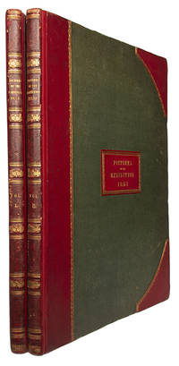
ref. 114198London Dickinson Brothers 1854. . First edition; 2 vols folio 59 x 44 cm; 55 chromo-lithograph plates including 2 frontispieces by Dickinson Brothers after Joseph Nash Louis Haghe and David Roberts finished by hand and heightened with gum arabic titles red and black with woodcut initials ex-library bookplates to pastedowns and stamps to title occasional minor creasing with a couple small tears to margins a touch of offsetting to guards otherwise plates clean and bright; contemporary half red morocco gilt rebacked with original spines laid down over green cloth boards gilt morocco title labels to upper boards spines lettered in gilt in five compartments all edges gilt inner hinges reinforced extremities a little bumped spines lightly rubbed a very good copy; 29; 29ff. The Great Exhibition housed within the 'Crystal Palace' embodied Prince Albert's vision to display the wonders of industry from around the world. This highly detailed and colourful sequence of images was published as a pictorial record of the hugely successful Great Exhibition of 1851 which ran in London's Hyde Park between May and October of that year. Originally conceived by the Royal Society for the Encouragement of Arts Manufactures and Commerce whose most famous patron was Prince Albert the exhibition set out to display the staggering progress that had been achieved in all of the Society's disciplines. The exhibition building itself was the source of worldwide acclaim: the famous 'Crystal Palace' designed by Joseph Paxton and built in cast-iron and plate-glass stretched symbolically 1851 feet in length and rose to 128 feet in the air. More than 100000 objects were displayed by over 14000 exhibitors from around the world grouped into four principal themes: Machinery Manufactures Fine Arts and Raw Materials. Included in the exhibits were full scale hydraulic presses steam engines carriages firearms porcelain enamels carpets textiles and even the 186 carat Kohi-Noor diamond among thousands upon thousands more artefacts many of which are shown in this sequence. Over six million people visited the exhibition during its relatively short opening period many of whom travelled to London from far-afield via the rapidly expanding railway network. Abbey Scenery 251. London, Dickinson Brothers, 1854. hardcover
ref. 05692London No. 39 Strand: M. Darly 1771. The Birth of the English Fashion Caricature Ninety-Six Superb Hand-Colored Etchings of Macaronis Fashionable Ladies and Georgian Eccentrics An Exceptionally Rare Complete Set of Mary and Matthew Darly's Celebrated Caricatures 1771-1773 From the Library of Prince Henry Duke of Gloucester in a Magnificent Rivière Binding DARLY Mary and Matthew. 24 Caricatures by Several Ladies Gentlemen Artists &c. 1771. And Vol. II of Caricatures Macaronies & Characters by Sundry Ladies Gentlemen Artists &c. London: M. Darly 1772. And Vol. III of Macaronies Characters Caricatures &c. Design'd by the Greatest Personages Artists &c. London: M. Darly 1772. And Vol. IV of Macaronies Characters Caricatures &c. By M. Darly. London: M. Darly 1773. First editions. Four octavo volumes bound in two 8 3/4 x 5 1/2 inches; 222 x 140 mm. Four finely hand-colored decorative engraved titles one leaf of engraved introductory text in Volume I and ninety-six superb contemporary hand-colored etched plates twenty-four in each volume. All plates mounted on stubs and interleaved. Some very occasional mainly marginal spotting; a light stain in the lower blank margin of plate 12 in Volume I; plates 2 and 3 in Volume II and plate 8 in Volume III with expertly repaired marginal tears. The plates generally exceptionally fresh with brilliant contemporary coloring. An extraordinarily fine and complete set certainly the finest example we have encountered. Early twentieth-century dark brown morocco by Rivière & Son. Covers elaborately paneled in gilt enclosing a richly gilt central lozenge; spines with five raised bands elaborately decorated and lettered in gilt in compartments; gilt-ruled board edges and richly gilt turn-ins; all edges gilt; marbled endpapers. The armorial bookplate of Prince Henry Duke of Gloucester on the front pastedown of each volume. A magnificent set. An exceptionally rare complete set of the four original volumes of caricatures published by Mary and Matthew Darly between 1771 and 1773 comprising ninety-six brilliantly hand-colored etchings that constitute one of the most important early collections of English social and fashion satire. The present collection represents a landmark in the development of British caricature. Published at the height of the extraordinary macaroni craze of the 1770s these spirited and frequently outrageous portraits ridicule the fashions affectations pretensions and eccentricities of Georgian society. Their subjects include extravagantly dressed young men fashionable ladies military officers clergymen lawyers tradesmen and a remarkable assortment of recognizable London characters. The figures are generally presented individually against deliberately minimal backgrounds their identities and personalities established through exaggerated physiognomy extravagant costume distinctive gestures and carefully selected accessories. This deceptively simple formula was ideally suited to the satirical portrayal of the fashionable world and helped establish a visual language that would be developed to extraordinary effect by the succeeding generation of British caricaturists. The term macaroni originally referred to a fashionable young Englishman who had returned from the Grand Tour with an excessive enthusiasm for Continental manners dress and sophistication. By the early 1770s however it had acquired a distinctly satirical meaning describing a man whose devotion to fashion and personal ornament had supposedly carried him beyond the bounds of conventional masculinity and good taste. Enormous powdered hairstyles miniature hats elaborately embroidered coats slender swords and affected postures became the identifying characteristics of the macaroni. The Darlys seized upon this phenomenon with remarkable commercial and artistic success. Their caricatures transformed the extravagances of contemporary dress into a form of popular entertainment appealing both to those who recognized the individuals portrayed and to a wider public delighted by the absurdities of fashionable society. Although many of the plates depict the familiar macaroni figure the scope of the collection extends considerably further. Among the numerous subjects represented are The City Tonsor The Turf-Macaroni The Oxford-Macaroni The Female Connoisseur The Macaroni Auctioneer The Macaroni Chimney Sweep and The Macaroni Preacher. Such images provide an extraordinary pictorial record of Georgian occupations social distinctions and public amusements filtered through the exuberant imagination of the eighteenth-century satirist. Particularly noteworthy is the prominent participation of women in the production of these prints. Mary Darly was not merely the wife of a successful print-seller but an artist engraver publisher and entrepreneur in her own right. Her work represents an important early contribution by a woman to the development of British graphic satire and the title of the first volume expressly acknowledges the participation of both ladies and gentlemen in the creation of its designs. Mary Darly fl. 1756-1779 sometimes described as the mother of English pictorial satire occupied a central position in the flourishing London print trade of the mid-eighteenth century. Working with her husband Matthew Darly fl. 1741-1778 a designer engraver and print-seller she helped establish caricature as a distinct and commercially successful branch of British printmaking. Matthew Darly had already acquired considerable prominence through his publications on ornament and decorative design including his association with Robert Manwaring's The Chair-Maker's Guide and George Edwards's A New Book of Chinese Designs. His involvement with satirical prints extended back at least to 1749 when he was questioned by the authorities concerning the distribution of caricatures directed against the Duke of Cumberland. By the 1760s Mary Darly had emerged as a publisher of satirical prints and the couple's establishment at 39 Strand became an important center for the production and sale of fashionable caricatures. The Darlys encouraged designs from both professional artists and talented amateurs including members of fashionable society itself an approach reflected in the deliberately inclusive wording of their engraved title-pages. Among artists associated with the Darly publications were Henry William Bunbury James Sayers Edward Topham Sir Edward Newenham Elizabeth Bridgetta Gulston and others. The contributions of aristocratic and amateur designers gave these caricatures a particularly intimate relationship with the fashionable society they mocked. The popularity of the Darly caricatures was such that the series was subsequently reissued including in 1776. Mary Darly's advertisements promoted the collection with characteristic confidence as "the most entertaining Work ever published in Europe." Despite their considerable contemporary popularity complete collections of these early Darly caricatures are now exceptionally scarce. The prints were intended to be enjoyed circulated and collected and individual examples have survived far more frequently than intact volumes. Their vulnerability to dispersal together with the frequent removal of particularly desirable images makes the survival of all ninety-six plates in their original four-volume sequence especially remarkable. The present set is further distinguished by its remarkably vivid contemporary hand-coloring the freshness of its impressions its handsome early twentieth-century Rivière binding and its distinguished royal provenance. Provenance: Prince Henry Duke of Gloucester 1900-1974 third son of King George V and Queen Mary and younger brother of Kings Edward VIII and George VI; his crowned armorial bookplate lettered "GLOUCESTER" on the front pastedown of each volume. Rarity: Exceptionally scarce particularly complete in all four volumes. Earlier bibliographical research located only three institutional examples of Volume I Yale University the Harry Ransom Center at the University of Texas and the University of Virginia and three of Volume II Los Angeles County Museum of Art Harvard University and Princeton University. These holdings should be reconfirmed against current institutional catalogues; they are not evidence of a complete census of surviving sets. [London] No. 39 Strand: M. Darly, 1771 unknown
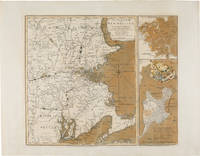
1775ref. WRCAM54968London: Printed for R. Sayer & J. Bennett 1775. Copper-engraved map with original color. Two insets along the right side titled "Plan of Boston Harbour from an Actual Survey" and "Plan of the Town of Boston with the Attack on Bunker's Hill in the Peninsula of Charlestown." Plate mark: 18 1/4 x 21 1/2 inches. Sheet size: 21 1/4 x 27 1/4 inches. Expertly conserved with a few instances of renewed color. In very good condition with large margins. A rare and dramatic Revolutionary war map of New England showing George Washington's troops marching on British-occupied Boston with a large inset plan of the Battle of Bunker Hill showing Charlestown in flames: among the earliest pictorial representations of the Battle of Bunker Hill. This copy is printed on a large full sheet with ample margins. Published by Sayer & Bennett shortly after news of the Battle of Bunker Hill reached London the map celebrates the British victory in the battle but gives a portent of the impending siege of Boston and the eventual Battle of Dorchester Heights. The general map of New England provides a backdrop for illustrations of American troops most notably including the "march of General Washington" in western Massachusetts but also showing militia marching from New Hampshire Connecticut and Rhode Island all converging on Boston. Two smaller insets along the right side of the map each printed from a separate plate depict a general plan of Boston Harbor and a plan of Boston and Charlestown showing the Battle of Bunker Hill. This latter inset is quite dramatic and of great significance. Charlestown is shown under attack by British forces with the town in flames as British warships bombard it from the water and a British battery fires across the Charles River from Cornhill in Boston; the locations of the British and American forces on Breed's Hill are shown as the two armies face each other in battle. In Boston a large encampment of British regulars is shown on Boston Commons surrounding the Liberty tree. The inset would later be re- engraved and used in Newcastle and Boston editions of Murray's IMPARTIAL HISTORY OF THE WAR. It is believed that the inset is a graphic representation of information on the battle derived from a June 25 1775 letter written by General Burgoyne to Lord Stanley: ".Howe's corps ascending the hill in the face of entrenchments and in a very disadvantageous ground was much engaged; and to the left the enemy pouring in fresh troops by the thousands over the land; and in the arm of the sea our ships and floating batteries cannonading them: straight before us a large and noble town in one great blaze; the church steeples being of timber were great pyramids of fire above the rest.the whole a picture and a complication of horror and importance beyond any thing that ever came to my lot to be witness to." Sayer and Bennett published this letter as a broadside on November 27 1775 nearly two months after this inset illustrating it with a different plan of the battle. The earliest cartographic representation of the Battle of Bunker Hill is an August 1 1775 plan published by Jefferys and Faden titled "A Sketch of the Action between British Forces and the American Provincials on the Heights of the Peninsula of Charlestown." That map however purely shows military movements. The inset to the present map is the second printed plan of the battle and considered to be the first pictorial representation. This map was produced on September 2 1775 a scant two- and-a-half months after the crucially important actions it depicts. It is remarkable that such detailed news was transmitted from New England to London and published in such a magnificent cartographic representation in so brief a period of time. Not in Nebenzahl's ATLAS OF THE AMERICAN REVOLUTION which reproduces a later version of the inset on page 55 or Phillips. An exciting important rare and early map of the American Revolution. NEBENZAHL BATTLE PLANS OF THE AMERICAN REVOLUTION 6 6A. McCORKLE NEW ENGLAND IN EARLY PRINTED MAPS 775.1. KRIEGER & COBB MAPPING BOSTON p.103. SCHWARTZ & EHRENBERG plate 117. GUTHORN BRITISH MAPS OF THE AMERICAN REVOLUTION p.66. STOKES B105. RISTOW CARTOGRAPHY OF THE BATTLE OF BUNKER HILL. SELLERS & VAN EE 813. Printed for R. Sayer & J. Bennett unknown books
1801ref. 19020London: Printed and Published by Robert Laurie and James Whittle 1801. Folio. 21 1/8 x 15 1/4 inches. Mounted on guards throughout letterpress title verso blank and 1p. index verso blank otherwise engraved throughout. 59 engraved maps on seventy-five mapsheets all hand-coloured in outline 1 map on 3 folding sheets; 14 on 2 folding sheets; 9 on single folding sheets; 34 on single double-page sheets; 1 on a one-page sheet. Contemporary tree calf covers with roll-tool border in gilt the flat spine divided into seven compartments by gilt fillets and roll-tools blue morocco lettering-piece in the second the other compartments with repeat neo-classical decoration of a single centrally-placed tool marbled endpapers A very fine copy of the fifth edition of this important atlas of the world including a newly revised chart of world and nine other maps that were not available in the early editions of this spectacular work. Eight editions of this work were issued on an almost annual basis from 1796 until 1807. The publishers constantly changed and improved the atlas in an effort to outdo not only their competitors but also to improve on the previous edition. Maps were added the first edition included only 66 map sheets maps were replaced the present work includes two maps dated 1800 including 'A New Chart of the World' dated 25 November 1800 and maps were updated eight maps are dated 1799. The scale of some of the maps is truly spectacular: this atlas contains 15 maps that if joined would form large scale wall maps: 'Asia and its Islands' on three folding sheets ranging from the Arctic regions in the north down through Russia Indonesia and Australia would measure approximately 56 x 46 inches if assembled. The remaining maps on two folding sheets would all be approximately 40 x 46 inches if joined: these include three maps of American interest: 'A new map of the whole continent of America'; 'A new map of North America with the West India Islands'; and 'A map of South America'. The remaining areas that are covered by large scale maps are 'A general map of the World'; England & Wales; Scotland; Ireland; the Netherlands; Germany; Hindoostan; Bengal Bahar etc; Delhi Agrah Oude and Allahabad. This atlas was originally created by Thomas Kitchin. Sayer and Bennett had published the work in 1773 and Laurie and Whittle took over the Sayer business in 1794. They subsequently enlarged the work adding maps and changing the name from the General Atlas to A New Universal Atlas. The maps are based on the work of a variety of mapmakers and surveyors: Thomas Kitchin Thomas Jefferys John Rocque Robert Campbell John Armstrong John Roberts L. S. d'Arcy Delarochette James Rennell Andrew Dury Thomas Pownall and Jean Baptiste Bourguignon d'Anville. Also included is the information gathered as a result of the important Pacific voyages of Captain James Cook George Vancouver and Jean Francois Galaup de La Perouse. Phillips Atlases 3534. Printed and Published by Robert Laurie and James Whittle unknown books