Harcourt School PublishersBiblio.com

10.184 resultados
ref. 0153519908.Ghardcover. Good. Access codes and supplements are not guaranteed with used items. May be an ex-library book. hardcover
ref. 1418546534.Ghardcover. Good. Access codes and supplements are not guaranteed with used items. May be an ex-library book. hardcover
ref. 1019435984.Ghardcover. Good. Access codes and supplements are not guaranteed with used items. May be an ex-library book. hardcover
ref. 1636510361.Ghardcover. Good. Access codes and supplements are not guaranteed with used items. May be an ex-library book. hardcover
ref. 0153435666.Gspiral_bound. Good. Access codes and supplements are not guaranteed with used items. May be an ex-library book. unknown
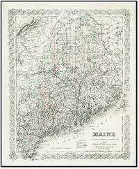
1887ref. 21550New York: G.W. & C.B. Colton & Co. 1887. Very Good. A highly detailed late-19th-century cartographic survey of Maine published specifically for the Maine State Year Book. This map captures the state's complex coastal topography and rapidly expanding interior transportation networks during the height of the Victorian industrial era. KEY FEATURES Visuals: Hand-colored in pastel washes to delineate county boundaries; features an elaborate stylized interlocking vine border characteristic of the Colton studio. Binding: Originally issued as a folding map as evidenced by standard folds; now flat. Content: Includes a detailed 'Explanations' key identifying Railroads Common Roads Canals County Towns and Post Offices. Associated Names: Published by the prestigious firm of G.W. & C.B. Colton at 312 Broadway New York for G.M. Donham of Portland. Rarity: Uncommon in this crisp hand-colored state; these maps were typically used heavily as reference tools in State Year Books and often survived with significant tanning or losses. Imprint: Entered according to Act of Congress in the year 1887 by G.W. & C.B. Colton & Co. Specs: 17 x 14 inches. CONDITION Very Good -- Standard folds as issued; minor edge wear and light creasing. Hand-coloring remains vivid and the paper is remarkably bright for a Victorian-era municipal map. HISTORICAL SIGNIFICANCE -- The Colton family defined American cartography for over 60 years. By 1887 their maps had moved beyond mere exploration into the realm of precise commercial and political tools. This specific map produced for the Maine State Year Book was the 'GPS' of its day for legislators merchants and industrialists navigating the Pine Tree State. It documents a pivotal moment in New England history where the 'Common Roads' were being superseded by the "Rail Roads" and 'Canals' that funneled timber and textiles to the Atlantic ports. For the New England collector it is a primary document of the state's transition into the modern industrial age. SUBJECTS: Maine History Cartography Railroad History G.W. & C.B. Colton 19th Century Infrastructure New England Geography Portland Maine Map Engraving Ephemera Americana. BIBLIOGRAPHIC REFERENCE: Cf. Thompson 'Maps of Maine' for Colton iterations; Phillips 'Maps of America'. G.W. & C.B. Colton & Co. unknown
2024ref. 66677Brepols Publishers. Fine in No DJ As Issued dust jacket. 2024. First Edition. Hardcover. Stiff unmarked book in clean blue cloth; about new.; Medieval and Renaissance Studies; 415 pages . 2503604234 . Brepols Publishers hardcover
ref. 0153528699.Gpaperback. Good. Access codes and supplements are not guaranteed with used items. May be an ex-library book. paperback
ref. 0791060551.Glibrary. Good. Access codes and supplements are not guaranteed with used items. May be an ex-library book. unknown
ref. 1019182636.Gpaperback. Good. Access codes and supplements are not guaranteed with used items. May be an ex-library book. paperback
ref. 1120870577.Gpaperback. Good. Access codes and supplements are not guaranteed with used items. May be an ex-library book. paperback
ref. 1565775406.Gpaperback. Good. Access codes and supplements are not guaranteed with used items. May be an ex-library book. paperback
ref. 076519130X.Ghardcover. Good. Access codes and supplements are not guaranteed with used items. May be an ex-library book. hardcover
ref. 0735571805.Gpaperback. Good. Access codes and supplements are not guaranteed with used items. May be an ex-library book. paperback
ref. 9076886474.Ghardcover. Good. Access codes and supplements are not guaranteed with used items. May be an ex-library book. hardcover
2006ref. 088533HARCOURT SCHOOL PUBLISHERS 2006. paperback. Good. 11x8x1. H.S.P: Science Grade 1 - Teaching Transparencies Softcover. Copyright-2007 ISBN:0153610573. This manual is in GOOD condition with clean interior pages that are fully intact with MODERATE wear to the exterior cover! We ship daily Mon-Sat. Customer service is always our top priority! Please contact us at 888-475-1077 to reach our customer service team!! HARCOURT SCHOOL PUBLISHERS paperback
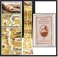
1920ref. 21981Köln: Verlag von Hoursch u. Bechstedt 1920. Very Good/No Dust Jacket As Issued. A striking interwar folding panorama offering a continuous bird's-eye relief view of the Rhine's course from Cologne Köln to Mainz. This production serves as both a high-detail cartographic achievement and a visual travelogue of the Rhineland's cultural and architectural landmarks during the early Weimar Republic. The map utilizes a vertical orientation where the river acts as the central axis flanked by dense topographical details and architectural vignettes. This specific edition is remarkably scarce; our research indicates only one institutional holding in Germany OCLC making it a significant find for collectors of European cartography or Rhine-related ephemera. BIBLIOGRAPHICAL FEATURES Physical: Folding accordion-style booklet. Folder measures 7.75 by 4.5 inches; opens to a continuous panorama nearly 60 inches in length. Structure: 13 total panels; the first and final panels feature full-page scenic views while the intervening 11 panels follow the river's winding course. Cartography: Not drawn to scale; features a relief "bird's-eye" perspective with the Rhine as the vertical spine. Text: Entirely in German; includes descriptive text blocks providing historical and geographical context for major towns and sites. Illustration: Richly colored vignettes depict castles cathedrals and riverboats including a detailed view of the Cologne Cathedral Der Kölner Dom. CONDITION Very Good - The internal accordion map is in exceptional state preserved without flaws tears or significant foxing. The colors remain vibrant and the folds are crisp. The outer grey card folder shows moderate wear along the overhanging edges and corners consistent with its age and intended use as a travel guide. The rear of the folder features an interesting non-original addition: a glued-on "Spearhead" insignia the 3rd Armored Division of the US Army suggesting this copy may have been a souvenir or utility map for an American serviceman during the post-WWII occupation era. HISTORICAL & CARTOGRAPHIC CONTEXT Post-WWI Proliferation: Published around 1920 this panorama captures the Rhine during a period of intense German national identity-building following the Great War. The 'Spearhead' Provenance: The 3rd Armored Division patch on the rear adds a layer of military association likely linking the object to the 'Watch on the Rhine' during the Allied occupation. Visual Narrative: By positioning the river vertically the map forces a linear narrative 'journey' for the viewer emphasizing the density of the villages and the 'Romantic Rhine' aesthetic of ruined castles and steep vineyards. Technical Detail: While not to scale the map accurately notes the names of nearly every village passed serving as a functional if stylized navigational aid for river travelers. SPECS: Subject: Cartography Rhine River German Travel Interwar Ephemera. Specs: Accordion-fold relief map; approx. 5 feet fully extended. Rarity: High; only one known institutional copy in Germany. Provenance: Likely US Occupation souvenir 3rd Armored Division. SUBJECTS: Cartography Rhine River Germany Weimar Republic Panoramic Maps Ephemera Military History Travel Guides Relief Maps. Verlag von Hoursch u. Bechstedt unknown
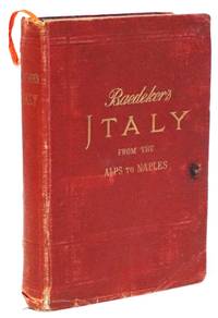
1909ref. 21860Leipsic: Karl Baedeker 1909. Good/No Dust Jacket As Issued. The definitive Edwardian-era guide to Rome and the Italian heartland featuring the complete cartographic program of nineteen maps and thirty-one plans. As the fifteenth revised edition this volume represents the peak of Baedeker's pre-WWI accuracy offering a high-resolution snapshot of the 'Eternal City' and its environs before the modernizations of the early 20th century. Renowned for its rigorous attention to detail and 'scientific' approach to tourism this handbook remains a primary document for both the history of travel and the topographical study of 1909 Italy. KEY FEATURES Visuals: Complete with 19 maps and 31 plans plus a panorama of Rome and a view of the Forum Romanum. Binding: Original flexible red cloth with gilt-lettered spine and front cover; marbled edges and signature yellow silk ribbon marker. Content: Exhaustive coverage of Central Italy the Marches and an extensive multi-part section dedicated to the history topography and art of Rome. Includes index and introductory essays on Italian art and travel logistics. Imprint: Leipsic: Karl Baedeker; London: Dulau and Co.; New York: Charles Scribner's Sons 1909. Specs: 6.25 x 4.25 inches; lxxviii 397 pages index. CONDITION: The bindings are tight and square holding the flexible text block firmly. The internal pages are clean and free of markings showing only light even age-toning consistent with early 20th-century paper stock. The maps and folding plans are well-preserved though the front endpapers show a hint of the usual cracking at the hinge-not affecting the structural integrity. The red cloth shows moderate handling wear and light rubbing to the spine ends. SCHOLARLY FEATURES Cartographic Excellence: The plans of Rome the Vatican and major archaeological sites provide a detailed record of the city's state just prior to the excavations of the Mussolini era. Travel Sociology: Documents the height of the 'Grand Tour' successor era capturing the transition from elite carriage travel to the burgeoning age of the railway and early automobile tourism. Topographical Record: Serves as a vital reference for the 'lost' layouts of 19th-century Italian villages and pre-urban sprawl Rome. HISTORICAL SIGNIFICANCE - Karl Baedeker transformed the nature of travel by replacing the discursive anecdotal guidebooks of the 18th century with systematic data-driven handbooks. By 1909 the 'Baedeker' was so authoritative that it dictated the success of hotels and the movement of thousands of travellers across the European continent. This fifteenth edition of 'Central Italy' is particularly valued for its balance of historical depth and modern for the time logistical detail. It captures Rome as a young capital of the Kingdom of Italy still navigating the tension between its ancient ruins and its role as a modern political center. For the collector the 1909 edition remains the quintessential 'Baedeker'-sturdy aesthetically consistent and representational of the era when the 'Red Book' was an essential piece of luggage for any serious global citizen. SUBJECTS: Italy Rome Cartography Travel Guides Edwardian Era Grand Tour Archaeology Handbook Atlas City Plans Travel Literature. BIBLIOGRAPHIC REFERENCE: Hinrichsen E21.; Bdkr Karl Baedeker unknown
ref. 1636512712.Gpaperback. Good. Access codes and supplements are not guaranteed with used items. May be an ex-library book. paperback
ref. 163651037X.Gpaperback. Good. Access codes and supplements are not guaranteed with used items. May be an ex-library book. paperback
1956ref. 750University of Oklahoma Press 1956. Hardcover. Good/Good. Dustjacket has wear a number of small to moderate tears along the edges moderate chipping on top edge and bottom of spine heavy foxing on the inside and spine is faded. Cover has some wear and moderate foxing on front and rear. Some spotting on top page edges. Moderate foxing on inside front and rear covers and on endpapers. Two pages have some darkening where a couple of newspaper clippings were stored. First edition. Former owner's name and date on inside front cover. Signe and inscribed by the author Ahmed Emin Yalman to former book owner on front endpaper where he used the term "Sister" which is what World War I nurses were called by the Turks. University of Oklahoma Press hardcover
ref. 1636516904.Gpaperback. Good. Access codes and supplements are not guaranteed with used items. May be an ex-library book. paperback
ref. 1868721604.Gpaperback. Good. Access codes and supplements are not guaranteed with used items. May be an ex-library book. paperback
2023ref. __1400335361Nelson Bibles 2023. Paperback. New. lea edition. 2240 pages. 9.17x6.37x1.85 inches. Nelson Bibles paperback
2016ref. Viva-9781634602617EUROSPAN GROUP 2016. Paperback with Sewing. New. EUROSPAN GROUP paperback