Jaillot; SansonBiblio.com
3 375 résultats
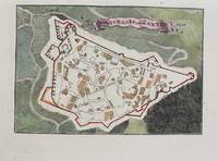
1690réf. M9475Paris c.1690. Very Good. Notes: A charming map of Forteresse de Zante Greece during the late 17th century. Size : 104x154 mm 4.09x6.06 Inches Coloring: Hand Colored Category: Maps Europe Greece Macedonia; unknown
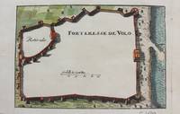
1690réf. M9474Paris c.1690. Very Good. Notes: A charming map of Forteresse de Volo Greece during the late 17th century. Size : 104x153 mm 4.09x6.02 Inches Coloring: Hand Colored Category: Maps Europe Greece Macedonia; unknown
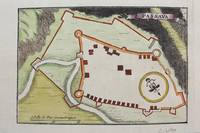
1690réf. M9481Paris c.1690. Very Good. Notes: Map of Passava Greece during the late 17th century. Size : 104x153 mm 4.09x6.02 Inches Coloring: Hand Colored Category: Maps Europe Greece Macedonia; unknown
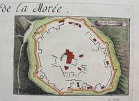
1690réf. M9483Paris c.1690. Very Good. Notes: A charming map of Zarnata Greece during the late 17th century. Size : 103x152 mm 4.06x5.98 Inches Coloring: Hand Colored Category: Maps Europe Greece Macedonia; unknown
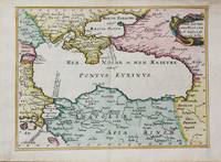
1656réf. M10647Paris c.1656. Very Good. Size : 182x246 mm 7.17x9.69 Inches Coloring: Hand Colored Category: Maps Russia; Maps Asia Near East Turkey; Maps Europe Ukraine; unknown
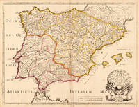
1704réf. 19604Paris: N. Sanson 1704. Other. In very good condition a slightly creasing in the lower part of the centrefold with minor tiny spots. 410 by 525mm 16¼ by 20¾ inches. 410 by 525mm 16¼ by 20¾ inches. Copper engraving hand colored in outline when published. Interesting and detailed map of Antique Spain with Portugal and the Balearic Islands by the French cartographer Nicolaus Sanson d´Abbeville. The map provides us a lot of information of the various place names of cities and small towns the rivers mountains and also engraved borders of the various Spanish provinces. The map impresses with the geographic exactness which is typical for the French cartographer Nicolaus Sanson. In the decorative cartouche which is in shape of a seashell we find the altered date 1704 which is a relatively late edition for maps by N. Sanson. The map is probably published in a French composit atlas around this date. N. Sanson unknown
réf. a92271Paris 1681. Chez H. I Aillot. first edition Color map 33 x 22 inches with 2 inch blank border on all 4 sides. "Dresse sur les Memoirs les plus Nouveaux par le S. Sanson Geographe Ordinaire du Roy." Fancy pictorial circle around map title and similar around map's key. Densely decorated map with lines of color in red pink orange green. No tears. Folded in half. One very light stain appears water-based at center fold about 8 inches by 1 inch. Very pretty map with bold black outlines and bright colors. Good plus condition. Map - ephemera. . unknown
réf. 698164489Taylor & Francis Group . Hardback. New. pp. 288 Taylor & Francis Group hardcover
2026réf. x-9819532671Springer Nature 2026. Hardcover. New. 200 pages. 9.25x6.10x9.49 inches. Springer Nature hardcover
réf. 697360040Ashgate Publishing Company . Hardback. New. pp. 275 Ashgate Publishing Company hardcover
193886 pages. Features: Nice color ad for Laird & Co. Apple Brandy inside front cover; Samson card table ad; Chamberlain and British press censorship; Britain War Preparations; The Kaiser on Hitler; Myra Kingsley - Star of the Star-Gazers; The German-Japanese Spy Alliance - article with photos of Nazi spies in America, Lt. Comm. Farnsworth, Harry T. Thompson, Eric Glaser, Otto Voss, Guenther Rumrich and Johanna Hofmann; 20th-Century Wonder Girl Eleanora Sears of Boston; Feuding Among the FCC; Red Cross Surgeon in China describes how injuried and sick Japanese soldiers are killed rather than tended to, 'for the glory of the Emperoro'; Photos of yoga disciple Buddha Bose in various unusual physical states; Photo of toy tanks being painted in Nuremberg, Germany; Photo of toy battleships being painted by Japanese teen; Other photo subjects include French Foreign Minister Bonnet, Labor man Dave Beck, the Matanuska Valley colony in Alaska, Mr. Rolly sharpening a huge saw blade in Alaska, Japanese soldiers in action, Dr, Virgil Dickson, Principal Bruce Zimmerman, Dr. Vaclav Podstata, many photos of children being racially integrated in the U.S., the Budin Clinic in New York, X-ray devices, streetlighting for safety, and the Brooklyn bail bond racket; Dave Beck - Political and Economic Boss of the Pacific Northwest; Hugh Bartlett Monjar and his assorted 'clubs' make him a lot of money; Meddling in Matanuska; Article on Marihuana - "Our Newest Vice"; America's Solution to a Minority Problem - racial mixing of kids in California; Would You Have Noticed That? - Albert S. Osbornprobably has the world's most observant eyes and is a 'student of questioned documents'; Humanitarian surgeons look forward to the day when their intervention will no longer be needed; Proper Highway Illumination for safety; Cleveland's Negro Problem - the "Future Outlook League" uses racketeer-style methods to promote black employment; Hoaxes often invented to sell newspapers; Photo of bicycle polo game; Article on Crooked Bond Bailsmen in New York; Nice color-photo back cover ad for Lucky Strike features tobacco buyer James Walker and associates chatting around pot-bellied stove; and more. Above-average wear. Front cover nearly loose. A worthy vintage copy. Magazine
réf. 85388Soit 9 années en 9 volumes in 8° reliés demi-chagrin brun, dos lisses ornés de filets dorés, initiales (A. de J.) frappées en queue du dos ; texte sur deux colonnes.
réf. 201415823Paris, Les heures claires, 1951 ; in-8, 26 pp., cartonnage de l'éditeur. En bon état sous étuit (celui-ci est bruni) texte en parfait état feuillet non reliés - Pointe sèches de CH. SAMSON - - pointes sèches hors texte de Charles SAMSON.
réf. 87016Les Heures Claires, 1954, 3 volumes de 210x270 mm environ, 150,149 et 153 pages, en feuillets libres sous chemise rempliée et emboîtage de l'éditeur. Illustrés de pointes sèches de Ch. Samson. Exemplaire N° 67, un des 112 exemplaires sur vélin pur fil de Lana auxquels on a ajouté une suite des gravures avec remarques, numérotés de 39 à 150. Etuis un peu salis avec quelques taches sur le dos, premiers plats des chemises rempliées légèrement brunis, sinon bon état.
1665réf. LBW-71881665. 427 x 511 mm.
1659réf. LBW-3663Paris, chez l'auteur, 1659. 362 x 530 mm.
1667réf. LBW-3266Paris, Pierre Mariette, 1667. 422 x 554 mm.
1690réf. 167791690 basane brune, dos à n. 2 tomes en un vol. in-12, (12ff.), 144pp. et titre, 178pp., (7ff.), 48pp., (catalogue des libraires), 4 planches dépliantes (la quatrième est incomplete de sa plus grande partie…) A Paris chez l'auteur, aux galleries du Louvres, vis-à-vis l'Eglise de St. Nicolas. 1690
1683réf. LBW-7051683. 189 x 265 mm.
1652réf. LBW041961652. 188 x 251 mm.
réf. 3244Americas: Amsterdam Francois Halma 1705. Copper engraved map of Guatemala by N. Sanson from Halma's Algemeene Werelde Beschryving Vol. 3 Black and white; title in Dutch; verso blank; strapwork title cartouche. This map appeared in Algemeene Weereld-Beschryving nae de Rechte Verdeeling der Landschappen Plaetsen Zeeën Rivieren &c. Geographisch Politisch Historisch Chronologisch en Genealogisch a Dutch edition of A. Phérotée de la Croix's Nouvelle Methode Pour Apprendre Facilement la Geographie Universelle which first appeared in 1690. Dark impression. Nicolas Sanson d'Abbeville.1600-67 ' father of the French cartography' and founder of the Sanson firm. Atlas ' Cartes générales de toutes les parties du Monde' 1658-70 and a pocket atlas in 4 parts 1652-1705. Sanson's small maps from A. Phérotée de la Croix's Nouvelle Methode Pour Apprendre Facilement la Geographie Universelle. first published in 1652 and engraved by A. Peyrounin were copied several times by various map publishers. Johann David Zunners made copies of Sanson's maps for his German translation of Die Gantze Erd-Kugel in 1679. Johannes Ribbius and Simon de Vries published copies in 1682 and 1683 with new maps engraved by Antoine d'Winter. The plates were later sold to Francois Halma who used them in 1699 and then again in 1705 with the titles re-engraved in Dutch. François Halma 1653 - 1722 Dutch publisher/printer; dealer/auction house. Cartographer and publisher of maps active in Utrecht Amsterdam Franeker and Leeuwarden. Published 'Description de l'Univers' 1700; 'Algemene Wereldtbescrijving' 1705; 'Corpus Inscriptionum' 1707 and 'Lexicon Philosophicum' 1713. Keoman: Hal 1; Phillips 528; B Americas Central America Guatemala Amsterdam Francois Halma 1705 unknown
réf. 3243Americas: Amsterdam Francois Halma 1705. Copper engraved map of Mexico by N. Sanson from Halma's Algemeene Werelde Beschryving Vol. 3 Black and white; title in Dutch; verso blank; strapwork title cartouche. The map shows Mexico including the Yucatan peninsula part of present-day Guatemala and Honduras. This map appeared in Algemeene Weereld-Beschryving nae de Rechte Verdeeling der Landschappen Plaetsen Zeeën Rivieren &c. Geographisch Politisch Historisch Chronologisch en Genealogisch a Dutch edition of A. Phérotée de la Croix's Nouvelle Methode Pour Apprendre Facilement la Geographie Universelle which first appeared in 1690. Dark impression. Nicolas Sanson d'Abbeville.1600-67 ' father of the French cartography' and founder of the Sanson firm. Atlas ' Cartes générales de toutes les parties du Monde' 1658-70 and a pocket atlas in 4 parts 1652-1705. Sanson's small maps from A. Phérotée de la Croix's Nouvelle Methode Pour Apprendre Facilement la Geographie Universelle. first published in 1652 and engraved by A. Peyrounin were copied several times by various map publishers. Johann David Zunners made copies of Sanson's maps for his German translation of Die Gantze Erd-Kugel in 1679. Johannes Ribbius and Simon de Vries published copies in 1682 and 1683 with new maps engraved by Antoine d'Winter. The plates were later sold to Francois Halma who used them in 1699 and then again in 1705 with the titles re-engraved in Dutch. François Halma 1653 - 1722 Dutch publisher/printer; dealer/auction house. Cartographer and publisher of maps active in Utrecht Amsterdam Franeker and Leeuwarden. Published 'Description de l'Univers' 1700; 'Algemene Wereldtbescrijving' 1705; 'Corpus Inscriptionum' 1707 and 'Lexicon Philosophicum' 1713. Keoman: Hal 1; Phillips 528; B Americas Mexico Yucatan Guatemala Honduras Amsterdam Francois Halma 1705 unknown
réf. H32ca. 1750. 30 mal 21 cm. Gefalt. Karte. unknown
18192 vols., 12mo., with fine engraved and printed titles, and a total of 8 engraved plates after Westall (most original tissue guards present), some minimal offsetting from plates; ORIGINAL BOARDS, very neatly rebacked to style, ORIGINAL PRINTED PAPER LABELS PRESERVED (labels chipped and worn but virtually all lettering entirely legible), uncut, boards mildly age-stained with a few old tape marks, else a most attractive and remarkably clean, crisp set in tastefully restored publisher's binding. The engraved titles, all after Westall and dated 1816, are by Engleheart (Vol. I: Paradise Regained) and Rhodes (Vol. II: Minor Poems). The fine engraved and captioned plates are also after Westall and dated 1816. In the first volume, the plates stand before Paradise Lost (Finden), Samson Agonistes (Romney) and Comus (Heath); in the second, the plates stand before Lycidas (Engleheart), L'Allegro (Heath), Il Penseroso (Mitan), Sonnets (Heath) and Odes (Finden).In the first volume Paradise Regained is paginated by line number only; the other works (including Arcades) are all separately paginated. In the second volume the pagination is continuous (including the Index).Something of a bibliographical puzzle here. The two volumes were clearly published as a set (vide the publisher's labels) but we can find no clear record of them as such. Volume I appears to be unrecorded by Stevens, falling as it does between Sharpe's first edition of 1809 and his quite distinct two-volume edition of 1827. Volume II would appear to be a later issue of Stevens 264 (who records the first edition thus as 1817 despite the dating on the engraved title). He makes the point that Vol. II was 'bound with his Paradise Regained, 1817' but lists no printings in 1819. These complexities notwithstanding, a scarce and delightful pair in well-nigh original period binding.
2011réf. x-0197264832Oxford Univ Pr 2011. Hardcover. New. 1st edition. 420 pages. 8.75x5.25x0.25 inches. Oxford Univ Pr hardcover