11 782 résultats
1925réf. 70992Chicago IL: Rand McNally & Co 1925. Engraved map 28 x 20 ½ inches recto showing counties outlined in yellow railroads and identified steamship lines in red along the coast and up the Delaware River and printing a list of railroads verso printing another map of the same dimensions this one in blue Rand McNally Main Highway Map of New Jersey. Title on first map: Rand McNally Standard Map of New Jersey. Index for "principal cities" printed in left margin of each map. Folded into printed brown wrappers spine partly split 12mo. 33 1 4 pp.; C. S. Hammond & Co. label pasted over publisher's imprint on front wrapper more information on cities towns etc. Good copy. Rand, McNally & Co unknown books
1900réf. 70990Chicago and New York: Rand McNally & Co. 1900. Engraved map 28 x 21 inches county and state borders in red inset map "Minneapolis St. Paul and Vicinity" 4 x 4 inches locating list of chief cities along left margin with population figures to the nearest thousand or hundred title at head: "Rand McNally & Co.'s Minnesota." Folded into printed brown wrappers 12mo. 46 pp. Very good. Rand, McNally & Co. unknown books
1945réf. 70987Chicago IL: Rand McNally & Co 1945. Map 26 ¼ x 29 ¾ inches Lake Michigan blue parks golf courses and boulevards dark green elevated lines and stations and subways red bus lines and railroads are also marked; marked CG99 in margin but without a date. Recto maps north Chicago to Evanston verso south Chicago to Calumet City inset map recto 31 ½ x 6 inches maps the North Shore from Evanston to Waukegan. Folded into narrow 8vo cream wrappers printed in red "Chicago Pocket Map". Traces of mounting on rear wrapper verso else very good. Rand McNally & Co unknown books
1928réf. 70989Chicago IL: Illinois Commerce Commission 1928. First edition. Mammoth lithograph map 52 ½ x 34 inches showing the railroad lines throughout the state and cities and towns they pas through with an inset detailed map of Chicago and vicinity 15 ¼ x 8 ½ inches and boxed panels for identification of the various railroads and "Passenger Terminals in Chicago" verso prints an index to counties and towns. Relatively uncommon OCLC locating 12 copies 6 in Illinois 4 in Wisconsin. Folded into 12mo printed light brown wrappers; several closed marginal tears into map one two-inch horizontal fold break else very good. Illinois Commerce Commission unknown books

1921réf. 70993Chicago and New York: Rand McNally Co 1921. Engraved map 27 ¾ x 21 inches county and state borders in orange railroads' table and marks and steamship lines on Lakes Superior and Michigan in red locating list of principal cities along left margin with population figures to the nearest thousand or hundred cartouche title: "Rand McNally standard Map of Wisconsin"; verso prints a "Main Highway Map of Wisconsin" with roadways printed in green. Folded into printed brown wrappers 12mo. 47 pp.; spine of wrappers separated a good copy the map fine. Rand McNally Co unknown books
1918réf. 70988Chicago IL: Rand McNally 1918. Minneapolis MN: Hudson Publishing Co. printed label over Rand McNally imprint c1918. 12mo. 74 18 ads pp. Original printed wrappers rubbed stapled map with a few tiny corner breaks else very good. Rand McNally unknown books
1889réf. 70991NY and Chicago: Rand McNally 1889. Engraved map 23 x 28 inches recto showing Lower Manhattan Brooklyn Jersey City and Hoboken lines for Manhattan Elevated Railway Suburban Rapid Transit Brooklyn Elevated R.R. and Kings Co. Elevated R.R. printed in dark red Bartholdi's Statue marked on Bedloes Island verso showing Upper Manhattan and printing a large more detailed inset of Lower Manhattan from Washington Square to the Battery 12 ½ x 13 inches and a boxed index to the street car lines 8 x 6 inches. Printed several times 1886-1889 this printing located in four copies on OCLC Newberry New York Public Boston Public Columbia. Folded into 16mo printed brown wrappers subtitle: Showing Street Car Lines Elevated Railroads Docks Ferries Steam Boat Lines etc.; some soiling several tiny corner fold breaks wrappers separated along the spine but still a good copy. Rand, McNally unknown books
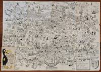
1954réf. BK0099Darmstadt Gemany: Stars and Stripes 1954. Folding pictorial map approximately 2 3¼ x 33 inches unfolded in original illustrated wrappers. OCLC 59284292. Near fine with some wear to wrappers. A wonderfully busy cartoon map of Frankfurt made for American servicemen stationed in Germany during the early Cold War. Byrel "Lefty" Burgess a career U.S. Army engineer and cartoonist fills the city with G.I.s military police beer halls historic buildings street jokes and visual gags while giving particular attention to the extensive American military presence in and around Frankfurt. American sites include barracks the 97th General Hospital WAC quarters Frankfurt High School the PX and residential areas occupied by servicemen and their families. The map ranges from Höchst and Bad Vilbel to Harheim and Offenbach mixing useful street information with caricatures and annotations. Burgess labels historic sites including the Saalhof Karmeliter Kloster Dominikaner Kloster and Drei Königs Kirche while military life and Frankfurt's drinking culture provide much of the humor. Along the upper edge references to places back home-including Texas Chicago Los Angeles Pike's Peak and the Rocky Mountains-reinforce the map's intended audience of Americans temporarily living overseas. Burgess served in the Army Corps of Engineers; he later produced a similarly humorous map of Seoul in 1957. OCLC 59284292. . Stars and Stripes unknown books
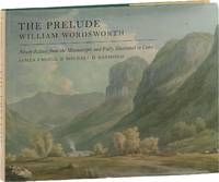
2016réf. 89152Oxford: Oxford University Press 2016. First Edition. First Impression. Oblong Octavo 25cm x 31cm; green cloth-covered boards with titling stamped in gilt on spine and front cover; pictorial endpapers; dustjacket; 281pp; colorful illustrations. From the library of noted poet translator and anthropologist Nathaniel Tarn 1928-2024 with his pictorial bookplate to verso of front endpaper. A Near Fine copy. Dustwrapper lightly spine-faded with trivial surface wear and price sticker to lower rear panel; Very Good. Biography of Wordsworth with marginal glosses notes chronology and bibliography. 89152. Oxford University Press unknown books
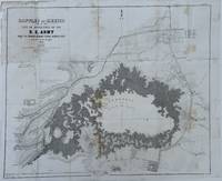
1848réf. 70172Washington 1848. Caption titles of the maps listed below in chronological order according to the date of the action described in the map; almost all bear the lithographer's slug. Several have tears in marginal folds and a few show some foxing one uniformly browned. All are serviceable examples almost all very good. 1 Sketch of the Actions Fought at San Pascal in Upper California between the Americans and Mexicans Dec. 6th & 7th 1846 caption title. 11 x 7 ¾ inches neatline. 2 Sketch of the Passage of the Rio San Gabriel Upper California by the Americas Discomfiting the Opposing Mex. Forces Jan 8th 1847 caption title. From a sketch by Lt. Emory. P. S. Duval Lith. Phil. 6 3/8 x 8 ¼ inches neatline. 3 Sketch of the Battle of Los Angeles Upper California Fought between the Americans and Mexicans Jany 9th 1847 caption title. From a sketch of Emory. 5 ¾ x 8 ¼ inches neatline. 4 Sketch Accompanying Col. Price's Despatch of 15th Feb. 1847 caption title. 8 1/8 x 5 ¾ inches neatline. 5 Linnard Capt. T. B. Plan of the Battle of Buena-Vista Fought February 22nd and 23rd 1847 caption title. Surveyed by Capt. Linnard & Lts. Pope & Franklin. Lith of P. S. Duval Phil. Notes in several margins. 16 ¼ x 20 inches neatline. 6 Sketch of the Battle of Sacramento Feb. 28th 1847 caption title. Printed note of the battle in lower margin. 12 ½ x 9 ½ inches neatline. 7 Coppee Lt. H. Survey of the Mexican Lines of Defence at Cerro Gordo and the Lines of Attack of the American Army under Major General Scott. On the 17th and 18th of April 1847 caption title. Surveyed by Major Turnbull and Capt. McClellan Top. Engineers. Lith of P. S. Duval Phil. 12 ¼ x 18 ¾ inches neatline. 8 Sketch Accompanying Col. Price's Despatch of 18 April 1847 caption title. P. S. Duval Lith Phil. 9 ½ x 11 ½ inches neatline. 9 Map of the California coast supplied title. June 19th 1847. Table in lower margin recording distances between towns and number of men available in each. Lith of P. S. Duval Phil. 14 ½ x 11 ¾ inches neatline. 10 Hardcastle Lt. Edmund. Battles of Mexico Line of Operations of the U. S. Army under the Command of Major General Winfield Scott on the 19th and 20th of August 1847 caption title. Surveyed by Major Turnbull Capt. McClellan and Lt. Hardcastle. Lith of P. S. Duval Phil. 23 ½ x 28 ½ inches neatline. 11 Hardcastle Lt. Edmund. Map of Genl. Worth's Operations on the 20th of Augt. 1847 caption title. Surveyed by Capt. Mason of Engineers and Lt. Hardcastle of Top. Engrs. 18 ½ x 30 ¾ inches neatline. 12 Hardcastle Lt. Edmund. Battle of Molino Del Re: Sketch of the Operations of the 1st Division United States Army under the Command of General Worth on the 8th Sept 1847 caption title. P.S. Duval Lith Phil. 19 3/8 x 12 ¼ inches neatline. 13 Hardcastle Lt. Edmund. Battles of Mexico Line of Operations of the U. S. Army under the Command of Major General Winfield Scott on the 8th 12th and 13th of September 1847 caption title. Surveyed by Major Turnbull Capt. McClellan and Lt. Hardcastle. Lith of P. S. Duval Phil. 28 x 21 ½ inches neatline . 14 Pemberton Bvt. Capt. J. C. Sketch of the Route of General Worth's Column from Chapultepec to the Alameda in the Attack upon the City of Mexico 13th & 14th September 1847 caption title. 14 ¼ x 10 ¼ inches neatline. Notes in lower margin. 15 Hardcastle Lt. Edmund. Map of the Valley of Mexico caption title. Lith of P. S. Duval. 12 x 16 ¾ inches neatline. Fold separations from edges. 16 Plan Accompanying Gen. Quitman's Report caption title. Duval's Lith Press. 13 x 17 ¾ inches neatline. Notes on the battle in lower margin. Some hand coloring. Two splits through margin at folds uniformly browned. 17 Sketch Accompanying Col. Price Despatch caption title. 9 ½ x 11 ½ inches neatline For the lot of 17 maps unknown books
1861réf. 61812New York: W. Schaus; printed by Sarony Major & Knapp 1861. Second Edition. 59 x 76cm open. 19.5x19cm closed. Tinted lithographic map backed in brown silk in black slipcase with printed paper label. Bookseller's ticket of Rev. A. O. Brickman Baltimore. Two ownership inscriptions of "J. M. Deems Maj. 1st MD Cav" and inscribed "Deems" on the slipcase. Trimmed; splits along half of one horizontal fold; minor stains and discoloration to verso not affecting image which is bright and generally Very Good. Hand-made slipcase worn with portion cut out but with manuscript ownership label intact. Uncommon Civil War map used by a distinguished Union Army officer. James Monroe Deems 1818-1901 was a composer and music educator from Baltimore who secured a commission as a major in 1861. He was promoted to Lieutenant Colonel in spring 1863; led the First Maryland Cavalry during the Battle of Gettysburg; retired due to rheumatism in November 1863; and was brevetted Brigadier General in 1867. He likely acquired this map in Baltimore near the beginning of his military career and certainly before his promotion in 1863 given the use of "Maj." in his ownership inscriptions. The map itself is the second edition of this design by J. Schedler despite the title it is not a bird's-eye view. The more common first edition has two insets showing the Lower Mississippi Valley and the city of Richmond see Stephenson 17.3. This version has only one inset showing the eastern United States. Stephenson describes this edition as having a Washington DC bookseller's ticket; the present copy has a Baltimore bookseller's ticket instead. This copy was mounted for use in the field: it was trimmed down to the neatline the captions removed the image cut up into segments and mounted on linen. The printed label on the slipcase appears to be a portion of the original title. This may have been done by the bookseller Brickman possibly at Deems' request. Uncommon. OCLC records about 10 similarly titled maps but few listings distinguish between the first and second editions. STEPHENSON LC Civil War Maps 2nd ed 17.35. 61812. [W. Schaus; printed by Sarony, Major & Knapp] unknown books
1941réf. 21072Window Rock AZ: United States Department of the Interior Office of Indian Affairs Navajo Service 1941. First Edition. Small quarto 26.25cm; mimeographed sheets printed recto and verso and side-stapled into illustrated wrappers; vi 180pp 20; illus. Former owner's name in ink to front wrapper with chipping thin splits and short tears to same; thin vertical paint streak to rear wrapper; text remains fresh and clean; Very Good. Guide book and gazeteer of the Navajo country and adjacent regions compiled by Richard Fowler Van Valkenburgh a former Bureau of Indian Affairs worker and long-time archeological assistant with the L.A. County Museum of History Art and Science. Contains a 4pp key to the Navajo alphabet palatalization and labialization an extensive list of Navajo place names providing detailed information regarding their origins history and significance. Illustrated throughout with maps drawn by Charles Keetsie Shirley. Scarce in commerce. United States Department of the Interior, Office of Indian Affairs, Navajo Service unknown books
1963réf. 9010503Indianapolis: Bobbs-Merrill 1963. 1st. Hardcover. Book fine Dust jacket fine. The dust jacket is price clipped and has minor chips and closed tears to the extremities. Bobbs-Merrill hardcover books
1997réf. 9010406New York: Henry Holt & Company 1997. 1st. Hardcover. Book fine Dust jacket fine. Henry Holt & Company hardcover books
1961réf. UCARGRE00hcBobbs-Merrill 1961. Very Good. Caruso John Anthony. The Great Lakes Frontier: An Epic of the Old Northwest. Mitchell maps Francis J. Indianapolis: Bobbs-Merrill 1961. 432pp. Indexed. Illustrated. Bibliography. 8vo. Cloth. Book condition: Very good with previous owner's name on front endsheet. Dust Jacket Condition: Good with rubbed bumped and chipped edges. Bobbs-Merrill hardcover books
1954réf. UTUCPOL00JMJBobbs-Merrill 1954. Very Good. Tucker Glenn . Poltroons and Patriots: A Popular Account of the War of 1812 Two volumes. Tucker Maps W.T. Indianapolis: Bobbs-Merrill 1954. 812pp. Indexed. Illustrated. 8vo. Cloth with gilt lettering. Book condition: Very good with lightly bumped and yellowed spines. Slipcase is very good with light rubbing and yellowing. Includes monthly bulletin of American History Publication Society. Bobbs-Merrill hardcover books
1992réf. UKINANO00CCWSeal Press 1992. Very Good. Kingsolver Barbara. Another America Otra America with Spanish Translations. Cartes translator Rebeca. Seattle: Seal Press 1992. 103pp. 12mo. Paperback. Book condition: Very good with lightly rubbed and bumped edges. Seal Press paperback books
1950réf. 1749Vichy France: Société des Cartes Folkloriques de France 1950. Wraps. Near fine. R. MARGOTTON. FRENCH LANGUAGE POSTCARDS FASHION / TRADITIONAL DRESS. R. MARGOTTON illustrator. 6 1/8" x 4 1/8" ; 84 cards numbered; half-bound tweed cloth folder with ties marbled paper over board color paper label to front folder; 3 black cloth folder ties; hand-colored wood-engraved cards verso is a divided back postcard with labeling and numbering within the series and four printed lines on which to write an address; light age-toning of edges; near fine. OCLC locates 3 copies all in the U.S. The art on the post cards is signed R. Margotton and it is possible this was Rene Margotton 1915-2009 although by the early 1950s he was a major French painter and one of the cubists from the early part of the 20th century. The laid-in form in the rear pocket is a listing of the cards by area. Société des Cartes Folkloriques de France unknown books
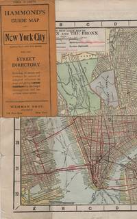
1913réf. 41637New York: Wehman Brothers Publishers 1913. Very good. An impressive color map of the island of Manhattan and the Bronx. Scale is 1" equals 1/2 mile and includes railroads subways elevated railroads surface railroads and proposed railroads. An uncommon early 20th Century New York City street map. Folding color map. Measuring approximately 18" x 36" when unfolded. In original printed card wrapper. Verso a thorough printed street index. Mild handling wear toning. A few tiny holes near fold corners. Overall well preserved; very good. Wehman Brothers Publishers unknown books
1944réf. 144301944. Collection of German produced maps created during World War II documenting military geography industrial targets and occupied territories across Europe. Printed between approximately 1939 and 1945 the maps reflect the cartographic infrastructure used by the German military and administrative authorities during the conflict. They include operational target mapping of industrial facilities in Britain as well as broader geographic maps of Central and Western Europe produced during the period of German expansion and occupation. The materials illustrate the strategic importance of cartography in wartime planning intelligence gathering and territorial administration. Archive of ten German language maps printed circa 1939-1945. The group includes a German aerial bombing target map of the Chesterfield Tube Works in Great Britain dated December 1942 showing an aerial photographic image of the factory area overlaid with roads bridges and designated target points. The document bears the warning "Nur für den Dienstgebrauch" translated as "For Internal Use Only." The Chesterfield Tube Works produced industrial cylinders and compressors important to the Allied war effort and German bombing raids targeted the factory and nearby rail lines; one recorded bombing attempt reportedly missed the intended target and struck a golf course several miles away. The archive also includes a map titled Karte der ehemaligen Tschechoslowakei "Map of the Former Czechoslovakia" printed with red elevation markings and bearing the headline "Sonderausgabe!" "Special Edition!" produced during the period of German occupation following the annexation of the Sudetenland in 1938 and the subsequent occupation of the remainder of Czechoslovakia in 1939. Additional maps depict the city of Plzeň located at the edge of the Sudetenland and occupied by German forces during the war along with maps of Köln Cologne Umgebung von Wien surroundings of Vienna and broader geographic overview maps labeled Deutsches Reich Frankreich and Italien. One large overview sheet titled Blatt Südost includes a color printed regional map with scale 1:1000000. During World War II the production of detailed maps formed a central component of military planning aerial reconnaissance and territorial administration across Europe. German cartographic units compiled aerial imagery industrial intelligence and geographic data to support bombing operations and to administer occupied territories. Maps such as the Chesterfield industrial target sheet demonstrate how aerial photography and cartographic overlays were combined to identify transportation networks and industrial infrastructure vulnerable to bombing campaigns. Other maps in the archive reflect the shifting political geography of Europe under Nazi occupation including representations of territories incorporated into or controlled by the German Reich. The group contains ten maps of varying sizes including large wall maps exceeding 50 inches in width. Several maps show signs of use including wear and annotations; the Plzeň map lacks the original key section. Overall condition ranges from good to very good with occasional handling wear consistent with wartime cartographic materials. A substantial group of World War II German maps documenting both strategic planning and the geography of occupied Europe. unknown books
1943réf. 144341943. Archive of nine large original World War II maps used by a United States Army soldier in the European Theater of Operations during the Allied liberation of Western Europe. Lithographed military maps variously issued by U.S. Army and War Office agencies 1943-1944. Large formats ranging from approximately 19" x 24" to 42" x 34". These maps document the cartographic infrastructure of Allied ground and air operations in the climactic campaigns of 1944-1945. The German sheets-many designated for "Army/Air" or restricted War and Navy Department use-reflect the intensive aerial reconnaissance bombing coordination and mechanized advance into the industrial and administrative heartland of the Third Reich. Cities such as Berlin Magdeburg Kassel and Düsseldorf were central to armaments production rail networks and military command making accurate and rapidly updated mapping indispensable. The Paris map corresponds to the Allied advance culminating in the Liberation of Paris in August 1944 marking the symbolic reclamation of a major European capital from Nazi control. Several sheets note reliance on prewar German cartography 1938 editions supplemented by wartime intelligence underscoring how Allied forces repurposed and revised enemy geographic data for invasion and occupation planning. Crucially these maps also capture a political geography that was almost immediately transformed by postwar settlement and Soviet expansion into Central and Eastern Europe. Within two years of their issue Germany was divided into occupation zones and by 1949 into separate states aligned with Western and Soviet blocs. Cities such as Berlin Halle Saale Magdeburg and Wernigerode fell within the Soviet zone and subsequently the German Democratic Republic fundamentally altering administrative boundaries transportation networks and the ideological framing of space. Cartographic production in these regions shifted accordingly with new editions reflecting socialist state structures and restricted internal mapping policies characteristic of the emerging Eastern Bloc. Thus these 1943-1944 sheets preserve a transitional moment: Nazi Germany still territorially intact on paper yet already subjected to Allied military penetration and poised on the brink of partition. As artifacts carried by an American soldier they embody both the tactical prosecution of total war and the immediate redrawing of Europe into Cold War spheres of influence. The archive includes operational maps of Magdeburg Sheet M.53 1:250000 "First Edition" 1943 with manuscript annotation Kassel Sheet L52 "Emergency Road Map" First Edition color based on 1938 mapping with wartime intelligence updates Düsseldorf Sheet K52 similar issue with fading highlighting and manuscript marks Hanover Sheet L53 1943 Berlin Sheet N53 "Army/Air" 1943 Halle Saale Sheet M52 marked "War and Navy Department Agencies only. Not for sale or distribution" 1943 Wernigerode Sheet 4130 First Edition War Office 1944 Jülich G.S.G.S. No. 4507 War Office 1944 35" x 30" and a large U.S.-issued map of Paris 42" x 34" 1944. All were retained by the soldier following his service. Very good overall with expected wartime folds and handling; several sheets with manuscript annotations highlighting fading or moderate water exposure notably Wernigerode stiffened from dampness; no major losses observed. A substantial and research-rich archive of original Allied operational maps materially linking frontline navigation aerial bombardment liberation campaigns and the swift geopolitical reconfiguration of Germany and Europe under the expanding Soviet Eastern Bloc. unknown books
1939réf. 144331939. Archive of six large original World War II-era maps used by a United States Army soldier in the European Theater of Operations during the Allied liberation of Europe. Lithographed maps various issuers 1938-1939 wartime use 1944-1945. Beyond their immediate tactical utility these maps occupy a pivotal geopolitical moment. The Czech sheets document territories liberated by American forces in May 1945 particularly around Plzeň which marked the effective western limit of U.S. advance before demarcation lines were fixed with Soviet forces. Within months these same regions fell firmly within the Soviet sphere of influence formalized through postwar agreements and culminating in the 1948 Communist coup in Czechoslovakia. Cartographically borders administrative divisions and place names shifted to reflect the new socialist state while subsequent Eastern Bloc map production emphasized different political geographies aligned with Moscow. Thus these pre-Communist and German-printed sheets capture a fleeting interstice: cities momentarily under American military administration before incorporation into the Soviet Eastern Bloc. The 1938 promotional map of Czechoslovakia preserves the nation's pre-Munich territorial identity prior to its partition under Nazi pressure while the 1939 Hamburg map reflects the industrial heartland of the Third Reich before Allied devastation and Germany's eventual division into East and West. In this sense the archive charts not only wartime movement but the rapid redrawing of Europe's political landscape-where American operational cartography was almost immediately superseded by Cold War boundary-making. Sizes range from 19" x 24" to 34" x 22". The archive comprises detailed city and regional maps of western Czechoslovakia-Město Teplá 19" x 24" Plzeň Sheet 4151 24" x 19" black and white with green overlay Horšovský Týn Sheet 4150 24" x 19" and Kralovice Sheet 4051-together with a large 1938 promotional map of Czechoslovakia 34" x 22" and a 1939 German-printed map of Hamburg 28" x 24". All are original period printings retained by the soldier following his service. Good overall with expected wartime folds creasing and moderate wrinkling from field use and storage; no significant losses observed. A rare and materially resonant survival of Allied operational maps that document both the liberation of Central Europe and the swift geopolitical transformation that consigned much of that terrain to the Soviet Eastern Bloc rendering these sheets artifacts of a brief and transitional military presence. unknown books
2001réf. 16600Lawrence KS: University Press of Kansas 2001. Hardcover. Very good. Hardcover. 9 1/2" X 6 1/4". xvii 364pp. Mild rubbing toning and shelf wear to covers corners and edges of black cloth over boards. Spine lettered in gilt. Gentle bump to tail of spine. Pages are clean and unmarked. Binding is firm and sound. ABOUT THIS BOOK: For centuries the world has witnessed the development and use of increasingly complex and powerful military systems and technologies. In the process the "art of war" has truly become the art of combined arms warfare in which infantry artillery air support intelligence and other key elements are all coordinated for maximum effect. Nowhere has this trend been more visible than in the history of twentieth-century warfare. Originally published as an essential "in-house" study for U.S. Army officers during the 1980s this much revised and expanded edition remains the most complete study available on the subject. Rewritten with a much wider readership in mind it both retains its enormous practical utility for military professionals and provides a valuable and appealing introduction for scholars and general readers. Jonathan House author of the original work brings the story of combined arms up to the present covering among other things Desert Storm the war in Chechnya and the rise of "smart weapons" and related technologies. He traces the evolution of tactics weapons and organization in five major militaries-American British German Russian and French-over 100 years of warfare. Revealing both continuities and contrasts within and between these fighting forces he also provides illuminating glimpses of Israeli and Japanese contributions to combined arms doctrine. Expanding his insightful analysis of the world wars and the wars in Korea and Vietnam House also offers much new material focused on the post-Vietnam period. Throughout he analyzes such issues as command-and-control problems of highly centralized organizations the development of special operations forces advances in weapons technology-including ballistic and anti-ballistic missile systems-the trade-offs involved in using "heavy" versus "light" armed forces and the enduring obstacles to effective cooperation between air and land forces. His strong critique of the "air superiority" propaganda that came out of the Gulf War is sure to spark some heated debates. Rigorously comparative House's study addresses significant questions about how nations prepare for war learn or don't learn its harsh lessons and adapt to changing times and technologies. Unique in the annals of the literature on warfare it will be the standard work on this subject for a long time to come.Publisher. University Press of Kansas hardcover books
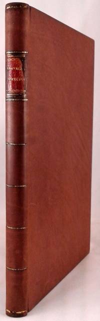
1804réf. 151171804. MOORE JOSHUA J. and THOMAS W. JONES. The Traveller's Directory: or a Pocket Companion Shewing the Course of the Main Road from Philadelphia to New York; and from Philadelphia to Washington: With Descriptions of the Places through which it Passes and the Intersections of the Cross Roads . By S. S. sic Moore and T. W. Jones. Philadelphia: Mathew Carey 1804. 8vo. 4 37 1 19 i.e. 17 p. 38 engraved strip maps on 22 plates. Modern full calf correctly done in perfect period style with original spine label slightly chipped at edges remounted and original endsheets relaid. Front free endsheet chipped at fore-edge name clipped from top blank margin of title page intermittant light browning of text and foxing of maps as is usual with this book. A very good copy of a book never found in fine condition. Second edition of the second American book of road maps following Christopher Colles' exceedingly rare Survey of the Roads of the United States 1789 and the first road map book to provide detailed maps of the road from Philadelphia north through New Jersey to New York and from Philadelphia south through Delaware Maryland and Virginia to Washington. Joshua John Moore and Thomas W. Jones were young surveyors in the employ of the Philadelphia publisher Mathew Carey. From several letters they wrote to Carey during the course of the survey Lea & Febiger papers PHi a clear picture emerges of the extremely difficult task they had undertaken. On June 29 1801 they wrote from New York: "We should have written to you before this had not fatigue of our daily Journies rendered repose indispensable after the finishing of our Notes and Traverses. After twelve days driving our way through an immense multitude of Questioners Observers laughters & Critics who generally thronged around us at every place to our great discomposure at first . we are at length arrived here. If astonishment would ensure success to a work we may entertain strong hopes indeed of ours; but it has nearly exhausted our health as every violent effort naturally must." Upon completion of the surveys the maps were drawn by the surveyors. They locate crossroads streams taverns churches and other public buildings and occasionally private houses. The text describes the various towns through which the roads pass. In this second edition published two years after the first edition of 1802 the descriptive text has been extensively corrected and expanded. The maps are identical to those in the earlier edition and are printed from the same plates. unknown books
1867réf. s02256Washington D.C: Government Printing Office 1867. 1st Edition. Hardcover. Very Good. Brown pebbled cloth boards with blindstamped rules; 9" tall; 151 pp plus large folding map. Good condition with wear to spine ends of corners of boards; map itself in very good condition colors bright folded properly modern tape reinforcement at creases. -- The "Map of the United States and Territories" by Joseph S. Wilson was one of the largest and most accurate maps of the country published at the time. It clearly marks major Native American territories and the colored mineral deposits show a clear rationale for expansion to the West. Joseph Wilson was Commissioner of the General Land Office both before and after the Civil War and this map was produced during the first year of his second tenure. The accompanying report asserts the United States' right to possession of the Western territories and states encourages the population thereof and admits to continuing arbitration land claims especially in California. Government Printing Office hardcover books