Gloria G SamsonBiblio.com

4 133 résultats
réf. Bloomsbury-9780313298738Praeger. Hardback. New. 288 pages Praeger hardcover
réf. Bloomsbury-9780313298738Praeger. Hardback. New. 288 pages Praeger hardcover
2021réf. DADAX0367521067CRC Press 2021-01-22. 1. hardcover. New. 0.77x6.15x9.22. Buy with confidence. Excellent Customer Service & Return policy. CRC Press hardcover
réf. 6374955like new. unknown
réf. 20034352-nnew. unknown
réf. 20034352like new. unknown
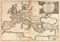
1667réf. 25060Paris: P. Mariette 1667. Other. The centre fold minor spotting else in excellent condition. 395 by 565mm 15 by 22 inches. Rare and decorative large-format historical map of Europe showing the locations of Church Councils and Synods in original outline color. By Guillaume Sanson 16331703 Géographe du Roy published by Pierre Mariette Paris 1667. Image: 395 x 565 mm 15.5 x 22 inches. Decorated with a superb allegorical title cartouche depicting a Catholic council in session a unique historical and cartographic document. Guillaume Sanson 16331703 was a leading French cartographer who inherited the celebrated family firm from his father Nicolas Sanson 16001667 known as the 'Father of French Cartography' and official Géographe du Roy to Louis XIV. Like his father Guillaume held the title of Géographe Ordinaire du Roy. Much of his work after 1671 was published in collaboration with Alexis-Hubert Jaillot and together the Sanson dynasty dominated French cartography throughout the 17th century. Their maps are held in the Bibliothèque nationale de France the British Library and major research collections worldwide.This large and striking map plots the locations of ecumenical councils national synods provincial councils and diocesan synods across Europe a unique cartographic subject of combined religious and historical significance. The coverage extends from the British Isles and Iberian Peninsula across to the eastern Mediterranean including Cyprus and Syria with North Africa also shown. Political borders are rendered in hand-applied outline color. The splendid allegorical title cartouche depicts a Catholic council in session and was engraved to the highest standard of the Parisian workshop. The Geographia Synodica is among the most unusual and collectible maps ever published of Europe: a historic document of scholarship faith and cartographic craft. In excellent condition. Original outline color fresh and vivid. The centrefold shows minor spotting as expected for a 17th-century map of this size; all else excellent. No tears or significant foxing. 395 x 565 mm. P. Mariette unknown
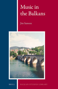
2019réf. DBS-9781682857274Willford 2019. 1st. Hardcover. New. Willford hardcover
2019réf. DBS-9781682857274Willford 2019. 1st. Hardcover. New. Willford hardcover
1976réf. DADAX06712213961976-01-15. First Edition. hardcover. New. xx. Buy with confidence. Excellent Customer Service & Return policy. hardcover
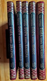
1993réf. 4876Jerusalem: Shvut Ami 1993. Hardcover Set. AsNew condition. 9.6"x6.8". be42. Contact the seller about the price of shipping. Shvut Ami hardcover
1846réf. 60753Nouvelle édition, augmentée d'une troisième partie inédite et précédée d'un avant-propos par de Pongerville, 1 vol. grand in-8 br., A. René et Cie, Paris, 1846, 320 pp. avec portrait en frontispice
2012réf. x-1780761198I B Tauris & Co Ltd 2012. Hardcover. New. 320 pages. 8.60x5.60x1.20 inches. I B Tauris & Co Ltd hardcover
1999réf. DADAX0631201890Wiley-Blackwell 1999-10-25. 1. hardcover. New. 6.90x1.30x10.00. Buy with confidence. Excellent Customer Service & Return policy. Wiley-Blackwell hardcover
1829réf. 6461615 vol. in-8 reliure demi-basane marron, dos à 5 nerfs, toutes tranches marbrées, Chez les Libraires Editeurs, Mequignon-Marvis, J.-B Baillière, Paris, 1829-1836
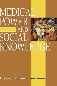
réf. 64508389Sage Publications . Hardback. New. pp. 284 2nd Edition Sage Publications hardcover
réf. 645597Oxford University Press OUP . Papeback. New. pp. xvii 387 Maps Oxford University Press OUP unknown
1654réf. 6571Paris 1654. Copper engraving 37 x 48 cms modern hand-colour blank verso. Nicolas Sanson 1600-1667 founder of the Sanson dynasty of map-makers is considered by many to be the father of the French school of cartography. He was a prolific and original map-maker admired for the clarity and scientific accuracy of his maps. Map unknown
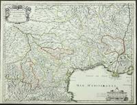
réf. 3863Paris: P. Mariette. 1651. No binding. Good. 420 x 550 mm. early outline colour. One small paper crease upper margin otherwise a superb example. Engraved by R. Cordier this fine map displays the region of Languedoc in south western France extending from the Pyranees to the Rhone valley. Inland to the north west the cities of Toulouse and Cahors are displayed. From the 'Cartes Generales de Toutes les Parties du Monde'. Pastoureau Sanson V A no. 44. P. Mariette. 1651 unknown
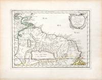
1657réf. 66689Paris. c. 1657. A very attractive and finely engraved map of the north eastern South American country of Guiana. The map is highlighted by numerous rivers tributaries mountains villages inlets bays and a very large inland equatorial lake that was thought to exist. Published in "Cartes Generales de toutes les parties du monde." Size: 285 x 360 mm. Copperplate engraving with original outline colouring. Fine condition. unknown
1657réf. 56721Histoire et Geographie de l'Amerique. 1657. Attractive map of Paraguay. Title cartouche at top right. Maps by Sanson in original colour are rare. Nicolas Sanson was founder of the French school of mapmakers at a time when the leadership in European cartography passed from the Low Countries to France. Copper engraving. Fine condition; very light offsetting. Original outline colour. Size: 28.5 x 21.5 cm. 11 x 8½ inches unknown
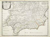
réf. 10313Paris: Pierre Mariette. 1652. No binding. Good. 410 x 540 mm. early outline colour in excellent condition. An attractive map of the south of Spain the Costa del Sol. First published in Nicolas Sanson's 'Les Cartes Generales' in 1658. Sanson was France's premier cartographer and helped to lift the field onto another plain during his career. The map extends from Faro in Portugal in the west eastwards to Valencia. Pastoureau Sanson Va no. 69; Phillips P.L. Atlases 4260-67. Pierre Mariette. 1652 unknown
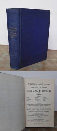
réf. 53908Sydney Walter Jameson Meyer 1866. TITLE CONTINUED: Including Sydney Bathurst Maitland Newcastle Goulburn Forbes Armidale Tamworth Grafton Murrurundi Muswellbrook Singleton Mudge etc. 1866. 8vo approximately 215 x 140 mm 8½ x 5½ inches large folding map pages: xvi adverts 1 a large folding plate 1 1-640 followed by 63 pages of adverts first and last advert page pasted down on pastedowns losing first advertisment original publisher's navy blue cloth gilt title to spine blind decoration to covers. Binding slightly rubbed folding map has some neat repairs to blank side no loss of image the map paper is delicate and needs care on opening otherwise a very good copy. See: National Library of Australia's Bib ID 1720838. MORE IMAGES ATTACHED TO THIS LISTING ALL ZOOMABLE FURTHER IMAGES ON REQUEST. POSTAGE AT COST. Sydney, Walter Jameson Meyer, [1866]. hardcover
2021réf. x-0198754957Oxford Univ Pr 2021. Hardcover. New. 656 pages. 9.50x6.50x1.75 inches. Oxford Univ Pr hardcover
1988réf. BN335947Hermann Luchterhand Verlag 1988. 1988. Wiederholungs- und Vertiefungskurs in den Kerngebieten des Rechts: Wiederholungskurs und Vertiefungskurs in den Kerngebieten des Rechts Bd.7 Strafrecht Wiederholungs- und Vertiefungskurs in den Kerngebieten des Rechts: Wiederholungskurs und Vertiefungskurs in den Kerngebieten des Rechts Bd.7 Strafrecht Erich Samson Hermann Luchterhand Verlag unknown