4 133 résultats
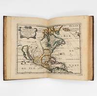
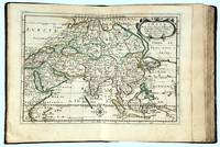
1662réf. bf4740Chez L'auteur Relié 1662 "MAGNIFIQUE ENSEMBLE DES QUATRE CONTINENTS CARTOGRAPHIÉS PAR LE PREMIER CARTOGRAPHE FRANÇAIS, DANS UN ÉTAT DE FRAICHEUR INCOMPARABLE. Quatre volumes petit in-4 (18,5 x 25 cm), reliés en plein veau brun de l'époque. Les reliures sont toutes identiques, dos à 5 nerfs, titrés, roulettes dorées sur les coupes. Nicolas Sanson d'Abbeville est considéré comme le fondateur de la cartographie en France. En 1627, rencontrant Richelieu (il venait d'Abbeville et s'était installé à Paris), il fut présenté par lui à Louis XIII, qui le nomma Géographe Ordinaire du Roi. Il cartographia quatre continents (ici présents : l'Europe, l'Asie, l'Afrique et l'Amérique), et fut même le premier à cartographier certaines parties du globe (ainsi, par exemple, la région des grands lacs canadiens, avec sa carte ""Le Canada ou Nouvelle France"" (carte datant de 1656)). Il fut le premier Français à concevoir le plan d'un atlas mondial. Les cartes et le texte de chaque volume sont entièrement montés sur onglets. Chaque carte reçoit un commentaire explicatif, avec informations sur l'économie, les habitants et les moeurs du pays décrit, tiré des auteurs anciens (Pline, Strabbon...), de récits de voyageurs ou de rapports des missions des jésuites. De plus, chacune des cartes présente les tracés de contours des pays ou régions aquarellés. Les volumes s'organisent comme suit : L'Europe (sans date) : Titre et dédicace gravés sur double page, 12 cartes doubles et 30 feuillets imprimés au recto. L'Asie (1662) : 108 pages (avec erreurs connues de chiffrage et inversion de feuillets) et 17 cartes doubles. L'Afrique (1662) : 96 pages et 17 planches doubles, proposant 18 cartes (car l'une des planches porte deux cartes) (ce volume est le seul à présenter une petite mouillure sur les quelques premières pages). L'Amérique (1662) : non paginé (80 pages) et 15 cartes doubles. Nos exemplaires sont en TRÈS BEL ÉTAT. Les pages sont très fraiches, sans aucune réelle trace, tache, piqûre ni mouillure. Les cartes, particulièrement, sont dans un vraiment très bel état de fraîcheur, avec des couleurs extrêmement éclatantes. Les reliures présentent des traces peu visibles de réparations anciennes. Les volumes ont étés reliés avec contre-gardes, mais sans pages de garde. Ce rare ensemble est véritablement en TRÈS BEL ÉTAT. Livraison a domicile (La Poste) ou en Mondial Relay sur simple demande."
réf. 05696London: S. W. Fores 1800. The Rarest Woodward of All London Is No Place To Be In The Summer WOODWARD George Moutard designer. SANSON Francis engraver. Every Body Out Of Town exemplified in six characteristic prints and illustrative labels with Every Body In Town exemplified in six characteristic prints and illustrative labels. London: S.W. Fores 1800. Second editions originally published by Woodward himself in 1794/1796. Quarto 10 1/8 x 8 3/8 in; 259 x 213 mm. Twelve hand-colored engraved plates 9 x 7 1/2 in; 297 x 192 mm two hand-colored engraved title-pages each imprinted Feb. 14 1800 and mounted on fourteen quarto sheets 133/4 x 18 1/4 in; 349 x 470 mm of various colors. Four blank leaves at rear folded blank quarto sheet inserted in rear pocket. Bound in contemporary full maroon morocco with double gilt fillets enclosing extravagantly blindstamped covers with an outer frame of floral and foliate motifs volutes curls with bacchants along lower edge an inner rolled frame and a central panel with center lozenge within an elaborately blocked medallion. Pocket to rear cover. Astonishingly bright clean and very fine. Housed in a felt-lined half maroon morocco over gray cloth clamshell case spine with five raised bands ruled and lettered in gilt in compartments. OCLC records one copy of the 1800 edition of Every Body Out of Town and only two copies of the 1800 edition of Every Body In Town in institutional holdings worldwide. Not found in the British Museum's collection of satirical prints. According to the ABPC Index the last time either title came to auction was in 1942 Every Body Out of Town 1800 and 1923 Every Body In Town 1800. These 1800 reprints are rarer than the original issues. They are also larger than the 1794-1796 first issues which measured only 7 7/8 x 6 5/8 inches 200 x 170 mm. Of George Murgatroyd Woodward 1760-1809 caricaturist and author the DNB notes that he "later known as Mustard George grew up in a Derbyshire town living with his father and to judge by the evidence of his later writings received a sound education. He took early to caricature ridiculing his neighbours in Derbyshire; a folio of these drawings dated 1781 is in the Derby Local Studies Library among a sizable collection of his prints drawings and book illustrations. His caricatures having caused something of a local stir he persuaded his father to let him seek his fortune in London. "Apart from two caricature prints dated 1785 designed by Woodward and published by him from 28 Cary Street Lincoln's Inn London it was not until 1790 that he made an impact on the London scene. Thereafter his output was copious. The British Museum catalogues list 525 examples of his work from the next twenty years published by Holland Fores Ackermann and latterly Tegg all leading printsellers. These prints designed by Woodward are etched by others-Rowlandson who was his friend and drinking companion Isaac Cruikshank Roberts and Williams. Woodward's original drawings are vigorous. and his value lay in his humorous ideas. "Woodward.might have rivalled Hogarth. Certainly his collaboration with Rowlandson constituted a lively if frivolous commentary on the social scene. Dorothy George described him as 'original prolific varied humorous and good-humoured' and few students of the subject would dispute her conclusion that his death was 'a loss to caricature' George English Political Caricature 1.174" Simon Heneage 'Woodward George Murgatroyd 1760-1809 Oxford Dictionary of National Biography Oxford University Press 2004. Etcher and engraver Francis Sanson was active 1784-1799. Bobins IV 1365; Gordon Library BC28 BC29; Not in Abbey or Tooley. London: S. W. Fores, 1800 unknown
réf. 05696London: S. W. Fores 1800. The Rarest Woodward of All London Is No Place To Be In The Summer WOODWARD George Moutard designer. SANSON Francis engraver. Every Body Out Of Town exemplified in six characteristic prints and illustrative labels with Every Body In Town exemplified in six characteristic prints and illustrative labels. London: S.W. Fores 1800. Second editions originally published by Woodward himself in 1794/1796. Quarto 10 1/8 x 8 3/8 in; 259 x 213 mm. Twelve hand-colored engraved plates 9 x 7 1/2 in; 297 x 192 mm two hand-colored engraved title-pages each imprinted Feb. 14 1800 and mounted on fourteen quarto sheets 133/4 x 18 1/4 in; 349 x 470 mm of various colors. Four blank leaves at rear folded blank quarto sheet inserted in rear pocket. Bound in contemporary full maroon morocco with double gilt fillets enclosing extravagantly blindstamped covers with an outer frame of floral and foliate motifs volutes curls with bacchants along lower edge an inner rolled frame and a central panel with center lozenge within an elaborately blocked medallion. Pocket to rear cover. Astonishingly bright clean and very fine. Housed in a felt-lined half maroon morocco over gray cloth clamshell case spine with five raised bands ruled and lettered in gilt in compartments. OCLC records one copy of the 1800 edition of Every Body Out of Town and only two copies of the 1800 edition of Every Body In Town in institutional holdings worldwide. Not found in the British Museum's collection of satirical prints. According to the ABPC Index the last time either title came to auction was in 1942 Every Body Out of Town 1800 and 1923 Every Body In Town 1800. These 1800 reprints are rarer than the original issues. They are also larger than the 1794-1796 first issues which measured only 7 7/8 x 6 5/8 inches 200 x 170 mm. Of George Murgatroyd Woodward 1760-1809 caricaturist and author the DNB notes that he "later known as Mustard George grew up in a Derbyshire town living with his father and to judge by the evidence of his later writings received a sound education. He took early to caricature ridiculing his neighbours in Derbyshire; a folio of these drawings dated 1781 is in the Derby Local Studies Library among a sizable collection of his prints drawings and book illustrations. His caricatures having caused something of a local stir he persuaded his father to let him seek his fortune in London. "Apart from two caricature prints dated 1785 designed by Woodward and published by him from 28 Cary Street Lincoln's Inn London it was not until 1790 that he made an impact on the London scene. Thereafter his output was copious. The British Museum catalogues list 525 examples of his work from the next twenty years published by Holland Fores Ackermann and latterly Tegg all leading printsellers. These prints designed by Woodward are etched by others-Rowlandson who was his friend and drinking companion Isaac Cruikshank Roberts and Williams. Woodward's original drawings are vigorous. and his value lay in his humorous ideas. "Woodward.might have rivalled Hogarth. Certainly his collaboration with Rowlandson constituted a lively if frivolous commentary on the social scene. Dorothy George described him as 'original prolific varied humorous and good-humoured' and few students of the subject would dispute her conclusion that his death was 'a loss to caricature' George English Political Caricature 1.174" Simon Heneage 'Woodward George Murgatroyd 1760-1809 Oxford Dictionary of National Biography Oxford University Press 2004. Etcher and engraver Francis Sanson was active 1784-1799. Bobins IV 1365; Gordon Library BC28 BC29; Not in Abbey or Tooley. London: S. W. Fores, 1800 unknown books
1595réf. 100047AG1595. Paris / London / Antwerp and other places of print c.1595 - 1851. Some stunning examples of hand-coloured copper-engravings plus one manuscript map Tuckey / Congo - Zaire. All of these maps in very good / excellent condition. This collection presents itself for becoming an amazing a meaningful starting-point for an Africana-Collection decoration for a Safari-Lodge interior-design for an Africana-themed library etc. etc. The price includes worldwide free shipping per DHL Express-Courier 2-3 day-delivery. Ask for complete list and images and please also inquire about our amazing book-collection of Africana which would be a great match for this collection of vintage maps. unknown
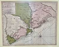
1696réf. 48399Amsterdam: Pierre Mortier 1696. Engraved broadside map 19 x 23 5/8 inches plate mark dimensions with extensive pink and green wash. Some light browning but an attractive copy. Matted glazed and framed. One of two issues of this map this one being a bit larger based on the Thornton-Morden map of circa 1685. Pictures the colony from the Santee River to the South Edisto River and well inland up the Cooper River. Physical features and names of plantation and land owners are given in English "Nouveau Londre" on the Edistow sic River being exceptions; soundings are given at river mouths in Charleston Harbor and in the ocean along some beaches. Cumming Southeast in Early Maps 121. Kendall Early Maps of Carolina 17c: "This map has a wealth of names of owners of land in Carolina. Pierre Mortier unknown
1696réf. 48399Amsterdam: Pierre Mortier 1696. Engraved broadside map 19 x 23 5/8 inches plate mark dimensions with extensive pink and green wash. Some light browning but an attractive copy. Matted glazed and framed. One of two issues of this map this one being a bit larger based on the Thornton-Morden map of circa 1685. Pictures the colony from the Santee River to the South Edisto River and well inland up the Cooper River. Physical features and names of plantation and land owners are given in English "Nouveau Londre" on the Edistow sic River being exceptions; soundings are given at river mouths in Charleston Harbor and in the ocean along some beaches. Cumming Southeast in Early Maps 121. Kendall Early Maps of Carolina 17c: "This map has a wealth of names of owners of land in Carolina. Pierre Mortier unknown books
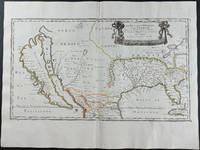
1656réf. 9429Engraving outlined in original color in the third state with Chez l'Autheur to the cartouche. Sanson's first large format regional map of North America depicting California as an island. The map measures approximately 21.5 x 12.5 in 54.5 x 32 cm with the paper size being 23.5 x 17.75 in 60 x 45 cm. Scarce.
réf. 16-6140Paris: 1653. Folio. 30 x 43.2cm. Defective contemporary thick paper covers. Title page and dedication page with losses. Handcolored in outline. One map with loss in lower right corner and one map with tear in lower right corner Sixteen double page maps complete some with waterstains visible verso.Rare to find such a large ensemble of Sanson's maps. Reference: Bibliothèque nationale de France; ark:/12148/btv1b530780775/; Bibliothèque nationale de France département Cartes et plans GE A-592 RES . Paris: 1653. unknown
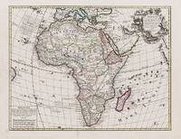
1656réf. B2984Paris: Nicolas Sanson c. 1656. Lower right corner of the first eight leaves strengthened otherwise a very good copy maps and text are clean and crisp. In protective cloth slipcase. Edition: First edition. Binding: Full contemporary calf expertly rebacked with spine in six compartments of raised bands and finely-gilt motifs morocco label on two edges speckled red. Notes: This atlas was dedicated to the Superintendent of Finances at the time Nicolas Fouquet. Regarding a map of South and Central Africa published the year before which bears resemblance to this map of South Africa--‘Pays et Costes des Caffres’--in particular Norwich writes: “This map although a fine example of cartography is based on very little information; for example the desert-like coast of South West Africa is presented as a land rich in rivers. The fictitious states are given fictitious boundaries and the interior is marked with large cities such as Vigiti Magna and Monomotapa. This information led to subsequent exploration in search of these fabulous cities. Although the map is dated three years after the foundation of a settlement at the Cape by Jan van Riebeeck no mention is made of any European settlement anywhere in the south.” Size: 4to Illustration: Recent stencilled title. Complete with 18 maps of Africa and its territories in original outline colour. References: Tooley IV:103; Tooley Africa 100 Peyrounin edition; Norwich 37 & 158. Pages: P. 1-96. Category: Book Africa General; Book Atlas & Cartography Nicolas Sanson hardcover
1657réf. 375003Paris: Chez L'Autheur 1657. 15 engraved double-page maps hand colored in outline. 4 40 of 42 unpaginated text leaves lacks final two leaves of text. 4to. Contemporary mottled calf gilt raised spine bands repairs at joints. Lacks final two leaves of text after the map of Brazil. 15 engraved double-page maps hand colored in outline. 4 40 of 42 unpaginated text leaves lacks final two leaves of text. 4to. First edition of important and quite handsome 17th-century French atlas of the Americas. This atlas was first published in 1657 and stands as a beautiful cartographic record of America for the 17th century. Sanson was official cartographer to the King. The maps include detailed charts of North South and Central America the West Indies Canada Mexico Florida and the southeast and a map of New Mexico showing most of the Spanish southwest territory with California depicted as an island. An impressive and detailed atlas for the time. The maps are titled as follows: 1 Americque Septentriole 2 Le Canada ou Nouvelle France &c. 3 La Floride 4 Audience de Mexico 5 Audience de Guadalajara Nouveau Mexique Californie &c. 6 Audience de Guatimala 7 Les Isles Antilles &c. 8 Amerique Meridionale 9 Terre Ferme Nouveau royme de Grenade &c. 10 Guiane divisee en Guiane et Caribane 11 Le Perou et le cours de la rivre Amazone 12 Le Chili 13 Le Brasil 14 Le Paraguay subdivise en ses principales parties suivant les dernieres relaons 15 Destroit de Magellan Terre et Isles Magellanicques &c. Sabin 76708; Phillips Atlases 1151; Streeter sale 68 undated edition; Leighley California as an Island plate 9 Chez L'Autheur unknown
1657réf. 375003Paris: Chez L'Autheur 1657. 15 engraved double-page maps hand colored in outline. 4 40 of 42 unpaginated text leaves lacks final two leaves of text. 4to. Contemporary mottled calf gilt raised spine bands repairs at joints. Lacks final two leaves of text after the map of Brazil. 15 engraved double-page maps hand colored in outline. 4 40 of 42 unpaginated text leaves lacks final two leaves of text. 4to. First edition of important and quite handsome 17th-century French atlas of the Americas. This atlas was first published in 1657 and stands as a beautiful cartographic record of America for the 17th century. Sanson was official cartographer to the King. The maps include detailed charts of North South and Central America the West Indies Canada Mexico Florida and the southeast and a map of New Mexico showing most of the Spanish southwest territory with California depicted as an island. An impressive and detailed atlas for the time. The maps are titled as follows: 1 Americque Septentriole 2 Le Canada ou Nouvelle France &c. 3 La Floride 4 Audience de Mexico 5 Audience de Guadalajara Nouveau Mexique Californie &c. 6 Audience de Guatimala 7 Les Isles Antilles &c. 8 Amerique Meridionale 9 Terre Ferme Nouveau royme de Grenade &c. 10 Guiane divisee en Guiane et Caribane 11 Le Perou et le cours de la rivre Amazone 12 Le Chili 13 Le Brasil 14 Le Paraguay subdivise en ses principales parties suivant les dernieres relaons 15 Destroit de Magellan Terre et Isles Magellanicques &c. Sabin 76708; Phillips Atlases 1151; Streeter sale 68 undated edition; Leighley California as an Island plate 9 Chez L'Autheur unknown books
réf. 000151150Cvi b. Shimshon Tuchfirer. Nachalat Zvi. Venice 1660. In Hebrew. The listing price is for a single volume of this title. The copy is in fair condition without binding. Some imperfections are among the following common defects: holes damaged pages tears water stains foxing worm holes or tracers age spots frayed margins handwritten notes inscriptions censorship stamps. Please contact us for more details on the condition of the book. SKU000151150 unknown
1656réf. 006682Paris: Chez l'Autheur 1656. First Edition. Full Calf. Very Good. 4to. 23.5 by 17.5 cm. Unpaginated 100 pages of text plus 2 pp. of ads. With 18 copper engraved maps all two page plates each with hand-colored of boundaries. Maps include one of the entire continent then of its various regions as then known plus the islands off the continent. Also a map of Malta. Bound in contemporary calf. Condition: calf dry and rubbed on spine and joints and edges rubbed. Light to moderate soiling in the margins of the pages. Two bookplates -- one of the Marquis of Lothian the other the Newbattle Abbey Library. Chez l'Autheur unknown
1652réf. 006683Paris: Chez l'Autheur 1652. First Edition. Full Calf. Very Good. 4to. 23.5 by 17.5 cm. Unpaginated 102 pages of text plus 2 pp. of ads 1 Royal privilege page. With 17 copper engraved maps all two page plates each with hand-colored of boundaries. Maps include one of the entire continent then of its various regions as then known plus island groups. Separate maps for China and Japan. Bound in contemporary calf. Condition: Rebacked with joints making this obvious. The original spine was re-mounted with some losses. Its blindstamped decoration of fans is discernible but somewhat vague. We think it is possible this decoration had some gilding or color originally but none survives. Still an interesting and unusual feature in our view. Calf dry and rubbed on spine and joints and edges rubbed. Light to moderate soiling in the margins of many pages and on a few pages the soiling invades inward beyond the margins and also in a few instances the marginal soiling is on the heavier side. There are a few archival tape repairs of small chips three on the title leaf one on the following leaf and after that wormhole edge damage was left untouched. That said the defect and repair isn't as glaring as it might sound. The edges elsewhere can have short spans of a chewed appearance. As a book generally we would consider this copy at best Good. As far as the maps go independent of the book we would regard them as Very Good. A few of the maps might individually fall short of such grading; on the other hand all the maps of this copy one can easily imagine someone enthusiastically framing even without an attempt to clean them up. Two bookplates -- one of the Marquis of Lothian the other the Newbattle Abbey Library. Chez l'Autheur unknown
1656réf. 006682Paris: Chez l'Autheur 1656. First Edition. Full Calf. Very Good. 4to. 23.5 by 17.5 cm. Unpaginated 100 pages of text plus 2 pp. of ads. With 18 copper engraved maps all two page plates each with hand-colored of boundaries. Maps include one of the entire continent then of its various regions as then known plus the islands off the continent. Also a map of Malta. Bound in contemporary calf. Condition: calf dry and rubbed on spine and joints and edges rubbed. Light to moderate soiling in the margins of the pages. Two bookplates -- one of the Marquis of Lothian the other the Newbattle Abbey Library. Chez l'Autheur unknown books
1652réf. 006683Paris: Chez l'Autheur 1652. First Edition. Full Calf. Very Good. 4to. 23.5 by 17.5 cm. Unpaginated 102 pages of text plus 2 pp. of ads 1 Royal privilege page. With 17 copper engraved maps all two page plates each with hand-colored of boundaries. Maps include one of the entire continent then of its various regions as then known plus island groups. Separate maps for China and Japan. Bound in contemporary calf. Condition: Rebacked with joints making this obvious. The original spine was re-mounted with some losses. Its blindstamped decoration of fans is discernible but somewhat vague. We think it is possible this decoration had some gilding or color originally but none survives. Still an interesting and unusual feature in our view. Calf dry and rubbed on spine and joints and edges rubbed. Light to moderate soiling in the margins of many pages and on a few pages the soiling invades inward beyond the margins and also in a few instances the marginal soiling is on the heavier side. There are a few archival tape repairs of small chips three on the title leaf one on the following leaf and after that wormhole edge damage was left untouched. That said the defect and repair isn't as glaring as it might sound. The edges elsewhere can have short spans of a chewed appearance. As a book generally we would consider this copy at best Good. As far as the maps go independent of the book we would regard them as Very Good. A few of the maps might individually fall short of such grading; on the other hand all the maps of this copy one can easily imagine someone enthusiastically framing even without an attempt to clean them up. Two bookplates -- one of the Marquis of Lothian the other the Newbattle Abbey Library. Chez l'Autheur unknown books
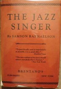
réf. 30548Brentano's. RAPHAELSON Samson. THE JAZZ SINGER. NY: Brentano's 1925. Small 8vo. cloth & patterned boards in dust jacket. First Edition. Signed by Raphaelson on the front endpaper and dated Christmas 1925. Basis for the hit play starring George Jessel and Sam Jaffe. The play was later adapted to the famous film starring Al Jolson and Warner Oland. The film generally considered the first "talkie" is certainly one of the milestones in cinematic history. Very Good; some edgewear & shallow chipping number of tears with professional interior repairs d/j. Enclosed in a custom-designed leather and cloth clam-shell box with Al Jolson in black face depicted on the spine and front cover. $4000.00. Brentano's unknown
réf. 30548Brentano's. RAPHAELSON Samson. THE JAZZ SINGER. NY: Brentano's 1925. Small 8vo. cloth & patterned boards in dust jacket. First Edition. Signed by Raphaelson on the front endpaper and dated Christmas 1925. Basis for the hit play starring George Jessel and Sam Jaffe. The play was later adapted to the famous film starring Al Jolson and Warner Oland. The film generally considered the first "talkie" is certainly one of the milestones in cinematic history. Very Good; some edgewear & shallow chipping number of tears with professional interior repairs d/j. Enclosed in a custom-designed leather and cloth clam-shell box with Al Jolson in black face depicted on the spine and front cover. $4000.00. Brentano's unknown books
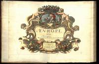
1647réf. 75287Paris Uten år. 1647-1665. 4to. Samtidig helskinnbind med opphøyde ryggbånd og ryggforgylling. Ryggen rebacked med bruk av den gamle ryggstripen. Håndkolorert gravert dobbeltsidig tittelblad og dedikasjonsblad. Upaginert. 30 bl. Med 12 dobbeltsidige håndkolorerte kart. 4to. Contemporary full calf with raised bands spine gilt. Spine rebacked by using of the old spine. Handcoloured doublepage title and handcoloured doublepage dedication. Not paginated. 30 leaves. With 12 doublepage handcoloured copper engraved maps. Chez Pierre Mariette. Fransk. “Nicolas Sanson le fils 1625 - 1648. Son of Nicolas and his intended heir prevented by his premature death from gunshot wounds. Only three known works. L’Europe 12 maps ca. 1648 compiled by N. Sanson fils engraved by A. Peyrounin theoretically published by Nicolas fils himself but may have been published posthumously by his father republished by Mariette 1660 1665. Tooley’s Dictionary of mapmakers. Revised edition. hardcover
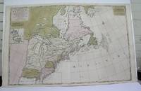
1698réf. M3704Paris 1698. Excellent. Notes: Rather rare original coloured version of this map an important 17th century map of the Great Lakes and East coast with an inset map of Boston. Cumming qtd in Arkway: "in spite of its scope and size it has a good deal of information for the Carolina Coast". This map by Sanson first appeared in Mortier's sea atlas "Le Neptune Francois"; interestingly it is not generally found in Sanson or Jaillot atlases. Size : 650x924 mm 25.625x36.375 Inches Coloring: Original Hand Coloring Reference: Arkway 58:23 Category: Maps Canada East; Maps United States New England unknown
1652réf. 14178Paris: Sanson 1652. Double hemisphere world map showing the rivers and water bodies of the world. Original outline color. 20 3/4 x 15 3/4". Depicts Australia prior to Tasman's discoveries and labels North Australia "Beach" according to Marco Polo and California as an island. References: Shirley R.W. World 394. Sanson unknown
1662réf. 16493Paris: chez l’Autheur 1662. SECOND EDITION. Complete with 17 double-page engraved maps hand-colored in outline. Contemporary mottled calf corner edges neatly repaired interior has some minor dampstaining mainly on text and on blank verso of maps last blank leaf torn on lower fore-edge. A contemporary signature on first blank leaf. Similar to L’Amerique this atlas of the continent of Asia was first printed in 1652 and reprinted here with a new title page. The maps are all dated 1652 with only one dated 1653 and do not include the address of Mariette. The atlas features maps of India Persia China Japan the Maldives Arabia and the Philippines among others. Just prior to publication of this series of works which also included atlases of Europe and Africa Sanson formed a partnership with Pierre Mariette an engraver and printseller. Pursuant to their contract Sanson drew the maps and Mariette engraved and printed them. Each maintained possession of half of the plates and they were allowed to exchange and/or buy from one another. Some bore the address of Sanson others Mariette. But Sanson allowed Mariette to store his plates and Mariette without prior agreement started placing his address on Sanson’s plates. In time a lawsuit which had been prosecuted was settled when both died and their respective sons took over the business. This atlas is a fine examples of French mapping by the foremost French cartographer of the seventeenth century. Sanson 1600-1667 “Geographe Ordinaire du Roi” to Louis XIII is considered the founder of French cartography and is generally acknowledged as the originator of the great age of French cartography. chez l’Autheur unknown
1662réf. 16493Paris: chez l’Autheur 1662. SECOND EDITION. Complete with 17 double-page engraved maps hand-colored in outline. Contemporary mottled calf corner edges neatly repaired interior has some minor dampstaining mainly on text and on blank verso of maps last blank leaf torn on lower fore-edge. A contemporary signature on first blank leaf. Similar to L’Amerique this atlas of the continent of Asia was first printed in 1652 and reprinted here with a new title page. The maps are all dated 1652 with only one dated 1653 and do not include the address of Mariette. The atlas features maps of India Persia China Japan the Maldives Arabia and the Philippines among others. Just prior to publication of this series of works which also included atlases of Europe and Africa Sanson formed a partnership with Pierre Mariette an engraver and printseller. Pursuant to their contract Sanson drew the maps and Mariette engraved and printed them. Each maintained possession of half of the plates and they were allowed to exchange and/or buy from one another. Some bore the address of Sanson others Mariette. But Sanson allowed Mariette to store his plates and Mariette without prior agreement started placing his address on Sanson’s plates. In time a lawsuit which had been prosecuted was settled when both died and their respective sons took over the business. This atlas is a fine examples of French mapping by the foremost French cartographer of the seventeenth century. Sanson 1600-1667 “Geographe Ordinaire du Roi” to Louis XIII is considered the founder of French cartography and is generally acknowledged as the originator of the great age of French cartography. chez l’Autheur unknown books
réf. 2091202133208116Not Available N.A. Soft Cover. Fine. Number of books: 1 Not Available paperback
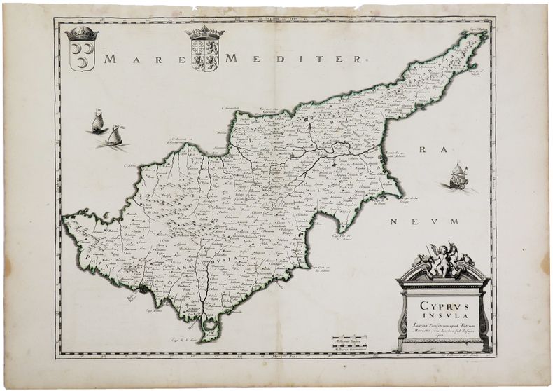
1670réf. LBW-3262Paris, Pierre Mariette, [1670]. 375 x 485 mm.