S SansonBiblio.com
4 045 résultats
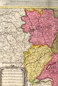
1700réf. BB614331700. unknown. gebraucht gut gefaltete Landkarte mit Mittelfalz Papier altersbedingt etwas fleckig und gebräunt sonst GUTES EXEMPLAR. 442 x 575 cm. Blatt: 535 x 605 cm. l'Archevesche et l'Elctorat de Mayence et le Palatinat du Rhein Lorraine Suisse l'Alsace Sueve la Duche et la Comte de Bourgogne et d'autres Provinces voisines de France et Italie. Altkolorierter Kupferstich um 1700 Für Ihre Zufriedenheit versenden wir mit DHL und ausschließlich mit Trackingcode für eine sichere Sendungsverfolgung! Weitere Angebote unter antiquariat-kastanienhof unknown
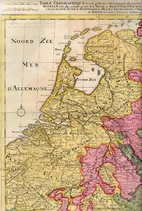
1710réf. BB614341710. unknown. gebraucht gut gefaltete Landkarte mit Mittelfalz Papier altersbedingt etwas fleckig und gebräunt sonst GUTES EXEMPLAR. 445 x 575 cm. du Rhein Meuse Moselle et les plus grandes parties de le Weser le Mein l'Ems l'Escault l'Issel et les autres rivieres qui fe dechargent dans elles comme aussi les Provinces d'Allemagne Basse de Westphalie de Hesse l'Archeveche et l'Elctorat de Cologne et de Treves avec les parties de Majence et le Palatinat du Rhein et d'autres Provinces voisines. Altkolorierter Kupferstich um 1710 Blatt: 535 x 605 cm Für Ihre Zufriedenheit versenden wir mit DHL und ausschließlich mit Trackingcode für eine sichere Sendungsverfolgung! Weitere Angebote unter antiquariat-kastanienhof unknown
réf. B9781948405089Hardback. New. hardcover
réf. B9798612875918Paperback / softback. New. paperback
réf. B9781855661684Hardback. New. An assessment of the life work and reputation of Spain's leading Golden Age dramatist hardcover
2002réf. AME_9780521590174Cambridge University Press 2002. 1. Hardcover. New/New. _ Cambridge University Press hardcover
1812réf. 006820Paris: Chez Jean Md d'Estampes 1812 Engraving 59 x 90 cm old color. The first edition of this map was published in 1674 by Hubert Jaillot under the title "La Russie Blanche ou Moscovie divisee suivant l'étendue des Royaumes Duches." It was incorporated into numerous atlases by Jaillot and his successors until approximately 1720 when it became evidently outdated. However around 1812 it was reissued likely to illustrate the French-Russian war. Chez Jean Md d'Estampes unknown
réf. 0811712443.Ghardcover. Good. Access codes and supplements are not guaranteed with used items. May be an ex-library book. hardcover
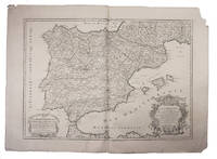
1708réf. E7GCJJB1RUYXParis 1708. Hubert Jaillot Engraved map on 2 assembled sheets 55.5 x 78 cm engraved by Cordier. With title in decorated cartouche on the bottom right corner scales and privilege in decorated cartouche on the bottom left corner and a few lines coloured in green. Large map of Spain and Portugal this state with a privilege for 20 years granted in 1708. Engraved by Cordier after the map by Nicolas Sanson.Strengthened fold damaged corners but map in very good condition.l Cf. Pastoureau Jail. II A map 91. unknown
1992réf. AME_9780817635039Birk 1992. N/A. Unknown Binding. New/New. _ Birk unknown
2006réf. AME_9780387283852Springer 2006. 1st. Hardcover. New/New. _ Springer hardcover
1993réf. AME_9780817636098Birk 1993. N/A. Hardcover. New/New. _ Birk hardcover
1997réf. AME_9780028616704Glencoe/Mcgraw-Hill 1997. 5th. Paperback. New/New. _ Glencoe/Mcgraw-Hill paperback
1998réf. USD_9780124759787AP 1998. 1st. Hardcover. Used - Like New/Used - Like New. _ AP hardcover
1990réf. AME_9780070545281MGH 1990. 1st. Hardcover. New/New. _ MGH hardcover
2019réf. AME_9781682857274Willford Press 2019. 1st. Hardcover. New/New. _ Willford Press hardcover
1996réf. AME_9780387946672Springer 1996. 1st. Paperback. New/New. _ Springer paperback
1996réf. AME_9780387946689Springer 1996. 1st. Hardcover. New/New. _ Springer hardcover
1678réf. 200041AG1678. Paris Sanson d'Abbeville 1678. Original hand-coloured engraving. Plate Size: 53.6 cm x 41.7 cm. Sheet Size: 61.8 cm x 46.5 cm. Original map. In very good condition. Faint signs of browning to map. Minor paper imperfections to the outer margins. Small stain to map near centre-fold. A richly detailed map showing the northern part of Portugal. Relief on map depicted pictorially and border inlaid with longitudinal and latitudinal details The map is dominated by three rivers: the Tajo Tagus in the south the Douro and the Minho further north. The Spanish kingdom and regions such as Leon are included and the great city of Salamanca can be seen. The lower part of the map runs out before the Tagus estuary empties into the Atlantic at Lisbon. The ornamental title cartouche is in the lower right corner of the map. Off the coast is a large warship flying the coat-of-arms Kingdom of Portugal and the Algarves. The sails of the boat carry Latin text commemorates the commercial and maritime exploits of King John IV in Africa Arabia Ethiopia Persia India and Brazil. Nicolas Sanson 20 December 1600 7 July 1667 was a French cartographer termed by some the creator of French geography in which he's been called the "father of French cartography." The French school of Geography was unprecedented in its attention to precision and scientific detail and discarded much of the decorative embellishments of previous maps as irrelevant. From Sanson's time in the second half of the seventeenth century until the latter part of the eighteenth century French geographical conceptions were more influential than those put forward by any other nation. He was tutor to Louis XIII and Louis XIV. Sanson published over 300 maps. In 1692 Hubert Jaillot collected Sanson's maps in an Atlas nouveau. Wikipedia unknown
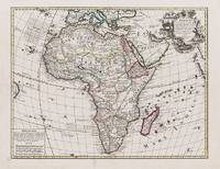
1595réf. 100047AG1595. Paris / London / Antwerp and other places of print c.1595 - 1851. Some stunning examples of hand-coloured copper-engravings plus one manuscript map Tuckey / Congo - Zaire. All of these maps in very good / excellent condition. This collection presents itself for becoming an amazing a meaningful starting-point for an Africana-Collection decoration for a Safari-Lodge interior-design for an Africana-themed library etc. etc. The price includes worldwide free shipping per DHL Express-Courier 2-3 day-delivery. Ask for complete list and images and please also inquire about our amazing book-collection of Africana which would be a great match for this collection of vintage maps. unknown
réf. 73602Paris Pierrr Mariette 1656/ca. 1950. 13 x 17.5 cm 26 x 30 cm Rahmen vergoldet unter Passepartout Min. gebrauchspurig sonst tadell. Handkolorierte Faksimile. - Nicolas Sanson der Ältere auch: Nicolas Sanson d’Abbeville 1600 in Abbeville Frankreich- 1667 in Paris französischer Kartograph. Er gilt als der Vater der Geographie in Frankreich.In den Jahren 1618 bis 1667 schuf Sanson etwa 300 einzelne Karten sowie Atlanten und illustrierte Texte. Er wurde zum Geographe Ordinaire du Roy königlicher Kartenmacher ernannt und unterrichtete die Könige Ludwig XIII. und Ludwig XIV. in Geographie. 010 Paris, Pierrr Mariette, 1656/ca. 1950 unknown
réf. 52827Paris Editions d’art les heures Claires ca.1950. Gr.8° 24 lose Bl. Bütten 12 pointes sèches Orig.- Radierungen handkoloriert in Mappe in Schuber Lose Bl. in Kart.-Hülle in Schuber Mappe und Schuber gebräunt innen tadell. Hübsches bibliophiles Werk über den Geburtsort der modernen Kunst. André Warnod 1885 -1960 franz. Schriftsteller Kunstkritiker und Zeichner. 010 Paris, Editions d’art les heures Claires, ca.1950 unknown
1719réf. E7CG2ENMSWHRParis: Hubert Jaillot 1719. Engraved map on 2 assembled sheets 54.5 x 88 cm. With title in decorated cartouche signed F.C. in upper right corner and scalebars in decorated cartouche in the lower left corner. Coloured in outline. Large map of the Pyrenees a mountain range on the border between France and Spain after Nicolas Sanson 1600-1675. Apparently printed from the original plates differing from the map issued in Mortier's "Jaillot-Atlas".Very good copy slightly browned.l Pastoureau Jail. II C map 166. Hubert Jaillot, unknown
réf. 6128752437VDM Verlag Dr. Mueller Aktiengesellschaft & Co. KG . Papeback. New. pp. 56 VDM Verlag Dr. Mueller Aktiengesellschaft & Co. KG unknown
réf. 698203724Taylor & Francis Group . Hardback. New. pp. 246 Taylor & Francis Group hardcover