SANSON D'ABBEVILLE, N[icolas].Biblio.com
4 034 résultats
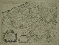
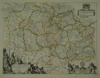
réf. 28798Paris: Pierre Mariette. c. 1658. 37.4 x 49.5 cm. Original outline colour. Double page map of Maine northern France. Title cartouche to lower left corner dedication cartouche to Christophe de Justel to upper right corner with the coat of arms of his family. Blank on verso. Small tears without loss to left and lower margins. Light stains to lower margin otherwise in good condition. Paris: Pierre Mariette. [c. 1658] unknown
réf. 30600Paris: Jaillot. 1689. 43.1 x 57 cm. Original outline colour. Single page folio map of southern Flanders and Artois. Blank on verso. Small tear without loss at upper edge just touching image. Small section of upper margin missing though not affecting map. Small brown spot to centre of lower edge. Paris: Jaillot. 1689 unknown
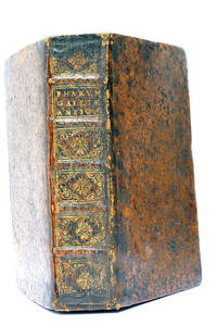
réf. 48297Paris Lutetiae Parisiorum Sumptibus et Impensis Autoris 1647. 3 ouvrages en 1 volume. 1. 2 feuillets blancs. 8 feuillets. 246 pages. 2. 13 feuillets. 283 pages. 3. 2 feuillets blancs. Page de titre. Carte gravée. 11 feuillets. 2 feuillets blancs. 15x9 Cm. Plein veau de l'époque. Dos à nerfs orné et doré un peu frotté. Pièce de titre doré. Charnières fendues. Petits accidents aux coiffes. Rousseurs et quelques taches. Les deux premiers ouvrages sont des critiques très rares du "Pharum Gallia Antiquae" de Philippe Labbé que Sanson rectifie sur plusieurs points. À la suite on trouve une courte description de la Judée accompagnée d'une belle carte dépliante. Bon exemplaire comportant l'exlibris gravé d'Henri Liébaux. Paris, Lutetiae Parisiorum Sumptibus et Impensis Autoris, 1647. unknown
2009réf. 2-2090354968CLE International 2009. Paperback. New. amis et compagnie edition. 128 pages. French language. 11.10x8.50x0.31 inches. CLE International paperback
2009réf. 2-2354030428Editions Med'Com 2009. Paperback. New. 416 pages. French language. 9.29x6.85x1.10 inches. Editions Med'Com paperback
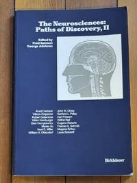
1992réf. 5076Secaucus New Jersey U.S.A.: Birkhauser 1992. Hardcover. Very Good. Very good-. Text clean. Short tear to top joint. Birkhauser hardcover
réf. 0500031061.Ghardcover. Good. Access codes and supplements are not guaranteed with used items. May be an ex-library book. hardcover
1980réf. 163476Warminster: Aris & Phillips 1980. 1st edition. Nice copy. small folio. hardback with dust jacket ix 144pp. b/w plates text ills. bibliog. indexes Detailed illustrated catalogue of statues statuettes reliefs inlays and other objects collected by Flinders Petrie from Tell el-Amarna the ancient Egyptian city of Akhenaten Aris & Phillips hardcover
réf. 38615752like new. unknown
réf. 0764563483.Gpaperback. Good. Access codes and supplements are not guaranteed with used items. May be an ex-library book. paperback
1989réf. 134311Frankfurt am Main: Judisches Museum 1989. 1st edition. As New. large octavo. softback with stiff wrappers 206pp. col. & b/w pls. Nice copy in like unclipped dust jacket. Hard to find in this condition Judisches Museum unknown
1992réf. SONG0802073999Brand: Univ of Toronto Pr 1992-12-12. paperback. Used: Good. 5.25x0.25x8.50. Buy with confidence. Excellent Customer Service & Return policy. Brand: Univ of Toronto Pr paperback
1713réf. 215454Amsterdam: Mortier Pieter 1713. unbound. very good. Map. Engraving with original hand outline. Image measures 14.5" x 18.75". Rare map of Paphlagonia an ancient region of northern Anatolia present-day Turkey along the southern coast of the Black Sea. Highlighting the capital city of Sinope this map depicts the region as defined by Strabo: bound by the Parthenius River in the west extending to the Hays river in the east. Sanson depicts the region comprising the Kingdom of Pontus during the rule of Mithridates IV. Neighboring historical regions of Gallatia and Bithynia et Pontus are labeled. Full original margins light scattered foxing. Based on earlier plates by Sanson. This map appeared in "Atlas Antiquus Sacer Ecclesiasticus et Profanus" published in Amsterdam by Pieter Mortier. Nicolas Sanson 1600-1667 who is considered the founder of the French school of cartography. In reaction to the prevailing trend of Dutch lavishness Sanson favored minimal details focusing rather on accurate cartography than ornament. Pierre Mortier 1661-1711 was a Dutch cartographer engraver and printseller who worked in Amsterdam. He used advanced Dutch printing methods to produce high quality editions of contemporary French maps by cartographers such as De L'Isle Sanson Jaillot de Fer and De Wit. His greatest feat was the nautical atlas "Le Neptune Francois" or "Suite de Neptune Francois" considered to contain the most beautiful examples of cartographic art. After his death his widow Amelia continued publishing in partnership with her brother-in-law David until her death in 1719. This map was published during Amelia's tenure at the firm. Mortier, Pieter unknown
1977réf. A109523London: J M Dent & Sons Ltd 1977. 1st edition. Near Fine. octavo. hardback with dust jacket 242pp. appends. bibliog. index Minor edge-wear to dust jacket o/w nice copy J M Dent & Sons Ltd hardcover
réf. 45400666like new. unknown
réf. 54427724like new. unknown
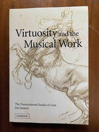
2007réf. ABE-1765316637902Cambridge University Press 2007. 1st Edition. Soft cover. New. New and lovely Cambridge University Press paperback
réf. 50336937like new. unknown
réf. 44369630like new. unknown
réf. 41445142-nnew. unknown
réf. 88347-nnew. unknown
réf. 26075102-nnew. unknown
réf. 20406166-nnew. unknown
réf. 45381745like new. unknown