Mwigamba, Maingu SamsonBiblio.com

4065 risultati
rif. 6209406912.Gpaperback. Good. Access codes and supplements are not guaranteed with used items. May be an ex-library book. paperback
rif. 6209412033.Gpaperback. Good. Access codes and supplements are not guaranteed with used items. May be an ex-library book. paperback
rif. 6920397Short description: In Russian. Glazer Samson Volfovich. Game box. Moscow: Det. lit. 1975. You are welcome to reach out to us for a detailed description of the copies currently available. Delivery of this book may take longer than usual including extended processing and pre-shipping time no expedited shipping is available. Please advise us if you have a set date or a deadline to receive your order.SKU6920397 unknown
rif. 0243041322.Gpaperback. Good. Access codes and supplements are not guaranteed with used items. May be an ex-library book. paperback
rif. 1275154875.Gpaperback. Good. Access codes and supplements are not guaranteed with used items. May be an ex-library book. paperback
rif. 1785890093.Gpaperback. Good. Access codes and supplements are not guaranteed with used items. May be an ex-library book. paperback
rif. 1025282922.Gpaperback. Good. Access codes and supplements are not guaranteed with used items. May be an ex-library book. paperback
rif. 35267899like new. unknown
rif. 44651824like new. unknown
rif. 45381529like new. unknown
rif. 1025280377.Ghardcover. Good. Access codes and supplements are not guaranteed with used items. May be an ex-library book. hardcover
rif. 158330746X.Ghardcover. Good. Access codes and supplements are not guaranteed with used items. May be an ex-library book. hardcover
rif. 0367700298.Gpaperback. Good. Access codes and supplements are not guaranteed with used items. May be an ex-library book. paperback
rif. 1592646123.Ghardcover. Good. Access codes and supplements are not guaranteed with used items. May be an ex-library book. hardcover
rif. 1021800988.Gpaperback. Good. Access codes and supplements are not guaranteed with used items. May be an ex-library book. paperback
rif. 1021060933.Ghardcover. Good. Access codes and supplements are not guaranteed with used items. May be an ex-library book. hardcover
rif. 1385821728.Ghardcover. Good. Access codes and supplements are not guaranteed with used items. May be an ex-library book. hardcover
rif. 191329434X.Gpaperback. Good. Access codes and supplements are not guaranteed with used items. May be an ex-library book. paperback
rif. 102404534X.Ghardcover. Good. Access codes and supplements are not guaranteed with used items. May be an ex-library book. hardcover
rif. 1024049795.Gpaperback. Good. Access codes and supplements are not guaranteed with used items. May be an ex-library book. paperback
rif. 1024661709.Gpaperback. Good. Access codes and supplements are not guaranteed with used items. May be an ex-library book. paperback
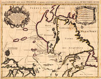
1693rif. 17230Paris: Hubert Jaillot. 1693. Other. In excellent condition. Minor offsetting of the old outline colors to the paper. 465 by 610mm 18 by 24 inches. 465 by 610mm 18 by 24 inches. Copper Engraving color by Jaillot Alexis-Hubert & Sanson N published 1693 by Hubert Jaillot Paris. Image size: 465 by 610mm 18 by 24 inches. By Jaillot after Sanson a landmark of late 17th-century French cartography of North America. Alexis-Hubert Jaillot c.16321712 was one of the most important French cartographers and map publishers of the late 17th century. He collaborated with the pioneering geographer Nicolas Sanson 16001667 and his sons to produce finely engraved large-format maps of the world's regions publishing in Paris from 1670 onwards. Jaillot's maps are distinguished by their impressive scale rich baroque cartouches and the high quality of their engraving. His map of Canada and New France 1693 is a landmark document of 17th-century French geographical knowledge of North America reflecting decades of French colonial exploration and mission activity in the St. Lawrence and Great Lakes regions.Large and decorative map of Canada by the French cartographer Nicolaus Sanson and Hubert Jaillot. Published in the 'Atlas Noveau.' this atlas was a masterpiece in the French cartography in the 17th century. The atlas was specially designed for Louis XIV and due of the very large size of the plates most maps were printed from two plates it took Hubert Jaillot over 12 years to complete the 'Atlas Noveau.'. Canada is very detailled shown on the map as well Labrador Terra Neuf & Nouvelle France are shown in engraved territory borders. The map is rich in detail with many cities and place names rivers lakes mountains bays etc. In excellent condition. Minor offsetting of the old outline colors to the paper. Hubert Jaillot. unknown
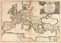
1667rif. 25060Paris: P. Mariette 1667. Other. The centre fold minor spotting else in excellent condition. 395 by 565mm 15 by 22 inches. Rare and decorative large-format historical map of Europe showing the locations of Church Councils and Synods in original outline color. By Guillaume Sanson 16331703 Géographe du Roy published by Pierre Mariette Paris 1667. Image: 395 x 565 mm 15.5 x 22 inches. Decorated with a superb allegorical title cartouche depicting a Catholic council in session a unique historical and cartographic document. Guillaume Sanson 16331703 was a leading French cartographer who inherited the celebrated family firm from his father Nicolas Sanson 16001667 known as the 'Father of French Cartography' and official Géographe du Roy to Louis XIV. Like his father Guillaume held the title of Géographe Ordinaire du Roy. Much of his work after 1671 was published in collaboration with Alexis-Hubert Jaillot and together the Sanson dynasty dominated French cartography throughout the 17th century. Their maps are held in the Bibliothèque nationale de France the British Library and major research collections worldwide.This large and striking map plots the locations of ecumenical councils national synods provincial councils and diocesan synods across Europe a unique cartographic subject of combined religious and historical significance. The coverage extends from the British Isles and Iberian Peninsula across to the eastern Mediterranean including Cyprus and Syria with North Africa also shown. Political borders are rendered in hand-applied outline color. The splendid allegorical title cartouche depicts a Catholic council in session and was engraved to the highest standard of the Parisian workshop. The Geographia Synodica is among the most unusual and collectible maps ever published of Europe: a historic document of scholarship faith and cartographic craft. In excellent condition. Original outline color fresh and vivid. The centrefold shows minor spotting as expected for a 17th-century map of this size; all else excellent. No tears or significant foxing. 395 x 565 mm. P. Mariette unknown
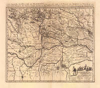
1693rif. 19103Amsterdam: Pierre Mortier 1693-1700. Other. A strong impression in excellent condition. 490 by 580mm 19 by 22 inches. 490 by 580mm 19 by 22 inches. Original antique copper engraving uncolored from the 'Atlas Nouveau' published in Paris 1693. Depicting Mantua this map is a fine example of 1690s European cartography. Image: 490 by 580mm 19 by 22 inches. An attractive and historically significant 17th-century map for the discerning collector. Nicolas Sanson d'Abbeville 16001667 was the founder of the French school of cartography and arguably the most important French cartographer of the 17th century. Appointed Géographe Ordinaire du Roi to Louis XIII in 1630 he produced hundreds of maps that set a new standard for geographic accuracy and systematic coverage. His work was continued and expanded by Alexis-Hubert Jaillot and later by Pierre Mortier in Amsterdam ensuring that Sanson's surveys remained in use well into the 18th century. Maps bearing the Sanson name are prized for their scholarly precision large format and the elaborate cartouches that reflect the grandeur of the Sun King's court.Large detailed and interesting map by the famous French cartographer Nicolaus Sanson published in the famous sea atlas Le Neptune francois. in Amsterdam at Pierre Mortier. This interesting and large map was originally first published in the Atlas Noveau. by Alexis Hubert Jaillot & N. Sanson in Paris 1683-89. Alexis Hubert Jaillot & Nicolaus Jaillot worked as a royal cartographers for the French royal house for king Louis XIV. His maps published for the Atlas Nouveau. can be regarded as masterpieces of cartography in France in the ending 18th century. Also the maps impress by their accuracy and are providing an enormous amount of place names monasteries rivers trails fortifications etc. Shown is the duchy of Mantua Mantova in Northern Italy. Mantua is shown prominently in the center of the map. The map provides many place names detailed information on the river system also in the lower right corner a cartouche with a mileage scale and a table of explanations.A fine example from Atlas Nouveau Paris / Amsterdam sought after by collectors of antique maps of Italy antique maps of Mantua and antique copper engraving uncoloreds for sale. In good condition consistent with age. Shown is the duchy of Mantua Mantova in Northern Italy. Mantua is shown prominently in the center of the map. The map provides many place names detailed information on the river system also in the lower right corner a cartouche with a mileage scale and a table of explanations. Pierre Mortier unknown
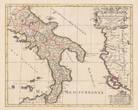
1696rif. 17229Paris: Hubert Jaillot 1696. Other. In excellent condition. 445 by 550mm 17 by 21 inches. 445 by 550mm 17 by 21 inches. Original antique hand-colored copper engraving from the 'Atlas Nouveau' published in Paris 1696. Depicting Kingdom of Naples this map is a fine example of 1690s European cartography. Image: 445 by 550mm 17 by 21 inches. An attractive and historically significant 17th-century map for the discerning collector. Alexis-Hubert Jaillot c. 16321712 was a French sculptor turned cartographer who became one of the most important map publishers of late 17th-century France. After marrying into the family of mapmaker Nicolas Berey he negotiated access to the plates of the great French cartographer Nicolas Sanson 16001667 and used them to publish his monumental 'Atlas Nouveau' from the 1690s onward. Appointed 'Géographe du Roi' Royal Geographer to Louis XIV in 1686 Jaillot produced large-format maps celebrated for their elaborate allegorical cartouches and decorative ambition. His maps of Italy were among the finest large-format representations of the peninsula produced in the 17th century frequently bearing dedications to members of the French royal family.Large and decorative map of England by the French cartographer Nicolaus Sanson and Hubert Jaillot. Published in the 'Atlas Noveau.' this atlas was a masterpiece in the French cartography in the 17th century. The atlas was specially designed for Louis XIV and due of the very large size of the plates most maps were printed from two plates it took Hubert Jaillot over 12 years to complete the 'Atlas Noveau.'. The kingdom of Naples is very detailled shown on the map as well the various principalities are shown in engraved territory borders. The map is rich in detail with many cities and place names rivers mountains castles etc. The map is ornated with a large fine allegoric title cartouche with coat of arms in the upper right corner as well a decorative cartouche with a milage scale.A fine example from Atlas Nouveau Paris sought after by collectors of antique maps of Italy antique maps of Kingdom of Naples and antique hand-colored copper engravings for sale. In good condition consistent with age. The map is ornated with a large fine allegoric title cartouche with coat of arms in the upper right corner as well a decorative cartouche with a milage scale. Hubert Jaillot unknown