Joseph SansonBiblio.com

4.133 Ergebnisse
Best.-Nr. 0243489099.Gpaperback. Good. Access codes and supplements are not guaranteed with used items. May be an ex-library book. paperback
Best.-Nr. 0364485329.Ghardcover. Good. Access codes and supplements are not guaranteed with used items. May be an ex-library book. hardcover
Best.-Nr. 1332623816.Gpaperback. Good. Access codes and supplements are not guaranteed with used items. May be an ex-library book. paperback
1996Best.-Nr. mon0004095112Praeger 2/28/1996 12:00:01 A. hardcover. Very Good. 1.0591 9.6181 6.3701. Praeger hardcover
Best.-Nr. 0332147479.Ghardcover. Good. Access codes and supplements are not guaranteed with used items. May be an ex-library book. hardcover
Best.-Nr. 0364017376.Ghardcover. Good. Access codes and supplements are not guaranteed with used items. May be an ex-library book. hardcover
Best.-Nr. 033155769X.Ghardcover. Good. Access codes and supplements are not guaranteed with used items. May be an ex-library book. hardcover
Best.-Nr. 0364430451.Ghardcover. Good. Access codes and supplements are not guaranteed with used items. May be an ex-library book. hardcover
Best.-Nr. 0243907990.Gpaperback. Good. Access codes and supplements are not guaranteed with used items. May be an ex-library book. paperback
Best.-Nr. 0267501021.Ghardcover. Good. Access codes and supplements are not guaranteed with used items. May be an ex-library book. hardcover
Best.-Nr. 0243949189.Gpaperback. Good. Access codes and supplements are not guaranteed with used items. May be an ex-library book. paperback
Best.-Nr. 0267502303.Ghardcover. Good. Access codes and supplements are not guaranteed with used items. May be an ex-library book. hardcover
Best.-Nr. 0259030821.Gpaperback. Good. Access codes and supplements are not guaranteed with used items. May be an ex-library book. paperback
Best.-Nr. 025928954X.Gpaperback. Good. Access codes and supplements are not guaranteed with used items. May be an ex-library book. paperback
Best.-Nr. 0259451568.Gpaperback. Good. Access codes and supplements are not guaranteed with used items. May be an ex-library book. paperback
Best.-Nr. 0259372145.Gpaperback. Good. Access codes and supplements are not guaranteed with used items. May be an ex-library book. paperback
Best.-Nr. 1332124267.Gpaperback. Good. Access codes and supplements are not guaranteed with used items. May be an ex-library book. paperback
Best.-Nr. 1330030141.Gpaperback. Good. Access codes and supplements are not guaranteed with used items. May be an ex-library book. paperback
Best.-Nr. 31825321like new. unknown
1920Best.-Nr. 206543Norwood: Plimpton Press 1920. Hardcover. VG: Wear to the boards with fading to the color of the title text. Clean body pages and solid binding. Very minor tanning and foxing to the end pages. A black casebound book with green text on the spine. xiii 248 pages; profusely illustrated in black-and-white. Plimpton Press hardcover
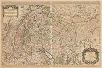
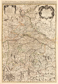
1675Best.-Nr. 33301Paris: Hubert Jaillot 1675. Blatt gebräunt Mittelfalz mit nicht säurebeständigem Tape hinterlegt heller Streifen. . 803 by 560mm 31 by 22 inches. Hand-Colored Original Copperplate Engraving by Alexis-Hubert Jaillot & N. Sanson depicting Le Cercle de Souabe subdivisé en tous les Estats qui le Composent Tire ´sur les Memoires les plus noueaux Par le S. Sanson Geographe Ordinaire du Roy. A Paris Ches H. Laillot joingnant les Augustins aux deux Globes Auec Priuilege du Roy pour Vingt Ans. Published Paris Hubert Jaillot 1675. Sheet: 803 by 560mm 31 by 22 inches. A fine and original hand-colored example of Jaillot's celebrated cartographic work documenting this region of Germany with the precision and decorative artistry characteristic of the 16700s. Alexis-Hubert Jaillot c.1632-1712 was one of the foremost French cartographers of the late 17th and early 18th centuries. Working in Paris he produced magnificent large-format maps of European territories often in collaboration with Nicolas Sanson -- considered the father of French cartography. Jaillot's maps are known for their striking decorative cartouches generous size and fine hand coloring representing the pinnacle of French Baroque cartography.This original copperplate engraving with original hand coloring depicts the region of Le Cercle de Souabe subdivisé en tous les Estats qui le Composent Tire ´sur les Memoires les plus noueaux Par le S. Sanson Geographe Ordinaire du Roy. A Paris Ches H. Laillot joingnant les Augustins aux deux Globes Auec Priuilege du Roy pour Vingt Ans. published in Paris Hubert Jaillot 1675. The map records the political and geographic boundaries of the region as understood in 1675 offering a fascinating window into the history of German territorial organization. Sheet measures 803 by 560mm 31 by 22 inches. In good condition overall with minor signs of age appropriate for a 17th-century engraving. Ready to frame. Hubert Jaillot unknown
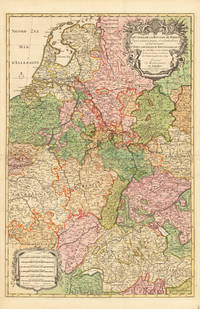
1692Best.-Nr. 33626Paris 1692. Schönes tadelloses Exemplar. . 803 by 560mm 31 by 22 inches. Hand-Colored Original Copperplate Engraving by Alexis-Hubert Jaillot & N. Sanson depicting Le Cours de la Riviere du Rhein depuis sa Source jusques a son Emboucheure ou sont distingues Tout les Estats et Souverainetes qui sont dessus et aux enuirons. Tire de tous les Memoires les plus Nouveaux Parle Sr. Sanson Geopgraphe Ordinaire du Roy. Published Paris 1692. Sheet: 803 by 560mm 31 by 22 inches. A fine and original hand-colored example of Jaillot's celebrated cartographic work documenting this region of Germany with the precision and decorative artistry characteristic of the 16900s. Alexis-Hubert Jaillot c.1632-1712 was one of the foremost French cartographers of the late 17th and early 18th centuries. Working in Paris he produced magnificent large-format maps of European territories often in collaboration with Nicolas Sanson -- considered the father of French cartography. Jaillot's maps are known for their striking decorative cartouches generous size and fine hand coloring representing the pinnacle of French Baroque cartography.This original copperplate engraving with original hand coloring depicts the region of Le Cours de la Riviere du Rhein depuis sa Source jusques a son Emboucheure ou sont distingues Tout les Estats et Souverainetes qui sont dessus et aux enuirons. Tire de tous les Memoires les plus Nouveaux Parle Sr. Sanson Geopgraphe Ordinaire du Roy published in Paris 1692. The map records the political and geographic boundaries of the region as understood in 1692 offering a fascinating window into the history of German territorial organization. Sheet measures 803 by 560mm 31 by 22 inches. In good condition overall with minor signs of age appropriate for a 17th-century engraving. Ready to frame. unknown
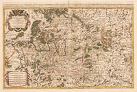
1692Best.-Nr. 33439Paris: H. Jaillot 1692. In ausgezeichnetem Zustand. . 570 by 850mm 22 by 33 inches. Hand-Colored Original Copperplate Engraving by Charles Hubert Alexis Jaillot & Nicolaus Sanson depicting Le Cercle de Franconie subdivise entous les Estats qui le composent. Dressè sur les Memotres les plus Nouveaux Parle Sr. Sanson Geographe Ordinaire du Roy. A Paris Chez H. Iaillot joignant les grands Augustins aux dewe Globes. Avec Privilege du Roypour Vingt Ans. 1692. Published Paris H. Jaillot 1692. Sheet: 570 by 850mm 22 by 33 inches. A fine and original hand-colored example of Jaillot's celebrated cartographic work documenting this region of Germany with the precision and decorative artistry characteristic of the 16900s. Alexis-Hubert Jaillot c.1632-1712 was one of the foremost French cartographers of the late 17th and early 18th centuries. Working in Paris he produced magnificent large-format maps of European territories often in collaboration with Nicolas Sanson -- considered the father of French cartography. Jaillot's maps are known for their striking decorative cartouches generous size and fine hand coloring representing the pinnacle of French Baroque cartography.This original copperplate engraving with original hand coloring depicts the region of Le Cercle de Franconie subdivise entous les Estats qui le composent. Dressè sur les Memotres les plus Nouveaux Parle Sr. Sanson Geographe Ordinaire du Roy. A Paris Chez H. Iaillot joignant les grands Augustins aux dewe Globes. Avec Privilege du Roypour Vingt Ans. 1692. published in Paris H. Jaillot 1692. The map features a decorative Baroque cartouche containing the title inscription. A distance scale is incorporated within the cartouche or alongside it. The map records the political and geographic boundaries of the region as understood in 1692 offering a fascinating window into the history of German territorial organization. Sheet measures 570 by 850mm 22 by 33 inches. In good condition overall with minor signs of age appropriate for a 17th-century engraving. Ready to frame. H. Jaillot unknown
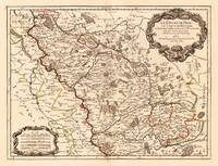
1700Best.-Nr. 24651Paris: H. Jaillot. 1700. Other. In excellent condition. 428 by 570mm 16 by 22 inches. 428 by 570mm 16 by 22 inches. Hand-Colored Original Copperplate Engraving by Alexis-Hubert Jaillot & N. Sanson depicting Le Duché de Berg le Comté de Homberg les Seigneuries de Hardenberg et de Wildenborg. Dressé surles Memoires les plus recents. Parle Sr. Sanson Geographe ordinaire du Roy. A Paris. Chez H. Iaillot joignant les grands Augustins aux deux Globes Aure Privilege du Roy. 1700. Published Paris H. Jaillot. 1700. Sheet: 428 by 570mm 16 by 22 inches. A fine and original hand-colored example of Jaillot's celebrated cartographic work documenting this region of Germany with the precision and decorative artistry characteristic of the 17000s. Alexis-Hubert Jaillot c.1632-1712 was one of the foremost French cartographers of the late 17th and early 18th centuries. Working in Paris he produced magnificent large-format maps of European territories often in collaboration with Nicolas Sanson -- considered the father of French cartography. Jaillot's maps are known for their striking decorative cartouches generous size and fine hand coloring representing the pinnacle of French Baroque cartography.This original copperplate engraving with original hand coloring depicts the region of Le Duché de Berg le Comté de Homberg les Seigneuries de Hardenberg et de Wildenborg. Dressé surles Memoires les plus recents. Parle Sr. Sanson Geographe ordinaire du Roy. A Paris. Chez H. Iaillot joignant les grands Augustins aux deux Globes Aure Privilege du Roy. 1700. published in Paris H. Jaillot. 1700. The map records the political and geographic boundaries of the region as understood in 1700 offering a fascinating window into the history of German territorial organization. Sheet measures 428 by 570mm 16 by 22 inches. In good condition overall with minor signs of age appropriate for a 18th-century engraving. Ready to frame. H. Jaillot. unknown
1692Best.-Nr. 28137Paris 1692. Other. Schönes tadelloses Exemplar. . 803 by 560mm 31 by 22 inches. Hand-Colored Original Copperplate Engraving by Alexis-Hubert Jaillot & N. Sanson depicting Le Cours de la Riviere du Rhein depuis sa Source jusques a son Emboucheure ou sont distingues Tout les Estats et Souverainetes qui sont dessus et aux enuirons. Tire de tous les Memoires les plus Nouveaux Parle Sr. Sanson Geopgraphe Ordinaire du Roy. Published Paris 1692. Sheet: 803 by 560mm 31 by 22 inches. A fine and original hand-colored example of Jaillot's celebrated cartographic work documenting this region of Germany with the precision and decorative artistry characteristic of the 16900s. Alexis-Hubert Jaillot c.1632-1712 was one of the foremost French cartographers of the late 17th and early 18th centuries. Working in Paris he produced magnificent large-format maps of European territories often in collaboration with Nicolas Sanson -- considered the father of French cartography. Jaillot's maps are known for their striking decorative cartouches generous size and fine hand coloring representing the pinnacle of French Baroque cartography.This original copperplate engraving with original hand coloring depicts the region of Le Cours de la Riviere du Rhein depuis sa Source jusques a son Emboucheure ou sont distingues Tout les Estats et Souverainetes qui sont dessus et aux enuirons. Tire de tous les Memoires les plus Nouveaux Parle Sr. Sanson Geopgraphe Ordinaire du Roy published in Paris 1692. The map records the political and geographic boundaries of the region as understood in 1692 offering a fascinating window into the history of German territorial organization. Sheet measures 803 by 560mm 31 by 22 inches. In good condition consistent with its age of over 330 years. Ready to frame. unknown