Nicolas SansonBiblio.com
3 988 résultats
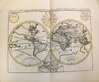
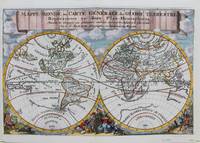
1692réf. M9110Trajecti ad Rhenum : Francisci Halma c. 1692. Very Good. Notes: A finely engraved map of the world by Nicolas Sanson "the father of French cartography" during the late 17th century. Engraved by A. de Winter. There are a lot of fascinating cartographic errors that were made such as California being shown as an island and the western half of North America not being depicted as it had yet to be discovered. But the treatment of far and southeast Asia is much improved when we compare it to Sanson's map of 1652. Korea reverts to an attenuated peninsula instead of the short squat round island in the earlier Sanson version. Likewise the partial outline of Australia changes it shape to a much more realistic outline of Australia. Size : 200x305 mm 7.87x12.01 Inches Coloring: Hand Colored Category: Maps World; Francisci Halma unknown
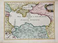
1656réf. M10647Paris c.1656. Very Good. Size : 182x246 mm 7.17x9.69 Inches Coloring: Hand Colored Category: Maps Russia; Maps Asia Near East Turkey; Maps Europe Ukraine; unknown
1696réf. M10191Amsterdam: Covens & Mortier c.1696. Very Good. Size : 393x540 mm 15.47x21.26 Inches Coloring: Original Hand Coloring Category: Maps World; Covens & Mortier unknown
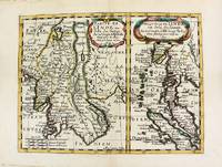
1652réf. M8177Paris. 1652. Very Good. Notes: Fine 17th century map of Thailand Burma and Malaysia. Size : 191x249 mm 7.50x9.80 Inches Coloring: Original Hand Coloring Category: Maps Asia South East Thailand Laos Vietnam Cambodia & Burma / Myanmar; Maps Asia South East Malaysia & Singapore; unknown
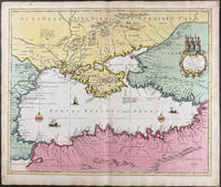
1696réf. 9749Scarce original hand-colored engraving by Sanson published in Pierre Mortier's Atlas Nouveau or Atlas Novum ad usum serenissimi. Image size is approximately 23 x 18.75 in 58.5 x 47.5 cm; page size is 24.75 x 21 in 63 x 53.5 cm. Some minor staining and toning to edges not affecting the image.
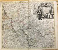
1708réf. M10193Amsterdam: Pierre Mortier c.1708. Very Good. Notes: "Theatre de la Guerre" Theater of War maps covering the battles raging in Europe and the Americas during the Spanish War of Succession 1701-1713 and the Northern War 1700-1721. The atlas maps are large folio size with most maps made of two sheets and many maps combining 4 or 6 sheets those also issued as wall maps separately. The atlas is most impressive for its large size and number of maps as well as being up to date for its time. Size : 517x585 mm 20.35x23.03 Inches Coloring: Original Outline Coloring Category: Maps Europe Germany; Pierre Mortier unknown
réf. 0666787816.Ghardcover. Good. Access codes and supplements are not guaranteed with used items. May be an ex-library book. hardcover
2009réf. Sq56930Routledge 2009-05-26. paperback. Very Good. 6x0x9. Clean sturdy and unmarked with mild shelf wear EP Routledge paperback
2009réf. G8-00057Routledge 2009-05-26. paperback. New. 6x1x9. Ship within 24hrs. 100% Satisfaction is Our #1 Goal! Routledge paperback
2009réf. SKU1752293Routledge 2009-05-26. paperback. New. 6x1x9. New Book Ships with Tracking Routledge paperback
réf. 6078884-nnew. unknown
réf. 6328161-nnew. unknown
réf. 6078884like new. unknown
réf. 6328161like new. unknown
2009réf. x-0415477190Routledge 2009. Hardcover. New. 1st edition. 464 pages. 9.45x6.38x1.14 inches. Routledge hardcover
2009réf. x-0415496802Routledge 2009. Paperback. New. 1st edition. 416 pages. 9.13x6.14x0.94 inches. Routledge paperback
réf. 939086-nnew. unknown
2002réf. Q-0745316751Pluto Press 2002-10-20. paperback. New. In shrink wrap. Looks like an interesting title! Pluto Press paperback
2002réf. x-0745316751Pluto Pr 2002. Paperback. New. illustrated edition. 407 pages. 9.00x6.00x1.00 inches. Pluto Pr paperback
réf. 6208101344.Gpaperback. Good. Access codes and supplements are not guaranteed with used items. May be an ex-library book. paperback
réf. 6208101379.Gpaperback. Good. Access codes and supplements are not guaranteed with used items. May be an ex-library book. paperback
réf. 6208101336.Gpaperback. Good. Access codes and supplements are not guaranteed with used items. May be an ex-library book. paperback
réf. 6208101352.Gpaperback. Good. Access codes and supplements are not guaranteed with used items. May be an ex-library book. paperback
1960réf. 900381960 Editions les Heures Claires, Paris, Collection " Images de....". Sans date (vers 1960) - 1 vol in-8 (17 x 25 cm) en feuillets volants réunis dans une chemise cartonnée crême elle même engagée dans un emboîtage de la même couleur crême. 55 pages - Reliure éditeur, Imprimerie Raymond Jacquet. Les pointes sèches de Charles Samson ont été tirées dans l'atelier de Manuel Robbe. Un des rares 400 exemplaires mis en couleurs à la main bien complet de sa suite en noir. Exemplaire N° 68
1955réf. RO20029411NOËL. 1955. In-12. Broché. Bon état, Couv. défraîchie, Agraffes rouillées, Intérieur bon état. Sans pagination. Nbreuses illust n&b dans le texte.. . . . Classification Dewey : 908.4426-Régionalisme : Picardie