Sanson Véronique - Sanson Véronique - Sanson VéroniqueLivre Rare Book

4.035 Ergebnisse
1979Best.-Nr. 111006Piano Blanc 1979
1988Best.-Nr. 111008Piano Blanc 1988
1979Best.-Nr. 111009Piano Blanc 1979
1981Best.-Nr. 111010Piano Blanc 1981
1988Best.-Nr. 111011Piano Blanc 1988
1988Best.-Nr. 111015Piano Blanc 1988
1979Best.-Nr. 111016Piano Blanc 1979
1985Best.-Nr. 111014Piano Blanc 1985
1976Best.-Nr. 111017Piano Blanc 1976
1997Best.-Nr. 111018Piano Blanc 1997
1988Best.-Nr. 111013Piano Blanc 1988
1992Best.-Nr. 111020Piano Blanc 1992
1997Best.-Nr. 110992Piano Blanc 1997
1997Best.-Nr. 110996Piano Blanc 1997
1997Best.-Nr. 110998Piano Blanc 1997
1954Best.-Nr. mon0000050986London 1954-01-01. Hardcover. Very Good. 2.5980 cent in x 18.3860 cent in x 13.1900 cent in. Complete with dust wrapper. Rare. London hardcover
1680Best.-Nr. 024707London: William Berry 1680. .Kingdoms and States which are found there at present/Described by Sanson/Corrected and amended By William Berry =Kopftitel; Text der figürlich reich verzierten Kartusche oben rechts: Asia Divided into its Principall Regions in which may be seen the extent of the Empires Monarchies Kingdoms and States which at present divide Asia/To the Most serene and Most Sacred Majesty of Charles II./By the Grace of God King of Great Britain France and Ireland/This Map of Asia is humbly Dedicated and Presented By Your Majesties Loyal Subject and Servand William Berry; Text der reich verzierten Kartusche links oben: Scale es folgen Maßstäbe verschiedener Länder/London/Sold by William Berry at the Sign of the Globe between Charing-Cross and White-Hall/1680; SW-Kupferstich-Landkarte nach Nicolas Sanson d'Abbeville gestochen von William Berry; ca. 51 x 39 cm; Falzspuren einige Tintenflecken hauptsächlich ausserhalb des Druckbildes mässige Lichtverfärbung; professionell hinter Glas gerahmt in schwarzem Holzrahmen; äußerst selten; for description in other languages of this extremely rare map please don't hesitate to contact me. . Gut. Landkarte. William Berry unknown
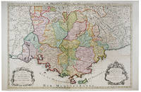
Best.-Nr. 1916-25Paris H. Jaillot 1692. Alt grenzkolorierte Kupferstichkarte von 2 Platten. 64 5 x 99 cm Blattgr. Breitrandiges Exemplar. Äußere Ränder etwas gebräunt kleiner Randeiniß sonst gut erhalten. Großformatige Karte von Guillaume Sanson 1633-1703 die das Gebiet von Deggendorf bis Wagram und von Kromeríz/Kremsier bis Veszprém/Weissbrünn mit dem Neusiedler See Newsidler See zeigt. Aus dem Verlag von Alexis-Hubert Jaillot um 1632-1712 der eng mit Sanson zusammenarbeitete. Paris, H. Jaillot 1692. unknown
Best.-Nr. 122122Paris 1692. . Double page engraved map with fine original hand-colour with two decorative cartouches surrounded by animals and foliage. Sheet size: 950 mm x 600 mm. Some minor offset and tiny worm holes otherwise very good. The map is dedicated to Jean-Baptiste Antoine Colbert Marquis de Seignelay the eldest son of the French minister of the same name who served Louis XIV. Alexis-Hubert Jaillot 1632-1712 was a French cartographer. He joined the Sanson heirs and redrew Nicolas Sanson's maps on a larger scale. 'Atlas Nouveau' 1674 sea-atlas ' Le Neptune François' 1693. Paris, 1692. unknown
Best.-Nr. 117739Paris H. Jaillot 1692 but 1696. . Large two-sheet engraved map of Ireland with extremely fine original hand colouring heightened with gold; sheet size: 945 x 628 mm.; left margin cropped into the scale some minor offset and reinforcement to fold on verso; framed & glazed: 1000 x 710 mm. One of the best large format maps of Ireland issued in the late 17th early 18th century. The map shows towns counties mountains islands and a host of other fine details. The title cartouche is impressive with the coat of arms all in stunning full original colour delicately heightened in gold. Based upon the geographical compilations and work of Nicolas Sanson which remained unpublished at the time of his death. In 1674 Jaillot conceived of the re-issue of Sanson's major work published and unpublished in an enlarged format. The maps were issued as early as 1674 and were later jointly issued by Sanson and Mortier in Amsterdam. Paris, H. Jaillot, 1692 [but 1696]. unknown
Best.-Nr. 117736Paris H. Jaillot 1693 but 1696. . Large two-sheet engraved map of Scotland with extremely fine original hand colouring heightened with gold; sheet size: 945 x 628 mm some minor offset; framed & glazed: 1000 x 710 mm. One of the best large format maps of Scotland issued in the late 17th early 18th century. The map shows towns counties mountains islands and a host of other fine details. The title cartouche is impressive with the coat of arms all in stunning full original colour delicately heightened in gold. Based upon the geographical compilations and work of Nicolas Sanson which remained unpublished at the time of his death. In 1674 Jaillot conceived of the re-issue of Sanson's major work published and unpublished in an enlarged format. The maps were issued as early as 1674 and were later jointly issued by Sanson and Mortier in Amsterdam. Paris, H. Jaillot, 1693 [but 1696]. unknown
Best.-Nr. 1332655343.Gpaperback. Good. Access codes and supplements are not guaranteed with used items. May be an ex-library book. paperback
Best.-Nr. 30523Paris, V. Masson 1870, 195x120mm, VII- 310pages, relié demi cuir, titre doré au dos.
1868Best.-Nr. VZ364181868 44 p., 10 figures, paperbound (plain covers). Published in: Journal de l’Anatomie et de la Physiologie. Small corner cut out of first page. Some scattered foxing.