4 035 résultats
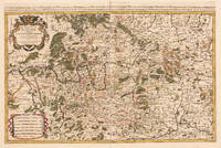
1696réf. 16269Paris: Alexis Hubert Jaillot 1696. Copper-engraved map with full original colour and gold embellishment in excellent condition. A stunning map of Normandy by Alexis Jaillot an exceptional example with gilt embellishments. One of the most important figures in French cartography Nicolas Sanson initiated the great school of French geographers. Born in Abbeville in 1600 Sanson established his first printing house in Paris in 1638. He soon became geographer to the king establishing himself as one of the most influential cartographers on the Continent. He was succeeded by his sons Adrien and Guillaume and by his son-in-law Pierre Duval who continued to publish a wealth of maps using Sanson's name. At the close of the seventeenth century Sanson's plates were purchased by the influential cartographer Alexis Hubert Jaillot who continued to publish his maps and atlases under Sanson's title. This stunning map of Normandy is based on Sanson's map published in 1650 but was redrawn and enlarged by Jaillot. It shows the provinces of Normandy as well as the northern tip of Brittany and part of the English Channel. Both Jersey and Guernsey are included as is Mont St. Michel off the coast of St. Malo. In keeping with all of Sanson's and Jaillot's superb maps forests rivers and towns are meticulously identified and named. The map includes an ornate cartouche in the upper section as well as a scale and key. Tooley Maps & Map-Makers pp. 40-41. Alexis Hubert Jaillot unknown
1696réf. 16269Paris: Alexis Hubert Jaillot 1696. Copper-engraved map with full original colour and gold embellishment in excellent condition. A stunning map of Normandy by Alexis Jaillot an exceptional example with gilt embellishments. One of the most important figures in French cartography Nicolas Sanson initiated the great school of French geographers. Born in Abbeville in 1600 Sanson established his first printing house in Paris in 1638. He soon became geographer to the king establishing himself as one of the most influential cartographers on the Continent. He was succeeded by his sons Adrien and Guillaume and by his son-in-law Pierre Duval who continued to publish a wealth of maps using Sanson's name. At the close of the seventeenth century Sanson's plates were purchased by the influential cartographer Alexis Hubert Jaillot who continued to publish his maps and atlases under Sanson's title. This stunning map of Normandy is based on Sanson's map published in 1650 but was redrawn and enlarged by Jaillot. It shows the provinces of Normandy as well as the northern tip of Brittany and part of the English Channel. Both Jersey and Guernsey are included as is Mont St. Michel off the coast of St. Malo. In keeping with all of Sanson's and Jaillot's superb maps forests rivers and towns are meticulously identified and named. The map includes an ornate cartouche in the upper section as well as a scale and key. Tooley Maps & Map-Makers pp. 40-41. Alexis Hubert Jaillot unknown books
1696réf. 206066Amsterdam: Alexis-Hubert Jaillot 1696. unbound. very good. Map. Engraving with hand outline. Image measures 23" x 35". Stunning map showing the vast extent of the German Empire including parts of Poland Bohemia Hungary Austria Croatia Italy France and the Netherlands. Exquisite and subtle coloring beautifully detailed. Based on a plate by Nicolas Sanson reworked and published in "Atlas Nouveau" by Jaillot. Severe toning due to early acid backing chipping to edges and corners and some tears. Priced as is. Alexis-Hubert Jaillot 1632--1712 was a French sculptor engraver publisher and cartographer. He served as official geographer to King Louis XIV and worked with other prominent mapmakers of the period such as Nicolas Sanson He is best known for his Atlas Nouveau of 1674. Alexis-Hubert Jaillot unknown books
1692réf. 33439Paris: H. Jaillot 1692. In ausgezeichnetem Zustand. . 570 by 850mm 22 by 33 inches. Hand-Colored Original Copperplate Engraving by Charles Hubert Alexis Jaillot & Nicolaus Sanson depicting Le Cercle de Franconie subdivise entous les Estats qui le composent. Dressè sur les Memotres les plus Nouveaux Parle Sr. Sanson Geographe Ordinaire du Roy. A Paris Chez H. Iaillot joignant les grands Augustins aux dewe Globes. Avec Privilege du Roypour Vingt Ans. 1692. Published Paris H. Jaillot 1692. Sheet: 570 by 850mm 22 by 33 inches. A fine and original hand-colored example of Jaillot's celebrated cartographic work documenting this region of Germany with the precision and decorative artistry characteristic of the 16900s. Alexis-Hubert Jaillot c.1632-1712 was one of the foremost French cartographers of the late 17th and early 18th centuries. Working in Paris he produced magnificent large-format maps of European territories often in collaboration with Nicolas Sanson -- considered the father of French cartography. Jaillot's maps are known for their striking decorative cartouches generous size and fine hand coloring representing the pinnacle of French Baroque cartography.This original copperplate engraving with original hand coloring depicts the region of Le Cercle de Franconie subdivise entous les Estats qui le composent. Dressè sur les Memotres les plus Nouveaux Parle Sr. Sanson Geographe Ordinaire du Roy. A Paris Chez H. Iaillot joignant les grands Augustins aux dewe Globes. Avec Privilege du Roypour Vingt Ans. 1692. published in Paris H. Jaillot 1692. The map features a decorative Baroque cartouche containing the title inscription. A distance scale is incorporated within the cartouche or alongside it. The map records the political and geographic boundaries of the region as understood in 1692 offering a fascinating window into the history of German territorial organization. Sheet measures 570 by 850mm 22 by 33 inches. In good condition overall with minor signs of age appropriate for a 17th-century engraving. Ready to frame. H. Jaillot unknown
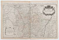
réf. 49665Paris: 1690. 54 x 87.5 cm. Double page copper engraved map of Lorraine. Original outline colour. Large decorative cartouche to upper right corner. Horizontal crease parallel and adjacent to centrefold otherwise good. [Paris:] 1690 unknown
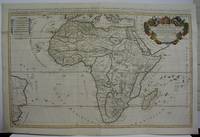
1719réf. M5162Paris 1719. Excellent. Size : 580x890 mm 22.875x35 Inches Coloring: Original Outline Coloring Category: ; Maps Africa Continent unknown
1674réf. ag662Jaillot H. Carte 1674 Carte de 43 x 57 cm en une partie : frontières colorées ; petites déchirures marginales sans gravité, bon exemplaire. Livraison a domicile (La Poste) ou en Mondial Relay sur simple demande.
1675réf. bb3400Jaillot H. Carte 1675 Carte de 41 x 56 cm en une partie : frontières colorées ; petits défauts, très bon exemplaire. Livraison a domicile (La Poste) ou en Mondial Relay sur simple demande.
1675réf. ag657Jaillot H. Carte 1675 Carte de 41 x 56 cm en une partie : frontières colorées ; petits défauts, très bon exemplaire. Livraison a domicile (La Poste) ou en Mondial Relay sur simple demande.
1695réf. bb3406Jaillot H. Carte 1695 Carte de 43 x 57 cm en une partie : frontières colorées ; petites déchirures marginales sans gravité, bon exemplaire. Livraison a domicile (La Poste) ou en Mondial Relay sur simple demande.
1695réf. ag659Jaillot H. Carte 1695 Carte de 43 x 57 cm en une partie : frontières colorées ; petites déchirures marginales sans gravité, bon exemplaire. Livraison a domicile (La Poste) ou en Mondial Relay sur simple demande.
1676réf. bb3407Jaillot H. Carte 1676 Cartes en deux parties, 53 par 90 cm ; frontières surlignées en couleur, très bel exemplaire. Livraison a domicile (La Poste) ou en Mondial Relay sur simple demande.
1676réf. ag661Jaillot H. Carte 1676 Cartes en deux parties, 53 par 90 cm ; frontières surlignées en couleur, petites déchirures marginales, bel exemplaire. Livraison a domicile (La Poste) ou en Mondial Relay sur simple demande.
1674réf. ag658Jaillot H. Carte 1674 Cartes en une partie, 42 par 56 cm ; frontières surlignées en couleur, mouillures marginales, n'atteignant pas la carte, bel exemplaire. Livraison a domicile (La Poste) ou en Mondial Relay sur simple demande.
1674réf. bb3404Jaillot H. Carte 1674 Carte de 43 x 57 cm en une partie : frontières colorées ; mouillure marginale sans gravité, bon exemplaire. Livraison a domicile (La Poste) ou en Mondial Relay sur simple demande.
1674réf. ag660Jaillot H. Carte 1674 Carte de 43 x 57 cm en une partie : frontières colorées ; mouillure marginale sans gravité, bon exemplaire. Livraison a domicile (La Poste) ou en Mondial Relay sur simple demande.
1674réf. bb3401Jaillot H. Carte 1674 Carte de 42 x 55 cm en une partie : frontières colorées ; très bon exemplaire. Livraison a domicile (La Poste) ou en Mondial Relay sur simple demande.
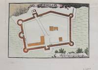
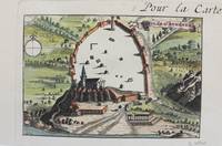
1690réf. M9479Paris c.1690. Very Good. Notes: Map of Chielafa Greece during the late 17th century. Size : 105x152 mm 4.13x5.98 Inches Coloring: Hand Colored Category: Maps Europe Greece Macedonia; unknown
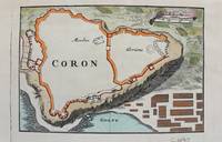
1690réf. M9480Paris c.1690. Very Good. Notes: Map of Coron Greece during the late 17th century. Size : 103x153 mm 4.06x6.02 Inches Coloring: Hand Colored Category: Maps Europe Greece Macedonia; unknown
1690réf. M9473Paris c.1690. Very Good. Notes: A charming map of Fort D'Asso Greece during the late 17th century. Size : 104x153 mm 4.09x6.02 Inches Coloring: Hand Colored Category: Maps Europe Greece Macedonia; unknown
1690réf. M9475Paris c.1690. Very Good. Notes: A charming map of Forteresse de Zante Greece during the late 17th century. Size : 104x154 mm 4.09x6.06 Inches Coloring: Hand Colored Category: Maps Europe Greece Macedonia; unknown
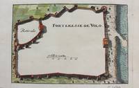
1690réf. M9474Paris c.1690. Very Good. Notes: A charming map of Forteresse de Volo Greece during the late 17th century. Size : 104x153 mm 4.09x6.02 Inches Coloring: Hand Colored Category: Maps Europe Greece Macedonia; unknown
1690réf. M9477Paris c.1690. Very Good. Notes: A charming map of Athens Greece during the late 17th century. Size : 103x154 mm 4.06x6.06 Inches Coloring: Hand Colored Category: Maps City Maps; Maps Europe Greece Macedonia; unknown
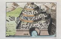
1690réf. M9478Paris c.1690. Very Good. Notes: A charming map of Lepanto Greece during the late 17th century. Size : 105x153 mm 4.13x6.02 Inches Coloring: Hand Colored Category: Maps Europe Greece Macedonia; unknown
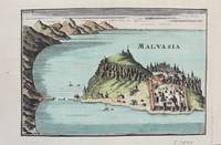
1690réf. M9577Paris c. 1690. Very Good. Notes: A charming map of Malvasia Greece during the late 17th century. Size : 103x152 mm 4.06x5.98 Inches Coloring: Hand Colored Category: Maps Europe Greece Macedonia; unknown