Nicholas Sanson (1600-1667)Biblio.com
4.064 Ergebnisse
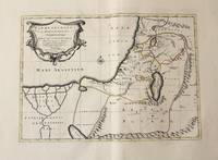
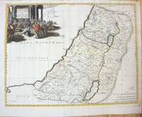
1660Best.-Nr. M7049Paris 1660. Very Good;. Notes: French map of the Holy Land with a decorative cartouche. Nicolas Sanson 1600–1667 was a renowned French cartographer termed by some as the "father of French cartography." His works are known for their incorporation of the most up to date information of the time and their clean modern style. Size : 385x485 mm 15.16x19.09 Inches Coloring: Hand Colored Category: Maps Asia Middle East Holy Land & Palestine; unknown
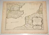
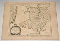
Best.-Nr. 90474PARIS Chez l’Auteur 1654. Title cartouche to lower right corner. Blank on verso. In good condition. Some light tanning on edges with a few faint foxing marks. A few small nicks lower margin edge. With original outline hand colouring. Engraved Size 17.5 x 23 inches Nicolas Sanson 1600-1667 sometimes called Nicolas Sanson d'Abbeville or Sanson d'Abbeville was the most important French cartographer of the 17th century. Tooley called Sanson "the founder of the French school of cartography." He began making maps in the late 1620s and in the 1630s he was working with Melchior Tavernier. Later Sanson worked in concert with the print publisher Pierre Mariette with whom he published his great atlas: Cartes générales de toutes les parties du monde 1658. After Sanson's death in 1667 his son Guillaume carried on the business in partnership with Alexis Hubert Jaillot. Guillaume established himself as a very important French mapmaker in his own right. PARIS Chez l’Auteur 1654. unknown
Best.-Nr. 90477PARIS Chez l’Auteur 1658. Title cartouche to lower left corner. Blank on verso. In good condition. Some light tanning on edges with a few faint foxing marks. With original outline hand colouring. Engraved Size 17.5 x 23 inches Nicolas Sanson 1600-1667 sometimes called Nicolas Sanson d'Abbeville or Sanson d'Abbeville was the most important French cartographer of the 17th century. Tooley called Sanson "the founder of the French school of cartography." He began making maps in the late 1620s and in the 1630s he was working with Melchior Tavernier. Later Sanson worked in concert with the print publisher Pierre Mariette with whom he published his great atlas: Cartes générales de toutes les parties du monde 1658. After Sanson's death in 1667 his son Guillaume carried on the business in partnership with Alexis Hubert Jaillot. Guillaume established himself as a very important French mapmaker in his own right. PARIS Chez l’Auteur 1658 unknown
2018Best.-Nr. 1-3330013656LAP LAMBERT Academic Publishing 2018. Paperback. New. 144 pages. 8.66x5.91x0.33 inches. LAP LAMBERT Academic Publishing paperback
2009Best.-Nr. x-9058677346Leuven Univ Pr 2009. Paperback. New. 1st edition. 200 pages. French language. 9.00x6.25x0.25 inches. Leuven Univ Pr paperback
Best.-Nr. 3659539643.Gpaperback. Good. Access codes and supplements are not guaranteed with used items. May be an ex-library book. paperback
Best.-Nr. 179364926X.Gpaperback. Good. Access codes and supplements are not guaranteed with used items. May be an ex-library book. paperback
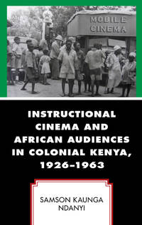
2024Best.-Nr. x-179364926XLexington Books 2024. Paperback. New. 176 pages. 9.41x6.28x0.38 inches. Lexington Books paperback
Best.-Nr. 1793649243.Ghardcover. Good. Access codes and supplements are not guaranteed with used items. May be an ex-library book. hardcover
2000Best.-Nr. 68sxDavid Philip 2000. 2nd Revised edition. Paperback. Very Good. Wraps are rubbed and marked.Creased.Minor markings.Well bound.R.K. Our orders are shipped using tracked courier delivery services. David Philip paperback
2026Best.-Nr. LRB79167Paris: Editions Recreasoft 2026 Language: English. Approximately 575 pages. English : Print-on-demand reprint. Original edition : 1886. This is a modern of the 1886 original. A practical pharmaceutical anatomical and chemical lexicon compiled by multiple contributors and intended as a reference work. Useful for collectors and researchers interested in medical and scientific terminology of the late 19th century. Images are non-contractual. This is a modern of the 1886 original. A practical pharmaceutical anatomical and chemical lexicon compiled by multiple contributors and intended as a reference work. Useful for collectors and researchers interested in medical and scientific terminology of the late 19th century. Images are non-contractual. Book images are non-contractual. Editions Recreasoft. Softcover. New. Editions Recreasoft paperback
2026Best.-Nr. LRB140655Paris: Editions Recreasoft 2026 Language: English. Approximately 575 pages. English : Print-on-demand reprint. Original edition : 1886. A specialized pharmaceutical anatomical and chemical lexicon compiled for practical reference bringing together terminology across medicine chemistry and related scientific fields. Of interest to collectors and researchers in the history of medical and scientific reference works professional nomenclature and late nineteenth-century technical dictionaries. Book images are non-contractual. Editions Recreasoft. Softcover. New. Editions Recreasoft paperback
Best.-Nr. 697287058Sage Publications . Papeback. New. pp. 213 Sage Publications unknown
Best.-Nr. 51274Milano, Skira, 2007 Illustrated cardboard cover in colour, 240 x 280mm., 94pp., profound colour illustration. tekst in het Nederlands ISBN 9788861305199.
Best.-Nr. 14036India & South East Asia, Paris, 1654 -1679, copperplate, Original o/l colour. 52.5 x 38cms [21 x 15ins] A good map of peninsula India, Ceylon and Southeast Asia including Sumatra and present-day Singapore from Nicolas Sanson's "Cartes Generales ...". Sanson was the major French mapmaker of the period and produced a number of important maps from information supplied by travellers and missionaries. This map marks an advance on those being produced in Amsterdam based on details from the 1620s and 30s.
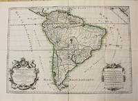
1698Best.-Nr. M10786Paris 1698. Very Good. Notes: A charming large scale 17th century map of South America with two decorative cartouches and original outline colouring. Size : 460x648 mm 18.11x25.51 Inches Coloring: Original Outline Coloring Category: Maps South America Continent; unknown
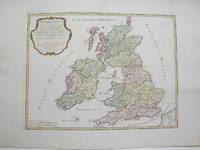
1754Best.-Nr. M3766Paris 1754. Excellent. Size : 410x540 mm 16.125x21.25 Inches Coloring: Hand Colored Category: ; Maps Europe Ireland;; Maps Europe United Kingdom unknown
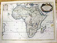
1700Best.-Nr. M11022Paris c.1700. Very Good. Notes: French map of Africa as a continent. Size : 462x645 mm 18.19x25.39 Inches Coloring: Hand Colored Category: Maps Africa Continent; unknown
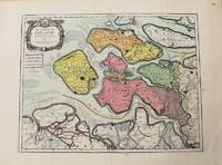
1693Best.-Nr. M10774Paris 1693. Very Good. Notes: Map of the county of Zeeland. Size : 440x575 mm 17.32x22.64 Inches Coloring: Original Hand Coloring Category: Maps Europe Benelux; unknown
1710Best.-Nr. M10330Amsterdam: Jean Covens & Corneille Mortier c.1710. Very Good. Size : 368x495 mm 14.49x19.49 Inches Coloring: Original Outline Coloring Category: Maps Asia Middle East Holy Land & Palestine; Maps Africa North; Maps Africa North Egypt; Jean Covens & Corneille Mortier unknown
1690Best.-Nr. M7990Paris: H. Jaillot c.1690. Very Good with some minor discoloration. Notes: Map of North-Central France Size : 460x610 mm 18.11x24.02 Inches Coloring: Original Hand Coloring Category: Maps Europe France; H. Jaillot unknown
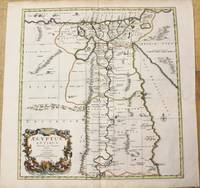
1696Best.-Nr. M10206Amsterdam: Covens & Mortier c.1696. Very Good. Size : 485x450 mm 19.09x17.72 Inches Coloring: Hand Colored Category: Maps Africa North Egypt; Covens & Mortier unknown
1696Best.-Nr. M8798Paris : Pierre Mariette c. 1696. Very Good. Notes: Fine detailed map of the straight of the Bosphorus and the city of Constantinople. Size : 405x528 mm 15.94x20.79 Inches Coloring: Hand Colored Category: Maps Asia Near East Turkey; Pierre Mariette unknown
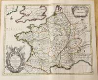
1710Best.-Nr. M10329Amsterdam: Jean Covens & Corneille Mortier c.1710. Very Good. Size : 378x486 mm 14.88x19.13 Inches Coloring: Original Outline Coloring Category: Maps Europe France; Jean Covens & Corneille Mortier unknown
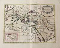
1710Best.-Nr. M10321Amsterdam: Jean Covens & Corneille Mortier c.1710. Very Good. Size : 402x520 mm 15.83x20.47 Inches Coloring: Original Hand Coloring Category: Maps Mediterranean Sea; Maps Asia Middle East; Jean Covens & Corneille Mortier unknown