SANSON D'ABBELVILLE, NicolasBiblio.com
4 064 résultats
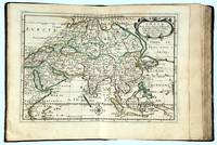
1662réf. 16493Paris: chez l’Autheur 1662. SECOND EDITION. Complete with 17 double-page engraved maps hand-colored in outline. Contemporary mottled calf corner edges neatly repaired interior has some minor dampstaining mainly on text and on blank verso of maps last blank leaf torn on lower fore-edge. A contemporary signature on first blank leaf. Similar to L’Amerique this atlas of the continent of Asia was first printed in 1652 and reprinted here with a new title page. The maps are all dated 1652 with only one dated 1653 and do not include the address of Mariette. The atlas features maps of India Persia China Japan the Maldives Arabia and the Philippines among others. Just prior to publication of this series of works which also included atlases of Europe and Africa Sanson formed a partnership with Pierre Mariette an engraver and printseller. Pursuant to their contract Sanson drew the maps and Mariette engraved and printed them. Each maintained possession of half of the plates and they were allowed to exchange and/or buy from one another. Some bore the address of Sanson others Mariette. But Sanson allowed Mariette to store his plates and Mariette without prior agreement started placing his address on Sanson’s plates. In time a lawsuit which had been prosecuted was settled when both died and their respective sons took over the business. This atlas is a fine examples of French mapping by the foremost French cartographer of the seventeenth century. Sanson 1600-1667 “Geographe Ordinaire du Roi” to Louis XIII is considered the founder of French cartography and is generally acknowledged as the originator of the great age of French cartography. chez l’Autheur unknown
réf. 3253Americas: Amsterdam Francois Halma 1705. Copper engraved map of Peru by N. Sanson from Halma's Algemeene Werelde Beschryving Vol. 3 Black and white; title in Dutch; verso blank; strapwork title cartouche. Small map of Tierra del Fuego showing both the Strait of Magellan and Le Maire Strait. Inland detail is confined to a mountain range and several rivers and the mythical Destroit de Browers is labeled at far right. This map appeared in Algemeene Weereld-Beschryving nae de Rechte Verdeeling der Landschappen Plaetsen Zeeën Rivieren &c. Geographisch Politisch Historisch Chronologisch en Genealogisch a Dutch edition of A. Phérotée de la Croix's Nouvelle Methode Pour Apprendre Facilement la Geographie Universelle which first appeared in 1690. Dark impression. Nicolas Sanson d'Abbeville.1600-67 ' father of the French cartography' and founder of the Sanson firm. Atlas ' Cartes générales de toutes les parties du Monde' 1658-70 and a pocket atlas in 4 parts 1652-1705. Sanson's small maps from A. Phérotée de la Croix's Nouvelle Methode Pour Apprendre Facilement la Geographie Universelle. first published in 1652 and engraved by A. Peyrounin were copied several times by various map publishers. Johann David Zunners made copies of Sanson's maps for his German translation of Die Gantze Erd-Kugel in 1679. Johannes Ribbius and Simon de Vries published copies in 1682 and 1683 with new maps engraved by Antoine d'Winter. The plates were later sold to Francois Halma who used them in 1699 and then again in 1705 with the titles re-engraved in Dutch. François Halma 1653 - 1722 Dutch publisher/printer; dealer/auction house. Cartographer and publisher of maps active in Utrecht Amsterdam Franeker and Leeuwarden. Published 'Description de l'Univers' 1700; 'Algemene Wereldtbescrijving' 1705; 'Corpus Inscriptionum' 1707 and 'Lexicon Philosophicum' 1713. Halma acquired many of the plates for Algemeene Weereld-Beschryving from Joannes Ribbius who had enlisted the services of engraver Antoine de Winter to make copies of the maps in Nicolas Sanson's quarto atlases of the four continents. De Winter made very few geographical changes and maintained the attribution to Sanson on the newly engraved plates. Halma supplemented the Sanson maps with about a dozen new maps engraved in the same style as Sanson's without any attribution on the maps as well as 23 panoramic views of famous cities around the world. Keoman: Hal 1; Phillips 528. Americas South America Tierra del Fuego Magellanica Strait of Magellan Amsterdam Francois Halma 1705 unknown
réf. 3243Americas: Amsterdam Francois Halma 1705. Copper engraved map of Mexico by N. Sanson from Halma's Algemeene Werelde Beschryving Vol. 3 Black and white; title in Dutch; verso blank; strapwork title cartouche. The map shows Mexico including the Yucatan peninsula part of present-day Guatemala and Honduras. This map appeared in Algemeene Weereld-Beschryving nae de Rechte Verdeeling der Landschappen Plaetsen Zeeën Rivieren &c. Geographisch Politisch Historisch Chronologisch en Genealogisch a Dutch edition of A. Phérotée de la Croix's Nouvelle Methode Pour Apprendre Facilement la Geographie Universelle which first appeared in 1690. Dark impression. Nicolas Sanson d'Abbeville.1600-67 ' father of the French cartography' and founder of the Sanson firm. Atlas ' Cartes générales de toutes les parties du Monde' 1658-70 and a pocket atlas in 4 parts 1652-1705. Sanson's small maps from A. Phérotée de la Croix's Nouvelle Methode Pour Apprendre Facilement la Geographie Universelle. first published in 1652 and engraved by A. Peyrounin were copied several times by various map publishers. Johann David Zunners made copies of Sanson's maps for his German translation of Die Gantze Erd-Kugel in 1679. Johannes Ribbius and Simon de Vries published copies in 1682 and 1683 with new maps engraved by Antoine d'Winter. The plates were later sold to Francois Halma who used them in 1699 and then again in 1705 with the titles re-engraved in Dutch. François Halma 1653 - 1722 Dutch publisher/printer; dealer/auction house. Cartographer and publisher of maps active in Utrecht Amsterdam Franeker and Leeuwarden. Published 'Description de l'Univers' 1700; 'Algemene Wereldtbescrijving' 1705; 'Corpus Inscriptionum' 1707 and 'Lexicon Philosophicum' 1713. Keoman: Hal 1; Phillips 528; B Americas Mexico Yucatan Guatemala Honduras Amsterdam Francois Halma 1705 unknown
réf. 3238Americas: Amsterdam Francois Halma 1705. Copper engraved map of North America by N. Sanson from Halma's Algemeene Werelde Beschryving Vol. 3 Black and white; title in Dutch; verso blank; strapwork title cartouche. Attractive small map showing North America with California as an Island California is shown with an indented northern coastline in the Foxe form. The detached coastline to the northwest of California is named Terre de Iesso ou Ieco rather than reflecting Sanson's earlier belief that it was an extension of the American continent. The R. de Nort drains into the Gulf of California from a large interior lake in the country of Les Apaches. The two western-most Great Lakes are left open-ended and Lake Erie remains unnamed. Engraved by Antoine d'Winter. This is the third state which includes a peninsula inserted northeast of California the Carolinas attributed to the French N. Iork added below N. Amstredam and an umlaut over the "Roy" in the title. This map appeared in Algemeene Weereld-Beschryving nae de Rechte Verdeeling der Landschappen Plaetsen Zeeën Rivieren &c. Geographisch Politisch Historisch Chronologisch en Genealogisch a Dutch edition of A. Phérotée de la Croix's Nouvelle Methode Pour Apprendre Facilement la Geographie Universelle which first appeared in 1690. Dark impression; dampstaining to edges not entering image. Nicolas Sanson d'Abbeville.1600-67 ' father of the French cartography' and founder of the Sanson firm. Atlas ' Cartes générales de toutes les parties du Monde' 1658-70 and a pocket atlas in 4 parts 1652-1705. Sanson's small maps from A. Phérotée de la Croix's Nouvelle Methode Pour Apprendre Facilement la Geographie Universelle. first published in 1652 and engraved by A. Peyrounin were copied several times by various map publishers. Johann David Zunners made copies of Sanson's maps for his German translation of Die Gantze Erd-Kugel in 1679. Johannes Ribbius and Simon de Vries published copies in 1682 and 1683 with new maps engraved by Antoine d'Winter. The plates were later sold to Francois Halma who used them in 1699 and then again in 1705 with the titles re-engraved in Dutch. François Halma 1653 - 1722 Dutch publisher/printer; dealer/auction house. Cartographer and publisher of maps active in Utrecht Amsterdam Franeker and Leeuwarden. Published 'Description de l'Univers' 1700; 'Algemene Wereldtbescrijving' 1705; 'Corpus Inscriptionum' 1707 and 'Lexicon Philosophicum' 1713. Keoman: Hal 1; Phillips 528; Burden #545; McLaughlin #89-3. Americas North America California as Island Amsterdam Francois Halma 1705 unknown
réf. 3250Americas: Amsterdam Francois Halma 1705. Copper engraved map of Paraguayby N. Sanson from Halma's Algemeene Werelde Beschryving Vol. 3 Black and white; title in Dutch; verso blank; strapwork title cartouche. The map shows the region of present day Paraguay Uruguay northern Argentina and southern Brazil. The Rio de la Plata is the main feature of the map along with the mountains and volcanoes of the Cordillera de los Andes. Engraved by Antoine de Winter. This map appeared in Algemeene Weereld-Beschryving nae de Rechte Verdeeling der Landschappen Plaetsen Zeeën Rivieren &c. Geographisch Politisch Historisch Chronologisch en Genealogisch a Dutch edition of A. Phérotée de la Croix's Nouvelle Methode Pour Apprendre Facilement la Geographie Universelle which first appeared in 1690. Dark impression; minor dampstain at top of centre fold. Nicolas Sanson d'Abbeville.1600-67 ' father of the French cartography' and founder of the Sanson firm. Atlas ' Cartes générales de toutes les parties du Monde' 1658-70 and a pocket atlas in 4 parts 1652-1705. Sanson's small maps from A. Phérotée de la Croix's Nouvelle Methode Pour Apprendre Facilement la Geographie Universelle. first published in 1652 and engraved by A. Peyrounin were copied several times by various map publishers. Johann David Zunners made copies of Sanson's maps for his German translation of Die Gantze Erd-Kugel in 1679. Johannes Ribbius and Simon de Vries published copies in 1682 and 1683 with new maps engraved by Antoine d'Winter. The plates were later sold to Francois Halma who used them in 1699 and then again in 1705 with the titles re-engraved in Dutch. François Halma 1653 - 1722 Dutch publisher/printer; dealer/auction house. Cartographer and publisher of maps active in Utrecht Amsterdam Franeker and Leeuwarden. Published 'Description de l'Univers' 1700; 'Algemene Wereldtbescrijving' 1705; 'Corpus Inscriptionum' 1707 and 'Lexicon Philosophicum' 1713. Keoman: Hal 1; Phillips 528. Americas South America Paraguay Uraguay Amsterdam Francois Halma 1705 unknown
réf. 3252Americas: Amsterdam Francois Halma 1705. Copper engraved map of Peru by N. Sanson from Halma's Algemeene Werelde Beschryving Vol. 3 Black and white; title in Dutch; verso blank; strapwork title cartouche. The map shows the western part of the continent and the full course of the Amazon. The spurious Lac ou Mer de Parime is prominent as is the location of the mythical city Manoa el Dorado. This map appeared in Algemeene Weereld-Beschryving nae de Rechte Verdeeling der Landschappen Plaetsen Zeeën Rivieren &c. Geographisch Politisch Historisch Chronologisch en Genealogisch a Dutch edition of A. Phérotée de la Croix's Nouvelle Methode Pour Apprendre Facilement la Geographie Universelle which first appeared in 1690. Dark impression. Upper margin short cut to plate mark. Nicolas Sanson d'Abbeville.1600-67 ' father of the French cartography' and founder of the Sanson firm. Atlas ' Cartes générales de toutes les parties du Monde' 1658-70 and a pocket atlas in 4 parts 1652-1705. Sanson's small maps from A. Phérotée de la Croix's Nouvelle Methode Pour Apprendre Facilement la Geographie Universelle. first published in 1652 and engraved by A. Peyrounin were copied several times by various map publishers. Johann David Zunners made copies of Sanson's maps for his German translation of Die Gantze Erd-Kugel in 1679. Johannes Ribbius and Simon de Vries published copies in 1682 and 1683 with new maps engraved by Antoine d'Winter. The plates were later sold to Francois Halma who used them in 1699 and then again in 1705 with the titles re-engraved in Dutch. François Halma 1653 - 1722 Dutch publisher/printer; dealer/auction house. Cartographer and publisher of maps active in Utrecht Amsterdam Franeker and Leeuwarden. Published 'Description de l'Univers' 1700; 'Algemene Wereldtbescrijving' 1705; 'Corpus Inscriptionum' 1707 and 'Lexicon Philosophicum' 1713. Halma acquired many of the plates for Algemeene Weereld-Beschryving from Joannes Ribbius who had enlisted the services of engraver Antoine de Winter to make copies of the maps in Nicolas Sanson's quarto atlases of the four continents. De Winter made very few geographical changes and maintained the attribution to Sanson on the newly engraved plates. Halma supplemented the Sanson maps with about a dozen new maps engraved in the same style as Sanson's without any attribution on the maps as well as 23 panoramic views of famous cities around the world. Keoman: Hal 1; Phillips 528. Americas South America Peru Amsterdam Francois Halma 1705 unknown
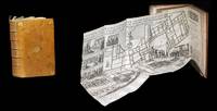
1643réf. 309321643. S.l. chez l'Autheur sic 1643 - A Paris de l'Imprimerie de Robert Mansion 1636 - A Paris chez Antoine de Sommaville 1655 - A Paris s.. 1604 pour le troisiÂme texte ; divis en trois parties pagination spare. 3 ouvrages le dernier compos de 3 parties relis en un fort vol. au format in-12 173 x 112 mm de 1 f. bl. 3 ff. n.fol. et 106 pp. ; 1 f. bl. ; 4 ff. n.fol. et 111 pp. ; 3 ff. n.fol. et 50 pp. ; 3 ff. n.fol. et 63 pp. ; 72 pp. et 2 ff. n.fol. de PrivilÂge in fine. Reliure de l'poque de plein veau glac blond larges fleurons angulaires et fleuron central dors ports sur chacun des plats dos nerfs orn de filets gras froid roulette dore sur les nerfs caissons d'encadrement dors filets verticaux dors filets en pointills dors larges fleurons dors semis de pointills dors piÂce de titre de maroquin fauve titre dor palette dore en tÂte et queue roulette dore sur les coupes tranches mouchetes. Le prsent exemplaire renferme trois textes ; relis en un volume. Le Crmonial de l'lection des Papes closant le prsent volume est ici bien complet de ses 3 parties ainsi que de ses deux grandes planches dpliantes graves. Les deux premiers ouvrages sont l'oeuvre de Nicolas Sanson d'Abbeville clÂbre cartographe s'il en est. Coiffe infrieure arase. Quelques tches brunes sur les plats. Contre-gardes absentes. Quelques feuillets lgÂrement oxyds et rousseurs dans les corps d'ouvrages. Restauration ancienne au revers de chacun des planches. Du reste belle condition. Rare. b42961 unknown
réf. 3245Americas: Amsterdam Francois Halma 1705. Copper engraved map of Caribbean by N. Sanson from Halma's Algemeene Werelde Beschryving Vol. 3 Black and white; title in Dutch; verso blank; strapwork title cartouche. The map shows the islands of the Caribbean with the tip of Florida to the North and the coast line of Honduras and Venezuela to the South This map appeared in Algemeene Weereld-Beschryving nae de Rechte Verdeeling der Landschappen Plaetsen Zeeën Rivieren &c. Geographisch Politisch Historisch Chronologisch en Genealogisch a Dutch edition of A. Phérotée de la Croix's Nouvelle Methode Pour Apprendre Facilement la Geographie Universelle which first appeared in 1690. Dark impression. Upper margin short cut to plate mark ; extra folds to fit in binding; light dampstaining to lower margin just entering plate. Nicolas Sanson d'Abbeville.1600-67 ' father of the French cartography' and founder of the Sanson firm. Atlas ' Cartes générales de toutes les parties du Monde' 1658-70 and a pocket atlas in 4 parts 1652-1705. Sanson's small maps from A. Phérotée de la Croix's Nouvelle Methode Pour Apprendre Facilement la Geographie Universelle. first published in 1652 and engraved by A. Peyrounin were copied several times by various map publishers. Johann David Zunners made copies of Sanson's maps for his German translation of Die Gantze Erd-Kugel in 1679. Johannes Ribbius and Simon de Vries published copies in 1682 and 1683 with new maps engraved by Antoine d'Winter. The plates were later sold to Francois Halma who used them in 1699 and then again in 1705 with the titles re-engraved in Dutch. François Halma 1653 - 1722 Dutch publisher/printer; dealer/auction house. Cartographer and publisher of maps active in Utrecht Amsterdam Franeker and Leeuwarden. Published 'Description de l'Univers' 1700; 'Algemene Wereldtbescrijving' 1705; 'Corpus Inscriptionum' 1707 and 'Lexicon Philosophicum' 1713. Keoman: Hal 1; Phillips 528. Americas Caribbean Antilles Bahamas Cuba Amsterdam Francois Halma 1705 unknown
réf. 3248Americas: Amsterdam Francois Halma 1705. Copper engraved map of Colombia Venezuela and Panama by N. Sanson from Halma's Algemeene Werelde Beschryving Vol. 3 Black and white; title in Dutch; verso blank; strapwork title cartouche. The map shows the Isthmus of Panama and North Western South America including most of present day Columbia and part of Venezuela. Regional boundaries are shown along with missions towns major rivers and mountains. The mythical Lage de Parime with the fabled city of Manoa del Dorado is shown at bottom right. This map appeared in Algemeene Weereld-Beschryving nae de Rechte Verdeeling der Landschappen Plaetsen Zeeën Rivieren &c. Geographisch Politisch Historisch Chronologisch en Genealogisch a Dutch edition of A. Phérotée de la Croix's Nouvelle Methode Pour Apprendre Facilement la Geographie Universelle which first appeared in 1690. Dark impression. Nicolas Sanson d'Abbeville.1600-67 ' father of the French cartography' and founder of the Sanson firm. Atlas ' Cartes générales de toutes les parties du Monde' 1658-70 and a pocket atlas in 4 parts 1652-1705. Sanson's small maps from A. Phérotée de la Croix's Nouvelle Methode Pour Apprendre Facilement la Geographie Universelle. first published in 1652 and engraved by A. Peyrounin were copied several times by various map publishers. Johann David Zunners made copies of Sanson's maps for his German translation of Die Gantze Erd-Kugel in 1679. Johannes Ribbius and Simon de Vries published copies in 1682 and 1683 with new maps engraved by Antoine d'Winter. The plates were later sold to Francois Halma who used them in 1699 and then again in 1705 with the titles re-engraved in Dutch. François Halma 1653 - 1722 Dutch publisher/printer; dealer/auction house. Cartographer and publisher of maps active in Utrecht Amsterdam Franeker and Leeuwarden. Published 'Description de l'Univers' 1700; 'Algemene Wereldtbescrijving' 1705; 'Corpus Inscriptionum' 1707 and 'Lexicon Philosophicum' 1713. Keoman: Hal 1; Phillips 528. Americas South America Colombia Venezuela Amsterdam Francois Halma 1705 unknown
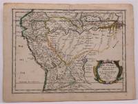
1657réf. W2347Paris: Chez Sanson 1657. Image is 8 1/8 inches by 11 inches on a folded sheet measuring 9 inches by 12 13/16 inches. Original hand-colored copper-engraved map from Sanson's atlas of maps of the Americas: L'Amerique en Plusieurs Cartes. It is a map of the Viceroyalty of Peru that displays the Amazon River and its many tributaries. Nicolas Sanson 1600-1667 was the official geographer for the king of France. His map of Peru and the Amazon became the standard that was copied by almost all geographers/cartographers--even reproduced by Bion for his 1700 treatise on globes. Cintra and Oliveira argue that Sanson's map was a scientific one that holds up well even when compared to 21st century maps of the region. The map is in about very good condition: clean with bright original outline color; minimal foxing ; some edgewear and soiling in the margins. . First Edition. Single Sheet. Very Good-. 8 1/8 inches by 11 Inches. Map. Chez Sanson
réf. 0331540630.Ghardcover. Good. Access codes and supplements are not guaranteed with used items. May be an ex-library book. hardcover
réf. 0282758410.Gpaperback. Good. Access codes and supplements are not guaranteed with used items. May be an ex-library book. paperback
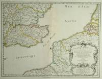
réf. 28812Paris: Sanson. 1654. 36.6 x 48 cm. Original outline colour. Double page map of the south east England shown with the adjacent coastline of France and Belgium. Title cartouche to lower right corner. Blank on verso. Wear to centrefold with some loss Paris: (Sanson). 1654 unknown
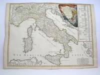
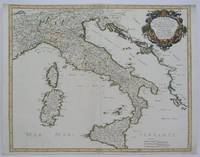
1778réf. M3888Paris: Delamarche 1778. Very Good. Size : 515x685 mm 20.25x27 Inches Coloring: Original Outline Coloring Category: ; Maps Europe Italy Delamarche unknown
Paris, Flammarion, 1937. Une plaquette de format in 8° de 48 pp. bon état. Peu courant.
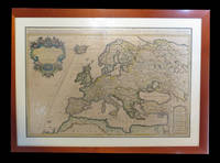
1690réf. 192941690. S.l. Alexis Hubert Jaillot 1680. Une grande carte 892 x 592 mm compose de deux feuillets contrecolls sous cadre moderne. Attractive 892 x 592 mm carte de la fin du XVIIÂme avec rehauts aquarells du temps. Elle s'orne d'un important cartouche aux armes du Grand Dauphin Louis de France et s'agrmente en marge gauche de la figuration de vaisseaux ayant pris part un combat naval. Kupcik Cartes gographiques anciennes p. 159. Papier trÂs lgÂrement oxyd. Prsence de rares et claires rousseurs ou petites tches. Deux plissures et une infime perforation en marge suprieure droite. Du reste belle condition. b42961 unknown
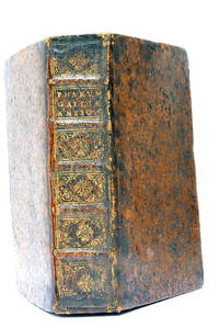
réf. 48297Paris Lutetiae Parisiorum Sumptibus et Impensis Autoris 1647. 3 ouvrages en 1 volume. 1. 2 feuillets blancs. 8 feuillets. 246 pages. 2. 13 feuillets. 283 pages. 3. 2 feuillets blancs. Page de titre. Carte gravée. 11 feuillets. 2 feuillets blancs. 15x9 Cm. Plein veau de l'époque. Dos à nerfs orné et doré un peu frotté. Pièce de titre doré. Charnières fendues. Petits accidents aux coiffes. Rousseurs et quelques taches. Les deux premiers ouvrages sont des critiques très rares du "Pharum Gallia Antiquae" de Philippe Labbé que Sanson rectifie sur plusieurs points. À la suite on trouve une courte description de la Judée accompagnée d'une belle carte dépliante. Bon exemplaire comportant l'exlibris gravé d'Henri Liébaux. Paris, Lutetiae Parisiorum Sumptibus et Impensis Autoris, 1647. unknown
1742réf. 38209Amsterdam: Pierre Mortier 1742. A BEAUTIFUL HAND-COLORED MAP OF WESTERN LANGUEDOC and areas to the west and north. 60 x 45.5 cm plate 62 x 52 cm sheet. The areas described in the title are FULLY COLORED BY A CONTEMPORARY HAND. Printed on fine thick laid paper. Reverse blank. A fine impression. A PRISTINE EXAMPLE with the paper FINE AND BRIGHT. Very scarce in such fine condition. Pierre Mortier unknown
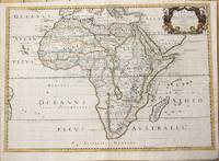
1650réf. M6678Paris: Pierre Mariette c. 1650. Very Good;. Notes: Title cartouche bordered by two outward-facing birds of prey. Norwich writes: "This is an early Sanson map. An odd feature is the name Barditus Mons given to a long chain of mountains running continuously from somewhere in Angolato Algoa Bay. No place names appear even on the coast of the southern part of the continent which is labelled 'Agi Symba' a name usually referring to the northern African region and inhabitants are 'Anthropophagi Aethiopes' or cannibals." Size : 396x553 mm 15.59x21.77 Inches Coloring: Hand Colored Reference: Norwich's Map 35. Category: Maps Africa Continent; Pierre Mariette unknown
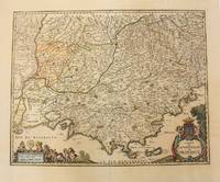
1656réf. M6320Paris 1656. Very Good. Notes: This map shows the southern coast of France. Size : 425x535 mm 16.75x21 Inches Coloring: Original Hand Coloring Category: Maps Europe France unknown
1676réf. 38217Paris: Sanson 1676. AN ATTRACTIVE MAP OF SPAIN AND PORTUGAL. 18 x 25 cm plate 23.5 x 32 cm sheet. FULLY COLORED by a later hand. Printed on fine laid paper. Reverse blank. A fine impression. A PRISTINE EXAMPLE with the paper FINE AND BRIGHT. Very scarce in such fine condition. Sanson unknown
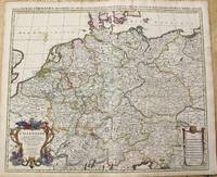
1696réf. M10211Amsterdam: Covens & Mortier c.1696. Very Good. Size : 510x605 mm 20.08x23.82 Inches Coloring: Original Outline Coloring Category: Maps Europe Germany; Covens & Mortier unknown
1652réf. 14178Paris: Sanson 1652. Double hemisphere world map showing the rivers and water bodies of the world. Original outline color. 20 3/4 x 15 3/4". Depicts Australia prior to Tasman's discoveries and labels North Australia "Beach" according to Marco Polo and California as an island. References: Shirley R.W. World 394. Sanson unknown
1654réf. M5952Paris 1654. Very Good some mild discoloration along the margins. Size : 350x555 mm 13.75x21.875 Inches Coloring: Original Outline Coloring Reference: Gole 16; Nebenzahl 3.9B Category: Maps Asia South East Thailand Laos Vietnam Cambodia & Burma / Myanmar; Maps Asia Central India & Sri Lanka / Ceylon; unknown
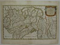
1665réf. M5118Paris 1665. Very Good central fold reinfrced. Notes: There is a water mark on the right hand portion of the map. Size : 435x540 mm 17.125x21.25 Inches Coloring: Original Outline Coloring Category: ; Maps Europe Italy unknown