4 068 résultats
réf. 3250Americas: Amsterdam Francois Halma 1705. Copper engraved map of Paraguayby N. Sanson from Halma's Algemeene Werelde Beschryving Vol. 3 Black and white; title in Dutch; verso blank; strapwork title cartouche. The map shows the region of present day Paraguay Uruguay northern Argentina and southern Brazil. The Rio de la Plata is the main feature of the map along with the mountains and volcanoes of the Cordillera de los Andes. Engraved by Antoine de Winter. This map appeared in Algemeene Weereld-Beschryving nae de Rechte Verdeeling der Landschappen Plaetsen Zeeën Rivieren &c. Geographisch Politisch Historisch Chronologisch en Genealogisch a Dutch edition of A. Phérotée de la Croix's Nouvelle Methode Pour Apprendre Facilement la Geographie Universelle which first appeared in 1690. Dark impression; minor dampstain at top of centre fold. Nicolas Sanson d'Abbeville.1600-67 ' father of the French cartography' and founder of the Sanson firm. Atlas ' Cartes générales de toutes les parties du Monde' 1658-70 and a pocket atlas in 4 parts 1652-1705. Sanson's small maps from A. Phérotée de la Croix's Nouvelle Methode Pour Apprendre Facilement la Geographie Universelle. first published in 1652 and engraved by A. Peyrounin were copied several times by various map publishers. Johann David Zunners made copies of Sanson's maps for his German translation of Die Gantze Erd-Kugel in 1679. Johannes Ribbius and Simon de Vries published copies in 1682 and 1683 with new maps engraved by Antoine d'Winter. The plates were later sold to Francois Halma who used them in 1699 and then again in 1705 with the titles re-engraved in Dutch. François Halma 1653 - 1722 Dutch publisher/printer; dealer/auction house. Cartographer and publisher of maps active in Utrecht Amsterdam Franeker and Leeuwarden. Published 'Description de l'Univers' 1700; 'Algemene Wereldtbescrijving' 1705; 'Corpus Inscriptionum' 1707 and 'Lexicon Philosophicum' 1713. Keoman: Hal 1; Phillips 528. Americas South America Paraguay Uraguay Amsterdam Francois Halma 1705 unknown
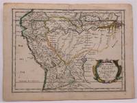
réf. 3252Americas: Amsterdam Francois Halma 1705. Copper engraved map of Peru by N. Sanson from Halma's Algemeene Werelde Beschryving Vol. 3 Black and white; title in Dutch; verso blank; strapwork title cartouche. The map shows the western part of the continent and the full course of the Amazon. The spurious Lac ou Mer de Parime is prominent as is the location of the mythical city Manoa el Dorado. This map appeared in Algemeene Weereld-Beschryving nae de Rechte Verdeeling der Landschappen Plaetsen Zeeën Rivieren &c. Geographisch Politisch Historisch Chronologisch en Genealogisch a Dutch edition of A. Phérotée de la Croix's Nouvelle Methode Pour Apprendre Facilement la Geographie Universelle which first appeared in 1690. Dark impression. Upper margin short cut to plate mark. Nicolas Sanson d'Abbeville.1600-67 ' father of the French cartography' and founder of the Sanson firm. Atlas ' Cartes générales de toutes les parties du Monde' 1658-70 and a pocket atlas in 4 parts 1652-1705. Sanson's small maps from A. Phérotée de la Croix's Nouvelle Methode Pour Apprendre Facilement la Geographie Universelle. first published in 1652 and engraved by A. Peyrounin were copied several times by various map publishers. Johann David Zunners made copies of Sanson's maps for his German translation of Die Gantze Erd-Kugel in 1679. Johannes Ribbius and Simon de Vries published copies in 1682 and 1683 with new maps engraved by Antoine d'Winter. The plates were later sold to Francois Halma who used them in 1699 and then again in 1705 with the titles re-engraved in Dutch. François Halma 1653 - 1722 Dutch publisher/printer; dealer/auction house. Cartographer and publisher of maps active in Utrecht Amsterdam Franeker and Leeuwarden. Published 'Description de l'Univers' 1700; 'Algemene Wereldtbescrijving' 1705; 'Corpus Inscriptionum' 1707 and 'Lexicon Philosophicum' 1713. Halma acquired many of the plates for Algemeene Weereld-Beschryving from Joannes Ribbius who had enlisted the services of engraver Antoine de Winter to make copies of the maps in Nicolas Sanson's quarto atlases of the four continents. De Winter made very few geographical changes and maintained the attribution to Sanson on the newly engraved plates. Halma supplemented the Sanson maps with about a dozen new maps engraved in the same style as Sanson's without any attribution on the maps as well as 23 panoramic views of famous cities around the world. Keoman: Hal 1; Phillips 528. Americas South America Peru Amsterdam Francois Halma 1705 unknown
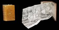
1643réf. 309321643. S.l. chez l'Autheur sic 1643 - A Paris de l'Imprimerie de Robert Mansion 1636 - A Paris chez Antoine de Sommaville 1655 - A Paris s.. 1604 pour le troisiÂme texte ; divis en trois parties pagination spare. 3 ouvrages le dernier compos de 3 parties relis en un fort vol. au format in-12 173 x 112 mm de 1 f. bl. 3 ff. n.fol. et 106 pp. ; 1 f. bl. ; 4 ff. n.fol. et 111 pp. ; 3 ff. n.fol. et 50 pp. ; 3 ff. n.fol. et 63 pp. ; 72 pp. et 2 ff. n.fol. de PrivilÂge in fine. Reliure de l'poque de plein veau glac blond larges fleurons angulaires et fleuron central dors ports sur chacun des plats dos nerfs orn de filets gras froid roulette dore sur les nerfs caissons d'encadrement dors filets verticaux dors filets en pointills dors larges fleurons dors semis de pointills dors piÂce de titre de maroquin fauve titre dor palette dore en tÂte et queue roulette dore sur les coupes tranches mouchetes. Le prsent exemplaire renferme trois textes ; relis en un volume. Le Crmonial de l'lection des Papes closant le prsent volume est ici bien complet de ses 3 parties ainsi que de ses deux grandes planches dpliantes graves. Les deux premiers ouvrages sont l'oeuvre de Nicolas Sanson d'Abbeville clÂbre cartographe s'il en est. Coiffe infrieure arase. Quelques tches brunes sur les plats. Contre-gardes absentes. Quelques feuillets lgÂrement oxyds et rousseurs dans les corps d'ouvrages. Restauration ancienne au revers de chacun des planches. Du reste belle condition. Rare. b42961 unknown
réf. 3245Americas: Amsterdam Francois Halma 1705. Copper engraved map of Caribbean by N. Sanson from Halma's Algemeene Werelde Beschryving Vol. 3 Black and white; title in Dutch; verso blank; strapwork title cartouche. The map shows the islands of the Caribbean with the tip of Florida to the North and the coast line of Honduras and Venezuela to the South This map appeared in Algemeene Weereld-Beschryving nae de Rechte Verdeeling der Landschappen Plaetsen Zeeën Rivieren &c. Geographisch Politisch Historisch Chronologisch en Genealogisch a Dutch edition of A. Phérotée de la Croix's Nouvelle Methode Pour Apprendre Facilement la Geographie Universelle which first appeared in 1690. Dark impression. Upper margin short cut to plate mark ; extra folds to fit in binding; light dampstaining to lower margin just entering plate. Nicolas Sanson d'Abbeville.1600-67 ' father of the French cartography' and founder of the Sanson firm. Atlas ' Cartes générales de toutes les parties du Monde' 1658-70 and a pocket atlas in 4 parts 1652-1705. Sanson's small maps from A. Phérotée de la Croix's Nouvelle Methode Pour Apprendre Facilement la Geographie Universelle. first published in 1652 and engraved by A. Peyrounin were copied several times by various map publishers. Johann David Zunners made copies of Sanson's maps for his German translation of Die Gantze Erd-Kugel in 1679. Johannes Ribbius and Simon de Vries published copies in 1682 and 1683 with new maps engraved by Antoine d'Winter. The plates were later sold to Francois Halma who used them in 1699 and then again in 1705 with the titles re-engraved in Dutch. François Halma 1653 - 1722 Dutch publisher/printer; dealer/auction house. Cartographer and publisher of maps active in Utrecht Amsterdam Franeker and Leeuwarden. Published 'Description de l'Univers' 1700; 'Algemene Wereldtbescrijving' 1705; 'Corpus Inscriptionum' 1707 and 'Lexicon Philosophicum' 1713. Keoman: Hal 1; Phillips 528. Americas Caribbean Antilles Bahamas Cuba Amsterdam Francois Halma 1705 unknown
réf. 3248Americas: Amsterdam Francois Halma 1705. Copper engraved map of Colombia Venezuela and Panama by N. Sanson from Halma's Algemeene Werelde Beschryving Vol. 3 Black and white; title in Dutch; verso blank; strapwork title cartouche. The map shows the Isthmus of Panama and North Western South America including most of present day Columbia and part of Venezuela. Regional boundaries are shown along with missions towns major rivers and mountains. The mythical Lage de Parime with the fabled city of Manoa del Dorado is shown at bottom right. This map appeared in Algemeene Weereld-Beschryving nae de Rechte Verdeeling der Landschappen Plaetsen Zeeën Rivieren &c. Geographisch Politisch Historisch Chronologisch en Genealogisch a Dutch edition of A. Phérotée de la Croix's Nouvelle Methode Pour Apprendre Facilement la Geographie Universelle which first appeared in 1690. Dark impression. Nicolas Sanson d'Abbeville.1600-67 ' father of the French cartography' and founder of the Sanson firm. Atlas ' Cartes générales de toutes les parties du Monde' 1658-70 and a pocket atlas in 4 parts 1652-1705. Sanson's small maps from A. Phérotée de la Croix's Nouvelle Methode Pour Apprendre Facilement la Geographie Universelle. first published in 1652 and engraved by A. Peyrounin were copied several times by various map publishers. Johann David Zunners made copies of Sanson's maps for his German translation of Die Gantze Erd-Kugel in 1679. Johannes Ribbius and Simon de Vries published copies in 1682 and 1683 with new maps engraved by Antoine d'Winter. The plates were later sold to Francois Halma who used them in 1699 and then again in 1705 with the titles re-engraved in Dutch. François Halma 1653 - 1722 Dutch publisher/printer; dealer/auction house. Cartographer and publisher of maps active in Utrecht Amsterdam Franeker and Leeuwarden. Published 'Description de l'Univers' 1700; 'Algemene Wereldtbescrijving' 1705; 'Corpus Inscriptionum' 1707 and 'Lexicon Philosophicum' 1713. Keoman: Hal 1; Phillips 528. Americas South America Colombia Venezuela Amsterdam Francois Halma 1705 unknown
1657réf. W2347Paris: Chez Sanson 1657. Image is 8 1/8 inches by 11 inches on a folded sheet measuring 9 inches by 12 13/16 inches. Original hand-colored copper-engraved map from Sanson's atlas of maps of the Americas: L'Amerique en Plusieurs Cartes. It is a map of the Viceroyalty of Peru that displays the Amazon River and its many tributaries. Nicolas Sanson 1600-1667 was the official geographer for the king of France. His map of Peru and the Amazon became the standard that was copied by almost all geographers/cartographers--even reproduced by Bion for his 1700 treatise on globes. Cintra and Oliveira argue that Sanson's map was a scientific one that holds up well even when compared to 21st century maps of the region. The map is in about very good condition: clean with bright original outline color; minimal foxing ; some edgewear and soiling in the margins. . First Edition. Single Sheet. Very Good-. 8 1/8 inches by 11 Inches. Map. Chez Sanson
2005réf. RO80165512CERF HISTOIRE. 2005. In-8. Broché. Etat du neuf, Couv. remarquable, Dos impeccable, Intérieur frais. 316 pages augmentées de planches de photos en noir et blanc.. . . . Classification Dewey : 230-Christianisme. Théologie chrétienne
2003réf. RO20163673CERF. 2003. In-8. Broché. Etat passable, Couv. convenable, Dos satisfaisant, Intérieur frais. 317 pages - quelques planches photos en noir et blanc.. . . . Classification Dewey : 922-Religieux
1989réf. R109655Paris, Cerf 1989 xvi + 708gr., 24cm., br.orig., Thèse de doctorat, cachet au verso de la p.d.t., texte frais, poids: 1.1kg., R109655
1911réf. 2499PARIS. ALBIN MICHEL, EDITEUR. SANS DATE (1911). IN-8 (14,5 X 21,5 X 3,5 CENTIMETRES ENVIRON) DE (4) + 390 PAGES, RELIURE D’EPOQUE 1/2 CHAGRIN VERT, DOS A QUATRE NERFS ORNE D’UN DECOR A FROID AVEC FILETS ET FLEURONS DORES, TITRE ET TETE DORES, COUVERTURE ILLUSTREE CONSERVEE. BEL EXEMPLAIRE.
1989réf. R100066675L'instant. 1989. In-8. Broché. Bon état, Couv. convenable, Dos satisfaisant, Intérieur frais. 339 pages.. . . . Classification Dewey : 944.04-Révolution de 1789
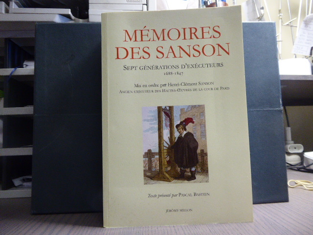
réf. 19541Jérôme Millon Grenoble 2013 Fort in-8 ( 240 X 160 mm ) de 1247 pages, broché sous couverture illustrée en couleurs. Très bel exemplaire de cette édition épuisée.Mémoires apocryphes, rédigés par le journaliste d'OLBREUSE d'après des documents originaux. Récit de toutes les grandes exécutions ( Tulard 1316 - Fierro 1315 ).
1988réf. R240084465L'INSTANT. 1988. In-8. Broché. Etat d'usage, Coins frottés, Dos satisfaisant, Intérieur frais. 340 pages - illustration en noir et blanc sur le 1er plat - petite annotation au stylo bleu sur la page de faux titre.. . . . Classification Dewey : 944.04-Révolution de 1789
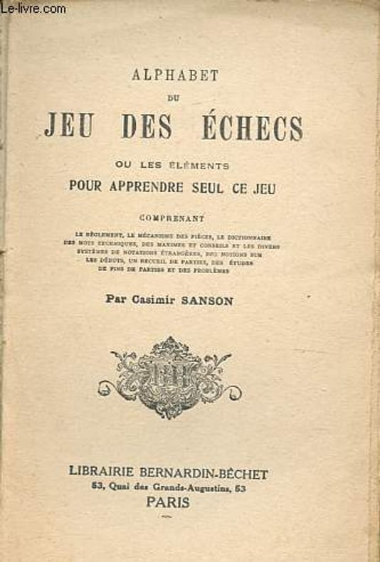
réf. RO80019263DEUX-TROIS / BERNARDIN-BECHET. Non daté. In-12. Broché. Etat d'usage, Couv. légèrement passée, Manque en coiffe de pied, Intérieur frais. 142 pages. Nombreuses figures en noir et blanc. Coiffe en tête abîmée, avec charnières fendues.. . . . Classification Dewey : 794.1-Echecs
réf. R200139717Librairie Bernardin-Béchet. non daté. In-12. Broché. A relier, 1er plat abîmé, Dos abîmé, Quelques rousseurs. 142 pages, nombreuses illustrations en noir et blanc dans et hors texte - papier jauni, 1er plat manquant, pliure et déchirure sur le 2e plat, dos partiellement manquant, ouvrage désolidarisé, déchirure et tampon en page de faux-titre.. . . . Classification Dewey : 794.1-Echecs
réf. 0331540630.Ghardcover. Good. Access codes and supplements are not guaranteed with used items. May be an ex-library book. hardcover
réf. 0282758410.Gpaperback. Good. Access codes and supplements are not guaranteed with used items. May be an ex-library book. paperback
2008réf. R200082302DE NOYELLES. 2008. In-8. Broché. Bon état, Couv. convenable, Dos satisfaisant, Intérieur frais. 505 pages.. . . . Classification Dewey : 820-Littératures anglaise et anglo-saxonne
réf. 5102Paris, Librairie agricole de la maison rustique, 1877-82. 4 vol. in-12, demi-reliure.
réf. ORD-9689Histoire naturelle et zootechnie. 5°édition. 56 gravures. Paris. Maison Rustique. 1894. In-12 (120 x 186mm) broché, couverture jaune imprimée, ornée d'un mouton, VI, 167 pages et catalogue de la librairie, 48 pages. Gravures en noir dans le texte.
1860réf. 23500Paris Bureaux de la Science Pittoresque et Bureaux de la Culture 1860 -in-12 demi-chagrin un volume, reliure demi-chagrin chocolat in-douze (binding half shagreen in-12)(20 x 13 cm), dos à nerfs (spine with raised bands) décoré "or" et à froid (gilt and blind stamping decoration), titre et auteur frappés "or" (gilt title), filet à froid de part et d'autre des nerfs et en tête et en pied, papier marbré marron et jaune aux plats (cover with marbled paper), toute tranches lisses, marque-page en tissu (bookmark in tissue), orné d'une gravure in-texte en noir + une figure de notation musicale in-texte en noir, 84 pages, 1860 Paris Bureaux de la Science Pittoresque et Bureaux de la Culture Editeurs,
1892réf. RO80034277LA MAISON RUSTIQUE. 2ème édition. 1892. In-12. Broché. Bon état, Couv. légèrement passée, Dos satisfaisant, Intérieur frais. 170 pages.. . . . Classification Dewey : 590-Zoologie
1864réf. 28164Paris Typographie de Renou et Maulde juin 1864 in-4 broché
réf. 5298in 12 broché,mention de 4ème édition.Titre,192 pages,Germer-Baillière & Cie Bibliothèque utile XII.Rousseurs éparses. Sinon très bon état
1863réf. 33551Paris Librairie agricole de la Maison rustique 1863 in-16 broché sous couverture imprimée