Samson, KarlBiblio.com

4 045 résultats
2012réf. Q-1118017269Frommers 2012-02-01. Paperback. New. In shrink wrap. Looks like an interesting title! *Frommers paperback
1999réf. AME_9780028626284pearson 1999. 4TH. Soft Cover. New/New. _ pearson paperback
1997réf. AME_9780028616704Glencoe/Mcgraw-Hill 1997. 5th. Paperback. New/New. _ Glencoe/Mcgraw-Hill paperback
2017réf. 2-6202013990LAP LAMBERT Academic Publishing 2017. Paperback. New. 236 pages. 8.66x5.91x0.54 inches. LAP LAMBERT Academic Publishing paperback
réf. 9780170124713 KKBrand New. Book Condition New U.S. EDITION. We Do not Ship APO FPO AND PO BOX. Printing in English language. Quick delivery by USPS/UPS/DHL/FEDEX/ARAMEX Customer satisfaction guaranteed. We may ship the books from Asian regions for inventory purpose unknown
réf. 6203685461.Gpaperback. Good. Access codes and supplements are not guaranteed with used items. May be an ex-library book. paperback
1678réf. M3431Paris: Mariette Pierre 1678. Excellent. Size : 357x595 mm 14x23.375 Inches Coloring: Original Outline with later cartouche coloring Category: ; Maps Asia Near East Turkey Mariette, Pierre unknown
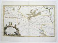
réf. 215370Amsterdam: Pierre Mortier. unbound. very good. Map. Engraving with hand outline. Image measures 13 3/4" x 22 1/2". Rare map of Galatia an ancient region of northern Anatolia present-day Turkey along the southern coast of the Black Sea. Published circa 1705 this map is centered on Ankara and shows provinces inhabited by Trocmi Tectosages and Tolistobogi - three Celtic tribes who inhabited the region from the 3rd century BC. Neighboring historical regions of Paphlagonia Pontus Phyrgia Cappadocia and Lycaonia are labeled. Mountains and cities are depicted pictorially. The map shows major roads connecting cities throughout the region. A decorative cartouche features lively figures celebrating with percussion and wind instruments. Full original margins minor offsetting. Based on earlier plates by Sanson. This map appeared in "Atlas Antiquus Sacer Ecclesiasticus et Profanus" published in Amsterdam by Pieter Mortier. Nicolas Sanson 1600-1667 who is considered the founder of the French school of cartography. In reaction to the prevailing trend of Dutch lavishness Sanson favored minimal details focusing rather on accurate cartography than ornament. Pierre Mortier 1661-1711 was a Dutch cartographer engraver and printseller who worked in Amsterdam. He used advanced Dutch printing methods to produce high quality editions of contemporary French maps by cartographers such as De L'Isle Sanson Jaillot de Fer and De Wit. This map is a lovely example of his work. Pierre Mortier unknown
réf. 215370Amsterdam: Pierre Mortier. unbound. very good. Map. Engraving with hand outline. Image measures 13 3/4" x 22 1/2". Rare map of Galatia an ancient region of northern Anatolia present-day Turkey along the southern coast of the Black Sea. Published circa 1705 this map is centered on Ankara and shows provinces inhabited by Trocmi Tectosages and Tolistobogi - three Celtic tribes who inhabited the region from the 3rd century BC. Neighboring historical regions of Paphlagonia Pontus Phyrgia Cappadocia and Lycaonia are labeled. Mountains and cities are depicted pictorially. The map shows major roads connecting cities throughout the region. A decorative cartouche features lively figures celebrating with percussion and wind instruments. Full original margins minor offsetting. Based on earlier plates by Sanson. This map appeared in "Atlas Antiquus Sacer Ecclesiasticus et Profanus" published in Amsterdam by Pieter Mortier. Nicolas Sanson 1600-1667 who is considered the founder of the French school of cartography. In reaction to the prevailing trend of Dutch lavishness Sanson favored minimal details focusing rather on accurate cartography than ornament. Pierre Mortier 1661-1711 was a Dutch cartographer engraver and printseller who worked in Amsterdam. He used advanced Dutch printing methods to produce high quality editions of contemporary French maps by cartographers such as De L'Isle Sanson Jaillot de Fer and De Wit. This map is a lovely example of his work. Pierre Mortier unknown books
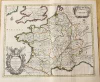
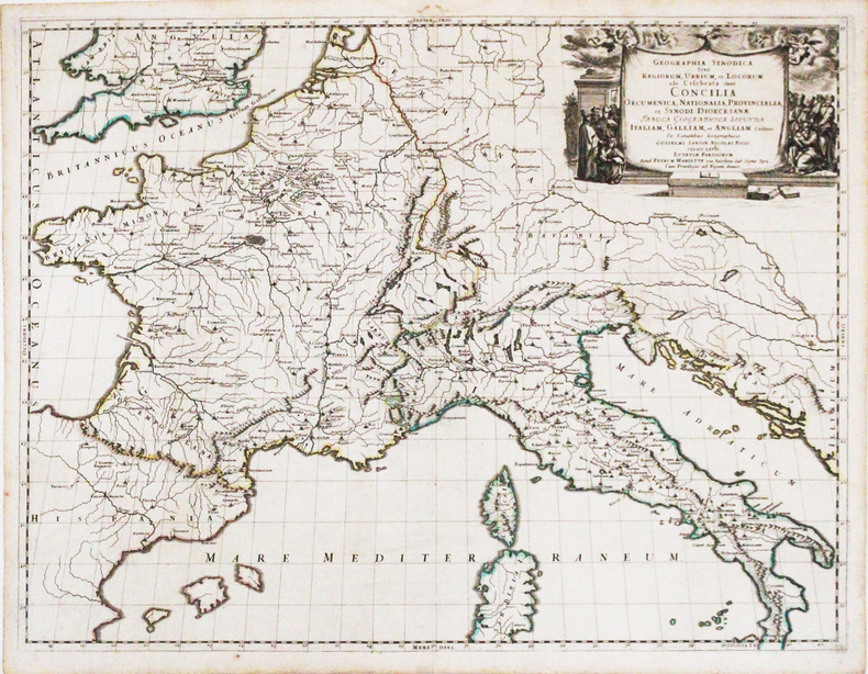
1710réf. M10329Amsterdam: Jean Covens & Corneille Mortier c.1710. Very Good. Size : 378x486 mm 14.88x19.13 Inches Coloring: Original Outline Coloring Category: Maps Europe France; Jean Covens & Corneille Mortier unknown
1760réf. M7988Paris: Sr. Delamarche c.1760. Very Good. Notes: Engraved by Delahaye. Large scale attractive map of France. Size : 493x668 mm 19.41x26.30 Inches Coloring: Original Hand Coloring Category: Maps Europe France; Sr. Delamarche unknown
réf. 008101600X.Gpaperback. Good. Access codes and supplements are not guaranteed with used items. May be an ex-library book. paperback
réf. 0123846986.Ghardcover. Good. Access codes and supplements are not guaranteed with used items. May be an ex-library book. hardcover
2011réf. STM-9780123846983United States: Academic Press 2011. Hardbound. Brand New. Book Condition:- Brand New. Secured Packaging. Fast DeliveryBookseller Inventory # 9780123846983 Academic Press hardcover
2011réf. BN527974Academic Press 2011. 2011. Hardcover. Game Theory and Learning for Wireless Networks: Fundamentals and Applications Game Theory and Learning for Wireless Networks: Fundamentals and Applications Samson Lasaulce BSc MSc PhD et Hamidou Tembine BSc MSc PhD Academic Press hardcover
1992réf. I8181Singapore: White Lotus Press 1992. Paperback. Good/no dj. 0.24. Gardens and Parks of Singapore White Lotus Press paperback
2013réf. 1-1598269526Philipp Feldheim 2013. Hardcover. New. 368 pages. 8.90x6.30x1.40 inches. Philipp Feldheim hardcover
2005réf. R300269955Gaz de Bordeaux/Le petit théâtre. 2005. In-8. Broché. Etat d'usage, Couv. convenable, Agraffes rouillées, Intérieur frais. 25 pages - quelques photos en noir et blanc dans le texte. Plats contrepliés en un rabat.. . . . Classification Dewey : 750-La peinture et les peintres
réf. 83285Berlin, Hasselberg’sche Verlagshandlung ohne Jahr, 190x130mm, 199 + 190 + 191Seiten, Halbperkalin.
réf. 83285Berlin : Hasselberg’sche Verlagshandlung ohne Jahr. demi-percaline. SANSON H.Geheimnisse des Schaffots. Memoiren der Scharsricher-Familie Sanson 1685-1847. 1. 2.und 3. Bd. in 1 Band. Berlin Hasselberg’sche Verlagshandlung ohne Jahr 190x130mm 199 190 191 Seiten Halbperkalin. No hidden customs fees for orders shipped to the U.S.A with a value of up to 800 USD PDDP shipping we pay the VAT in advance Hasselberg’sche Verlagshandlung unknown
1667réf. LBW-3266Paris, Pierre Mariette, 1667. 422 x 554 mm.
1704réf. 48770Amsterdam, Franciscus Halma, 1704. Folio. (45,5 x 29 cm.). Contemp. full blindtooled Dutch vellum. Raised bands. Spine ends with tears, some cracking along fronthinge, but not loose. Vellum at frontcover a bit soiled. Egraved titlepage (Coxis del., ianen fecit). Printed titlepage in red/black with an engraved vignette. 15,(119),51,(1) pp., 1 engraved plate with portrait and coat of arms. 4 large folded engraved maps. Light yellowing to margins of textleaves, but maps and text fine and clean. (3 of the maps engraved by F. Halma).
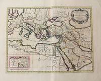
1710réf. M10321Amsterdam: Jean Covens & Corneille Mortier c.1710. Very Good. Size : 402x520 mm 15.83x20.47 Inches Coloring: Original Hand Coloring Category: Maps Mediterranean Sea; Maps Asia Middle East; Jean Covens & Corneille Mortier unknown
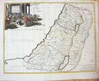
1660réf. M7049Paris 1660. Very Good;. Notes: French map of the Holy Land with a decorative cartouche. Nicolas Sanson 1600–1667 was a renowned French cartographer termed by some as the "father of French cartography." His works are known for their incorporation of the most up to date information of the time and their clean modern style. Size : 385x485 mm 15.16x19.09 Inches Coloring: Hand Colored Category: Maps Asia Middle East Holy Land & Palestine; unknown
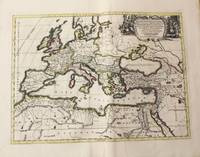
1710réf. M10325Amsterdam: Jean Covens & Corneille Mortier c.1710. Very Good. Size : 413x562 mm 16.26x22.13 Inches Coloring: Original Hand Coloring Category: Maps Europe Continent; Maps Africa North; Maps Mediterranean Sea; Jean Covens & Corneille Mortier unknown