Gosset LéonLivre Rare Book

4.034 Ergebnisse
Best.-Nr. 9722Piazza Petit In-4°, reliure postérieure demi chagrin cognac au 2/3, premier plat délimitant par un fin serpentin la lisière cuir et cartonnage jaspé, dos à deux nerfs ouvragés larges et et cinq nerfs ouvragés au centre- Motifs floraux pour les premiers et chainons dorés, titre sobre au petit fer à même le cuir.Belle pagination, enrichie de 21 illustrations colorisées de Ch Samson dans le texte, bandeaux et cul-de-lampes, très bel exemplaire dont la reliure semble avoir si fidèlement suivi l'esprit de cet ouvrage qu'elle semble originelle-Un travail signé Marion Ben Houssine.
1980Best.-Nr. ABE-1548271584098220 PAGES-EN COUVERTURE "AVEC EUX C'EST LA FETE", CHANTAL GOYA ET THIERRY LE LURON-LE PINCEAU ET LE BISTOURI, 7P, CHIRURGIE ESTHETIQUE-YVONNE DE GAULLE CETTE INCONNUE, 5P PAR ANNE ROUANET-GRUAU POUR PUBLICITE PARFUM "JULES" DE CHRISTIAN DIOR-CHANTAL GOYA ET JEAN-JACQUES DEBOUT, 4P-VERONIQUE SANSON A INVENTE LA LOVE CUISINE POUR SON NOUVEL AMOUR, 2P-POLOGNE LES RUSSES VONT-ILS INTERVENIR?, 10P-L'INTERVIEW INTEGRALE DE LA PRESIDENTE-LES CORNES DU DESIR, MAGRITTE, 8P-LE MONDE SECRET DES "VERTS", 4P, PLATINI, LOPEZ, PAGANELLI-AC/DC C'EST LA NOUVELLE DEFONCE, 4P-APRES MARX, LES COLUCHE, 2P PAR JEAN CAU
1995Best.-Nr. ABE-1547905280573104 PAGES-23 CM X 30 CM-EN COUVERTURE "PALMADE SANSON CE N'EST PAS DE L'AMOUR C'EST DE LA PASSION ILS RACONTENT TOUT"-LE CORBUSIER DICTATEUR DU BETON, 4P, 21 PHOTOS, LE CORBUSIER AVEC YVONNE GALLIS IL DEVIENT ENFIN HUMAIN, 1P, 4 PHOTOS-PALMADE SANSON, 6P-DEMARCHELIER, 4P-L'ATTENTAT FAIRE "PARLER" LE WAGON!, RER SAINT MICHEL, 10P-LA FEMME DE LA LIBERTE, AUNG SAN SUUKYI, BIRMANIE, 4P-SAINT-TROPEZ SUR STARS, 8P, JOHNNY HALLYDAY, BELMONDO, FRANCE GALL, EDDY MITCHELL,.-COUPLES DE LEGENDE 3 TAYLOR BURTON, 10P-MAZARINE ET SA COUVERTURE, DROIT DE REPONSE-HIROSHIMA L'HEURE DE L'APOCALYPSE, 14P
2005Best.-Nr. ABE-1549275249101116 PAGES-EN COUVERTURE "VERONIQUE SANSON L'AMOUR M'A SAUVEE DE L'ALCOOL"-JOUEURS DE RUGBY POUR PUBLICITE "EDEN PARK"-VICTOIRE DE CASTELLANE, 3P-OBISPO LE PARRAIN, 1P, PHOTO-TERESA BERGANZA DIVA ASSOLUTA, 1P, PHOTO-LE CARDINAL LUSTIGER AU NOM DE LA FOI, 4P-VERONIQUE SANSON AMOUREUSE, 8P-ALLEGRA VERSACE L'ANOREXIE EN HERITAGE, 4P-BRUNO SOLO, YVAN LE BOLLOC'H L'AMITIE PLUS FORTE QUE LE SUCCES, 4P-LE JOUR OU JE ME SUIS CRUE DEFIGUREE, 1P PAR ARIANE MASSENET
1678Best.-Nr. 200041AG1678. Paris Sanson d'Abbeville 1678. Original hand-coloured engraving. Plate Size: 53.6 cm x 41.7 cm. Sheet Size: 61.8 cm x 46.5 cm. Original map. In very good condition. Faint signs of browning to map. Minor paper imperfections to the outer margins. Small stain to map near centre-fold. A richly detailed map showing the northern part of Portugal. Relief on map depicted pictorially and border inlaid with longitudinal and latitudinal details The map is dominated by three rivers: the Tajo Tagus in the south the Douro and the Minho further north. The Spanish kingdom and regions such as Leon are included and the great city of Salamanca can be seen. The lower part of the map runs out before the Tagus estuary empties into the Atlantic at Lisbon. The ornamental title cartouche is in the lower right corner of the map. Off the coast is a large warship flying the coat-of-arms Kingdom of Portugal and the Algarves. The sails of the boat carry Latin text commemorates the commercial and maritime exploits of King John IV in Africa Arabia Ethiopia Persia India and Brazil. Nicolas Sanson 20 December 1600 7 July 1667 was a French cartographer termed by some the creator of French geography in which he's been called the "father of French cartography." The French school of Geography was unprecedented in its attention to precision and scientific detail and discarded much of the decorative embellishments of previous maps as irrelevant. From Sanson's time in the second half of the seventeenth century until the latter part of the eighteenth century French geographical conceptions were more influential than those put forward by any other nation. He was tutor to Louis XIII and Louis XIV. Sanson published over 300 maps. In 1692 Hubert Jaillot collected Sanson's maps in an Atlas nouveau. Wikipedia unknown
1654Best.-Nr. 6981520 192 62 pages 2. Illustrated with engravings of heads of Kings and shields throughout the text as well as decorative headpieces and decorated capitals. Printed for Humphrey Moseley hardcover
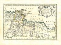
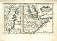
1656Best.-Nr. 78507Uten sted. Paris 1656. Tverr4to. Arkets størrelse : 335 cm X 245 cm. Med samtidig grensekolorering. Fransk. Nicolas Sanson 1600-1667 blir regnet for å være grunnleggeren av fransk kartografi. Kommer fra atlaset “L’Afrique” med flere senere utgivelser. unknown
1656Best.-Nr. 78505Uten sted. Paris 1656. Tverr4to. Arkets størrelse : 335 cm X 245 cm. Med samtidig grensekolorering. Fransk. Nicolas Sanson 1600-1667 blir regnet for å være grunnleggeren av fransk kartografi. Kommer fra atlaset “L’Afrique” med flere senere utgivelser. unknown
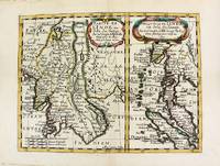
1652Best.-Nr. M8177Paris. 1652. Very Good. Notes: Fine 17th century map of Thailand Burma and Malaysia. Size : 191x249 mm 7.50x9.80 Inches Coloring: Original Hand Coloring Category: Maps Asia South East Thailand Laos Vietnam Cambodia & Burma / Myanmar; Maps Asia South East Malaysia & Singapore; unknown
1666Best.-Nr. M1204Paris: Mariette Pierre 1666. Very Good. Size : 410x555 mm 16.125x21.875 Inches Coloring: Hand Colored Reference: Mojski Piotr Maria "Cartographia Rappersviliana Polonorum" page 388 number 32; Category: ; Maps Europe Poland Lithuania Mariette, Pierre unknown
1665Best.-Nr. M589Paris: Mariette Pierre 1665. Excellent. Size : 410x560 mm 16.125x22 Inches Coloring: Hand Colored Reference: Mojski Piotr Maria "Cartographia Rappersviliana Polonorum" page 387 number 31; Category: ; Maps Europe Poland Lithuania Mariette, Pierre unknown
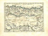
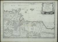
Best.-Nr. 3952Paris: 1655. No binding. Very Good. 370 x 530 mm. in early outline colour in very good condition. Engraved by Joannes Somer and published in Paris by Pierre Mariette this attractive map of central north Africa bears an ornate title cartouche top right. It is centred on Tunisia and Libya and includes the island of Malta in the Mediterranean. It comes from Sanson's 'Cartes Generales de Toutes les Parties du Monde'. Pastoureau Sanson V A no. 16. 1655 unknown
1683Best.-Nr. 297468Paris 1683. unbound. Map. Copper engraving with hand coloring. Image measures 7 5/8 x 11 1/4 inches. This map published in Paris in Afrique en plusieurs cartes is one of Sanson's small atlas maps of depicting various African regions. This map offers extensive detail on the cities of North Africa as well as topographical and geographical features with mountains beautifully rendered in profile. Nicolas Sanson 1600-1667 is considered the founder of the French school of cartography. In reaction to the prevailing trend of Dutch lavishness Sanson favored minimal details focusing rather on accurate cartography than ornament. This map is a fine example of his work. unknown
1683Best.-Nr. 297468Paris 1683. unbound. Map. Copper engraving with hand coloring. Image measures 7 5/8 x 11 1/4 inches. This map published in Paris in Afrique en plusieurs cartes is one of Sanson's small atlas maps of depicting various African regions. This map offers extensive detail on the cities of North Africa as well as topographical and geographical features with mountains beautifully rendered in profile. Nicolas Sanson 1600-1667 is considered the founder of the French school of cartography. In reaction to the prevailing trend of Dutch lavishness Sanson favored minimal details focusing rather on accurate cartography than ornament. This map is a fine example of his work. unknown books
1652Best.-Nr. LBW041961652. 188 x 251 mm.
1656Best.-Nr. 78506Uten sted. Paris 1656. Tverr4to. Arkets størrelse : 335 cm X 245 cm. Med samtidig grensekolorering. Fransk. Nicolas Sanson 1600-1667 blir regnet for å være grunnleggeren av fransk kartografi. Kommer fra atlaset “L’Afrique” med flere senere utgivelser. unknown
1656Best.-Nr. 78509Uten sted. Paris 1656. Tverr4to. Arkets størrelse : 335 cm X 245 cm. Med samtidig grensekolorering. Fransk. Nicolas Sanson 1600-1667 blir regnet for å være grunnleggeren av fransk kartografi. Kommer fra atlaset “L’Afrique” med flere senere utgivelser. unknown
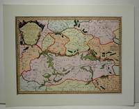
Best.-Nr. 1916-25Paris H. Jaillot 1692. Alt grenzkolorierte Kupferstichkarte von 2 Platten. 64 5 x 99 cm Blattgr. Breitrandiges Exemplar. Äußere Ränder etwas gebräunt kleiner Randeiniß sonst gut erhalten. Großformatige Karte von Guillaume Sanson 1633-1703 die das Gebiet von Deggendorf bis Wagram und von Kromeríz/Kremsier bis Veszprém/Weissbrünn mit dem Neusiedler See Newsidler See zeigt. Aus dem Verlag von Alexis-Hubert Jaillot um 1632-1712 der eng mit Sanson zusammenarbeitete. Paris, H. Jaillot 1692. unknown
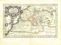
1700Best.-Nr. 54023Nicolas Bion: L'Usage des Globes. Amsterdam: Francois Halma. 1700. Attractive map of Morocco the Saharan hinterland and the Canary Islands. Handsome title cartouche at top left. Much of the charm of early maps of Africa lies in how they show the interior of the continent which was not explored until the 19th century. Maps by Sanson in original colour are rare. Nicolas Sanson was founder of the French school of mapmakers at a time when the leadership in European cartography passed from the Low Countries to France. This map was published in Brion's treatise on globes. Nicolas Brion was a famous French mathematical and scientific instrument maker. Copper engraving. Very good condition. Faint library stamp right margin. Original colour. Size: 28 x 17 cm. 11 x 6½ inches. unknown
1663Best.-Nr. M1708Paris: Mariette Pierre 1663. Excellent. Size : 425x575 mm 16.75x22.625 Inches Coloring: Hand Colored Category: ; Maps Europe France Mariette, Pierre unknown
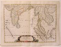
1654Best.-Nr. M2656Paris 1654. Excellent. Size : 385x530 mm 15.125x20.875 Inches Coloring: Original Hand Coloring Reference: Nebenzahl 3.9C Category: Maps Asia South East; Maps Asia Central India & Sri Lanka / Ceylon; unknown
Best.-Nr. 14036India & South East Asia, Paris, 1654 -1679, copperplate, Original o/l colour. 52.5 x 38cms [21 x 15ins] A good map of peninsula India, Ceylon and Southeast Asia including Sumatra and present-day Singapore from Nicolas Sanson's "Cartes Generales ...". Sanson was the major French mapmaker of the period and produced a number of important maps from information supplied by travellers and missionaries. This map marks an advance on those being produced in Amsterdam based on details from the 1620s and 30s.
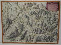
1689Best.-Nr. 52354Paris. 1689. The map covers the area from the Moselle in NW to Worms in SE. ornamental cartouche at lower left. Copper engraving. Good condition though map is slightly discolured and stained. Original colour. Size: 56 x 43 cm. unknown
1674Best.-Nr. bb3404Jaillot H. Carte 1674 Carte de 43 x 57 cm en une partie : frontières colorées ; mouillure marginale sans gravité, bon exemplaire. Livraison a domicile (La Poste) ou en Mondial Relay sur simple demande.
1674Best.-Nr. ag660Jaillot H. Carte 1674 Carte de 43 x 57 cm en une partie : frontières colorées ; mouillure marginale sans gravité, bon exemplaire. Livraison a domicile (La Poste) ou en Mondial Relay sur simple demande.