Jane (eds) Frost, Alan and SamsonBiblio.com

4045 risultati
rif. 0522847919.Gpaperback. Good. Access codes and supplements are not guaranteed with used items. May be an ex-library book. paperback
rif. 59850Genève, Editions Henn 1950, 250x170mm, 210pages, broché. Charnière supérieure fendue sur 3 cm en haut et en bas.
rif. 97867Genève, Editions Henn, 1950. 15 x 24, 211 pp., reliure pleine rexine rouge, très bon état.
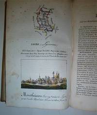
rif. 16-4577Paris : Palais-Royal Librairie d'Education de A. J. Sanson 1825. . This copy with the maps and town views all with contemporary handcoloring. OCLC Number: 642902888.Notes: Engravings by S. Hosse and Duchâtel.Title vignette.Publisher's advertisements: p. 2 and p. 179-180.Description: 180 pages 87 unnumbered leaves of plates : illustrations 87 maps with birds eye views all handcolored. ; 21 cm.In-8 12 x 20cm. cartonnage de l'époque plats illustrés. Ouvrage illustré d'une carte générale de France lithographiée avec contours colorié et de 86 planches lithographiées et coloriées. Les quatre-vingt-six départements ont chacun un feuillet de description accompagné d'une planche ornée d'une carte et d'une vue de la ville principale. Elles sont toutes lithographiées par Duchâtel d'après S. Hoffe. Parmi les villes représentées se trouvent La Rochelle Ajaccio Dijon Bordeaux Rennes Nantes Angers Vannes Lyon ou Paris. Bon exemplaire. Défauts aux coins et aux mors.Expertise by M. Christian GASCHBoite Postale 405F-58004 NEVERS Cedex. Paris : Palais-Royal, Librairie d'Education de A. J. Sanson, 1825. unknown
rif. 334703967X.Ghardcover. Good. Access codes and supplements are not guaranteed with used items. May be an ex-library book. hardcover
1678rif. M3434Paris: Mariette Pierre 1678. Excellent. Size : 390x522 mm 15.375x20.5 Inches Coloring: Original Outline with later cartouche coloring Category: ; Maps Asia Near East Turkey Mariette, Pierre unknown
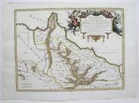
1713rif. 215454Amsterdam: Mortier Pieter 1713. unbound. very good. Map. Engraving with original hand outline. Image measures 14.5" x 18.75". Rare map of Paphlagonia an ancient region of northern Anatolia present-day Turkey along the southern coast of the Black Sea. Highlighting the capital city of Sinope this map depicts the region as defined by Strabo: bound by the Parthenius River in the west extending to the Hays river in the east. Sanson depicts the region comprising the Kingdom of Pontus during the rule of Mithridates IV. Neighboring historical regions of Gallatia and Bithynia et Pontus are labeled. Full original margins light scattered foxing. Based on earlier plates by Sanson. This map appeared in "Atlas Antiquus Sacer Ecclesiasticus et Profanus" published in Amsterdam by Pieter Mortier. Nicolas Sanson 1600-1667 who is considered the founder of the French school of cartography. In reaction to the prevailing trend of Dutch lavishness Sanson favored minimal details focusing rather on accurate cartography than ornament. Pierre Mortier 1661-1711 was a Dutch cartographer engraver and printseller who worked in Amsterdam. He used advanced Dutch printing methods to produce high quality editions of contemporary French maps by cartographers such as De L'Isle Sanson Jaillot de Fer and De Wit. His greatest feat was the nautical atlas "Le Neptune Francois" or "Suite de Neptune Francois" considered to contain the most beautiful examples of cartographic art. After his death his widow Amelia continued publishing in partnership with her brother-in-law David until her death in 1719. This map was published during Amelia's tenure at the firm. Mortier, Pieter unknown
1713rif. 215454Amsterdam: Mortier Pieter 1713. unbound. very good. Map. Engraving with original hand outline. Image measures 14.5" x 18.75". Rare map of Paphlagonia an ancient region of northern Anatolia present-day Turkey along the southern coast of the Black Sea. Highlighting the capital city of Sinope this map depicts the region as defined by Strabo: bound by the Parthenius River in the west extending to the Hays river in the east. Sanson depicts the region comprising the Kingdom of Pontus during the rule of Mithridates IV. Neighboring historical regions of Gallatia and Bithynia et Pontus are labeled. Full original margins light scattered foxing. Based on earlier plates by Sanson. This map appeared in "Atlas Antiquus Sacer Ecclesiasticus et Profanus" published in Amsterdam by Pieter Mortier. Nicolas Sanson 1600-1667 who is considered the founder of the French school of cartography. In reaction to the prevailing trend of Dutch lavishness Sanson favored minimal details focusing rather on accurate cartography than ornament. Pierre Mortier 1661-1711 was a Dutch cartographer engraver and printseller who worked in Amsterdam. He used advanced Dutch printing methods to produce high quality editions of contemporary French maps by cartographers such as De L'Isle Sanson Jaillot de Fer and De Wit. His greatest feat was the nautical atlas "Le Neptune Francois" or "Suite de Neptune Francois" considered to contain the most beautiful examples of cartographic art. After his death his widow Amelia continued publishing in partnership with her brother-in-law David until her death in 1719. This map was published during Amelia's tenure at the firm. Mortier, Pieter unknown books
1995rif. ABE-1547905280573104 PAGES-23 CM X 30 CM-EN COUVERTURE "PALMADE SANSON CE N'EST PAS DE L'AMOUR C'EST DE LA PASSION ILS RACONTENT TOUT"-LE CORBUSIER DICTATEUR DU BETON, 4P, 21 PHOTOS, LE CORBUSIER AVEC YVONNE GALLIS IL DEVIENT ENFIN HUMAIN, 1P, 4 PHOTOS-PALMADE SANSON, 6P-DEMARCHELIER, 4P-L'ATTENTAT FAIRE "PARLER" LE WAGON!, RER SAINT MICHEL, 10P-LA FEMME DE LA LIBERTE, AUNG SAN SUUKYI, BIRMANIE, 4P-SAINT-TROPEZ SUR STARS, 8P, JOHNNY HALLYDAY, BELMONDO, FRANCE GALL, EDDY MITCHELL,.-COUPLES DE LEGENDE 3 TAYLOR BURTON, 10P-MAZARINE ET SA COUVERTURE, DROIT DE REPONSE-HIROSHIMA L'HEURE DE L'APOCALYPSE, 14P
1980rif. ABE-1548271584098220 PAGES-EN COUVERTURE "AVEC EUX C'EST LA FETE", CHANTAL GOYA ET THIERRY LE LURON-LE PINCEAU ET LE BISTOURI, 7P, CHIRURGIE ESTHETIQUE-YVONNE DE GAULLE CETTE INCONNUE, 5P PAR ANNE ROUANET-GRUAU POUR PUBLICITE PARFUM "JULES" DE CHRISTIAN DIOR-CHANTAL GOYA ET JEAN-JACQUES DEBOUT, 4P-VERONIQUE SANSON A INVENTE LA LOVE CUISINE POUR SON NOUVEL AMOUR, 2P-POLOGNE LES RUSSES VONT-ILS INTERVENIR?, 10P-L'INTERVIEW INTEGRALE DE LA PRESIDENTE-LES CORNES DU DESIR, MAGRITTE, 8P-LE MONDE SECRET DES "VERTS", 4P, PLATINI, LOPEZ, PAGANELLI-AC/DC C'EST LA NOUVELLE DEFONCE, 4P-APRES MARX, LES COLUCHE, 2P PAR JEAN CAU
2005rif. ABE-1549275249101116 PAGES-EN COUVERTURE "VERONIQUE SANSON L'AMOUR M'A SAUVEE DE L'ALCOOL"-JOUEURS DE RUGBY POUR PUBLICITE "EDEN PARK"-VICTOIRE DE CASTELLANE, 3P-OBISPO LE PARRAIN, 1P, PHOTO-TERESA BERGANZA DIVA ASSOLUTA, 1P, PHOTO-LE CARDINAL LUSTIGER AU NOM DE LA FOI, 4P-VERONIQUE SANSON AMOUREUSE, 8P-ALLEGRA VERSACE L'ANOREXIE EN HERITAGE, 4P-BRUNO SOLO, YVAN LE BOLLOC'H L'AMITIE PLUS FORTE QUE LE SUCCES, 4P-LE JOUR OU JE ME SUIS CRUE DEFIGUREE, 1P PAR ARIANE MASSENET
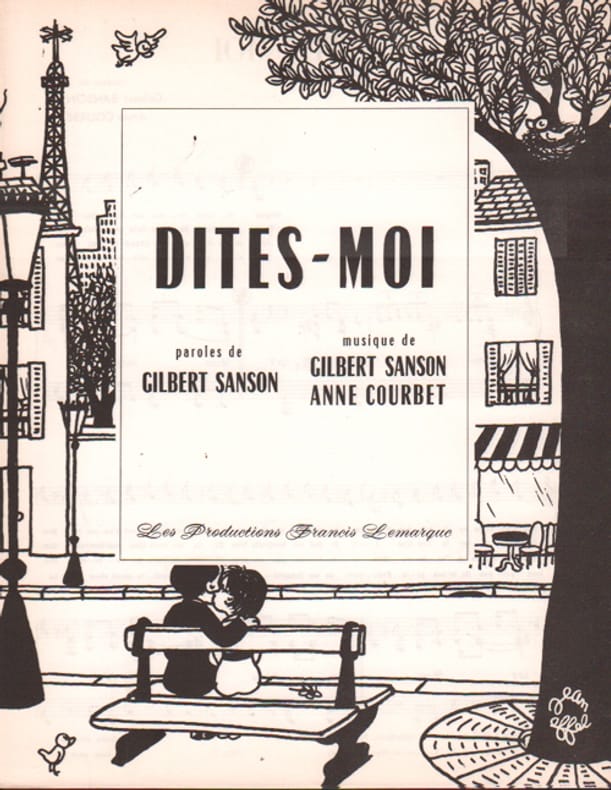
1962rif. 102757Lemarque Francis 1962
1946rif. 20793Bernard 1946
1952rif. 79478Société Intercontinentale de Musique 1952
1880rif. 15160Partitions sur le Militaria Benoit Emile 1880 approx.
1926rif. 20922Partitions sur la Provence Bosc 1926
rif. 9722Piazza Petit In-4°, reliure postérieure demi chagrin cognac au 2/3, premier plat délimitant par un fin serpentin la lisière cuir et cartonnage jaspé, dos à deux nerfs ouvragés larges et et cinq nerfs ouvragés au centre- Motifs floraux pour les premiers et chainons dorés, titre sobre au petit fer à même le cuir.Belle pagination, enrichie de 21 illustrations colorisées de Ch Samson dans le texte, bandeaux et cul-de-lampes, très bel exemplaire dont la reliure semble avoir si fidèlement suivi l'esprit de cet ouvrage qu'elle semble originelle-Un travail signé Marion Ben Houssine.
1948rif. 1660181948 PARIS . Aspects et reflets.Illustrations en couleurs de Ch Samson.Piazza , 1948 , grand in8 broché,193pp.Petits manques de papier au dos. Très bon état intérieur.
1674rif. bb3401Jaillot H. Carte 1674 Carte de 42 x 55 cm en une partie : frontières colorées ; très bon exemplaire. Livraison a domicile (La Poste) ou en Mondial Relay sur simple demande.
1674rif. bb3404Jaillot H. Carte 1674 Carte de 43 x 57 cm en une partie : frontières colorées ; mouillure marginale sans gravité, bon exemplaire. Livraison a domicile (La Poste) ou en Mondial Relay sur simple demande.
1674rif. ag660Jaillot H. Carte 1674 Carte de 43 x 57 cm en une partie : frontières colorées ; mouillure marginale sans gravité, bon exemplaire. Livraison a domicile (La Poste) ou en Mondial Relay sur simple demande.
rif. 14036India & South East Asia, Paris, 1654 -1679, copperplate, Original o/l colour. 52.5 x 38cms [21 x 15ins] A good map of peninsula India, Ceylon and Southeast Asia including Sumatra and present-day Singapore from Nicolas Sanson's "Cartes Generales ...". Sanson was the major French mapmaker of the period and produced a number of important maps from information supplied by travellers and missionaries. This map marks an advance on those being produced in Amsterdam based on details from the 1620s and 30s.
1936rif. 5822Francis Day 1936
1936rif. 5823Francis Day 1936
1938rif. 14401Salabert 1938