4068 risultati
rif. 9781536175530NOVA SCIENCE PUBLISHERS INC
1710rif. M10331Amsterdam: Jean Covens & Corneille Mortier c.1710. Very Good. Size : 410x508 mm 16.14x20.00 Inches Coloring: Original Outline Coloring Category: Maps Africa North; Maps Europe Continent; Maps Mediterranean Sea; Jean Covens & Corneille Mortier unknown
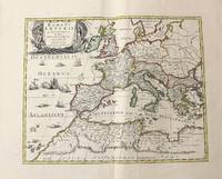
1710rif. M10332Amsterdam: Jean Covens & Corneille Mortier c.1710. Very Good. Size : 403x555 mm 15.87x21.85 Inches Coloring: Original Outline Coloring Category: Maps Mediterranean Sea; Maps Asia Middle East; Jean Covens & Corneille Mortier unknown
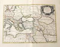
1720rif. LBW-464Amsterdam, J. Covens et C. Mortier, [circa 1720]. 400 x 501 mm.
2020rif. x-0367581736Taylor & Francis 2020. Paperback. New. 346 pages. 9.69x6.85x0.70 inches. Taylor & Francis paperback
2015rif. __0415711312Routledge 2015. Hardcover. New. 1st edition. 324 pages. 9.75x7.00x1.00 inches. Routledge hardcover
1663rif. LBW-9481663 417 x 378 mm.
1656rif. 78503Uten sted. Paris 1656. Tverr4to. Arkets størrelse : 335 cm X 245 cm. Med samtidig grensekolorering. Fransk. Nicolas Sanson 1600-1667 blir regnet for å være grunnleggeren av fransk kartografi. Kommer fra atalset “L’Afrique” med flere senere utgivelser. unknown
rif. H32ca. 1750. 30 mal 21 cm. Gefalt. Karte. unknown
1656rif. M8114Paris c.1656. Very Good. Size : 375x521 mm 14.76x20.51 Inches Coloring: Original Hand Coloring Category: Maps Asia Far East Japan & Korea; unknown
1700rif. 54022Nicolas Bion: L'Usage des Globes. Amsterdam: Francois Halma. 1700. Attractive map of north eastern Africa including Egypt and northern Libya. Much of the charm of early maps of Africa lies in how they show the interior of the continent which was not explored until the 19th century. Maps by Sanson in original colour are rare. Nicolas Sanson was founder of the French school of mapmakers at a time when the leadership in European cartography passed from the Low Countries to France. This map was published in Brion's treatise on globes. Nicolas Brion was a famous French mathematical and scientific instrument maker. Copper engraving. Very good condition. Darkened edges to margins. Faint inkstamp on right margin not affecting map. Original colour. Size: 27 x 17 cm. 10½ x 6½ inches. unknown
1655rif. M2801Paris: Mariette Pierre 1655. Excellent. Size : 345x523 mm 13.625x20.625 Inches Coloring: Original Outline Coloring Category: Maps Africa North Egypt Mariette, Pierre unknown
rif. 0670082643.Ghardcover. Good. Access codes and supplements are not guaranteed with used items. May be an ex-library book. hardcover
rif. Q-1595545468Thomas Nelson Publishing 2014-02-25. Paperback. New. New. In shrink wrap. Looks like an interesting title! Thomas Nelson Publishing paperback
1834rif. 1415500Paris: J. B. Baillière Libraire 1834. First Edition. Softcover. Octavo 4 115 pages. In Very Good condition. Rebound in modern blue paper wraps. Moderate to heavy toning to covers with spine area nearly toned to white; a small vertical crease to rear cover. Text block has soiling to edges light penciling to half-title page a few scattered stains and age-toning and light foxing throughout. Text in French. Shelved in Room A octavo overflow. 1415500. Special Collections - Upstairs. J. B. Baillière, Libraire unknown books
rif. 7056Quebecor ,2000, in-8 de 156 pages ,br. couv. illustrée ,Bon état , .Isbn : 2764004230.(1 photo sur mon site https://www.vieuxlivre.fr .Les frais de port pour la France sont offerts à partir de 25 euros d'achat (Mondial relay ). (colissimo suivi +6,90 ).
rif. lc_18401Québécor (2000)
rif. 220271Rouen [puis :] Paris, Schneider [puis :] Honoré Champion, s.d. (1911-1912) 5 vol. in-8, demi-chagrin cerise, dos à nerfs, couvertures conservées (reliure de l'époque).
1834rif. 1415500Paris: J. B. Baillière Libraire 1834. First Edition. Softcover. Octavo 4 115 pages. In Very Good condition. Rebound in modern blue paper wraps. Moderate to heavy toning to covers with spine area nearly toned to white; a small vertical crease to rear cover. Text block has soiling to edges light penciling to half-title page a few scattered stains and age-toning and light foxing throughout. Text in French. Shelved in Room A octavo overflow. 1415500. Special Collections - Upstairs. J. B. Baillière, Libraire unknown
rif. 0684848724.Gpaperback. Good. Access codes and supplements are not guaranteed with used items. May be an ex-library book. paperback
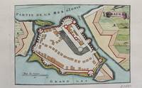
1690rif. M9472Paris c.1690. Very Good. Notes: A charming map of Santa Maura on the island of Lefkada Greece during the late 17th century. Size : 104x153 mm 4.09x6.02 Inches Coloring: Hand Colored Category: Maps Europe Greece Macedonia; unknown
1900rif. 76237- Notice de 4 pages, avec 1 gravure du saint en première page. 18 x 25 cm.
1991rif. 2-0811716538Stackpole Books 1991. Hardcover. New. 9.25x6.25x1.00 inches. Stackpole Books hardcover
1991rif. Q-0811716538Stackpole Books 1991-07-01. Hardcover. New. In shrink wrap. Looks like an interesting title! Stackpole Books hardcover
1991rif. 002542Mechanicsburg Pennsylvania U.S.A.: Stackpole Books 1991. INSCRIBED AND DATED BY JACK SAMSON TO AJ McCLANE on fep. Beautiful inscription. Near fine book with just a touch of shelfwear. Brodart protected. Ships in a box. Signed by Author. First Edition. Hard Cover. Near Fine/Fine. Stackpole Books Hardcover