Samson, AnneBiblio.com

4 117 résultats
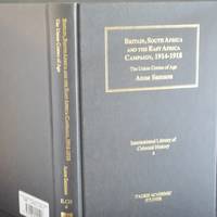
2006réf. 469592Tauris Academic Studies London 2006 International Library of Colonial History v.4. 2006. 1st Edition. Hardcover. 1845110404 1st edition hardback 8vo 262pp map clean and tight no inscriptions black cloth gilt Very Good condition / no dustwrtapper. ISBN: 1845110404 . Tauris Academic Studies, London, 2006, International Library of Colonial History v.4, hardcover
2006réf. 80788London: Tauris Academic Studies. This is a Fine Copy of this book in black cloth with bright and vibrant gilt title lettering to spine and upper cover.Issued without Dust-Jacket.This copy has no names or inscriptions present.The book has a firm binding with NO hinge weakness and there is NO leaning or rolling to spineno loose pages.Clean copy internally8vo 262pp First Edition 2006 . Fine. Hardcover. First Edition. 1st Printing. 2006. Tauris Academic Studies hardcover
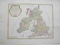
1754réf. M3766Paris 1754. Excellent. Size : 410x540 mm 16.125x21.25 Inches Coloring: Hand Colored Category: ; Maps Europe Ireland;; Maps Europe United Kingdom unknown
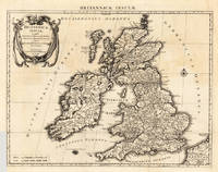
1696réf. 23767Amsterdam: Covens 1696 -1700. Other. In very good to excellent condition. A small tear at the left side. 392 by 517mm 15½ by 20¼ inches. 392 by 517mm 15½ by 20¼ inches. Copper engraving uncolored as published. Covens unknown
réf. 67570766-20Taylor & Francis Group. Used - Very Good. Former library copy. Pages intact with possible writing/highlighting. Binding strong with minor wear. Dust jackets/supplements may not be included. Includes library markings. Stock photo provided. Product includes identifying sticker. Better World Books: Buy Books. Do Good. Taylor & Francis Group unknown
réf. 1917426348.Gpaperback. Good. Access codes and supplements are not guaranteed with used items. May be an ex-library book. paperback
réf. 18699Société Archéologique Du Finistère, Brest, Imp. du Télégramme - 1970 - Couverture Imprimée - In-8 - Broché - 413 pages - Bon exemplaire
réf. 1628578971.Gpaperback. Good. Access codes and supplements are not guaranteed with used items. May be an ex-library book. paperback
réf. 44499444-nnew. unknown
réf. 44499444like new. unknown
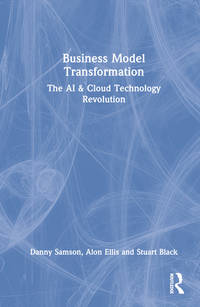
réf. ria9781032186405_inpPaperback. New. New Book; Fast Shipping from UK; Not signed; Not First Edition; This book showcases inspirational Australian case studies in order to inspire Australian and non-Australian organisations to undertake the challenge. This book synthesises the key learnings and contrasts those with the conventional wi paperback
réf. A9781032186412Hardback. New. This book showcases inspirational Australian case studies in order to inspire Australian and non-Australian organisations to undertake the challenge. This book synthesises the key learnings and contrasts those with the conventional wisdom on this topic. hardcover
réf. 6394879806H N H International Limited . Papeback. New. H N H International Limited unknown
réf. A9781032186405Paperback / softback. New. This book showcases inspirational Australian case studies in order to inspire Australian and non-Australian organisations to undertake the challenge. This book synthesises the key learnings and contrasts those with the conventional wisdom on this topic. paperback
2023réf. Atlantic-9781032186405Routledge 2023. 1. Paperback. New. Routledge paperback
2023réf. Atlantic-9781032186405Routledge 2023. 1. Paperback. New. Routledge paperback
réf. 44499445-nnew. unknown
réf. 44499445like new. unknown
2022réf. x-1032186410Routledge 2022. Hardcover. New. 184 pages. 9.19x6.13x0.64 inches. Routledge hardcover
2022réf. x-1032186402Routledge 2022. Paperback. New. 184 pages. 9.19x6.13x0.46 inches. Routledge paperback
réf. 1032186402.Gpaperback. Good. Access codes and supplements are not guaranteed with used items. May be an ex-library book. paperback
1985réf. Q-0935576142M. Kesend Pub 1985-11-01. Paperback. New. In shrink wrap. Looks like an interesting title! M. Kesend Pub paperback
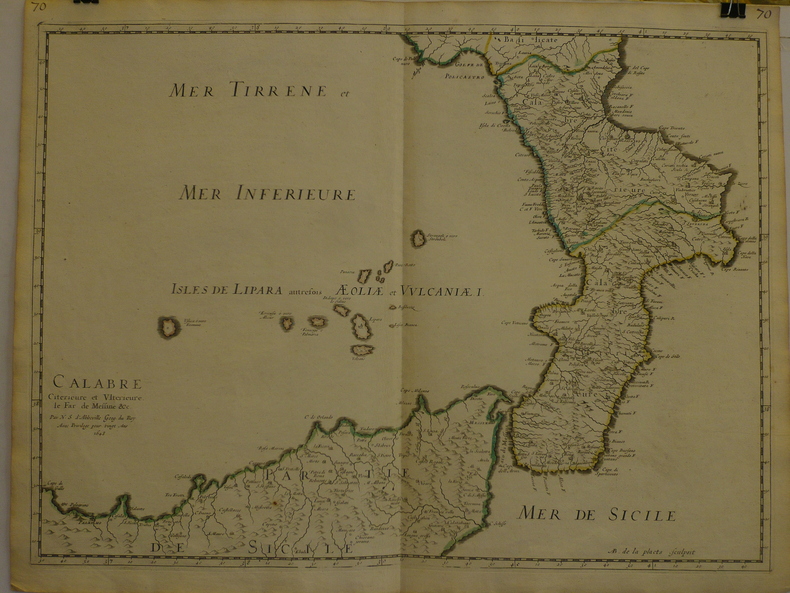
1648réf. LBW-9691648 409 x 558 mm.
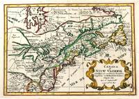
1705réf. M11241Amsterdam c.1705. Very Good. Notes: A reduced version of the most influential 17th century maps of the French and English colonies in North America. The map not only shows details of the Great Lakes but also it is a great source for Indian tribal names and locations. Two names Aouentsiouaeron and Attiouandarons appear here for the first time. Lake Superior and Michigan Lac du Puans are left open-end to the west. It is engraved by Anthony d'Winter. Size : 207x300 mm 8.15x11.81 Inches Coloring: Hand Colored Reference: Burden #575; Kershaw #138. Category: Maps Canada East; Maps North America Great Lakes; unknown
réf. 3239Americas: Amsterdam Francois Halma 1705. Copper engraved map of Canada by N. Sanson from Halma's Algemeene Werelde Beschryving Vol. 3 Black and white; title in Dutch; verso blank; strapwork title cartouche. Attractive small map of Canada and the Great Lakes a reduced version of one of the most influential seventeenth century maps of the French and English colonies in North America. It concentrates on the region of greatest French interest. The entire Great Lakes basin and the St. Lawrence River are shown in great detail. The most important aspect of the map is the first appearance of L. Erie ou du Chat as a recognizable lake on an atlas map. This delineation influenced the cartography of the region for more than 100 years and was not superceded until Delisle's "Carte du Canada" in 1703. The map is also an outstanding source for Indian tribal names and locations. Two names:Aouentsiouaeron and Attiouandarons appear here for the first time. Lake Superior and Michigan Lac du Puans are left open-end to the west. Embellished with a nice title cartouche and engraved by Anthoine d'Winter. This is the third state. Published in Francois Halma's Dutch edition of A. Pherotee de la Croix's Nouvelle Methode Pour Apprendre facilement la Geographie Universelle. Dark impression; dampstaining to lower margin just entering plate; centrefold and 2 further folds to fit in binding. Nicolas Sanson d'Abbeville.1600-67 ' father of the French cartography' and founder of the Sanson firm. Atlas ' Cartes générales de toutes les parties du Monde' 1658-70 and a pocket atlas in 4 parts 1652-1705. Sanson's small maps from A. Phérotée de la Croix's Nouvelle Methode Pour Apprendre Facilement la Geographie Universelle. first published in 1652 and engraved by A. Peyrounin were copied several times by various map publishers. Johann David Zunners made copies of Sanson's maps for his German translation of Die Gantze Erd-Kugel in 1679. Johannes Ribbius and Simon de Vries published copies in 1682 and 1683 with new maps engraved by Antoine d'Winter. The plates were later sold to Francois Halma who used them in 1699 and then again in 1705 with the titles re-engraved in Dutch. François Halma 1653 - 1722 Dutch publisher/printer; dealer/auction house. Cartographer and publisher of maps active in Utrecht Amsterdam Franeker and Leeuwarden. Published 'Description de l'Univers' 1700; 'Algemene Wereldtbescrijving' 1705; 'Corpus Inscriptionum' 1707 and 'Lexicon Philosophicum' 1713. Keoman: Hal 1; Phillips 528; Burden #575; Kershaw #138; McCorkle #683.5. Americas Canada Great Lakes New France Niew Vrankryk Amsterdam Francois Halma 1705 unknown