SANSON (R.P.).-Livre Rare Book
SANSON (R. P.)Livre Rare Book
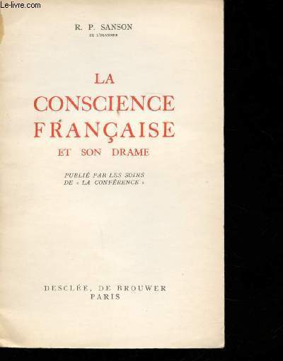
La conscience française et son drame.
1941réf. 129826Couverture souple. Broché. 54 pages. Avec son bandeau de librairie.

Librairie et Cætera · Belin-Beliet, France7,20 €
4 034 résultats
réf. 15082P., Desclée de Brouwer, 1941, in 12 broché, 54 pages.
réf. 30176P., Desclée de Brouwer, 1941, in 12 broché, 54 pages ; couverture fanée avec petite déchirure sans manque ; inscriptions manuscrites sur le faux-titre.
réf. 201004605Paris, Desclée de Brouwer, 1948 ; in-12, 54 pp., broché. Comme neuf.
1941réf. 129826Couverture souple. Broché. 54 pages. Avec son bandeau de librairie.
1941réf. R300264656Desclée. 1941. In-12. Broché. Bon état, Couv. convenable, Dos satisfaisant, Intérieur frais. Paris, Desclée, 1941, in 12, broché, 54 pp.. . . . Classification Dewey : 940.53-Seconde Guerre mondiale 1939-1945
1941réf. 4203523766GLN-80, Desclée de Brouwer 1941
1941réf. ROD0022911"Desclée de Brouwer. 1941. In-12. Broché. Etat d'usage, Couv. partiel. décollorée, Dos satisfaisant, Intérieur bon état. 54 pages. Ouvrage publié par les soins de ""La Con férence"".. . . . Classification Dewey : 153-Processus mentaux conscients"
1910réf. ROD0046182DESCLEE, DE BROUWER. 1910. In-12. Broché. Etat d'usage, Couv. défraîchie, Dos satisfaisant, Papier jauni. 54pp.. . . . Classification Dewey : 940.53-Seconde Guerre mondiale 1939-1945
réf. 72445Desclée de Brouwer 1941, in-12 broché, 54pp - très bon état
1941réf. R240088173DESCLEE DE BROUWER. 1941. In-12. Broché. Etat d'usage, Coins frottés, Dos satisfaisant, Intérieur acceptable. 54 pages .. . . . Classification Dewey : 200-RELIGION
1941réf. R240088420DESCLEE DE BROUWER. 1941. In-12. Broché. Bon état, Couv. convenable, Dos satisfaisant, Quelques rousseurs. 54 pages - quelques rousseurs sans réelle conséquence sur la lecture.. . . . Classification Dewey : 200-RELIGION
1941réf. RO40072108Desclée de Brouwer. 1941. In-8. Broché. Bon état, Couv. légèrement passée, Dos satisfaisant, Quelques rousseurs. 54 pages, envoi de l'auteur, coupure de journal avec portrait de l'auteur collée en page de garde.. . . . Classification Dewey : 248-Vie chrétienne et méditations
1930réf. RO40207876Imprimerie M. Poirier, Gien. 1930. In-8. Broché. Bon état, Couv. convenable, Dos satisfaisant, Intérieur frais. 62 pages. Tableaux sur planches dépliables en fin d'ouvrage. Dos muet. Avec 2 tirés à part, dont 1 tableau sur grande planche dépliable.. . . . Classification Dewey : 657-Comptabilité
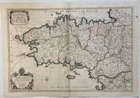
1693réf. 324404Paris: Alexis-Hubert Jaillot 1693. Map. Engraving with hand colored outline. Image measures 21" x 31" This large 17th century double-page map features the Brittany region of France. Cities towns abbeys government buildings rivers ports and harbors are labeled. Mountains forests and wetlands are depicted pictorially. The attention to detail in topography and population centers hints at the abundance of the region known for its production of Muscadet wine cheese boar seafood and other agricultural products. Executed by Nicolas Sanson in dedication to his son this map was published by Alexis-Hubert Jaillot in Paris and later reproduced in Amsterdam by Jaillot and Pierre Mortier. This early edition is scarce and hard to find. In very good condition with some offsetting to left side and a spot in the right margin. Nicolas Sanson 1600-1667 is considered the founder of the French school of cartography. In reaction to the prevailing trend of Dutch lavishness Sanson favored minimal details focusing rather on accurate cartography than ornament. Alexis-Hubert Jaillot unknown books
1693réf. 324404Paris: Alexis-Hubert Jaillot 1693. Map. Engraving with hand colored outline. Image measures 21" x 31" This large 17th century double-page map features the Brittany region of France. Cities towns abbeys government buildings rivers ports and harbors are labeled. Mountains forests and wetlands are depicted pictorially. The attention to detail in topography and population centers hints at the abundance of the region known for its production of Muscadet wine cheese boar seafood and other agricultural products. Executed by Nicolas Sanson in dedication to his son this map was published by Alexis-Hubert Jaillot in Paris and later reproduced in Amsterdam by Jaillot and Pierre Mortier. This early edition is scarce and hard to find. In very good condition with some offsetting to left side and a spot in the right margin. Nicolas Sanson 1600-1667 is considered the founder of the French school of cartography. In reaction to the prevailing trend of Dutch lavishness Sanson favored minimal details focusing rather on accurate cartography than ornament. Alexis-Hubert Jaillot unknown
réf. 0259218197.Gpaperback. Good. Access codes and supplements are not guaranteed with used items. May be an ex-library book. paperback
réf. 0265479150.Ghardcover. Good. Access codes and supplements are not guaranteed with used items. May be an ex-library book. hardcover
1700réf. M7994Paris c. 1700. Very Good. Notes: Engraved by Cordier. A map of Central Germany. Frankfurt appears at the south-center of the map. Size : 457x648 mm 17.99x25.51 Inches Coloring: Original Hand Coloring Category: Maps Europe Germany; unknown
réf. ce1572A compte d'auteur Dos agrafé In-8 (15 x 21 cm.), fascicule au dos agrafé, couverture illustrée, 35 pages, charmantes illustrations in-texte de Kassape Sanson, sans date ; comme neuf. Livraison a domicile (La Poste) ou en Mondial Relay sur simple demande.
2026réf. LRB1013252Paris: Editions Recreasoft 2026 Langue : Français. Environ 666 pages. Français : Réimpression à la demande. Édition originale : 1843. Traduction en prose de l'Énéide de Virgile grand poème épique de l'Antiquité latine. Cet ouvrage propose une version française destinée à rendre le récit de la fondation mythique de Rome les errances d'Énée ainsi que les épisodes majeurs du poème dans une forme accessible aux lecteurs du XIXe siècle. L'intérêt bibliographique tient à la présence des traducteurs Jean Baptiste Antoine Aimé Sanson de Pongerville et Ferdinand Collet et à l'importance durable de ce texte dans la réception de Virgile en langue française. Images du livre non contractuelles English : Print-on-demand reprint. Original edition : 1843. Prose translation of Virgil's Aeneid the great epic poem of Latin antiquity. This work presents a French rendering designed to convey the mythic foundation of Rome Aeneas's wanderings and the poem's major episodes in a form accessible to nineteenth-century readers. Its bibliographical interest lies in the involvement of the translators Jean Baptiste Antoine Aimé Sanson de Pongerville and Ferdinand Collet and in the enduring importance of this text in the French reception of Virgil. Book images are non-contractual. Editions Recreasoft. Softcover. New. Editions Recreasoft paperback
1778réf. M3888Paris: Delamarche 1778. Very Good. Size : 515x685 mm 20.25x27 Inches Coloring: Original Outline Coloring Category: ; Maps Europe Italy Delamarche unknown
1665réf. M5118Paris 1665. Very Good central fold reinfrced. Notes: There is a water mark on the right hand portion of the map. Size : 435x540 mm 17.125x21.25 Inches Coloring: Original Outline Coloring Category: ; Maps Europe Italy unknown
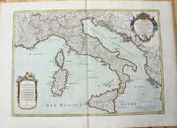
1783réf. M10279Paris: H. Jaillot c.1783. Very Good. Size : 469x655 mm 18.46x25.79 Inches Coloring: Original Hand Coloring Category: Maps Europe Italy; Maps Mediterranean Islands; H. Jaillot unknown
1651réf. R320074492A COMPTE D'AUTEUR. 1651. In-Folio. Broché. Etat d'usage, Couv. défraîchie, Dos satisfaisant, Intérieur frais. 43 pages - Quelques taches jaunatres en fin de volume (en tranches - gouttiere) sans conséquence sur la lecture - + 1 planche depliante. Bandeau et lettrine en tete de chapitre. Renfort en 1er plat et dos. Bandaux; lettrines et culs de lampe. 4 PHOTOS DISPONIBLES -. . . . Classification Dewey : 94.2-Livres anciens XVII ème
1667réf. 10027Paris 1667. No Binding. Near Fine. 12 ½ x 17 inches. Original outline color; excellent. Earliest map of Martinique listed in Phillips featuring attractive original color and an elegant cartouche. This map depicts the situation on the island before 1660 when it was still largely inhabited by natives and only about half of it had been claimed by colonists for sugar cane farming. The map goes so far as to mark with a printed line the partition dividing the "demeure des François" and the "demeure des savages." However by 1660 the entirety of the native population was either dead expelled or in slavery and Martinique was a full-fledged sugar cane-farming European colony. Phillips Maps P. 389. unknown books