4.065 Ergebnisse
Best.-Nr. SLIVCN-9782844852021ALLIA EDITIONS
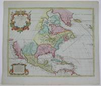
1792Best.-Nr. M4892Amsterdam 1792. Excellent. Notes: North America revised from the Sanson/Jaillot maps. California is shown as a peninsula but named "isle de California" to the northwest is "Mer de Iesso" and beyond that a small stretch of coastline "Terre de Iesso ou Ieco." The Great Lakes are defined if not with great accuracy a number of settlements in Nouveau Mexico are identified and a R. del Norte flows southwest from a large lake near Taosii to the Gulf of California. Size : 480x580 mm 18.875x22.875 Inches Coloring: Original Hand Coloring Category: Maps North America; Maps Central America; Maps West Indies General unknown
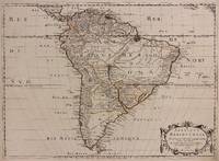
1650Best.-Nr. 309461Paris: Pierre Mariette 1650. unbound. Abraham Peyrounin. Map. Engraving with original outline color. Image measures 15 3/4" x 21 3/4" This exceptionally fine map of South America covers the continent in fine detail. Coastlines are extensively labeled and mountains beautifully rendered in profile. The Orinoco and Amazon Rivers as well as Rio de la Plata are prominently rendered. Sanson refrains from drawing a southern coastline to Tierra del Fuego and the relatively unknown Amazon region is depicted in minimal detail. Sanson does however include the mythical lake "Lac de Parime" and the city of gold "Manoa del Dora" between the Orinoco and Amazon rivers. Nice dark impression. In very good condition. Minor dampstain to lower margin not affecting the image and some faint stains near the center of the map - otherwise clean and bright. Hard to find. Nicolas Sanson 1600-1667 is considered the founder of the French school of cartography. In reaction to the prevailing trend of Dutch lavishness Sanson favored minimal details focusing rather on accurate cartography than ornament. Pierre Mariette unknown books
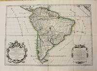
1698Best.-Nr. M10786Paris 1698. Very Good. Notes: A charming large scale 17th century map of South America with two decorative cartouches and original outline colouring. Size : 460x648 mm 18.11x25.51 Inches Coloring: Original Outline Coloring Category: Maps South America Continent; unknown
1650Best.-Nr. 309461Paris: Pierre Mariette 1650. unbound. Abraham Peyrounin. Map. Engraving with original outline color. Image measures 15 3/4" x 21 3/4" This exceptionally fine map of South America covers the continent in fine detail. Coastlines are extensively labeled and mountains beautifully rendered in profile. The Orinoco and Amazon Rivers as well as Rio de la Plata are prominently rendered. Sanson refrains from drawing a southern coastline to Tierra del Fuego and the relatively unknown Amazon region is depicted in minimal detail. Sanson does however include the mythical lake "Lac de Parime" and the city of gold "Manoa del Dora" between the Orinoco and Amazon rivers. Nice dark impression. In very good condition. Minor dampstain to lower margin not affecting the image and some faint stains near the center of the map - otherwise clean and bright. Hard to find. Nicolas Sanson 1600-1667 is considered the founder of the French school of cartography. In reaction to the prevailing trend of Dutch lavishness Sanson favored minimal details focusing rather on accurate cartography than ornament. Pierre Mariette unknown
1691Best.-Nr. M1345Paris 1691. Very Good. Size : 590x885 mm 23.25x34.875 Inches Coloring: Hand Colored in Outline Category: ; Maps South America Continent unknown
2010Best.-Nr. x-0313353263Praeger Pub Text 2010. Hardcover. New. 224 pages. 9.30x6.40x1.20 inches. Praeger Pub Text hardcover
Best.-Nr. 0313353263.Ghardcover. Good. Access codes and supplements are not guaranteed with used items. May be an ex-library book. hardcover
2010Best.-Nr. DADAX0313353263Bloomsbury Academic 2010-03-23. hardcover. New. 6.15x0.62x9.21. Buy with confidence. Excellent Customer Service & Return policy. Bloomsbury Academic hardcover
Best.-Nr. Bloomsbury-9780313353260Praeger. Hardback. New. 260 pages Praeger hardcover
Best.-Nr. ria9780313353260_inpHardcover. New. New Book; Fast Shipping from UK; Not signed; Not First Edition; N/A hardcover
Best.-Nr. A9780313353260Hardback. New. This hard-hitting analysis of the U.S. missile defense program explains the system's limitations and argues that it is not nearly as effective as Americans have been led to believe. hardcover
Best.-Nr. B9780313353260Hardback. New. This hard-hitting analysis of the U.S. missile defense program explains the system's limitations and argues that it is not nearly as effective as Americans have been led to believe. hardcover
Best.-Nr. 6707340ABC-Clio Incorporated . Hardback. New. pp. 258 ABC-Clio, Incorporated hardcover
1959Best.-Nr. 053400Cleveland Oh: Bloch And Company 1959. 1st Edition 1st Printing. Hardcover. Very Good. Color Maps. 64 Pp. Blue Cloth Gilt. First Printing. Near Fine; Dust Jacket Slightly Worn; 1/2" X 1" Tape Residues Where Dust Jacket Was Formerly Neatly Attached To Front And Rear Endpapers. Review Copy With January 1959 Review Letter From Bloch & Co. Bloch And Company hardcover
Best.-Nr. 104573aafA Paris chez Langlois, s.d., (ca. 1700), 51x72 cm, carte aux contours coloriée, cartouche-titre en haut a droite. Eschelle en bas a gauche. Tachée d’eau dans la partie haute de la feuille, / Oben am Rand leicht wasserfleckig, 1 Blatt.
1660Best.-Nr. 33638ABA Paris chez P. Mariette 1660. Blattgrösse: 44x58 cm. Grenzkolorierte Karte (36,7x55 cm) von Nicolas Sanson, gestochen von Somer.
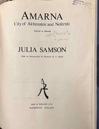
1978Best.-Nr. 193146Warminster Wiltshire England: Aris & Phillips Ltd 1978. Softcover. VG- scuffs scratches to wraps. dark toning to spine. light rubbing to corners. old glue glue cracking to interior wrap edges w/ slight separation otherwise textblock & pgs firm. glossy white wraps w/ black printing pink illustration. 145 pgs w/ bw illustrations. Remains tightly bound. Interior bright. Aris & Phillips Ltd paperback books
Best.-Nr. Z1-C-079-C-00056Aris and Phillips. Used - Good. Used - Good. Paper covers appear to have been stiffened and laminated by the library. Ships from UK in 48 hours or less usually same day.Your purchase helps support Sri Lankan Children's Charity 'The Rainbow Centre.' Ex-library but has been well cared for. 100% money back guarantee. We are a world class secondhand bookstore based in Hertfordshire United Kingdom and specialize in high quality textbooks across an enormous variety of subjects. We aim to provide a vast range of textbooks rare and collectible books at a great price. Our donations to The Rainbow Centre have helped provide an education and a safe haven to hundreds of children who live in appalling conditions. We provide a 100% money back guarantee and are dedicated to providing our customers with the highest standards of service in the bookselling industry. Aris and Phillips unknown
Best.-Nr. M13114aAris and Phillips Ltd London 1972. First edition. In-4 x & 110 pages. Original cloth without dust-jacket a fine copy. Ex-library with stamp on title page. From the library of Egyptologist Charles Cornell Van Siclen III VSX. Language: English. This book ships from the USA shipping costs will be updated accordingly TXR. Relevant subjects: Egypt: Catalogue New Kingdom Amarna. unknown
1980Best.-Nr. 163476Warminster: Aris & Phillips 1980. 1st edition. Nice copy. small folio. hardback with dust jacket ix 144pp. b/w plates text ills. bibliog. indexes Detailed illustrated catalogue of statues statuettes reliefs inlays and other objects collected by Flinders Petrie from Tell el-Amarna the ancient Egyptian city of Akhenaten Aris & Phillips hardcover
2025Best.-Nr. x-1032800399Routledge 2025. Hardcover. New. 256 pages. 9.18x6.12x9.45 inches. Routledge hardcover
Best.-Nr. 6202271957.Gpaperback. Good. Access codes and supplements are not guaranteed with used items. May be an ex-library book. paperback
Best.-Nr. RO80019263DEUX-TROIS / BERNARDIN-BECHET. Non daté. In-12. Broché. Etat d'usage, Couv. légèrement passée, Manque en coiffe de pied, Intérieur frais. 142 pages. Nombreuses figures en noir et blanc. Coiffe en tête abîmée, avec charnières fendues.. . . . Classification Dewey : 794.1-Echecs