4035 resultados
2018ref. x-1516573021Cognella Academic Publishing 2018. Hardcover. New. 486 pages. 8.50x1.06x11.00 inches. Cognella Academic Publishing hardcover
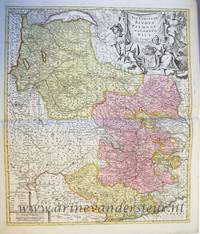
ref. PR120639Map of the States of Savoy Piedmont and Nice. Titled above on the right: ""LES ESTATS DE SAVOYE PIEMONT et le COMTE de NICE Par le Sr: Sanson Geog Ordinaire du Roy.'With address of the publisher on the bottom right: 'a Amsterdam chez Pierre Schenk avec Privilege de .'.On the bottom left the various scales. Hand colored etching and engraving on laid paper; plate mark: 577 x 485 mm total: 625 x 531 mm; besides some smudges along the margins and a folding crease at center in very good condition. unknown
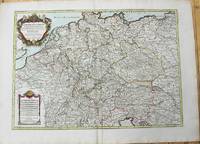
ref. 61441Paris Alexis Hubert Jaillot 1700. One sheet ink on paper. Copper engraving. Hand painted. Good condition. The map depicts the upper and lower Rhine region from Metz in the north to Lake Como in the south and Dijon in the west to Augsburg in the east. On the left hand side is the legend with miles to Italian French and German miles. In passepartout total size 650 x 750 mm. unknown
1939ref. 88806New York: Random House 1939. Hardcover. Very Good. First edition. A bookplate on the front pastedown playbill and related material affixed to rear pastedown spine lettering a trifle rubbed thus a very good copy lacking the dustwrapper. This copy Signed by Samson Raphaelson producer John Golden and star of the play Gertrude Lawrence. Golden and Lawrence were also the co-dedicatees of the play. Autograph Card Signed laid in from Helen Wayne Rauh who appeared in the lead of a road production of the play. A play adapted from the author's novel of the same name and basis for the 1941 Mark Dansdrich film featuring Claudette Colbert Ray Milland Brian Aherne and Binnie Barnes. Random House hardcover books
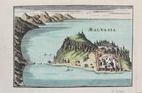
1690ref. M9577Paris c. 1690. Very Good. Notes: A charming map of Malvasia Greece during the late 17th century. Size : 103x152 mm 4.06x5.98 Inches Coloring: Hand Colored Category: Maps Europe Greece Macedonia; unknown
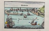
1690ref. M9578Paris c. 1690. Very Good. Notes: A charming map of Modon Greece during the late 17th century. Size : 104x152 mm 4.09x5.98 Inches Coloring: Hand Colored Category: Maps Europe Greece Macedonia; unknown
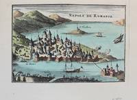
1690ref. M9576Paris c. 1690. Very Good. Notes: A charming map of Nafplio Greece during the late 17th century. Size : 104x152 mm 4.09x5.98 Inches Coloring: Hand Colored Category: Maps Europe Greece Macedonia; unknown
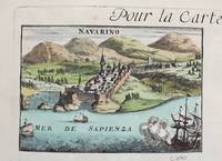
1690ref. M9579Paris c. 1690. Very Good. Notes: A charming map of Pylos Navarino Greece during the late 17th century. Size : 104x154 mm 4.09x6.06 Inches Coloring: Hand Colored Category: Maps Europe Greece Macedonia; unknown
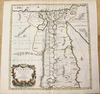
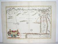
1696ref. M10206Amsterdam: Covens & Mortier c.1696. Very Good. Size : 485x450 mm 19.09x17.72 Inches Coloring: Hand Colored Category: Maps Africa North Egypt; Covens & Mortier unknown
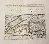
1710ref. M10273Paris: Jean Covens & Corneille Mortier c.1710. Very Good. Size : 397x460 mm 15.63x18.11 Inches Coloring: Hand Colored Category: Maps Asia Middle East Holy Land & Palestine; Jean Covens & Corneille Mortier unknown
1690ref. M7990Paris: H. Jaillot c.1690. Very Good with some minor discoloration. Notes: Map of North-Central France Size : 460x610 mm 18.11x24.02 Inches Coloring: Original Hand Coloring Category: Maps Europe France; H. Jaillot unknown
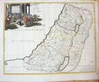
1660ref. M7049Paris 1660. Very Good;. Notes: French map of the Holy Land with a decorative cartouche. Nicolas Sanson 1600–1667 was a renowned French cartographer termed by some as the "father of French cartography." His works are known for their incorporation of the most up to date information of the time and their clean modern style. Size : 385x485 mm 15.16x19.09 Inches Coloring: Hand Colored Category: Maps Asia Middle East Holy Land & Palestine; unknown
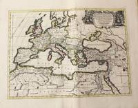
1710ref. M10325Amsterdam: Jean Covens & Corneille Mortier c.1710. Very Good. Size : 413x562 mm 16.26x22.13 Inches Coloring: Original Hand Coloring Category: Maps Europe Continent; Maps Africa North; Maps Mediterranean Sea; Jean Covens & Corneille Mortier unknown
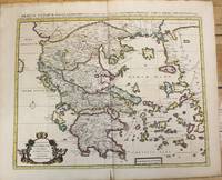
1710ref. M10235Amsterdam: Jean Covens & Corneille Mortier c.1710. Very Good. Size : 470x566 mm 18.50x22.28 Inches Coloring: Original Hand Coloring Category: Maps Europe Greece Macedonia; Jean Covens & Corneille Mortier unknown
1939ref. 88806New York: Random House 1939. Hardcover. Very Good. First edition. A bookplate on the front pastedown playbill and related material affixed to rear pastedown spine lettering a trifle rubbed thus a very good copy lacking the dustwrapper. This copy Signed by Samson Raphaelson producer John Golden and star of the play Gertrude Lawrence. Golden and Lawrence were also the co-dedicatees of the play. Autograph Card Signed laid in from Helen Wayne Rauh who appeared in the lead of a road production of the play. A play adapted from the author's novel of the same name and basis for the 1941 Mark Dansdrich film featuring Claudette Colbert Ray Milland Brian Aherne and Binnie Barnes. Random House hardcover
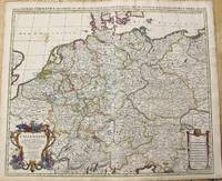
1696ref. M10211Amsterdam: Covens & Mortier c.1696. Very Good. Size : 510x605 mm 20.08x23.82 Inches Coloring: Original Outline Coloring Category: Maps Europe Germany; Covens & Mortier unknown
1742ref. 38209Amsterdam: Pierre Mortier 1742. A BEAUTIFUL HAND-COLORED MAP OF WESTERN LANGUEDOC and areas to the west and north. 60 x 45.5 cm plate 62 x 52 cm sheet. The areas described in the title are FULLY COLORED BY A CONTEMPORARY HAND. Printed on fine thick laid paper. Reverse blank. A fine impression. A PRISTINE EXAMPLE with the paper FINE AND BRIGHT. Very scarce in such fine condition. Pierre Mortier unknown
1640ref. M2804Paris: Mariette Pierre 1640. Very Good. Size : 372x510 mm 14.625x20.125 Inches Coloring: Original Outline Coloring Category: Maps Africa North Egypt Mariette, Pierre unknown
1785ref. M10224Paris: Chez Brion 1785. Very Good. Notes: Detailed large map of Germany with large decorative cartouches. Size : 465x652 mm 18.31x25.67 Inches Coloring: Original Hand Coloring Category: Maps Europe Germany; Chez Brion unknown
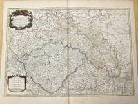
1785ref. M10271Paris c.1785. Very Good. Size : 470x658 mm 18.50x25.91 Inches Coloring: Original Outline Coloring Category: Maps Europe Czech Republic Slovakia; Maps Europe Germany; unknown
ref. 998864714X-11-1Sub-Saharan Pub & Traders. Very Good. It's a well-cared-for item that has seen limited use. The item may show minor signs of wear. All the text is legible with all pages included. It may have slight markings and/or highlighting. Sub-Saharan Pub & Traders unknown
2015ref. __0415711312Routledge 2015. Hardcover. New. 1st edition. 324 pages. 9.75x7.00x1.00 inches. Routledge hardcover
ref. V8-NUF0-P6TNGood. Good condition. Clean pages intact binding. Light shelf wear. unknown
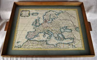
1650ref. 2312280001Petrum Mariette: Lutetiae Parisiorum 1650. First Edition. Maps. Very Good. Ancient Europe : The Roman Empire Fine hand-colored double-page engraved map of Roman provinces of Europe. Mounted in wood frame with wooden side handles. Dimensions of mounted image: 40 x 56 cm. 53 x 69.5 cm in frame. Latin province names cities seas. This is an oversized or heavy book which requires additional postage for international delivery outside the US. Petrum Mariette: Lutetiae Parisiorum unknown