3406 resultados
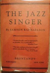
1925ref. 140940956New York: Brentano's 1925. First Edition. Fine/Near Fine. First edition first printing of the dramatic version of a play which entered history when filmed becoming the first "talkie." Bound in publisher's patterned paper cover boards over green spine cloth with paper title label on spine. Fine pages lightly toned. In a Near Fine dust jacket with light rubbing light fading and light edge wear. A lovely copy scarce in the dust jacket. Brentano's unknown books
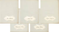
1950ref. 158225Rome: Unitalia Film / IFE 1950. Collection of 14 vintage oversize promotional brochures for Italian and international actresses. Each brochure features a one-page biography in Italian and a full-page black-and-white photograph of each actress. Actresses represented are Sylvana Mangano Isa Miranda Annamaria Gerrero Yvonne Sanson Alida Valli Delia Scala Ingrid Bergman Silvana Pampanini Lea Padovani Lucia Bose Eleanora Rossi Gina Lollobrigida Carla Del Poggio and Anna Magnani. 11 x 14.25 inches folded once vertically as issued with a company statement on the verso. Very Good plus overall some with light toning and foxing and a few with short tears. Unitalia Film / IFE unknown books
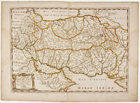
1658ref. MEE1132Paris:: Chez l'Autheur 1658. 1658. PRINT: 390 x 520 mm. Paper: 457 x 610 mm. Creased cross-ways. Map outlined with original coloring. Excellent condition. First printing of this map. Nicolas Sanson 1600-1667 the "Father of French Cartography" was educated by the Jesuits at Amiens. He was soon recognized as having a gift for map drawing. As such by the age of ten he has produced his first map. "In 1627 he attracted the attention of Richelieu by a map of Gaul which he had constructed or at least begun while only eighteen." "Active from 1627 Sanson issued his first map of importance the "Postes de France" which was published by Melchior Tavernier in 1632. After publishing several general atlases himself he became the associate of Pierre Mariette a publisher of prints." Wikip. In 1630 he was appointed Geographe Ordinaire du Roy by King Louis XIII. As a geographer his most important work was his maps of the world Cartes generales de toutes les parties du monde issued in 1658 with later editions to follow. He died in 1667. Two younger sons Adrien d. 1708 and Guillaume d. 1703 succeeded him as geographers to the king. / Nicolas Sanson's map was issued "by the author" this version and another version where his printer-publisher Pierre Mariette issued the map with his own imprint on the cartouche. Chez l'Autheur, [1658]. unknown books
1942ref. 24364New York: Dramatists Play Service. c.1942. Acting Edition. Softcover. Very Good. slight discoloration to covers short diagonal bend at lower right corner of front cover also affecting first couple of pages tiny tear in bottom edge of front cover; one-time owner's signature on ffep. frontispiece photo of stage setting Comedy about a snooty drama critic who is brought down to earth and taught the facts of life by a free-spirited playwright somewhat modeled after William Saroyan at least in the opinion of Brooks Atkinson in the NY Times. The original 1942 Broadway production starred Alexander Knox and Nicholas Conte who changed his name to Richard Conte when he became a full-time movie actor after World War II and ran for a respectable 125 performances. . Dramatists Play Service paperback books
1700ref. 104160Copper engraved map double page 24" x 20" hand colored and large uncolored title cartouches. Some minor soiling a little wear along centerfold with old verso repair normal aging; very good. Samson 1600-1667 is often referred to as the father of French cartography. Louis XIII was impressed with his work and appointed him "Geographe Ordinaire du Roi". During his career Sanson would produce about 300 maps and his major atlas "Cartes Generales de Toutes les Parties du Monde" would represent an important part of his body of work. While two of his sons continued publication of his maps after his death Pieter Schenk 1655-1718 an important publisher and engraver in his own right published this map. The map is attractively colored and gives a detailed view of the provinces of France. The map is also decorated with a large title cartouche. Bagrow p. 185. map hist website. books
1948ref. 622650Los Angeles: Twentieth Century-Fox 1948. Softcover. Very Good. Quarto. Mimeographed sheets printed rectos only in brad-bound pale blue mimeographed wrappers. Faint stamp on front wrap from the studio's legal department tiny tears on the yapped edges very good or better. A continuity and dialogue script taken from the screen. The film featured Betty Grable and Douglas Fairbanks Jr. Twentieth Century-Fox unknown books
1948ref. 144742OH: Child Life 1948. Softcover. Very Good. Very good in wrappers a paperback. Staple binding. Pages browned clean text. Address label on front cover. Corners rubbed. Child Life unknown books
1976ref. 121785New York: Holt Rinehart And Winston 1976. Hardcover. Very Good/Very Good. First edition. Very good in very good dust jacket. Hardcover and dust jacket both lightly rubbed at spine ends and corners clean text dust jacket browned. Holt, Rinehart And Winston hardcover books
1961ref. 29169L.T. Slaughter & Company 1961. SAMSON P. HAH-FI! Cedar Falls Iowa: L.T. Slaughter & Company 1961. 16mo. printed wraps. Limited Edition of 1000 numbered copies. Volume One. Near fine. $15.00. L.T. Slaughter & Company unknown books
ref. 30548Brentano's. RAPHAELSON Samson. THE JAZZ SINGER. NY: Brentano's 1925. Small 8vo. cloth & patterned boards in dust jacket. First Edition. Signed by Raphaelson on the front endpaper and dated Christmas 1925. Basis for the hit play starring George Jessel and Sam Jaffe. The play was later adapted to the famous film starring Al Jolson and Warner Oland. The film generally considered the first "talkie" is certainly one of the milestones in cinematic history. Very Good; some edgewear & shallow chipping number of tears with professional interior repairs d/j. Enclosed in a custom-designed leather and cloth clam-shell box with Al Jolson in black face depicted on the spine and front cover. $4000.00. Brentano's unknown books
1920ref. 206543Norwood: Plimpton Press 1920. Hardcover. VG: Wear to the boards with fading to the color of the title text. Clean body pages and solid binding. Very minor tanning and foxing to the end pages. A black casebound book with green text on the spine. xiii 248 pages; profusely illustrated in black-and-white. Plimpton Press hardcover books
1978ref. 193146Warminster Wiltshire England: Aris & Phillips Ltd 1978. Softcover. VG- scuffs scratches to wraps. dark toning to spine. light rubbing to corners. old glue glue cracking to interior wrap edges w/ slight separation otherwise textblock & pgs firm. glossy white wraps w/ black printing pink illustration. 145 pgs w/ bw illustrations. Remains tightly bound. Interior bright. Aris & Phillips Ltd paperback books
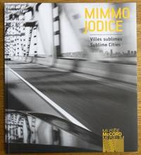
2012ref. 163079McCord Museum 2012. Softcover. VG. Inscribed on title page to previous owner. BW pictorial wraps French flaps 148 pp. many BW illus. Text is in French and English. Issued in conjunction with a 2012-2013 exhibition of photographs rendered by Italian photographer Mimmo Jodice b. 1934. With essays by Dany Laferriere and Helene Samson. Includes an exhibitions history selected bibliography and many BW illustrations. McCord Museum paperback books
2012ref. 153438McCord Museum 2012. Softcover. VG. BW pictorial wraps French flaps 148 pp. many BW illus. Text is in French and English. Issued in conjunction with a 2012-2013 exhibition of photographs rendered by Italian photographer Mimmo Jodice b. 1934. With essays by Dany Laferriere and Helene Samson. Includes an exhibitions history selected bibliography and many BW illustrations. McCord Museum paperback books
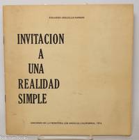
1974ref. 343576Los Angeles: Ediciones de la Frontera 1974. Pamphlet. 20 pages staplebound pamphlet. 8.75x8.5 in. Author's presentation inscription on title page: "Para Enrique mi buen amigo y profesor con el aprecio de su ex-alumno signed Eduardo Arguello Sanson." Covers dustsoiled bottom corner bumped. Scarce book of poems by the Nicaraguan-born writer. WorldCat lists only four locations three in the US one in the UK as of January 2026. Ediciones de la Frontera unknown books
ref. 343395Sevilla: Imp. del Correo Politico a cargo de D. Manuel Valvidares n.d. 7p. pamphlet very good sewn into marbled wrappers together with a four-page printed letter from 1822 which begins "Exmo. Sr.= El Exmo. Sr. Secretario del Despacho de la Gobernacion de la Peninsula con fecha 22 del mes proximo pasado me remite el decreto de la Cortes comunicado por el ministerio de Grace y Justicia cuyo tenor es el que sigue." The letter discusses the censorship laws of the Spanish Constitution of 1820. Imp. del Correo Politico a cargo de D. Manuel Valvidares unknown books
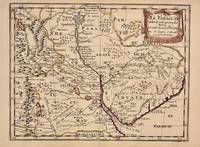
1657ref. 326341Paris 1657. unbound. Map. Original outline coloring. Sheet measures 8 3/4" x 12 1/8". Image measures 8" x 10 5/8". Paris: Nicolas Sanson 1657. This rare 17th century map by Nicolas Sanson with original color depicts the region showing present day Paraguay Uruguay with parts of Brazil and Argentina. Mountains are rendered pictorially and cities rivers and notations describing indigenous populations are labeled. In very good condition. Nicolas Sanson 1600-1667 is considered the founder of the French school of cartography. In reaction to the prevailing trend of Dutch lavishness Sanson favored minimal details focusing rather on accurate cartography than ornament. unknown books
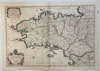
1693ref. 324404Paris: Alexis-Hubert Jaillot 1693. Map. Engraving with hand colored outline. Image measures 21" x 31" This large 17th century double-page map features the Brittany region of France. Cities towns abbeys government buildings rivers ports and harbors are labeled. Mountains forests and wetlands are depicted pictorially. The attention to detail in topography and population centers hints at the abundance of the region known for its production of Muscadet wine cheese boar seafood and other agricultural products. Executed by Nicolas Sanson in dedication to his son this map was published by Alexis-Hubert Jaillot in Paris and later reproduced in Amsterdam by Jaillot and Pierre Mortier. This early edition is scarce and hard to find. In very good condition with some offsetting to left side and a spot in the right margin. Nicolas Sanson 1600-1667 is considered the founder of the French school of cartography. In reaction to the prevailing trend of Dutch lavishness Sanson favored minimal details focusing rather on accurate cartography than ornament. Alexis-Hubert Jaillot unknown books
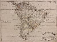
1650ref. 309461Paris: Pierre Mariette 1650. unbound. Abraham Peyrounin. Map. Engraving with original outline color. Image measures 15 3/4" x 21 3/4" This exceptionally fine map of South America covers the continent in fine detail. Coastlines are extensively labeled and mountains beautifully rendered in profile. The Orinoco and Amazon Rivers as well as Rio de la Plata are prominently rendered. Sanson refrains from drawing a southern coastline to Tierra del Fuego and the relatively unknown Amazon region is depicted in minimal detail. Sanson does however include the mythical lake "Lac de Parime" and the city of gold "Manoa del Dora" between the Orinoco and Amazon rivers. Nice dark impression. In very good condition. Minor dampstain to lower margin not affecting the image and some faint stains near the center of the map - otherwise clean and bright. Hard to find. Nicolas Sanson 1600-1667 is considered the founder of the French school of cartography. In reaction to the prevailing trend of Dutch lavishness Sanson favored minimal details focusing rather on accurate cartography than ornament. Pierre Mariette unknown books
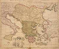
1705ref. 311838Amsterdam: Petrus Schenk 1705. unbound. Map. Engraving with original hand outline. Image measures 18 7/8" x 22 3/4" Beautiful map of southeastern Europe extending from Italy to Turkey and from Hungary to Cyprus. Published circa 1705 this map depicts the region during the Ottoman-Habsburg wars. In fair condition. Wear to original centerfold with tape repair and stain at bottom edge. Lower margin worn and frayed not affecting the image. Minor cracking and small loss near center due to oxidization of original viridian green coloring. Some foxing. Publisher's crease to upper right corner. Sold as-is. Petrus Schenk c.1660--1711 was a German engraver and cartographer. He began his training in Amsterdam in the art of mezzotint and soon began working closely with Gerard Valck. The two took advantage of the bustling cartographic trade in the city and quickly expanded their business from portraits and prints into maps and globes. In 1700 Schenk grew the business further by moving to Leipzig Germany and opening a shop. As his sons and grandson returned to the Netherlands to become active engravers as well the Schenk firm developed into one of the best-known publishing houses in 18th-century Amsterdam. This map attests to Schenk's prolific production and skill in both cartographic artistry and business. Petrus Schenk unknown books
1683ref. 297468Paris 1683. unbound. Map. Copper engraving with hand coloring. Image measures 7 5/8 x 11 1/4 inches. This map published in Paris in Afrique en plusieurs cartes is one of Sanson's small atlas maps of depicting various African regions. This map offers extensive detail on the cities of North Africa as well as topographical and geographical features with mountains beautifully rendered in profile. Nicolas Sanson 1600-1667 is considered the founder of the French school of cartography. In reaction to the prevailing trend of Dutch lavishness Sanson favored minimal details focusing rather on accurate cartography than ornament. This map is a fine example of his work. unknown books
1663ref. 283501Paris 1663. unbound. very good. Map. Hand-colored engraving. 15" x 23". This map of Sicily from the 17th century shows the entire island as well as the southwesternmost tip of the Italian peninsula. The names of the surrounding bodies of water are named in Latin and rivers mountains lakes and towns are noted on the map. Nicolas Sanson 1600-1667 is considered the founder of the French school of cartography. In reaction to the prevailing trend of Dutch lavishness Sanson favored minimal details focusing rather on accurate cartography than ornament. This map is a fine example of his work. unknown books
1648ref. 251162Paris 1648. unbound. Map. Engraving with hand outline color. Image measures 14.5 x 21.5 inches. This map of Switzerland centers on Lucerne covering approximately the area from Lake Constance south to Lake Como in Italy. Published in 1648 the map dates to the period of the Old Swiss Confederacy. Furthermore it predates by only a few years the Swiss Peasant War of 1653 a siege of Lucerne and Bern that demonstrated the significance of the rural population to the confederacy's stability. Hand-colored outlines on the map indicate the various independent states that made up the confederacy. A title cartouche with elaborate scrollwork adorns the lower right corner of the map. The map is in good condition with full margins and no chips or tears. Wear to lower margin. Nicolas Sanson 1600-1667 is considered the founder of the French school of cartography. In reaction to the prevailing trend of Dutch lavishness Sanson favored minimal details focusing rather on accurate cartography than ornament. This map demonstrates the skill that made him such a valuable asset to the French monarchy. unknown books
ref. 215370Amsterdam: Pierre Mortier. unbound. very good. Map. Engraving with hand outline. Image measures 13 3/4" x 22 1/2". Rare map of Galatia an ancient region of northern Anatolia present-day Turkey along the southern coast of the Black Sea. Published circa 1705 this map is centered on Ankara and shows provinces inhabited by Trocmi Tectosages and Tolistobogi - three Celtic tribes who inhabited the region from the 3rd century BC. Neighboring historical regions of Paphlagonia Pontus Phyrgia Cappadocia and Lycaonia are labeled. Mountains and cities are depicted pictorially. The map shows major roads connecting cities throughout the region. A decorative cartouche features lively figures celebrating with percussion and wind instruments. Full original margins minor offsetting. Based on earlier plates by Sanson. This map appeared in "Atlas Antiquus Sacer Ecclesiasticus et Profanus" published in Amsterdam by Pieter Mortier. Nicolas Sanson 1600-1667 who is considered the founder of the French school of cartography. In reaction to the prevailing trend of Dutch lavishness Sanson favored minimal details focusing rather on accurate cartography than ornament. Pierre Mortier 1661-1711 was a Dutch cartographer engraver and printseller who worked in Amsterdam. He used advanced Dutch printing methods to produce high quality editions of contemporary French maps by cartographers such as De L'Isle Sanson Jaillot de Fer and De Wit. This map is a lovely example of his work. Pierre Mortier unknown books
1696ref. 206066Amsterdam: Alexis-Hubert Jaillot 1696. unbound. very good. Map. Engraving with hand outline. Image measures 23" x 35". Stunning map showing the vast extent of the German Empire including parts of Poland Bohemia Hungary Austria Croatia Italy France and the Netherlands. Exquisite and subtle coloring beautifully detailed. Based on a plate by Nicolas Sanson reworked and published in "Atlas Nouveau" by Jaillot. Severe toning due to early acid backing chipping to edges and corners and some tears. Priced as is. Alexis-Hubert Jaillot 1632--1712 was a French sculptor engraver publisher and cartographer. He served as official geographer to King Louis XIV and worked with other prominent mapmakers of the period such as Nicolas Sanson He is best known for his Atlas Nouveau of 1674. Alexis-Hubert Jaillot unknown books