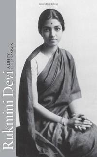
Lisa SamsonBiblio.com

ref. Q-1595545468Thomas Nelson Publishing 2014-02-25. Paperback. New. New. In shrink wrap. Looks like an interesting title! Thomas Nelson Publishing paperback
ref. 0670082643.Ghardcover. Good. Access codes and supplements are not guaranteed with used items. May be an ex-library book. hardcover
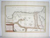
1655ref. M2801Paris: Mariette Pierre 1655. Excellent. Size : 345x523 mm 13.625x20.625 Inches Coloring: Original Outline Coloring Category: Maps Africa North Egypt Mariette, Pierre unknown
1700ref. 54022Nicolas Bion: L'Usage des Globes. Amsterdam: Francois Halma. 1700. Attractive map of north eastern Africa including Egypt and northern Libya. Much of the charm of early maps of Africa lies in how they show the interior of the continent which was not explored until the 19th century. Maps by Sanson in original colour are rare. Nicolas Sanson was founder of the French school of mapmakers at a time when the leadership in European cartography passed from the Low Countries to France. This map was published in Brion's treatise on globes. Nicolas Brion was a famous French mathematical and scientific instrument maker. Copper engraving. Very good condition. Darkened edges to margins. Faint inkstamp on right margin not affecting map. Original colour. Size: 27 x 17 cm. 10½ x 6½ inches. unknown
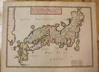
1656ref. M8114Paris c.1656. Very Good. Size : 375x521 mm 14.76x20.51 Inches Coloring: Original Hand Coloring Category: Maps Asia Far East Japan & Korea; unknown
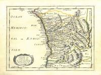
1656ref. 78503Uten sted. Paris 1656. Tverr4to. Arkets størrelse : 335 cm X 245 cm. Med samtidig grensekolorering. Fransk. Nicolas Sanson 1600-1667 blir regnet for å være grunnleggeren av fransk kartografi. Kommer fra atalset “L’Afrique” med flere senere utgivelser. unknown
ref. H32ca. 1750. 30 mal 21 cm. Gefalt. Karte. unknown
1663ref. LBW-9481663 417 x 378 mm.
2020ref. x-0367581736Taylor & Francis 2020. Paperback. New. 346 pages. 9.69x6.85x0.70 inches. Taylor & Francis paperback
2015ref. __0415711312Routledge 2015. Hardcover. New. 1st edition. 324 pages. 9.75x7.00x1.00 inches. Routledge hardcover
1710ref. M10331Amsterdam: Jean Covens & Corneille Mortier c.1710. Very Good. Size : 410x508 mm 16.14x20.00 Inches Coloring: Original Outline Coloring Category: Maps Africa North; Maps Europe Continent; Maps Mediterranean Sea; Jean Covens & Corneille Mortier unknown
1710ref. M10332Amsterdam: Jean Covens & Corneille Mortier c.1710. Very Good. Size : 403x555 mm 15.87x21.85 Inches Coloring: Original Outline Coloring Category: Maps Mediterranean Sea; Maps Asia Middle East; Jean Covens & Corneille Mortier unknown
1720ref. LBW-464Amsterdam, J. Covens et C. Mortier, [circa 1720]. 400 x 501 mm.
ref. 9781536175530NOVA SCIENCE PUBLISHERS INC
ref. 8078952007.Gpaperback. Good. Access codes and supplements are not guaranteed with used items. May be an ex-library book. paperback
ref. 6209409474.Gpaperback. Good. Access codes and supplements are not guaranteed with used items. May be an ex-library book. paperback
ref. 6209140017.Gpaperback. Good. Access codes and supplements are not guaranteed with used items. May be an ex-library book. paperback
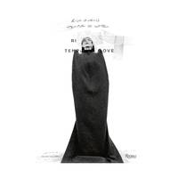
2025ref. SKU1740544Rizzoli 2025-07-08. hardcover. New. 8x0x11. New Book Ships with Tracking Rizzoli hardcover
2025ref. 1-084784451XRizzoli Intl Pubns 2025. Hardcover. New. 200 pages. 12.00x8.50x1.00 inches. Rizzoli Intl Pubns hardcover
2025ref. 9780847844517Rizzoli 2025 Book. New. Hardcover. Rizzoli hardcover
ref. Juanpebooks008652WE ship worldwide. Brand new 100%guarentee unknown
ref. 9780847844517Rizzoli New York
ref. 6209414591.Gpaperback. Good. Access codes and supplements are not guaranteed with used items. May be an ex-library book. paperback
ref. 6209406912.Gpaperback. Good. Access codes and supplements are not guaranteed with used items. May be an ex-library book. paperback
ref. 0538192801.Gpaperback. Good. Access codes and supplements are not guaranteed with used items. May be an ex-library book. paperback