Desnos, RobertBiblio.com
The Voice
Best.-Nr. ANAIS-0670747491Penguin Books. paperback. Good. 9.5X6.5X1.5. Buy with confidence. Excellent Customer Service & Return policy. Penguin Books paperback

Ausvora INC · Vereinigte Staaten124,80 $≈ 111,50 €
585 Ergebnisse
Best.-Nr. 70195Paris Desnos à l'enseigne du Glôbe 1780. Reliure d'origine. Les couvertures ne présentent que de légères traces d'usure et quelques marques aux coins. L'ouvrage comprend une double page sans illustrations une double page gravée avec une préface 21 cartes dont certaines dépliantes un tableau de 17 pages et un catalogue alphabétique des itinéraires de 17 pages. Un rare atlas de voyage français datant de 1780. Le livre est globalement en bon état avec quelques traces d'usure et de vieillissement typiques. La reliure a été récemment réparée. Les 20 cartes répertoriées sont toutes présentes. La reliure du livre est solide et résistante. Paris Desnos, à l'enseigne du Glôbe, 1780 unknown
Best.-Nr. ANAIS-0670747491Penguin Books. paperback. Good. 9.5X6.5X1.5. Buy with confidence. Excellent Customer Service & Return policy. Penguin Books paperback
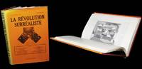
1975Best.-Nr. 319861975. Paris Editions Jean-Michel Place 1980. Un fort vol. au format in-4 297 x 208 mm non pagin. Reliure d'dition de pleine percaline satine cerise sous jaquette illustre. Reprint de cette clÂbre revue ; agrmente de nombreuses illustrations. ''La Rvolution surraliste sera pendant cinq anne le creuset dans lequel vont se fondre les grands thÂmes de ce mouvement trÂs connu et toujours trÂs mystrieux le surralisme. C'est l'incitation la vie dangereuse la sagesse de l'Orient l'engagement potique la libration sexuelle l'amour la femme''. Dos et marge gauche du premier plat insols. Infime altration affectant la coiffe suprieure de la jaquette. Du reste trÂs belle condition. b42961 unknown
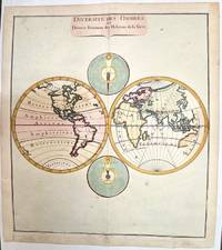
1780Best.-Nr. M1807Paris 1780. Very Good both right and left margins are extended. Notes: Louis Charles Desnos 1725-1805 was a French geographer of the 18th century. A Parisian map seller bookseller; and globe maker. He made globes for the King of Denmark Christian VII. Size : 262x305 mm 10.31x12.01 Inches Coloring: Hand Colored Category: Maps World unknown
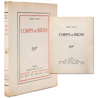
1930Best.-Nr. 339399Paris: Editions de la Nouvelle Revue Française 1930. First edition no. LVII of 100 numbered copies on vergé pur fil Lafuma watermarked nrf for the Bibliophiles de la Nouvelle Revue Française. 191 5 pp. 1 vols. 8vo. Original printed wrappers. Fine copy. First edition no. LVII of 100 numbered copies on vergé pur fil Lafuma watermarked nrf for the Bibliophiles de la Nouvelle Revue Française. 191 5 pp. 1 vols. 8vo. Collection of poetry and prose poems including his Rrose Selavy 1923 a formally innovative sequence of 150 allusive and often punning texts and aphorism nodding to his inspiration in no. 13: Rrose Selavy est bien connue du marchand du sel. Editions de la Nouvelle Revue Française unknown
2021Best.-Nr. x-3030565025Springer Nature 2021. Hardcover. New. 294 pages. 10.98x8.27x0.80 inches. Springer Nature hardcover
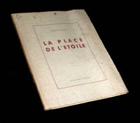
1945Best.-Nr. 225011945. Rodez Collection Humour 1945. Un vol. au format pt in-4 242 x 192 mm de 91 pp. broch sous couverture rabats remplis. Edition originale pour laquelle il n'est pas fait mention d'un tirage en grands papiers. ''Mconnue rarement joue "La Place de l'toile" fut crite la fin des annes 1920 par Robert Desnos l'un de nos plus grands poÂtes surralistes. Ce chef-d'Ãuvre de drlerie insolite se compose de neuf scÂnes o se croisent d'improbables personnages la fois proches et fuyants en une balade toile aux multiples branches.'' Plats prsentant de discrÂtes rousseurs ainsi qu'un clat lgÂrement altr. Papier lgÂrement jauni. TrÂs rares rousseurs dans le texte. Nonobstant belle condition. b42961 unknown
Best.-Nr. SONG0976844990Used: Good unknown
1945Best.-Nr. 87831Rodez: Privately Published 1945. Later Edition Revised softcover. Octavo 24cm; gray paper wrappers with paper title label on spine; fore-edge untrimmed; glassine wrapper; 89-911pp. Humour Collection published under the direction of Gaston Ferdiere. Text in French. Numerical series stamped in red on rear wrapper. Modest shelf-soil to wrappers with light surface wear; Very Good. Glassine dustwrapper lightly tanned with tiny tears and creases to extremities; Very Good. First published in 1928 and revised in 1944 the French poet shares this drama. 87831. Privately Published unknown
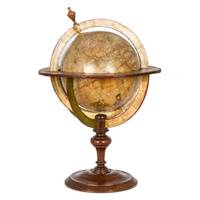
Best.-Nr. 46572Dressé sur les Relations les plus nouvelles de Mrs. de l'Académie Royale des Sciences par L. C. Desnos et J. B. Nolin Géographe. Se fait et se vends chez Desnos rue St. Jacque St. Severin Quartier de la Place Maubert. Paris 1760 avec privilége du Roy. Dedié au Roy par son trés humble trés obéissant et fidel sujet Desnos et monté par lui. Terrestrial globe 265 mm in diameter; engraved gores and two polar calottes with original hand-colouring over plaster base a few old sealed tears without loss; graduated equator tropics of Cancer and Capricorn ecliptic and Premiere Meridian fixe de l'isle de fer the prime meridian on the island of El Hierro which Louis XIII decreed in 1634; two cartouches - including the dedication to the King sometimes found removed during the French Revolution - decorative vignettes of exotic fauna indigenous peoples and maritime vessels numerous coloured tracks of historical and contemporary explorers including Ferdinand Magellan Jacob Le Maire and Willem Schouten Louis de l'Isle de la Croyere Nicolas de Frondat Aleksei Ilyich Chirikov Jean-Baptiste Charles Bouvet de Lozier and Admiral George Anson; papier-mâché meridian ring with printed declination and elevation engraved calendrical papier-mâché horizon ring with zodiac; edges painted red; supported on four papier-mâché quadrant arcs with the printed names of towns and their longitude and latitudes; turned wooden base and finial; total dimensions 600 x 390 mm; a few discreet signs of old restoration including at the North Pole; warm patina; a fine example of this rare terrestrial globe. A vividly illustrated French table globe from the mid-eighteenth century rich in geographical detail that includes the voyages and discoveries of French English Dutch and Russian explorers. Created during the reign of Louis XV by the partnership of Desnos and Nolin two great mapmakers of the period it is a tremendously evocative artefact from the Age of Enlightenment. The globe shows the discoveries made in the Pacific by the early European expeditions prior to those of Cook and the grands voyages of La Perouse Baudin Freycinet and Duperrey. It depicts the newly charted territory of Nouvelle Hollande as it was known from the most recent discoveries: the western coastline as well as the partial coastlines of Van Diemen's Land and New Zealand are based on the discoveries of the Dutch. Also marked are Dampier's Passage separating New Guinea from New Britain and Terre de S. Esprit Australia del Espíritu Santo the island in the New Hebrides originally mistaken by Quiros for the Australian continent. Louis-Charles Desnos 1725-1805 was one of the most prolific and influential map and globe makers of his age at a time when Paris was the major centre for map production in Europe. He married the widow of Nicolas Hardy the son of Jacques Hardy a globe maker active in the years 1738-1745. Desnos acquired Hardy's inventory and tools and expanded the company further through the acquisition of the inventories of the Jaillot family and of Nicolas de Fer. Desnos would be appointed Royal Globemaker to King Christian VII of Denmark and continued publishing throughout the late eighteenth century. Jean-Baptiste Nolin 1686-1762 continued the established business of his father the famous French cartographer engraver publisher and map dealer Jean-Baptiste Nolin 1657-1708. Collections: The only globe by Desnos recorded in Australian public collections is in the National Gallery of Victoria acquired from us in 2023. Another example of this globe is held in Libraries and Archives Canada. Provenance: Jean R. Perrette his bookplate pasted under the base of the globe. Jean R. Perrette's important collection of rare travel and exploration books was sold through Christie's New York in 2016 Sale 12259 Important Travel Exploration and Cartography April 5 2016. The globe is photographed in the catalogue in situ in Mr. Perrette's Library. Reference: van der Krogt Old globes in The Netherlands 1984 pp. 104-105 unknown
2017Best.-Nr. 1-3639653289Éditions universitaires européennes 2017. Paperback. New. 108 pages. French language. 8.66x5.91x0.25 inches. Éditions universitaires européennes paperback
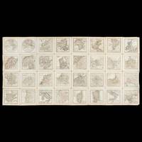
Best.-Nr. 42554Paris : Desnos circa 1771. Thirty-two copperplate engraved maps each measuring 95 x 95 mm image and 115 x 115 mm sheet numbering in the upper right corner of each map; laid on linen overall measurements 470 x 940 mm; inscribed verso Presented by the Marquis St. Simon to A. Gordon with the initials M. G. another Gordon family member below and with another inscription crossed out; housed in a red morocco presentation case with gilt-tooled decoration and title ATLAS 125 x 125 mm lined with blue paper and silk. A rare configuration - possibly unique - of Desnos' Almanach géographique ou petit atlas élémentaire dissected and laid on linen in a fully contemporary presentation case. An inscription records that the cased atlas was presented - presumably to its second owner - by Claude Anne de Rouvroy Marquis de Saint-Simon-Montbléru 1743-1819 a highly significant figure in the American Revolutionary War. The Marquis de Saint-Simon sailed for the Caribbean in 1779 as a colonel in the Touraine regiment. In 1781 he arrived at Jamestown Virginia in command of 3500 French soldiers where he joined forces with a smaller American army under Lafayette. Between them Saint-Simon and Lafayette conducted the siege of Yorktown during which Saint-Simon's force succeeded in preventing Cornwallis and his troops from escaping northwards along the road to Williamsburg. Although he was badly wounded in the leg Saint-Simon refused to leave the lines until the British surrendered and insisted on mounting his horse in order to take part in the surrender ceremony. Saint-Simon was personally thanked by Washington for his contribution to the American cause in a letter written just before his return to the West Indies Library of Congress George Washington Papers Series 4 General Correspondence: George Washington to Saint-Simon October 24 1781. He was also made one of the original members of the Society of the Cincinnati the private patriotic organisation founded by Washington. In 2018 the American Revolution Institute of the Society of the Cincinnati in Washington D.C. announced its acquisition of a portrait of Saint-Simon painted between 1815 and 1818 by the Spanish artist Vicente Lopez. It is the only portrait in American institutional collections of this lesser-known yet important participant in the Revolutionary War. Louis-Charles Desnos was one of the most prolific and influential map and globemakers of his age at a time when Paris was the leading centre of map production in Europe. Desnos married the widow of Nicolas Hardy son of Jacques Hardy a globemaker active during the period 1738-1745. Desnos acquired Hardy's inventory and tools and expanded the company also acquiring the inventories of the Jaillot family and of Nicolas de Fer. Desnos would be appointed Royal Globemaker to King Christian VII of Denmark and continued publishing throughout the late eighteenth century. Desnos first published his miniature atlas in 1770; it would be reissued in two volumes later the same year and again in 1771 with the addition of plate numbers to the maps as in the present example. The maps are titled: Hemisphere Orientale; Hemisphere Occidentale; Europe; Asie; Afrique; Amerique Septentrionale; Amerique Meridionale; Royaume de France; La Suisse diviseÌe en ses xiii cantons et ses allies; L’Italie; DucheÌs de Savoye et Piemont; Le Royaume de Naple et de Sicile; Royaume de Sardaigne; Royaume de Corse; Espagne et Portugal; Royaume de Portugal; Les Isles Britanniques; Pays Bas septentrionaux; Pays Bas meridionaux; L’Empire d’Allemagne; Royaume de Boheme na. les 16 cercles portent le nom de leurs capitales; Royaume de Prusse; Le Royaume de Hongrie; Royaume de Pologne; Royaume de Danemarck; Suede et Norwege; Suede et Norwege septentrionales; Suede et Norwege meridionales; Russie d’Europe; Turquie d’Europe; Russie d’Asie partie occidentale; Russie d’Asie partie orientale. We can locate no other examples which have been laid on linen and specially housed in a morocco case. The present example originally owned by a significant figure in the Revolutionary War is possibly a uniquely prepared copy with a purpose-made sturdy leather case portable and eminently suited to being carried in the pocket of a military coat. hardcover
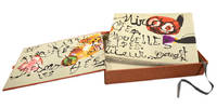
Best.-Nr. 96271Paris Arte Adrien Maeght 1974. . Limited edition number 51 of 150 copies on Arches wove paper signed in red pencil by Miro from an edition of 200 with an additional 20 copies hors commerce; oblong folio 29 x 40 cm; title text and limitation on Arches wove paper 25 lithographs in total 20 colour 5 black and white including wrappers limitation page all bar three double-page; original paper wrappers with first lithograph printed on front spine and back; set of six lithographs in black by or after the same hand one with additions in red ball-point pen in beige paper folder entitled 'documents 1929' housed in publisher's orange cloth covered box with artist's and author's names on spine. A fine example of the limited edition signed by Miro in red pencil. Both the Spanish artist Joan Miro and the French poet Robert Desnos were prominent figures in the Surrealist movement in Paris where they met in 1925. Miro had long planned to illustrate a book by Desnos but the project was delayed by the outbreak of the Spanish Civil War and subsequently the Second World War in which Desnos was an active member of the French Resistance. He was arrested by the Gestapo in 1944 and sent to several concentration camps including Auschwitz and Buchenwald. Desnos survived the war only to die of typhoid a few weeks after the liberation of the camp where he was held. Nearly thirty years later Desnos' widow approached Miro with the idea of illustrating his works again. In the end they settled on Pénalités de l'enfer ou les nouvelles Hébrides The Penalties of Hell or The New Hebrides Desnos' first work in prose written in Morocco in 1922. Mourlot 959-90; Cramer 188. Paris, Arte Adrien Maeght, 1974. hardcover
1766Best.-Nr. 67669Paris: c. 1766. A fine and handsome map of the British Isles with an inset of Orkneys and Shetland islands and a very ornate title cartouche. The map is flanked by informative text in French pertaining to the British Isles.The map is surrounded with a very pleasing "framed" effect border decoration. Published in the "Atlas Generale Civil et Ecclesiastique". Size: 390 x 575 mm. Copperplate engraving with later hand colour. Good condition. unknown
1945Best.-Nr. 162609Rodez: Humour 1945. Softcover. gr.8°. französische Broschur Posthum am 30. November 1945 erschienene Gedichtfolge die Desnos bereits 1927 geschrieben und 1944 gründlich überarbeitet hatte. Desnos starb am 8. Juni 1945 kurz nach der Befreiung aus dem Lager Theresienstadt wo er an Thypus erkrankt war. Dieses Antipoème ist der einzige erschienene Band der collection "Humour" für die "nächsten Monate" geplant waren noch Texte von Antonin Arthaud Gaston Ferdière und Guy Mercier. Frankreich; 20. Jahrhundert; Surrealismus Collection "Humour" vol I Humour, paperback
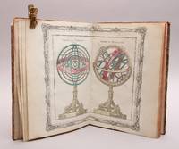
Best.-Nr. 95730Paris Chez le Sr Desnos Ingénieur-Géographe pour les Glôbes et Sphéres et Libraire de sa Majesté Danois 1781. 4to. 23 x 30 cm. Engraved title-page 26 engraved double-paged and hand-coloured maps. Contemporary half calf gilt spine red leather label. Rubbed. . 1. Le systême de Ptolémée Thico-Brahé Copernic et Descartes. 2. Sphéres de Ptolémée et de Copernic. 3. Sphéres droite et paralléle. 4. Démonstration géométrique des spéres. 5. Glôbe terrestre et Céleste. 6. A. Position réspective des peuples de la terre. B. Suite de la planche précédente. 7. Hémisphère Occidental. 8. Hémisphère Occidental. 9. Mappe-Monde. 10. L`Europe. 11. La France. 12. La Suisse. 13. L`Italie. 14. L`Espagne. 15. Les Isles Britannique. 16. Les Pays-Bas. 17. L`Allemagne. 18. La Hongrie. 19. La Pologne. 20. La Dannemarc. 21. La Suède et Norvége. 22. La Russie Européene. 23. La Turquie Eoropéene. 24. L`Asie. 25. L`Afrique. 26. L`Amerique. hardcover
1989Best.-Nr. BN319684Haux 1989. 1989. Hardcover. Gegenrichtung: Gedichte Gegenrichtung: Gedichte Robert Desnos Haux hardcover
1979Best.-Nr. BN392822Polskie Wydawnictwo Muzyczne J. & W. Chester Limited 1979. 1979. Softcover. Les Espaces du Sommeil na baryton i orkiestre do slow Roberta Desnosa 1975 for baritone and orchestra to words by Robert Desnos = PWM 8283. Partytura Score. Les Espaces du Sommeil na baryton i orkiestre do slow Roberta Desnosa 1975 for baritone and orchestra to words by Robert Desnos = PWM 8283. Partytura Score. Lutoslawski Witold Robert Desnos Text Polskie Wydawnictwo Muzyczne J. & W. Chester Limited paperback
1943Best.-Nr. s00014377Paris: Gallimard 1943. First printing. Paperback. Good. Inscribed on the front flyleaf by Desnos to the well-known French novelist and screen-writer Pierre Bost. Inscribed books by this central figure in the Surrealist group are rare. Desnos' unusual "druggy" novel revolving around a beautiful opium-addicted woman modeled upon the tragic singer Yvonne George. First edition 1943. Softcover 206 pp. clean unmarked text Good copy general age-toning to the pages some soiling to the covers wear to the covers including creasing tearing and loss at the bottom third of the spine. We have housed the book in protective mylar. Gallimard paperback
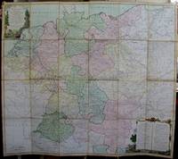
1791Best.-Nr. M5426Paris 1791. Very Good disected and laid on original canvas folding map. Notes: A decoratvie cartoche is on the upper left corner and a decorative map legend is located in the lower right. Size : 745x850 mm 29.25x33.5 Inches Coloring: Original Hand Coloring Category: Maps Folding Map; Maps Europe West Benelux General; Maps Europe West Germany; Maps Europe West Switzerland; Maps Europe West Austria unknown
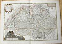
1764Best.-Nr. M10199Paris c. 1764. Very Good. Notes: An important and decorative map of Switzerland published in mid 18th century. The map originally was drawn by De Fer and later updated and improved by Desnos. Size : 485x670 mm 19.09x26.38 Inches Coloring: Hand Colored Category: Maps Europe Switzerland; unknown
1760Best.-Nr. M5799Paris: Desnos 1760. Very Good. Notes: French map of Poland Lithuania and the surrounding region. 1760 edition of rare Nicolas De Fer's map. Size : 480x590 mm 18.875x23.25 Inches Coloring: Hand Colored in Outline Category: Maps Europe Poland Lithuania Desnos unknown
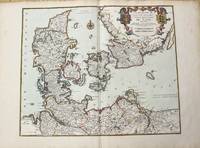
1780Best.-Nr. M10230Paris 1780. Very Good. Notes: Louis Charles Desnos 1725-1805 was a cartographer and maker of globes and mathematical instruments who settled in Paris where he worked for among other famous patrons the King of Denmark Christian VII as a Royal Globemaker. Size : 472x579 mm 18.58x22.80 Inches Coloring: Original Hand Coloring Category: Maps Europe Scandinavia Countries; unknown
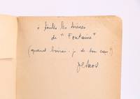
1942Best.-Nr. 92570Paris: Gallimard 1942. Fine. Gallimard Paris 1942 12 x 19 cm broché First collected edition with no deluxe issue; one of the press copies. Two small tears at head of spine. Rare and fine signed autograph inscription from Robert Desnos: "" à toutes les sirènes de ""Fontaine"" quand boirai-je de ton eau ."" Â Gallimard unknown
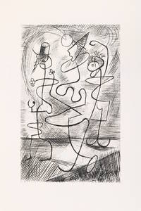
1943Best.-Nr. 91028Paris: Robert J. Godet 1943. Fine. Robert J. Godet Paris 1943 22.2 x 29.5 cm En feuilles First edition printed in 170 numbered copies on Holland paper this copy being one of the 100 reserved for Robert J. Godet.Illustrated with ten burin engravings by Gaston-Louis Roux.A very good copy with only a few negligible and faint spots to some leaves. Robert J. Godet unknown