Pinkney, David HBiblio.com

2.980 Ergebnisse
2019Best.-Nr. x-069165669XPrinceton Univ Pr 2019. Hardcover. New. 408 pages. 9.21x6.14x1.54 inches. Princeton Univ Pr hardcover
2018Best.-Nr. x-1108415997Cambridge Univ Pr 2018. Hardcover. New. 5th edition. 594 pages. 10.00x7.75x1.25 inches. Cambridge Univ Pr hardcover
Best.-Nr. 9642073-nnew. unknown
Best.-Nr. 9642073like new. unknown
1911Features: New Presidents for Harriman Railway System - informative article with excellent photo of Harriman officials in Seattle in November of 1909; Golden Spike Driving at Bend, Oregon (article); Increased use of Oil on Railroads; Seattle Port Commission studies improvements; President Shaughnessy's Report to C.P.R Stockholders - major article; Feature write-up of James Rolph, Jr., the next mayor of San Francisco, with photo; How is This For Passenger Traffic?; New Invention by David H. Wilson of Chicago Revolutionizes Telephony - C.P.R. sends message by telephone from Montreal to Fort William via telegraph line; Railroad Ties Pickled in Great Salt Lake, UT; Freight Congestion in New York City - major article with two photos; Death of Popular Ship Master Capt. Walter McWilliams of the American-Hawaiian S.S. Co. - article with photo; C.P.R. Purchases Fast Turbine Steamer Queen Alexandra for the Vancouver - Nanaimo Run; Successful Trial Trip of new Sound Steamer Calista; Schooner Daisy Gadsby Launched; Ramona Captain and Engineer Found Guilty; The Gaertner Releasing Hook - article with diagram; Review of Marine Insurance and Shipping Law; Casualties to Pacific Coast Shipping; Bernard N. Baker, president of the Atlantic & Pacific Transport Co. Tells of Great Trade Possibilities; and more. 44 pages including several pages of nostalgic ads, some illustrated in black and white, featuring local marine and rail interests. Printed upon glossy coated stock. Average wear. Binding intact. Few library markings to front cover. A well-preserved copy of this highly-informative memento of Pacific Northwest transportation over a century ago. 12" x 9". Magazine
2015Best.-Nr. __1482250217Chapman & Hall 2015. Hardcover. New. 3rd revised edition. 600 pages. 10.16x7.24x1.26 inches. Chapman & Hall hardcover
2008Best.-Nr. __0849380308CRC Pr I Llc 2008. Hardcover. New. 1st edition. 608 pages. 10.35x7.32x1.30 inches. CRC Pr I Llc hardcover
1927Best.-Nr. 29Emile-Paul, Paris, 1927, in-4 (285x195mm), 138pp., broché, couverture jaune orangée illustrée, étui (taches au dos de l'étui).
1943Best.-Nr. 1244Creuzevault, Paris, 11 novembre 1943, in-8 (27x17,5cm), en feuilles, couverture blanche illustrée et rempliée, chemise et étui de papier doré et moiré (étui légèrement défraîchi).
1948Best.-Nr. 69Creuzevault, Paris, 1948, in-4 (285x190mm), VII-352pp., en feuilles, couverture blanche illustrée et rempliée, chemise et étui de papier gris (étui défraîchi (mouillures) et tache sur le dos de la chemise).
1929Best.-Nr. 19360paris Emile-Paul 1929 -in-4 broché un volume, broché (paperback) petit in-quarto (19,5 x 28 cm), dos et couverture saumon rempliée imprimés en rouge et noir (spine and cover printed), toutes tranches non rognées (edges no smoothes), - long papier (fore-edge - great paper), légères rousseurs sur la tête (redness marks on the top edge), Tirage limité à 225 exemplaires numérotés, 1/200 sur Arches (n° 217).(limited edition - 225 copies were printed), Illustrations de gravures sur cuivre (pointes-sèches) par Hermine DAVID (titre frontispice, 12 planches hors-texte et 3 vignettes), 147 pages+gravures+table alphabétique en fin de volume, 1929 Paris, Emile-Paul Frères Editeurs, .
2013Best.-Nr. DADAX0810871947Scarecrow Press 2013-04-11. Second. hardcover. New. 6.45x2.11x9.25. Buy with confidence. Excellent Customer Service & Return policy. Scarecrow Press hardcover
2023Best.-Nr. 1-1543856454Aspen Opco Llc 2023. Hardcover. New. 3rd har/psc edition. 924 pages. 10.00x7.38x1.50 inches. Aspen Opco Llc hardcover
2010Best.-Nr. 1-0132157802Pearson College Div 2010. Hardcover. New. 4th edition. 376 pages. 11.00x8.50x0.50 inches. Pearson College Div hardcover
1990Best.-Nr. ZB976037Wiley-Interscience 1990. 390 pp. Hardcover ex library else text clean and binding tight. - If you are reading this this item is actually physically in our stock and ready for shipment once ordered. We are not bookjackers. Buyer is responsible for any additional duties taxes or fees required by recipient's country. Photos available upon request. Wiley-Interscience hardcover
1995Best.-Nr. x-085496780XBerg Pub Ltd 1995. Hardcover. New. 9.00x5.75x1.00 inches. Berg Pub Ltd hardcover
2016Best.-Nr. x-013405573XPearson College Div 2016. Paperback. New. 12 edition. 668 pages. 9.00x7.25x0.75 inches. Pearson College Div paperback
Best.-Nr. BN97776Multiscale Phenomena in Materials - Experiments and Modeling Related to Mechanical Behavior. Symposium held April 22-24 2003 San Francisco California U.S.A. = MRS Proceedings Volume 779. Multiscale Phenomena in Materials - Experiments and Modeling Related to Mechanical Behavior. Symposium held April 22-24 2003 San Francisco California U.S.A. = MRS Proceedings Volume 779. unknown
Best.-Nr. SONG1626161429Georgetown University Press 2014-11-01. Second. hardcover. Used: Good. 6.00x0.69x9.00. Buy with confidence. Excellent Customer Service & Return policy. Georgetown University Press hardcover
2007Best.-Nr. DADAX0805859187Routledge 2007-06-11. hardcover. New. 6.49x1.05x9.14. Buy with confidence. Excellent Customer Service & Return policy. Routledge hardcover
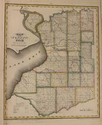
1829Best.-Nr. 337482New York: David H. Burr 1829. unbound. Rawdon Clark & Co. Map. Copper plate engraving with original hand-colored outline. Image measures 18 1/2" x 15 1/4" This map depicts Erie County in New York State hand-colored by town. The map denotes major routes rivers and creeks and other topographical details. Includes the city of Buffalo. Flouring mills saw mills manufactories forges and churches are indicated. This first edition of Burr's county map appeared in his "Atlas of the State of New York" of the same year which was the second atlas of an individual state ever published. The map is in very good condition. Some foxing. Full original margins. David H. Burr 1803-1875 served as Topographer to the United States Post Office and Geographer to the House of Representatives and was widely known for his accuracy and attention to detail. His "Universal Atlas" was the first to map each of the United States individually. This map is a lovely rendering of a hard-to-find county in New York State. David H. Burr unknown
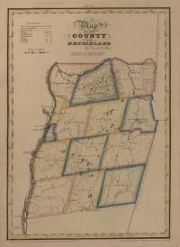
1829Best.-Nr. 337480New York: David H. Burr 1829. unbound. Rawdon Clark & Co. Map. Copper plate engraving with original hand-colored outline. Image measures 18 1/4" x 12 5/8" This map depicts Rensselaer County in New York State hand-colored by town. The map denotes major routes rivers and creeks and other topographical details. Features the cities of Albany Troy and parts of the Erie and Champlain Canals. Flouring mills saw mills manufactories and forges are indicated. This first edition of Burr's county map appeared in his "Atlas of the State of New York" of the same year which was the second atlas of an individual state ever published. The map is in very good condition. Some foxing. Full original margins. David H. Burr 1803-1875 served as Topographer to the United States Post Office and Geographer to the House of Representatives and was widely known for his accuracy and attention to detail. His "Universal Atlas" was the first to map each of the United States individually. This map is a lovely rendering of a hard-to-find county in New York State. David H. Burr unknown
1829Best.-Nr. 337482New York: David H. Burr 1829. unbound. Rawdon Clark & Co. Map. Copper plate engraving with original hand-colored outline. Image measures 18 1/2" x 15 1/4" This map depicts Erie County in New York State hand-colored by town. The map denotes major routes rivers and creeks and other topographical details. Includes the city of Buffalo. Flouring mills saw mills manufactories forges and churches are indicated. This first edition of Burr's county map appeared in his "Atlas of the State of New York" of the same year which was the second atlas of an individual state ever published. The map is in very good condition. Some foxing. Full original margins. David H. Burr 1803-1875 served as Topographer to the United States Post Office and Geographer to the House of Representatives and was widely known for his accuracy and attention to detail. His "Universal Atlas" was the first to map each of the United States individually. This map is a lovely rendering of a hard-to-find county in New York State. David H. Burr unknown books
1829Best.-Nr. 337480New York: David H. Burr 1829. unbound. Rawdon Clark & Co. Map. Copper plate engraving with original hand-colored outline. Image measures 18 1/4" x 12 5/8" This map depicts Rensselaer County in New York State hand-colored by town. The map denotes major routes rivers and creeks and other topographical details. Features the cities of Albany Troy and parts of the Erie and Champlain Canals. Flouring mills saw mills manufactories and forges are indicated. This first edition of Burr's county map appeared in his "Atlas of the State of New York" of the same year which was the second atlas of an individual state ever published. The map is in very good condition. Some foxing. Full original margins. David H. Burr 1803-1875 served as Topographer to the United States Post Office and Geographer to the House of Representatives and was widely known for his accuracy and attention to detail. His "Universal Atlas" was the first to map each of the United States individually. This map is a lovely rendering of a hard-to-find county in New York State. David H. Burr unknown books
1987Best.-Nr. 010735Provo UT U.S.A.: Brigham Young University 1987. First Edition First Printing . Hardcover. Fine/Fine. x 615 pages. New condition in archival dj protector. A beautiful copy of this scarce title. THIS IS BY FAR THE SCARCEST OF THE VOLUMES IN CLARK'S 5-VOL PAPERS SERIES. Carefully packaged to PREVENT shipping damage. Brigham Young University hardcover