2.980 Ergebnisse
2010Best.-Nr. SKU1746432Mosby 2010-06-11. hardcover. New. 8x0x11. New Book Ships with Tracking Mosby hardcover
2010Best.-Nr. SKU0203683Mosby 2010-06-11. Hardcover. Good. Textbook May Have Highlights Notes and/or Underlining BOOK ONLY-NO ACCESS CODE NO CD Ships with Tracking Mosby hardcover
2010Best.-Nr. 1-0721691684W B Saunders Co 2010. Hardcover. New. 1st edition. 368 pages. 11.10x8.80x0.80 inches. W B Saunders Co hardcover
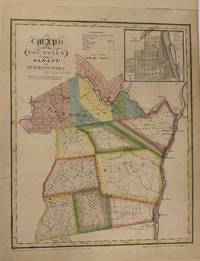
1829Best.-Nr. 337474New York: David H. Burr 1829. unbound. Rawdon Clark & Co. Map. Copper plate engraving with original hand-coloring. Image measures 17 1/2" x 14 1/8" This map depicts Albany and Schenectady County in New York State hand-colored by town. The map denotes major routes rivers and creeks and other topographical details. An inset of the city of Albany is in the upper right corner. This first edition of Burr's county map appeared in his "Atlas of the State of New York" of the same year which was the second atlas of an individual state ever published. The map is in very good condition. Some foxing. Full original margins. David H. Burr 1803-1875 served as Topographer to the United States Post Office and Geographer to the House of Representatives and was widely known for his accuracy and attention to detail. His "Universal Atlas" was the first to map each of the United States individually. This map is a lovely rendering of a hard-to-find county in New York State. David H. Burr unknown
1829Best.-Nr. 337474New York: David H. Burr 1829. unbound. Rawdon Clark & Co. Map. Copper plate engraving with original hand-coloring. Image measures 17 1/2" x 14 1/8" This map depicts Albany and Schenectady County in New York State hand-colored by town. The map denotes major routes rivers and creeks and other topographical details. An inset of the city of Albany is in the upper right corner. This first edition of Burr's county map appeared in his "Atlas of the State of New York" of the same year which was the second atlas of an individual state ever published. The map is in very good condition. Some foxing. Full original margins. David H. Burr 1803-1875 served as Topographer to the United States Post Office and Geographer to the House of Representatives and was widely known for his accuracy and attention to detail. His "Universal Atlas" was the first to map each of the United States individually. This map is a lovely rendering of a hard-to-find county in New York State. David H. Burr unknown books
1966Best.-Nr. 008665Boston: Ginn and Company 1966. Book. Very Good Plus. Cloth. Sixth Edition. Double Elephant - over 25" - 50" tall. 25 3/4" h x 18 1/2" w. A teacher's book for reading to the whole class with folding wings that unsnap so book can be fully open and on display. Contains 9 stories 38 pages each page with great period illustrations featuring biracial children playing. earlier editions have only 6 stories and 25 or fewer pages. States "100 Edition" bottom of title page copyright dates of 1966 1964 1961 1957 1952 1948. Very Good Plus bump top edge of front cover slight waviness to thick paper pages a clean and quite handsome copy would be lovely displayed in a child's room or given the condition with years of use left for a preschool. Ginn and Company Hardcover
1966Best.-Nr. 008665Boston: Ginn and Company 1966. Book. Very Good Plus. Cloth. Sixth Edition. Double Elephant - over 25" - 50" tall. 25 3/4" h x 18 1/2" w. A teacher's book for reading to the whole class with folding wings that unsnap so book can be fully open and on display. Contains 9 stories 38 pages each page with great period illustrations featuring biracial children playing. earlier editions have only 6 stories and 25 or fewer pages. States "100 Edition" bottom of title page copyright dates of 1966 1964 1961 1957 1952 1948. Very Good Plus bump top edge of front cover slight waviness to thick paper pages a clean and quite handsome copy would be lovely displayed in a child's room or given the condition with years of use left for a preschool. Ginn and Company Hardcover books
Best.-Nr. 2448649like new. unknown
2008Best.-Nr. DBS-9780387363189Springer 2008. 1st. Hardcover. New. Springer hardcover
2008Best.-Nr. DBS-9780387363189Springer 2008. 1st. Hardcover. New. Springer hardcover
2004Best.-Nr. SONG0714655538Routledge 2004-08-26. 1. hardcover. Used: Good. 6.12x0.69x9.44. Buy with confidence. Excellent Customer Service & Return policy. Routledge hardcover
2008Best.-Nr. NJan2018--1118Pearson 2008-03-07. Hardcover. New. 0x0x0. New US Edition Textbook Ships with Emailed Tracking from USA Pearson hardcover
2022Best.-Nr. x-0357657845Cengage Learning 2022. Hardcover. New. 9th edition. 784 pages. 10.80x9.30x1.00 inches. Cengage Learning hardcover
2012Best.-Nr. x-1841849855Informa Healthcare 2012. Hardcover. New. 1st edition. 239 pages. 10.00x7.25x0.75 inches. Informa Healthcare hardcover
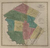
1829Best.-Nr. 337485New York: David H. Burr 1829. unbound. Rawdon Clark & Co. Map. Copper plate engraving with original hand-colored outline. Image measures 16 3/4" x 17 1/2" This map depicts Sullivan County in New York State hand-colored by town. The map denotes major routes rivers and creeks and other topographical details. Flouring mills saw mills manufactories forges and churches are indicated. The Delaware & Hudson Canal is shown. This first edition of Burr's county map appeared in his "Atlas of the State of New York" of the same year which was the second atlas of an individual state ever published. The map is in very good condition. Some foxing. Full original margins. David H. Burr 1803-1875 served as Topographer to the United States Post Office and Geographer to the House of Representatives and was widely known for his accuracy and attention to detail. His "Universal Atlas" was the first to map each of the United States individually. This map is a lovely rendering of a hard-to-find county in New York State. David H. Burr unknown
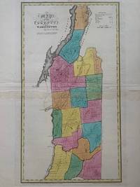
1829Best.-Nr. 337502New York: David H. Burr 1829. unbound. Rawdon Clark & Co. Map. Copper plate engraving with original hand-colored outline. Image measures 17 1/4" x 18 3/4" This map depicts Washington County in New York State hand-colored by town. The map denotes major routes rivers and creeks and other topographical details. Flouring mills saw mills manufactories forges and churches are indicated. Includes Lake George and Lake Champlain and the Champlain Canal is shown. This first edition of Burr's county map appeared in his "Atlas of the State of New York" of the same year which was the second atlas of an individual state ever published. The map is in very good condition. Some foxing. Full original margins. David H. Burr 1803-1875 served as Topographer to the United States Post Office and Geographer to the House of Representatives and was widely known for his accuracy and attention to detail. His "Universal Atlas" was the first to map each of the United States individually. This map is a lovely rendering of a hard-to-find county in New York State. David H. Burr unknown
1829Best.-Nr. 337485New York: David H. Burr 1829. unbound. Rawdon Clark & Co. Map. Copper plate engraving with original hand-colored outline. Image measures 16 3/4" x 17 1/2" This map depicts Sullivan County in New York State hand-colored by town. The map denotes major routes rivers and creeks and other topographical details. Flouring mills saw mills manufactories forges and churches are indicated. The Delaware & Hudson Canal is shown. This first edition of Burr's county map appeared in his "Atlas of the State of New York" of the same year which was the second atlas of an individual state ever published. The map is in very good condition. Some foxing. Full original margins. David H. Burr 1803-1875 served as Topographer to the United States Post Office and Geographer to the House of Representatives and was widely known for his accuracy and attention to detail. His "Universal Atlas" was the first to map each of the United States individually. This map is a lovely rendering of a hard-to-find county in New York State. David H. Burr unknown books
1829Best.-Nr. 337502New York: David H. Burr 1829. unbound. Rawdon Clark & Co. Map. Copper plate engraving with original hand-colored outline. Image measures 17 1/4" x 18 3/4" This map depicts Washington County in New York State hand-colored by town. The map denotes major routes rivers and creeks and other topographical details. Flouring mills saw mills manufactories forges and churches are indicated. Includes Lake George and Lake Champlain and the Champlain Canal is shown. This first edition of Burr's county map appeared in his "Atlas of the State of New York" of the same year which was the second atlas of an individual state ever published. The map is in very good condition. Some foxing. Full original margins. David H. Burr 1803-1875 served as Topographer to the United States Post Office and Geographer to the House of Representatives and was widely known for his accuracy and attention to detail. His "Universal Atlas" was the first to map each of the United States individually. This map is a lovely rendering of a hard-to-find county in New York State. David H. Burr unknown books
1998Best.-Nr. DADAX0471968064Wiley 1998-10-15. 1. hardcover. New. 6.36x0.93x9.37. Buy with confidence. Excellent Customer Service & Return policy. Wiley hardcover
1993Best.-Nr. DADAX0805814124Routledge 1993-09-01. hardcover. New. 6.46x1.27x9.22. Buy with confidence. Excellent Customer Service & Return policy. Routledge hardcover
1993Best.-Nr. DADAX0306441748Springer 1993-03-31. 1993. hardcover. New. 6.34x1.36x9.50. Buy with confidence. Excellent Customer Service & Return policy. Springer hardcover
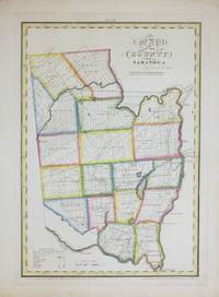
1829Best.-Nr. 264493New York: David H. Burr 1829. unbound. Rawdon Clark & Co. Map. Copper plate engraving with original hand-coloring. Image measures 12 x 17 1/2". This map depicts Saratoga County in eastern New York divided into 18 towns outlined in vivid color. The county is bordered by the Hudson River in the east and the Mohawk River in the south. Saratoga Springs is identified. The map denotes major routes waterways and topographical details and icons label villages flouring mills factories forges saw mills and churches. This first edition of Burr's county map appeared in his "Atlas of the State of New York" of the same year which was the second atlas of an individual state ever published. The map is in good condition with light foxing throughout. Full original margins. David H. Burr 1803-1875 served as Topographer to the United States Post Office and Geographer to the House of Representatives and was widely known for his accuracy and attention to detail. His "Universal Atlas" was the first to map each of the United States individually. This map is a lovely rendering of a hard-to-find county in New York State. David H. Burr unknown
1829Best.-Nr. 264493New York: David H. Burr 1829. unbound. Rawdon Clark & Co. Map. Copper plate engraving with original hand-coloring. Image measures 12 x 17 1/2". This map depicts Saratoga County in eastern New York divided into 18 towns outlined in vivid color. The county is bordered by the Hudson River in the east and the Mohawk River in the south. Saratoga Springs is identified. The map denotes major routes waterways and topographical details and icons label villages flouring mills factories forges saw mills and churches. This first edition of Burr's county map appeared in his "Atlas of the State of New York" of the same year which was the second atlas of an individual state ever published. The map is in good condition with light foxing throughout. Full original margins. David H. Burr 1803-1875 served as Topographer to the United States Post Office and Geographer to the House of Representatives and was widely known for his accuracy and attention to detail. His "Universal Atlas" was the first to map each of the United States individually. This map is a lovely rendering of a hard-to-find county in New York State. David H. Burr unknown books
2022Best.-Nr. 1-0357720636Cengage Learning 2022. Paperback. New. 14 edition. 576 pages. 10.00x8.50x0.94 inches. Cengage Learning paperback
2023Best.-Nr. 1-0323810411Elsevier Science Health Science 2023. Hardcover. New. 5th edition. 560 pages. 10.88x8.50x1.38 inches. Elsevier Science Health Science hardcover