30 592 résultats
2008réf. 1-1422016463Progressive Management 2008. Ring-bound. New. 40 pages. 11.30x10.10x1.30 inches. Progressive Management unknown
2008réf. 1-1422015432Progressive Management 2008. Ring-bound. New. 115 pages. 11.30x10.50x1.30 inches. Progressive Management unknown
2008réf. 1-1422016692Progressive Management 2008. Ring-bound. New. 188 pages. 11.30x10.40x1.10 inches. Progressive Management unknown
2008réf. 1-1422015505Progressive Management 2008. CD-ROM. New. 250 pages. 11.60x10.40x1.90 inches. Progressive Management unknown
2008réf. 1-1422015785Progressive Management 2008. Ring-bound. New. 328 pages. 11.60x10.90x1.70 inches. Progressive Management unknown
2008réf. 1-1422015548Progressive Management 2008. Ring-bound. New. 189 pages. 10.70x9.20x1.50 inches. Progressive Management unknown
2008réf. 1-1422016234Progressive Management 2008. Ring-bound. New. 183 pages. 11.40x10.30x1.40 inches. Progressive Management unknown
2008réf. 1-1422015971Progressive Management 2008. Ring-bound. New. 185 pages. 11.30x10.40x1.10 inches. Progressive Management unknown
2010réf. 1-1422052311Progressive Management 2010. CD-ROM. New. 15605 pages. 5.70x5.00x0.40 inches. Progressive Management unknown
1902réf. 21136Lpz: Brockhaus 1902. 592 S., 39 Abb. teilw. auf Taf., 1 Faltkarte, Reg. *Schiel war u.a. Kommandant d. Dt.Freikorps in der Südafrikanischen Republik* Erste Ausgabe* schönes Expl.
1944réf. 70378Washington DC: Army Map Service 1944. First edition 23 color broadside maps each about 22 x 20 in.; 1:200000 scale covering the western section of the series from XI-XII 42-43 to XXVII-XXVIII 48-49 lacking XI-XII 44-45 XIII-XIV 44-45 XIII-XIV 50-51 XV-XVI 42-43 XV-XVI 44-45 XVII-XVIII 42-43 XVII-XVIII 44-45 and XIV-XX 44-45. Geographical region covered is the west coast From Kuching to Soekamara and some outlying islands. Each map is numbered in marker on the bottom left margin otherwise clean and near fine. The Army Map Service was the primary map producing body of the US Military through WWII. Service cartographers many of them women recruited after Pearl Harbor produced 40000 maps covering 400000 miles between 1941 and 1945. LoC Their work formed the basis of silk escape maps provided to soldiers. Army Map Service unknown
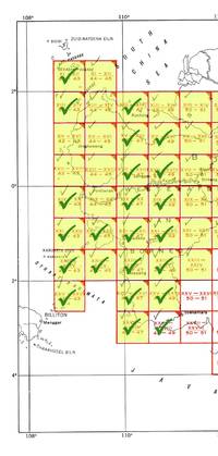
1945réf. 70379Washington DC: Army Map Service 1945. 23 broadside color maps; each about 22.25 x 20 in. 1:250.000 scale covering two separate regions: North Borneo including part of Brunei and Southeast Borneo from Samarinda to Kualakapuas and inland to Boentok. All maps in fine condition. Maps included are: NB-49 X; NB-50 I J O P Q R S V W; NA-50-D; SA-50-C D G H I M N O S T U; SB-50-A. The Army Map Service was the primary map producing body of the US Military through WWII. Service cartographers many of them women recruited after Pearl Harbor produced 40000 maps covering 400000 miles between 1941 and 1945. LoC Their work formed the basis of silk escape maps provided to soldiers. Army Map Service unknown
1944réf. 70378Washington DC: Army Map Service 1944. First edition 23 color broadside maps each about 22 x 20 in.; 1:200000 scale covering the western section of the series from XI-XII 42-43 to XXVII-XXVIII 48-49 lacking XI-XII 44-45 XIII-XIV 44-45 XIII-XIV 50-51 XV-XVI 42-43 XV-XVI 44-45 XVII-XVIII 42-43 XVII-XVIII 44-45 and XIV-XX 44-45. Geographical region covered is the west coast From Kuching to Soekamara and some outlying islands. Each map is numbered in marker on the bottom left margin otherwise clean and near fine. The Army Map Service was the primary map producing body of the US Military through WWII. Service cartographers many of them women recruited after Pearl Harbor produced 40000 maps covering 400000 miles between 1941 and 1945. LoC Their work formed the basis of silk escape maps provided to soldiers. Army Map Service unknown books
1945réf. 70379Washington DC: Army Map Service 1945. 23 broadside color maps; each about 22.25 x 20 in. 1:250.000 scale covering two separate regions: North Borneo including part of Brunei and Southeast Borneo from Samarinda to Kualakapuas and inland to Boentok. All maps in fine condition. Maps included are: NB-49 X; NB-50 I J O P Q R S V W; NA-50-D; SA-50-C D G H I M N O S T U; SB-50-A. The Army Map Service was the primary map producing body of the US Military through WWII. Service cartographers many of them women recruited after Pearl Harbor produced 40000 maps covering 400000 miles between 1941 and 1945. LoC Their work formed the basis of silk escape maps provided to soldiers. Army Map Service unknown books
réf. 110574Paris, Charles-Lavauzelle, 1920 in-8, 13 pp., broché.
1946réf. 2545San Antonio: C. Ekmark 1946. Very good. Panoramic photograph 8 x 52.25 inches. Very minor wear. A dramatic panoramic image capturing the 23rd Infantry Battalion of the Second Infantry Division while training at Camp Swift Texas in the wake of the Second World War. Four large groups of soldiers are ranged across the photograph with the officers in the middle-front of the image all standing in front of three long rows of jeeps and military transport trucks. Camp Swift located just west of Austin in Bastrop County can be seen in the far background. "During World War II Camp Swift reached a maximum strength of 90000 troops and included at different times the 95th 97th and 102d Infantry divisions the 10th Mountain Division the 116th and 120th Tank Destroyer battalions and the 5th Headquarters Special Troops of the Third Army. Swift was the largest army training and transshipment camp in Texas. It also housed 3865 German prisoners of war. After the war much of the site was returned to former owners. The government retained 11700 acres as a military reservation. That land housed parts of the Texas National Guard a medium-security federal prison and a University of Texas cancer research center" - Handbook of Texas online. The photographer Carl John Ekmark of San Antonio was a noted and somewhat prolific chronicler of military life throughout the Lone Star State. C. Ekmark unknown
1946réf. 2545San Antonio: C. Ekmark 1946. Very good. Panoramic photograph 8 x 52.25 inches. Very minor wear. A dramatic panoramic image capturing the 23rd Infantry Battalion of the Second Infantry Division while training at Camp Swift Texas in the wake of the Second World War. Four large groups of soldiers are ranged across the photograph with the officers in the middle-front of the image all standing in front of three long rows of jeeps and military transport trucks. Camp Swift located just west of Austin in Bastrop County can be seen in the far background. "During World War II Camp Swift reached a maximum strength of 90000 troops and included at different times the 95th 97th and 102d Infantry divisions the 10th Mountain Division the 116th and 120th Tank Destroyer battalions and the 5th Headquarters Special Troops of the Third Army. Swift was the largest army training and transshipment camp in Texas. It also housed 3865 German prisoners of war. After the war much of the site was returned to former owners. The government retained 11700 acres as a military reservation. That land housed parts of the Texas National Guard a medium-security federal prison and a University of Texas cancer research center" - Handbook of Texas online. The photographer Carl John Ekmark of San Antonio was a noted and somewhat prolific chronicler of military life throughout the Lone Star State. C. Ekmark unknown books
1963réf. 24522München : Rütten + Loening, 1963. 431 S. : Ill., Kt. 8°. OLwd ohne SU.
1939réf. AUB-9525Ed. Arme et technique de l'air Zurich 1939. Bel exemplaire broché, couverture d'origine ornée, in-4, plus de 100 pages.
réf. 84639aafSaint-Maurice, Presses de Rhône Graphic, 1994, in-4to, 239 p., rich. illustr. avec des photogr. en n./bl., cartonnage original illustr.
1985réf. 257047Penzing, 1985.
1980réf. 233464Wien, Bundesministerium für Landesverteidigung, 1980.
1979réf. 255757Wiesbanden: Deutsche Schützenzeitung. 1979. 204 Seiten. 30x21,5cm. Zustand: Sehr Gut min. bis gering gebräunt (Innen); Einband (Außen) hat geringe Gebrauchsspuren; Schutzumschlag fehlt, oder es gibt keinen; Ppbd.
1978réf. 059892Brausnchweig., 1978. 56 Seiten mit Abbildungen, im Anhang eine Einsatzkarte für die Zeit von 1939 - 1945. Zustand: Einbandbroschur an den Rändern und an den Seitenrändern leicht braunfleckig. 8°. OBroschur / Karton.
réf. 207987S.l., s.d. (1918) cahier in-8, [28] ff. n. ch., broché.