CONSEIL COLONIAL DE LA GUADELOUPE,Livre Rare Book
7490 risultati
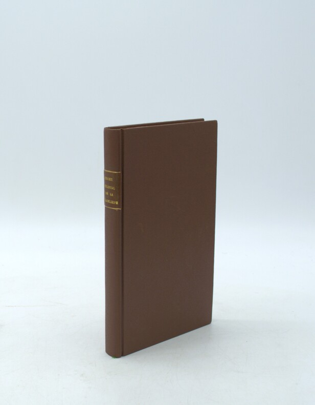
1838rif. PHO-2186Paris, Imprimerie de Guiraudet et Jouaust, 1839, in-8 (21x13cm), 2ff.-iii-425pp., percale postérieure, titre au dos, légère mouillure en marge.
FIRMIN DIDOT. NON DATE. In-4 Carré. Relié cuir dos-coins. Etat passable. Plats abîmés. Dos abîmé. Mouillures. 783 pages augmentées de nombreuses gravures en noir et blanc hors texte , sous serpente - 5 planches sur planches en couleur - MANQUE LA PLANCHE N°1. Texte sur colonnes - Traces de mouillures altérant parfoislegerement la lecture - VENDU EN L'ETAT.
rif. R320093259FIRMIN DIDOT. NON DATE. In-4. Relié cuir dos-coins. Etat passable, Plats abîmés, Dos abîmé, Mouillures. 783 pages augmentées de nombreuses gravures en noir et blanc hors texte , sous serpente - 5 planches sur planches en couleur - MANQUE LA PLANCHE N°1. Texte sur colonnes - Traces de mouillures altérant parfoislegerement la lecture - VENDU EN L'ETAT.. . . . Classification Dewey : 350-Administration publique
rif. 23112228like new. unknown
ISBN : 270282630X. QUARANTE QUATRIEME PARALLELE.. 2000. In-8 Carré. Broché. Bon état. Couv. légèrement passée. Dos satisfaisant. Intérieur frais. 223 pages.
2000rif. RO20177579FIRST EDITIONS. 2000. In-8. Broché. Etat d'usage, Couv. convenable, Dos satisfaisant, Intérieur frais. 967 pages de nombreux modeles de lettres.. . . . Classification Dewey : 350-Administration publique
1998rif. 2081002108803499Fukuoka Agricultural and Forestry Statistics Association 1998. Soft Cover. Fine. Number of books: 1 Fukuoka Agricultural and Forestry Statistics Association paperback
1953rif. 141290Couverture souple. 6 brochures de 32 pages. 10 x 15 cm.
1992rif. R260136506AU BUREAU DE LA REVUE. 1992. In-4. Broché. Bon état, Couv. convenable, Dos satisfaisant, Intérieur frais. 177 pages. Premier plat illustré en couleurs.. . . . Classification Dewey : 350-Administration publique
rif. 2080502106915765Not Available N.A. Soft Cover. Fine. The book is in fine condition. Not Available paperback
2009rif. 2081502111903469Bunbutsu 2009. Soft Cover. Fine. Number of pages: 631p Size: A4 hardcover book Bunbutsu paperback
rif. 65924Paris, sd, in-4, 323pp, broché, Très bel exemplaire! 323pp
1993rif. 268448PN. New. 1993. Soft Cover. Date is original print. This is a reprint edition . PN paperback
rif. 114594aafFédération suisse du personnel des services publics, 1980, in-8vo, 254 p., ill., brochure originale.
1927Very Good French Original wrappers. Roy. 8vo. (23 x 17.5 cm). In Ottoman script (Old Turkish with Arabic letters). 64 p. Chippings on extremities and spine, stains on back wrapper, clean interior, overall a good copy. First and only edition of this extremely rare administrative report of Diyarbakir Province after the first census of the Republican Turkey. The 1927 Turkey census was held on 28 October 1927 and became the first census in the history of the Turkish Republic. This book contains administrative results reported according to the results of this census across Diyarbakir Province. The Vilayet of Diyarbakir was created in 1867. In 1867 or 1868, Mamuret-ul-Aziz and the Kurdistan Eyalet merged with and joined the Vilayet of Diyarbakir. In 1879-80 Mamuret-ul-Aziz was separated again from the Vilayet of Diyarbakir, and turned into the Vilayet of Mamuret-ul-Aziz. It was one of the six Armenian Vilayets of the Empire. Not in Özege., Not in OCLC., Not in the National Library of Turkey.
rif. 238470LL. dd. [Paris, Quimper, Troyes et Dijon], 1790 - 1794 39 pièces in-4 ou in-8, brochées sous couvertures modernes de papier bleu imprimé. Mouillures claires à certaines pièces.
1925Very Good Turkish, Ottoman (1500-1928) Original color map. Very good and clean. Atlas folio. (73 x 59 cm). In Ottoman script. Map of New United States, Canada, Alaska; and South America. Scale: 1/35000000. Hegira: 1341 = Gregorian: 1925. Mehmed Neset Bey was born in Scutari, Istanbul. He served as colonel in World War 1 and Turkish National Struggle. He was a military origin map-maker. (Source: Savaslarda haritacilar, Harita Genel Komutanligi, Ank., 2017). Extremely rare.
1843Very Good French Original b/w map. Oblong folio. (30 x 34 cm). In French. [MAP of BATTLE of MOHACZ] Bataille de Mohacz entre Louis Roi de Hongrie et Souleman I. le 28 Aôut 1526 (20 Silkide 932). Grave par U. Muschani. Atlas des batailles et sieges pour servir a l'histoire de l'Empire Ottoman, Pl. VIII. From "Nouvel atlas physique, politique et historique de l'Empire ottoman et des États limitrophes. / dressé. par J.-J. Hellert ; revu, corrigé et accompagné d'un commentaire historique, géographique et statistique. par Ge Heck, et L[é]on Plée..." printed in 1843. Engraved. Rare.
1782Very Good French Original b/w map. Oblong folio. (25 x 37 cm). In French. Jean-Denis Barbié, dit Barbié du Bocage , né le 28 avril 1760 à Paris et mort dans cette ville le 28 décembre 1825, est un géographe et cartographe français, doyen de la Faculté de lettres de Paris, membre de l'Institut. It shows Black Sea and its shores with their old toponyms very detailed.
1927Very Good Turkish, Ottoman (1500-1928) Original color map. Chipped on folded places. Folded. Slightly toning on paper. Oblong atlas folio. (62 x 89 cm). In Ottoman script. Map of New Europe. Scale: 1/10.000.000. Gregorian: 1927. It's printed from 'Sudi Bey' Map Corpus. This was a map serie printed in the early Republican period in Turkish with Arabic letters. Very decorative map with its color flags of various countries longitudinal on right and left sides of map. Sudi printing house was an Ottoman / Turkish publisher who was one of the longest-running of Turkish publishers.
1927Very Good Turkish, Ottoman (1500-1928) Original color map. Chipped on folded places. Folded. Slightly toning on paper. Oblong atlas folio. (63 x 94 cm). In Ottoman script. Map of New Oceania. It shows Australia, Bahr-i Muhit-i Kebir, Pacific Ocean, New Zealand, Micronesia et alli. Scale: 1/20.000.000. Gregorian: 1927. It's printed from 'Sudi Bey' Map Corpus. This was a map serie printed in the early Republican period in Turkish with Arabic letters. Very decorative map with its color flags of various countries longitudinal on right and left sides of map. Sudi printing house was an Ottoman / Turkish publisher who was one of the longest-running of Turkish publishers.
1925Very Good Turkish, Ottoman (1500-1928) Original color map. Very good and clean. Atlas folio. (73 x 59 cm). In Ottoman script. Map of Oceania. It shows Australia, New Zealand, Micronesia etc. Scale: 1/20.000.000. Hegira: 1341 = Gregorian: 1925. Mehmed Neset Bey was born in Scutari, Istanbul. He served as colonel in World War 1 and Turkish National Struggle. He was a military origin map-maker. (Source: Savaslarda haritacilar, Harita Genel Komutanligi, Ank., 2017). Extremely rare.
1843Very Good French Original b/w map. Oblong folio. (30 x 34 cm). In French. [MAP of OTTOMAN CRIMEA] Crimee. Gravee par U. Muschani. Shows Crimean peninsula, shores of Black Sea, Azov Sea, Kerkinit Golf, with its old places names. From "Nouvel atlas physique, politique et historique de l'Empire ottoman et des États limitrophes. / dressé. par J.-J. Hellert ; revu, corrigé et accompagné d'un commentaire historique, géographique et statistique. par Ge Heck, et L[é]on Plée..." printed in 1843. Engraved. Rare.
1900Very Good Turkish, Ottoman (1500-1928) Original color map on cloth. Oblong: 67x75 cm. In Ottoman script. Folded originally. A very detailed map. Scale: 1:210.000. Shows Shkodra Lake, its shores, Bog Mountains, Karadag (Montenegro), Iakoh, Has etc. [MAP of OTTOMAN PROVINCE of BALKANS-ALBANIA] 52 Ipek (Peja). 53 Yakoh. 59 Akola. 60 Iskodra (Shkodra).
1890Very Good Turkish, Ottoman (1500-1928) Original color map. Folded. Very good. Large oblong 8vo. (21 x 26 cm). In Ottoman script. [MAP of OTTOMAN PROVINCE of DIYAR-I BEKR] Diyarbakir Vilâyeti. Province of Diyarbekir in Southeast Anatolia and its around. Many sandjaks and provinces with their detailed place names. Scale: 1/500.000.