7490 risultati
1890Very Good Turkish, Ottoman (1500-1928) Original color map. Folded. Very good. Large oblong 8vo. (21 x 26 cm). In Ottoman script. [MAP of OTTOMAN PROVINCE of DIYAR-I BEKR] Diyarbakir Vilâyeti. Province of Diyarbekir in Southeast Anatolia and its around. Many sandjaks and provinces with their detailed place names. Scale: 1/1.500.000.
1890Very Good Turkish, Ottoman (1500-1928) Original color map. Folded. Very good. Large oblong 8vo. (21 x 26 cm). In Ottoman script. [MAP of OTTOMAN PROVINCE of EASTERN ROUMELI] Rumeli-yi Sarkî Vilâyeti, Bulgaristan Eyâleti, Edirne Vilâyeti, [Trakya], Selânik Vilâyeti. [East Roumeli, Salonica, Adrianople provinces; Old Zagra Sandjak, Bulgarian State]. Scale: 1/1.500.000. Ottoman Provinces in the Balkan Peninsula.
1890Very Good Turkish, Ottoman (1500-1928) Original color map. Folded. Very good. Large oblong 4to. (19 x 37 cm). In Ottoman script. [MAP of OTTOMAN PROVINCE of ERZURUM] Erzurum Vilâyeti. Province of Erzurum of east Anatolia and its around. Many sandjaks and provinces with their detailed place names. Scale: 1/1.500.000.
1890Very Good Turkish, Ottoman (1500-1928) Original color map. Folded. Very good. Oblong 4to. (21 x 42 cm). In Ottoman script. [MAP of OTTOMAN PROVINCE of KONIA] Konya Vlâyeti and around; Burdur, Isparta, Teke sandjaks, Hüdavendigâr Province Tozlu Ova, Tuz Gölü etc. Scale: 1/500.000.
1890Very Good Turkish, Ottoman (1500-1928) Original color map. Folded. Very good. Large oblong 8vo. (26 x 26 cm). In Ottoman script. [MAP of OTTOMAN PROVINCE of SIVAS] Sivas Vilâyeti, Trabzon Vilâyeti, Tokat Sancagi. [Sivas and Trabzon Provinces, Tokat Sandjak]. Scale: 1/1.500.000.
1890Very Good Turkish, Ottoman (1500-1928) Original color map. Folded. Very good. Obblong 4to. (21 x 38 cm). In Ottoman script. Scale:: 1/500.000. [MAP of OTTOMAN PROVINCE of TREBIZOND] Trabzon Vilâyeti, Trabzon Sancagi, Canik Sancagi, Sivas Vilâyeti. [Provinces of Trabzon and Sivas; Canik and Trebizond Sandjak]. Black Sea at north.
1890Very Good Turkish, Ottoman (1500-1928) Original color map. Folded. Very good. Large oblong 8vo. (21 x 26 cm). In Ottoman script. [MAP of OTTOMANT SALONICA -THESSALONIKI-] Selânik Vilâyeti. Ottoman Greece. Scale: 1/1.500.000. It shows Thessaloniki and its around. Manastir Vilayat, At north Kosovo, Siroz Sandjak etc.
rif. 166259Paris, 1819-1833 11 pièces en un vol. in-8, basane fauve racinée, dos lisse orné de filets, guirlandes et larges fleurons dorés, tranches mouchetées (reliure de l'époque). Accrocs en coiffe sup., dos un peu frotté.
rif. 164103LL. dd., 1815-1820 8 pièces en un vol. in-folio, demi-basane fauve, dos lisse, coins en vélin (reliure de l'époque). Manques de cuir aux deux coiffes sur 3 cm.
1897Very Good Turkish, Ottoman (1500-1928) Original engraved map on the silk handkerchief made in Yildiz Palace for the 'Iane Sergisi' [i.e. Exhibition of the Social Assistance] in the period of Sultan Abdülhamid II. In its decorative frame. Frame size: 53,5x53,5 cm; map size: 38x38 cm. In Ottoman script. Scale: 1/600.000. Several minimal splits, minor foxing, and slight stains on cloth. Otherwise in good condition. A rare and decorative 1897 silk handkerchief map of the Greco-Turkish War in 1897, which was the only war in which the Ottoman army was victorious during the reign of Abdulhamid 2, is a fine example of Ottoman / Turkish cartographic textiles made in Ottoman court (Yildiz Palace textile workshops). This beautiful map depicts an attractive war scene from the 1313 Greek War on the upper half, and it's engraved a map of Balkan & Greek lands on its lower half. War painting has 'Melona' signature in Ottoman script. The map shows Thessaloniki [i.e. Salonica] Bay on the west; Yanya [i.e. Ioanna] Vilayat on the east; lands of Greece, Galos Bay, Uzi Strait on the south and Dimetoka and Avalonia areas in the Serefiye, Ergiri sanjaks on the north in its period. Written on the map, "Baht-i himâye-yi feyzvâne-i cenâb-i hilâfetpenâhide evlad-i süheda ve mecrûhin-i asakir-i sâhâne", [i.e. It was printed for the "Iane Sergisi" (i.e. The Social Help Exhibition) in the high memory of our soldiers who were martyred and veterans in the Greek War under the patronage of the Sultan.]. The Greco-Turkish War of 1897, also called the Thirty Days' War and known in Greece as the Black '97 (Mauro '97), or the Unfortunate War (Atychis polemos), was a war fought between the Kingdom of Greece and the Ottoman Empire. Its immediate cause was the question over the status of the Ottoman province of Crete, whose Greek majority long-desired union with Greece. Despite the Ottoman victory on the field, an autonomous Cretan State under Ottoman suzerainty was established the following year (as a result of the intervention of the Great Powers after the war), with Prince George of Greece and Denmark as its first High Commissioner. This was the first war effort in which the military and political personnel of Greece were put to test since the Greek War of Independence in 1821. For the Ottoman Empire, this was also the first war effort in which the reorganized military personnel were put to test. The Ottoman army was under the guidance of a German military mission led by Colmar Freiherr von der Goltz, who had reorganized it after the defeat in the Russo-Turkish War (1877-1878). The conflict proved Greece was wholly unprepared for war. Plans, fortifications and weapons were non-existent, the mass of the officer corps was unsuited to its tasks, and training was inadequate. As a result, the numerically superior, better organized, equipped and led Ottoman forces pushed the Greek forces south out of Thessaly. Almost all of the aids made to the families or disabled people of those who were martyred in the 1897 Ottoman-Greek War (such as printing this map) were made within the framework of the donations of "Evlâd-i Süheda and Malûlîn-i Guzât-i Asâkir-i Sahane". People and citizens of all classes and beliefs, including members of the Ottoman court, ministers, bureaucrats, civil servants, merchants and tradesmen, participated in this aid campaign at the end of the 19th, beginning of the 20th century. Not in OCLC.
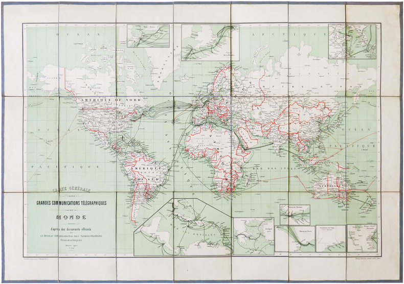
1901rif. LBW-6826Berne, Kartographische Anstalt Lips, 1901. En 21 sections montées sur toile gris-bleu et pliées, formant une carte de 468 x 668 mm ; étiquette au dos portant le titre manuscrit.
1976rif. 2080502106910829Not Available 1976. Soft Cover. Fine. The book is in fine condition. Not Available paperback
1976rif. 2080502106912453Not Available 1976. Soft Cover. Fine. The book is in fine condition. Not Available paperback
rif. 2508P-13998A-1506EGovernment Printing Office 2017-11-15. paperback. Very Good. 7x0x10. This Book is in Very Good condition. See our picture for exact item you will receive. All items ship within 24 hours. Packaging is 100% Recyclable. Most items purchased from Charitable organizations. A portion of each sale is also donated to a monthly charity check your package for this month's charity. Reuse-Recycle-Rebook! Government Printing Office paperback
1941rif. TB33750Washington DC: U.S. Department of the Interior National Park Service WPA and CCC 1941. First Edition. Both volumes of this complete two volume set are in very good and near fine conditions. Both are small quartos of 10 1/4 by 7 3/4 inches bound in adhesive bindings in light brown cloth covered boards with darker brown text on the spines and front boards. The cloth at the head and heel of volume I is rubbed and worn and the upper fore corners of the front and rear boards are bumped but professionally straightened and strengthened. Volume II shows only light wear to the cloth at the head of the spine and the text block for this volume was made from two-hole punched paper. Volume I is made from standard un-holed paper. Both volumes contain four index tabs each. In volume I: Northwest Inland States; Pacific States; Yellowstone; and Yosemite; Volume II: Central States Southwestern National Monuments; Southwestern States; and Territorial Parks and Monuments. These two volumes contain 664 pages of bibliographies on 79 national parks and national monuments each one with its own pagination. This bibliography is not listed in any of the WPA or American Guide resources held by Town's End Books. OCLC locates only five institutions owning the book version of this title. The forward contained in volume I mentions that this project started in 1936 with: where "much credit is due Mrs. Hazel Hunt Voth for originally laying out the program and directing it until her resignation in April 1939." Hazel Voth's other other major accomplishment was A Bibliography of Yellowstone National Park which is reprinted in this set. U.S. Department of the Interior, National Park Service, WPA and CCC hardcover
1961rif. 714548PN. New. 1961. Soft Cover. Date is original print. This is a reprint edition. . PN paperback
1961rif. 714549PN. New. 1961. Soft Cover. Date is original print. This is a reprint edition. . PN paperback
1915rif. 3478513Cambridge, Harvard University Press, 1915. XIII, 472 S. Lwd.
1941rif. TB33750Washington DC: U.S. Department of the Interior National Park Service WPA and CCC 1941. First Edition. Both volumes of this complete two volume set are in very good and near fine conditions. Both are small quartos of 10 1/4 by 7 3/4 inches bound in adhesive bindings in light brown cloth covered boards with darker brown text on the spines and front boards. The cloth at the head and heel of volume I is rubbed and worn and the upper fore corners of the front and rear boards are bumped but professionally straightened and strengthened. Volume II shows only light wear to the cloth at the head of the spine and the text block for this volume was made from two-hole punched paper. Volume I is made from standard un-holed paper. Both volumes contain four index tabs each. In volume I: Northwest Inland States; Pacific States; Yellowstone; and Yosemite; Volume II: Central States Southwestern National Monuments; Southwestern States; and Territorial Parks and Monuments. These two volumes contain 664 pages of bibliographies on 79 national parks and national monuments each one with its own pagination. This bibliography is not listed in any of the WPA or American Guide resources held by Town's End Books. OCLC locates only five institutions owning the book version of this title. The forward contained in volume I mentions that this project started in 1936 with: where "much credit is due Mrs. Hazel Hunt Voth for originally laying out the program and directing it until her resignation in April 1939." Hazel Voth's other other major accomplishment was A Bibliography of Yellowstone National Park which is reprinted in this set. U.S. Department of the Interior, National Park Service, WPA and CCC hardcover books
1940rif. 10778Boston: Historical Records Survey 1940. Wrappers. Very Good binding. Quarto. 2 v 1 165 1 pp. Side-stapled in paper wrappers. An indifferent copy with general and light toning throughout; previous owner bookplate covering an early owner name else contents clean. The publication indexes records found in Richmond VA by Rev. William H. Ryder after the fall of Richmond April 2 1865. Historical Records Survey unknown
1939rif. pl189-75Sponsored by the University of Louisville 1939. Hardcover. Used - Good. Year: 1939. Publisher: Uni of Louisville. This preowned item is in good condition with some visible wear and tear marks. This item may have some visible damage such as corner dings small tears/rips bent pages scuffs or scratches etc. Clean text. Sponsored by the University of Louisville hardcover
1939rif. w776-1Sponsored by the University of Louisville 1939. Hardcover. Used - Very Good. Year: 1939. This preowned item is in very good condition with very minimal wear and tear visible ex. Corner dings small tears/rips bent pages scuffs/scratches etc. This item includes library markings including stickers barcodes. Additional materials such as CD's and access codes may or may not be included. If the book has a dust jacket it may not be included. Free tracking provided. International shipping available. Sponsored by the University of Louisville hardcover
1939rif. 180461Louisville: Sponsored by the University of Louisville 1939. Hardcover. xv 301p. foreword preface appendixes bibliography index illustrated with b&w photos gift inscription otherwise a very good first edition stated in wine cloth and gilt. American Guide Series. Dykes 112 Powell 569. Sponsored by the University of Louisville hardcover
1939rif. 180461Louisville: Sponsored by the University of Louisville 1939. Hardcover. xv 301p. foreword preface appendixes bibliography index illustrated with b&w photos gift inscription otherwise a very good first edition stated in wine cloth and gilt. American Guide Series. Dykes 112 Powell 569. Sponsored by the University of Louisville hardcover books