[Empire State Building]Biblio.com
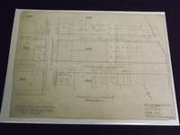
1929réf. 101409Architectural diagram plans for the construction of the Empire State Building. 8 items all pencil on paper or tracing vellum various sizes ranging from 8x13 inches to 36x48 inches. Included are 5 plot plans showing the building's outline and the surrounding streets and properties 5 section plans of existing vaults and the machine room 2 sub-basement plans and the details of the pit for the refrigeration unit. Condition varies but is generally very good; most of the plans have minor folds or tears in the margins. The freight elevator plan has some tape repairs on the reverse but is not obtrusive. A plan showing a map of 34th and 33rd Streets has the most damage with tears in the margin some pieces missing and some significant wrinkling; probably the least important plan in this collection. Eight of the plans will be shipped rolled. The 102 story landmark Empire State Building was completed in 1931 on the former site of the original Waldof-Astoria Hotel. The cost of construction was about $41 million estimates suggest that today's cost would be close to $600 million and was completed in less than a year and a half. The building was designed by William Lamb of Shreve Lamb and Harmon whose plans are included in this collection. Considered as the "Eight Wonder of the World" when it opened the building has had its share of notoriety both good and bad. Suicides a shooting on the observation deck and even a plane crashing into it in 1945 have been part of the dark side of the building's history. However this iconic art deco building is as popular as ever and probably one of the busiest tourist attractions in New York City. One of the most significant parts of this architectural collection is the plan for the rather famous information desk. Other parts include plans for the sub-basement the machine room pit for the freight elevators and refrigeration unit and several plans illustrating the building's outline on the surrounding streets. A unique collection of New York City history. History1900s about website.
1929réf. 101409Architectural diagram plans for the construction of the Empire State Building. 8 items all pencil on paper or tracing vellum various sizes ranging from 8x13 inches to 36x48 inches. Included are 5 plot plans showing the building's outline and the surrounding streets and properties 5 section plans of existing vaults and the machine room 2 sub-basement plans and the details of the pit for the refrigeration unit. Condition varies but is generally very good; most of the plans have minor folds or tears in the margins. The freight elevator plan has some tape repairs on the reverse but is not obtrusive. A plan showing a map of 34th and 33rd Streets has the most damage with tears in the margin some pieces missing and some significant wrinkling; probably the least important plan in this collection. Eight of the plans will be shipped rolled. The 102 story landmark Empire State Building was completed in 1931 on the former site of the original Waldof-Astoria Hotel. The cost of construction was about $41 million estimates suggest that today's cost would be close to $600 million and was completed in less than a year and a half. The building was designed by William Lamb of Shreve Lamb and Harmon whose plans are included in this collection. Considered as the "Eight Wonder of the World" when it opened the building has had its share of notoriety both good and bad. Suicides a shooting on the observation deck and even a plane crashing into it in 1945 have been part of the dark side of the building's history. However this iconic art deco building is as popular as ever and probably one of the busiest tourist attractions in New York City. One of the most significant parts of this architectural collection is the plan for the rather famous information desk. Other parts include plans for the sub-basement the machine room pit for the freight elevators and refrigeration unit and several plans illustrating the building's outline on the surrounding streets. A unique collection of New York City history. History1900s about website. books
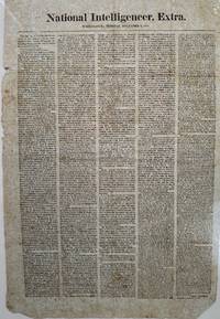
1817réf. 68171Washington 1817. Broadside newspaper extra 52 x 34 cm. printed in five columns. "This day at 12 o'clock the President of the United States transmitted." Apparently the first printing of Pres. James Monroe's first State of the Union address done on the day he submitted it to Congress. Old fold lines a bit of spotting some shallow chipping along left margin not affecting text. No copies located of this edition and no other separate printings found. Pres. Monroe discusses foreign and domestic affairs including the "expedition. set on foot against East Florida by persons claiming to act under the authority of some of the colonies who took possession of Amelia Island. the island being made a channel for the illicit introduction of slaves from Africa into the United States." By the end of the month Monroe would send both a small naval force and an army detachment to take possession of the island. He also mentions the land cessions by Native tribes in the Northwest including parts of Ohio Indiana and Michigan; also cessions by the Cherokee in the southern state of Georgia with arrangements for more territory to be ceded in North Carolina and Tennessee and in Alabama Territory. unknown
1817réf. 68171Washington 1817. Broadside newspaper extra 52 x 34 cm. printed in five columns. "This day at 12 o'clock the President of the United States transmitted." Apparently the first printing of Pres. James Monroe's first State of the Union address done on the day he submitted it to Congress. Old fold lines a bit of spotting some shallow chipping along left margin not affecting text. No copies located of this edition and no other separate printings found. Pres. Monroe discusses foreign and domestic affairs including the "expedition. set on foot against East Florida by persons claiming to act under the authority of some of the colonies who took possession of Amelia Island. the island being made a channel for the illicit introduction of slaves from Africa into the United States." By the end of the month Monroe would send both a small naval force and an army detachment to take possession of the island. He also mentions the land cessions by Native tribes in the Northwest including parts of Ohio Indiana and Michigan; also cessions by the Cherokee in the southern state of Georgia with arrangements for more territory to be ceded in North Carolina and Tennessee and in Alabama Territory. unknown books
1915réf. 4045Boston Mass: A. Williams & Co./Houghton Mifflin 1915. Hardcovers. all VG except for vols. 3 & 7: G. 8vos 9.25"x6.25". Brown coated cloth-covered boards with giltstamped titles. General shelfwear to roughly all volumes: rubbed corners edges spine extremes. Gilt-loss to the spines of several volumes. Pen and pencil marks to some front endpapers. Endpapers cracking at hinges to vols.: 1 3 4-6 8-9 and 12. Front hinge of vol. 7 cracked front and back hinges of vol. 3 cracked. Covered in rubbed seller's mylar. Pages toned. B&W plates and fold-out maps throughout some in color. Extra shipping will be charged due to weight. A. Williams & Co./Houghton Mifflin hardcover
1904réf. 8792San Francisco: Whitaker & Ray Company 1904. First Edition. Hardcover. Good. Whitaker & Ray Company San Francisco 1904. First Edition. Covers reinforced at the outer edges and spine with white tape. First free end-paper missing. Front hinge separated from the text. Moderate foxing to a few pages most pages clean and bright. -- A Juvenile book of jingles characteristic of the west. Contains jingles on such subjects as the Chinaman Cliff House Golden Gate Park etc. Beautifully illustrated by 19 full page seven color litho-prints. -- One edition published in 1904 in English and held by 2 libraries worldwide. Size: Quarto. 39 pages not numbered. -- Condition:. Whitaker & Ray Company hardcover
1881réf. 10532Las Vegas N.M.: Imprenta Del Rio Grande 1881. First Edition. Good condition. 8vo. handcrafted leather binding self bound frontis portrait pp. 292 errata page. -- Author's name written in pencil on the title page; appears to be a crude attempt to copy the authors signature. I doubt it is authentic. Last blank leaf has writing in pencil in Spanish. Printed pastedown inside rear cover mostly complete; top part in Spanish and last paragraph in English. the English part commends the work of the author Estanislao N. Ronquilla. Imprenta Del Rio Grande unknown
1820réf. 105055Archive contains more than 5o items including letters manifests printed and manuscript and pay vouchers etc. in a loose-leaf binder. Some light wear and creasing some minor chips and fold tears normal aging and toning; overall about fine.This is a fairly large archive of the career of Captain Paul Ambrose Oliver c1796-c1848 and his ships the "Louisiana" the "Tiber' and the "Trenton". The archive includes manifests for the shipment of sugar cigars and coffee from Havana to New Orleans St. Petersburg Hamburg and London. One key item is a partially printed Bill of Sale for the Ship "Tiber" dated January 13 1834 for $21500. There is also an estimate for repairs to the "Tiber' dated November 6 1836. The earliest document is dated September 14 1829 and while most of the other documents are between the late 1820s to the 1840s the archive includes some items that are later. There is a letter to his son Brigadier-General and Medal of Honor recipient Paul A. Oliver dated March 29 1869 there is also a copy of the Last Will and Testament of the younger Oliver done in 1911. General Oliver was actually born on his father’s ship the "Louisiana’". There are numerous pay vouchers and receipts from what appears to be a successful career. There is even a rare book list and the burial confirmation for Captain Oliver dated September 17 1849. Other interesting items include a family tree for the Olivers some family letters including a letter to his sons several receipts concerning coffee shipments and a number of ship manifests from various places. Over 50 documents in the collection.
1820réf. 105055Archive contains more than 5o items including letters manifests printed and manuscript and pay vouchers etc. in a loose-leaf binder. Some light wear and creasing some minor chips and fold tears normal aging and toning; overall about fine.This is a fairly large archive of the career of Captain Paul Ambrose Oliver c1796-c1848 and his ships the "Louisiana" the "Tiber' and the "Trenton". The archive includes manifests for the shipment of sugar cigars and coffee from Havana to New Orleans St. Petersburg Hamburg and London. One key item is a partially printed Bill of Sale for the Ship "Tiber" dated January 13 1834 for $21500. There is also an estimate for repairs to the "Tiber' dated November 6 1836. The earliest document is dated September 14 1829 and while most of the other documents are between the late 1820s to the 1840s the archive includes some items that are later. There is a letter to his son Brigadier-General and Medal of Honor recipient Paul A. Oliver dated March 29 1869 there is also a copy of the Last Will and Testament of the younger Oliver done in 1911. General Oliver was actually born on his father’s ship the "Louisiana’". There are numerous pay vouchers and receipts from what appears to be a successful career. There is even a rare book list and the burial confirmation for Captain Oliver dated September 17 1849. Other interesting items include a family tree for the Olivers some family letters including a letter to his sons several receipts concerning coffee shipments and a number of ship manifests from various places. Over 50 documents in the collection. books
1856réf. 40406Philadelphia 1856. Folio broadside 13" x 18-1/2." Printed in five columns beneath the caption title. Lightly toned with scattered spotting and several shallow chips at blank margins. Good. Signed in type at the end by "Charles Gibbons Chairman of Rep. State Ex. Committee Philadelphia Oct. 20 1856." This rare broadside prints the Address of Pennsylvania's Republican State Executive Committee "To the People of Pennsylvania." It reports Republicans' efforts to form an alliance with members of the American or Know-Nothing Party who are "opposed to the extension of slavery and to the election of Mr. Buchanan to the Presidency." The broadside demonstrates the chaotic rearrangements of Party affiliations in this crucial election year: the Whig Party was on the verge of extinction destroyed by the growing sectional conflict over slavery; and the Know Nothings under former President Fillmore sought to fill the void. The Committee warns that "Mr. Fremont and Mr. Fillmore are therefore rival candidates." The Committee urges "Friends of liberty" to vote the Fremont ticket "If you would check the extension of slavery and assert the worth and dignity of free labor." The Library of Congress is the only location recorded by OCLC. Its title Control No. 2021768425 reverses the placement of our second and third sentences. We have located no other copies. Not in Sabin Eberstadt Decker. Not at AAS. OCLC 1280407366 1- DLC as of December 2024. unknown
1856réf. 40406Philadelphia 1856. Folio broadside 13" x 18-1/2." Printed in five columns beneath the caption title. Lightly toned with scattered spotting and several shallow chips at blank margins. Good. Signed in type at the end by "Charles Gibbons Chairman of Rep. State Ex. Committee Philadelphia Oct. 20 1856." This rare broadside prints the Address of Pennsylvania's Republican State Executive Committee "To the People of Pennsylvania." It reports Republicans' efforts to form an alliance with members of the American or Know-Nothing Party who are "opposed to the extension of slavery and to the election of Mr. Buchanan to the Presidency." The broadside demonstrates the chaotic rearrangements of Party affiliations in this crucial election year: the Whig Party was on the verge of extinction destroyed by the growing sectional conflict over slavery; and the Know Nothings under former President Fillmore sought to fill the void. The Committee warns that "Mr. Fremont and Mr. Fillmore are therefore rival candidates." The Committee urges "Friends of liberty" to vote the Fremont ticket "If you would check the extension of slavery and assert the worth and dignity of free labor." The Library of Congress is the only location recorded by OCLC. Its title Control No. 2021768425 reverses the placement of our second and third sentences. We have located no other copies. Not in Sabin Eberstadt Decker. Not at AAS. OCLC 1280407366 1- DLC as of December 2024. unknown books
1928réf. 22040Paris, René Kieffer, 1928. In-8 oblong, plein maroquin caramel, dos à nerfs orné de fleurons estampés, riche plaque estampée à froid aux plats (Rose des vents, saxophone, etc), tête dorée, couvertures et dos conservés. Reliure de René Kieffer avec son étiquette.
1959réf. 3460[Alès], [PAB], [1959]. In-4 de 66-[4] pages. Plein maroquin rouge, dos lisse, tête dorée, couverture et dos conservés, sous chemise de demi-maroquin rouge et étui cartonné rouge.
1997réf. ZB394759Tinnitus Center the State University of New York 1997-1998. Price HAS BEEN REDUCED by 10% until Monday Nov. 2 weekend sale item volumes 3-4. 1997-1998. partly bound library markings textually clean & tight PRICE IS FOR THE LOT. - If you are reading this this item is actually physically in our stock and ready for shipment once ordered. We are not bookjackers. Buyer is responsible for any additional duties taxes or fees required by recipient's country. Photos available upon request. Tinnitus Center, the State University of New York unknown
1913Very Good Turkish, Ottoman (1500-1928) Full leather new bdg. Original illustrated cover saved inside. Roy. 8vo. (24 x 17 cm). In Ottoman script (Old Turkish with Arabic letters). [12], 166, [2] p., b/w and color plates of Ottoman warships and scenes from naval wars, seven maps of the earliest examples of Ottoman cartography. Very rare second edition of this book on the history of Ottoman naval wars against Venetians began with the Crete campaign (War of Candia) in 1645 and lasted for years until 1656. The book was published first in 1729 in Müteferrika Printing House which was the first printing house in the Islamic world as the third printed book. This is the second edition including five maps of almost the same size (two paged) titled world map, The Mediterranean, The Archipelago (Aegean), The Adriatic Sea, and the compass-like in its first edition as well as two maps and twenty-six plates (some of them are color) and small illustrations of Ottoman ships as head of some carriage returns. Additional maps depict the city of Venice (from Kitab-i Bahriye [i.e. Book of Navigation) and the travels of Ottoman Admiral Sidi Ali Reis through the Sea of Oman. The Cretan War or the Fifth Ottoman-Venetian War, was a conflict between the Republic of Venice and her allies (chief among them the Knights of Malta, the Papal States, and France) against the Ottoman Empire and the Barbary States because it was largely fought over the island of Crete, Venice's largest and richest overseas possession. This account of Ottoman maritime warfare in Turkish, written in Safer 1067/November 1656. This date places the book in a moment of utmost danger for the Ottoman capital following the defeat of the Ottoman navy at the hands of the Venetians at the Dardanelles (4 Ramadan 1066/26 June 1656) and the subsequent loss of the islands of Lemnos and Tenedos. It is also written shortly after the appointment of Köprülü Mehmed Pasha as grand vizier (25 Dhulqada 1066/14 September 1656). Thus it is suggested to read it as a program of reform of the navy intended for a person whom Hadji Khalfa might have seen as the "man of the sword" who might revert the fate of the Empire. Of the four ulemâ [i.e. scholars] who wrote endorsements for the book, two are closely related to the Köprülü family. The first part is a history of Ottoman maritime campaigns from the beginning to 1067/1656, while the second is a systematic description of naval affairs, from administration and offices to shipbuilding, culminating in a list of 40 suggestions for the organization and strategy of the Ottoman navy, including the use of recent scientific and technological innovations. Thus the juxtaposition with history provides an argument for reform. Suggestions are largely centered around the traditional qanun-i qadim; there is no reference to high-board ships. The final pages include an important discussion of historical causality, explaining how divine omnipotence creates the consequence of historical causes, in reward for the righteous rule, or punishment of injustice. (Source: Ottomanhistorians). Özege 21273.
1895Very Good Turkish, Ottoman (1500-1928) Original handsome brown quarter leather binding with Ottoman lettered gilt to spine. Five raised bands to spine, separated from each other with lined gilt. Slight stains on the title page. Else a fine copy. Roy. 8vo. (23 x 16 cm). In Ottoman script (Old Turkish with Arabic letters). 99 p. Hegira: 1313 = Gregorian: 1895. Extremely rare first printed edition of this one of the earliest travel accounts, of an Ottoman admiral's early expeditions to the Indian Ocean, Arabian Sea, Red Sea, and Persian Gulf to counter Portuguese piracy and attacks on Muslim pilgrim ships, which describes the lands he has seen during his voyage from India to Constantinople by Sidi (Seydi) Ali Reis (1498-1563) sent by Sultan Suleiman the Magnificent covering the years 1553-1556. During these naval wars, after two marine battles against the Portuguese fleet and a great storm named The Elephant Typhoon (Tufan-i Fil) by the locals, Reis' remaining six galleys drifted to India. The fleet was unserviceable, resulting in his return home overland with 50 men. Reis then arrived at the royal court of the Mughal Emperor Humayun in Delhi, where he met the future Mughal emperor Akbar, who was twelve years old at the time. He returned to the Ottoman Land over Muslim states in South Asia; Afghanistan, Central Asia, and Iran. But he delayed his return because of the war between the Ottoman and the Safavid Empires in Iran. Finally, following the treaty of Amasya in 1555, he was able to return home and present his book of this narrative journey to the Sultan in 1557. This work offers an extensive insight into the Muslim situation in 16th century South and Central Asia and the Middle East, Islamic navigation, and Turkish - Portuguese relations as well as Persian, Afghan, and Indian geography, naval routes, flora, and fauna. Seydi Ali Reis, formerly also written Sidi Ali Reis and Sidi Ali Ben Hossein, was an Ottoman admiral and navigator. Known also as Katib-i Rumi, Galatali, or Sidi Ali Çelebi, he commanded the left wing of the Ottoman fleet at the naval Battle of Preveza in 1538. He was later promoted to the rank of fleet admiral of the Ottoman fleet in the Indian Ocean, and as such, encountered the Portuguese forces based in the Indian city of Goa on several occasions in 1554. Seydi was able to unite several Muslim countries on the coast of the Arabian Sea (such as the Makran Kingdom, Gujarat Sultanate, and Adal Sultanate) against the Portuguese. He is famous today for his books of travel such as the Mir'ât ül Memâlik [i.e. The Mirror of Countries], and his books of navigation and astronomy, such as the Mir'ât-i Kâinât (Mirror of the Universe) and the Kitâb ül Muhit: El Muhit fî Ilmi'l Eflâk ve'l Buhûr [i.e. Book of the Regional Seas and the Science of Astronomy and Navigation] which contain information on navigation techniques, methods of determining direction, calculating time, using the compass, information on stars, sun and moon calendars, wind and sea currents, as well as portolan information regarding the ports, harbours, coastal settlements and islands in the various regions of the Ottoman Empire. His books are translated into numerous languages including English, French, Italian, German, Greek, Arabic, Persian, Urdu, Russian, and Bengali, and are considered among the finest literary works dating from the Ottoman period. "When Sultan Suleiman had taken up his winter residence in Aleppo, I, the author of these pages, was appointed to the Admiralship of the Egyptian fleet and received instructions to fetch back to Egypt the ships (15 galleys), which some time ago had been sent to Basrah on the Persian Gulf. But, 'Man proposes, God disposes.' I was unable to carry out my mission, and as I realized the impossibility of returning by water, I resolved to go back to Turkey by the overland route, accompanied by a few tried and faithful Egyptian soldiers. I traveled through Gujarat, Hind, Sind, Balkh, Zabulistan, Bedakhshan, Khotlan, Turan, and Iran
réf. 27328St. Paul & Philadelphia 1860-1920. Volume I 1902 being a republication of the original "Annals" all scarce in original editions 1850-56; Vol. II 1889 a republication of Major Stephen H. Long's Voyage in a Six-Oared Skiff to the Falls of St. Anthony in 1817 with Introductory Note by Edward D. Neill Phila. 1860 see Howes L-445; Vol. III 1880 containing the Relation of M. Penicault Levenworth's Expedition to Fort Snelling in 1819 A Reminiscence of Fort Snelling by Charlotte Ouisconsin Van Cleve and numerous other titles; Vol. IV 1876 Fletcher Williams' History of St. Paul; Vol. V 1885 Edward D. Neill's excellent History of the Ojibways; Vol. VI 1887 containing Baker's The Sources of the Mississippi; Williams' The Protestant Missions in the Northwest and Hill's Indian Mounds in Dakota Minnesota and Wisconsin etc.; Vol. VII 1893 J.V. Brower's The Mississippi River and its Source with a large and detailed folding map of the headwaters ton but no loss; presentation copy from the author; Vol. VIII 1898 Upham's Settlement and Development of the Red River Valley Grant's The International Boundary between Lake Superior and The Lake of the Woods Winchell's Minnesota's Northern Boundary etc.; Vol. IX 1901 Baker's History of Transportation of Minnesota Gilfillan's The Ojibways Flandreau's Reminiscences of Minnesota during the Territorial Days etc.; Vol. X parts 1 and 2 1905 Lamphere's History of Wheat in the Red River Valley Rogers' History of Flour Manufacture in Minnesota Hughes' History of Steamboating on the Minnesota River Upham's Groseilliers and Radisson the First White Men in Minnesota etc. ; Vol. XI 1904 Brower's Itasca State Park an Illustrated History; Vol. XII 1908 Gilfillan's History of the University of Minnesota Murray's Recollections of Early Territorial Days Johnson's Minnesota Journalism etc; vol. XIII 1908 James H. Baker's Lives of the Governors of Minnesota; Vol. XIV 1912 Warren Upham & Rose Dunlap's excellent Minnesota Biographies 1655-1912; vol. XV 1915 Saby's Railroad Legislation in Minnesota Randall's The Beginnings of Railroad Building in Minnesota Daniels' Reminiscences of the Little Crow Uprising etc.; Vol. XVI part 1 1913 all published - Winchell's The Weathering of Aboriginal Stone Artifacts and A Consideration of the Paleoliths of Kansas; and vol. XVII 1920 Upham's Minnesota Geographic Names. Includes scores of historical essays by other known historians including Sibley Ramsey Langford Flandreau Mayo and others. Orig. brown green or terracotta cloth Browner in half morocco joints cracked; some chipping and fading some pages browning but generally very good or better with a number of plates and maps throughout some folding. unknown
réf. 27328St. Paul & Philadelphia 1860-1920. Volume I 1902 being a republication of the original "Annals" all scarce in original editions 1850-56; Vol. II 1889 a republication of Major Stephen H. Long's Voyage in a Six-Oared Skiff to the Falls of St. Anthony in 1817 with Introductory Note by Edward D. Neill Phila. 1860 see Howes L-445; Vol. III 1880 containing the Relation of M. Penicault Levenworth's Expedition to Fort Snelling in 1819 A Reminiscence of Fort Snelling by Charlotte Ouisconsin Van Cleve and numerous other titles; Vol. IV 1876 Fletcher Williams' History of St. Paul; Vol. V 1885 Edward D. Neill's excellent History of the Ojibways; Vol. VI 1887 containing Baker's The Sources of the Mississippi; Williams' The Protestant Missions in the Northwest and Hill's Indian Mounds in Dakota Minnesota and Wisconsin etc.; Vol. VII 1893 J.V. Brower's The Mississippi River and its Source with a large and detailed folding map of the headwaters ton but no loss; presentation copy from the author; Vol. VIII 1898 Upham's Settlement and Development of the Red River Valley Grant's The International Boundary between Lake Superior and The Lake of the Woods Winchell's Minnesota's Northern Boundary etc.; Vol. IX 1901 Baker's History of Transportation of Minnesota Gilfillan's The Ojibways Flandreau's Reminiscences of Minnesota during the Territorial Days etc.; Vol. X parts 1 and 2 1905 Lamphere's History of Wheat in the Red River Valley Rogers' History of Flour Manufacture in Minnesota Hughes' History of Steamboating on the Minnesota River Upham's Groseilliers and Radisson the First White Men in Minnesota etc. ; Vol. XI 1904 Brower's Itasca State Park an Illustrated History; Vol. XII 1908 Gilfillan's History of the University of Minnesota Murray's Recollections of Early Territorial Days Johnson's Minnesota Journalism etc; vol. XIII 1908 James H. Baker's Lives of the Governors of Minnesota; Vol. XIV 1912 Warren Upham & Rose Dunlap's excellent Minnesota Biographies 1655-1912; vol. XV 1915 Saby's Railroad Legislation in Minnesota Randall's The Beginnings of Railroad Building in Minnesota Daniels' Reminiscences of the Little Crow Uprising etc.; Vol. XVI part 1 1913 all published - Winchell's The Weathering of Aboriginal Stone Artifacts and A Consideration of the Paleoliths of Kansas; and vol. XVII 1920 Upham's Minnesota Geographic Names. Includes scores of historical essays by other known historians including Sibley Ramsey Langford Flandreau Mayo and others. Orig. brown green or terracotta cloth Browner in half morocco joints cracked; some chipping and fading some pages browning but generally very good or better with a number of plates and maps throughout some folding. unknown books
réf. 50894Minneapolis: Vermillion Editions 1987. Edition limited to 40 copies consisting of 5 printer's proofs and 35 in the edition this copy no. 11; 4to 10 unbound sheets printed on rectos only and contained in a black cloth-covered portfolio with printed paper label on spine and pictorial pastedown on upper cover; fine. Rathman's first book printed at Vermillion Editions under the guidance of Steve Anderson. Gerald Lange of the Bieler Press and Norman Fritzberg of the Hansestadt Letterfoundry were responsible for the typographic design and composition. The portfolios were constructed by the Campbell-Logan Bindery. "Mythological in conception and Nigerian in origin.the linocut illumination that accompanies the text exhibits such regimented verve that it almost seems as if a scourge has been placed upon each page. The jags curves and swirls of the elemental naturalistic borders take on pantheistic qualities as they move organically into the inner sanctum . harbors dangerous disorderly creatures alongside humans with their primitive and fantastic accoutrements. Gesture posture and facial expressions of beasts trees and humans.exhibit a stunning force of feeling and an atavistic quality that illuminates meaning and emotion." Pamela Sund in Artscape Volume 2 no. 4. Vermillion Editions unknown
réf. 50894Minneapolis: Vermillion Editions 1987. Edition limited to 40 copies consisting of 5 printer's proofs and 35 in the edition this copy no. 11; 4to 10 unbound sheets printed on rectos only and contained in a black cloth-covered portfolio with printed paper label on spine and pictorial pastedown on upper cover; fine. Rathman's first book printed at Vermillion Editions under the guidance of Steve Anderson. Gerald Lange of the Bieler Press and Norman Fritzberg of the Hansestadt Letterfoundry were responsible for the typographic design and composition. The portfolios were constructed by the Campbell-Logan Bindery. "Mythological in conception and Nigerian in origin.the linocut illumination that accompanies the text exhibits such regimented verve that it almost seems as if a scourge has been placed upon each page. The jags curves and swirls of the elemental naturalistic borders take on pantheistic qualities as they move organically into the inner sanctum . harbors dangerous disorderly creatures alongside humans with their primitive and fantastic accoutrements. Gesture posture and facial expressions of beasts trees and humans.exhibit a stunning force of feeling and an atavistic quality that illuminates meaning and emotion." Pamela Sund in Artscape Volume 2 no. 4. Vermillion Editions unknown books
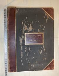
1889réf. 028277New York: Julius Bien & Co 1889. Condition of the binding is only Fair with pest damage. Leather over the spine has perished. Front and rear outer hinges cracks have been neatly reinforced with high quality clear flexible glue. Inner hinges are OK having been reinforced by the publisher/bookbinder with sturdy maroon cloth. SEE PHOTOS. Condition of all maps is NEAR FINE - FINE. NO foxing or toning. Pages are clean and unmarked. SEE PHOTOS. Includes a title page map of New Jersey Key to the System of Mapping and 19 linen-backed double page maps. Collated and complete per table of contents -- SEE PHOTOS. The maps are lithographically printed in blue red yellow and black. The double page maps open to an impressive 26.50" across by 36.50" tall. No year of publication is stated but Phillips 2149 in A LIST OF GEOGRAPHIC ATLASES Vol. 1 says 1889. The maps themselves are variously dated up to 1888. Titles of Sheets: No. 0. New Jersey State Map Geographic; No. 1. Kittatinny Valley and Mountain No. 2. Southwestern Highlands; No. 3. Central Highlands; No. 4. Northeastern Highlands; No. 5.Vicinity of Flemington; No. 6. Valley of the Passaic; No. 7. The Counties of Bergen Hudson Essex No. 8. Vicinity of Trenton; No. 9. Monmouth Shore; No. 10. Vicinity of Salem No. 11. Vicinity of Camden; No. 12. Vicinity of Mount Holly; No. 13. Vicinity of Barnegat Bay; No. 14. Vicinity of Bridgeton; No. 15. Southern Interior; No. 16. Egg Harbor and Vicinity; No. 17. Peninsula of Cape May; Unnumbered map. "New Jersey from Original Surveys based on the Triangulation of the U.S. Coast and Geodetic Survey Relief Map." Scale of first and last doublepage maps: 5 miles to an Inch. Scale of maps No. 1 to No. 17: 1 mile to an Inch. Bound in black pebble-grain cloth with gilt-stamped brown leather title label leather spine and corners leather backstrip has perished. SEE PHOTOS. The textblock could be easily rebacked or recased with no re-sewing required since all pages/maps are still securely bound together. Oversize Hardcover. 19.50" wide by 27" tall. This massive extremely heavy book will require SUBSTANTIAL extra postage at our cost based on your location. LeGear ATLASES OF THE UNITED STATES L5609. See also Schwartz and Ehrenerg's THE MAPPING OF AMERICA pp. 310-311. Phillips 2149. This massive extremely heavy book will require SUBSTANTIAL extra postage at our cost based on your location. Second Edition. Oversize Hardcover. Fair - FINE condition. Illus. by NOT a library discard. Atlas folio. Great Packaging Fast Shipping. Julius Bien & Co Hardcover
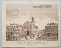
1793réf. 3843"One of the more important images of postcolonial Boston" The building now known as "the Old State House" at the head of State Street in downtown Boston stands on the site of the first Town House that was built in the 1650s and burned in 1711. Its successor building the State House housed both town and provincial officers and activities until 1742 at which time town personnel moved to a location in the newly constructed Faneuil Hall. Of this view Deák notes: "The view from Washington Street shows the rear of the structure flanked by eminent merchant houses. Fashionable residents tradesmen mounted pedestrians and a variety of horse-drawn vehicles animate the streets. We can look past the State House down State Street far off into the distance of the harbor. There numerous masts of ships can be detected towering above the town's buildings which are constructed close together and are of substantial proportions.What we have in this engraving is one of the more important images of postcolonial Boston showing it as a thriving independent seaport" p. 128. References: Lewis Guide to Engravings in American Magazines 1741-1810: pp. 11 49. Stokes & Haskell American Historical Prints: Early Views of American Cities etc.: B-109. Deák Picturing America: 194. Condition: Old fold lines some of which have been strengthened on the reverse; minor edge tears. Scattered spots of very light foxing. Overall a well-preserved and visually pleasing example. ICN 7755. From the July, 1793 issue of Massachusetts Magazine
1870réf. 193591870. African AmericanVoting Rights New Constitution for the State of Illinois. 1870 printing of the Illinois Constitution ratified after the Civil War documents Reconstruction-era legal reform in a Midwestern state that had previously enforced restrictive Black Codes despite its status as a free state. By the outbreak of the Civil War the Illinois Constitution of 1848 had proven inadequate to address rapid railroad expansion industrialization immigration and intensifying debates over suffrage. Illinois had been among the Midwestern states that denied voting rights to African American residents and had enforced statutes permitting the sale of free Black individuals unable to prove their status. Following the repeal of the state's Black Code provisions after 1865 voters authorized a new constitutional convention in 1869. Meeting for ninety-five days with evenly divided Democratic and Republican delegations the convention produced the 1870 Constitution which granted voting rights to Black men and restructured state governance in response to wartime and postwar transformation. New Constitution for the State of Illinois. Chicago: Rand McNally & Co. 1870. Presented by the Sangamo Insurance Company. Octavo approximately 5.5 x 8.5 inches. 32 pages. Printed gray wrappers. The 1870 Constitution expanded provisions governing public education transportation infrastructure taxation and corporate regulation particularly of railroads reflecting the economic centrality of industrial capital and internal improvements in the postwar Midwest. It affirmed the property tax as the chief source of state revenue strengthened gubernatorial authority limited legislative power and reformed the judicial system. The document remained the governing constitution of Illinois for a century shaping state political structure through the Progressive Era and into the late twentieth century. Chipping to wrapper edges; front wrapper separated; rear wrapper attached; binding tight; interior clean. Overall good condition. Reconstruction-era state constitution marking the formal extension of Black male suffrage and the reorganization of Midwestern governance after the Civil War. unknown
1870réf. 193591870. African AmericanVoting Rights New Constitution for the State of Illinois. 1870 printing of the Illinois Constitution ratified after the Civil War documents Reconstruction-era legal reform in a Midwestern state that had previously enforced restrictive Black Codes despite its status as a free state. By the outbreak of the Civil War the Illinois Constitution of 1848 had proven inadequate to address rapid railroad expansion industrialization immigration and intensifying debates over suffrage. Illinois had been among the Midwestern states that denied voting rights to African American residents and had enforced statutes permitting the sale of free Black individuals unable to prove their status. Following the repeal of the state's Black Code provisions after 1865 voters authorized a new constitutional convention in 1869. Meeting for ninety-five days with evenly divided Democratic and Republican delegations the convention produced the 1870 Constitution which granted voting rights to Black men and restructured state governance in response to wartime and postwar transformation. New Constitution for the State of Illinois. Chicago: Rand McNally & Co. 1870. Presented by the Sangamo Insurance Company. Octavo approximately 5.5 x 8.5 inches. 32 pages. Printed gray wrappers. The 1870 Constitution expanded provisions governing public education transportation infrastructure taxation and corporate regulation particularly of railroads reflecting the economic centrality of industrial capital and internal improvements in the postwar Midwest. It affirmed the property tax as the chief source of state revenue strengthened gubernatorial authority limited legislative power and reformed the judicial system. The document remained the governing constitution of Illinois for a century shaping state political structure through the Progressive Era and into the late twentieth century. Chipping to wrapper edges; front wrapper separated; rear wrapper attached; binding tight; interior clean. Overall good condition. Reconstruction-era state constitution marking the formal extension of Black male suffrage and the reorganization of Midwestern governance after the Civil War. unknown books
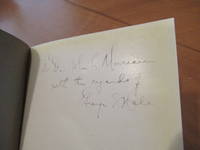
1915réf. 056314Washington: Carnegie Institution 1915. First Edition . Printed Grey Wrappers. Near Fine. Photographs. 99 Pp. Printed On Glossy Paper High Quality Plates. First Printing The Scarce Hardcover Issue 1915. Near Fine Gilt Brilliant No Stains Inscribed By Author To His Friend John Campbell Merriam; Documentation Of Their Relationship May Be Found In The Hale Papers At Caltech And In The Merriam Papers At The Library Of Congress. Per Wikipedia John Campbell Merriam 1869 - 1945 Was An American Paleontologist Educator And Conservationist. The First Vertebrate Paleontologist On The West Coast Of The United States He Is Best Known For His Taxonomy Of Vertebrate Fossils At The La Brea Tar Pits. In 1912 He Was Appointed Chairman Of The Department Of Paleontology At The University Of California. That Same Year He Began His Famous Studies Of Vertebrates At The La Brea Tar Pits. He And His Students Categorized Many Of The Vertebrate Fossils Found At The Site And Many More Were Placed In Storage. The Smilodon Was Later Established As The California State Fossil. In 1918 He Was Elected To The United States National Academy Of Sciences. That Same Year He Co-Founded The Save The Redwoods League Which Began Significant Preservation Efforts After Merriam Traveled The Redwood Areas Of Humboldt County California In 1922 Seeking To Spare Its Old-Growth The Effects Of Logging He Witnessed In Redwood Forests Closer To San Francisco. A Biography Which Details His Efforts To Preserve Wild Lands In California And Throughout The United States Was Published In 2005. In 1919 Merriam Served As President Of The Geological Society Of America. In 1920 He Was Appointed Dean Of Faculty At The University Of California Berkeley But He Left That Same Year To Become President Of The Carnegie Institution In Washington D.C. He Accomplishments As President Included Helping To Advance The Educational Programs Of The National Park Service As Well As Helping To Preserve The California Redwoods. He Was Elected To The American Academy Of Arts And Sciences In 1921. His Published Papers Are Collected In A Four-Volume Set Published In 1938 By The Carnegie Institution. Merriam Was A Founding Member Of The Galton Institute And A Cautious Political Supporter Of Eugenics. His Paternal First Cousin Frank Merriam The Eldest Child Of Civil War Veteran Henry C. Merriam Served As The 28Th Governor Of California Between 1934 And 1939 Having Defeated Upton Sinclair With The Aid Of Vicious Propaganda By Ultra-Conservative Interests. . Carnegie Institution unknown