MERCATOR, Gerard - PTOLEMY, ClaudiusBiblio.com
296 risultati
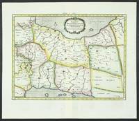
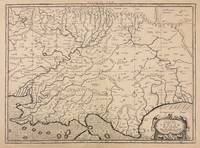
rif. 6094Amsterdam: R & J Wetstenii & G Smith. 1578-1730. No binding. Very Good. 360 x 460 mm. a fine example in recent wash colour. Gerard Mercator's edition of Ptolemy's 'Geography' is highly acclaimed; he spent much of his life studying the work and even engraved the plates himself. The 'Geographia' is the earliest surviving geographical treatise. Much of Mercator's efforts were spent projecting Ptolemy's geography onto the projection which bears his name. Mercator is one of the world's greatest cartographers and the 'Claudii Ptolemaei Tabulae Geographicae Orbis Terrarum' was first published in 1578. This map focuses on the Caucasus and modern day Russia is in the third state with the addition of a latitude and longitude grid illustrating the projection. It displays the Crimean Peninsula lower left and the Caspian Sea lower right. Koeman Me 5; Nordenskiold 234; Phillips P.L. Atlases 384; Shirley BL T.Ptol-11a & 11k; Van der Krogt P. Atlantes 1:501. R & J Wetstenii & G Smith. 1578-[1730] unknown
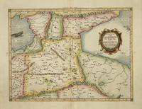
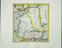
rif. 4017Utrecht: Francois Halma. 1578-c.1695. No binding. Very Good. 350 x 460 mm. a fine example in modern wash colour. From Gerard Mercator's edition of 'Claudii Ptolemaei Tabulae Geographicae Orbis Terrarum'. It was in 1578 that one of the world's greatest cartographers put out an edition of the earliest surviving geographical treatise. This map is centred on Armenia and shows the Black Sea and Caspian Sea to the west and east respectively. Koeman Me 5; Nordenskiold 234; Phillips P.L. Atlases 384; Shirley BL T.Ptol-11a & 11k; Van der Krogt P. Atlantes 1:501. Francois Halma. 1578-[c.1695] unknown
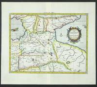
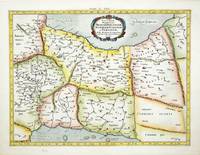
rif. 6095Amsterdam: R & J Wetstenii & G Smith. 1578-1730. No binding. Very Good. 350 x 460 mm. a fine example in recent wash colour. Gerard Mercator's edition of Ptolemy's 'Geography' is highly acclaimed; he spent much of his life studying the work and even engraved the plates himself. The 'Geographia' is the earliest surviving geographical treatise. Much of Mercator's efforts were spent projecting Ptolemy's geography onto the projection which bears his name. Mercator is one of the world's greatest cartographers and the 'Claudii Ptolemaei Tabulae Geographicae Orbis Terrarum' was first published in 1578. This map is centred on Armenia and shows the Black Sea and Caspian Sea to the west and east respectively. It is in the third state with the addition of a latitude and longitude grid illustrating the projection. Koeman Me 5; Nordenskiold 234; Phillips P.L. Atlases 384; Shirley BL T.Ptol-11a & 11k; Van der Krogt P. Atlantes 1:501. R & J Wetstenii & G Smith. 1578-[1730] unknown
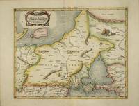
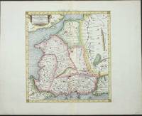
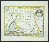
rif. 4019Utrecht: Francois Halma. 1578-c.1695. No binding. Very Good. 350 x 430 mm. in recent wash colour in good condition. From Gerard Mercator's edition of 'Claudii Ptolemaei Tabulae Geographicae Orbis Terrarum'. It was in 1578 that one of the world's greatest cartographers put out an edition of the earliest surviving geographical treatise. This map shows north eastern Europe and Russia. With an attractive scene of a camp upper right. The map extends southwards to the Black Sea. Koeman Me 5; Nordenskiold 234; Phillips P.L. Atlases 384; Shirley BL T.Ptol-11a & 11k; Van der Krogt P. Atlantes 1:501. Francois Halma. 1578-[c.1695] unknown
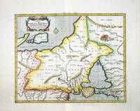
rif. 6085Amsterdam: R & J Wetstenii & G Smith. 1578-1730. No binding. Very Good. 350 x 430 mm. in recent wash colour and very good condition. Gerard Mercator's edition of Ptolemy's 'Geography' is highly acclaimed; he spent much of his life studying the work and even engraved the plates himself. The 'Geographia' is the earliest surviving geographical treatise. Much of Mercator's efforts were spent projecting Ptolemy's geography onto the projection which bears his name. Mercator is one of the world's greatest cartographers and the 'Claudii Ptolemaei Tabulae Geographicae Orbis Terrarum' was first published in 1578. This map of north eastern Europe and Russia is in the third state with the addition of a latitude and longitude grid illustrating the projection. With an attractive scene of a camp upper right. The map extends southwards to the Black Sea. Koeman 1967-70 Me 5; Nordenskiold 1979 234; Phillips P.L. 1909- 384; Shirley 2004 T.Ptol-11a & 11k; Van der Krogt P. 1997-2004 1:501. R & J Wetstenii & G Smith. 1578-[1730] unknown
rif. 4032Utrecht: Francois Halma. 1578-c.1695. No binding. Very Good. 340 x 400 mm. a fine example in modern wash colour. From Gerard Mercator's edition of 'Claudii Ptolemaei Tabulae Geographicae Orbis Terrarum'. It was in 1578 that one of the world's greatest cartographers put out an edition of the earliest surviving geographical treatise. Ptolemy's image of France as seen through the eyes of Mercator. Koeman Me 5; Nordenskiold 234; Phillips P.L. Atlases 384; Shirley BL T.Ptol-11a & 11k; Van der Krogt P. Atlantes 1:501. Francois Halma. 1578-[c.1695] unknown
rif. 6080Amsterdam: R & J Wetstenii & G Smith. 1578-1730. No binding. Very Good. 340 x 400 mm. a fine example in recent wash colour. Gerard Mercator's edition of Ptolemy's 'Geography' is highly acclaimed; he spent much of his life studying the work and even engraved the plates himself. The 'Geographia' is the earliest surviving geographical treatise. Much of Mercator's efforts were spent projecting Ptolemy's geography onto the projection which bears his name. Mercator is one of the world's greatest cartographers and the 'Claudii Ptolemaei Tabulae Geographicae Orbis Terrarum' was first published in 1578. This map of France is in the third state with the addition of a latitude and longitude grid illustrating the projection. Koeman 1967-70 Me 5; Nordenskiold 234; Phillips P.L. Atlases 384; Shirley 2004 T.Ptol-11a & 11k; Van der Krogt P. Atlantes 1:501. R & J Wetstenii & G Smith. 1578-[1730] unknown
rif. 6096Amsterdam: R & J Wetstenii & G Smith. 1578-1730. No binding. Very Good. 340 x 460 mm. a fine example in recent wash colour. Gerard Mercator's edition of Ptolemy's 'Geography' is highly acclaimed; he spent much of his life studying the work and even engraved the plates himself. The 'Geographia' is the earliest surviving geographical treatise. Much of Mercator's efforts were spent projecting Ptolemy's geography onto the projection which bears his name. Mercator is one of the world's greatest cartographers and the 'Claudii Ptolemaei Tabulae Geographicae Orbis Terrarum' was first published in 1578. This map of Persia or modern day Iran is in the third state with the addition of a latitude and longitude grid illustrating the projection. Ala'i Cyrus. 2003. 'Mapping Persia: A brief introduction' in IMCoS Journal 94 pp. 5-22; Koeman Me 5; Nordenskiold 234; Phillips P.L. Atlases 384; Shirley BL T.Ptol-11a & 11k; Van der Krogt P. Atlantes 1:501. R & J Wetstenii & G Smith. 1578-[1730] unknown
rif. 9641Amsterdam: 1578-1695. No binding. Very Good. 340 x 460 mm. in full recent wash colour good condition. Gerard Mercator's edition of Ptolemy's 'Geography' is highly acclaimed; he spent much of his life studying the work and even engraved the plates himself. The 'Geographia' is the earliest surviving geographical treatise. Much of Mercator's efforts were spent projecting Ptolemy's geography onto the projection which bears his name. Mercator is one of the world's greatest cartographers and the 'Claudii Ptolemaei Tabulae Geographicae Orbis Terrarum' was first published in 1578. This map of Persia or modern day Iran is in the scond state before the addition of a latitude and longitude grid illustrating the projection. Ala'i Cyrus. 2003. 'Mapping Persia: A brief introduction' in IMCoS Journal 94 pp. 5-22; Koeman Me 5; Nordenskiold 234; Phillips P.L. Atlases 384; Shirley BL T.Ptol-11a; Van der Krogt P. Atlantes 1:501. 1578-[1695] unknown
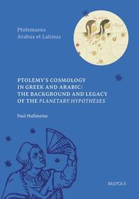
rif. BN383845Ptolemy's Cosmology in Greek and Arabic. The Background and Legacy of the Planetary Hypotheses Ptolemy's Cosmology in Greek and Arabic. The Background and Legacy of the Planetary Hypotheses Ptolemy Paul Hullmeine ed unknown
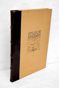
1983rif. 3638099Valencia.: Vicent García. 1983. Hardcover. Falta el facsimil con los mapas . Good. 46 cm. 1 v. il. col. map. col. Encuadernación en tapa dura de editorial holandesa. Libro de estudios del facsimil. Introducción por Víctor Navarro Brotóns ; traducción y notas por Angel Aguirre Alvarez Víctor Navarro Brotóns y Enrique Rodríguez Galdeano. Tít. de la cub. : Atlas de Claudio Ptolomeo . Falta el facsimil con los mapas . ISBN: 8485094352 v.1 Geografía del mundo antiguo. Geografía regional en general. Geografía universal 913.1"01" Mapas. Atlas geográficos. Globos terráqueos 912100:528.9:091.07 Vicent García. hardcover
1915rif. 181190Munich: J.B. Obernetter 1915. Hardcover. VG- covers have heavy wear but pages of text and illustrations are clean and clear. Front cover is unnattached and heavy chipping to spine. Tan boards with brown lettering 2 preliminary leaves 180 pp many uncut bw illustrations and diagrams. Text is in Portuguese. Title translates to: "Treaty of the sphera with Theorica of the sun and the moon and the first book of Geographia by Claudio Ptolomeo." History of Portuguese nautical science at the time of the great discoveries. J.B. Obernetter hardcover
1915rif. 181190Munich: J.B. Obernetter 1915. Hardcover. VG- covers have heavy wear but pages of text and illustrations are clean and clear. Front cover is unnattached and heavy chipping to spine. Tan boards with brown lettering 2 preliminary leaves 180 pp many uncut bw illustrations and diagrams. Text is in Portuguese. Title translates to: "Treaty of the sphera with Theorica of the sun and the moon and the first book of Geographia by Claudio Ptolomeo." History of Portuguese nautical science at the time of the great discoveries. J.B. Obernetter hardcover books
1574rif. M7263Venice: Ruscelli c. 1574. Very Good;. Notes: Italian text on verso. Early map of Sicily Malta and Sardinia beautifully hand coloured. Girolamo Ruscelli 1518–1566 was an Italian mathematician and cartographer active in Venice during the early 16th century. Ruscelli is best known for his important revision of Ptolemy's Geographia published posthumously in 1574. Size : 190x265 mm 7.48x10.43 Inches Coloring: Hand Colored Category: Maps Mediterranean Islands; Ruscelli unknown
1561rif. M7270Venice: Ruscelli c. 1561. Very Good;. Notes: Italian text on verso. An early map of the Iberian Peninsula including Spain and Portugal beautifully hand coloured. Girolamo Ruscelli 1518–1566 was an Italian mathematician and cartographer active in Venice during the early 16th century. Ruscelli is best known for his important revision of Ptolemy's Geographia published posthumously in 1574. Size : 195x265 mm 7.68x10.43 Inches Coloring: Hand Colored Category: Maps Europe Spain;Maps Europe Portugal; Ruscelli unknown
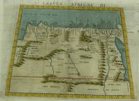
1574rif. M7260Venice: Ruscelli c. 1574. Very Good;. Notes: Italian text on verso. Girolamo Ruscelli 1518–1566 was an Italian mathematician and cartographer active in Venice during the early 16th century. Ruscelli is best known for his important revision of Ptolemy's Geographia published posthumously in 1574. Size : 189x261 mm 7.44x10.28 Inches Coloring: Hand Colored Category: Maps Africa North Egypt;Maps Africa North; Ruscelli unknown
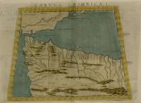
1561rif. M7261Venice: Ruscelli 1561. Very Good;. Notes: Italian text on verso. Girolamo Ruscelli 1518–1566 was an Italian mathematician and cartographer active in Venice during the early 16th century. Ruscelli is best known for his important revision of Ptolemy's Geographia published posthumously in 1574. Size : 188x165 mm 7.40x6.50 Inches Coloring: Hand Colored Category: Maps Africa North; Ruscelli unknown
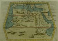
1574rif. M7259Venice: Ruscelli c. 1574. Very Good;. Notes: Italian text on verso. Girolamo Ruscelli 1518–1566 was an Italian mathematician and cartographer active in Venice during the early 16th century. Ruscelli is best known for his important revision of Ptolemy's Geographia published posthumously in 1574. Size : 190x253 mm 7.48x9.96 Inches Coloring: Hand Colored Category: Maps Africa North; Maps Mediterranean Islands; Ruscelli unknown
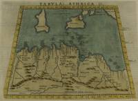
1574rif. M7258Venice: Ruscelli c. 1574. Very Good;. Notes: Italian text on verso. Girolamo Ruscelli 1518–1566 was an Italian mathematician and cartographer active in Venice during the early 16th century. Ruscelli is best known for his important revision of Ptolemy's Geographia published posthumously in 1574. Size : 187x262 mm 7.36x10.31 Inches Coloring: Hand Colored Category: Maps Africa North; Ruscelli unknown
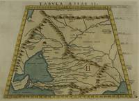
1574rif. M7272Venice: Ruscelli c. 1574. Very Good;. Notes: Italian text on verso. Map of the ancient region of Asiatic Sarmatia. Girolamo Ruscelli 1518–1566 was an Italian mathematician and cartographer active in Venice during the early 16th century. He was also an alchemist writing pseudonymously as Alessio Piemontese. Claudius Ptolemy better known mononymously as Ptolemy was a Greco-Roman mathematician astronomer astrologer geographer and music theorist who wrote about a dozen scientific treatises three of which were important to later Byzantine Islamic and Western European science. Size : 188x262 mm 7.40x10.31 Inches Coloring: Hand Colored Category: Maps Russia; Ruscelli unknown
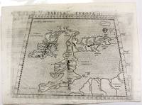
1574rif. M11040Venice c.1574. Very Good. Notes: Map of the British Isles United Kingdom based on Ptolemy's map. Girolamo Ruscelli 1518–1566 was an Italian mathematician and cartographer active in Venice during the early 16th century. Ruscelli is best known for his important revision of Ptolemy's Geographia published posthumously in 1574. Size : 190x262 mm 7.48x10.31 Inches Coloring: Black & White Category: Maps Europe United Kingdom; unknown
1598rif. M8431Venice: G. Fratelli; G.A. Magini c. 1598. Very Good. Notes: Ptolemaic Map of Tabula Asiae X Plate 10 from "Geografia cioe Descrittione Universale della Terra" published by Magini c.1598. Text in Italian. Size : 140x173 mm 5.50x6.80 Inches Coloring: Black & White Category: Maps Asia Central Afghanistan Pakistan; Maps Asia Central India & Sri Lanka / Ceylon; G. Fratelli; G.A. Magini unknown
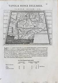
1598rif. M8430Venice.: G. Fratelli; G.A. Magini c. 1598. Very Good. Notes: Ptolemaic Map of Tabula Asiae IX Plate 9 from "Geografia cioe Descrittione Universale della Terra" published by Magini c.1598. Text in Italian. Size : 140x173 mm 5.50x6.80 Inches Coloring: Black & White Category: Maps Asia Central Afghanistan Pakistan; Maps Asia Central Turkmenistan Uzbekistan Tajikistan Kyrgyzstan Kazakhstan; Maps Asia Central India & Sri Lanka / Ceylon; G. Fratelli; G.A. Magini unknown
1730rif. 332605Amsterdam: R. & W. Wetstein William Smith 1730. unbound. Map. Copper plate engraving. Image measures 13.25" x 18". Printed circa 1730 this map of the Indian subcontinent was based on Ptolemy's 2nd century map and refined by Mercator beginning in the 16th century. This 1730 edition features graticule lines and a cartouche with a cherub. Covering an area from the Himalayan Mountains south to the Indian Ocean the map names many cities and topographical features. The map is in good condition wear to edges small tear to top of original center fold line. Gerard Mercator 1512-1594 was an accomplished mathematician cartographer globe maker and engraver best known for the Mercator Projection. Incorporating the newly accepted fact that the world is round Mercator was able to render longitude lines consistently straight on a chart. Although this requires some distortion it was of great use for navigators; furthermore it has since become historically important as it is still the most commonly used projection today. R. & W. Wetstein, William Smith unknown
1730rif. 332605Amsterdam: R. & W. Wetstein William Smith 1730. unbound. Map. Copper plate engraving. Image measures 13.25" x 18". Printed circa 1730 this map of the Indian subcontinent was based on Ptolemy's 2nd century map and refined by Mercator beginning in the 16th century. This 1730 edition features graticule lines and a cartouche with a cherub. Covering an area from the Himalayan Mountains south to the Indian Ocean the map names many cities and topographical features. The map is in good condition wear to edges small tear to top of original center fold line. Gerard Mercator 1512-1594 was an accomplished mathematician cartographer globe maker and engraver best known for the Mercator Projection. Incorporating the newly accepted fact that the world is round Mercator was able to render longitude lines consistently straight on a chart. Although this requires some distortion it was of great use for navigators; furthermore it has since become historically important as it is still the most commonly used projection today. R. & W. Wetstein, William Smith unknown books