356 résultats
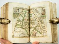
1574réf. 18848Venetia Venice Giordano Ziletti 1574-73. 4to. Hcalf from ab 1820. Gilt back. Slight rubbing to spine. 78350 pp. and 65 double-page engraved maps with text on verso of plates 130 pp5665 pp. 6 textlvs. at end with brownspots in right margin sometimes a little browning to pages few brownspots and a few textlvs. with minor wormtracts. Complete with all 65 maps called for each measuring ab. 19 x 26 cm. A great part of the maps have some background shadowing from the printers ink mainly due to the fact that this is the third Ruscelli-edition where the plates have been used before. 3 printer's wood-cut devices and 20 smaller and larger woodcuts in the text. 2 woodcuts with Ptolemy shown observing. Third edition of Ruscelli's translation from Venice 1561. The maps are printed from the same plates with the exception of Ptolemy's map of the world for which Malomba had returned to the original conical projection of Ptolemy. Moreover one map is added: the map of "Territorio di Roma". In general the maps are enlarged copies of Gastaldi's maps from the edition of 1548 which came out in 8vo. The Ruscelli translation contains an important innovation namely the division of the world map into two parts one for the Old World and one for the New as seen on the plate "Tavola Universal" depicting the 2 hemispheres. The atlas contains 27 ptolemaic maps and 38 new. 1 World 1 Hemisphere 10 Europe 4 Africa 12 Asia and 38 others. 10 of the maps relate to America.Philipps I:380. Sabin 66505. Nordenskiöld Nr. 34 p.27. unknown
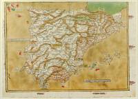
1486réf. 1271161486. Ulm: Johann Reger 1486. Original woodcut map hand-colored printed on a double-page sheet 570 x 407 mm with a central vertical fold verso blank. Upper margin closely trimmed with some loss of the printed border but no loss of the map central fold reinforced on verso a little inkwash and light soiling in the margins; a strong impression with bright contemporary coloring. Matted. § A "modern" map of the Iberian Peninsula Spain and Portugal by the 15th century German cartographer Nicolas Germanus who updated Ptolemy's Geography to show contemporary kingdoms and place names with towns marked by small circles and mountain ranges with brown ridges. The engraving was done by Johannes de Armsheim the first woodcut artist to sign his maps on this map his mark is the backwards "N" in the woodcut text. The map was first published by Lienhart Holle in his atlas of 1482 possibly a ruinous venture as Holle went bankrupt soon afterwards and the sheets and plates were bought by Johann Reger who reissued the atlas in 1486. The two issues can be distinguished by the coloring of the sea: a blue was in 1482 a tan wash in 1486. unknown
1486réf. 1271161486. Ulm: Johann Reger 1486. Original woodcut map hand-colored printed on a double-page sheet 570 x 407 mm with a central vertical fold verso blank. Upper margin closely trimmed with some loss of the printed border but no loss of the map central fold reinforced on verso a little inkwash and light soiling in the margins; a strong impression with bright contemporary coloring. Matted. § A "modern" map of the Iberian Peninsula Spain and Portugal by the 15th century German cartographer Nicolas Germanus who updated Ptolemy's Geography to show contemporary kingdoms and place names with towns marked by small circles and mountain ranges with brown ridges. The engraving was done by Johannes de Armsheim the first woodcut artist to sign his maps on this map his mark is the backwards "N" in the woodcut text. The map was first published by Lienhart Holle in his atlas of 1482 possibly a ruinous venture as Holle went bankrupt soon afterwards and the sheets and plates were bought by Johann Reger who reissued the atlas in 1486. The two issues can be distinguished by the coloring of the sea: a blue was in 1482 a tan wash in 1486. unknown books
[Anno MCCCCLXXXII augusti vero kalendas XVII impressum Ulme per ingeniosum virum Leonardum Hol. (Ulm, Lienhart Holle, 16 luglio 1482)]. Foglio del "Tolomeo di Ulm" (prima edizione, del 16 luglio) recante la carta geografica della penisola indocinese impressa in xilografia a doppia pagina su una facciata e il relativo testo descrittivo, stampato su una pagina dell'altra facciata. Il foglio misura mm. 401x523; l'immagine, misura, al filetto esterno della xilografia, mm. 380x300 (nel punto più corto in larghezza) e mm. 380x372 (nel punto più lungo in larghezza). Coloritura a mano originale. Sulla xilografia sono visibili delle ossidazioni dovute alla presenza al verso del foglio d'una cornice e d'una iniziale a stampa miniate con un colore verde che col tempo ha ossidato la carta. Nel 1482 Lienhart Holle pubblicò ad Hulm una edizione della Geografia di Tolomeo basata sulle carte di Nicolaus Germanus (c. 1420 - c. 1490) che aveva prodotto a Firenze una serie di magnifici atlanti manoscritti su pergamena negli anni 60 e 70 del Quattrocento. Il modello sul quale furono esemplate le carte di Hulm fu l'atlante manoscritto che Nicolaus aveva offerto al papa Paolo II e che pare fosse stato inviato appositamente in Germania (senza essere mai più rispedito a Roma: è conservato allo Schloss Wolfegg). L'edizione di Ulm è il primo atlante pubblicato a Nord delle Alpi e il primo con le carte impresse in xilografia (i due incunaboli precedenti della Geografia di Tolomeo - Bologna 1477 e Roma 1478 - recavano carte incise in rame). L'incisore delle xilografie fu probabilmente Johann Schnitzer di Armsheim (il planisfero reca la sua firma). Una delle mappe più ricercate della penisola indocinese, la terza in assoluto, in ordine di tempo, che sia stata impressa in un atlante a stampa. Per quanto riguarda il Tolomeo stampato ad Ulm cfr. Gof P1084; HC *13539; BMC II 538; IC.9309; Schreiber 5031; Sabin 66472; Nordenskiold Collection II, 199.Sheet of "Ptolemy of Ulm" (first edition, July the 16th, 1482) bearing the geographical map of the Indochinese peninsula printed in double-page woodcut on one side and the relative descriptive text, printed on one page of the other side. The sheet measures mm. 401x523; the image measures, to the external fillet of the woodcut, mm. 380x300 (at the shortest point in width) and mm. 380x372 (at the longest point in width). Original hand coloring. On the woodcut you can see some oxidations due to the presence on the back of the sheet of a frame and of an initial illuminated with a green color that over time has oxidized the paper. In 1482 Lienhart Holle published in Hulm an edition of Ptolemy's Geography based on the maps of Nicolaus Germanus (c. 1420 - c. 1490) who had produced in Florence a series of magnificent handwritten atlases on parchment in the 1460s and 1470s. The model on which Hulm's maps were patterned was the manuscript atlas that Nicolaus had offered to Pope Paul II and which seems to have been specially sent to Germany (without ever being sent back to Rome: it is kept at Schloss Wolfegg). The Ulm edition is the first atlas published north of the Alps and the first with the maps printed in woodcut (the two previous incunabula of Ptolemy's Geography - Bologna 1477 and Rome 1478 - had copper engraved maps). The engraver of the woodcuts was probably Johann Schnitzer of Armsheim (the planisphere bears his signature). One of the most sought after maps of the Indochinese peninsula, the third ever, in order of time, which has been imprinted in a printed atlas.
1548réf. ST20876Venice: Giovanni Baptista Pedrezano 1548. First Complete Edition in Italian. Translated by Pietro Andrea Mattioli. Binding size: 175 x 116 mm. 6 7/8 x 4 5/8". ENTIRELY COMPLETE: binder's blank 816 pp. collating as dagger8 A-DD8 DD8 being blank 240 pp. as maps a-h8. Modern 19th century vellum over flexible boards three raised double bands new pastedowns and free endpapers. Woodcut initials throughout occasional diagrams one full-page decorative woodcut side-borders to title-page fine woodcut portrait of Ptolemy observing the heavens and 60 DOUBLE-PAGE COPPER-ENGRAVED MAPS BY GIACOMO GASTALDI ALL COLORED BY A CONTEMPORARY HAND the land masses enhanced with small depictions of ships mermaids sea monsters strange human figures wild and domestic animals including fish an elephant leopard and chicken and other charming embellishments Pedrezano's large woodcut device on colophon leaf 2D7r and verso of final leaf the maps with landmarks and place names each map guarded by a thin vellum strip taken from a 14th century manuscript executed in a fine scribal hand. Front flyleaf with the early signature of Lelio Capilupi presumably belonging to the book's first or at least early owner and very possibly being that of the Mantuan poet humanist and courtier Lelio Capilupi 1497-1560 known for his "Centones ex Virgilio." Adams P-2234; Alden & Landis 548/31; Burden North America 16 & 17; EDIT16 CNCE 47524; Harrisse BAV 285; JCB3 I:153; Mortimer Italian 404; Nordenskiold 2:214; Phillips Atlases 369; Sabin 66502; Shirley Mapping of the World 87 & 88; Streeter sale 1. Spine and part of the covers with some darkening apparently as an antiquing effect but the binding completely solid and entirely harmless. Intermittent faint dampstain at various places on the page though the vast majority of leaves unaffected map of British Isles with very small repaired hole caused by acidic paint only visible if you look for it bottom margin of three maps and one left margin of another neatly reinforced a handful of margins a bit smudged other trivial imperfections but an extremely attractive copy internally the paper remarkably strong and fresh and with virtually none of the signs of use so often seen with early atlases. Because of its innovative size its extensive use of copper engravings instead of woodcuts its introduction of nearly three dozen modern maps and especially its new images of the Americas this is a landmark cartographical publication--and the copy we offer is an extremely rare example of the work enriched with full contemporary hand coloring. It is the first complete printing in Italian following Berlinghieri’s verse paraphrase of 1482 of Ptolemy's universally recognized atlas of the classical world and much more important it is the first version of the work small enough to be practicably carried by hand or in a purse or pocket. In addition although a very small number of earlier atlases exist with copper engravings no previous one is engraved to the extent seen here with five dozen double-page maps presenting dramatically finer detail for example in more refined coastlines and more cleanly realized decorative elements than was possible with images cut from wood. As Nordenskiold notes our 1548 edition was a kind of rediscovery of the virtues of the intaglio cartographic image with no engraved atlas having been printed in the 16th century before ours. In terms of content of central importance here are first engraved maps of parts of North and South America providing legitimacy to Nordenskiold's characterization of our work as "the very first atlas of the New World." There are seven major America-related cartographical achievements in our Pedrezano edition five of them being the modern World map map 59; the other world map "Carta marina" which is the first sea chart depicting the modern world map 60; "Tierra nova" the first separate map of the South American Continent map 54; "Nueva Hispania" the earliest separate map of the Gulf Coast Mexico and the present American Southwest map 55; and "Tierra nueva" the earliest individual map of the east coast of North America from north Florida to Labrador map 56 showing the discoveries of Giovanni da Verrazzano and Jacques Cartier. These last three plus a map of Cuba and one of Hispaniola represent the earliest printed American regional maps. Beyond the American images the 1548 "Geografia" also includes an atypically exo-European eclecticism highlighted by what is apparently the first separate map of the Indian peninsula along with the first separate map devoted to Arabia and the first reference to Singapore on a printed map. The maps were the work of Giacomo Gastaldi ca. 1500 - 1566 Cosmographer to the Venetian Republic and the most prominent Italian cartographer of the period known especially for keeping up to date with the latest geographical discoveries and incorporating them into his maps. While 26 of the 60 maps are based on Ptolemy distinctive here and in other editions within their trapezoidal frames the greater number 34 are the modern work of Gastaldi. The book is consequently one of the very best examples of the integration of the period's Age of Discovery with the groundwork laid by Classical writers. Gastaldi was also responsible for updating and adding modern place names an enormous undertaking as is reflected in the 127-page index here. The history of world exploration owes an immeasurable debt to Claudio Tolomeo ca. 90 - ca. 168 AD who included in his "Geografia" what was known about the geography of the world during the Roman Empire of his lifetime and except for some excavated carved maps Ptolemy's are essentially all we have as a source for the world trodden by the ancients. Manuscripts of his work are known to date as early as ca. 1300 and there were multiple 15th century printings. But all incunabular editions were very large books volumes to be beheld rather than be held and used in any portable context. Waldseemuller's 1513 Strassburg edition was just as weighty. By contrast our edition offered its owner a much more practical format and yet because of its broadening world of 60 maps it was nevertheless the most comprehensive atlas--and the most important one--published between Waldseemuller's and the monumental Ortelius "Theatrum" of 1570. Copies of the 1548 Ptolemy appear on the market from time to time though they typically are beset with condition problems. What seems never to appear--at least so far as we've been able to ascertain--are copies of the book with contemporary coloring. Surely even with a small format atlas issued for functional purposes there must have been copies that were colored on occasion. The Morgan Library does own a copy--apparently once possessed by Marie de Medici--that is colored and it is possible that such copies silently reside in other admittedly sometimes very brief records of institutional holdings but we were unable to find any evidence of such. Likewise and perhaps more telling we were unable to find any copies with period color in auction records which certainly would have prominently announced such an important feature. The Streeter copy and the Wardington copy for example were uncolored. In sum this is a cartographic work of signal importance in especially attractive condition with no small amount of charm in its maps' various real and imagined inhabitants and offered in a colored state that seems virtually never to appear for sale. Giovanni Baptista Pedrezano unknown
1548réf. ST20876Venice: Giovanni Baptista Pedrezano 1548. First Complete Edition in Italian. Translated by Pietro Andrea Mattioli. Binding size: 175 x 116 mm. 6 7/8 x 4 5/8". ENTIRELY COMPLETE: binder's blank 816 pp. collating as dagger8 A-DD8 DD8 being blank 240 pp. as maps a-h8. Modern 19th century vellum over flexible boards three raised double bands new pastedowns and free endpapers. Woodcut initials throughout occasional diagrams one full-page decorative woodcut side-borders to title-page fine woodcut portrait of Ptolemy observing the heavens and 60 DOUBLE-PAGE COPPER-ENGRAVED MAPS BY GIACOMO GASTALDI ALL COLORED BY A CONTEMPORARY HAND the land masses enhanced with small depictions of ships mermaids sea monsters strange human figures wild and domestic animals including fish an elephant leopard and chicken and other charming embellishments Pedrezano's large woodcut device on colophon leaf 2D7r and verso of final leaf the maps with landmarks and place names each map guarded by a thin vellum strip taken from a 14th century manuscript executed in a fine scribal hand. Front flyleaf with the early signature of Lelio Capilupi presumably belonging to the book's first or at least early owner and very possibly being that of the Mantuan poet humanist and courtier Lelio Capilupi 1497-1560 known for his "Centones ex Virgilio." Adams P-2234; Alden & Landis 548/31; Burden North America 16 & 17; EDIT16 CNCE 47524; Harrisse BAV 285; JCB3 I:153; Mortimer Italian 404; Nordenskiold 2:214; Phillips Atlases 369; Sabin 66502; Shirley Mapping of the World 87 & 88; Streeter sale 1. Spine and part of the covers with some darkening apparently as an antiquing effect but the binding completely solid and entirely harmless. Intermittent faint dampstain at various places on the page though the vast majority of leaves unaffected map of British Isles with very small repaired hole caused by acidic paint only visible if you look for it bottom margin of three maps and one left margin of another neatly reinforced a handful of margins a bit smudged other trivial imperfections but an extremely attractive copy internally the paper remarkably strong and fresh and with virtually none of the signs of use so often seen with early atlases. Because of its innovative size its extensive use of copper engravings instead of woodcuts its introduction of nearly three dozen modern maps and especially its new images of the Americas this is a landmark cartographical publication--and the copy we offer is an extremely rare example of the work enriched with full contemporary hand coloring. It is the first complete printing in Italian following Berlinghieri’s verse paraphrase of 1482 of Ptolemy's universally recognized atlas of the classical world and much more important it is the first version of the work small enough to be practicably carried by hand or in a purse or pocket. In addition although a very small number of earlier atlases exist with copper engravings no previous one is engraved to the extent seen here with five dozen double-page maps presenting dramatically finer detail for example in more refined coastlines and more cleanly realized decorative elements than was possible with images cut from wood. As Nordenskiold notes our 1548 edition was a kind of rediscovery of the virtues of the intaglio cartographic image with no engraved atlas having been printed in the 16th century before ours. In terms of content of central importance here are first engraved maps of parts of North and South America providing legitimacy to Nordenskiold's characterization of our work as "the very first atlas of the New World." There are seven major America-related cartographical achievements in our Pedrezano edition five of them being the modern World map map 59; the other world map "Carta marina" which is the first sea chart depicting the modern world map 60; "Tierra nova" the first separate map of the South American Continent map 54; "Nueva Hispania" the earliest separate map of the Gulf Coast Mexico and the present American Southwest map 55; and "Tierra nueva" the earliest individual map of the east coast of North America from north Florida to Labrador map 56 showing the discoveries of Giovanni da Verrazzano and Jacques Cartier. These last three plus a map of Cuba and one of Hispaniola represent the earliest printed American regional maps. Beyond the American images the 1548 "Geografia" also includes an atypically exo-European eclecticism highlighted by what is apparently the first separate map of the Indian peninsula along with the first separate map devoted to Arabia and the first reference to Singapore on a printed map. The maps were the work of Giacomo Gastaldi ca. 1500 - 1566 Cosmographer to the Venetian Republic and the most prominent Italian cartographer of the period known especially for keeping up to date with the latest geographical discoveries and incorporating them into his maps. While 26 of the 60 maps are based on Ptolemy distinctive here and in other editions within their trapezoidal frames the greater number 34 are the modern work of Gastaldi. The book is consequently one of the very best examples of the integration of the period's Age of Discovery with the groundwork laid by Classical writers. Gastaldi was also responsible for updating and adding modern place names an enormous undertaking as is reflected in the 127-page index here. The history of world exploration owes an immeasurable debt to Claudio Tolomeo ca. 90 - ca. 168 AD who included in his "Geografia" what was known about the geography of the world during the Roman Empire of his lifetime and except for some excavated carved maps Ptolemy's are essentially all we have as a source for the world trodden by the ancients. Manuscripts of his work are known to date as early as ca. 1300 and there were multiple 15th century printings. But all incunabular editions were very large books volumes to be beheld rather than be held and used in any portable context. Waldseemuller's 1513 Strassburg edition was just as weighty. By contrast our edition offered its owner a much more practical format and yet because of its broadening world of 60 maps it was nevertheless the most comprehensive atlas--and the most important one--published between Waldseemuller's and the monumental Ortelius "Theatrum" of 1570. Copies of the 1548 Ptolemy appear on the market from time to time though they typically are beset with condition problems. What seems never to appear--at least so far as we've been able to ascertain--are copies of the book with contemporary coloring. Surely even with a small format atlas issued for functional purposes there must have been copies that were colored on occasion. The Morgan Library does own a copy--apparently once possessed by Marie de Medici--that is colored and it is possible that such copies silently reside in other admittedly sometimes very brief records of institutional holdings but we were unable to find any evidence of such. Likewise and perhaps more telling we were unable to find any copies with period color in auction records which certainly would have prominently announced such an important feature. The Streeter copy and the Wardington copy for example were uncolored. In sum this is a cartographic work of signal importance in especially attractive condition with no small amount of charm in its maps' various real and imagined inhabitants and offered in a colored state that seems virtually never to appear for sale. Giovanni Baptista Pedrezano unknown books