MERCATOR, Gerard - PTOLEMY, ClaudiusBiblio.com
349 risultati
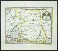
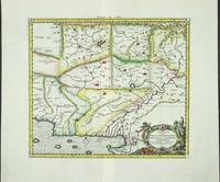
rif. 6100Amsterdam: R & J Wetstenii & G Smith. 1578-1730. No binding. Very Good. 350 x 400 mm. a fine example in recent wash colour. Gerard Mercator's edition of Ptolemy's 'Geography' is highly acclaimed; he spent much of his life studying the work and even engraved the plates himself. The 'Geographia' is the earliest surviving geographical treatise. Much of Mercator's efforts were spent projecting Ptolemy's geography onto the projection which bears his name. Mercator is one of the world's greatest cartographers and the 'Claudii Ptolemaei Tabulae Geographicae Orbis Terrarum' was first published in 1578. This map centres on present day Pakistan with the Indus River prominent. Upper right can be seen the Himalayan Mountains. It is in the third state with the addition of a latitude and longitude grid illustrating the projection. Koeman Me 5; Nordenskiold 234; Phillips P.L. Atlases 384; Shirley BL T.Ptol-11a & 11k; Van der Krogt P. Atlantes 1:501. R & J Wetstenii & G Smith. 1578-[1730] unknown
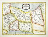
rif. 6094Amsterdam: R & J Wetstenii & G Smith. 1578-1730. No binding. Very Good. 360 x 460 mm. a fine example in recent wash colour. Gerard Mercator's edition of Ptolemy's 'Geography' is highly acclaimed; he spent much of his life studying the work and even engraved the plates himself. The 'Geographia' is the earliest surviving geographical treatise. Much of Mercator's efforts were spent projecting Ptolemy's geography onto the projection which bears his name. Mercator is one of the world's greatest cartographers and the 'Claudii Ptolemaei Tabulae Geographicae Orbis Terrarum' was first published in 1578. This map focuses on the Caucasus and modern day Russia is in the third state with the addition of a latitude and longitude grid illustrating the projection. It displays the Crimean Peninsula lower left and the Caspian Sea lower right. Koeman Me 5; Nordenskiold 234; Phillips P.L. Atlases 384; Shirley BL T.Ptol-11a & 11k; Van der Krogt P. Atlantes 1:501. R & J Wetstenii & G Smith. 1578-[1730] unknown
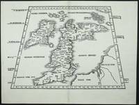
rif. 7407Lyon: 1522-41. No binding. Very Good. 295 x 410 mm. in very good condition. A very attractive early map of the British Isles projected in a trapezoidal style with rivers and towns noted with Latin text on the verso. The author of the map is Laurent Fries a physician and geographer from Alsace. It is derived from that of Martin Waldseemuller published in Strasbourg in 1513. First published in 1522 by now Lorenz Fries had died. The blocks found their way into the possession of Melchoir and Gaspar Treschel. This edition was published in Lyon but printed in Vienne. Karrow 1993 16 c. 28/2; Nordenskiold Collection 1979 211 no. 1; Pastoureau 1984 Ptolemee F 1541 no. 2; Shirley 1991 nos. 15 & 30; Shirley 2004 T.Ptol 7g. 1522-[41] unknown
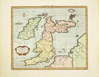
rif. 10520Amsterdam: R & J Wetstenii & G Smith. 1578-1730. No binding. Very Good. 340 x 400 mm. recent wash colour in good condition. Gerard Mercator's edition of Ptolemy's 'Geography' is highly acclaimed; he spent much of his life studying the work and even engraved the plates himself. The 'Geographia' is the earliest surviving geographical treatise. Much of Mercator's efforts were spent projecting Ptolemy's geography onto the projection which bears his name. Mercator 1512-94 is one of the world's greatest cartographers and the 'Claudii Ptolemaei Tabulae Geographicae Orbis Terrarum' was first published in 1578. This map of the British Isles is in the third state with the addition of a latitude and longitude grid illustrating the projection. Provenance: Doreen Green 1999. Koeman Me 5; Nordenskiold 234; Phillips P.L. Atlases 384; Shirley BI 123; Shirley BL T.Ptol-11a & 11k; Van der Krogt P. Atlantes 0901:1.2. R & J Wetstenii & G Smith. 1578-[1730] unknown
rif. 9641Amsterdam: 1578-1695. No binding. Very Good. 340 x 460 mm. in full recent wash colour good condition. Gerard Mercator's edition of Ptolemy's 'Geography' is highly acclaimed; he spent much of his life studying the work and even engraved the plates himself. The 'Geographia' is the earliest surviving geographical treatise. Much of Mercator's efforts were spent projecting Ptolemy's geography onto the projection which bears his name. Mercator is one of the world's greatest cartographers and the 'Claudii Ptolemaei Tabulae Geographicae Orbis Terrarum' was first published in 1578. This map of Persia or modern day Iran is in the scond state before the addition of a latitude and longitude grid illustrating the projection. Ala'i Cyrus. 2003. 'Mapping Persia: A brief introduction' in IMCoS Journal 94 pp. 5-22; Koeman Me 5; Nordenskiold 234; Phillips P.L. Atlases 384; Shirley BL T.Ptol-11a; Van der Krogt P. Atlantes 1:501. 1578-[1695] unknown
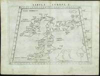
rif. 11742Venice: 1561. No binding. Good. FIRST EDITION FIRST ISSUE. 190 x 255 mm. light even toning otherwise in good condition. The first edition first issue of Girolamo Ruscelli's Ptolomaic map of the British Isles published in his edition of Ptolemy's 'Geographia' 1561. The border contains figures of latitude and longitude the 'G' in the corners most likely standing for the Latin 'gradus' for degrees. This map is one of two that were engraved on the same plate. Note how the plate mark runs off the top of the map. Girolamo Ruscelli c.1504-66 edited the Latin text for this quarto edition of Claudius Ptolemy's classic work 'Geographia' which included newly engraved copper plates engraved by the brothers Giulio fl.1540-88 and Livio c.1520-76 Sanuto. The work was published by Vincenzo Valgrisi in Venice. Provenance: Clive A. Burden Ltd.; private English collection. Nordenskiold 1979 216; Shirley 1991 67; Shirley 2004 T.Ptol 10a; Tooley's Dictionary. 1561 unknown
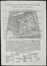
rif. 11329Venice: 1596-98. No binding. Good. Two maps 135 x 175 mm. each set on a leaf of text in good condition. A new edition of Ptolemy's 'Geography' was edited by Giovanni Antonio Magini 1555-1617 a noted geographer from Padua. Published in Venice a second edition appeared in 1598 from which this appears. It contains this Ptolemaic map of France with that of Germany on the verso. The neatly engraved copper plates are attributed to Girolamo Porro 1520-1604 also from Padua. The atlas was first published in a smaller format in Venice 1596. It was closely copied in the following year by Petrus Keschedt in Cologne in a work which contained a whole new set of engraved plates. Many references incorrectly state that the two editions contain the same plates. Magini famously produced the first atlas of Italy which was published posthumously by his son Fabio in 1620. Nordenskiöld 1979 no. 227; Nordenskiöld 1889 p. 27; Phillips 1909- no. 405; Shirley 2004 T.Ptol 12b; Tooley's Dictionary 1999-2004. 1596-[98] unknown
rif. 0912504315.Ghardcover. Good. Access codes and supplements are not guaranteed with used items. May be an ex-library book. hardcover
rif. ria9798985923780_inpPaperback. New. New Book; Fast Shipping from UK; Not signed; Not First Edition; Introducing a groundbreaking translation of Ptolemy's work Ge¿¿¿af¿¿¿ ¿f¿¿¿s¿¿ directly from ancient Greek to English accompanied by the original Greek text! Delve into the depths of this scholarly masterpiece and uncover a wealth of paperback
rif. B9781018753300Hardback. New. hardcover
rif. B9781108063661Paperback / softback. New. Published 1898-1907 this three-part collection edited by the Danish philologist Johan Ludvig Heiberg 1854-1928 contains the extant astronomical works in Greek of Ptolemy active in second-century Alexandria. Volume 2 1907 contains Ptolemy's shorter astronomical works notably Hypotheseis ton planomenon his planetary hypotheses along with a substantial Latin prolegomena. paperback
rif. B9781108063654Paperback / softback. New. Published 1898-1907 this three-part collection edited by the Danish philologist Johan Ludvig Heiberg 1854-1928 contains the extant astronomical works in Greek of Ptolemy active in second-century Alexandria. Volume 1 appeared in two parts. Part 2 1903 contains Books 7-13 of Ptolemy's major astronomical treatise the Almagest. paperback
rif. B9781108063647Paperback / softback. New. Published 1898-1907 this three-part collection edited by the Danish philologist Johan Ludvig Heiberg 1854-1928 contains the extant astronomical works in Greek of Ptolemy active in second-century Alexandria. Volume 1 appeared in two parts. Part 1 1898 contains Books 1-6 of Ptolemy's major astronomical treatise the Almagest. paperback
rif. 0380790629.Gpaperback. Good. Access codes and supplements are not guaranteed with used items. May be an ex-library book. paperback
rif. ria9781024022940_inpHardcover. New. New Book; Fast Shipping from UK; Not signed; Not First Edition; Syntaxis Mathematica Volume 1 by Ptolemy Ptolemy is a seminal work in the history of mathematics and astronomy. Originally written in Greek this volume presents Ptolemy's systematic treatment of mathematical astronomy offering insi hardcover
rif. ria9781605204390_inpHardcover. New. New Book; Fast Shipping from UK; Not signed; Not First Edition; Geography of Claudius Ptolemy originally titled Geographia and written in the second century is a depiction of the geography of the Roman Empire at the time. Though inaccurate due to Ptolemy's varying methods of measurement and use of hardcover
rif. ria9781108063647_inpPaperback. New. New Book; Fast Shipping from UK; Not signed; Not First Edition; Published 1898–1907 this three-part collection edited by the Danish philologist Johan Ludvig Heiberg 1854–1928 contains the extant astronomical works in Greek of Ptolemy active in second-century Alexandria. Volume 1 appeared i paperback
rif. ria9781108063661_inpPaperback. New. New Book; Fast Shipping from UK; Not signed; Not First Edition; Published 1898–1907 this three-part collection edited by the Danish philologist Johan Ludvig Heiberg 1854–1928 contains the extant astronomical works in Greek of Ptolemy active in second-century Alexandria. Volume 2 1907 con paperback
rif. ria9781108063654_inpPaperback. New. New Book; Fast Shipping from UK; Not signed; Not First Edition; Published 1898–1907 this three-part collection edited by the Danish philologist Johan Ludvig Heiberg 1854–1928 contains the extant astronomical works in Greek of Ptolemy active in second-century Alexandria. Volume 1 appeared i paperback
rif. 400150-nnew. unknown
1985rif. 204502Franklin Center Pennsylvania: Franklin Library 1985. First Edition; First Printing. Hardcover. Near Fine Leather Bound. Printed on archival paper with gilded edges. The endsheets are of moire fabric with a silk ribbon page marker. Smyth sewing and concealed muslin joints to ensure the highest quality binding. This book is in full leather with hubbed spines.; Great Books of the Western World. Franklin Library hardcover
2001rif. 81701Planeta–De Agostini 2001. Planeta–De Agostini unknown
rif. B9781017204117Hardback. New. hardcover
1730rif. 76110Amsterdam:: Apud. R. & J. Wetstenios & Guil. Smith 1730. original pale blue boards; leather spine perished; sewn over tapes which are still largely intact. This copy lacks the last two leaf of the Index and the final blank leaf. . Folio. Added engraved illustrated title leaf; 28 fine maps on 56 leaves. Apud. R. & J. Wetstenios & Guil. Smith, hardcover