346 risultati
rif. 12582Suivi de : LORENCE Gilles : Comment les astres influent-ils sur l'homme ? (selon Ptolémée). Sans lieu. Ed. LAF. Vers 1980. Grand in-8 (30x21). 150 feuillets tapuscrits. Broché.
1730rif. 332605Amsterdam: R. & W. Wetstein William Smith 1730. unbound. Map. Copper plate engraving. Image measures 13.25" x 18". Printed circa 1730 this map of the Indian subcontinent was based on Ptolemy's 2nd century map and refined by Mercator beginning in the 16th century. This 1730 edition features graticule lines and a cartouche with a cherub. Covering an area from the Himalayan Mountains south to the Indian Ocean the map names many cities and topographical features. The map is in good condition wear to edges small tear to top of original center fold line. Gerard Mercator 1512-1594 was an accomplished mathematician cartographer globe maker and engraver best known for the Mercator Projection. Incorporating the newly accepted fact that the world is round Mercator was able to render longitude lines consistently straight on a chart. Although this requires some distortion it was of great use for navigators; furthermore it has since become historically important as it is still the most commonly used projection today. R. & W. Wetstein, William Smith unknown
1730rif. 332605Amsterdam: R. & W. Wetstein William Smith 1730. unbound. Map. Copper plate engraving. Image measures 13.25" x 18". Printed circa 1730 this map of the Indian subcontinent was based on Ptolemy's 2nd century map and refined by Mercator beginning in the 16th century. This 1730 edition features graticule lines and a cartouche with a cherub. Covering an area from the Himalayan Mountains south to the Indian Ocean the map names many cities and topographical features. The map is in good condition wear to edges small tear to top of original center fold line. Gerard Mercator 1512-1594 was an accomplished mathematician cartographer globe maker and engraver best known for the Mercator Projection. Incorporating the newly accepted fact that the world is round Mercator was able to render longitude lines consistently straight on a chart. Although this requires some distortion it was of great use for navigators; furthermore it has since become historically important as it is still the most commonly used projection today. R. & W. Wetstein, William Smith unknown books
rif. 2014497656.Gpaperback. Good. Access codes and supplements are not guaranteed with used items. May be an ex-library book. paperback
rif. 2329075766.Gpaperback. Good. Access codes and supplements are not guaranteed with used items. May be an ex-library book. paperback
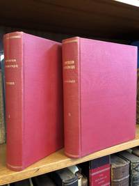
1813rif. 1346487Paris: Chez Henri Grand 1813 1816. First French Edition. Hardcover. Octavo Two Volumes. In Very Good condition. Bound in full 20th-century red library bindings with gilt lettering to spine. Boards show mild shelf wear and soiling. Very mild age toning to text blocks. Facing text in Greek and French. Contains mathematical diagrams. Shelved in Case 10. 1346487. Shelved Dupont Bookstore. Chez Henri Grand hardcover
1813rif. 1346487Paris: Chez Henri Grand 1813 1816. First French Edition. Hardcover. Octavo Two Volumes. In Very Good condition. Bound in full 20th-century red library bindings with gilt lettering to spine. Boards show mild shelf wear and soiling. Very mild age toning to text blocks. Facing text in Greek and French. Contains mathematical diagrams. Shelved in Case 10. 1346487. Shelved Dupont Bookstore. Chez Henri Grand hardcover books
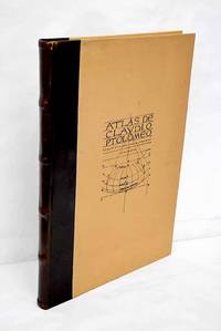
1983rif. 3638099Valencia.: Vicent García. 1983. Hardcover. Falta el facsimil con los mapas . Good. 46 cm. 1 v. il. col. map. col. Encuadernación en tapa dura de editorial holandesa. Libro de estudios del facsimil. Introducción por Víctor Navarro Brotóns ; traducción y notas por Angel Aguirre Alvarez Víctor Navarro Brotóns y Enrique Rodríguez Galdeano. Tít. de la cub. : Atlas de Claudio Ptolomeo . Falta el facsimil con los mapas . ISBN: 8485094352 v.1 Geografía del mundo antiguo. Geografía regional en general. Geografía universal 913.1"01" Mapas. Atlas geográficos. Globos terráqueos 912100:528.9:091.07 Vicent García. hardcover
1990rif. 154085Wigston: Magna Books 1990. 1st ed. thus. Nice copy. large folio. laminated boards xv 56pp. colour maps appends. bibliog. index With 27 fine double-page coloureed maps taken from an edition of Clavdii Ptolemaei: Cosmographia Magna Books hardcover
rif. 053104Paris Editions Hier et Demain 1976 grand in folio (46,5x35) 1 volume sous boitage de l'éditeur, dos et plat supérieur titrés, renfermant un fascicule de texte de 24 pages [1], suivi de 27 planches doubles hors-texte en couleurs de cartes. Collection cartographie antique. Collationné complet. Tirage limité à 999 exemplaires numérotés. Bel exemplaire ( Photographies sur demande / We can send pictures of this book on simple request ) poids du colis: 3 kilogrammes, emballage de protection
rif. 60385Paris, Bookking International, 1990, gd. in-folio, cartonnage couv. ill. coul. éd., XVI pp. de texte par Lelio PAGANI et XXVII pp. de reproductions des 27 doubles planches en coul. du Manuscrit latin VF.32 du XVe siècle de la Bibliothèque Nationale de Naples, bibliographie ainsi que le sommaire des planches, Superbe album qui reprend les planches de la "Cosmographie" de Ptomélée détenu par la bibliothèque nationale de Naples. RARE Très bon état
rif. 1016854706.Ghardcover. Good. Access codes and supplements are not guaranteed with used items. May be an ex-library book. hardcover
2026rif. LRB559885Paris: Editions Recreasoft 2026 Sprache: Deutsch. Ca. 506 Seiten. Deutsch : Nachdruck auf Anfrage. Originalausgabe : 1912-13. Wissenschaftlich bedeutende Ausgabe eines klassischen astronomischen Textes des Claudius Ptolemäus in deutscher Bearbeitung. Das Werk bietet einen wichtigen Zugang zur antiken Astronomie zur Überlieferungsgeschichte und zur philologischen Erschließung der ptolemäischen Schriften. Besonders interessant für Sammler Historiker der Naturwissenschaften und Leser mit Interesse an der Geschichte der Astronomie. Buchbilder sind unverbindlich English : Print-on-demand reprint. Original edition : 1912-13. Scientifically important edition of a classical astronomical text by Claudius Ptolemy in German form. The work provides a valuable introduction to ancient astronomy to the transmission of the text and to the philological study of the Ptolemaic writings. Of particular interest to collectors historians of science and readers interested in the history of astronomy. Book images are non-contractual. Editions Recreasoft. Softcover. New. Editions Recreasoft paperback
rif. 146020Used. For more details please contact me unknown
rif. SLIVCN-9782251006444BELLES LETTRES EDITIONS -LES-
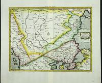
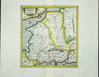
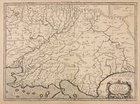
rif. 6086Amsterdam: R & J Wetstenii & G Smith. 1578-1730. No binding. Very Good. 360 x 460 mm. a fine example in recent wash colour. Gerard Mercator's edition of Ptolemy's 'Geography' is highly acclaimed; he spent much of his life studying the work and even engraved the plates himself. The 'Geographia' is the earliest surviving geographical treatise. Much of Mercator's efforts were spent projecting Ptolemy's geography onto the projection which bears his name. Mercator is one of the world's greatest cartographers and the 'Claudii Ptolemaei Tabulae Geographicae Orbis Terrarum' was first published in 1578. This map of south eastern Europe is centred on the River Danube and is in the third state with the addition of a latitude and longitude grid illustrating the projection. Koeman 1967-70 Me 5; Nordenskiold 1979 234; Phillips 1909- 384; Shirley 2004 T.Ptol-11a & 11k; Tibor 1987 73; Van der Krogt P. 1997-2010 1:501. R & J Wetstenii & G Smith. 1578-[1730] unknown
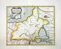
rif. 4019Utrecht: Francois Halma. 1578-c.1695. No binding. Very Good. 350 x 430 mm. in recent wash colour in good condition. From Gerard Mercator's edition of 'Claudii Ptolemaei Tabulae Geographicae Orbis Terrarum'. It was in 1578 that one of the world's greatest cartographers put out an edition of the earliest surviving geographical treatise. This map shows north eastern Europe and Russia. With an attractive scene of a camp upper right. The map extends southwards to the Black Sea. Koeman Me 5; Nordenskiold 234; Phillips P.L. Atlases 384; Shirley BL T.Ptol-11a & 11k; Van der Krogt P. Atlantes 1:501. Francois Halma. 1578-[c.1695] unknown
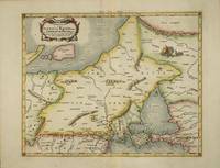
rif. 6085Amsterdam: R & J Wetstenii & G Smith. 1578-1730. No binding. Very Good. 350 x 430 mm. in recent wash colour and very good condition. Gerard Mercator's edition of Ptolemy's 'Geography' is highly acclaimed; he spent much of his life studying the work and even engraved the plates himself. The 'Geographia' is the earliest surviving geographical treatise. Much of Mercator's efforts were spent projecting Ptolemy's geography onto the projection which bears his name. Mercator is one of the world's greatest cartographers and the 'Claudii Ptolemaei Tabulae Geographicae Orbis Terrarum' was first published in 1578. This map of north eastern Europe and Russia is in the third state with the addition of a latitude and longitude grid illustrating the projection. With an attractive scene of a camp upper right. The map extends southwards to the Black Sea. Koeman 1967-70 Me 5; Nordenskiold 1979 234; Phillips P.L. 1909- 384; Shirley 2004 T.Ptol-11a & 11k; Van der Krogt P. 1997-2004 1:501. R & J Wetstenii & G Smith. 1578-[1730] unknown
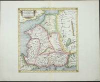
rif. 4032Utrecht: Francois Halma. 1578-c.1695. No binding. Very Good. 340 x 400 mm. a fine example in modern wash colour. From Gerard Mercator's edition of 'Claudii Ptolemaei Tabulae Geographicae Orbis Terrarum'. It was in 1578 that one of the world's greatest cartographers put out an edition of the earliest surviving geographical treatise. Ptolemy's image of France as seen through the eyes of Mercator. Koeman Me 5; Nordenskiold 234; Phillips P.L. Atlases 384; Shirley BL T.Ptol-11a & 11k; Van der Krogt P. Atlantes 1:501. Francois Halma. 1578-[c.1695] unknown
rif. 6080Amsterdam: R & J Wetstenii & G Smith. 1578-1730. No binding. Very Good. 340 x 400 mm. a fine example in recent wash colour. Gerard Mercator's edition of Ptolemy's 'Geography' is highly acclaimed; he spent much of his life studying the work and even engraved the plates himself. The 'Geographia' is the earliest surviving geographical treatise. Much of Mercator's efforts were spent projecting Ptolemy's geography onto the projection which bears his name. Mercator is one of the world's greatest cartographers and the 'Claudii Ptolemaei Tabulae Geographicae Orbis Terrarum' was first published in 1578. This map of France is in the third state with the addition of a latitude and longitude grid illustrating the projection. Koeman 1967-70 Me 5; Nordenskiold 234; Phillips P.L. Atlases 384; Shirley 2004 T.Ptol-11a & 11k; Van der Krogt P. Atlantes 1:501. R & J Wetstenii & G Smith. 1578-[1730] unknown
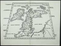
rif. 7407Lyon: 1522-41. No binding. Very Good. 295 x 410 mm. in very good condition. A very attractive early map of the British Isles projected in a trapezoidal style with rivers and towns noted with Latin text on the verso. The author of the map is Laurent Fries a physician and geographer from Alsace. It is derived from that of Martin Waldseemuller published in Strasbourg in 1513. First published in 1522 by now Lorenz Fries had died. The blocks found their way into the possession of Melchoir and Gaspar Treschel. This edition was published in Lyon but printed in Vienne. Karrow 1993 16 c. 28/2; Nordenskiold Collection 1979 211 no. 1; Pastoureau 1984 Ptolemee F 1541 no. 2; Shirley 1991 nos. 15 & 30; Shirley 2004 T.Ptol 7g. 1522-[41] unknown
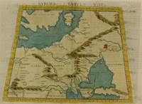
1574rif. M7264Venice: Ruscelli c. 1574. Very Good;. Notes: Italian text on verso. Girolamo Ruscelli 1518–1566 was an Italian mathematician and cartographer active in Venice during the early 16th century. Ruscelli is best known for his important revision of Ptolemy's Geographia published posthumously in 1574. Size : 190x265 mm 7.48x10.43 Inches Coloring: Hand Colored Category: Maps Russia; Maps Europe Ukraine; Maps Europe Poland Lithuania; Ruscelli unknown
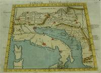
1574rif. M7262Venice: Ruscelli c. 1574. Very Good;. Notes: Italian text on verso. An early map of Italy the Adriatic Sea. Croatia Dalmatia Slovenia and Serbia beautifully hand coloured. Girolamo Ruscelli 1518–1566 was an Italian mathematician and cartographer active in Venice during the early 16th century. Ruscelli is best known for his important revision of Ptolemy's Geographia published posthumously in 1574. Size : 186x266 mm 7.32x10.47 Inches Coloring: Hand Colored Category: Maps Europe Italy; Maps Europe Balkans; Ruscelli unknown
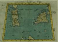
1574rif. M7263Venice: Ruscelli c. 1574. Very Good;. Notes: Italian text on verso. Early map of Sicily Malta and Sardinia beautifully hand coloured. Girolamo Ruscelli 1518–1566 was an Italian mathematician and cartographer active in Venice during the early 16th century. Ruscelli is best known for his important revision of Ptolemy's Geographia published posthumously in 1574. Size : 190x265 mm 7.48x10.43 Inches Coloring: Hand Colored Category: Maps Mediterranean Islands; Ruscelli unknown
1970rif. 1970Liechtenstein: Klaus Reprint 1970. FacsimileFacsimile. Hardcover. Very Good/Very Good. Klaus Reprint Liechtenstein 1970 in - folio 20.5 x 14" 52x35cm of 141 pages 51 double-plate maps. New reprint edition of the standard work on the history of cartography by geologist explorer and collector of old maps Adolf Erik Nordenskjöld 1832-1901. Extensive iconography with numerous in-text map reproductions and 51 high-quality double-plate reproductions based on the famous atlases by Ptolemy Mercator Gastaldi and Apinius Ortelius; Published in Stockholm in 1889 entitled “Facsimile-Atlas to the Early History of Cartography with Reproductions of the Most Important Maps Printed in the XV and XVI Centuries”. This copy is from the second reprint edition of 1961 with a preface by Kraus. In very good condition. Klaus Reprint hardcover