PtolemyBiblio.com

296 risultati
rif. 102483560X.Ghardcover. Good. Access codes and supplements are not guaranteed with used items. May be an ex-library book. hardcover
1991rif. P-09206Dover Publications 1991. Paperback. Fine. Translated by Edward Luther Stevenson with an introduction for this edition by Prof. Joseph Fischer. An unabridged republication of the work first published in an edition limited to 250 copies by the New York Public Library with the title GEOGRAPHY OF PTLOEMY. Clean unmarked and tight: a pristine copy. Dover Publications paperback
rif. 47779890-nnew. unknown
rif. 47779890like new. unknown
1991rif. DADAX0486268969Dover Publications 1991-11-19. paperback. New. 9.50x1.00x12.25. Buy with confidence. Excellent Customer Service & Return policy. Dover Publications paperback
rif. 16845Paris Le Club du Livre - Philippe Lebaud 1972 grand in 4 Un volume reliure plein maroquin havane ornée de l'éditeur, dos à nerfs, tête dorée, sous chemise doublée, étui toilé, 220 pages. Ouvrage illustré de 20 lithographies hors-texte en couleurs par Jean Picart Le Doux (tirage par Fernand Mourlot). Traduction de Nicolas Bourdin de Vilennes revue et accompagnée de deux études par André Barbault, les quatres livres des jugements des astres de Ptolémée ou le Tetrabiblos. Collection gravure contemporaine. Tirage limité à 300 exemplaires numérotés, celui-ci un des 225 exemplaires numérotés sur Rives, et signé par l'illustrateur. (poids du Colis: 4 kilogrammes). Exemplaire à l'état de neuf ( Photographies sur demande / We can send pictures of this book on simple request )
1986rif. 1265801986 Vernal/ Philippe Lebaud - 1986 - In-8, broché, couverture frottée - 181 pages
1972rif. 010314PARIS CLUB DU LIVRE PHILIPPE LEBAUD 1972 Un fort volume grand in-folio de 206 pges , dans sa très belle reliure éditeur plein cuir havane , dos plat , motifs de frises grecs inscrustés sur les plats et médaillon en cuir sur le premier plat , tête doré et bien complet de bsa chemise et de sa boite bordurée , ouvrage comportant 20 lithographies originales en couleurs de Jean PICART LE DOUX , tirage à 300 ex. numérotés , un des 225 sur Rives signé par l' artiste , très bon exemplaire . PORT POUR LA FRANCE 20 ? ET POUR L' U.E. 28 ? Très bon Couverture rigide
rif. 658618765Rowman & Littlefield Publishers Incorporated . Papeback. New. Rowman & Littlefield Publishers, Incorporated unknown
rif. 0674994795.Ghardcover. Good. Access codes and supplements are not guaranteed with used items. May be an ex-library book. hardcover
1936rif. 304164 pages in dark blue cloth with gilt titling on spine. Second printing of this edition. Appendix contains extracts from Ptolemy's Almagest the whole of his Centiloquy and a diagram of the Zodiacal Planisphere with an explanation by J.M. Ashmand. Several diagrams and tables throughout. Previous owner's inscription on front pastedown. Hinges shaken possibly glued. One front free end paper razored out. A few check marks in the margins. Else pages are clean and unmarked. Binding is firm spine is square. Good. The Aries Press hardcover
1980rif. 1-0674994795Loeb Classical Library 1980. Hardcover. New. 466 pages. 6.75x4.50x1.00 inches. Loeb Classical Library hardcover
1987rif. 3674210Madrid.: Barath. 1987. Paperback. Cubierta deslucida. Good. 21 cm. 302 p. Encuadernación en tapa blanda de editorial ilustrada. Tetrabiblos. Traducción y notas de Demetrio Santos. Astrología. Obras anteriores a 1800. Santos Demetrio. 1924-2016. Quadripartitum. Astronomía . Cubierta deslucida. ISBN: 8485799011 9788485799015 null 133.52035.3"01" null 52 Ptolomeo Claudio null 52"01" Barath. paperback
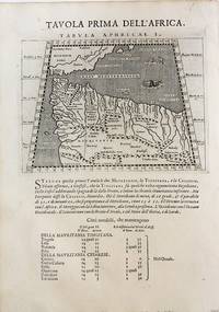
1598rif. M8434Venice: G. Fratelli; G.A. Magini c. 1598. Very Good. Notes: Ptolemaic Map of the North west part of Africa Morocco Tabula Aphricae I Plate 1 from "Geografia cioe Descrittione Universale della Terra" published by Magini c.1598. Text in Italian. Size : 140x173 mm 5.50x6.80 Inches Coloring: Black & White Category: Maps Africa North; Maps Africa West; G. Fratelli; G.A. Magini unknown
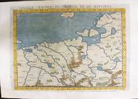
1574rif. M11141Venice: Ruscelli c. 1574. Very Good. Notes: Italian text on verso. Map of Prussia Poland Lithuania part of of Estonia and the Baltic Region. Girolamo Ruscelli 1518–1566 was an Italian mathematician and cartographer active in Venice during the early 16th century. Ruscelli is best known for his important revision of Ptolemy's Geographia published posthumously in 1574. Size : 190x263 mm 7.48x10.35 Inches Coloring: Hand Colored Category: Maps Europe Poland Lithuania; Ruscelli unknown
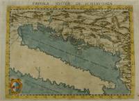
1574rif. M7268Venice: Ruscelli c. 1574. Very Good;. Notes: Italian text on verso. Girolamo Ruscelli 1518–1566 was an Italian mathematician and cartographer active in Venice during the early 16th century. Ruscelli is best known for his important revision of Ptolemy's Geographia published posthumously in 1574. Size : 190x261 mm 7.48x10.28 Inches Coloring: Hand Colored Category: Maps Europe Balkans; Ruscelli unknown
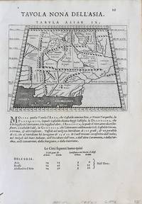
1598rif. M8430Venice.: G. Fratelli; G.A. Magini c. 1598. Very Good. Notes: Ptolemaic Map of Tabula Asiae IX Plate 9 from "Geografia cioe Descrittione Universale della Terra" published by Magini c.1598. Text in Italian. Size : 140x173 mm 5.50x6.80 Inches Coloring: Black & White Category: Maps Asia Central Afghanistan Pakistan; Maps Asia Central Turkmenistan Uzbekistan Tajikistan Kyrgyzstan Kazakhstan; Maps Asia Central India & Sri Lanka / Ceylon; G. Fratelli; G.A. Magini unknown
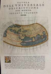
1597rif. M7336Venice: Gio. Battista & Giorgio Galignani c. 1597. Very Good;. Notes: Text in Italian. From Magini's "Geografia cioe Descrittione Universale della Terra". The first edition of this map was printed with Latin text with the later issues printed in Italian. "This quarto edition of Ptolemy was edited by the distinguished Italian geographer Giovanni Magini who also published as part of the same work the first reduced-size version of Mercator's atlas. The four world maps -- one ancient and three modern engravings -- are all by Girolamo Porro neatly copying other earlier works." Shirley Size : 135x175 mm 5.31x6.89 Inches Coloring: Hand Colored Reference: Shirley 193; Phillips 405. Category: Maps World; Gio. Battista & Giorgio Galignani unknown
1598rif. M8431Venice: G. Fratelli; G.A. Magini c. 1598. Very Good. Notes: Ptolemaic Map of Tabula Asiae X Plate 10 from "Geografia cioe Descrittione Universale della Terra" published by Magini c.1598. Text in Italian. Size : 140x173 mm 5.50x6.80 Inches Coloring: Black & White Category: Maps Asia Central Afghanistan Pakistan; Maps Asia Central India & Sri Lanka / Ceylon; G. Fratelli; G.A. Magini unknown
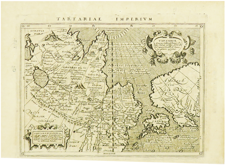
1617rif. LBW-1964[Arnhem, Joannes Jansson, 1617]. 129 x 170 mm.
1525rif. 56635Strasbourg. 1525. Originalt tresnitt. Arkets størrelse : 535 cm X 395 cm. Latin. Latinsk tekst. Bretten noe gulnet et par brunpletter.Med Kypros.Map of Palestine Mesopotamia and Babylonia in present day Middle East.Relief shown pictorially.Includes names of places and natural features.Descriptive text within ornamental borders on verso.Appears in the author's Geographia translated by Willibald Pirckheimer with annotations by Joannes Regiomontanus. Argentoragi i.e. Strasbourg : Iohannes Grieningerus communibus Iohannis Koberger impensis excudebat anno a Christi Natiuitate 1525 tertio Kalendas Apriles. Boston Public Library. unknown
2001rif. 81701Planeta–De Agostini 2001. Planeta–De Agostini unknown
1513rif. 54087Strasbourg. 1513. Originalt tresnitt. Arkets størrelse : 60 cm X 425 cm. Norsk. “Martin Waldseemüller a highly accomplished scholar of geography merged the science of mapmaking and the art of printing in his 1513 atlas one of the most groundbraking documents in the history of cartography. He intended this atlas as a new edition of Ptolemy’s Geographia but included the addition of 20 modern maps which were not based upon the tradition of Ptolemy. Waldseemüller’s use of a quadratic plane projection was also a noteworthy advance.”Martin Waldseemüller 1470-1520.Liten rift ved nedre marg. Et lite ormehull i venstre marg. Et par slitasjer i øvre marg. unknown
1541rif. 15881Vienna 1541. Very good condition. The second map to show just southern Africa; it is based on the Waldseemuller modern map of southern Africa and derived from Ptolemy. Decoratively illustrated with African kings serpents an elephant and a Christian soldier riding a sea monster towards Madagascar. Three large rivers arise from a mountain range labeled 'Fontes Nili' source of the Nile other mountain ranges and coastal towns named in Latin or Portuguese. With the figure of the King of Portugal riding a sea monster towards Madagascar. Based on the slightly larger map from 1513 published in "Ptolemy's Geographia". The atlas was reprinted in 1520 1522 1525 1535 and 1541. This wood block was cut in 1525 for the publisher J.Grünninger. This being the variant of 1541 now without the banner title but title in letter type and blank verso. From the last edition of Ptolemy's "Geography" with maps by Laurens Fries and the text edited by Michael Servetus. Servetus was accused of heresy and burnt at the stake. Calvin ordered that copies of the book should be burnt with him although this copy seems to have eluded the flames. Wood block map with early hand color. Blank on the verso with the number 39 at the lower right corner. Image size: 16 7/8 x 13". Paper size: 21 1/4 x 15". Strengthened on the verso very faint browning at middle of center fold otherwise very good. Betz p. 55-56. Tooley "Map Collectors' Circle No. 30 Printed Maps of the Continent of Africa Part II" p. 61-62. Karrow "Mapmakers of the Sixteenth Century" unknown
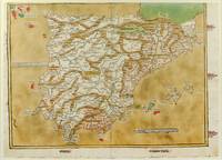
1486rif. 1271161486. Ulm: Johann Reger 1486. Original woodcut map hand-colored printed on a double-page sheet 570 x 407 mm with a central vertical fold verso blank. Upper margin closely trimmed with some loss of the printed border but no loss of the map central fold reinforced on verso a little inkwash and light soiling in the margins; a strong impression with bright contemporary coloring. Matted. § A "modern" map of the Iberian Peninsula Spain and Portugal by the 15th century German cartographer Nicolas Germanus who updated Ptolemy's Geography to show contemporary kingdoms and place names with towns marked by small circles and mountain ranges with brown ridges. The engraving was done by Johannes de Armsheim the first woodcut artist to sign his maps on this map his mark is the backwards "N" in the woodcut text. The map was first published by Lienhart Holle in his atlas of 1482 possibly a ruinous venture as Holle went bankrupt soon afterwards and the sheets and plates were bought by Johann Reger who reissued the atlas in 1486. The two issues can be distinguished by the coloring of the sea: a blue was in 1482 a tan wash in 1486. unknown books